Dallol in Danakil depression is about 120km from Mekele – the capital of Tigray region in Ethiopia. We travelled in December of 2018 when the situation in Tigray was peaceful and there was much hope about normalization of relations with Eritrea. Since then war broke out in Tigray making travel to Danakil an impossible proposition, at least via Mekele as we did.
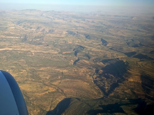
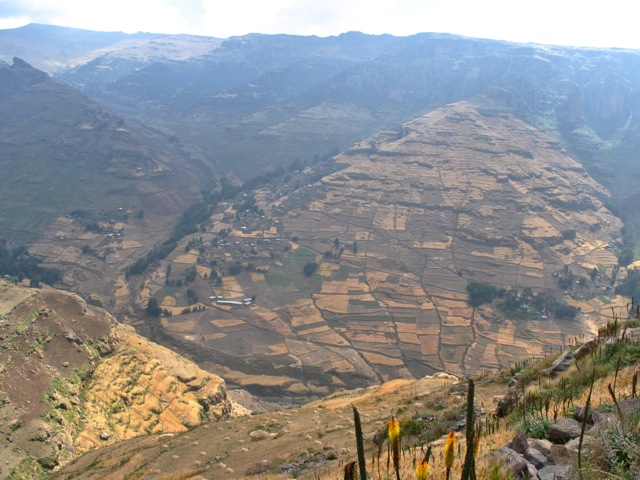
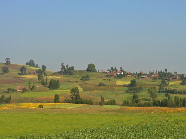
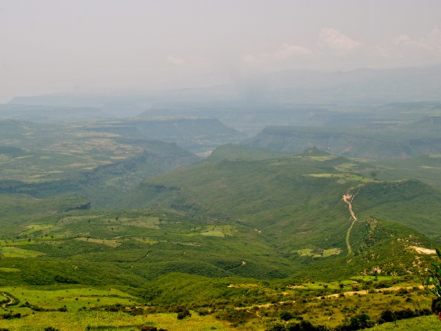
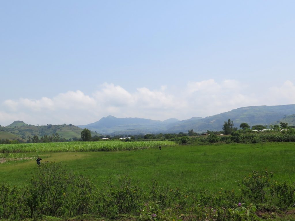
We arrived to Mekele on a morning flight from Addis Ababa. Tigray region and Mekele are part of Ethiopia highlands. The city itself is at 2,500m altitude. As the plane approaches Mekele, one gets a good view of the scenic hills criss crossed by deep canyons and every slope terraced for growing food.
View from airplane on approach to Mekele, Ethiopia
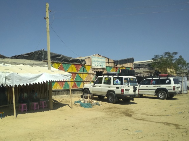
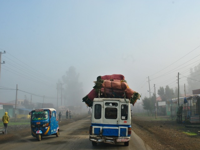
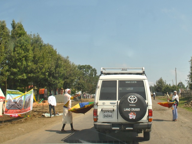
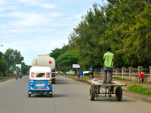
After meeting our tour guide in Mekele we joined the convoy of 3 cars all 4×4 and headed down to Afar region to the Danakil depression on a good paved road.
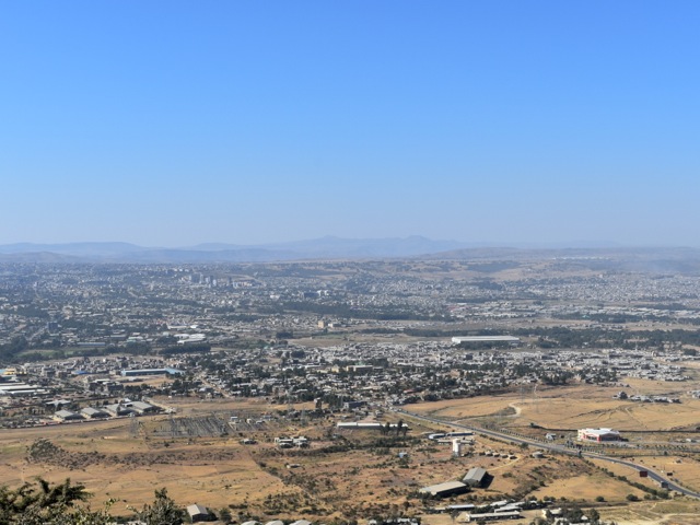
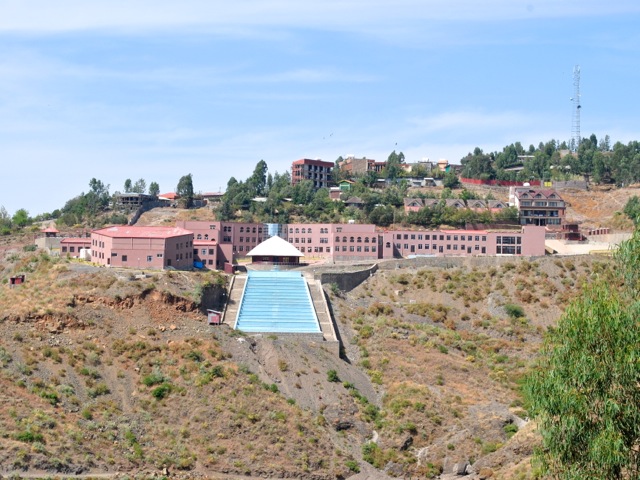
View of Mekele city, Ethiopia
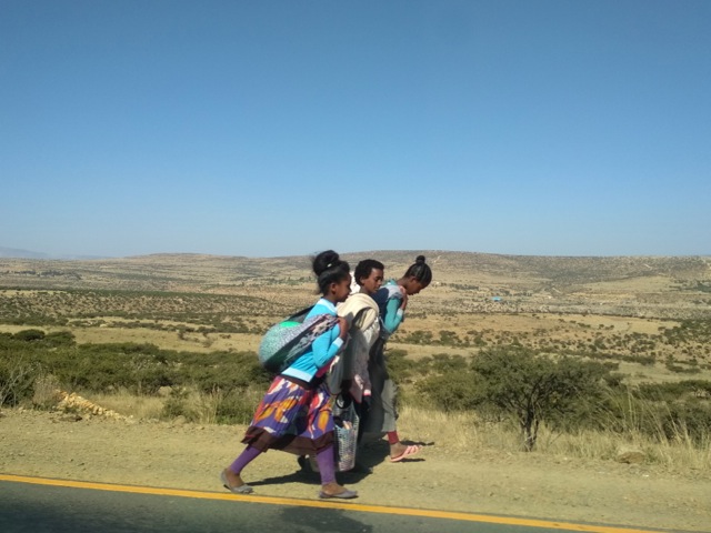
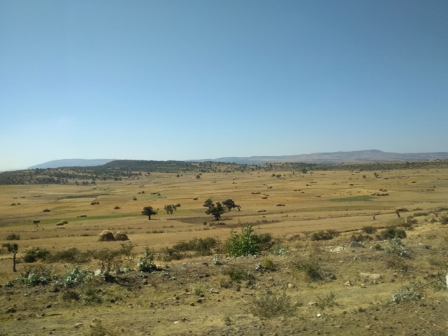
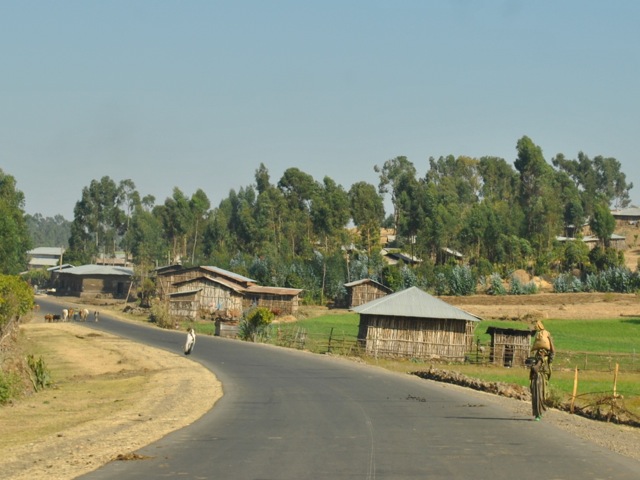
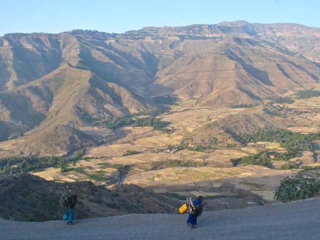
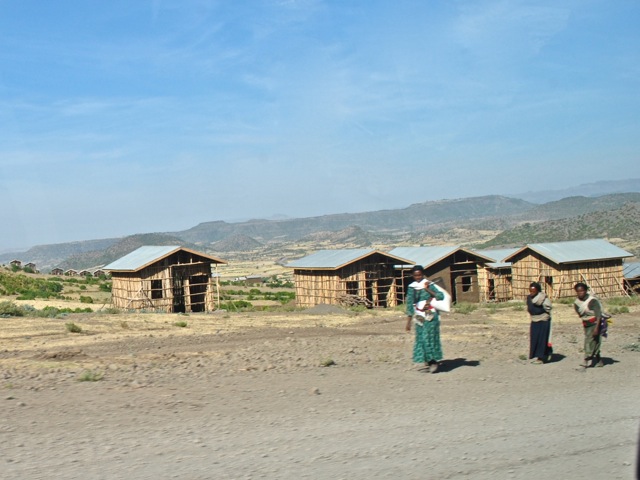
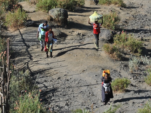
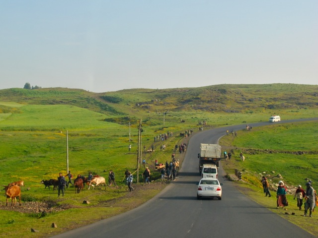
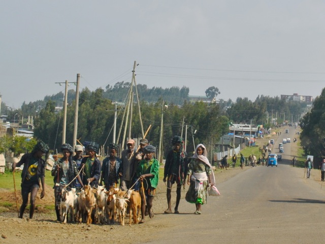
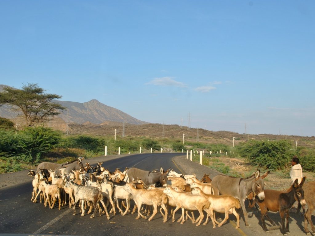
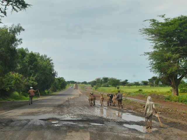
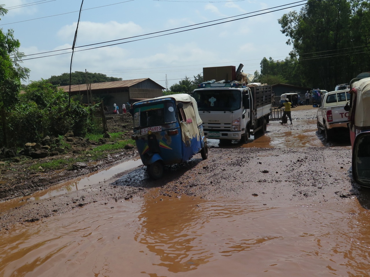
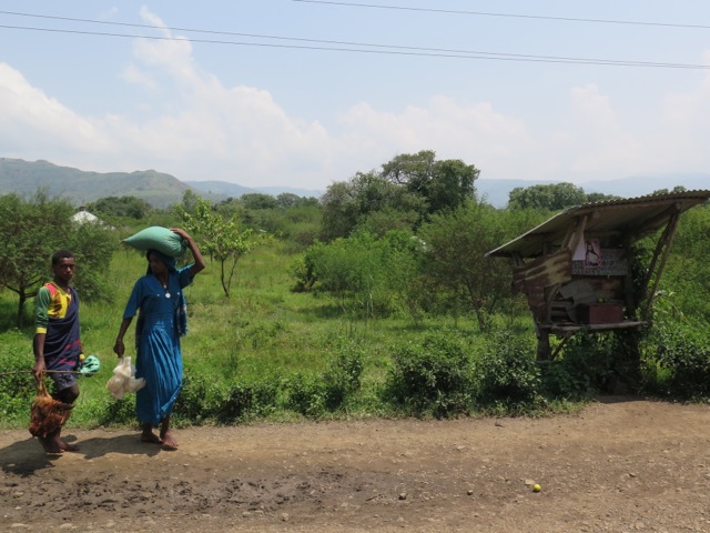
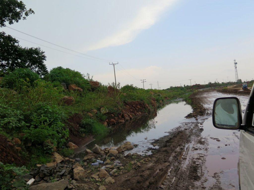
As the road heads out of Mekele and descends towards Afar the scenery continuously changes. We started in highlands at over 2000m elevation with a fair bit of vegetation and fields at the end of harvest season. We progressed down to desert and salt planes with altitude of 100m below sea level. The styles of houses and locals’ dress also changed as we headed from Christian agricultural Tigray to mostly Muslim pastoralist Afar.
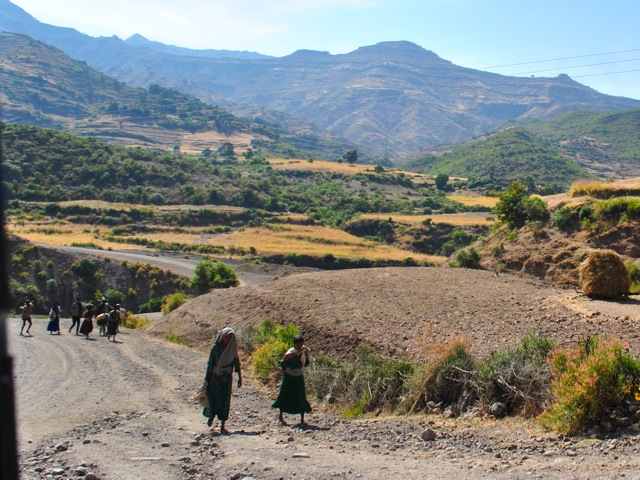
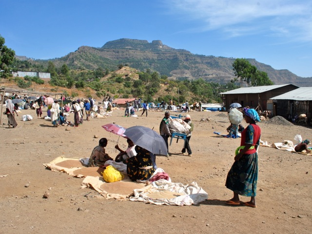
People heading to the market on the road near Mekele, Ethiopia
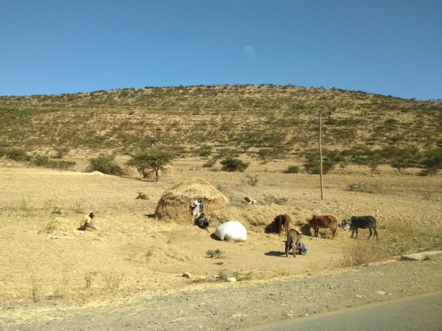
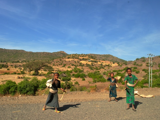
Farmers along the road from Mekele towards Afar, Ethiopia
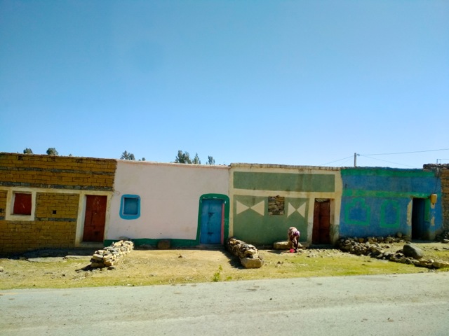
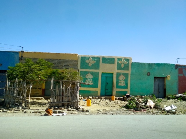
Houses in a village near Mekele on the road towards Afar, Ethiopia
Houses in a village near Mekele on the road towards Afar, Ethiopia
Harvest in Tigray highlands along the road towards Afar, Ethiopia
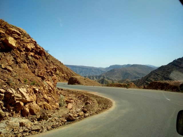
Road descends towards Afar, Ethiopia
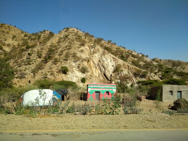
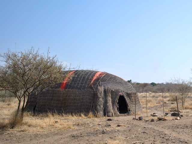
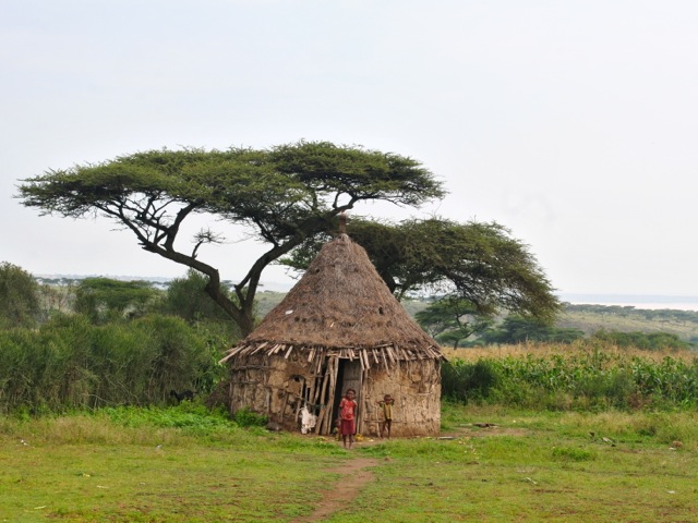
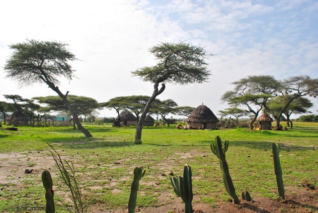
Traditional Afar house (left) next to more modern style building, Ethiopia
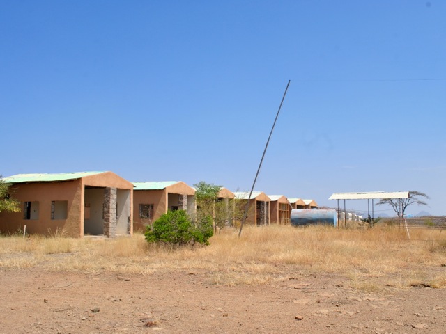
Afar village with traditional round temporary houses and more recent permanent buildings, Ethiopia
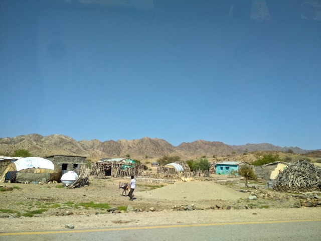
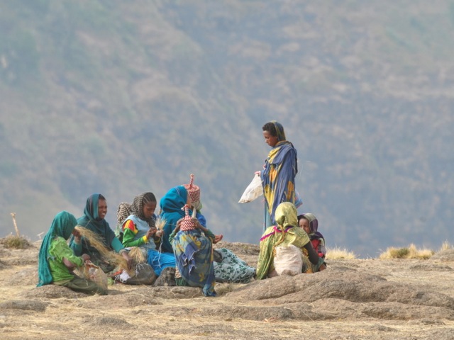
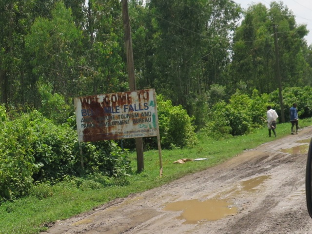
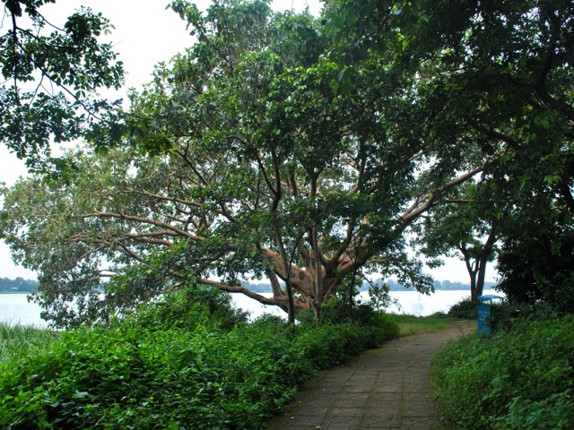
Scene in Berhale village in Afar near Dallol, Ethiopia
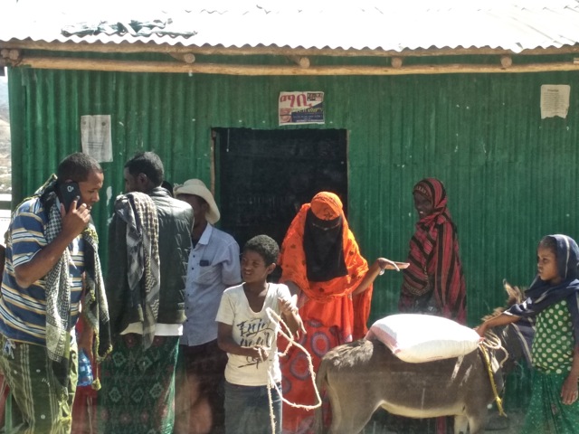
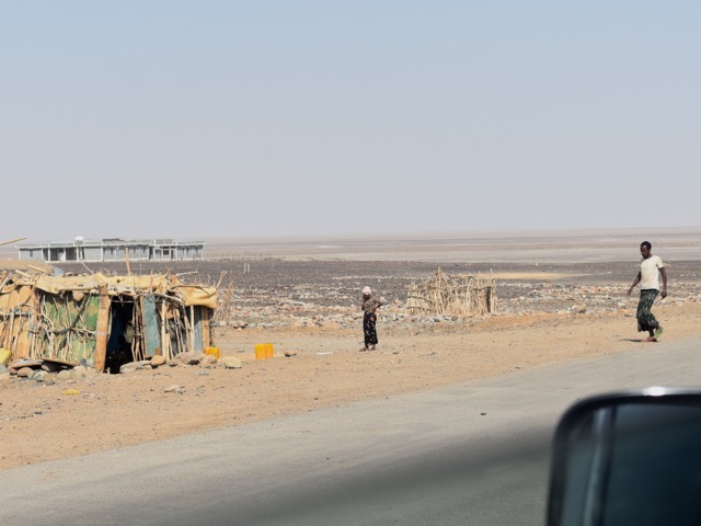
Along the way we stopped in Berhale for lunch. It is a very basic set up with a rice mixed with vegetable for food and some coffee to drink. Bathroom was also very basic – a concreted floor with a hole in the ground with a curtain fashioned from a bag which at some point held humanitarian food. Since the region is frequently impacted by droughts food distribution is not unusual and the bags in which the food arrived eventually end up used as building materials to cover Afar traditional huts and all sorts of other shelter.
Lunch stop at Berhale near Dallol, Ethiopia
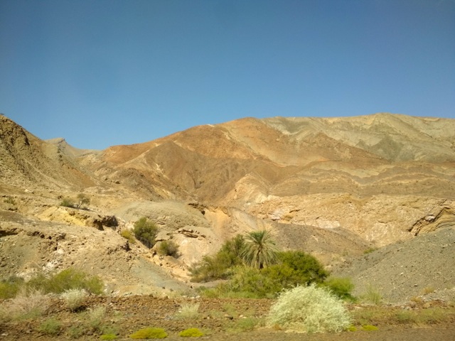
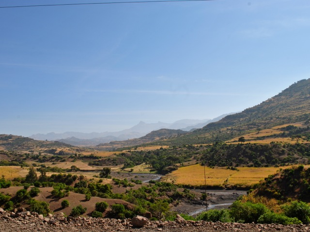
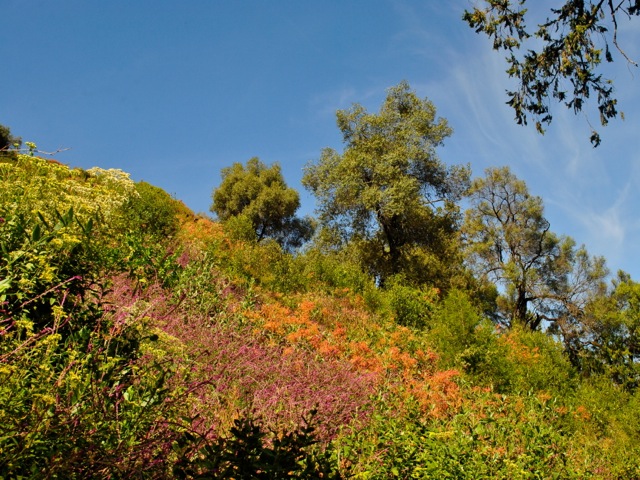
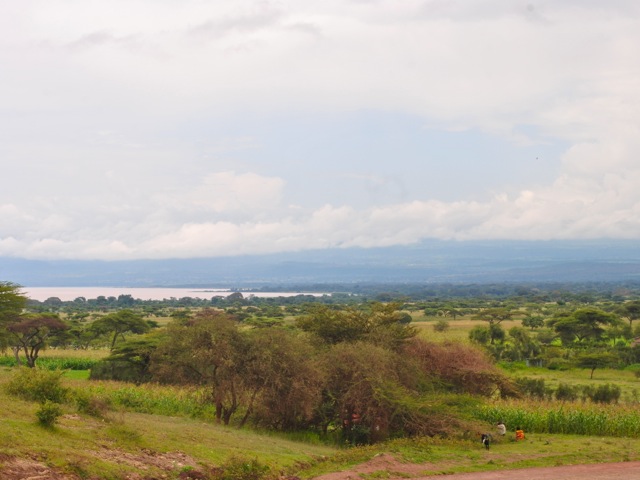
Scenery in Afar towards Danakil depression, Ethiopia
Start of salt planes near Hamed Ela in Afar, Ethiopia
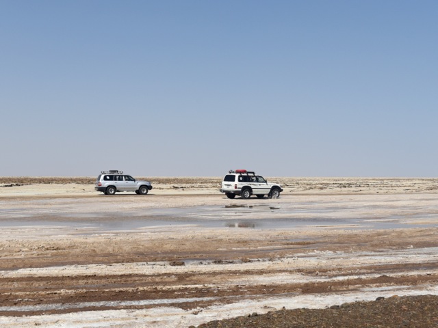
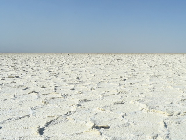
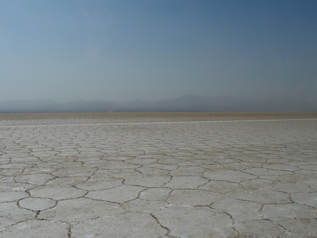
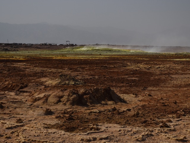
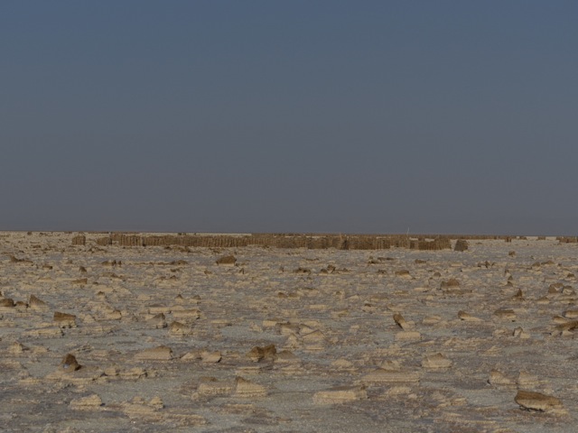
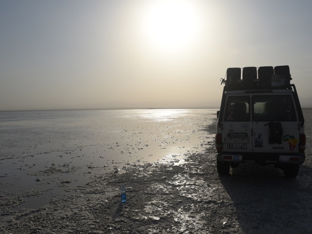
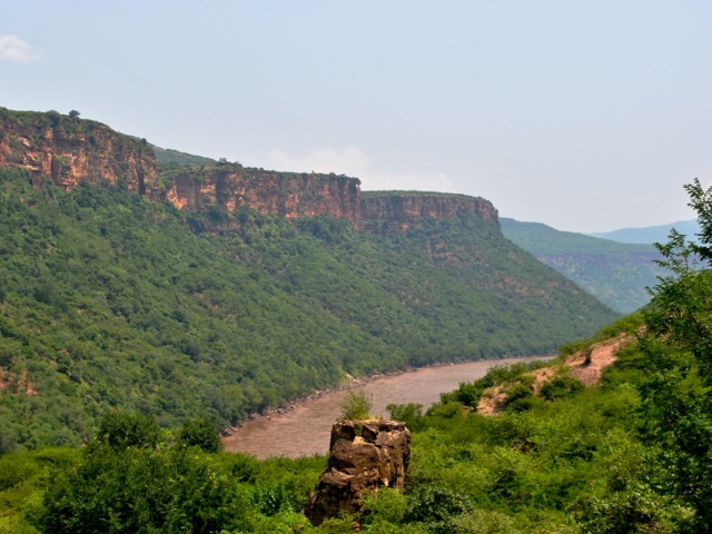
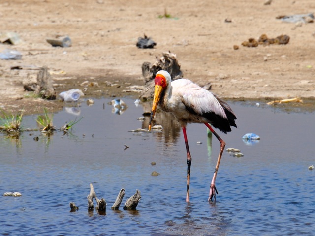
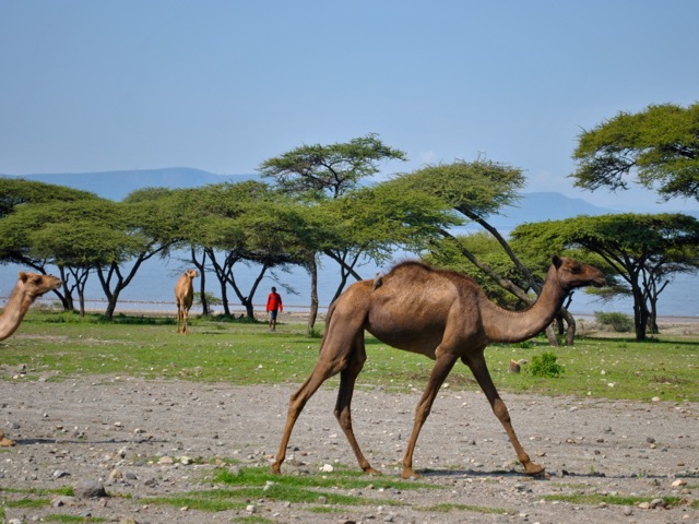
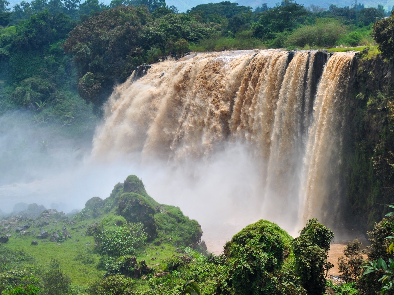
After about two hours of driving plus lunch we reached the salt planes and were in Danakil depression proper. The salt planes were once a bay in Red Sea before the tectonic planes shifted. The salt has been mined by Afar people for centuries and reportedly reaches 1km deep in places. The drive on the salt planes is a surreal experience. They range in color from near perfect white to brownish near the Dallol volcano and have all sorts of cool formations.
Salt planes of Danakil depression near Dallol, Ethiopia
Salt planes in Danakil depression near Dallol, Ethiopia
Salt planes in Danakil depression near Dallol, Ethiopia
Salt planes in Danakil depression next to Dallol, Ethiopia
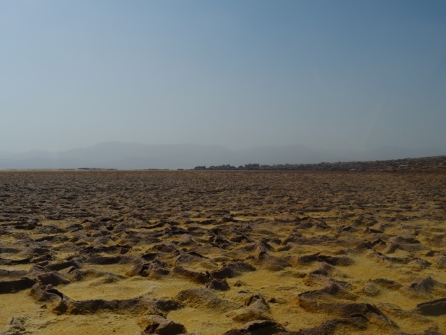
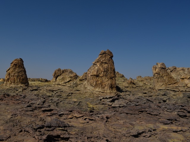
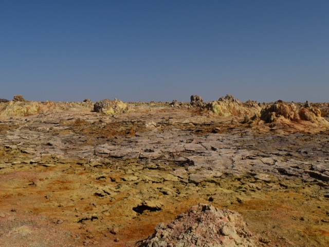
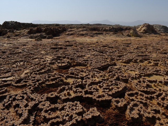
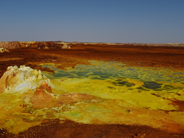
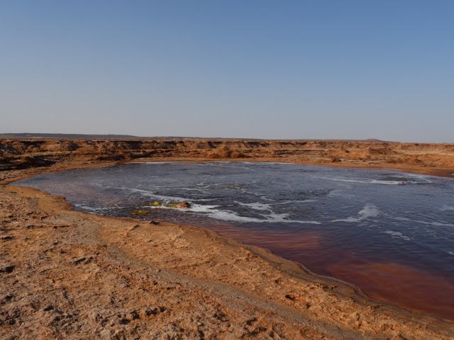
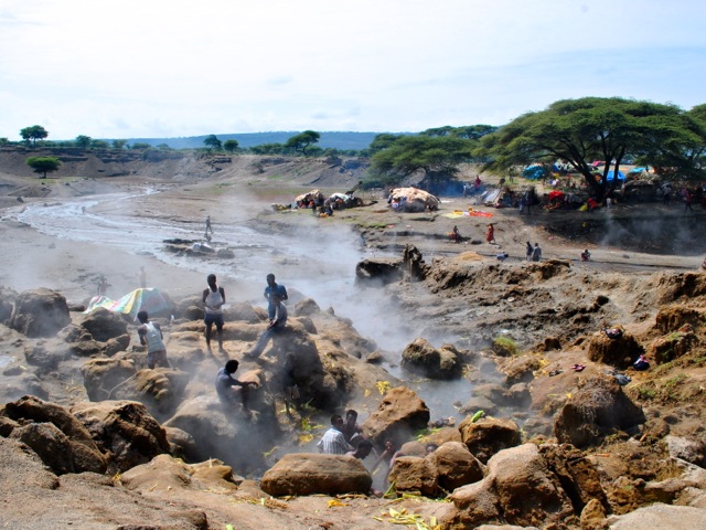
As we approached Dallol volcano salt planes turned brown color – a result of all the fumes from colorful geysers and sulphur springs at the Dallol crater. The cars parked at the base of the Dallol and we hiked up the very gentle slope dotted with volcanic vents.
Dallol in Afar, Ethiopia
Salty volcanic vents on the slopes of Dallol volcano, Ethiopia
Dallol in Danakil depression, Ethiopia
Dallol in Danakil depression, Ethiopia
Dallol in Danakil depression, Ethiopia
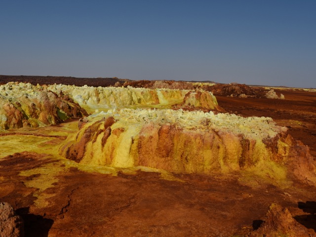
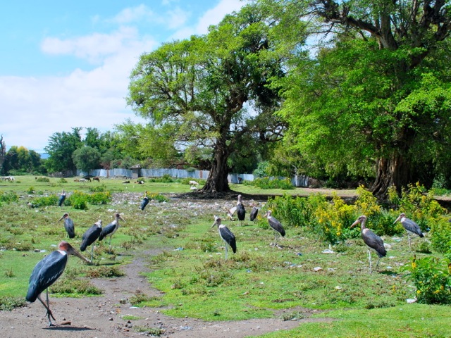
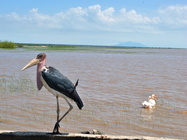
The bright colors are a result of a reaction where magma comes in contact with salty water and bubbles up to the surface. This is one of the most acidic places on Earth with PH near zero. There is a debate among scientists on whether there is life here or not in the form of microorganisms. Animals and birds can’t survive here because of the sulphur fumes – we humans are better off because we are taller though probably nobody would be able to stay permanently. We were there in December in late afternoon and it was supper hot. Water is essential and proper footwear too as the surface on which you walk is very hot.
Dallol in Danakil depression, Ethiopia
Dallol in Danakil depression, Ethiopia
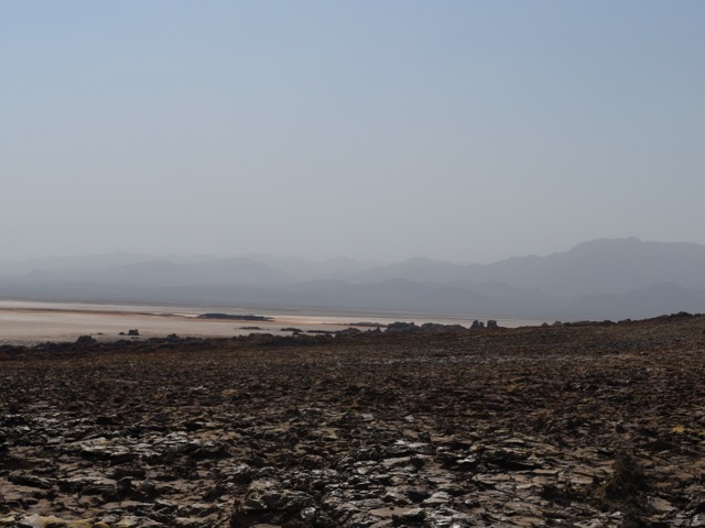
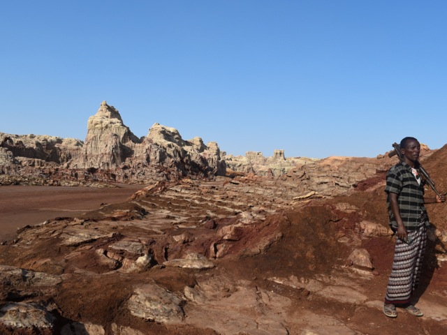
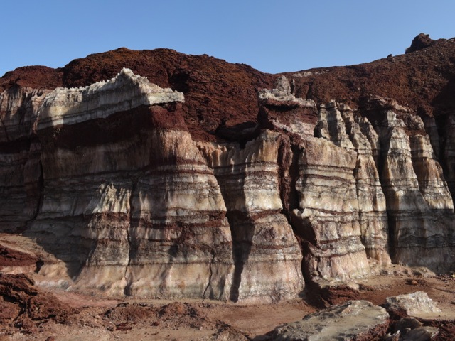
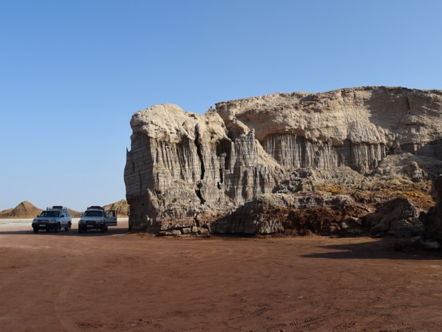
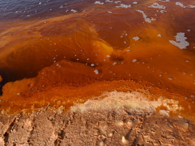
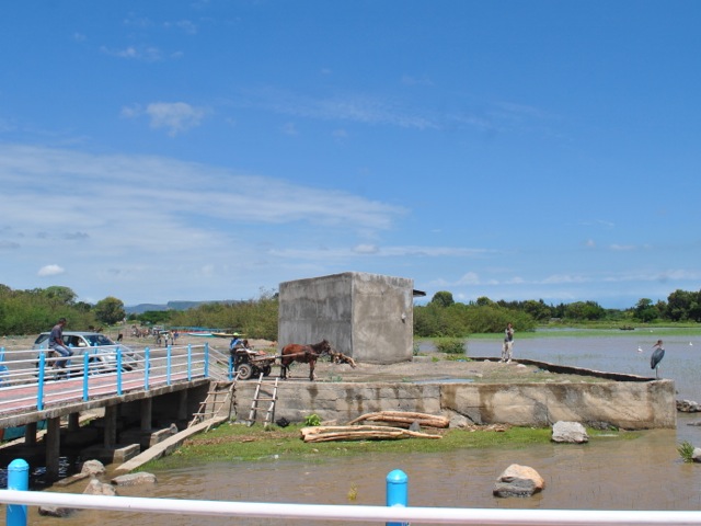
After exploring the crater we headed back to the salt planes to check out salt cliffs purple in color, an oily lake and a super salty lake under the salt crust of the plane. On the trip along with the guides it is required to have security guard. The area used to be dangerous due to proximity with Eritrea border – only about 15km away. Since 2018 relations between Eritrea and Ethiopia improved and security risk is considered less though situation remains fluid with conflict within Ethiopia and between regions being more of an issue. Security guards in any case is also a job creation strategy in the are where economic opportunities are very limited.
Salt cliffs near Dallol in Danakil depression, Ethiopia
Salt cliffs near Dallol in Danakil depression, Ethiopia
Salt cliffs near Dallol in Danakil depression, Ethiopia
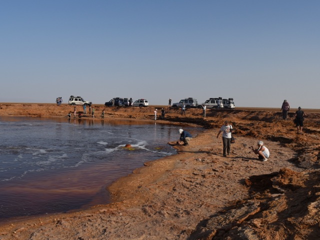
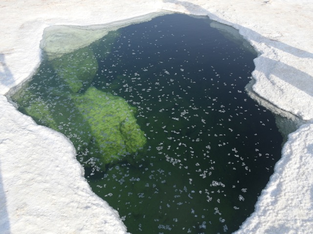
The “oily lake” called Gaet’ale is an thermal spring that got reactivated during volcanic activity of 2005. The oily feel of the water is actually due to the high concentration of salts and not because of oil. The red color is the result of high concentration of dissolved iron. The springs emit CO2 with varying degree of intensity. The researchers find many dead birds and insects that suffocate by inhaling high concentrations of CO2 around the springs. Researchers also argue that more monitoring and measurement is needed to manage possible risk to visitors.
Gaet’ale springs and lake near Dallol in Danakil, Ethiopia
Gaet’ale springs and lake with tourist vehicles near Dallol in Danakil, Ethiopia
Gaet’ale springs and lake near Dallol in Danakil, Ethiopia
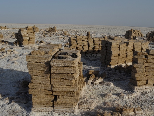
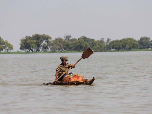
Driving across salt planes we got to the mining site where Afar people mine salt in traditional way. On the day we were there the miners were not working reportedly because of some dispute. But we got to see square slabs of salt carved out of the plane and ready to be transported – by camels to the markets of Ethiopia.
Salt mine near Dallol in Danakil, Ethiopia
Blocks of salt near Dallol in Danakil, Ethiopia
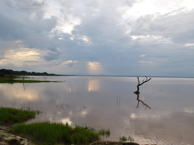
As we headed toward lake Karum we came across the spot where there is a break in the salt crust and the very salty water of the lake Karum is visible under the surface layer of salt. The water is super crystal clear and vey very salty (we had a taste). We opted against submerging into it – but seems some tourists go for it.
Water of lake Karum seen through the break in the salt crust near Dallol in Danakil, Ethiopia
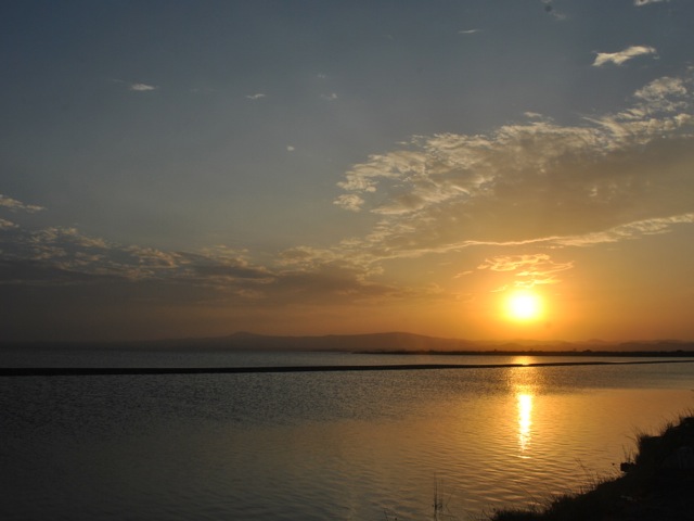
By the time we reached the shore of lake Karum sun was setting down. We got beautiful sunset reflection views over the salty lake.
Lake Karum near Dallol in Danakil, Ethuopia
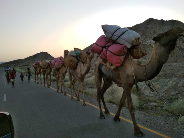
We then headed back all the way to Berhale to overnight in a guest house. We got more stunning scenery views and camel caravans on the road back.
Camels along the road back from Danakil in Afar, Ethiopia
The guest house where we stayed was pretty basic. A room with a dozen mattresses on the floor; toilet in a separate building and a cold bucket shower. It is a good idea to bring a sheet or a sleeping bag to sleep in and baby wipes/wet tissues. The food was delicious though and we were so tired after the long day that it did not take long to fall asleep. Next morning we headed back to Danakil depression on a different road this time to the Erta Ale volcano.
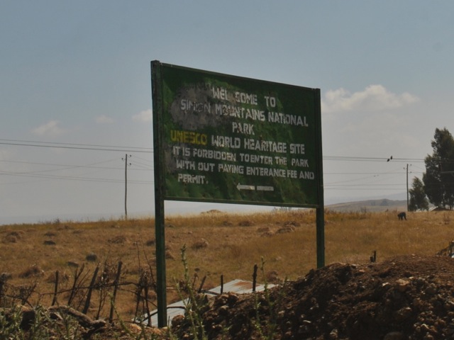
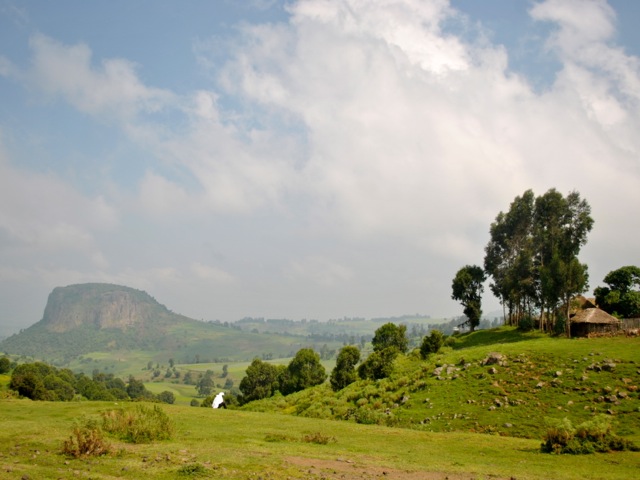
The city of Gonder and Simien Mountains national park are located in the northern part of Ethiopia. Gonder is a former capital of Abyssinian empire and is mostly known to tourists for its castle. Now it is one of the major cities in Ethiopia with a number of daily flights from Addis Ababa. Simien Mountains national park is about 3 hour drive from Gonder and has some of the most striking landscapes in Ethiopia. We visited Gonder and Simien mountains in November 2017 on a 3 day trip.
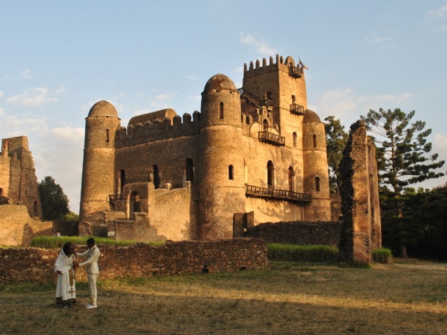
Fasilidas’s Castle, Gonder, Ethiopia
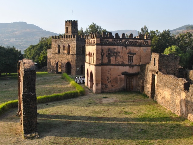
The afternoon flight from Addis Ababa arrived to Gonder at about 4pm and we had just enough time to visit the castle in sunset light. Fasil Ghebbi is a royal compound with six stone castles and some other buildings in a 7ha walled enclosure – now a UNESCO heritage site. The main castle and other buildings were built in the 17th and 18th centuries. The buildings are a fusion of Axumite, western and eastern architectural influences. The entrance ticket includes a guide and the tour of the compound can be done in half an hour. We were about the only tourists at the site but there was an Ethiopian wedding party on a photoshoot in traditional attire. Apparently there is much more action in Gonder around major Ethiopia religious festivals. Graham Hancock in his The Sign and The Seal: The Quest for the Lost Ark of Covenant has some wild stories about Timkat celebration in Gonder.
Yohannes’s library and archive view from Fasilidas’s castle, Gonder, Ethiopia
In 1930s Gonder was an Italian administrative center and the main street has some buildings from that period. The night we were in Gonder unfortunately the power was off (yes in the entire city). After visiting the castle we roamed around in search of a restaurant but because of the power outage that was not exactly easy. We eventually managed to get a beer and some shiro in a small local place. A sheep roamed around in the main dining hall enhancing the authenticity of the experience.
Early next morning we headed for Simien mountains on a tour that we arranged from Addis.
View towards Simien Mountains on the road near Gonder, Ethiopia
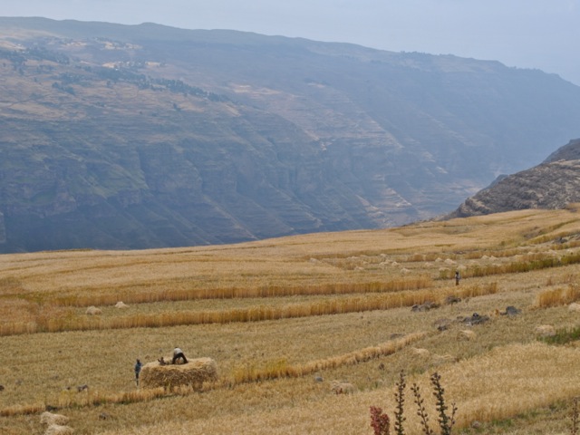
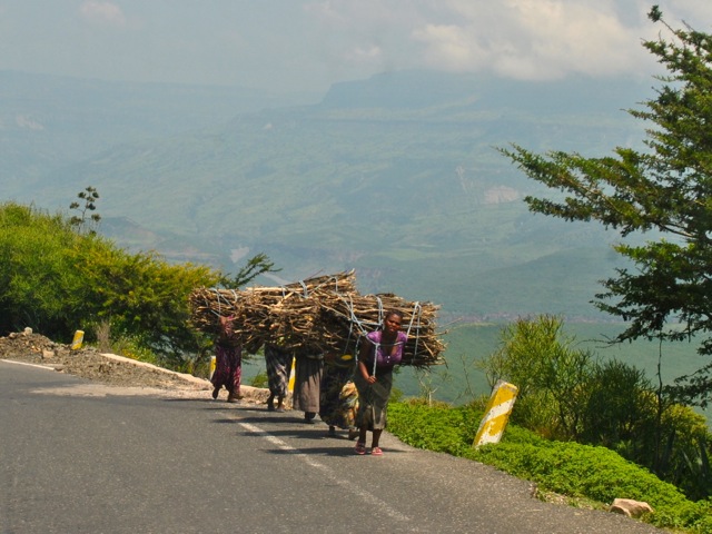
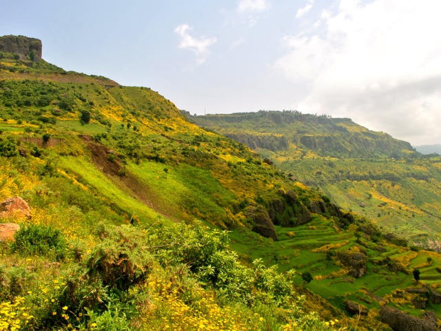
On the way there is a view point on the left side of the road with a spectacular view towards Simien mountains where one can stop and take a picture. The good paved road then proceeds through fields and villages towards the national park. In late November all the farmers were busy harvesting and fields were very pretty golden color. Highlands of Ethiopia is a very densely populated part of the country. We saw people, small villages and cultivated fields everywhere.
Fields along the road from Gonder to Simien Mountains, Ethiopia
Village along the road from Gonder to Simien Mountains, Ethiopia
Before getting into the national park we had to collect our guide from the guide association office in Debark. Once we arrived to the park we headed directly to the Simien’s lodge where we stayed. There are currently two lodges in the park – Simien lodge and Limalimo. The feedback seems to be that Limalimo is much nicer but it was full when we tried to book. As elsewhere in Ethiopia prices for the lodge are rather high for what you get. Alternative to staying in a lodge is to camp and there are shorter and longer track options where all the stuff gets carried by mules separately so one would not need to carry all the camping gear. We had a lunch at our lodge and headed for an afternoon hike. In the park in addition to the guide it is required to take a scout. The scout carries a gun though we were not quite sure whether it was for protection from wild animals or from hostile humans. At least in part it seems to be an employment creation scheme for former rebel fighters.
Simien mountains national park entrance sign, Ethiopia
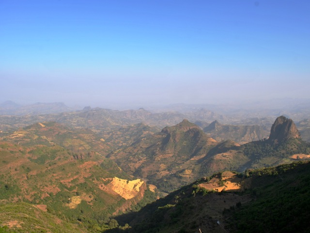
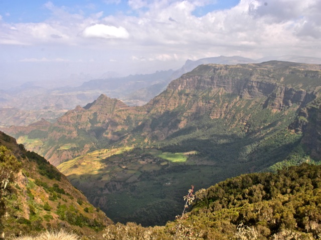
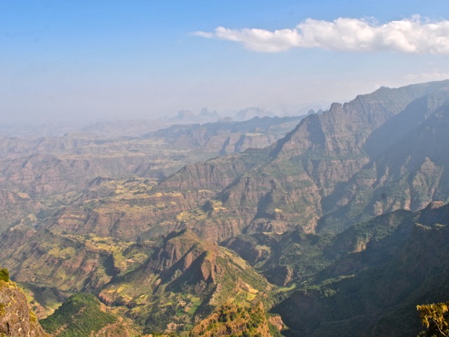
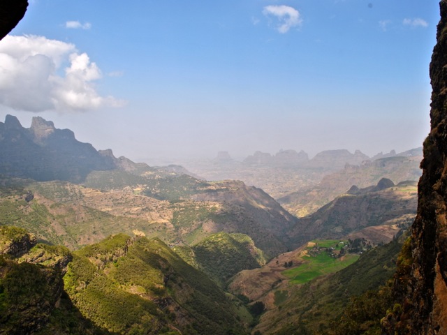
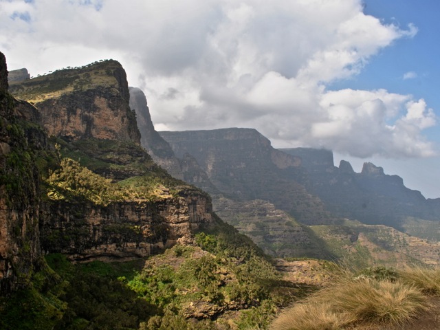
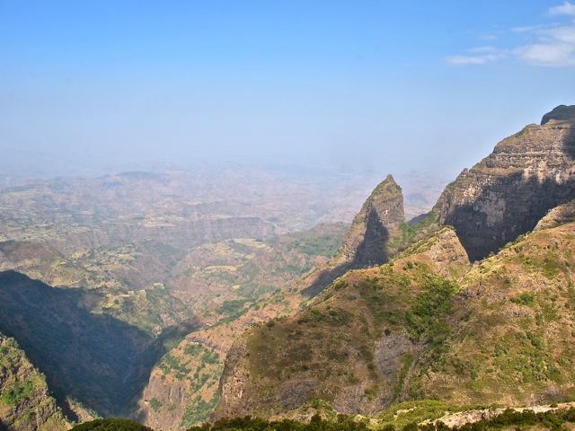
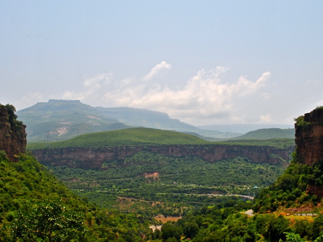
The pictures cannot really capture the beauty of Simien Mountains. The rugged terrain carved over millions of years by water and wind is absolutely breathtaking. Ethiopia’s highest peak Ras Dashen is part of the mountain range towering over beautiful river valleys. The park boundaries seem to mostly cover parts of cliff tops and the cliffs themselves. As a result when you hike through the park and look down to the valleys you see cultivated fields and villages. It is hard to imagine how residents get to those villages because there were no roads to be seen. Certainly locals must be super fit to go up and down the hillsides.
Simien mountains national park, Ethiopia
Simien mountains national park, Ethiopia
Mules get loaded to carry supplies for multi-day tracks, Simien Mountains, Ethiopia
We came across a few locals in what was presumably the area within the boundaries of the national park walking around, chasing cattle and some kids trying to sell souvenirs to tourists.
Locals in Simien Mountains national park, Ethiopia
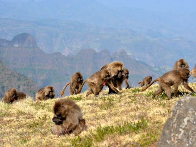
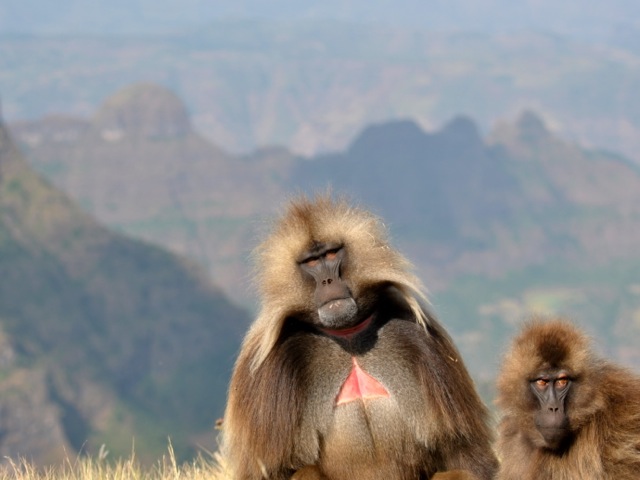
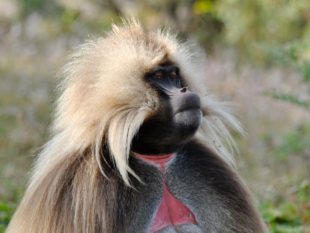
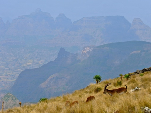
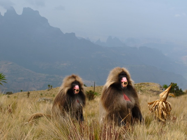
For us the most amazing part of the trip – aside of stunning vistas – was seeing gelada monkeys and hanging out with them. Geladas are endemic to Ethiopia highlands. They sleep in steep cliffs and during the day come up to the plateau to feed on the grass. Geladas are the only remaining specie of the grass eating monkeys that were at some point in the past plentiful across Africa. But as the continent got hotter only geladas survived by moving to higher elevations in Ethiopian highlands. They are amazing creatures with vocal range complexity second only to humans. In Simien mountains where geladas are protected it is possible to get very near to them and hear them “chatting” to each other making all kinds of noises. Once plentiful across Ethiopia highlands they are declining in number due to habitat loss and competition for grazing land. Simiens lodge shows a very interesting documentary about Geladas during the cocktail hour.
Gelada monkeys, Simien Mountains, Ethiopia
Gelada monkeys, Simien Mountains, Ethiopia
Gelada monkeys, Simien Mountains, Ethiopia
On the second day in the park we went by a car along the road that stretches through the park and is also the rode along which a portion of the hike takes place. Along the way we hopped out for short walks to a waterfall or a stunning view point. The road climbs up with amazing views along the way.
Simien mountains national park, Ethiopia
Simien mountains national park, Ethiopia
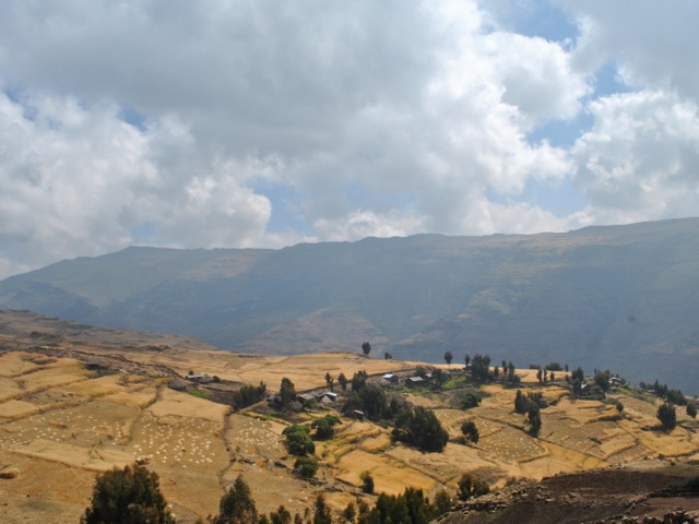
The drive also took us through a stretch of fields with villagers harvesting their crops. We drove along the edges of a canyon with views of villages precariously pitched on steep slopes with surrounding land terraced for growing food.
Fields in highlands near Simien mountains national park, Ethiopia
Fields in highlands near Simien mountains national park, Ethiopia
Villages and field on the slopes near Simien mountains park, Ethiopia
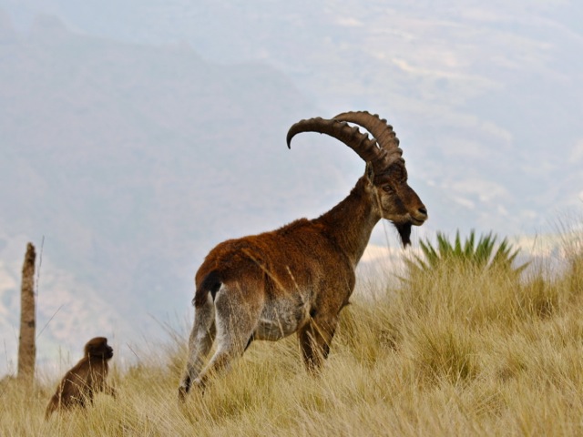
We headed towards Mount Bwahit and took a short hike around its foothills finding gelada monkeys and walia ibexes. Walia ibex is an endangered specie endemic to Ethiopia highlands with only about 1200 of them surviving in Ethiopia in Simien Mountains park.
Walia Ibex in Simien Mountians park, Ethiopia
Walia Ibex and gelada monkey in Simien Mountians park, Ethiopia
As we were walking around we saw two old male gelada monkeys relaxing. Suddenly they perked up, sat down and started making scary faces. Apparently they heard a commotion in gelada group not too far away. So making scary faces including making eye brows stand out and turn light pink and showing gums and teeth (in the picture below) is a sure way to scare off possible attackers. Whether false alarm or scare tactics worked, but a couple of minutes later these two relaxed again.
Gelada monkey, Simeon Mountains, Ethiopia
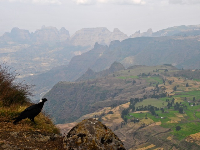
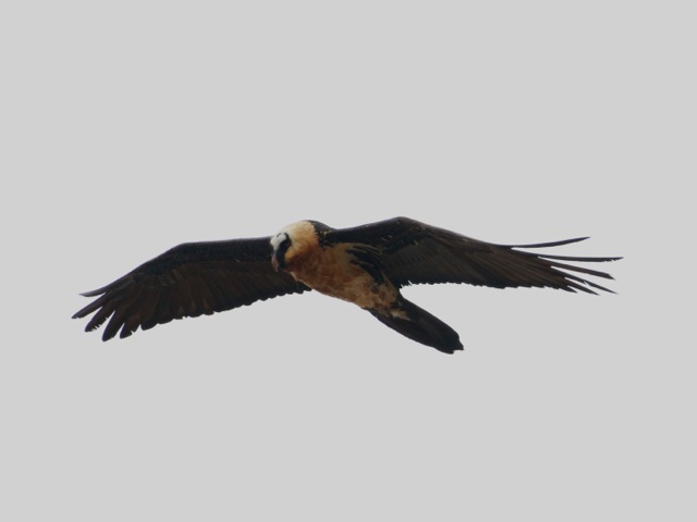
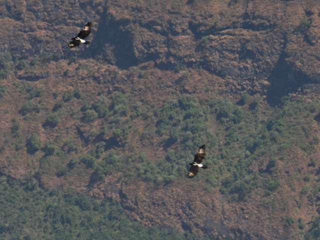
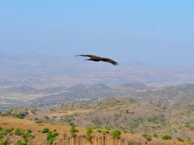
For lunch we headed towards the area of Cheneck camp site with more incredible views to take in. Simien park is excellent to see various birds of pray. Unfortunately they soar really high and it is hard to get a good picture. Lemmergeier was cruising around just as we were having lunch. These are the only birds that eat bone marrow. They through the bones from a hight of up to 1500 meters so they crack against the rocks and eat the marrow. It was as hard to get a good photo of them this time as when we were in Lalibela though.
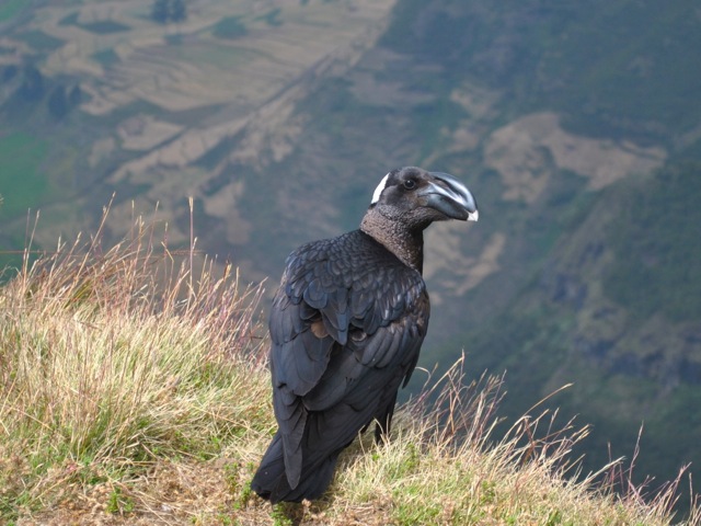
Thick-billed raven endemic to Ethiopia, Simien Mountains, Ethiopia
Thick-billed raven endemic to Ethiopia, Simien Mountains, Ethiopia
Lammergeier, Simien mountains, Ethiopia
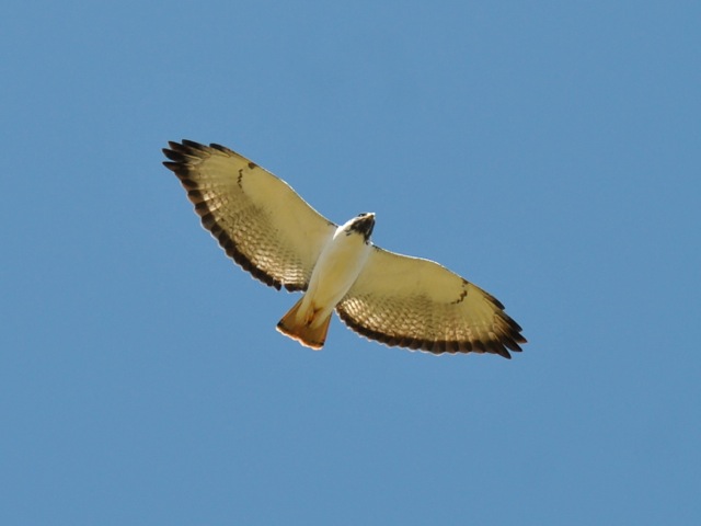
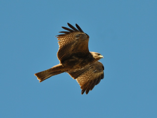
Augur Bazzard, Simien mountains , Ethiopia
Varreaux’s eagles, Simien mountains, Ethiopia
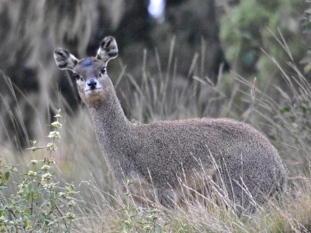
On the drive back we came across a small group of klipspringers grazing on steep hills fringing the road.
Klipspringer, Simien mountains, Ethiopia
We got back to the lodge for sunset beer with a nice warming fire and another (different) gelada documentary. Because of the 4000m altitude it gets really cold at night in the Simiens. Layers is a good idea as during the day in the sun it is quite warm while at night even walking from the lodge’s main building to the room one wished one had a hat on.
Simien mountains national park, Ethiopia
On our last day Sunday we went for another short hike around the lodge taking in more mind-blowing scenery and trying to get pictures of soaring eagles and other birds of pray. After lunch we headed back to Gonder airport to catch later afternoon flight to Addis Ababa. If not time limitations, it would have been great to do a week long track perhaps even taking on Ras Dashen peak – the highest mountain in Ethiopia of 4,550m. Another option is to do Simien as part of the Northern circuit trip also taking in Bahir Dar, Lalibela, Axum or maybe even Geralta and Danakil Depression.
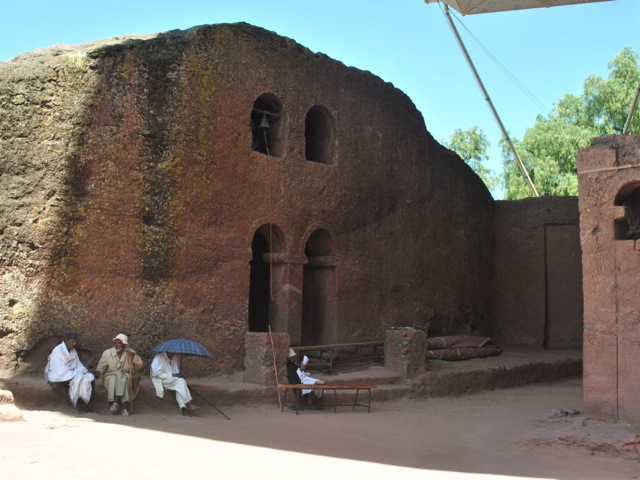
Lalibela is a town in Ethiopia famous for its medieval rock-cut monolithic churches. Cut from solid rock some of the churches are more than 10 meters tall. It is hard to imagine how much effort it required to excavate these churches and decorate them. No wonder a legend says that the churches were built with the help of angels overnight. Another story goes that the power of the Arc of covenant (still believed to be in Ethiopia by many) was used to help excavate the churches.
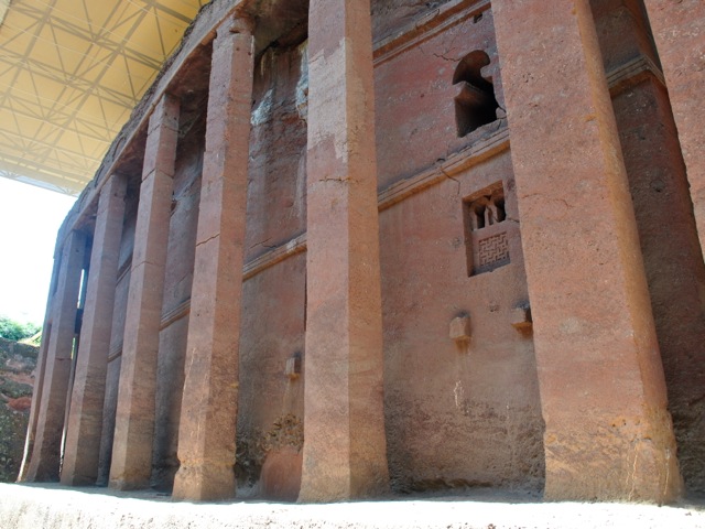
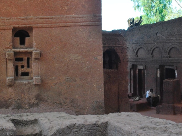
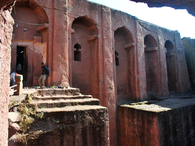
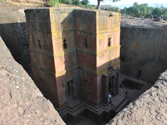
Bet Medhane Alem – the largest of Lalibela churches, Ethiopia
Modern historians say that the churches were build over a long period of time between 7th to 13th century AD. The churches are a UNESCO World Heritage site and most of them now are covered with roofs for protection against the elements. All the churches are still functioning and are the center for pilgrims especially during major Ethiopian Orthodox Church religious holidays. We visited in November 2017 and there were few tourists.
Bet Medhane Alem, Lalibela, Ethiopia
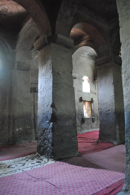
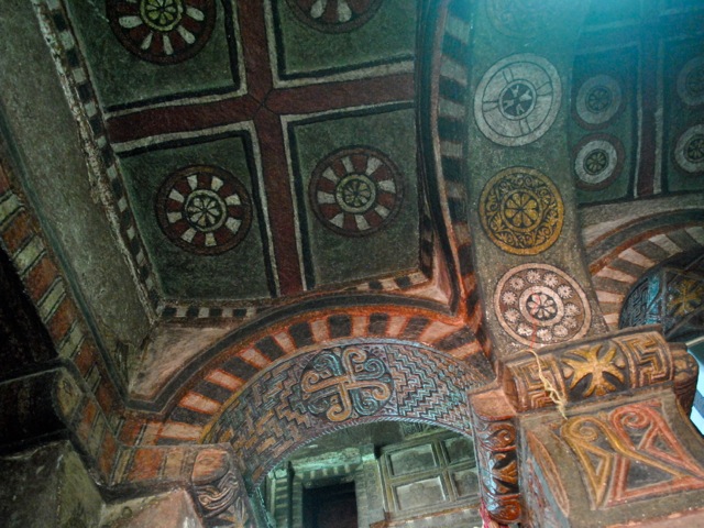
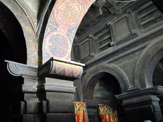
Each of the churches was carved out of the mountain first. Then windows and doors would be carved and then the entire interior with columns and variety of decorative elements. The interior then was painted with most churches having very impressive paintwork on ceilings.
Bet Medhane Alem, Interior, Lalibela EthiopiaPriest in Bet Medhane Alem, Lalibela Ethiopia
Bet Maryam painted ceiling, Lalibela, Ethiopia
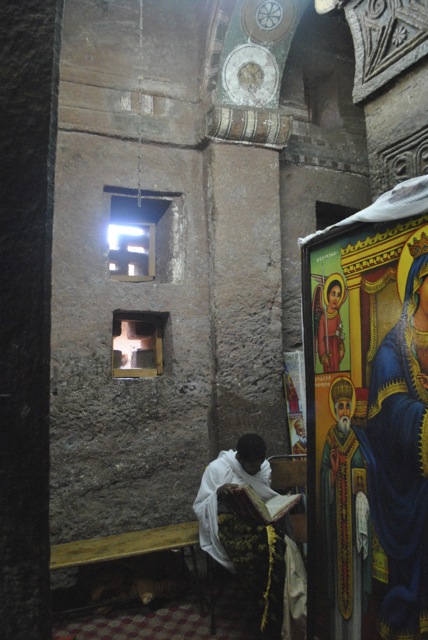
As we wondered around the churches we saw several monks and hermits who emerge from their cells for some light and warmth.
Bet Maryam and Bet Meskel, Lalibela, Ethiopia
Courtyard near Bet Maryam, Lalibela, Ethiopia
The churches are clustered in northern and southern cluster and Bet Giyorgis – the most famous cross-shaped church – is standing on its own. We arrived to Lalibela on the morning direct flight from Addis Ababa and after dropping the bags to the hotel went straight to visit the northern cluster. The churches close between noon and 2 pm so we headed back to the hotel for lunch. In the afternoon we did the southern cluster and St. Georgis which is particularly striking at sunset.
Bet Gabriel- Rafael, Lalibela, Ethiopia
Bet Giyorgis dedicated to St. George is the only church in Lalibela that does not have a protective cover over it. It is the most recognizable of all Lalibela churches and is particularly popular in low afternoon sun.
Bet Giyorgis, Lalibela, Ethiopia
Bet Giyorgis, Lalibela, Ethiopia
Students of religious education, Lalibela, Ethiopia
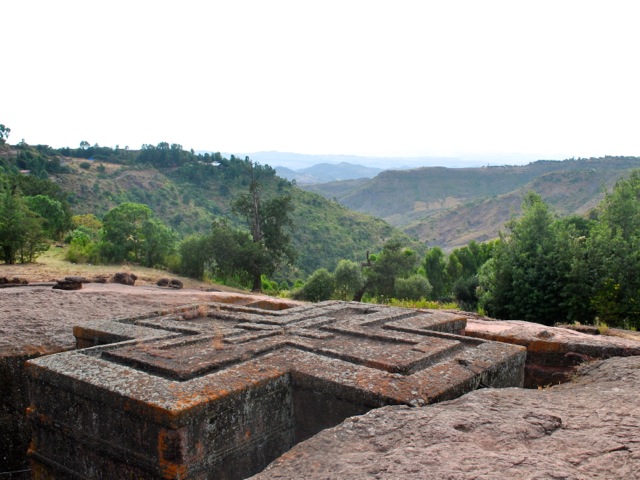
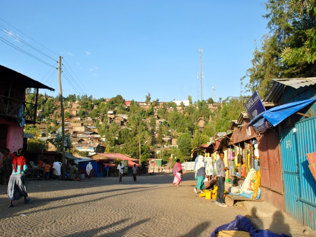
The town of Lalibela has a population of about 30 thousand. It sits on a small plateau at an altitude of 2,600 meters with stunning views of the valleys and mountains around.
Lalibela town, Ethiopia
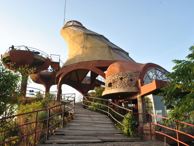
To get a good view of the landscape we headed for dinner to Ben Abeba restaurant. Ran by a Scottish-Ethiopian duo the name of the restaurant means mountain flower – ben being mountain in Gaelic and abeba – flower in Amharic. The structure looks odd but it does have excellent sitting to enjoy stunning views and sundowner in one of the “flower pods”. Once the sun set though it got pretty cold and eating inside was definitely the way to go. In the spirit of Scottish-Ethiopian fusion we got a shiro shepherd’s pie for dinner – basically a shepherd’s pie with Ethiopian traditional shiro (chickpea stew) inside.
Ben Abeba restaurant, Lalibela, Ethiopia
Views around Lalibela and women carrying wood, Ethiopia
Sunset view from Ben Abeba restaurant, Ethiopia
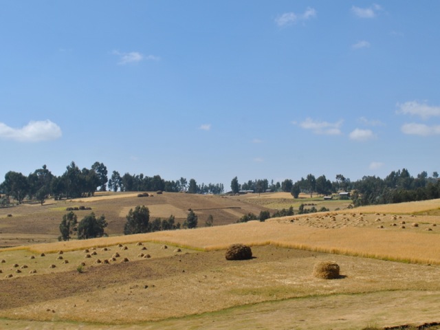
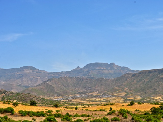
The next day we headed to Yemrehanna Kristos monastery. The trip starts with a descent from Lalibela town to the valley with stunning views on the way. In November when we visited all the fields were bright yellow with grains ready for harvesting. As we drove through the countryside we saw lots of farmers in the fields threshing grains. We travelled on Saturday and so also saw lots of people walking along the road to the market.
Descending from Lalibela, Ethiopia
Landscape near Lalibela, Ethiopia
Women walking along the road toward Lalibela, Ethiopia
Children along the road near Lalibela, Ethiopia
The road from Lalibela to Sekota that took us to the monastry was in the process of being paved at the time of the visit. About half way to the monastery the very nice freshly paved road turned into a gravel road. The trip definitely needed a 4×4 and in rainy season would be quite a track.
Road from Lalibela to Secota, Ethiopia
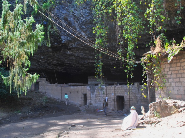
The monastery is located in a cave on top of the hill. There was a nice concreted path leading up to the cave through a beautiful forest with blooming flowers. In Ethiopia churches are protecting forests. Areas belonging to church often are the only places where any forested land is left as people in surrounding areas plow hilltops to plant grains.
Path to Yemrehanna Kristos monastery, Ethiopia
Flowers in the forest surrounding Yemrehanna Kristos monastery, Ethiopia
At the top of the hill there was the entrance to the cave where monastery was. The modern protective wall unfortunately did not follow the old elaborate architectural tradition that inspired the monastery inside. You have to take off shoes at the entrance of all churches and monasteries so wearing socks is a good idea.
Protective wall and entrance to Yemrehanna Kristos monastery, Ethiopia
Yemrehanna Kristos cave monastery, Ethiopia
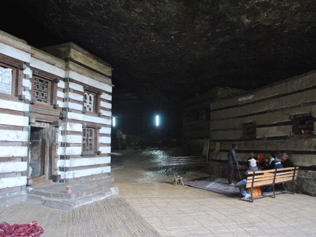
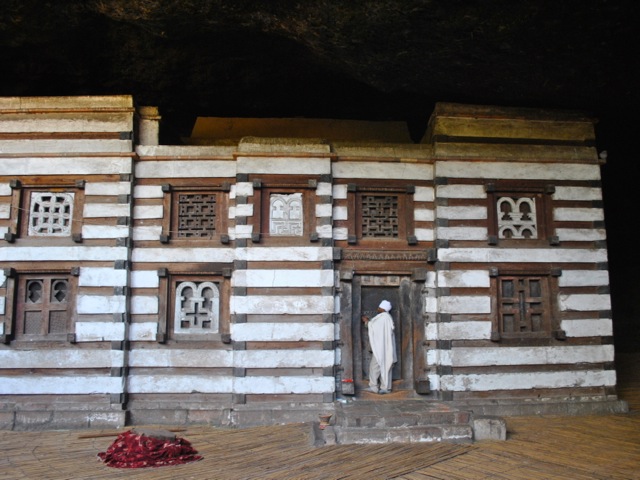
The buildings inside of the cave are built in Axumite style with wood and rock. The main church has elaborately carved windows and finely painted interior. In the back of the cave there is an area full with mummified bodies of more than 10 thousand pilgrims who came to the monastery to die as it is a holy place.
Yemrehanna Kristos monastery main church, Ethiopia
Yemrehanna Kristos monastery main church interior, Ethiopia
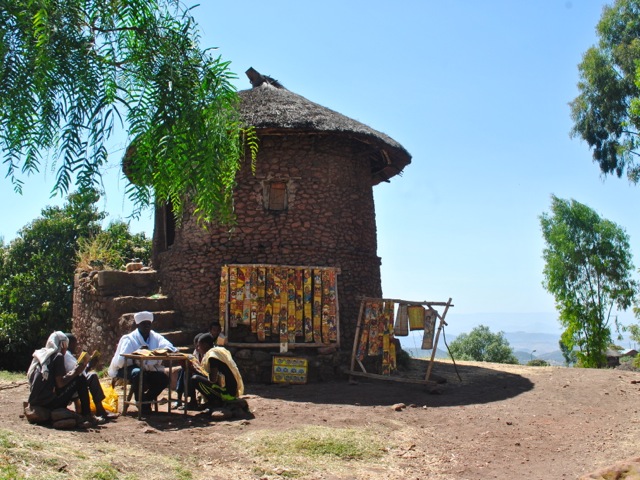
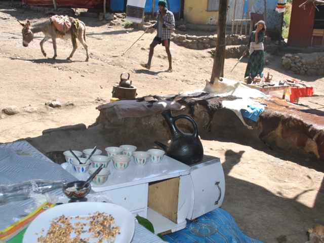
On the way back we stopped and had a coffee in a little coffee shop at the parking area. The setup is very basic with a half a dozen shops in mostly corrugated iron boxes selling souvenirs.
Coffee place at the parking of the Yemrehanna Kristos monastery, Ethiopia
We headed back to Lalibela passing more harvest scenery along the way. There is a very nice view on the way of the striking hill on top of which Lalibela town is perched. One can understand why the builders of the churches selected this spot providing ample protection from attackers back in the day.
View along the road to Lalibela, Ethiopia
View towards town of Lalibela on tops of the hill, Ethiopia
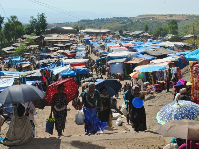
Our next activity was a visit to the market in Lalibela. On the way to the market we passed a very impressive looking structure. We thought it was some sort of luxury new hotel being built with cascading pools but were told that this was a new honey museum – area being famous for its honey. The building was not finished at the time we visited but we wonder what came out of it and what would be in that massive honey museum.
Honey museum, Lalibela, Ethiopia
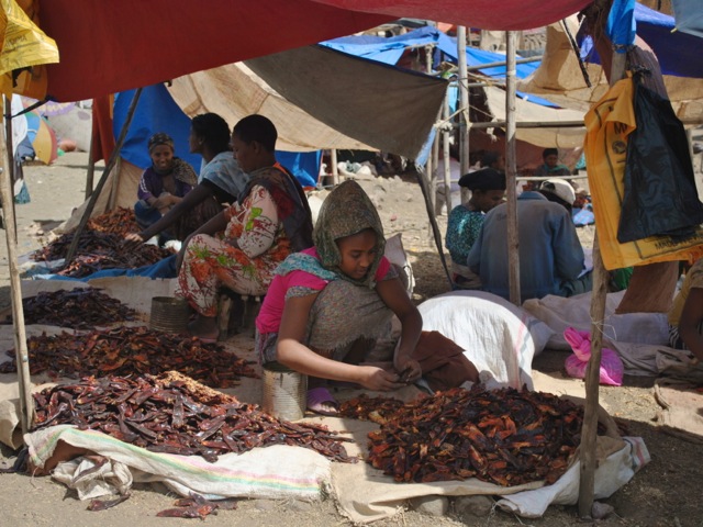
The market was colorful and chaotic. We arrived a bit late for the main action and most of the cattle was gone. But there were still many traders mostly women selling salt, honey, grains, spices, vegetables and all sorts of housewares.
Lalibela market, Ethiopia
Selling salt, Lalibela market, Ethiopia
Trader with spices and herbs, Lalibela market, Ethiopia
Selling chili peppers, Lalibela market, Ethiopia
Lalibela market entrance, Ethiopia
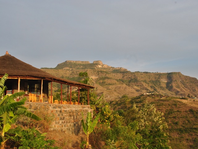
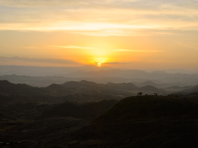
For our second day sunset viewing we stayed in our hotel – Sora lodge. It was perfect not only for the sunset but also for excellent bird viewing.
Sunset at Sora lodge, Ethiopia
Sunset view from Sora lodge, Ethiopia
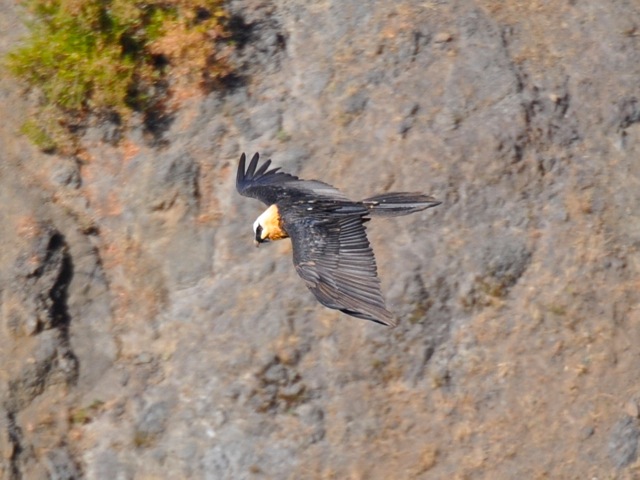
The next day Sunday was our day to go back to Addis Ababa. The latest direct flight to Addis Ababa goes at 1pm which leaves limited time for doing more tours. We decided to just stay at the lodge and watch birds and people going up and down the steep hills. We saw some really cool eagles and kites and even a lammergeier. Lammergeier or bearded vulture is the only bird specie that feeds on bone marrow. It extracts it by taking the bones of dead animals, flying up to 150m high and then dropping the bones so they crash and crack. The old name for the bird – ossifrage- literally means bone breaker. We also saw one in action in Semien mountains though on both occasions it was hard to get a good picture of them in flight.
Kite and scenery around Lalibela, Ethiopia
Kite near Lalibela, Ethiopia
Lammergeier near Lalibela, Ethiopia
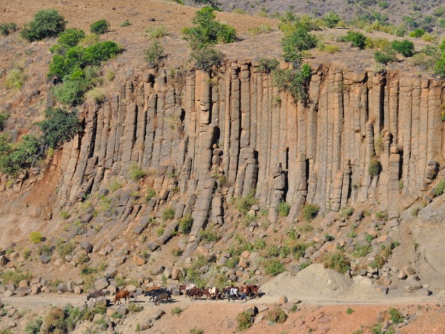
Columnar rock formation and cattle near Lalibela, Ethiopia
People walking uphill to the town, Lalibela, Ethiopia
Lalibela is a unique place with amazing history and spectacular landscapes. At a minimum it can be done on a weekend trip from Addis Ababa. If one has more time, tracking tours with Lalibela and surroundings sound very interesting. Tesfa tours does community tracking and we heard good feedback but did not have a chance to try – hiking at high altitude is no mean fit though. Many tours offer Lalibela trips as part of the so-called Northern circuit which depending on the operator includes Bahir Dar with Lake Tana and Blue Nile falls, Gonder and Simien Mountains, and Axum.
Blue Nile Gorge is about 200km away from Addis Ababa and makes for a good day trip. The Gorge is sometimes described as the the largest canyon in Africa – competing with the Fish River Canyon in Namibia. Having not yet seen Fish River Canyon it is hard to tell – but definitely Blue Nile Gorge is a stunningly beautiful geological formation. We visited at the end of September in 2017 around Meskel time. Yellow meskel flowers were everywhere around the gorge making it extra beautiful in all the post-rainy- season greenery.
Road out of Addis Ababa towards Chanco, Ethiopia
Out of Addis we took the road heading north towards Bahir Dar via the Blue Nile Gorge bridge. Once we passed heavy traffic out of Addis and its suburbs the road went through picturesque hilly highlands. In late September the fields were green with meskel flowers blossoming everywhere.
Along the road towards Blue Nile Gorge from Addis Ababa, Ethiopia
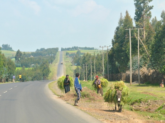
We went on Saturday leaving Addis early at about 6am. There were people everywhere walking along the road to the nearest markets with their cattle, chickens and other stuff to trade.
People walking to the market along the road from Addis Ababa to Bahir Dar, Ethiopia
Collecting donations for a church along the road, Ethiopia
Scenery along the road from Addis Ababa towards Blue Nile Gorge, Ethiopia
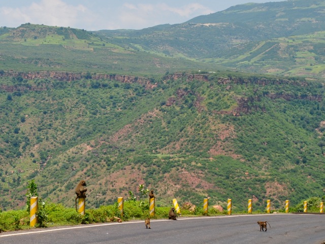
As the road nears the Gorge it starts to zigzag to reach the bottom of the spectacular canyon. Still all along the road there were people walking with cattle, women carrying wood (in Ethiopia it is generally a woman’s or girl’s job to collect and bring wood and water), trucks taking villagers to the market and baboons roaming around the edges of the road.
Women carry wood with the Blue Nile Gorge in the background, Ethiopia
Baboons along the road to Blue Nile Gorge, Ethiopia
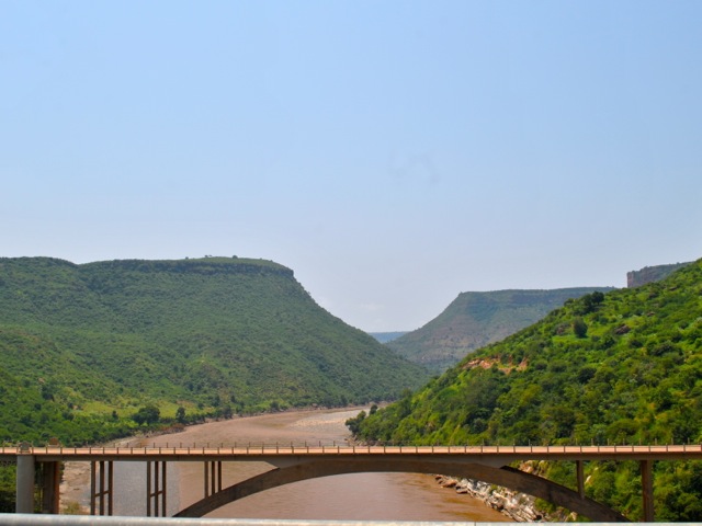
Blue Nile Gorge, Ethiopia
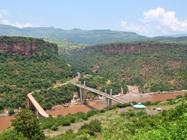
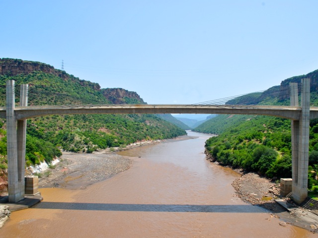
Blue Nile emerges from Lake Tana and then goes through this striking canyon for nearly 400km most of it over 1,500m deep. Amazingly it is only in 2004 that a group of explorers rafted the entire length of Blue Nile from its source to Mediterranean sea for the first time. The views of the river were breathtaking as we approached down the steep walls of the Gorge. There are two bridges across the Blue Nile – the newer one built by Japan and the older one built by Italians. The Italian bridge is now only used by pedestrians. When we visited we were the only tourists. There was not much of infrastructure – say a cafe where one could enjoy a lunch or coffee taking in stunning views would be nice. We crossed the bridge and headed a little bit further up the road to get the view of the bridges and a panorama of the gorge and its surroundings.
The two bridges across Blue Nile Gorge, Ethiopia
Blue Nile Gorge view, Ethiopia
View on the new bridge over Blue Nile from the old one, Ethiopia
View of the blue nile gorge and old bridge, Ethiopia
On the way back as the fog had cleared we got more stunning views of the top of the plateau and the Gorge snaking through it. All the hills and cliffs were covered in bright yellow meskel flowers.
Blue Nile Gorge view, Ethiopia
Hills with meskel flowers near Blue Nile Gorge, Ethiopia
Heading back we saw more familiar road scenery with people now mostly returning from the markets.
Road from Blue Nile Gorge to Addis Ababa, Ethiopia
Road from Blue Nile falls to Addis Ababa, Ethiopia
We wanted to stop by Debre Libanos – a famous monastery about 100km out of Addis Ababa half way between the Gorge and the city. It is located near the bottom of a striking canyon carved by a Nile tributary river. The road zigzags down towards the monastery with nice views of the canyon. We saw a group of gelada monkeys. They were keeping away and you could not get too close to them unlike the ones we saw in Simien Mountains. We got to the Debre Libanos church but did not get to do the walk around as some nice person came with a rock and tried to scratch our car with it while we were trying to figure out where to park. We decided against trying to park and leaving the car and headed away. We stopped for a (very) late lunch at Ethio-German park hotel with superb views of the canyon.
Gelada monkeys near Debre Libanos, Ethiopia
View of the canyon from Ethio-German park hotel.
It was definitely a nice day trip from Addis Ababa even if with quite a bit of driving. Many travel agencies offer the trip which makes it easier and probably better for Debre Libanos visit. It can also be a part of a longer overland trip to lake Tana as the road to Bahir Dar crosses the gorge.
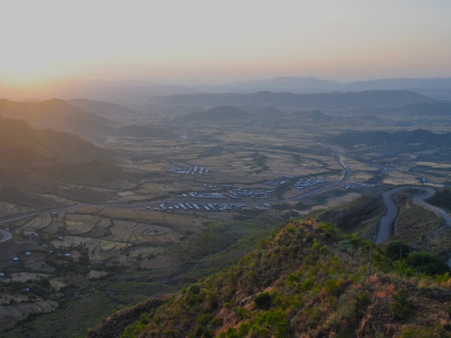
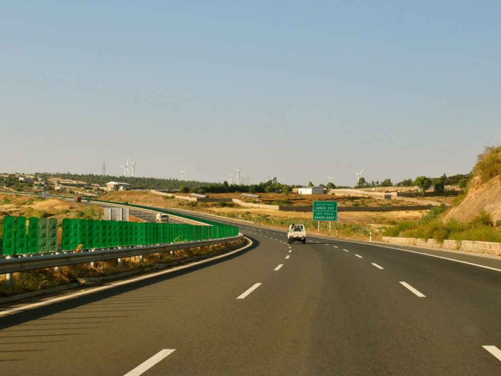
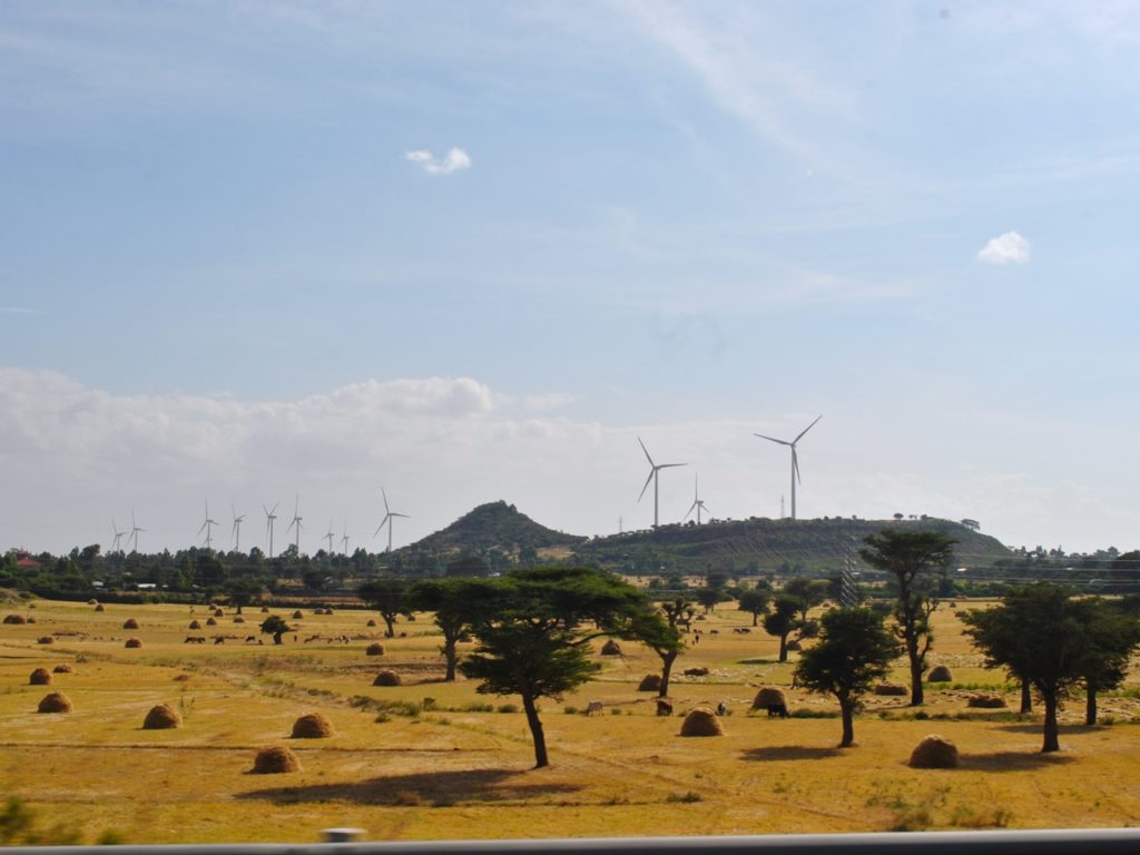
Awash national park is one of the oldest in Ethiopia and is only about 200km east of the capital Addis Ababa. We visited in November 2017 for a weekend trip leaving Friday afternoon. The drive takes about 3 hours. The first part of the drive is along the new excellent Adama expressway toll road.
Adama expressway, Ethiopia
Windmills and harvest in the field approaching Adama on expressway, Ethiopia
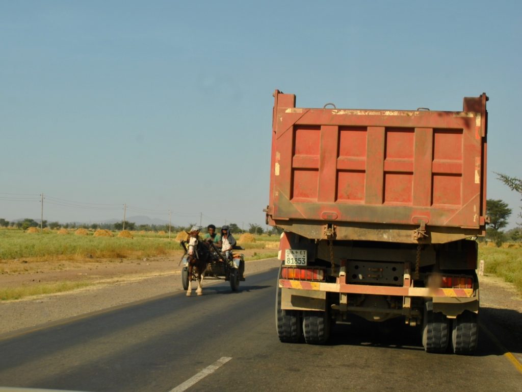
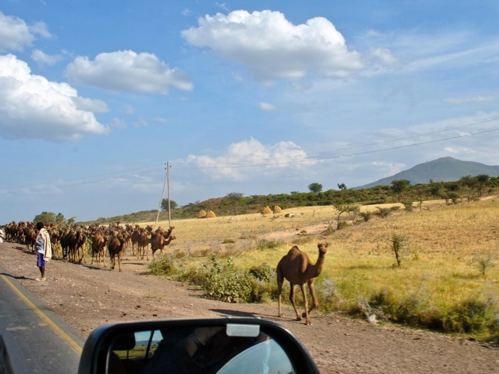
After Adama the road becomes a regular two way road and driving slows down quite a bit. This road goes all the way to Djibouti and is the main route for all trucks going to Djibouti port. There are also tricycles, horse drawn carriages, cattle, camels and people crossing or walking along the road making driving on it not the most relaxing task.
Djibouti road towards Awash national park, Ethiopia
Djibouti road towards Awash national park, EthiopiaCamels along Djibouti road towards Awash national park, EthiopiaCattle crossing Djibouti road towards Awash national park, Ethiopia
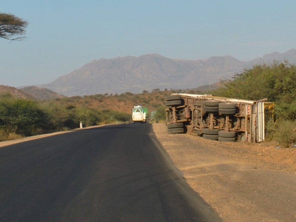
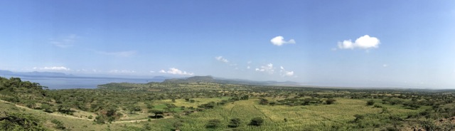
The drive was very scenic with stunning views of escarpment as we descended from the highlands and headed towards hotter lowlands.
View towards Ethiopia highlands
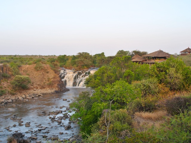
We stayed in Awash Falls Lodge located at the south-western edge of the park near to the park’s entrance gate. The park is divided in two parts by the road that goes through it and this lodge, Awash river and the main game viewing area are all south of the road. The lodge is in a beautiful location overlooking Awash falls. The accommodation is pretty basic with limited facilities but there is running water and electricity.
Awash falls and Awash falls lodge, Ethiopia
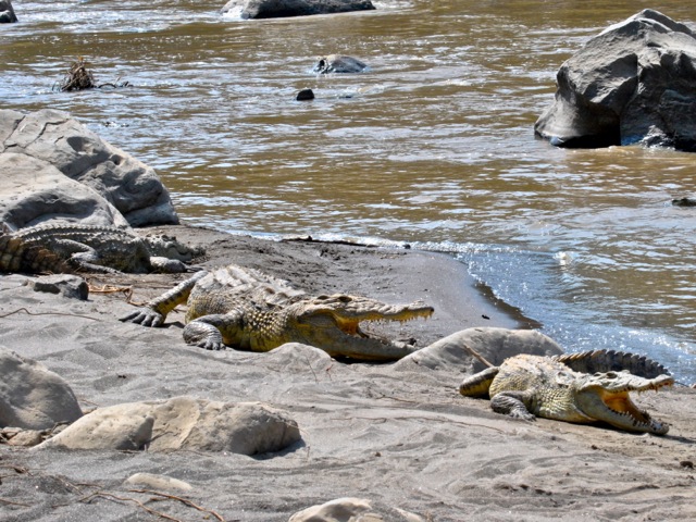
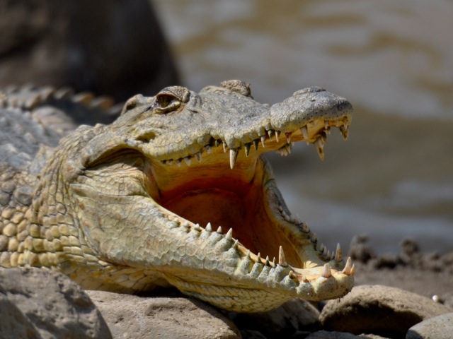
The restaurant area has a very nice view of the falls and the crocodiles congregating at the bottom of the falls. There were probably 20 Nile crocodiles hanging on the beach or floating at the bottom of the falls. It is possible to walk down to the beach to get a closer look at the crocodiles some of which were easily 4 meters long.
Awash falls, Ethiopia
Nile crocodiles near Awash falls, Awash national park, Ethiopia
Nile crocodile near Awash falls, Awash national park, Ethiopia
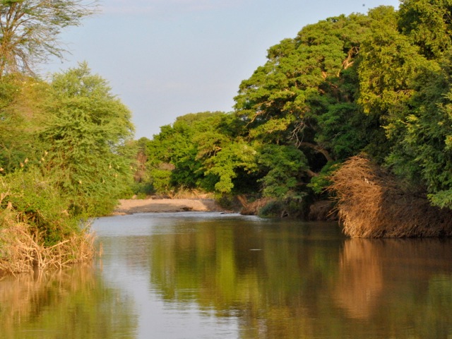
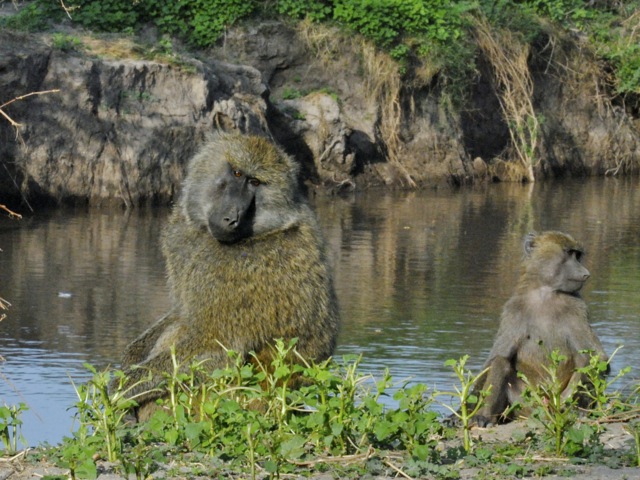
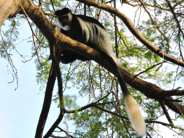
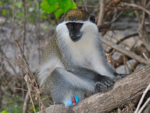
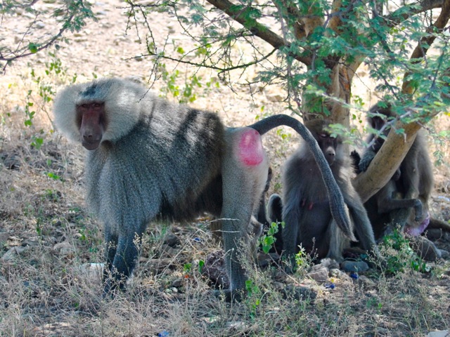
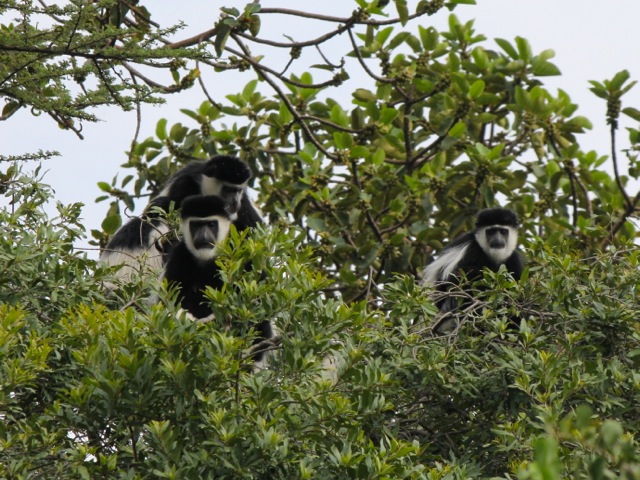
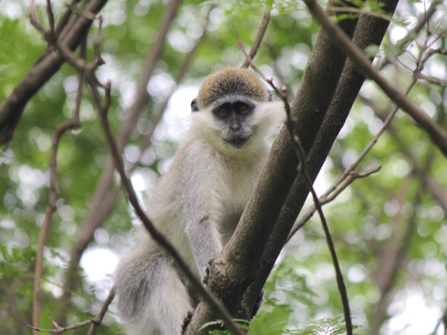
Awash river serves as a southern boundary of the national park and there is a nice trail starting at the lodge and going along the river. There is incredible variety of bird life along the river as well as baboons and monkeys and crocodiles in the river. Baboons and grivet monkeys seemed quite relaxed and one could get really close to them. Colobus monkeys were very shy mostly hiding in the top of tree canopy as it seems they get poached fair bit.
Awash river, Awash national park, Ethiopia
Baboons, Awash national park, Ethiopia
Colobus monkey, Awash national park, Ethiopia
Grivet monkey, Awash national park, Ethiopia
Hamadryas baboons, Awash national park, Ethiopia
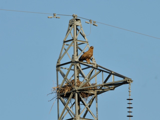
Eagle with a nest on power line, Awash national park, Ethiopia
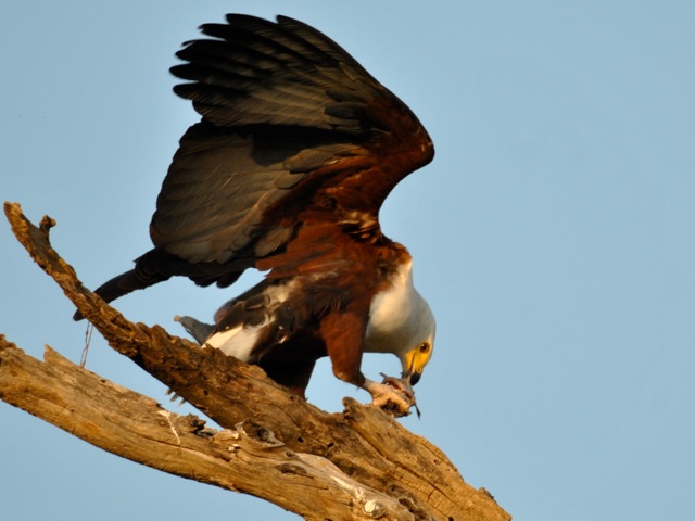
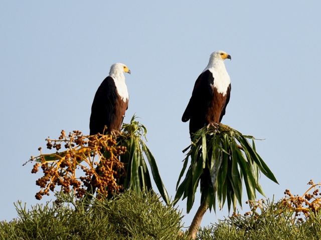
African fish eagle eating fish, Awash national park, Ethiopia
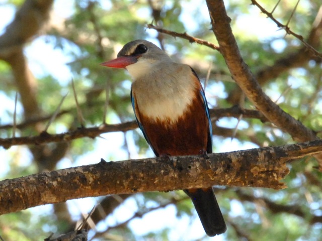
Grey-headed kingfisher, Awash national park, Ethiopia
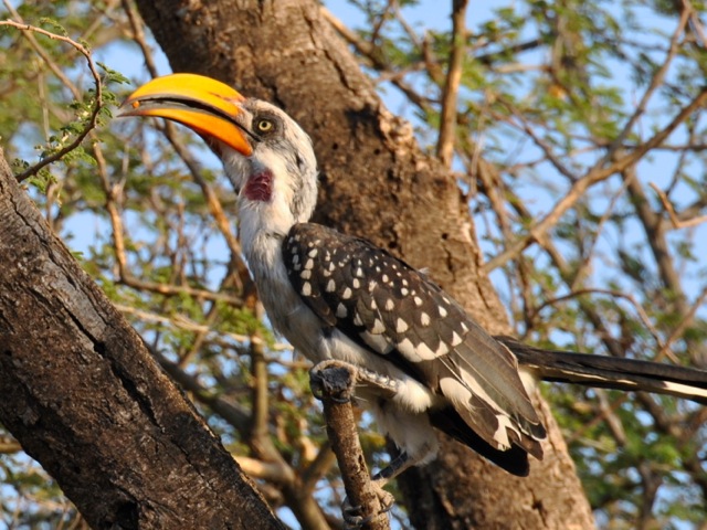
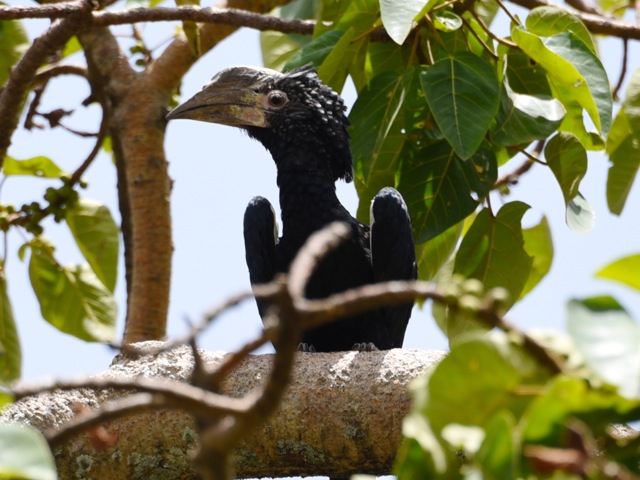
Eastern yellow-billed hornbill, Awash national park, Ethiopia
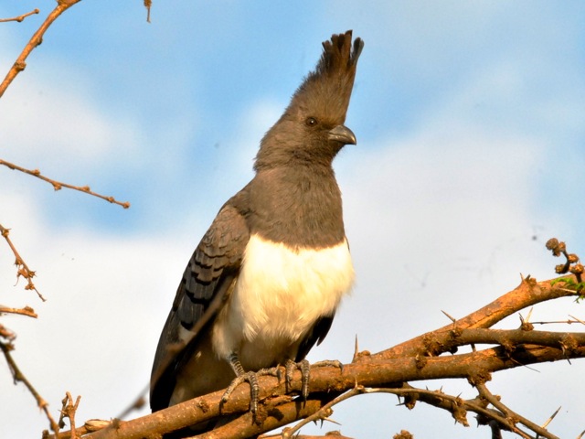
White bellied go-away bird, Awash national park, Ethiopia
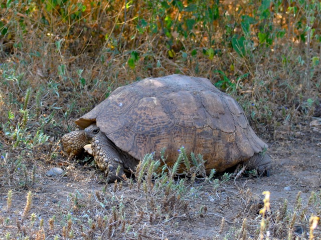
Leopard tortoise, Awash national park, Ethiopia
There is a game drive loop around the park and we drove in our vehicle but with the guide from the park. We saw a few oryxes and a small group of Soemmering gazelles. Guide told us that quite a lot of animals died in the drought that hit the are in 2015 and 2016. People with their cattle encroach on the park and poaching of the wildlife is a problem also. The enforcement is weak and fines are quite small even if applied.
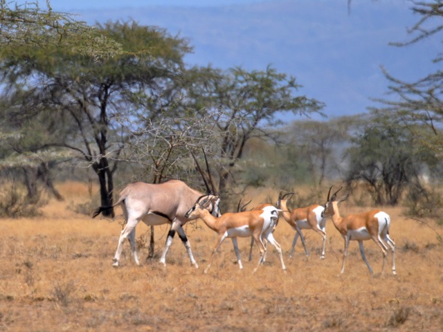
Oryx and Soemmering gazelle, Awash national park, Ethiopia
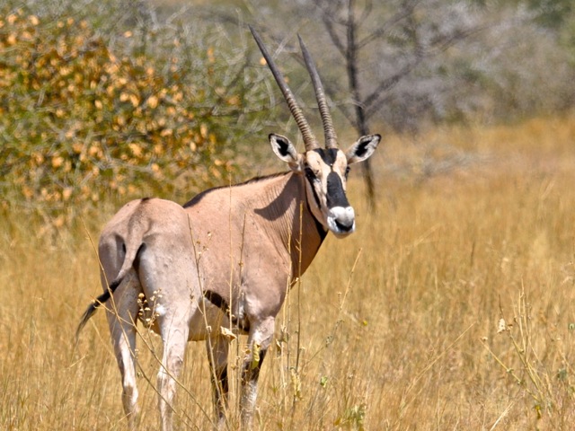
Oryx, Awash national park, Ethiopia
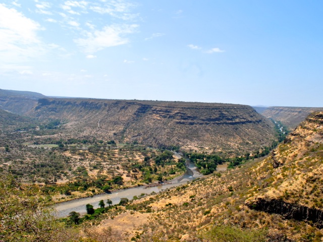
The game driving loop takes you to the Kereyu lodge with a nice view over Awash river gorge. It seems the lodge was going to get upgraded and expanded adding pool and proper rooms to the trailer cabins it had before. At the time of the visit though there was no sign of any construction continuing. And with unrest that started in 2015 and periodically flairs up it seems fewer tourists make it to the park.
Awash river gorge, Awash national park, Ethiopia
Unfinished pool in Kereyu lodge overlooking Awash gorge, Awash national park, Ethiopia
Stopped construction in Kereyu lodge, Awash national park, Ethiopia
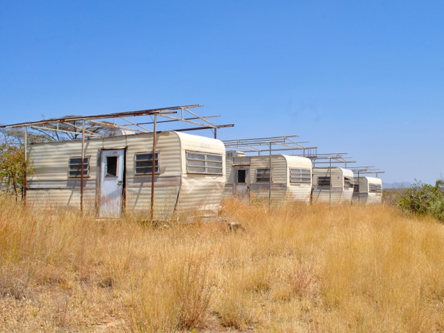
Trailer-rooms in old Kereyu lodge, Awash national park, Ethiopia
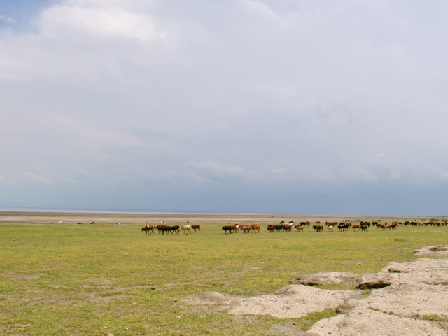
Similar to the Abijatta-Shalla park we saw cattle grazing in Awash national park. Generally it seems Awash situation is better though as there was still plenty of long grass and we saw only one herd of cattle – unlike Abijatta-Shalla with its manicured-lawn look.
Cattle in the distance in Awash national park, Ethiopia
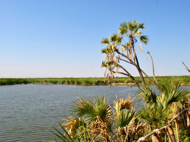
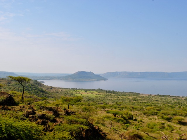
About 10km from the national park there is lake Beseka with good birdlife, Mount Fentalle and hyena cave at the foot of the mountain. We headed for the sunset on the lake and a look at the hyena cave. Hyenas emerge from the cave at sunset and head out to hunt.
Mount Fentalle and lake Beseka, Ethiopia
Mount Fentalle is a dormant volcano that last erupted probably in early 19th century. The scenery is quite stark with old lava flow and vents surrounding the mountain. It is possible to hike up the mountain to see the crater. The lake at the foothills of the mountain has lots of birds but is also quite polluted with the growing town of Metahara on its shore.
Yellow-billed stork, lake Beseka, Ethiopia
Marabou stork, lake Beseka, Ethiopia
Sunset on lake Beseka, Ethiopia
To see the hyena cave we joined a small group of local tourists with a guide and drove from the lake towards the Fentalle mountain for about 2km. We then parked and hiked. The walk involved crossing the newly constructed railway line connecting Addis Ababa with Djibouti. The terrain at the foothill of the mountain is rocky with solidified lava flows. There are also massive volcanic fissures in the ground that seem to go very very deep with bats popping out of them. We reached the hill providing a good view of the cave as sun was setting. We saw about 5-6 hyenas emerge from the cave and trot away hunting. It was too dark to get a good picture of them unfortunately. As we started going back it was already dark. Hopping over volcanic fissures and stumbling around rocky solidified lava with a phone torch as the only source of light was quite an adventure.
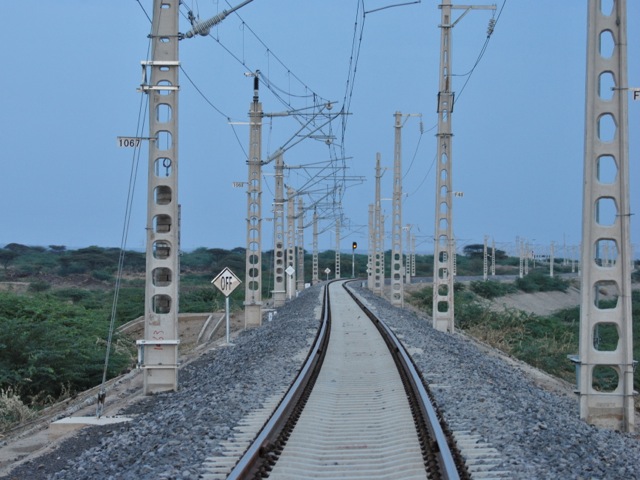
Addis Djibouti railway, Ethiopia
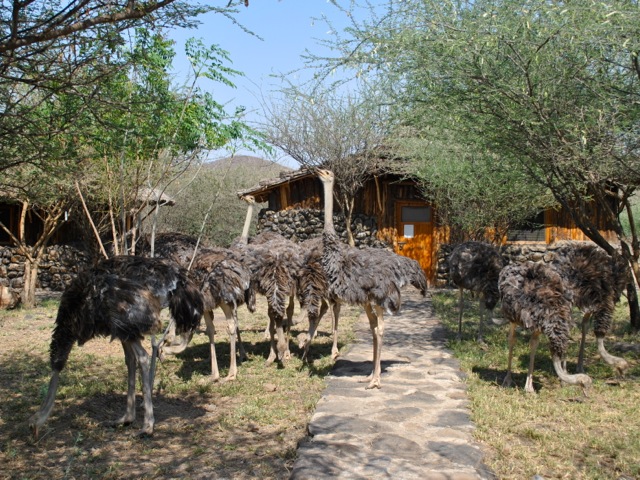
Next day we headed to the northern part of the park to Doho lodge and hot springs passing some traditional Afar homes on the way.
Afar traditional home, Ethiopia
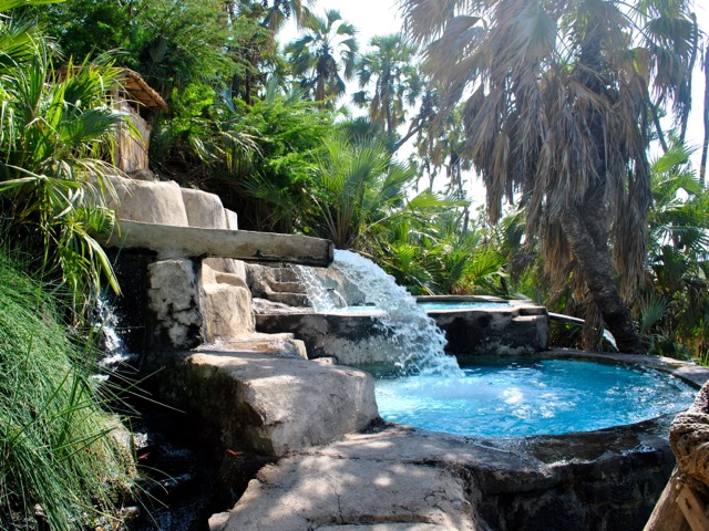
Doho lodge has ostriches wondering around the grounds and nice looking cabins. The hot springs are concreted in several pools – the water was super hot boiling temperature and given it was a hot day we did not quite feel the need to jump into these hot pools. The hotsprings drain into a nice little lake and the lodge’s restaurant is set up so that you have a nice view over the lake. It seemed that the place would be very good for bird watching too.
Ostriches at Doho Lodge, near Awash national park, Ethiopia
Hot springs at Doho lodge, near Awash national park, Ethiopia
The view of the lake from the Doho lodge restaurant, near Awash national park, Ethiopia
After having a nice lunch overlooking the lake we headed back to Addis Ababa enjoying more impressive scenery on the way back.
View along Adama express towards Addis Ababa, Ethiopia
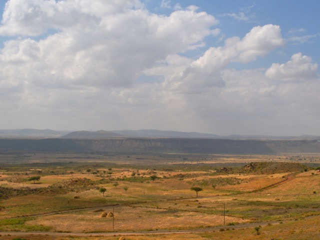
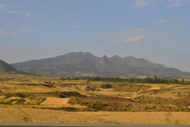
Lakes Langano, Abijatta and Shalla are about 200km south of Ethiopia’s capital Addis Ababa with Lake Ziway along the way at about 150km. These lakes are a part of the string of East Africa Rift Valley lakes stretching further south through Kenya, Tanzania, Malawi and Mozambique. This is the line along which Africa tectonic plate is splitting at a rate of 6-7mm a year. In 10 million years a new continent will appear and the ocean will cover the Rift Valley. For now East Africa Rift Valley is incredibly scenic part of Africa and Ethiopia has a good chunk of it from Danakil depression in the north to lake Turkana in the south and many lakes and striking hills in between.
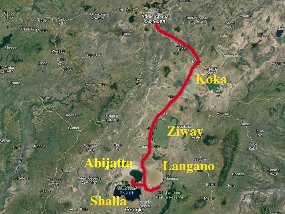
Route from Addis Ababa to lakes Ziway, Langano, Abijatta and Shalla, Ethiopia
Lakes Langano, Abijatta, Shalla and Ziway are relatively easy to reach from Addis Ababa by car through Adama expressway to Mojo and then the road going south to Hawassa. The expressway is an excellent recently built modern tall road that so far takes you to the city of Adama but will eventually be part of the road going all the way to Djibouti.
Adama expressway, Ethiopia
After passing Bishoftu – a town surrounded by four small lakes all part of the same Rift Valley, the road reaches Mojo – home for the main dry port of Ethiopia and a hectic little town packed with trucks. Here is where you exit the nice expressway and go on the “normal” road towards Hawassa. The new Hawassa expressway is under construction and once finished will make the trip much shorter and a less intense driving experience. For now it takes about 3.5 hours to get to Langano from Addis.
Road from Mojo to Hawassa, Ethiopia
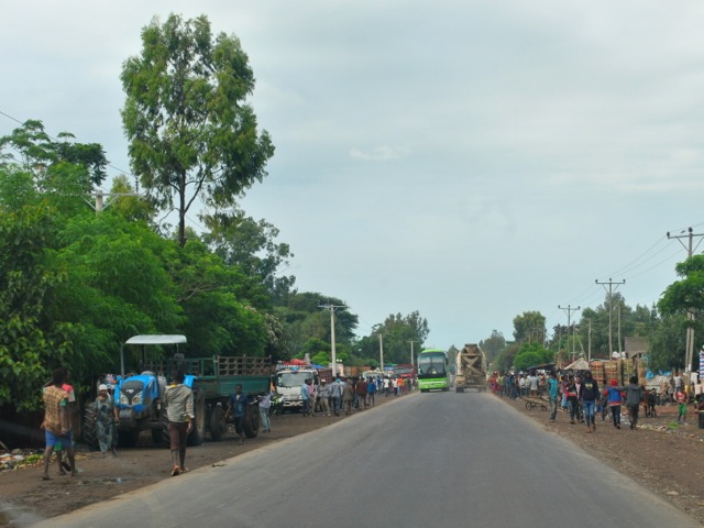
The two-way Hawassa road passes through numerous towns. There is a lot of traffic including overloaded not necessarily road-worthy trucks, tricycles, and horse drawn carriages. There is also cattle walking along the road or crossing it and also people walking everywhere. The situation is further complicated by the poor state of the road with lots of potholes. Drivers prefer to drive around potholes even if it means going to oncoming traffic at high speed.
Road from Mojo to Hawassa, Ethiopia
Bottom line driving is not easy and absolutely not to be attempted in the dark. There are many tour companies that offer trips covering these lakes so this is another option if driving in such conditions does not appeal. We went to the lakes in the fall of 2017 and since then security situation has been fluid in some of the areas. The unrest often means that roads get blocked or protesters try to throw stones at vehicles. It is always good to check before heading out whether roads are calm.
Road from Mojo to Hawassa passing through city of Ziway, Ethiopia
After turning south from Mojo the first lake along the road is lake Koka. This is a man made lake – a reservoir created by the Koka dam blocking Awash river. The size of the lake varies greatly between rainy and dry season. The picture below is at the very end of the rainy season when the lake is at its largest. In dry season water recedes and floodplain is farmed.
Lake Koka, Ethiopia
The road continues through fields and villages. Driving during Saturday morning hours we saw lots of people walking along the road to the nearest markets.
Along the road from Mojo to Ziway, Ethiopia
After about 85km on the road from Mojo is the town of Ziway on the lake of the same name. As you approach the city along the road you see hundreds of marabou storks cruising in the sky and dotting the trees along the road. It appears Marabou storks thrive in Ethiopia as they tend to hang around landfill sites in busy towns across the country with plentiful food supply.
Marabou storks at a garbage dump near lake Ziway, Ethiopia
Once in Ziway we headed first to the pier to have a look at the lake Ziway. Lake Ziway is a big lake with a surface of about 430 square km and an average depth of about 9 meters. The lake has rich bird life and hippos. It is possible to take a boat to go around the lake and to visit some of the islands. One of the islands Tullo Gudo is where the Ark of Covennat was stored for safekeeping at some point according to tradition. As we were heading further down to Langano on the same day we did not do the boat and island thing but stopped for a lunch at Haile resort (owned by the running legend Haile Gebrselassie). Many tours overnight in Ziway as part of the longer rift valley lakes trip which allows for time to explore Ziway lake more.
Ziway town pier, Ethiopia
Lake Ziway formed during the last Ice Age and used to be part of one giant lake encompassing Ziway, Abijata, Shalla and Langano. Over time water levels came down and the four distinct lakes eventually formed by about 2000 years ago. Geological changes in the rift valley combined with increase in human activity contribute to changes in water levels and quality.
Marabou stork and pelicans on lake Ziway, Ethiopia
Marabou stork and fishing boat on lake Ziway, Ethiopia
After our lunch in Ziway we headed further south towards lake Langano. The road stretches along the lake and is lined with flower farms that have expanded fast in recent years turning Ethiopia into the second larges flower exported in Africa after Kenya. We stayed in Hara Langano lodge on the south eastern side of the lake Langano. Reaching the lodge required taking off the main road and shifting towards a local road which was mostly paved to go around the southern shore of the lake.
View on Langano lake from the road at the souther side of the lake, Ethiopia
Taking this road we were getting deeper into rural Ethiopia. There were villages, small subsistence farms and kids running around everywhere. The birdlife along this rode was amazing. We saw plenty of hornbills and all sorts of other spectacular birds.
Traditional house near lake Langano, Ethiopia
Hana Langano lodge is quite remote located away from the main concentration of lodges along the main road. It has basic wooden cabins, hot water and reasonable food. The cabins are facing the lake and you can see hippos from your room. Same hippos at night come and graze in the vicinity of the lodge. We saw a group of colobus monkeys passing through the beautiful huge trees dotting the lodge. There was also plenty of birdlife.
Colobus monkeys at Hana Langano lodge, Ethiopia
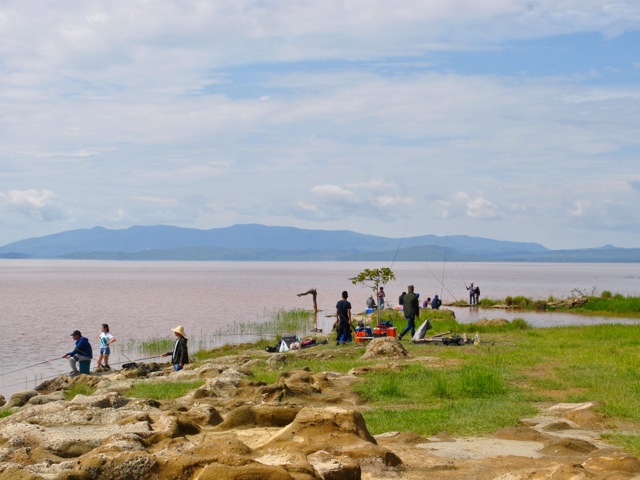
Amazingly for this relatively remote location – it took us nearly five hours to get there – there were two fairly large groups of Chinese and Japanese people from Addis Ababa. They were well equipped with fishing gear, tents and all things needed for preparing big dinner – including own barbecue grill and blow torch for starting the fire.
Fishing on lake Langano, Ethiopia
Sunset on lake Langano from Hana Langano lodge, Ethiopia
Next morning, after a nice breakfast we headed for the Abijatta Shalla National park – back to the main road. This national park, like other national parks in Ethiopia are not exactly as well run as the parks in neighboring Kenya or Uganda. You can self drive through the park but must take a guide with you when you pay for your permit at the gate. We did not pre-book the tickets and did not see many tourists in the park.
Entrance gate to Abijatta Shalla National Park
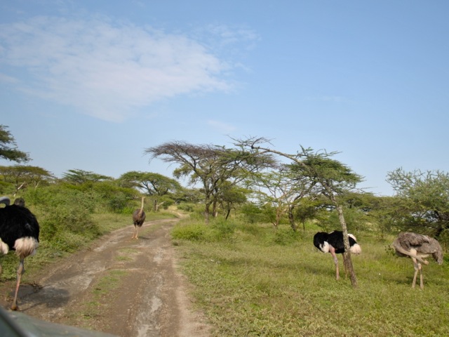
After passing the guards’s house presumably national park starts. We were quite excited to see ostriches walking towards us along the road. But then after driving a bit further we passed a fence and it turned out that the ostriches we saw were an ostrich farm not exactly wild park ones.
Ostrich farm in Abijatta Shalla national park, Ethiopia
We then proceeded to the hill top with an incredible view over both lakes and the narrow strip of land separating them. The view was stunning especially given the contrast between the two lakes. Shalla is a deep 257m lake covering a crater of ancient volcano. Abijatta is a shallow shrinking lake that lost about 100 square km or half of its surface since the 1980s. The land between the lakes is also part of the national park so it was surprising to see permanent villages, cultivated fields and cattle scattered over the area. Population encroachment is a problem across the national parks in Ethiopia it turned out. By some estimate about 50,000 individuals reside in Abijtta Shalla National Park.
View of the Abijatta Shalla National park.
From the hilltop view point we headed down to the park. The route did not appear to be frequented by tourists. Most tourists – at least those on a big bus with what seemed to be school kids that we saw – finished the tour of the park by taking pictures at the hilltop view point. The roads in the park are not exactly maintained and as we were there just at the end of the rainy season some of the driving we did was on riverbeds. It would be impossible to know where to go without the guide – though even guide was not too sure at times as rains washed away parts of “roads”.
View of lake Shalla, Ethiopia
We first went towards the lake Shalla. It is a large lake of dark blue color framed by spectacular cliffs. Because of its depth the lake holds more water than Lake Tana even though Lake Tana has surface area almost ten times larger. As we were heading down towards the lakes we saw (not wild) camels with their herders. We also saw a horse-drawn carriage heading down – amazing given that even in 4×4 it was quite a fit to drive on that road.
Camels on shore of lake Shalla, Ethiopia
Horse-drawn carriage in Abijatta Shalla National Park, Ethiopia
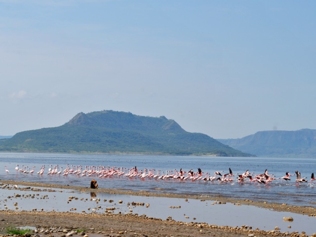
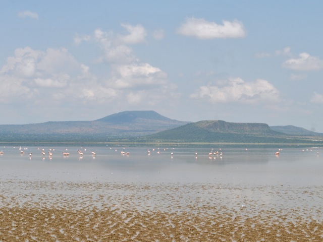
But then we reached the lake and there was an empty shore and lots of flamingoes and it looked perfectly wild and beautiful. It was before our camera lens upgrade and we unfortunately did not get any closeups of these beautiful birds.
Flamingoes on lake Shalla, Ethiopia
Then we went a little further up the shore of the lake towards the hot springs and were surprised to see all the people there. They were cooking corn in the boiling water coming out of the ground and then further down the stream where the water cools a bit as it reaches the lake – doing laundry. There was an entire settlement set up on the shore. All still firmly inside the national park according to the map.
Hot spring flowing into lake Shalla and people doing laundry, Ethiopia
Cooking corn in hot springs near lake Shalla, Ethiopia
From hot springs we headed across the land separating the two lakes towards lake Abijatta. Driving through washed away roads we passed many little settlements with their gardens. We saw some nice birds along the way but no mammals of any kinds, even monkeys.
Settlements inside of Abijatta Shalla National Park, Ethiopia
It is only as we were reaching lake Abijatta we saw several Grant’s gazelles in a distance. They were very skittish – unsurprisingly as it seems encounters with humans do not usually go well for them even in what is technically a national park.
Grant’s gazelle in the distance in Abijatta Shalla National Park, Ethiopia
Lake Abijatta is a very shallow lake of brownish color with very scenic hills on the western side of the lake. The lake has been shrinking fast over the past thirty years and is now surrounded by a wide margin of dried lake bed.
Lake Abijatta, Ethiopia
As we walked closer the ground got softer. The surface of it was actually crispy solid dry but under it was shifty moving mud so you could not get all the way to the water really. There were quite a few flamingoes on the lake though we could not quite get near enough to get good pictures.
Flamingoes on lake Abijatta, Ethiopia
The grass around the lake and through most of the park area that we drove through was very short – looking like a perfectly manicured lawn. And then we saw a large herd of cattle grazing next to the lake – all still inside the national park boundaries.
Cattle grazing near lake Abijatta, Ethiopia
Done with Abijatta and Shalla we headed for the exist from the park and towards lake Langano. We stopped at Sabana lodge for a late lunch. The lodge overlooks lake Langano and is a popular spot for Addis residents on weekends. There are several less fancy lodges along the shore and a few modern houses.
View of lake Langano, Ethiopia
Lake Langano is reportedly free of bilharzia or schistosomiasis – a disease caused by parasitic warm carried by snails – and is safe for swimming. We did not try our luck and as it was not that hot yet did not see many people in the water. We enjoyed a nice lunch overlooking the beautiful lake before heading back to Addis Ababa after quite active weekend exploring the four lakes.
View of lake Langano, Ethiopia
Ethiopia is a densely populated country of 100 million people and enforcing borders of national parks is very difficult. Competition for land and resources is a major source of conflict. On some level it was fascinating to see the people and their cattle and their villages in the stunningly beautiful environment. But it was also clear that wild life does not have much chance and is being squeezed out. Overgrazing in these marginal areas that are often hit by droughts makes one also wonder if the large herds of cattle are sustainable. Water resource use as towns around lakes grow also threatens the lakes themselves. Ethiopia has incredible landscape and nature and still some wildlife left as we saw in other national parks in Awash, Simeon mountains and Nechisar. As Government plans to boost tourism hopefully chances for wildlife in national parks will improve too.
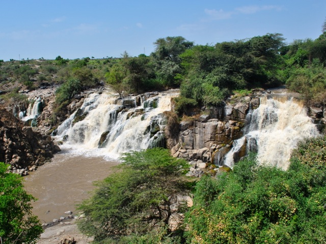
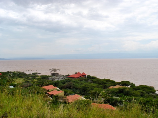
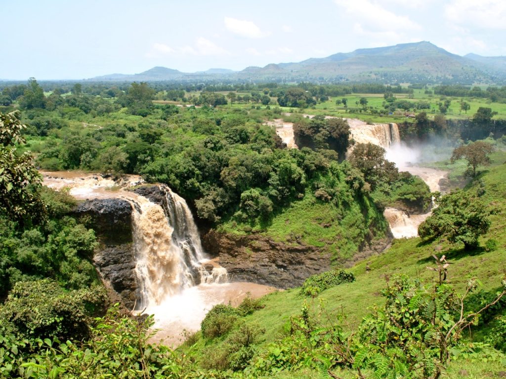
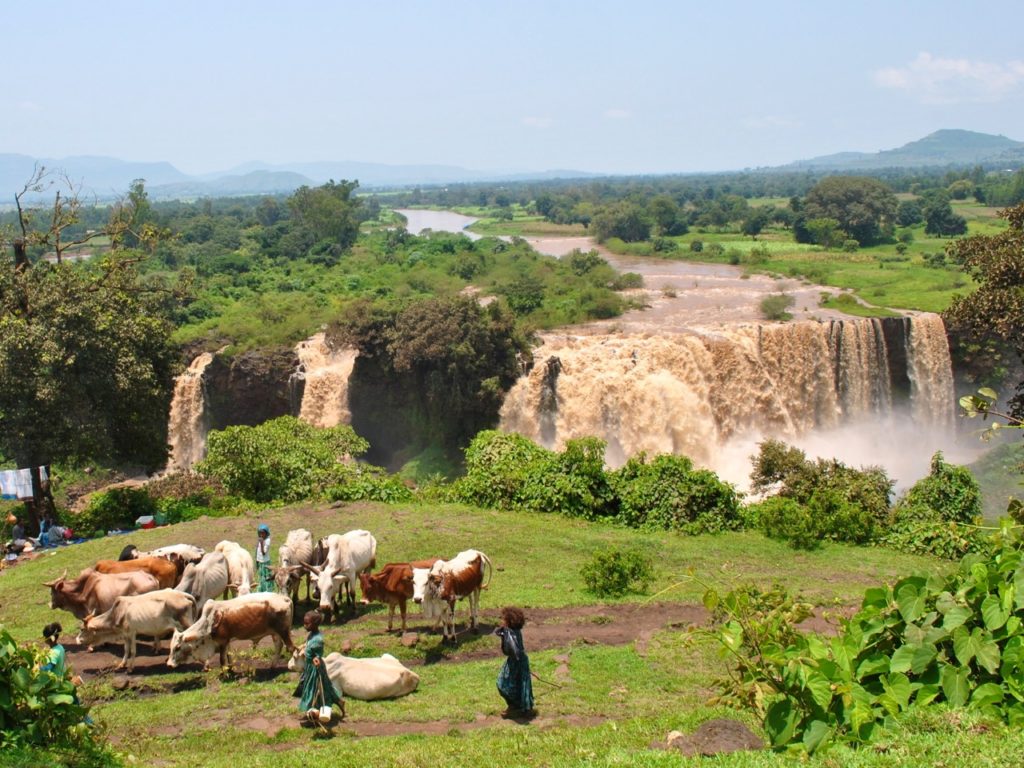
Blue Nile falls in Ethiopia known as Tis Issat (Smoke of Fire) or Tis Abay (Smoke of the Nile) are about 30 km downstream from the lake Tana – the source of Blue Nile. We visited in September 2017 – the end of the rainy season when water level is the highest and the falls are at their most impressive. The falls are a worthy day trip from Bahir Dar – a city on lake Tana and a capital of Amhara region.
Blue Nile falls, Ethiopia
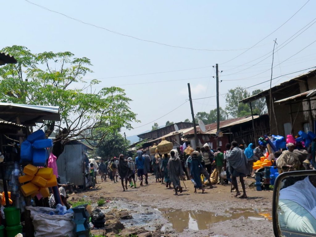
We went to the falls on Saturday – a market day – and it was the market day ahead of Ethiopian new year celebrated on September 11 (Ethiopia has its own calendar with 13 months in it). Bahir Dar is the capital of the region and the main commercial center and market town. With the new year’s market on, some of the main roads in the city were closed so we had to drive around through back roads which are not sealed.
Back street roads after rains, Bahir Dar, Ethiopia
It’s being the end of the rainy season some of the roads looked more like rivers. So the trip to the falls took us a bit longer than expected 1.5-2 hours but also gave a glimpse of life in the town off the main street. Once we reached the main road, we saw a constant flow of people heading to the market in Bahir Dar from surrounding villages. Men herding goats, sheep and cows and women carrying sacks of grain or baskets with chickens and all sorts of other produce on their heads.
people walking to the market, Bahir Dar, Ethiopia
The road to the falls runs through picturesque fields with mountains in the distance. After the rainy season the fields were bright emerald green. And all along the way we saw farmers walking down the road to do their holiday buying and selling. The Blue Nile falls may be one of the major tourist attractions in the area but the road to them is still a work in progress. Reportedly during the dry season it is not an issue but after heavy rains parts of it are barely passable and 4×4 is essential.
view on the way from Bahir Dar to Blue Nile falls, Ethiopia
on the way from Bahir Dar to Blue Nile falls, Ethiopia
Blue Nile falls sign, Ethiopia
The starting point for the track to the falls is the village of Tis Abay (also called Tis Issat) – both of which are the names for Blue Nile falls – so basically the Blue Nile falls village. Being a market day, it was very busy and took us a while to get through the main street with all the shoppers sharing the road with vehicles. We picked up our guide – advisable not because it would be difficult to find the way to the falls but to avoid harassment along the trail by unofficial guides and locals – and set of for the falls.
Tis Abay village near Blue Nile falls, Ethiopia
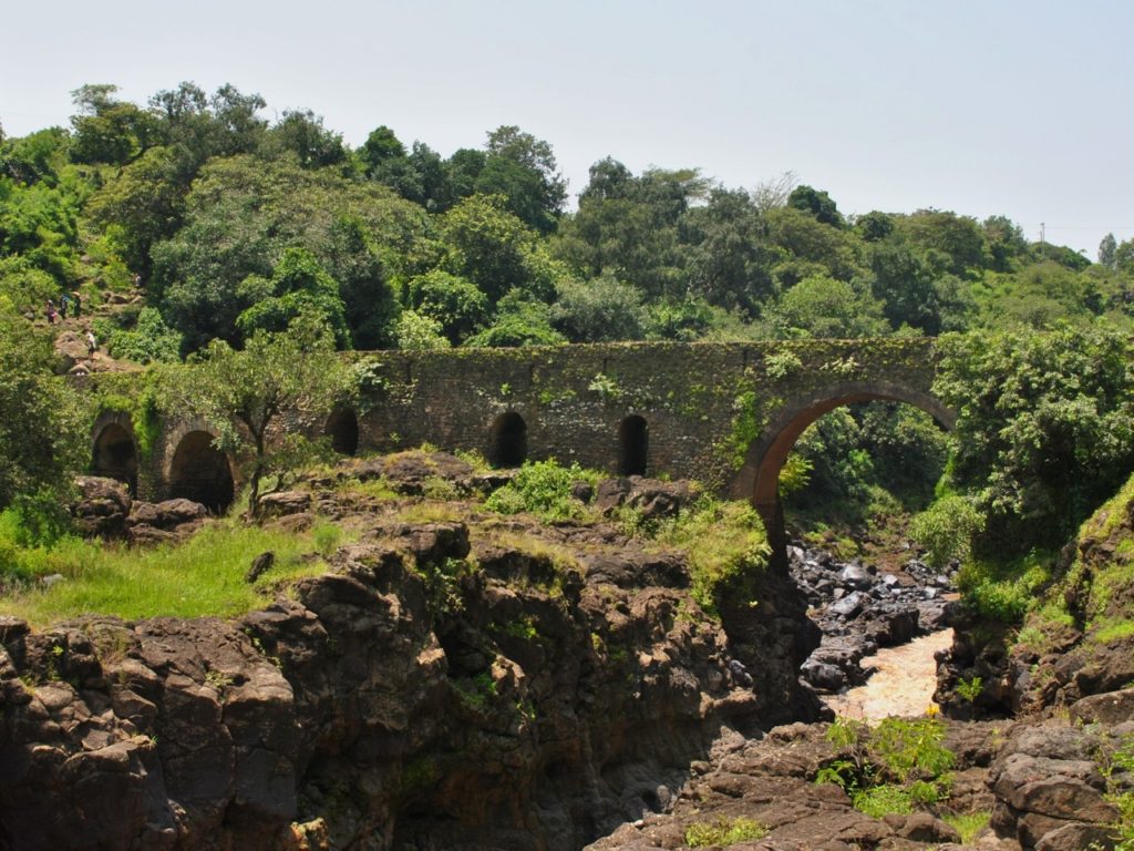
The falls are an easy walk and we reached the first view point in about half hour stopping frequently taking pictures. Parts of the trail got quite muddy and slippery after the rain so it is a good idea to have proper shoes and definitely not advisable to try to do it in flip flops. The walk starts by crossing a stone bridge built by Portuguese in 1626 – presumably the oldest stone bridge in Ethiopia.
Portuguese bridge near Blue Nile falls, Ethiopia
on the hike towards Blue NIle falls, Ethiopia
Walking up the hill we could hear the waterfall’s roar and once up the hill the first view of the falls was spectacular. The volume of water has declined in recent years since part of the river was diverted to hydropower plant and in dry season there is very little of water trickles through. When we were there in September at the end of the rainy season though there was plenty of water plunging down the cliffs with spray reaching across the gorge and you could understand why the local name for the falls was Smoke (of the fire or of the Nile).
Blue Nile falls or Tis Issat, Ethiopia
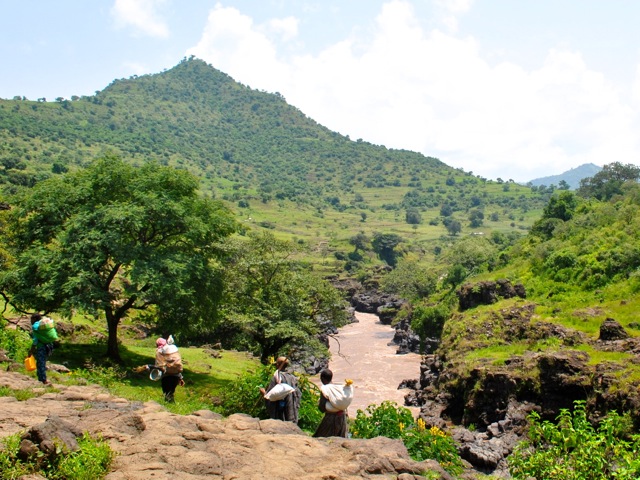
We walked along the falls enjoying the beautiful scenery. There were very few tourists around I think we only saw two or three other small groups mostly couples or families. Instead we saw many locals going to and from market, herding their cattle, fetching water or just going somewhere. As in most places in Ethiopia cattle is pretty much everywhere – including right in front of the waterfalls. Giving the place a very un-touristy feel.
Blue Nile Falls, Ethiopia
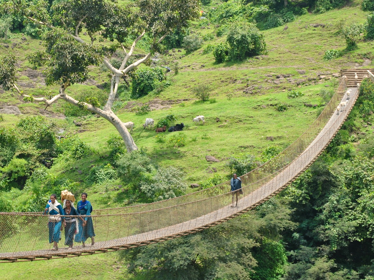
We walked down at the other end of the falls, got properly drenched by the spray and had to give up on getting the up-close photo of the falls. The option for return was to either walk back the same way or proceed further, over suspension bridge and by ferry back to the village. We went for the latter option and crossed over the suspension walking bridge – this one Swiss built in the late 20th century – sharing the bridge with a few goats and giggling local girls.
Suspension bridge, Blue Nile falls, Ethiopia
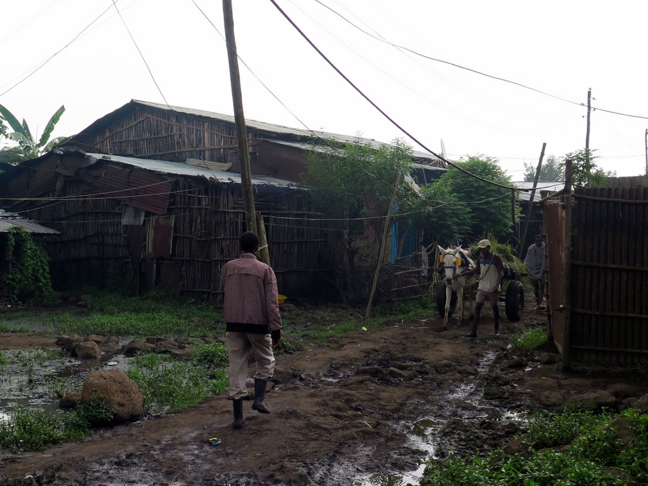
Once on the other side we walked through the fields to the little ferry boat that took us across the Nile back to Tis Abay village. We then walked through some backyards and alleys of the village to get back to our car for the return drive to Bahir Dar. By this time the rain started but we made it back without getting stuck.
Backstreets of Tis Abay village, Ethiopia
It was a nice trip and waterfalls are definitely worth it. Lack of infrastructure and the fact that the falls are not fenced off into a park only for visitors adds to the uniqueness of the adventure. Most likely things will be changing and there might even be hotels around the falls once the road is improved. In the mean time there is a way to see one of the major waterfalls in a very un-touristy way – a rare chance. It is also good to combine with visiting monasteries and watching hippos and birds on Lake Tana using Bahir Dar as a base.
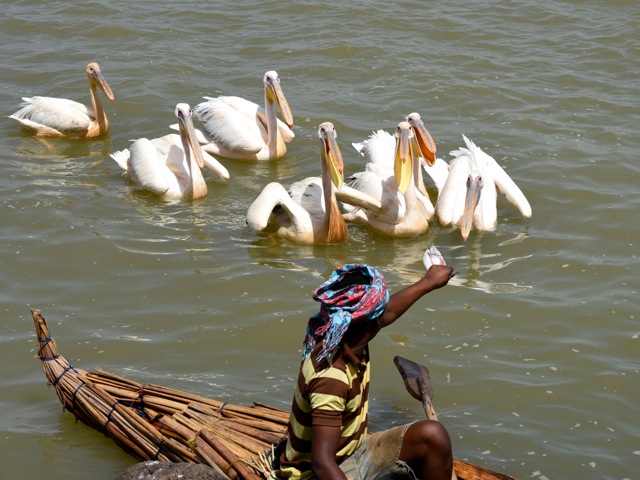
fisherman in a papyrus boat and pelican, lake Tana, Ethiopia
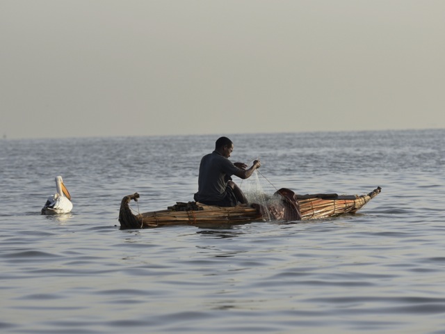
Lake Tana is the largest lake in Ethiopia and the source of Blue Nile. The city of Bahir Dar is a good base to explore the lake with its monasteries and to visit Blue Nile falls. A boat ride towards the marshes near the source of the Nile is good to see hippos and birds. It is possible to arrange your own boat from the hotel or to go on the one departing from the pier – a more crowded option. On the lake it is still possible to see fisherman in traditional papyrus boats usually accompanied by pelicans.
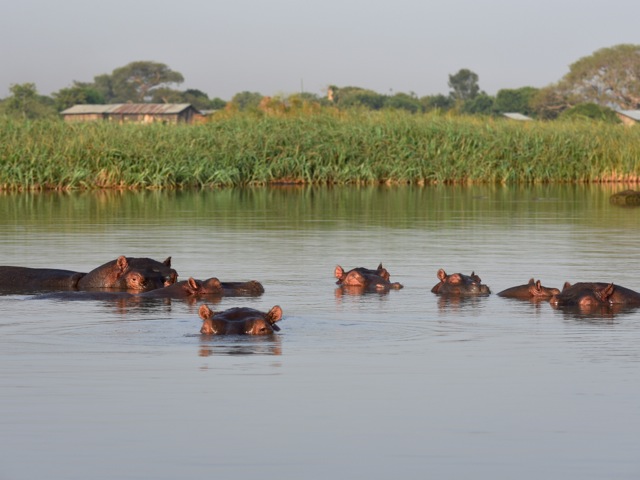
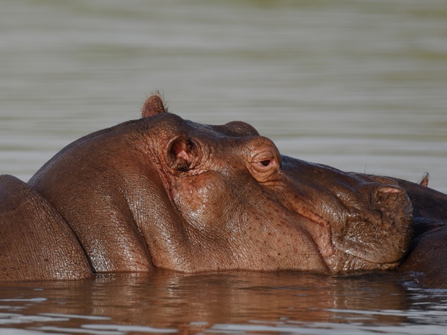
hippos, lake Tana, Ethiopia
Hippos tend to hang around around the western shore where Blue Nile flows out of Lake Tana. You cant quite go on a boat from the lake to Blue Nile it seems as the area is shallow and covered in marsh. People live all around the lake. Having seen hippos mostly in national parks it is quite incredible to see hippos and all sorts of exotic birds right next to people’s houses or groups of people waiting for a boat to take them to town.
hippos, lake Tana, Ethiopia
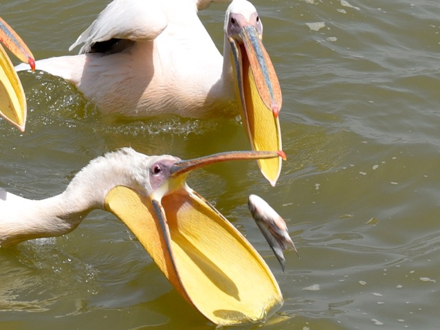
Bird life on the shores of the lake is spectacular. We are not exactly bird watchers but given the amazing diversity of bird life in Ethiopia combined with a rather sad situation in its mammal kingdom (cattle excluded), we have started developing interest in birds. Lake Tana does not seem to be part of the standard bird watcher circuit going mostly south of Addis Ababa along the Rift Valley lakes where it is more likely to see rare endemic species of interest to pro bird watchers. But for us newbie pretend birdwatchers with a greater interest in how large or colorful the bird is than how rare or endemic it is – Lake Tana was perfect. On the boat ride to see hippos we saw several African fish eagles – including in action catching fish, pelicans being fed by a fisherman, cormorants catching fish, and lots of Egyptian geese.
African fish eagles, lake Tana, Ethiopia
pelicans, Lake Tana, Ethiopia
pelicans, Lake Tana, Ethiopia
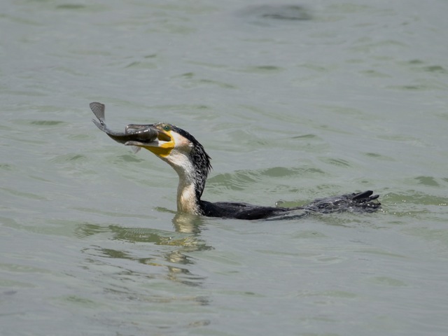
cormorant fishing, lake Tana, Ethiopia
There is a nice path along the lakeshore about 2km long where you can find all sorts of birds. It is a very nice walk even if you are not keen on birds and we even saw some velvet monkeys along the path.
lakeshore path, Lake Tana, Ethiopia
Velvet monkey, lake Tana, Ethiopia
Silvery-cheeked hornbill, lake Tana, Ethiopia
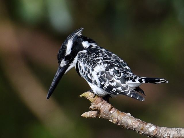
Pied kingfisher, lake Tana, Ethiopia
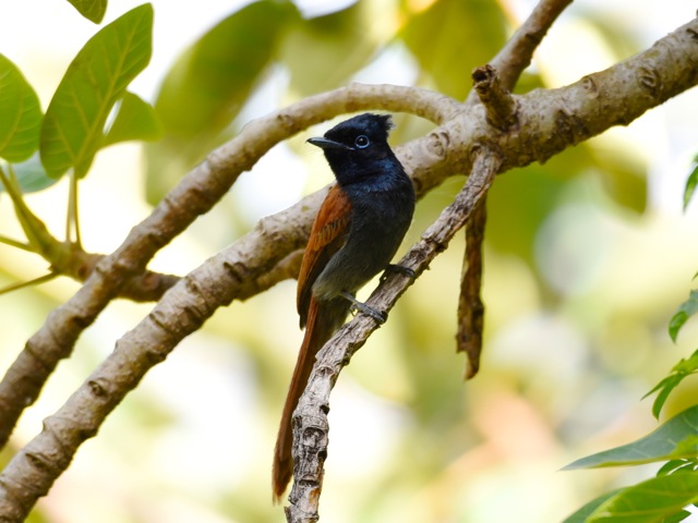
African paradise flycatcher, lake Tana, Ethiopia
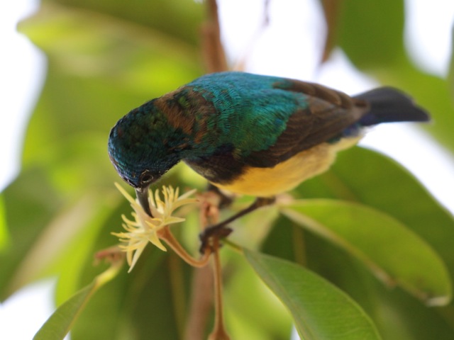
Variable sunbird, lake Tana, Ethiopia
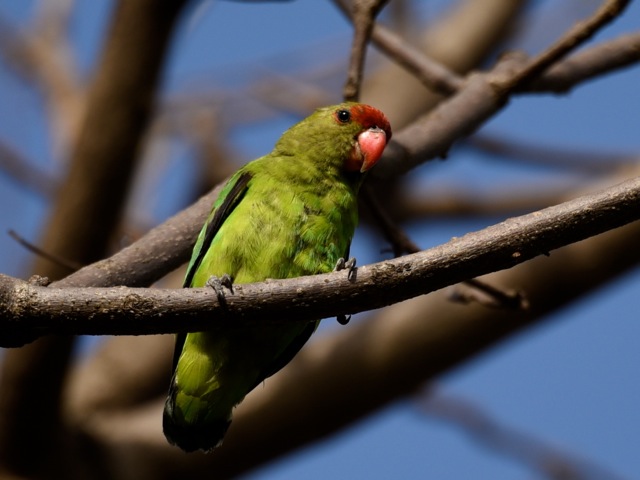
Black-winged lovebird, lake Tana, Ethiopia
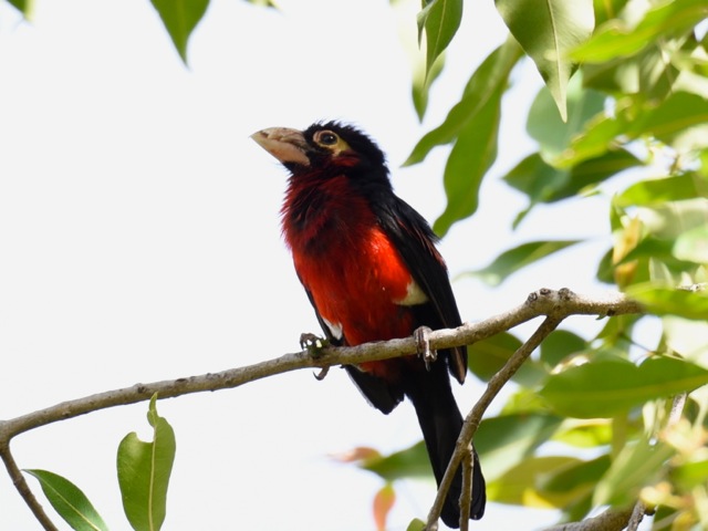
Double-toothed barbet, Lake Tana, Ethiopia
Village weaver, lake Tana, Ethiopia
Speckled mousebird, lake Tana, Ethiopia
Egret, lake Tana, Ethiopia
And after all the walking it is nice to stop at one of the cafes along the lake shore for a beverage and to enjoy the sunset. With Blue Nile falls, lake monasteries, birds, hippos and just chilled out lake side atmosphere Bahir Dar is excellent for a long weekend away from Addis or a 2-3 day stop on an Ethiopia trip.
Lake Tana is the largest lake in Ethiopia and the source of Blue Nile. The city of Bahir Dar on the shore of lake Tana is a nice base to explore the lake with its wild life, islands with monasteries and to visit Blue Nile falls.
Fisherman, lake Tana, Ethiopia
There are about 20 monasteries scattered around the southern shore of the Lake Tana and the islands on the lake. The Ark of Covenant was kept for 800 years at Tana Chirkos on one of the islands after is was brought from Jerusalem and before it was taken to Axum, at least according to the theory explored in Sign and the Seal by Graham Hancock.
ferry taking worshippers to one of the monasteries, lake Tana, Ethiopia
A couple of churches are a short boat trip away from Bahir Dar but many are on further away islands. We visited Ura Kidane Mihret where women are allowed. We tried to go to a further away island (Tana Chirkos being the objective) but were told that it was too far, would take a full day and could be somewhat risky considering the state of the boats and the likelihood of storms as we were visiting at a tail end of the rainy season. Besides women are not allowed in those monasteries as we understood.
Ura Kidane Mihret is located on a Zege Peninsula. We reached by boat from our hotel in Bahir Dar. It took about 40 minutes. The boats taking tourists around the lake are comfortable small flat bottomed ones, with a roof, cushions and life vests. Engines are not exactly the fastest – but enough to reach the nearby monasteries and to explore the marshes with hippos and birds.
Jetty at Zege Peninsula to reach Ura Kidane Mihret, Ethiopia
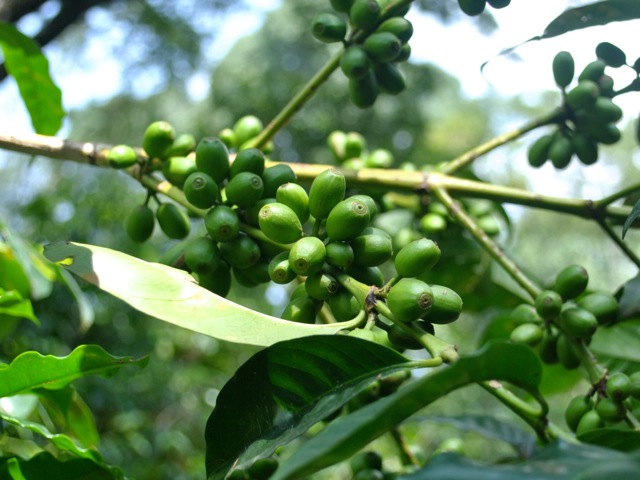
Once out of the boat, we walked on a nicely maintained path through a beautiful thick forest with wild coffee trees. Zege peninsula supports what is reportedly the largest tract of natural forest left around lake Tana. In Ethiopia most forests have been cut out over the years to make way for agriculture and only about 5% of the territory is covered in forests compared to 45% a hundred years ago. The pockets of forests that remain more often than not would have a church or a monastery in the middle -preserving the forest as a symbol of heaven on Earth and home for God’s creatures.
Wild coffee tree, Zege peninsula, Ethiopia
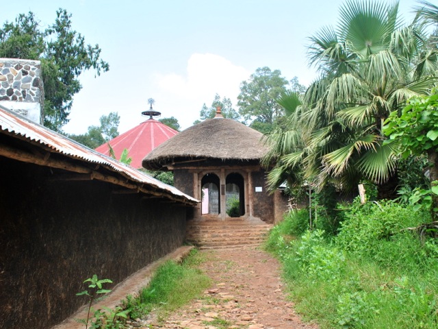
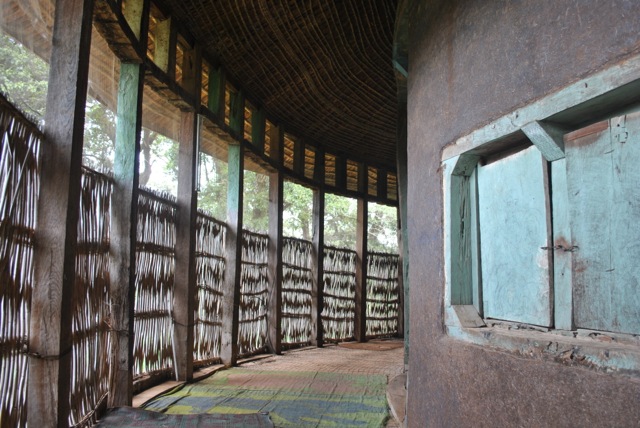
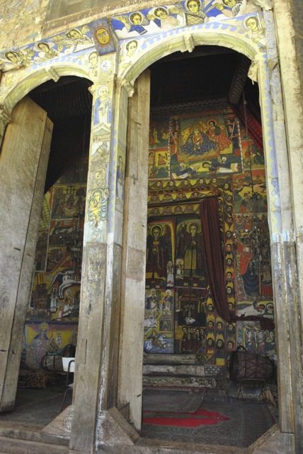
Ura Kidane Mihret was founded in the 14th century and is reportedly one of the most beautifully decorated churches around Tana lake. The round church was built first in 16th century and then renovated multiple times. The outside walls and outer gallery of this round church are not decorated. But the square holly of holies is richly decorated with some beautifully restored paintings.
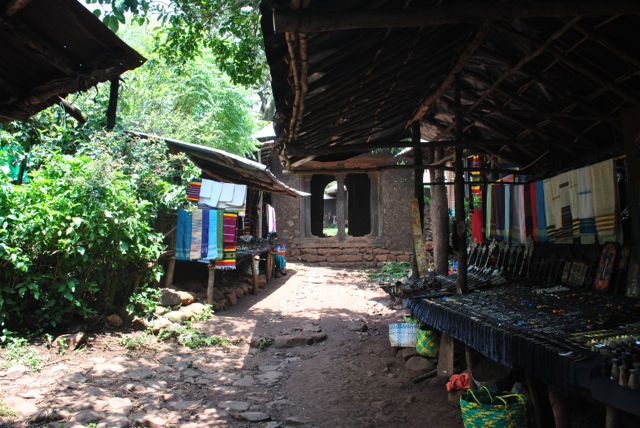
souvenir shops near the entrance to Ura Kidane Mihret compound, Ethiopia
Ura Kidane Mihret entrance and church in the back, Ethiopia
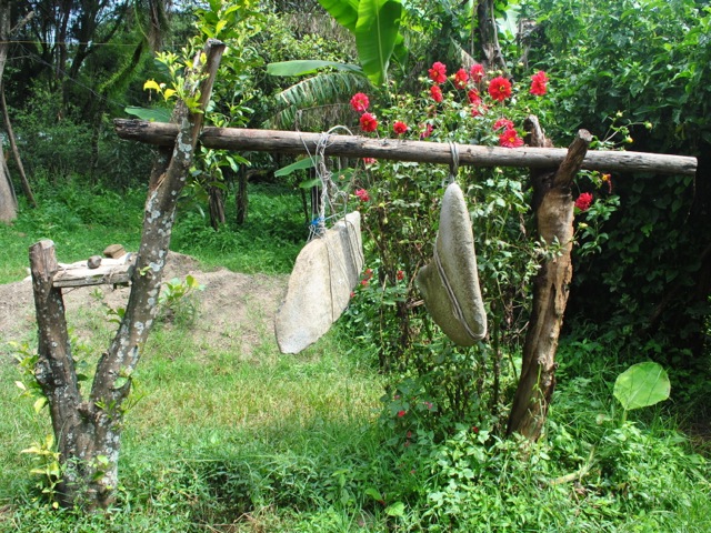
stone “bells” near Ura Kidane Mihret church, Ethiopia
Outer gallery of Ura Kidane Mihret church, Ethiopia
The inner sanctuaries of Ethiopian churches contain the copy of talbot – the Tablets on which Ten Commandments are inscribed. The original is in the Ark of the Covenant. Ethiopians believe that the Ark of the Covenant was brought to Ethiopia by Menelik, son of King Solomon and Queen Sheeba and that the Ark of the Covenant is now in St Mary of Zion Church in Axum. Only priests are allowed in the holly of holies. But talbots are taken out for procession and ceremonies such as during Timket in January.
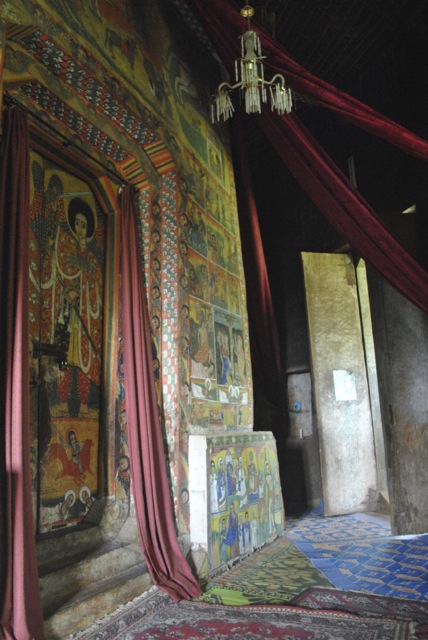
Doors opening to the view of holly of hollies in Ura Kidane, Mihret, EthiopiaOne of the walls of the holly of hollies, Ura Kidane Mihret, Ethiopia
Fragment of the wall of the holly of hollies at Ura Kidane Mihret, Ethiopia
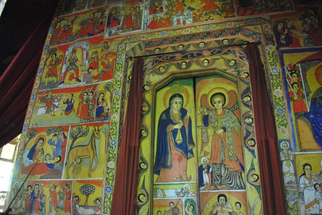
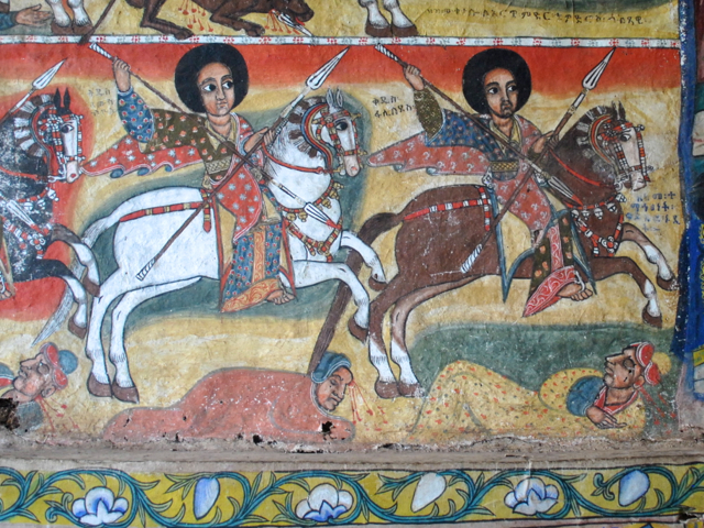
The elaborate paintings decorate the walls of holly of hollies. The guide provides a very good explanation on the meaning of the drawings. After visiting a few other churches there seemed to be a standard set that one can find in most Ethiopian churches. The paintings mostly depict the life of Christ and various conquests of Ethiopian kings defeating the enemies in all medieval glory.
fragment of painting, Ura Kidane Mihret, Ethiopia
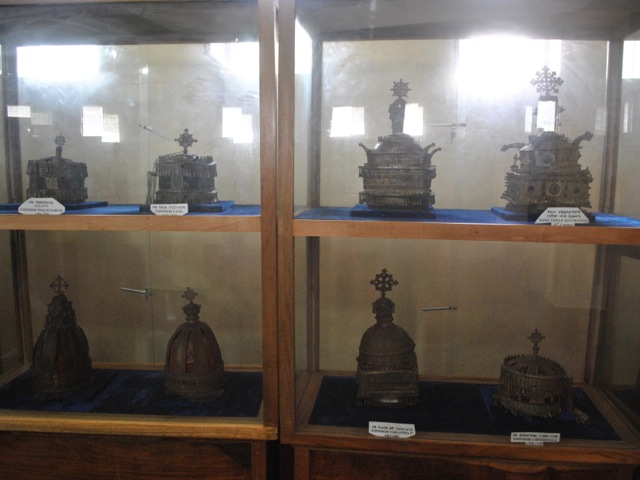
In addition to the church there is also a small museum in the compound that has religious books, imperial dress and crowns for kings and emperors since 17th century.