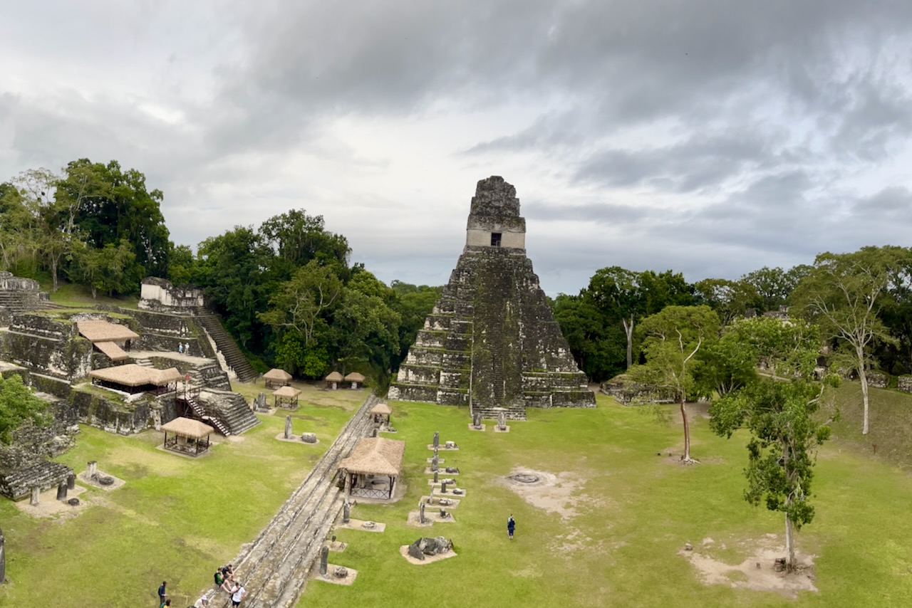
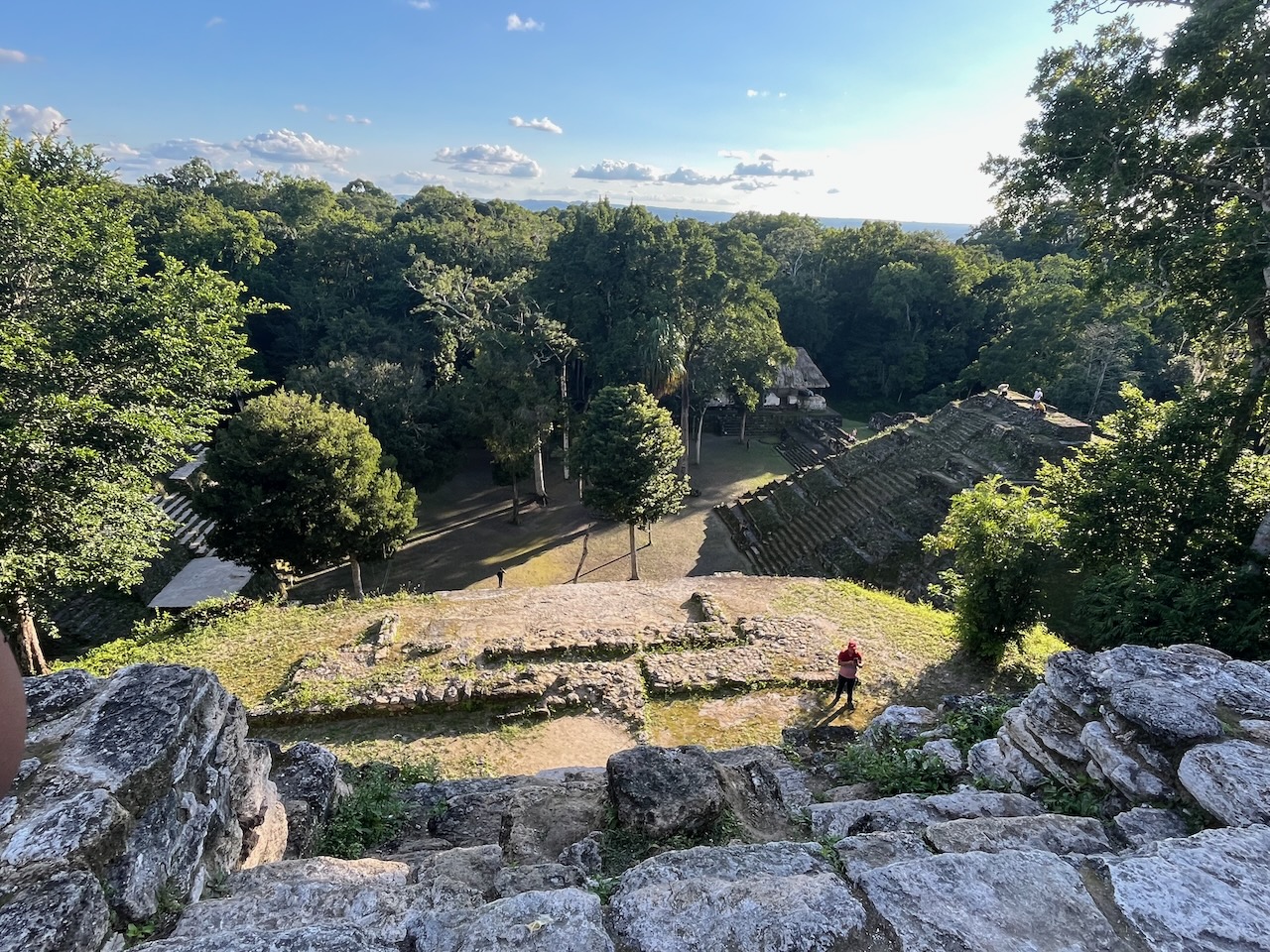
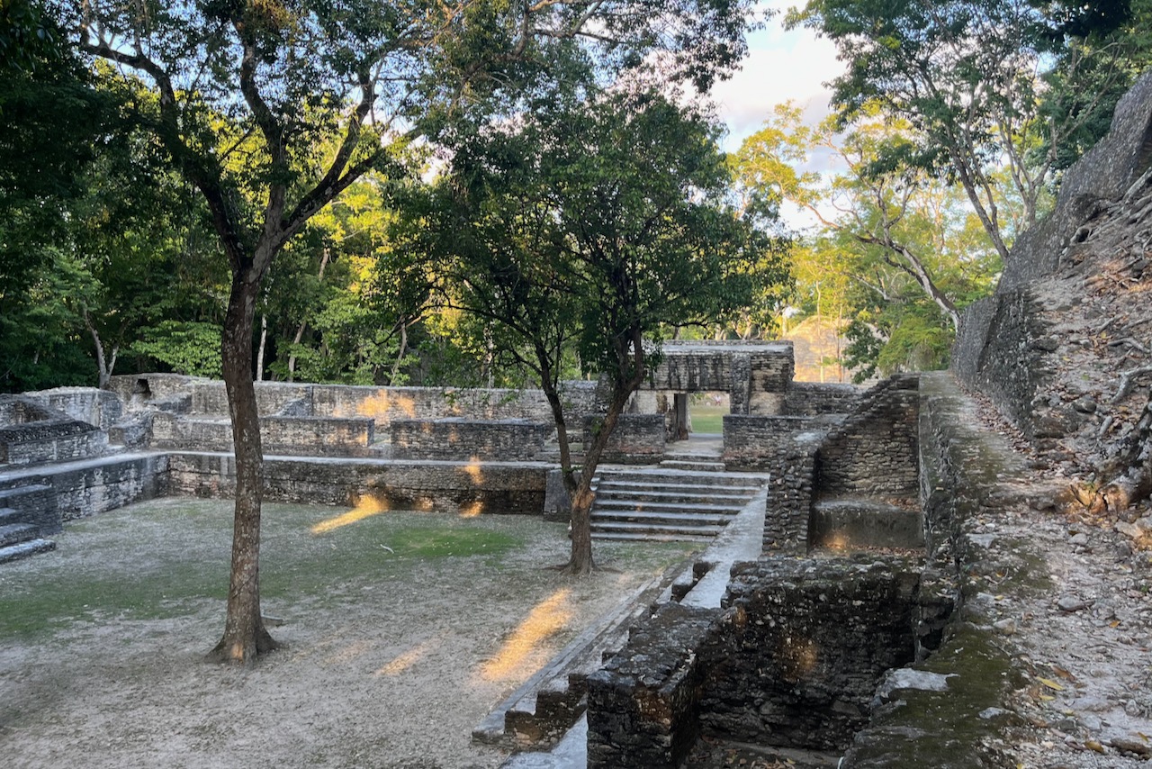
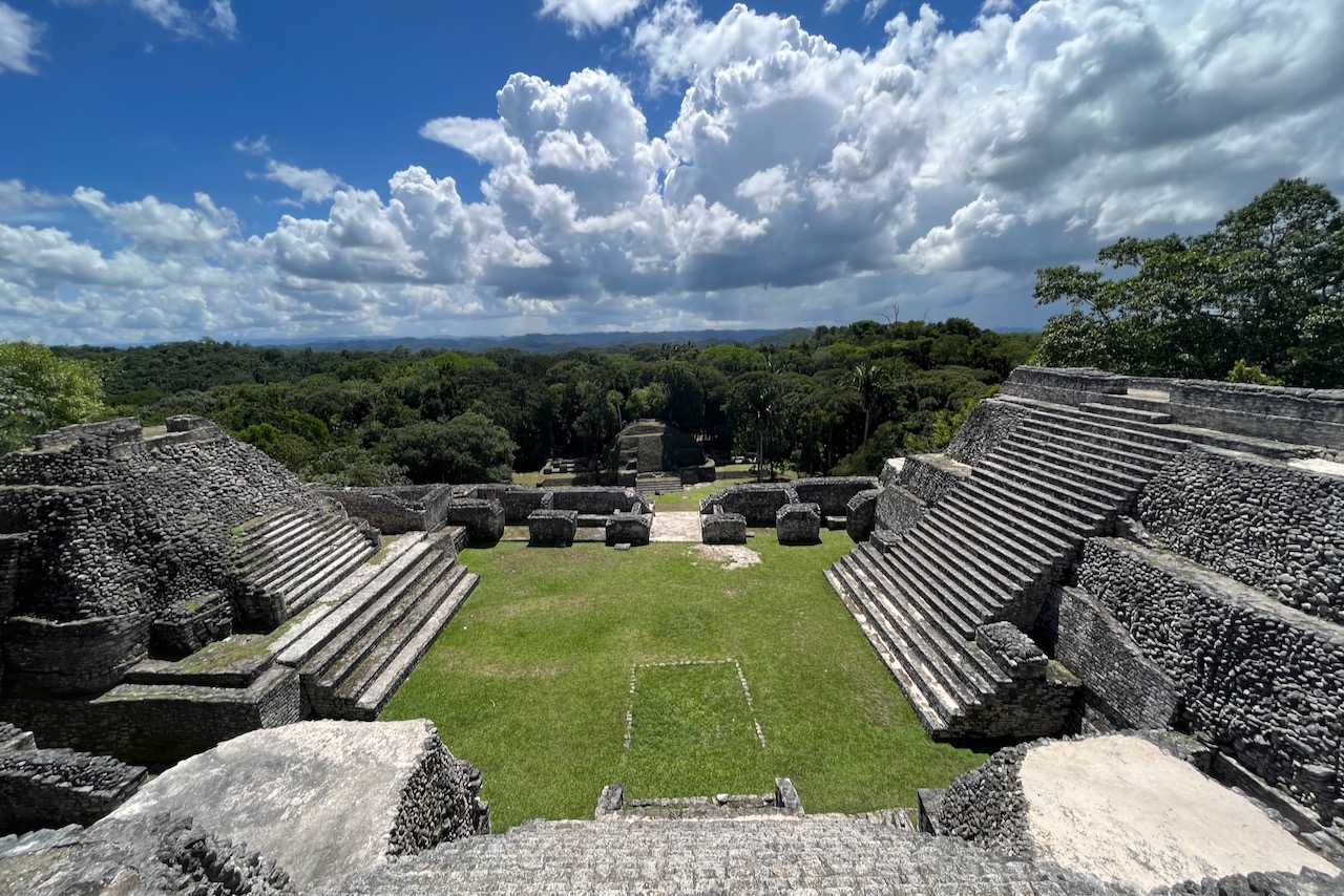
Tikal was a major political and economic center of Maya civilization inhabited between 600BC and 900AD. The urban zone of Tikal is 400 hectares and has palaces, temples, ceremonial squares and various other structures. Tikal national park is part of Maya Biosphere reserve covering more than 21 thousand square kilometers or one fifth of Guatemala. Wondering through TIkal one almost feels like an explorer discovering sites not seen before. Jungle is everywhere, many structures are not excavated, wild life is plentiful and the area is huge. Tikal was a great addition to our collection of Mayan temples that we visited in Belize and Mexico.
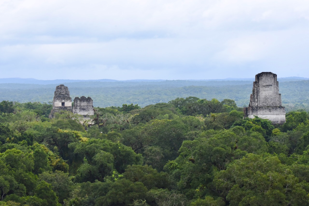
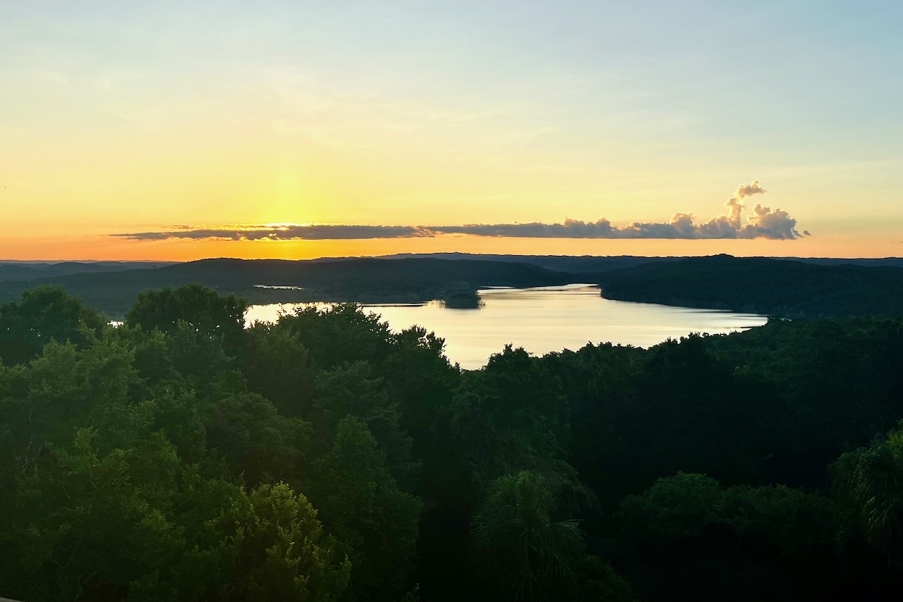
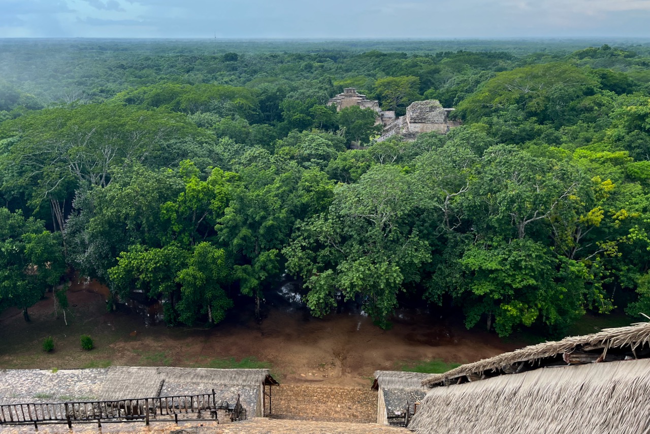
View over Tikal from Temple IV, made famous by star wars movie
Tikal’s otherworldly scenery impressed George Lucas so much that he decided to use it as a filming location for Star Wars Episode IV. Tikal’s Temple IV was the rebel base in the film. Temple IV has a great view over Tikal – with various temples poking out from the jungle. One can not only climb up to Temple IV but view sunrise over Tikal from there. We decided that we should experience that. If one is staying in Flores or other locations outside of the park it would mean a pick up at 3am. We chose to stay for a night at Tikal Jungle Lodge inside of the national park. The lodge is very nice with an excellent restaurant. It also arranges transport to and from airport and Flores.
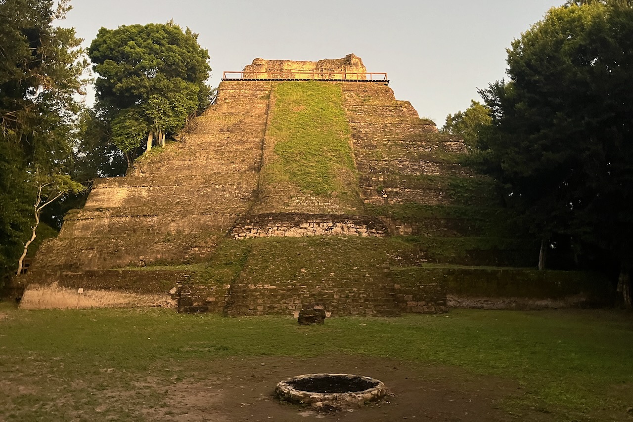
Tikal temple, Guatemala
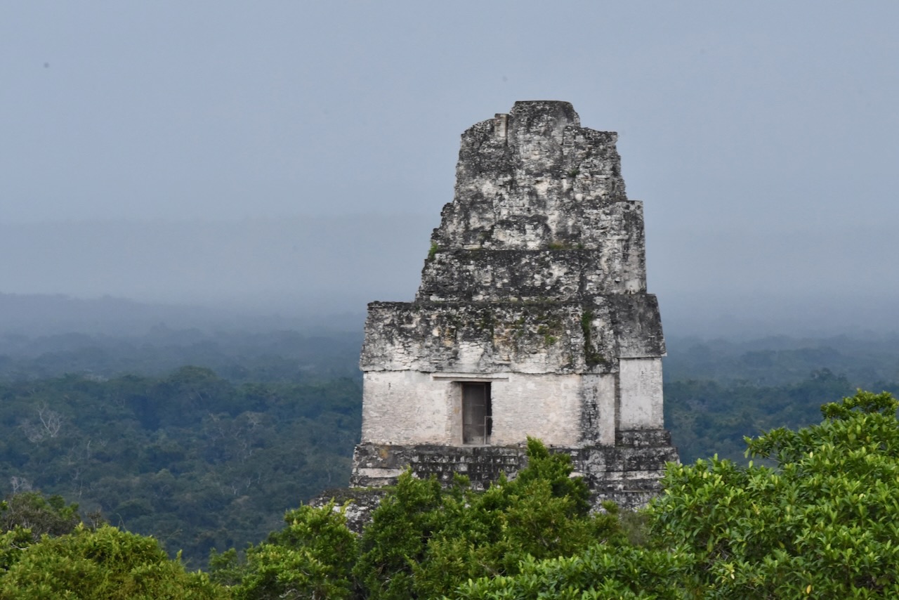
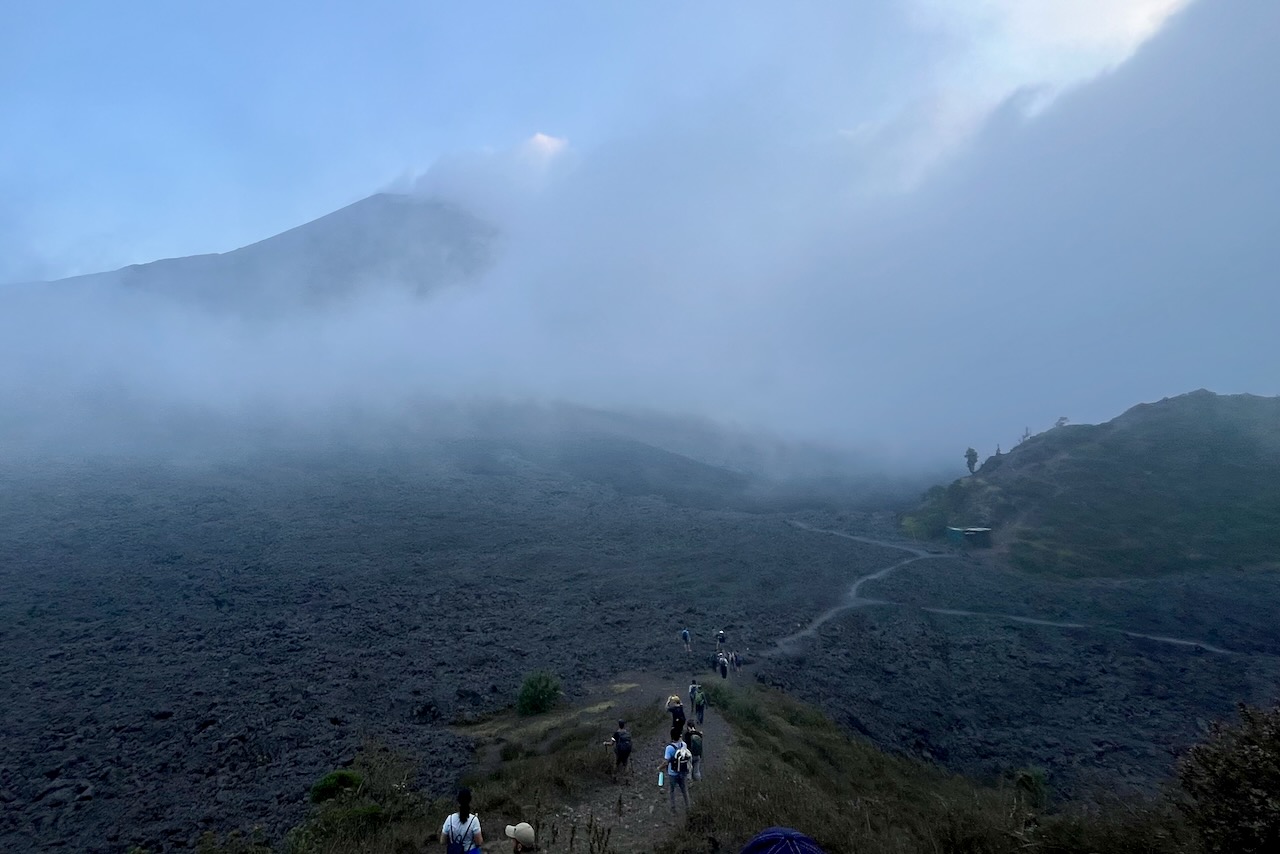
We arrived to Tikal around midday and went to explore the site. The next day we woke up early to hike to the Temple IV for the sunrise. The walk is in the dark with headlamps. It is also an opportunity to see a variety of nocturnal wildlife.
Our sunrise was not too great unfortunately due to very thick fog. We could barely see the edge of the platform. Later in the day the fog lifted. But we did not get that perfect sunrise photo. Though I must say, even in thick fog the experience of sunrise over this beautiful and spiritually very important place for so many people (over time) was worth it.
Tikal, Guatemala
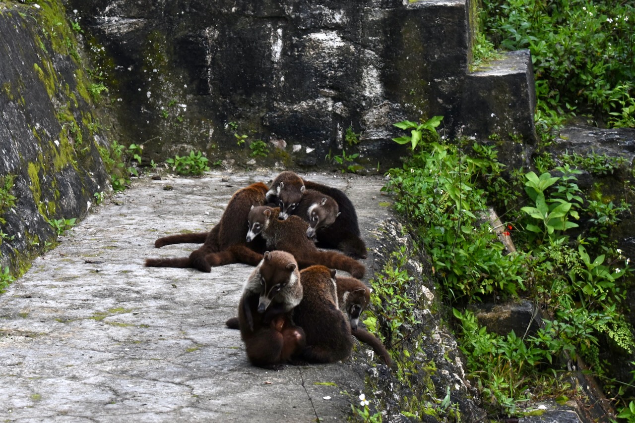
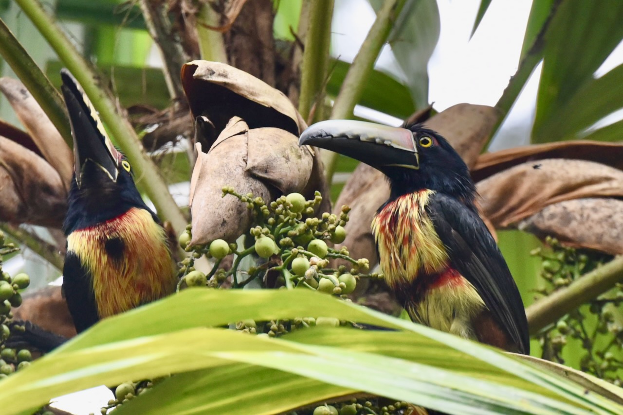
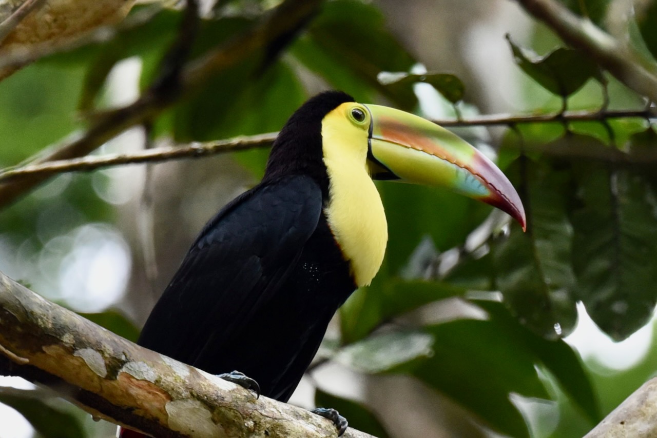
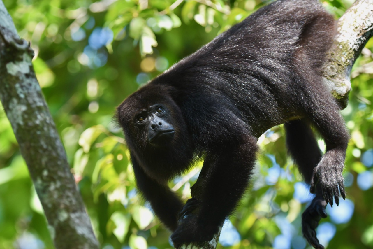
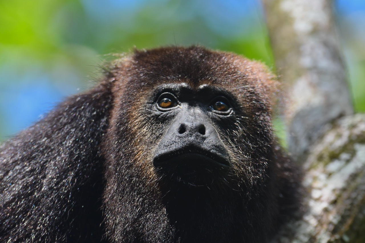
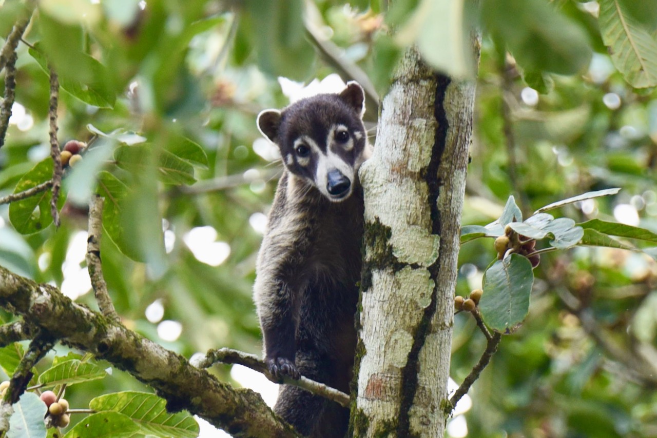
In the jungles around the ruins there are all sorts of wildlife. We saw monkeys, birds and bands of coatis. We came across aracaris and toucans quite close in the trees and saw plenty of them flying around up in the canopy.
Band of coatis on the steps of one of Tikal templesCollared aracari, Tikal, GuatemalaKeel-billed toucan, Tikal, Guatemala
In the afternoon we headed back to Flores. All in all we were happy we decided to overnight in the park and felt that two half days was a good amount of time. Though one could roam around and explore Tikal and beyond endlessly!
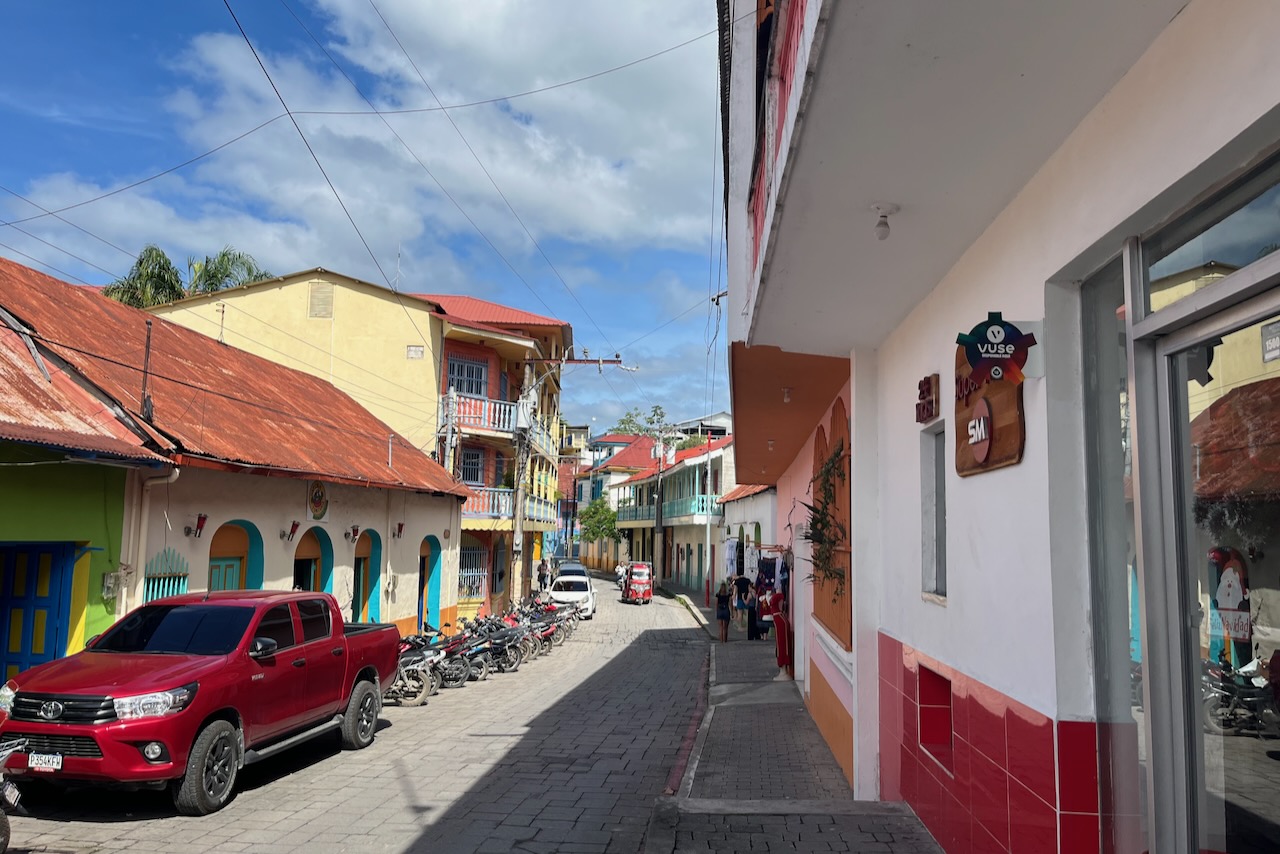
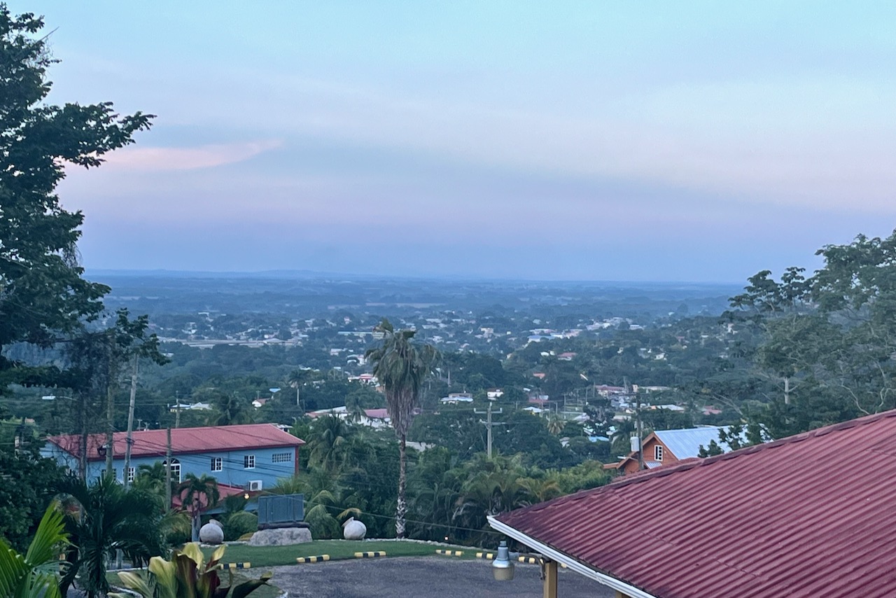
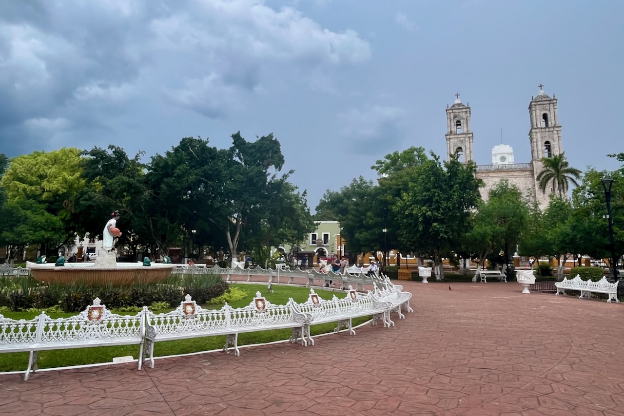
Small town of Flores is a popular base for exploring Tikal and many other sites in Peten region of Guatemala. The old part of town is located on a tiny island which is connected by a short causeway to the coast and the main Flores city. There is plenty of accommodation and many restaurants with delicious food on the island.
Town and island of Flores, GuatemalaA street on Flores island, Guatemala
The vibe on the island is very relaxed and happy. The streets are narrow and cute and very clean. Art and creativity seems to be everywhere – like those toucan planters made of used tires below.
Toucan shaped planter made from used tires, Flores, Guatemala
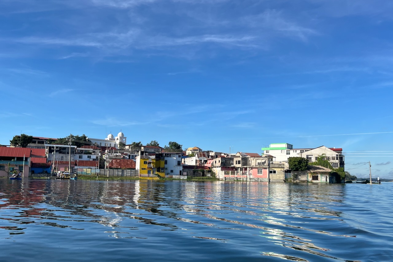
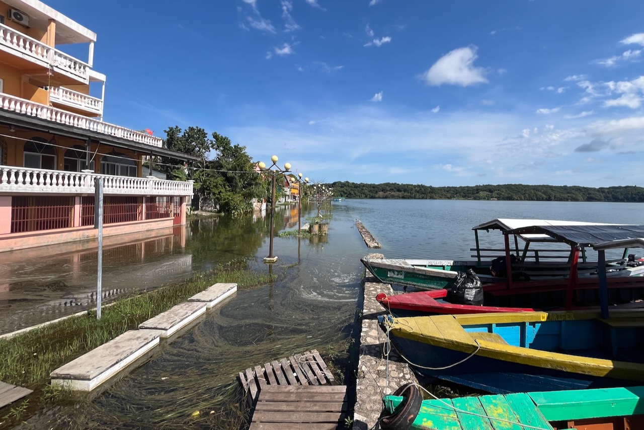
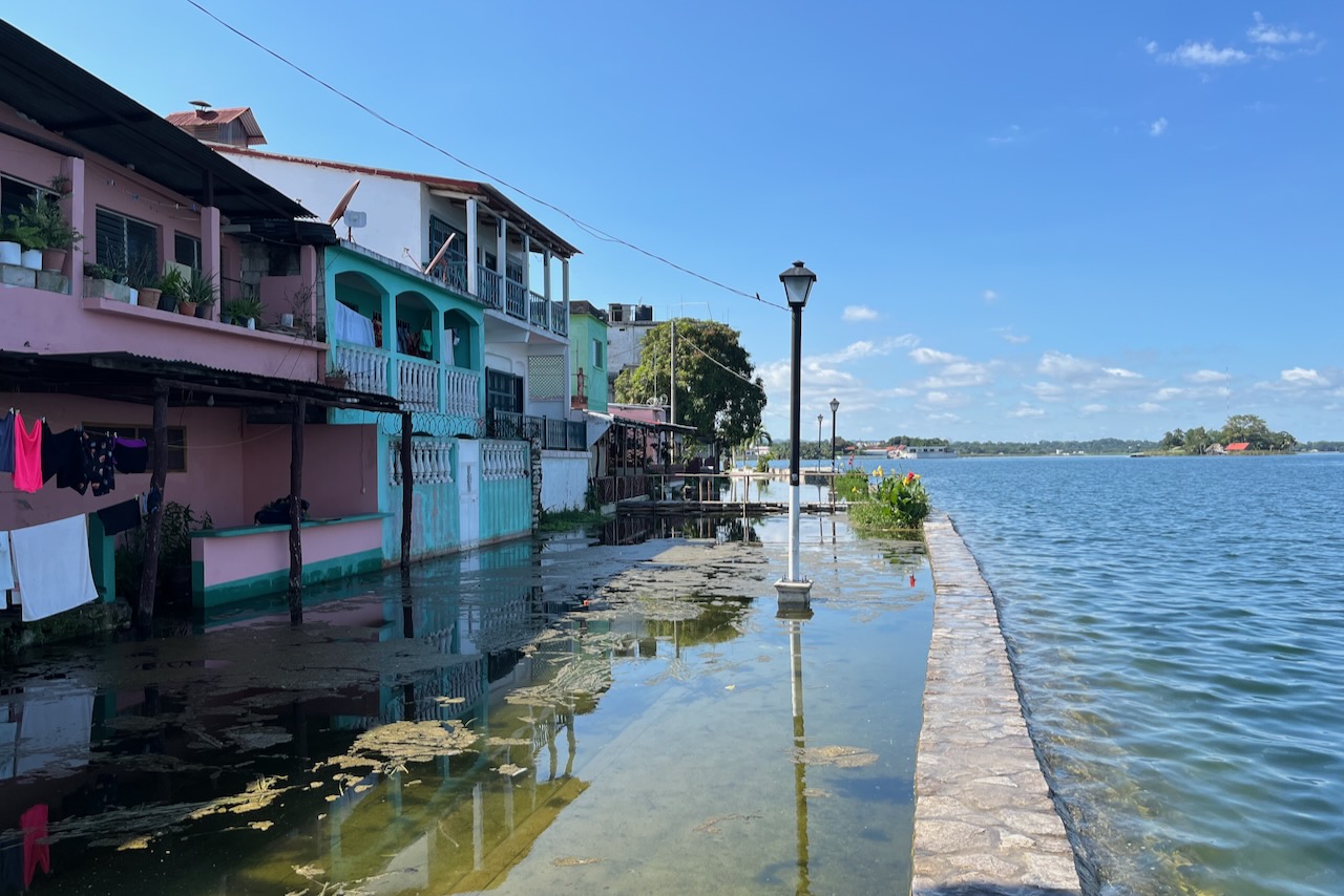
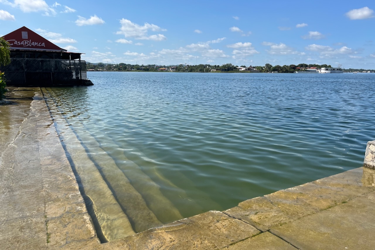
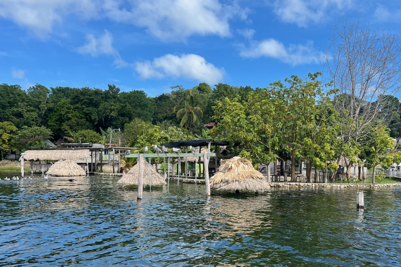
Water level in Peten Itza lake fluctuates a lot and lately has been rising. Some say it is a regular cycle. Some say it relates to climate change. Some say drainage is not working as it should. When we were there in December of 2023 lower side of the island and its Malecon (main waterside promenade) were under water. Amazingly people just seem to have moved on to higher floor (or built an extra floor?). A fair bit of more recent building happened around the lakeshore (not on the island) including quite a few guesthouses. Some say that local people always knew that water comes up and down and hence never built on the lakeshore. But then with tourism newcomers bought land and built on the shore and now are under water.
Flores island malecon under water, GuatemalaFlores island houses and pavement under water, GuatemalaFlores island landing, Guatemala
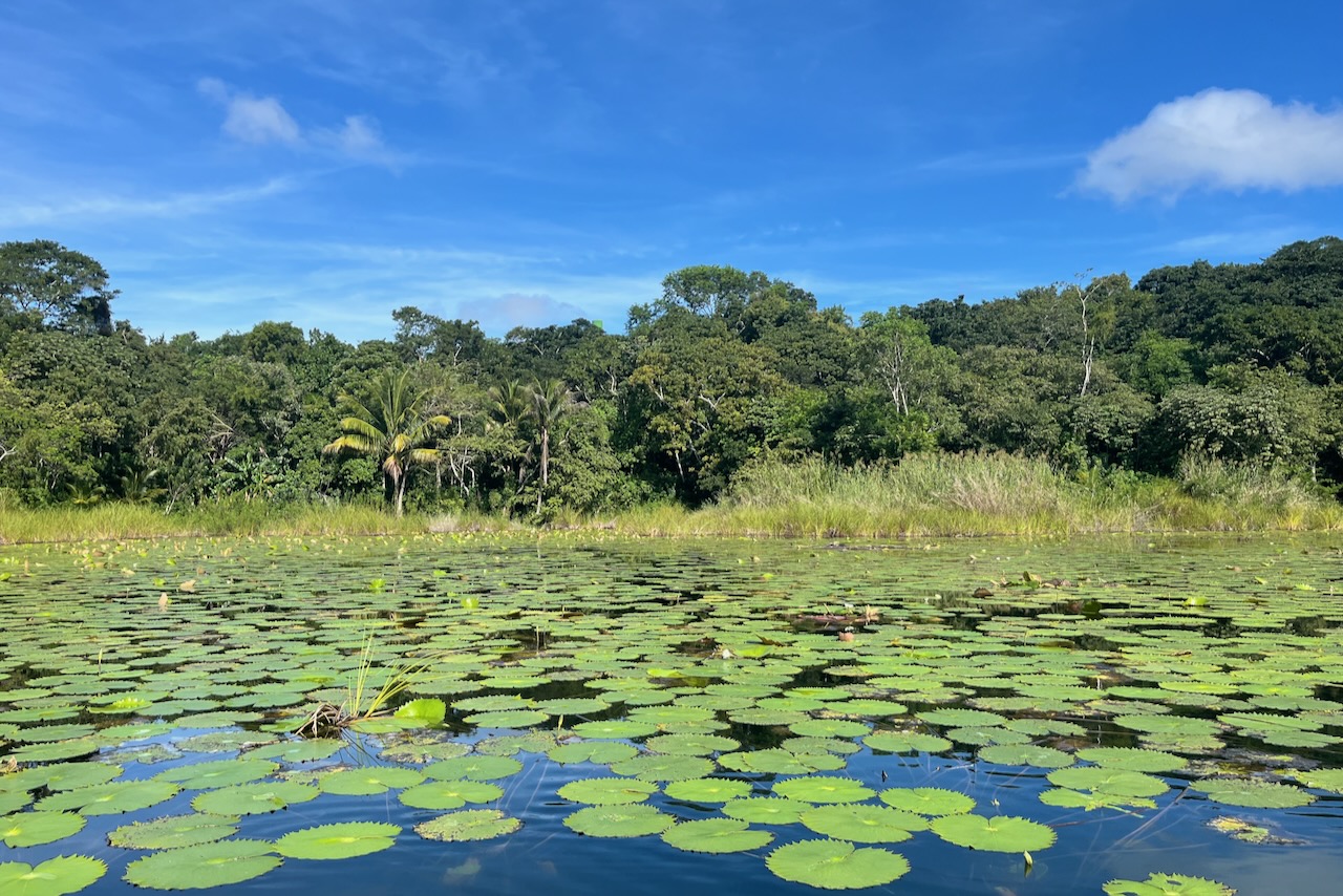
We hired a boat and went around the lake to see some wildlife and more of the coast areas.
A guesthouse lake beach area under water, Peten Itza lake near Flores, Guatemala
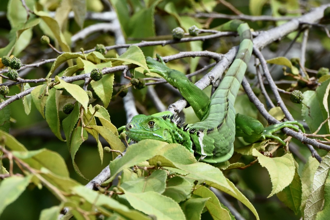
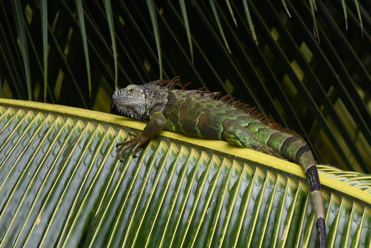
The scenery is beautiful. The lake has many little and not so little lagoons. We went into a couple covered in beautiful water lilies and with iguanas sitting on trees warming up in the sun. Lots of water birds around too.
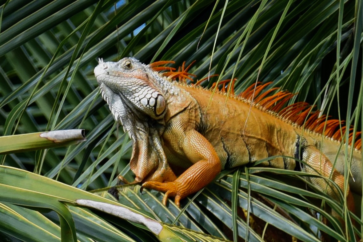
Around lake Peten Itza, GuatemalaJuvenile green iguana, Peten Itza lake near Flores, GuatemalaGreen iguana adult, Peten Itza lake near Flores, GuatemalaGreen iguana adult male in mating season turns orange, Peten Itza lake near FLores, Guatemala
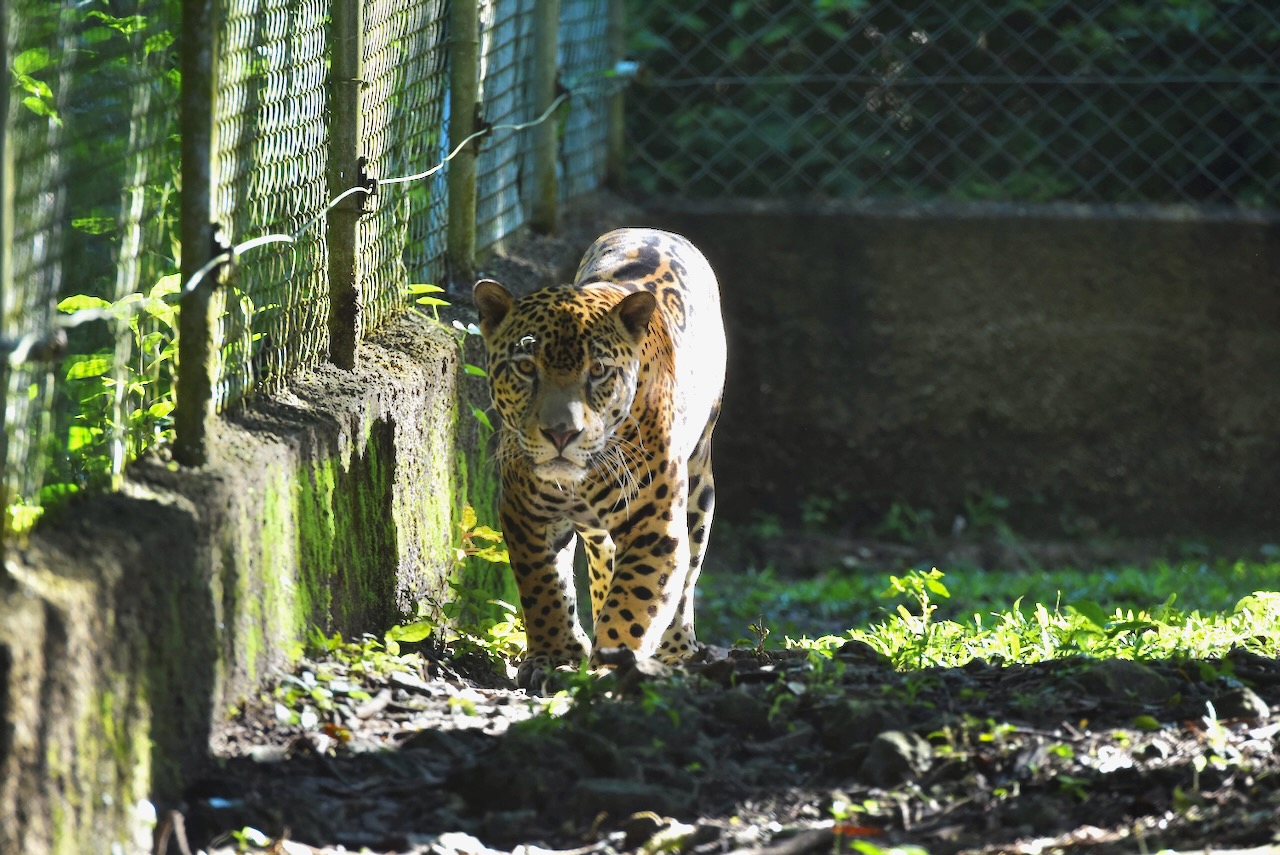
On our little boat trip we stopped at the ARCAS Wildlife Rescue Center. It was very informative about the challenges and scale of wildlife trafficking in Guatemala and the region. The center receives between 300 and 600 animals per year. It is, sadly, one of the few places other than a zoo where one can see jaguars or scarlet macaws in Guatemala. It is a large sanctuary with many animals waiting for their chance to get back to the wild.
Jaguar at ARCAS wildlife sanctuary on lake Peten Itza near Flores, Guatemala
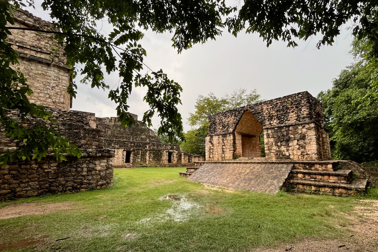
We also went to see one more Mayan site. After all the Mayan ruins in Belize, Mexico and TIkal we just could not stop. Every tour agency in Flores sells a tour to Yaxha. A major site it was the third largest city in the region in its day between 250-600AD. The site is huge, covered in jungle and is only partially excavated. It has 500 structures, including 9 temple pyramids! Walking through trails which used to be causeways connecting various parts of this ceremonial center, one can only feel amazement and awe at Maya civilization.
Mayan ruins at Yaxha, Guatemala
The tours are mostly afternoon tours and include a sunset view over the lake Yaxha from the top of one of the pyramids named (not very poetically) structure 216. It is the tallest of the structures with fantastic view of the lake and the site.
Structure 216 – 30m temple at Yaxha with stunning sunset views, GuatemalaSunset view over Yaxha lake from structure 216 of Yaxha Mayan site, Guatemala
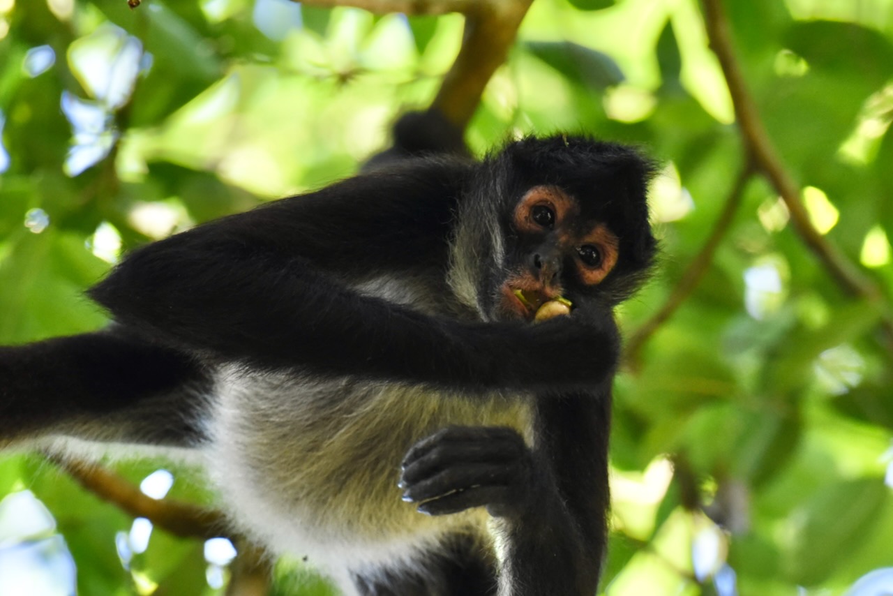
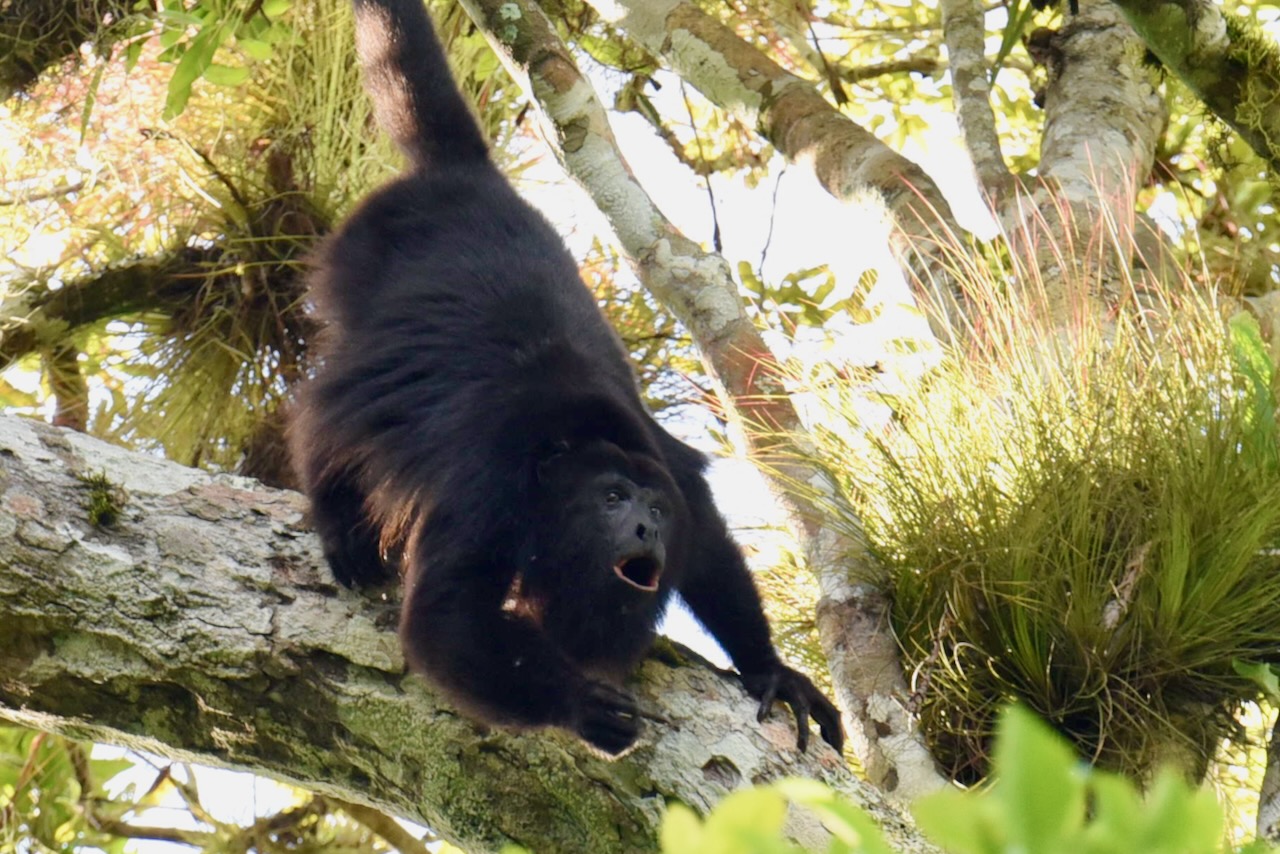
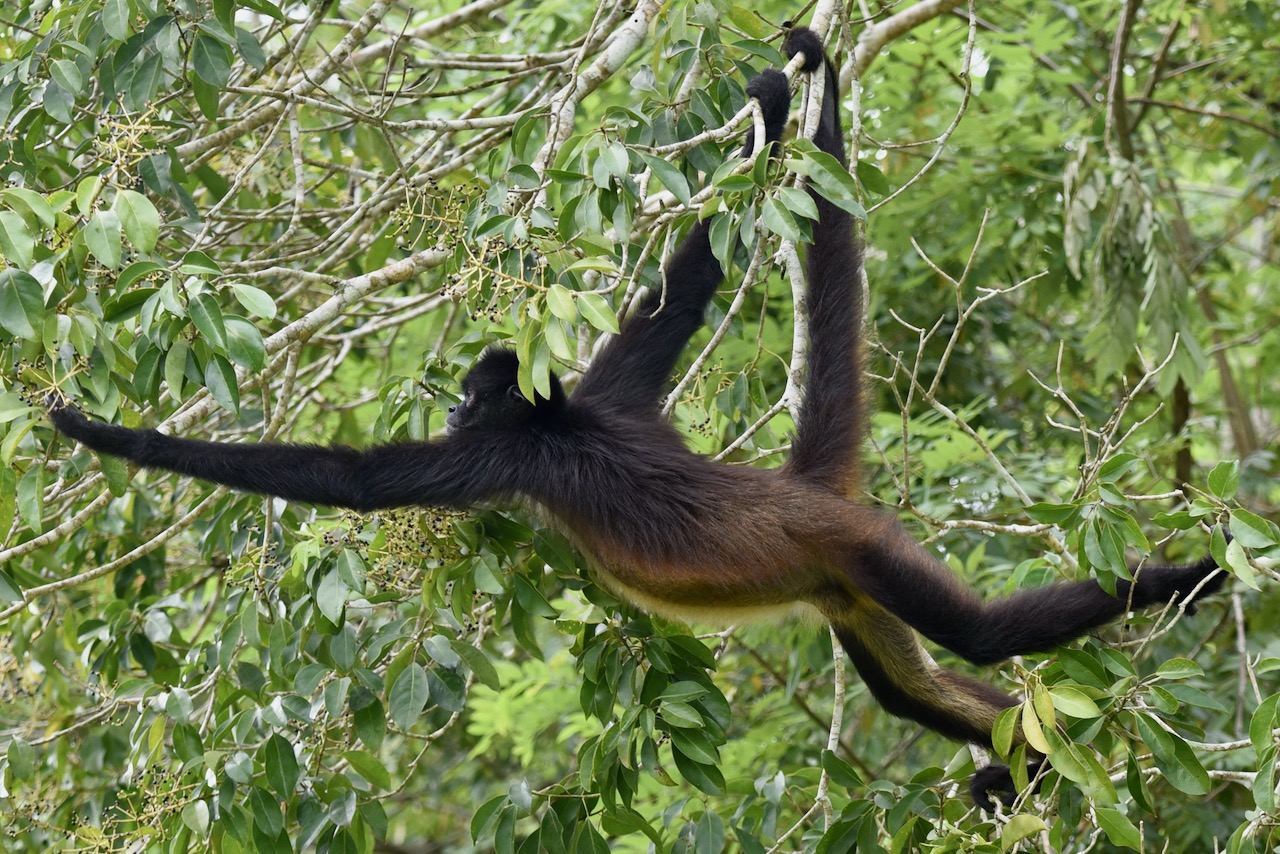
Wildlife on the site is plentiful and during our visit was very active. Spider monkeys were feeding and hopping around trees. Howler monkeys were in an extended howling match. It was a special experience to stand right next to Mayan pyramids, listen to and watch howling monkeys and trying to imagine what was it like in around 500AD.
Spider monkey eating at Yaxha Mayan site, GuatemalaHowler monkey at Yaxha Mayan cite, Guatemala.
The distance from Flores to Yaxha is 70km and it should not take more than 2 hours to get there. The group tour takes a fair bit longer though as the bus drives around to pick up all the visitors in Flores and in the area. It is not exactly a chicken bus – as Guatemalan public buses in rural areas are known, as it is a modern comfortable bus. But it does take a while and they do fill the bus, including by picking up friends who need a ride to Flores and are ok with standing. If time is a constraint maybe it is better to get a private or smaller tour. We had time and did not mind the slow trip and got a few laughs along the way in that high density transport.
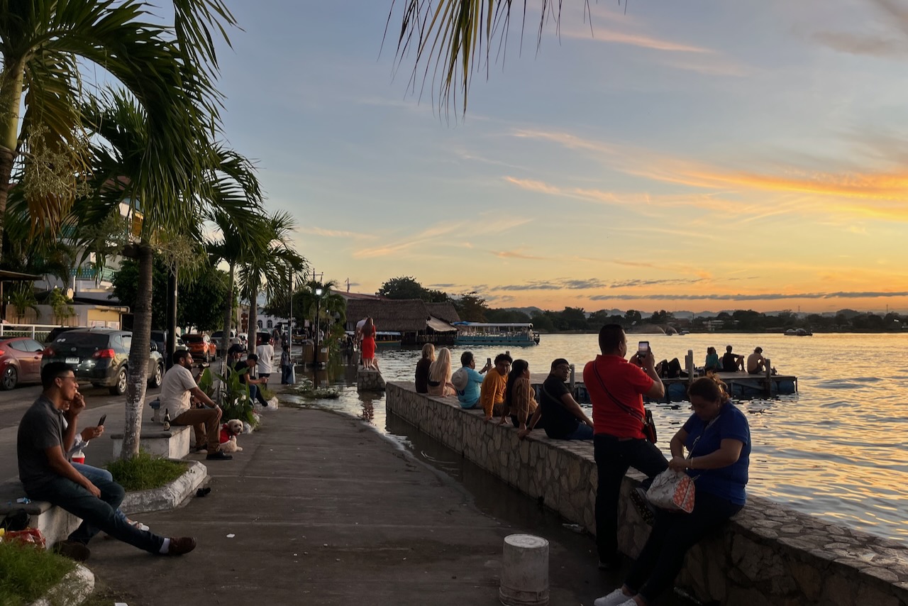
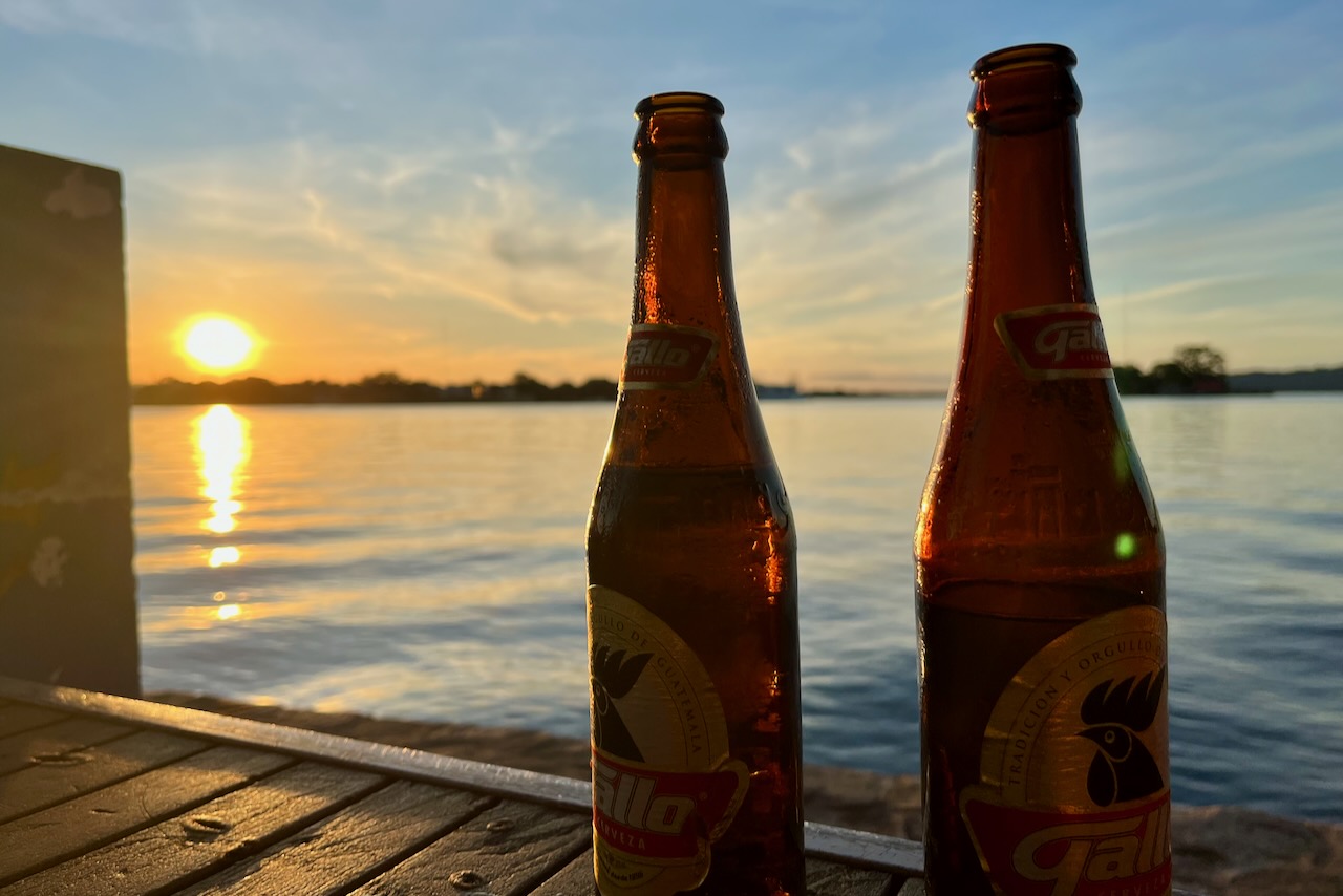
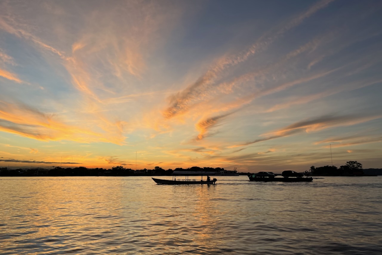
We really enjoyed our stay in Flores. It is a very relaxed happy place to base oneself at to explore Tikal and other wonders of Peten region. After our daily explorations it was highly enjoyable to join the locals and tourists watching sunset and drinking Gallo (english translation “rooster”) – excellent Guatemalan beer.
Watching sunset from Flores island waterfront, Flores, GuatemalaSunset and Gallo beer, Flores, GuatemalaSunset and a ferry over Peten Itza, view from Flores Island, Guatemala
From here we flew back to Guatemala City and headed to explore highlands of Guatemala in Antigua and lake Atitlan.
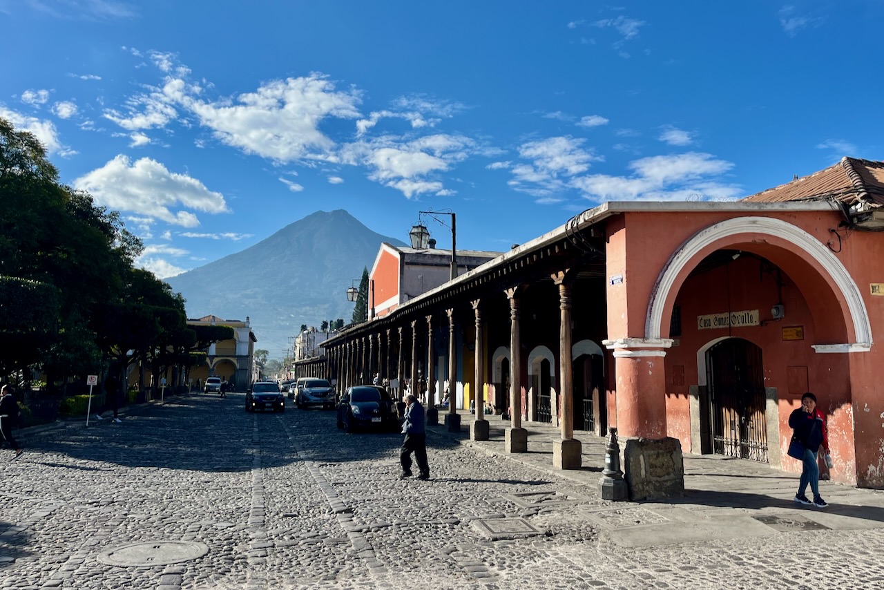
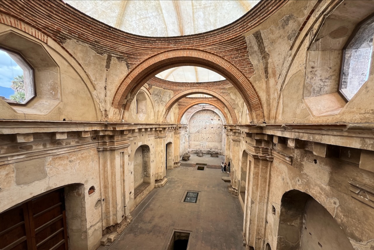
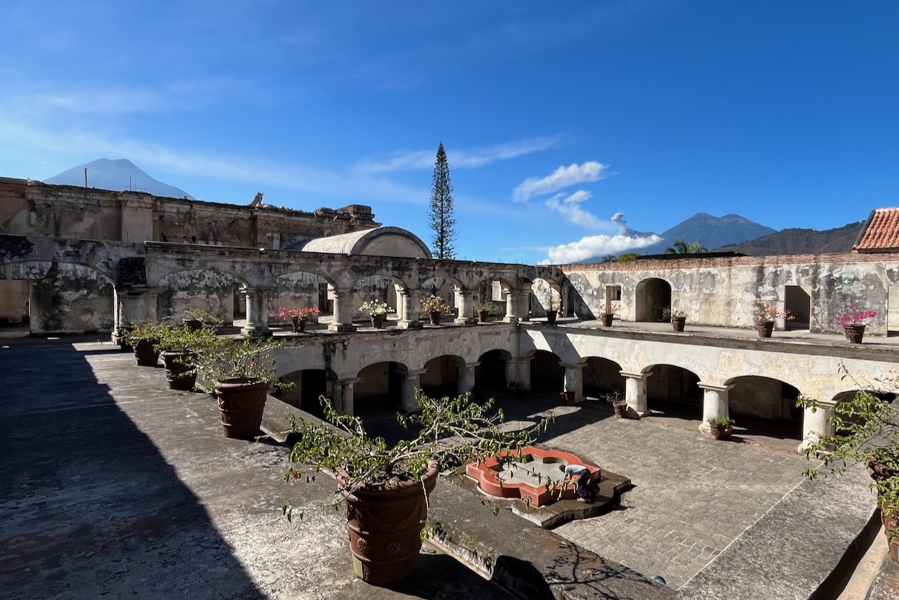
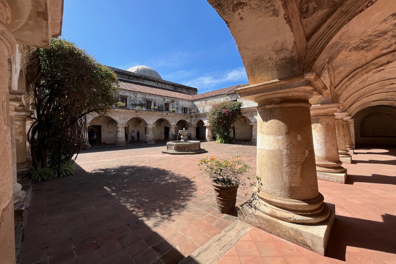
Antigua was a capital of colonial Guatemala, which included all of Central America and Mexican Chiapas, from 1543 through 1773. A major administrative, business and religious center it had many palaces, grand houses, churches and convents. Antigua sits in a beautiful valley surrounded by 3 volcanoes, one of which – Fuego, has been continuously erupting for more than 20 years.
In 1773 a major earthquake destroyed Antigua and it was decided to move the capital to Guatemala City. Antigua was depopulated but not abandoned. The city was listed as a UNESCO World Heritage Site in 1979 which helped with preserving its unique architecture and culture. Today, Antigua is a major tourist attraction for its architecture and culture mix, and as a great base to hike nearby volcanoes.
Buildings framing Parque Central with volcano views, Antigua, Guatemala
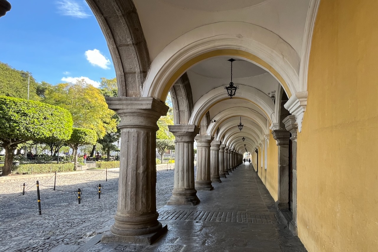
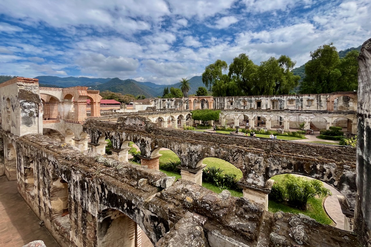
We spent several days in Antigua basing ourselves in one of many boutique hotels in old converted buildings in the city center. We walked around and visited the many museums and ruins. We checked out the many art galleries and craft markets, as well as the regular market. We ate delicious food.
Hiking Acatenango volcano, the third highest in Central America at 3,976m with spectacular close up views of erupting Fuego, was definitely something we considered. But it is a serious hike and an overnight one. We decided we were not exactly fit for it. Maybe one day. We met many travelers who did it and were happy they did, even if sore. We did go for a day hike of Volcano Pataya.
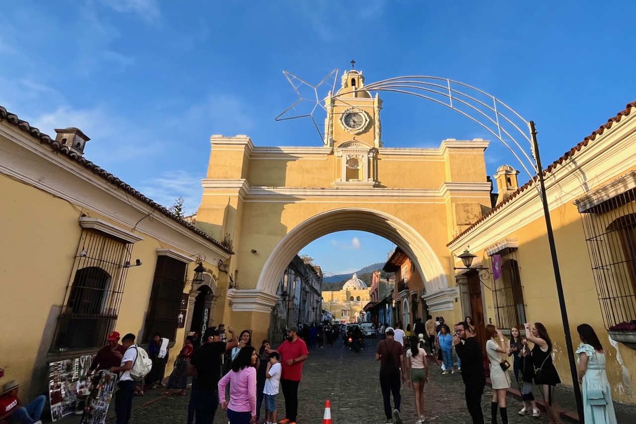
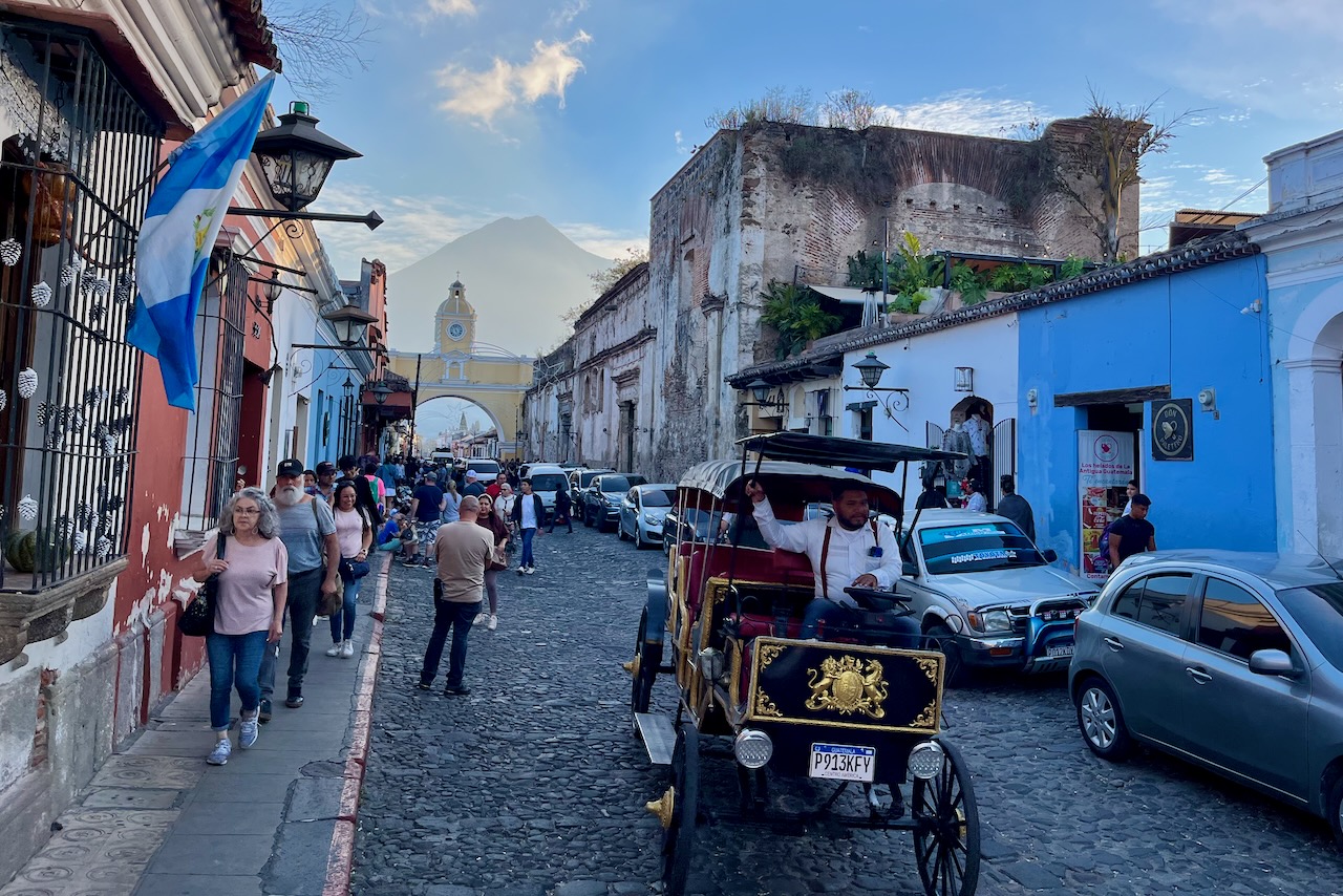
Palacio de los Capitanes Generales at Parque Central, Antigua, GuatemalaSanta Catalina arch, Antigua, Guatemala5Th Avenue north with Santa Catalina arch and Agua volcano view, Antigua, GuatemalaLa Merced Church, Antigua, Guatemala
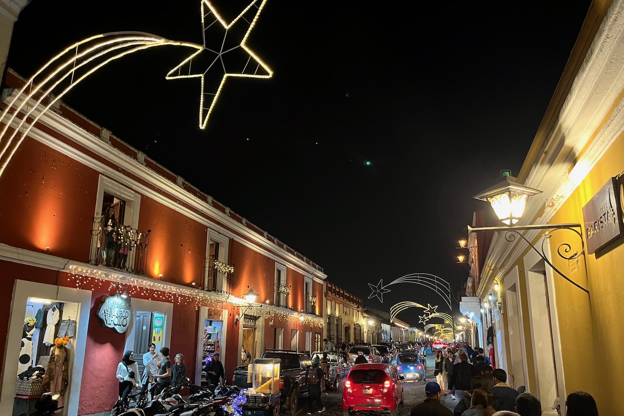
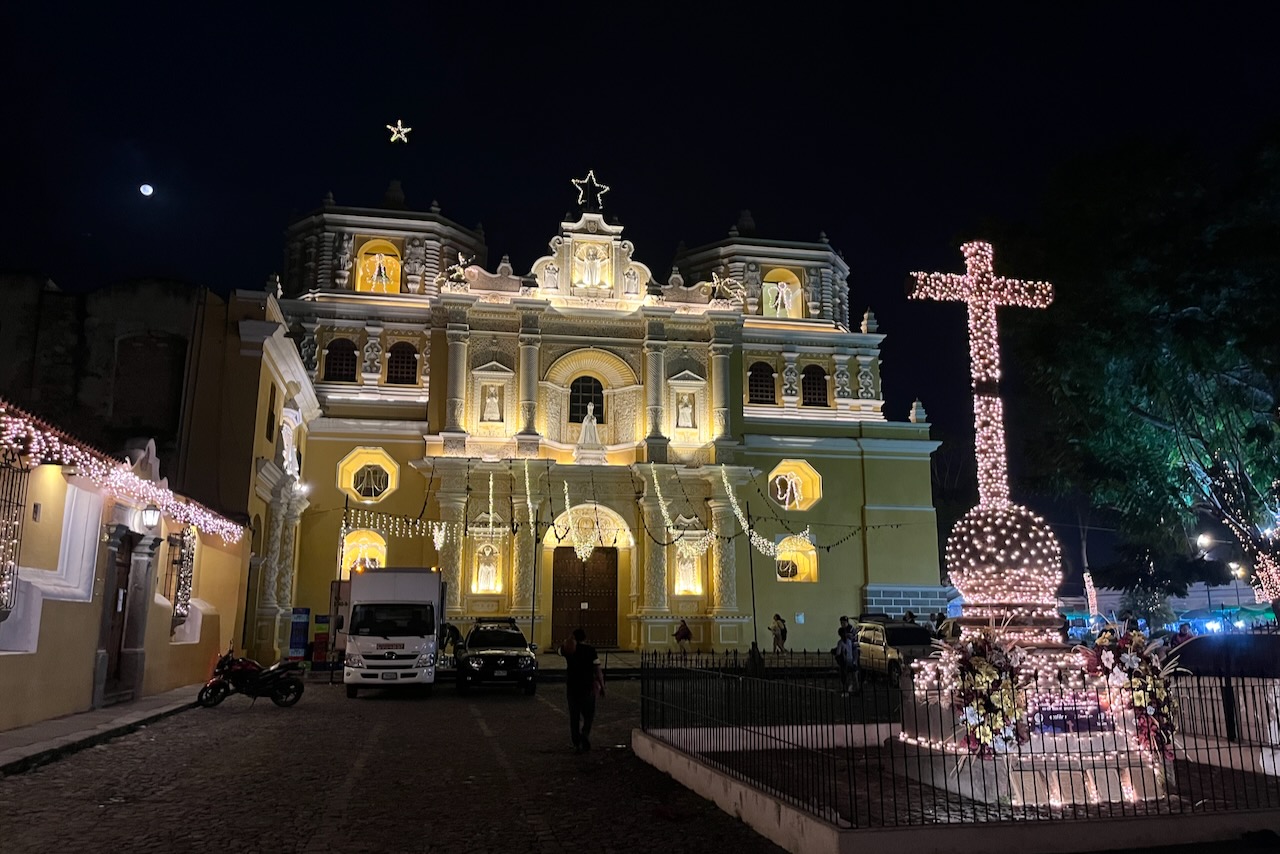
We were visiting in December between Christmas and New Years and the city center was very busy with Christmas market, illuminations and cheerful crowds of locals and visitors. We felt completely safe walking around town at night.
One of the streets in the city center at night, Antigua, GuatemalaLa Merced church illuminated at night, Antigua, Guatemala
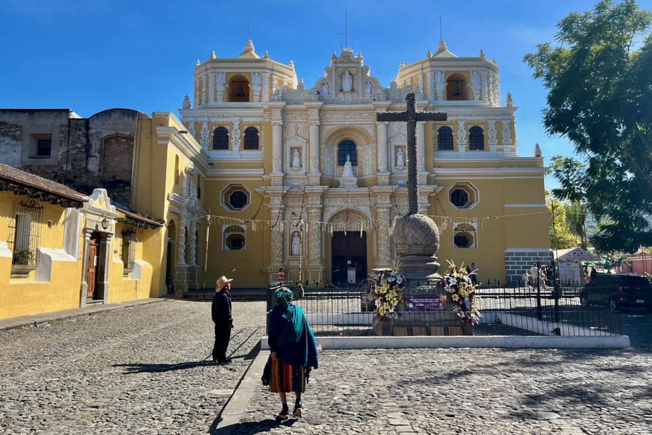
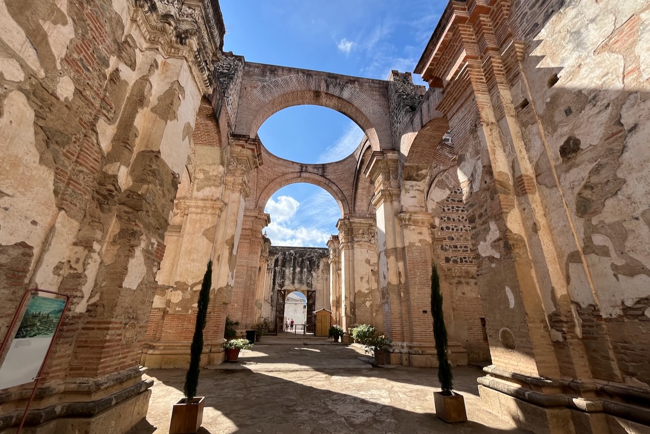
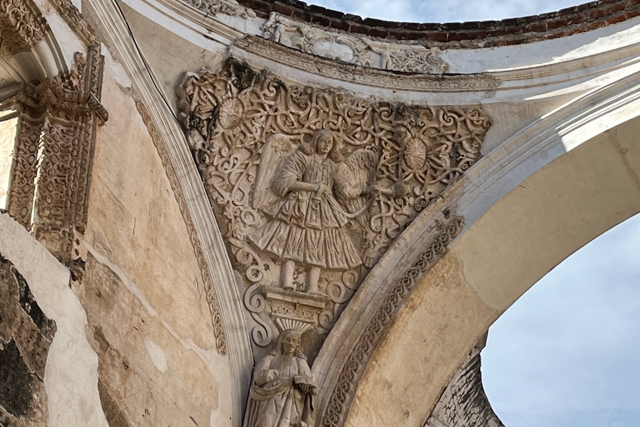
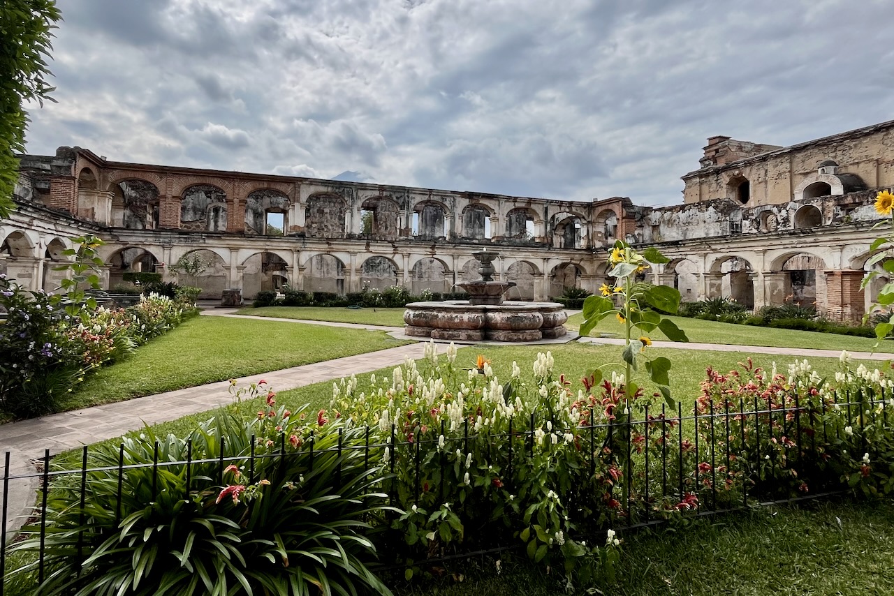
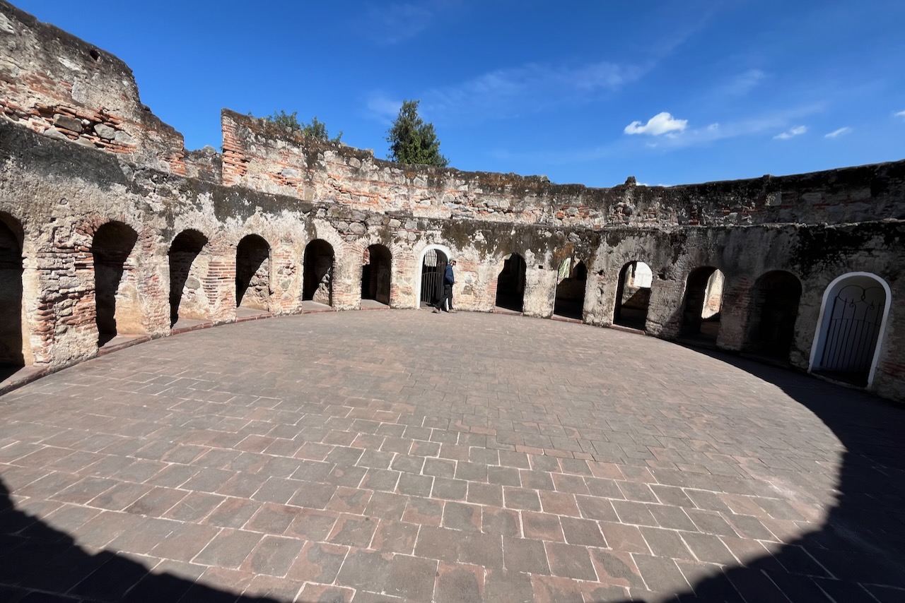
Antigua has an impressive collection of churches, cathedrals, convents and other religious buildings. It seems every monastic order came and set up a base in Antigua. Most of these buildings were severely damaged by the 1773 earthquake. Quite a few have been restored and are now museums or functioning religious entities.
Ruins of Antigua Cathedral, Antigua, GuatemalaRuins of Antigua Cathedral, detail, Antigua, GuatemalaSanta Clara convent, Antigua, GuatemalaSanta Clara convent, Antigua, GuatemalaSanta Clara convent, Antigua, GuatemalaSan Jeronimo ruins, Antigua, GuatemalaLas Capuchinas convent ruins, Antigua, GuatemalaLas Capuchinas convent ruins, Antigua, Guatemala
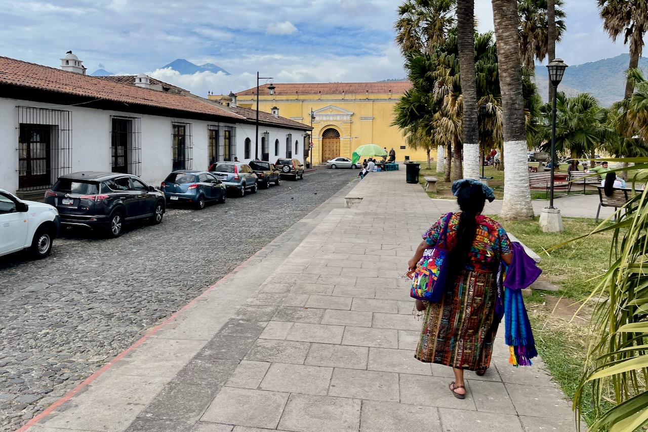
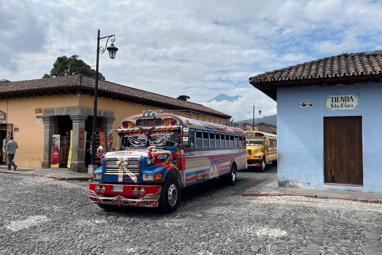
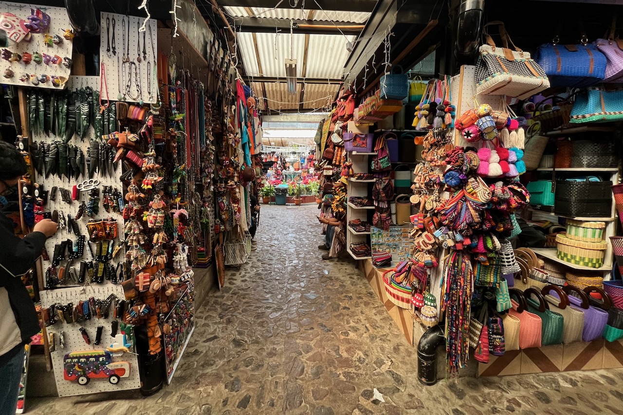
Streets of Antigua are very colorful. Many women wear traditional clothes elaborately embroidered in bright colors. Buses and tricycles are highly decorated too. And there are shops selling all kind of handicrafts and paintings everywhere one looks.
A woman selling souvenirs wearing traditional clothes on a street in Antigua, Antigua, GuatemalaDecorated “chicken bus”, Antigua, GuatemalaHandicrafts market, Antigua, Guatemala
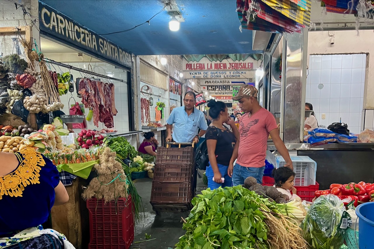
We visited the main fresh market in town located next to the handicrafts market. We were very impressed with the quality of vegetables and fresh produce in Guatemala. It must be that wonderful volcanic soil. It was just a little bit odd that in a market stalls are all intermixed. One would see vegetables sold right next to meat.
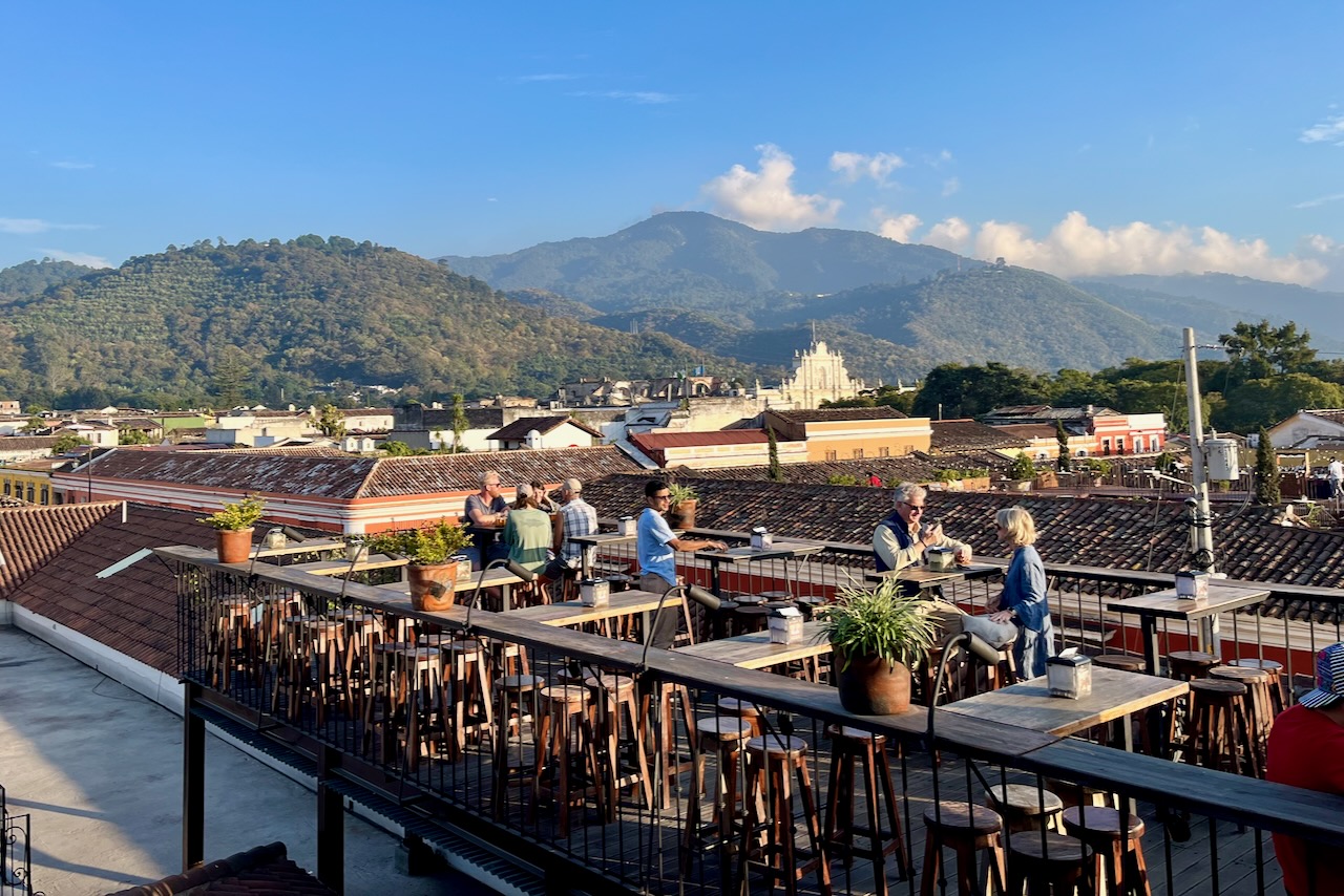
After a day of exploration it was good to watch the sunset in one of the many rooftop bars, taking in spectacular surroundings.
A rooftop bar in Antigua, Guatemala
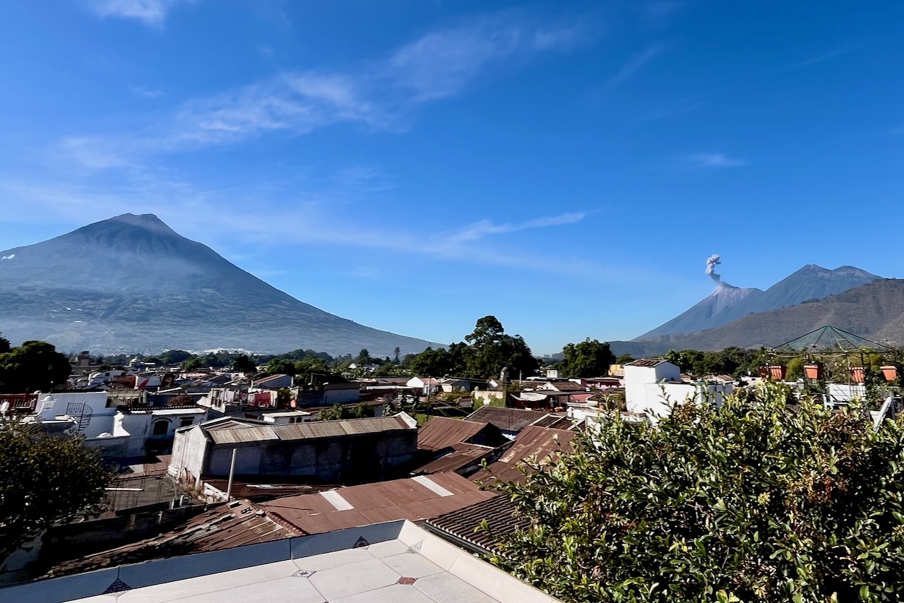
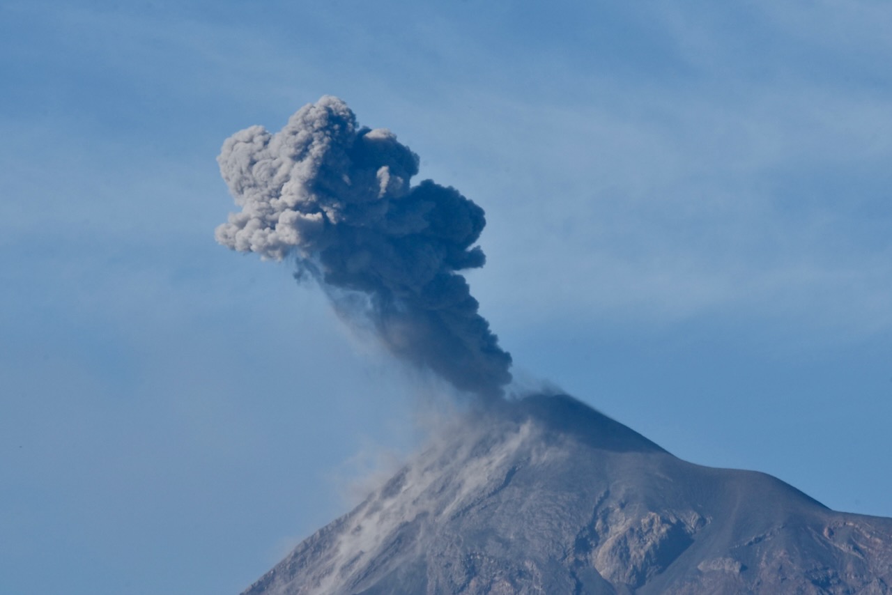
Our hotel also had a little rooftop and it was really nice to sit and watch all three volcanoes, including slowly erupting Fuego while sipping morning coffee.
Volcanoes view from hotel rooftop, Antigua, GuatemalaFuego volcano close up, Antigua, Guatemala.
It would have been good to hike Acatenango, but we just did not think we were fit for that. Instead we went for a short half day hike to Pataya volcano on a group hike with OX Expeditions. One is meant to see stunning views of the other volcanoes on this hike. The day we went though, by the time we reached the top view point, the cloud descended and we could not see anything. We were in the cloud. On the way down it got a bit better and we could see silhouette of one of the volcanoes. It was still fascinating to walk through lava fields. We also did have marshmallows cooked over hot lava. We may need another trip to properly explore Guatemala’s magnificent volcanoes.
Pacaya volcano hike through lava fields, Antigua, Guatemala.
After spending several days in Antigua we headed for our next stop – the beautiful Atitlan lake.
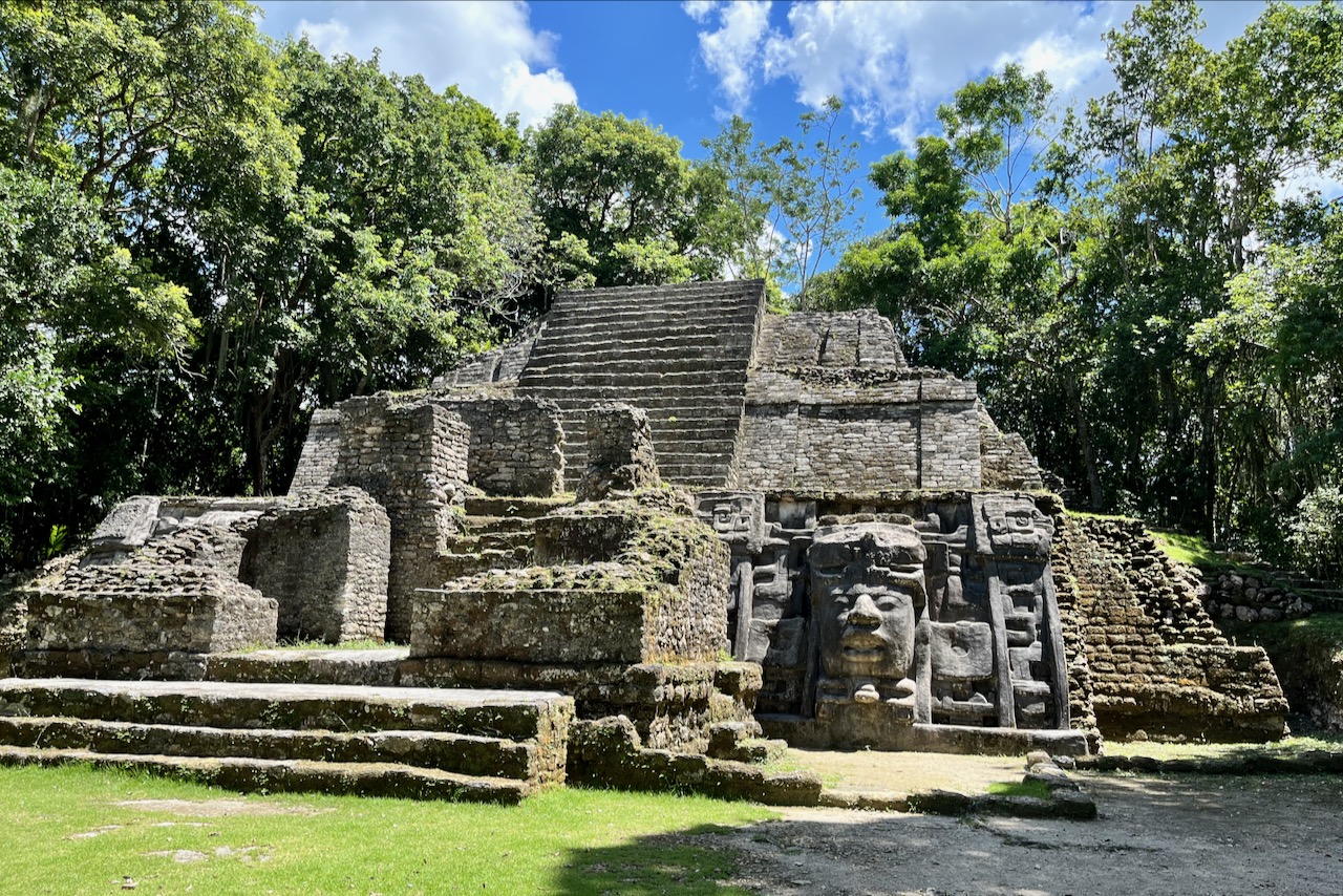
Before and after our dive trip in Belize we explored the top side covering most major Mayan ruins in the country. Belize has impressive history and ruins from Maya period. Unlike Mexico, the sites were not crowded at all, sometimes we had a site to ourselves. One can also climb many of the pyramids still.
The first site we went to was Lamanai. We went in the morning and got back in time to board our liveaboard by late afternoon.
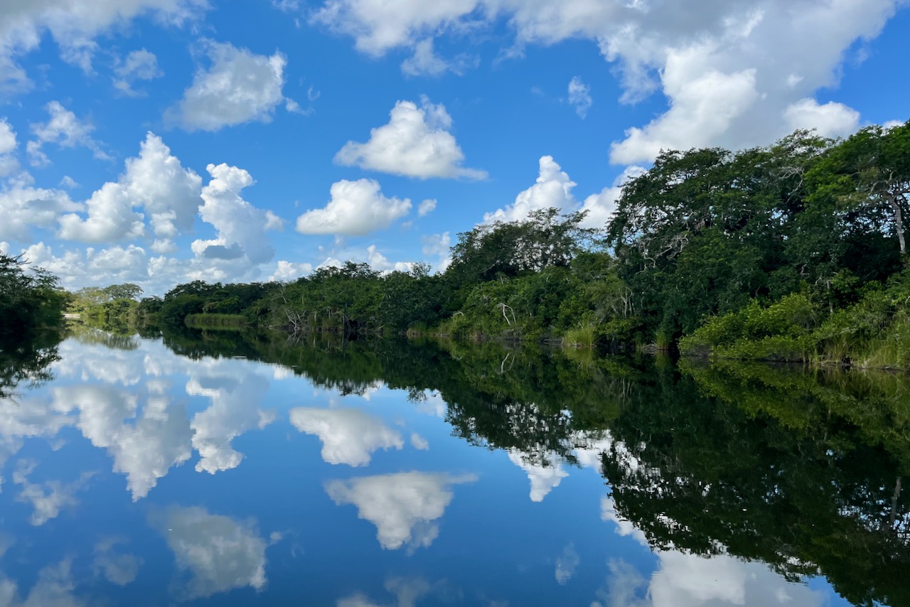
River view on the way to Lamanai, Belize
Lamanai site is located on a shore of the New river. Most tours access it by boat from the town of Orange walk. Boat ride is very picturesque and we saw a couple of crocodiles and some nice birds on the way. Site is partially excavated and has a couple of pyramids one can climb. Lamanai is one of the longest continuously occupied sites – people lived here over 3 thousand years.
Lamanai
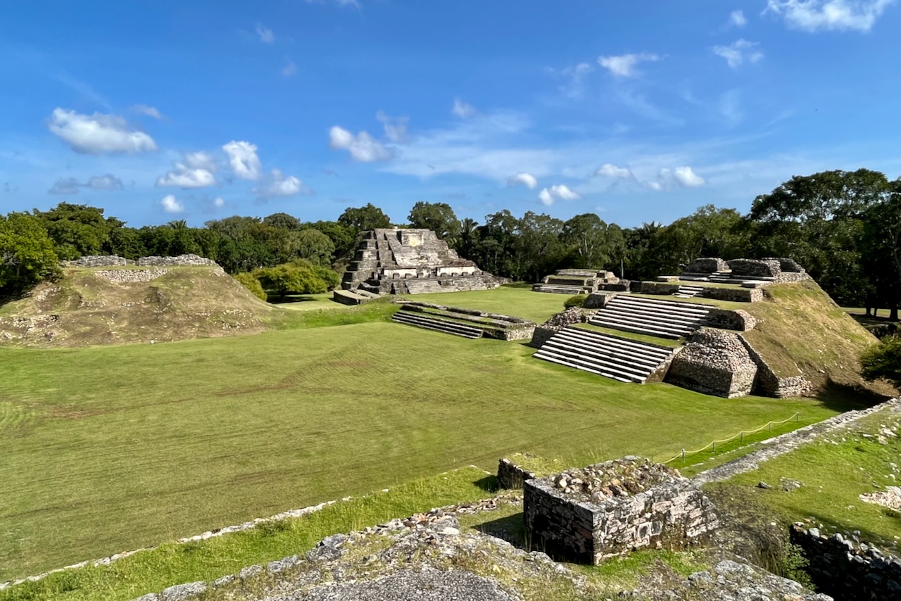
After finishing our diving trip. We got off the boat in the morning and picked up our car rental from the airport. We then headed to Altun Ha – a Mayan site near Belize city – before making our way over across the country to San Ignacio. Altun Ha is an impressive site with some buildings partially excavated and some waiting to be uncovered.
Altun Ha
As we headed west, we made a few stops on the way. First we stopped at the community baboon sanctuary. Local community agreed not to cut trees between their estates to let animals pass and now offers tours to go and see howler monkeys and possibly other species. We were first hoping to go on the boat tour that the center also operates. But this was the day of a solar eclipse and the guide declared that there would be no boat tour because day will turn into night with the eclipse. There was no point in debating and we headed instead on foot to find howler monkeys. It did not take long 10-15min at most, we found a little group of howlers, they ate and mostly napped in the tree but one came down closer and another one howled. Good stop to do.
howler monkey, Belizehowler monkey, Belize
On the way we stopped by Belize zoo and tropical education center. It serves as rescue and rehabilitation facility. We stopped in the middle of the day and most animals were hiding. The place is popular for visiting with kids.
And then we headed to San Ignacio. Belize is not a big country so it only takes a couple of hours to cross it east to west. We made it to San Ignacio in time to visit Cahal Pech just before sunset – another Mayan ruin located in the town of San Ignacio.
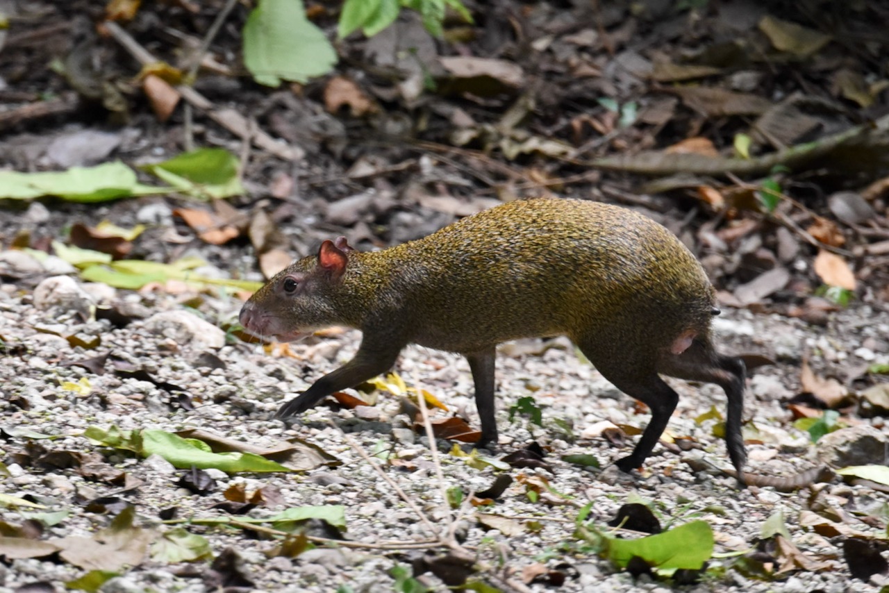
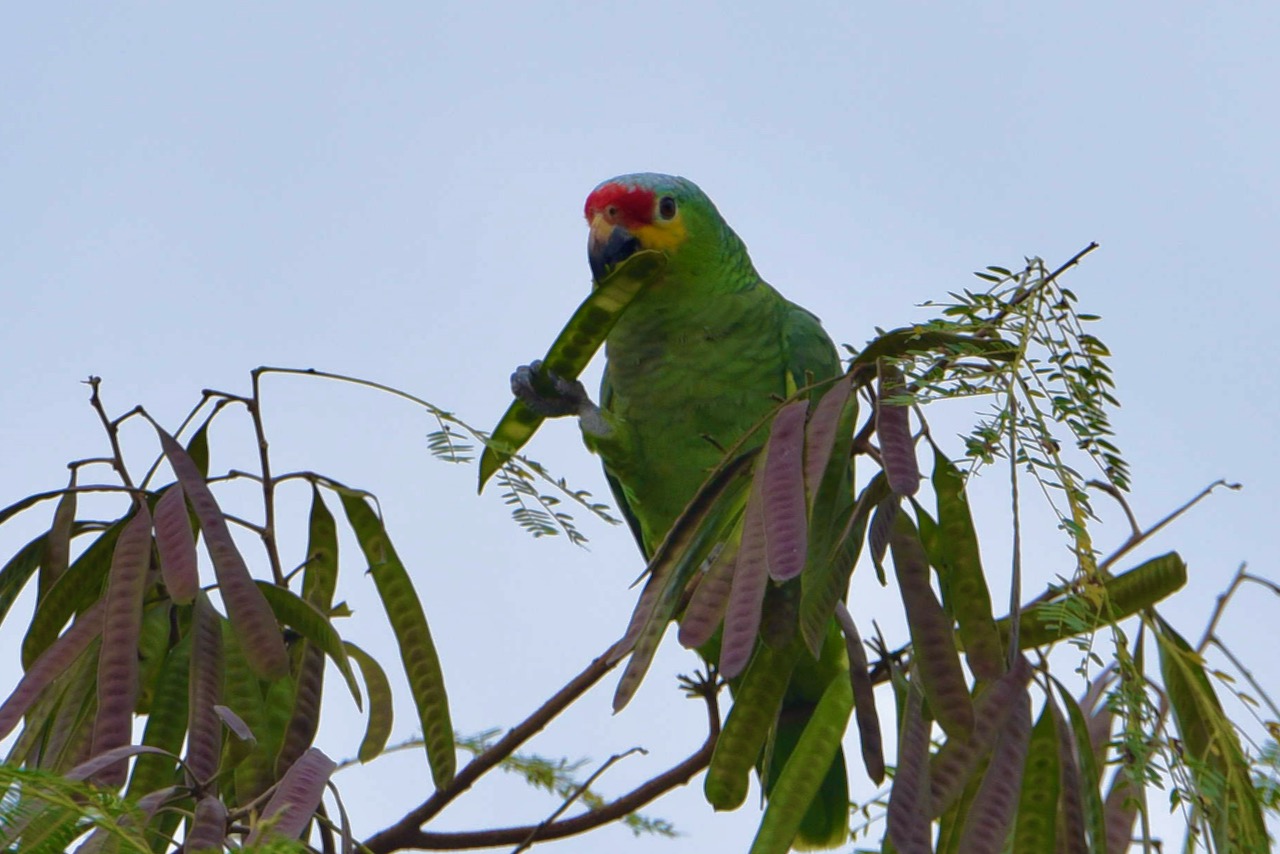
While exploring the site we saw several agouties running around. We could hear parrots and toucans but could not see them. It is a very nice site with a good museum.
Agouti at Cahal Pech, Belize
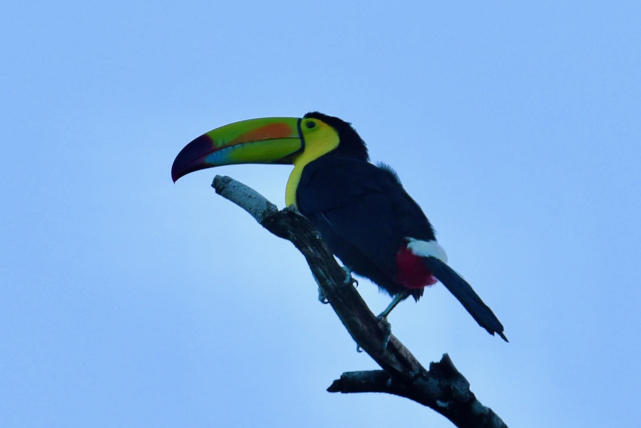
We stayed at Falling Leaves Lodge right next to Cahal Pech. The place is surrounded by big trees and is one of the hot spots for birdwatchers. Food was delicious too.
View from Falling Leaves Lodge
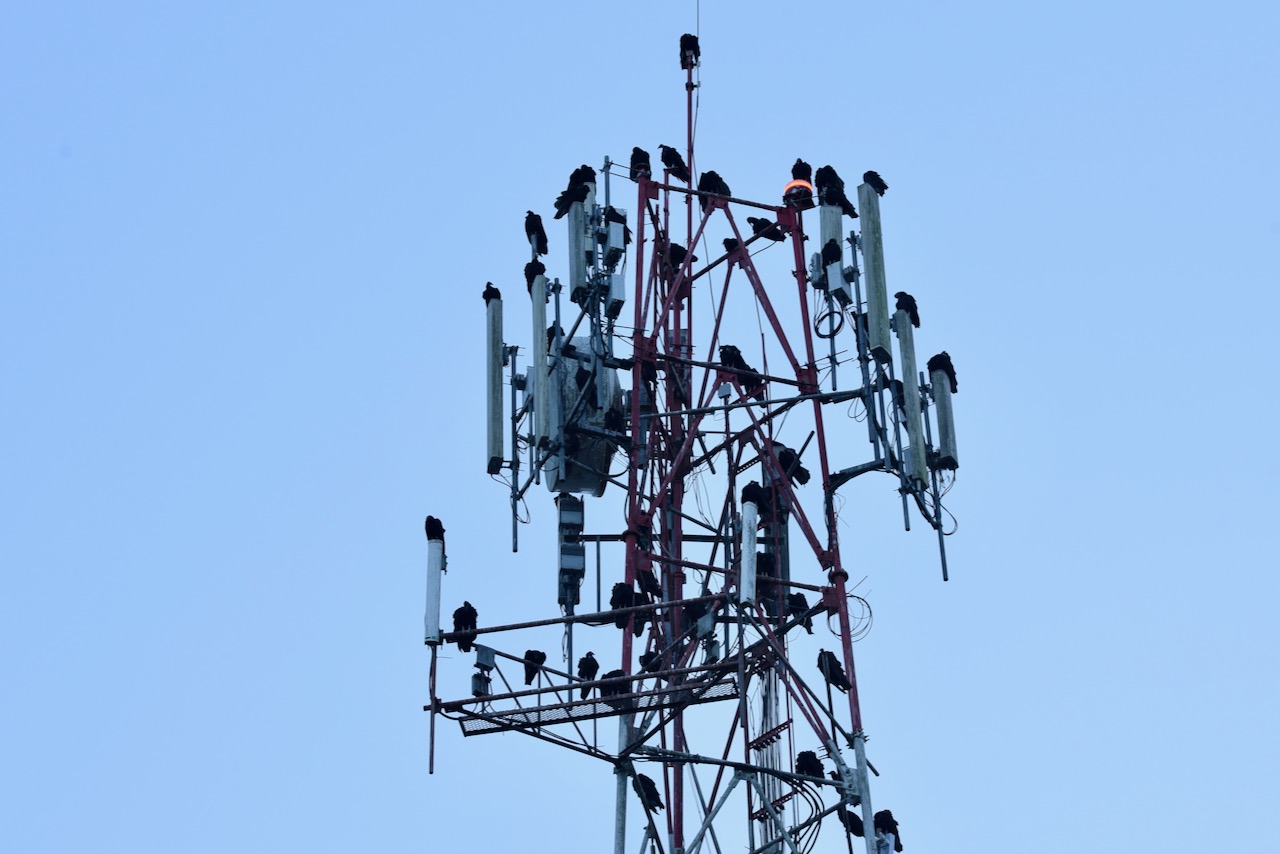
At sunset dozens of vultures make cell phone tower nearby their roust. Is quite a site
VUltures on cell phone tower, San Ignacio, BelizeToucan, San Ignacio, BelizeRed lored parrot, San Ignacio, Belize
Mountain Pine Ridge Reserve and Caracol
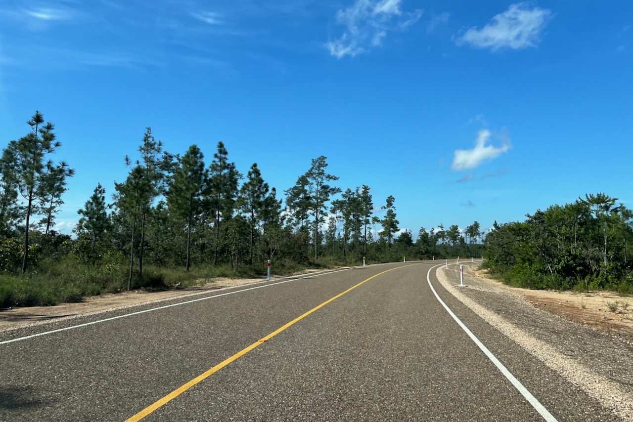
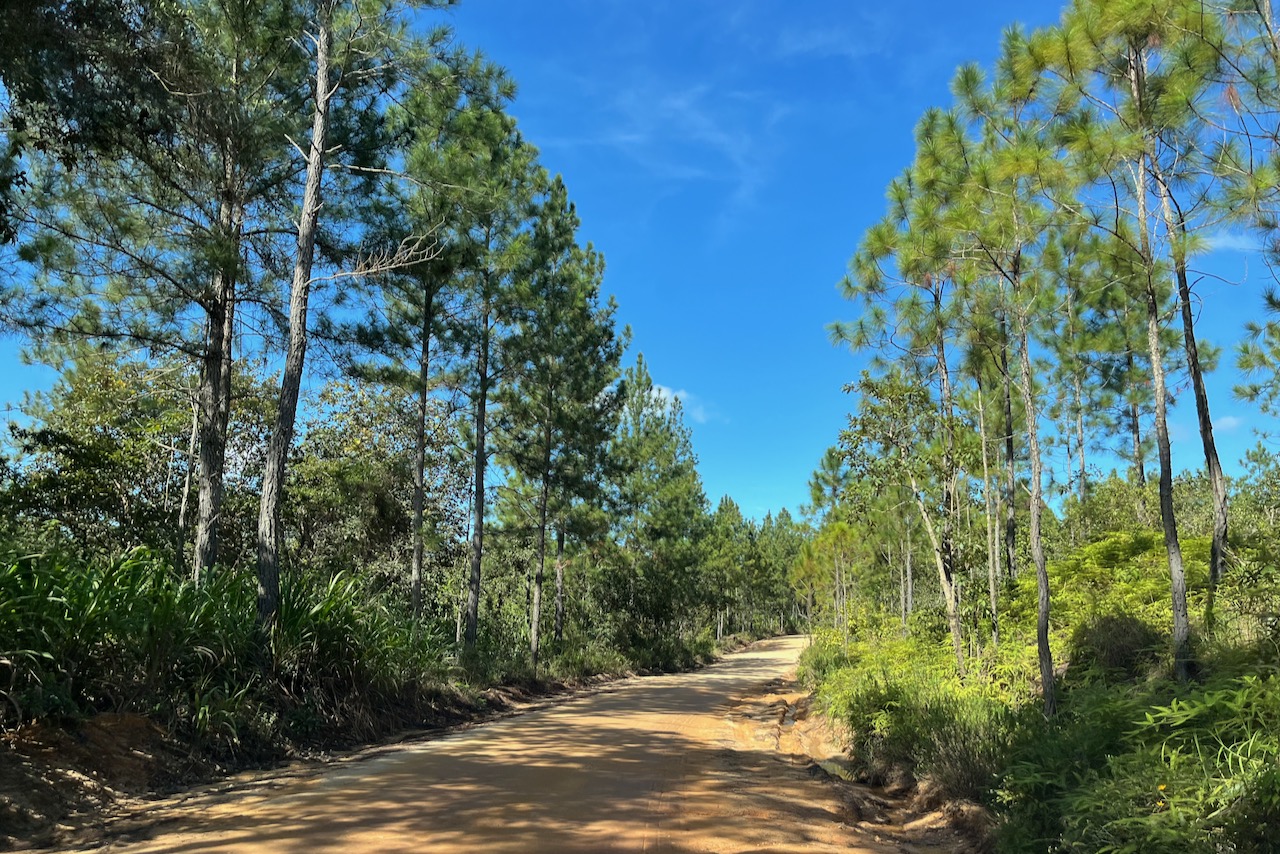
The next day we headed to Caracol and explored a little of the Mountain Pine Ridge reserve on the way back. The new road to Caracol was about 1/3 built at the time we were visiting and the work continues. First one drives on a brand new excellent road and then on compacted but not paved road. We were in a small 2 wheel drive and did not have any issues. It was dry when we visited though and after heavy rains the road might be more difficult to pass. It is a very scenic drive. Pines suffered from a decease some years ago and many of them did not survive, but it seems the forest is recovering. At lower elevations jungle is sick and lush. It took us about 2 hours to reach Caracol.
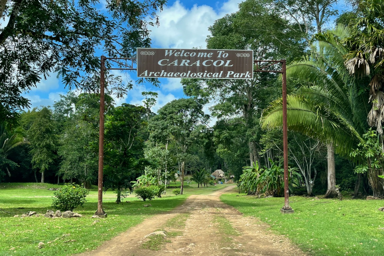
New road from San Ignacio to Caracol, BelizeNot yet paved section of the road from San Ignacio to CaracolCaracol entrance sign, Belize
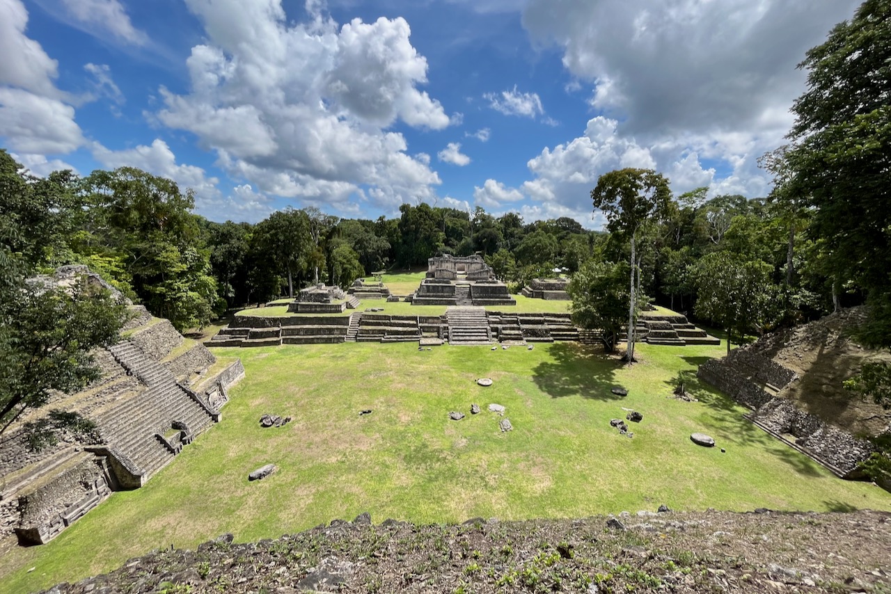
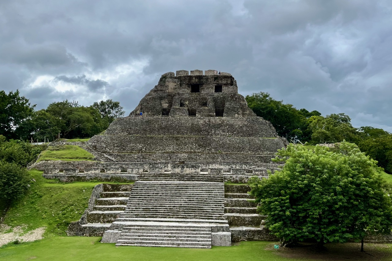
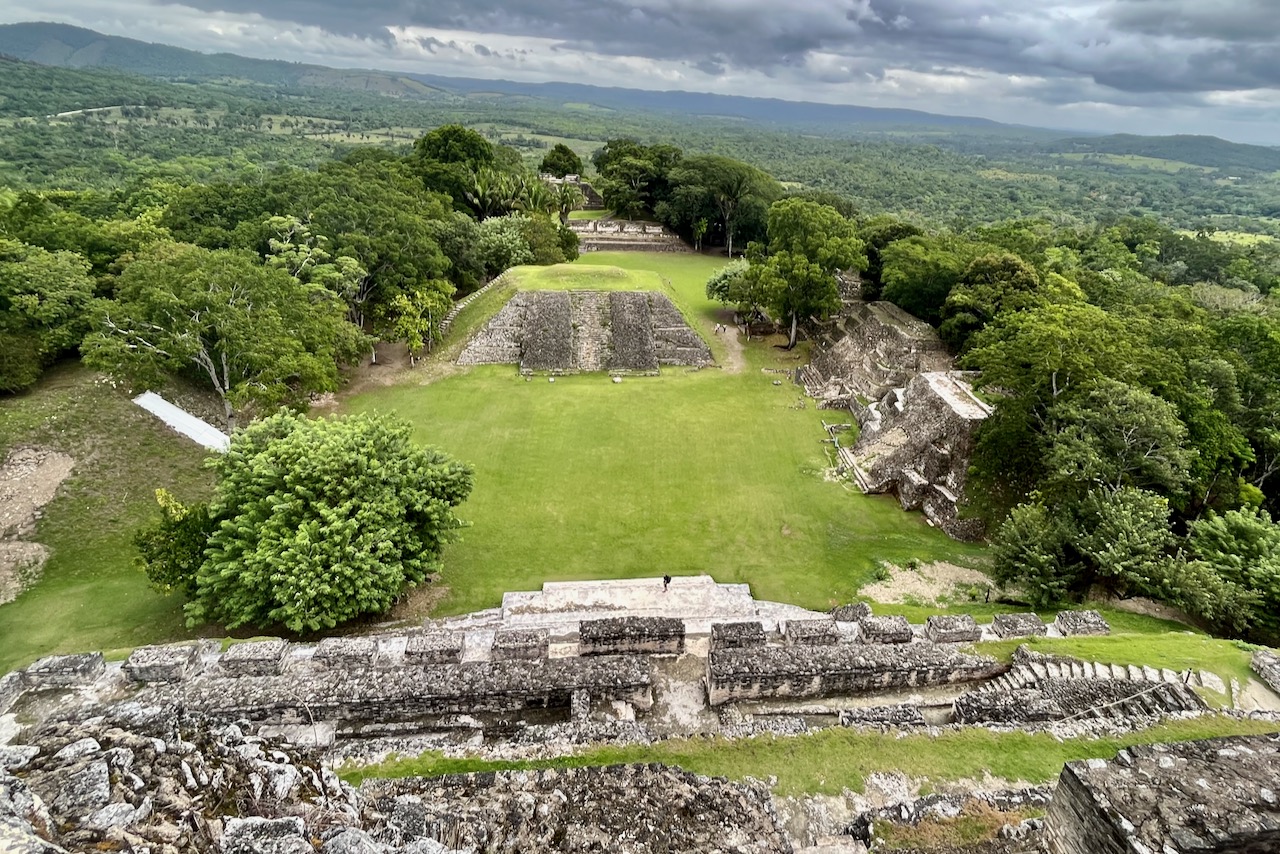
Caracol is one of the more famous Mayan sites and was a major settlement in its day. The site is very large with impressive buildings and excavation work continuing. We were the first to arrive and at the start had the entire site to ourselves. As day went on a few more groups came, but we did not see more than 20 people in total throughout the day. Definitely a benefit of traveling in low season, and before the road is finished and cruise tourists can reach the site!
Caracol, BelizeCaracol, view from the tallest pyramid, Belize
There were many animals and birds around the site. We saw toucans, white nosed coatie, howling monkeys and parrots.
White nosed coati at Caracol, Belize
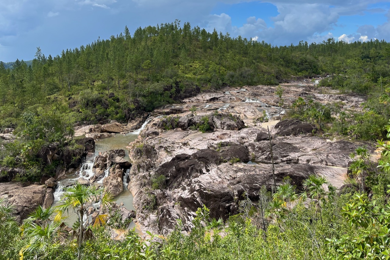
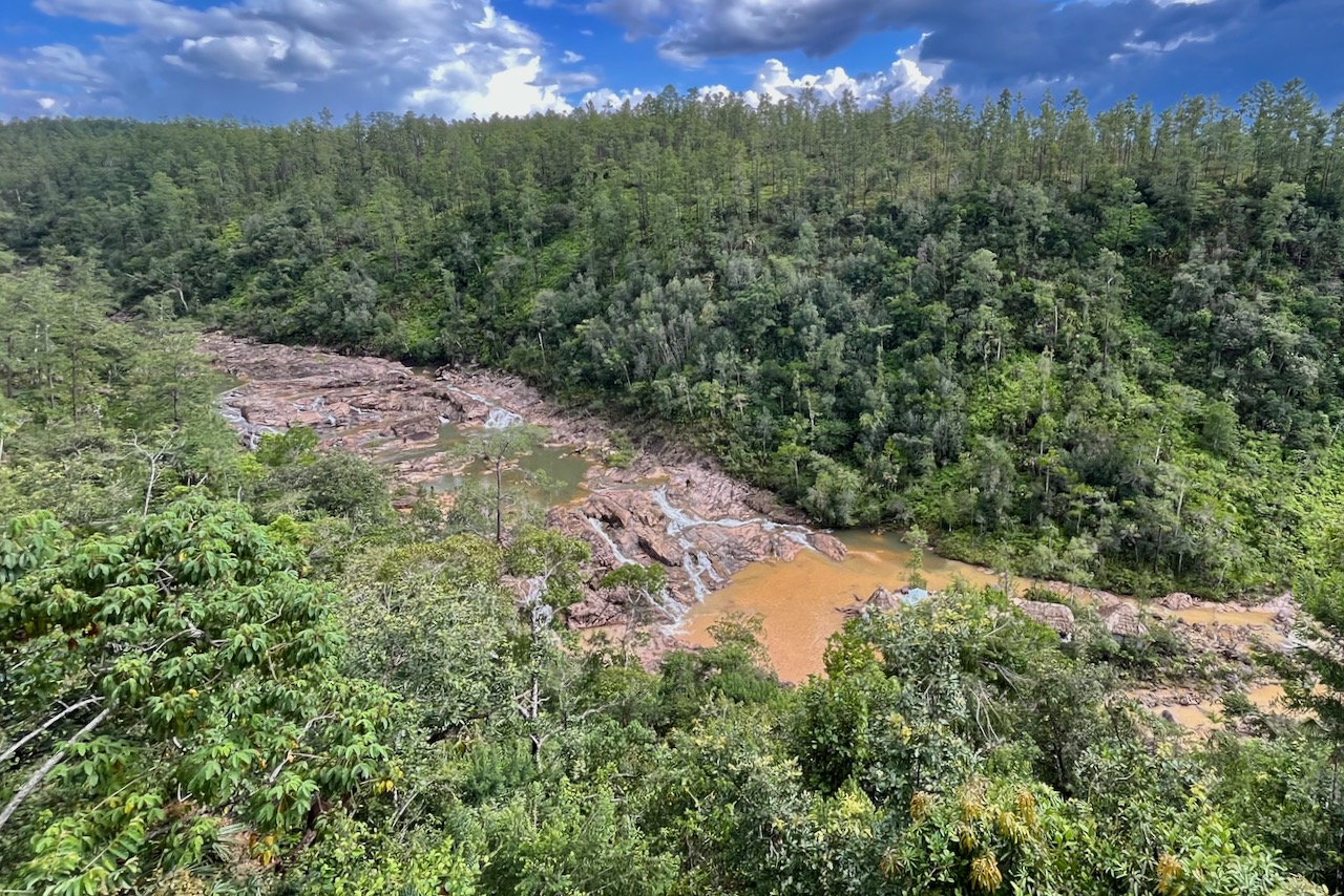
On the way back from Caracol we stopped at a few scenic spots on the drive through Mountain Pine Ridge Reserve. it is a stunningly beautiful place. We only had less than a half day left but there is definitely much to do and explore.
Rio on pools views, Belize
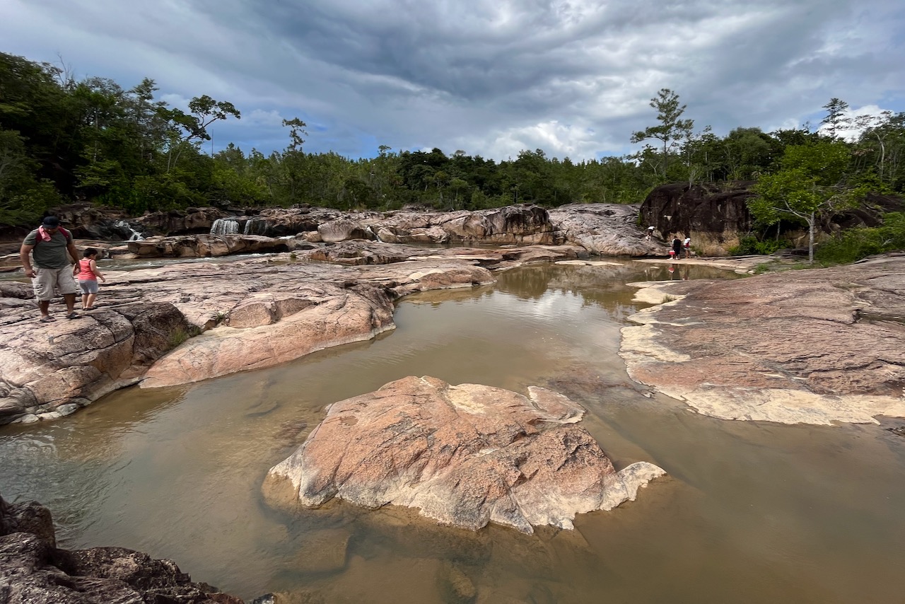
First we stopped at Rio on pools lookout.There is a nicely organized area and there were quite a few people having picknicks enjoying the view. A little walk from the look out one walks to the rock pools themselves. There were quite a few people there, big groups enjoying cooling down in the waters. The short trail is only about 5 minutes. And the site is well managed with toilets and no trash in site. It is a beautiful place and had a very nice peaceful happy vibe about it with all the locals enjoying cool waters.
Rio on pools, Belize
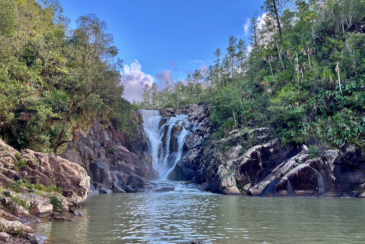
Then we drove by 5 sisters restaurant in a lodge. A great place to have lunch overlooking beautiful waterfalls cascade. Food was great too.
five sisters waterfalls, Belize
And then we stopped by nig rocks falls. This one has long set of steps down. Steps are in a good shape, Easy to go up and down just many of them. Pool at the bottom of the falls is very nice and by the time we were there, there was barely any people. Very nice other stop.
We then tried to get to 1000 foot falls, but day was running out on us and the road was not paved. We decided to keep it till next time as clearly, there is much more to do in the area.
On the last day we headed to Xunantunich, a major Mayan site less than half hour from San Ignacio. The site is spectacular, one can climb the tollest pyramid and see Guatemala border from it and all the countryside around. We also saw many spider monkeys in the trees around the site, toucans, other birds and could hear howlers howling. And again, perhaps because of low season, we almost had site to ourselves – an amazing experience.
We dove in two cenotes and explored several Mayan ruins around Tulum in Mexico, after doing some diving in Cozumel in August 2023.
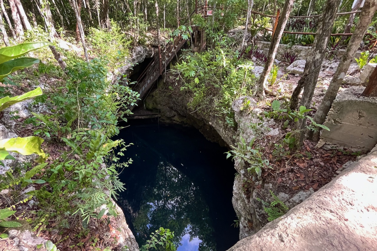
Cenotes are sinkholes resulting from the collapse of the limestone bedrock. It is estimated that there are 10,000 cenotes around Yucatan peninsula. Some forming vast underground systems – a big draw for cave divers. We dove El Pit and Dos Ojos cenotes. Both are considered caverns – meaning one can always (or most of the time) see ambient light from outside. Here is a short video.
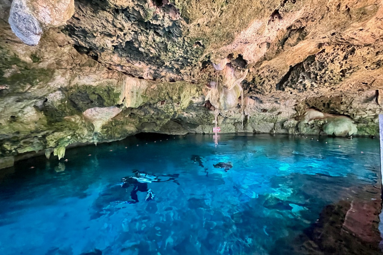
Here is what entrance into El Pit looks like. We were extremely lucky as we were the first to arrive to the site and were the first ones to go down. The surreal beauty of the undisturbed hydrogen sulfide layer in the crystal clear water with shimmering rays of light coming in made it an incredible dive.
Cenote El Pit entrance, Tulum, Mexico
Dos Ojos is a part of a cave system, and has two routes. We went for the Barbie line. Diving here is along the line, and while we could see a little bit of light coming from outside, most of the route is through the overhead environment but there are no narrow passages – it is rather spacious.
Cenote Dos Ojos entrance, Tulum, Mexico
We really liked our introduction to cenotes and definitely can see why so many cave divers flock to this part of Mexico. We dove with Flying Fish dive operator in Tulum. They are very professional, gear is in excellent condition, and they were really helpful in deciding where to go as we were new to cenotes and had some concerns about “not seeing the light”. Had excellent experience.
Exploring Mayan ruins from Tulum as a base
There are many Mayan ruins around Yucatan peninsula. We have explored four of them using Tulum town as our base
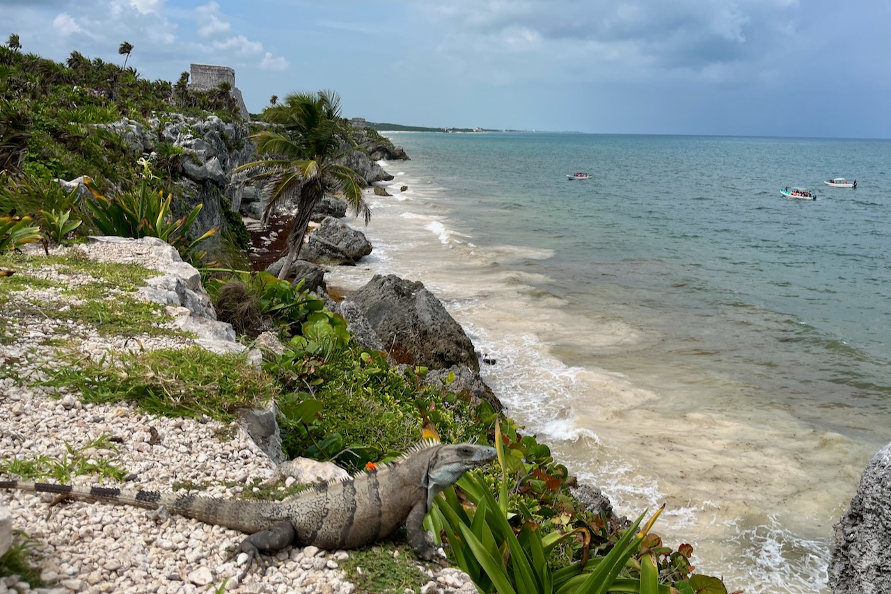
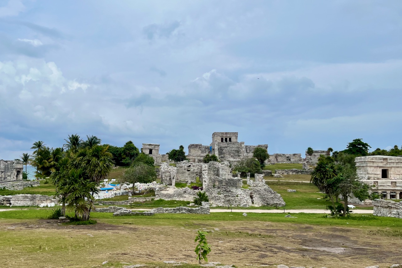
The nearest one is in Tulum itself. Mayan city of Tulum is located on the cliffs along the coast. It was a major trading center, built and occupied between 13th and 15th century and abandoned in 16th century, later than many other Mayan centers. It is a beautiful site and unique in being right on the coast unlike other sites hidden in the jungle.
Tulum Mayan ruins and sea, Tulum, Mexico
Tulum can get very busy with tourists even in low season. It is very popular with both cruise ship travelers and those staying along the Riviera Maya coast. The site is an open space, not shaded by jungle, and definitely a hat and sunscreen are essential.
Tulum ruins, Mexico
We took a day to explore further Mayan sites of Chichen Itza and Ek Balam with a stop in Vallabolid for lunch.
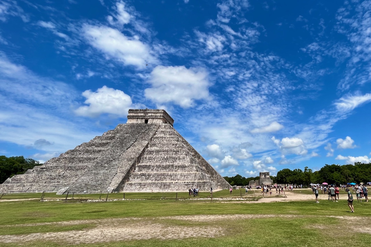
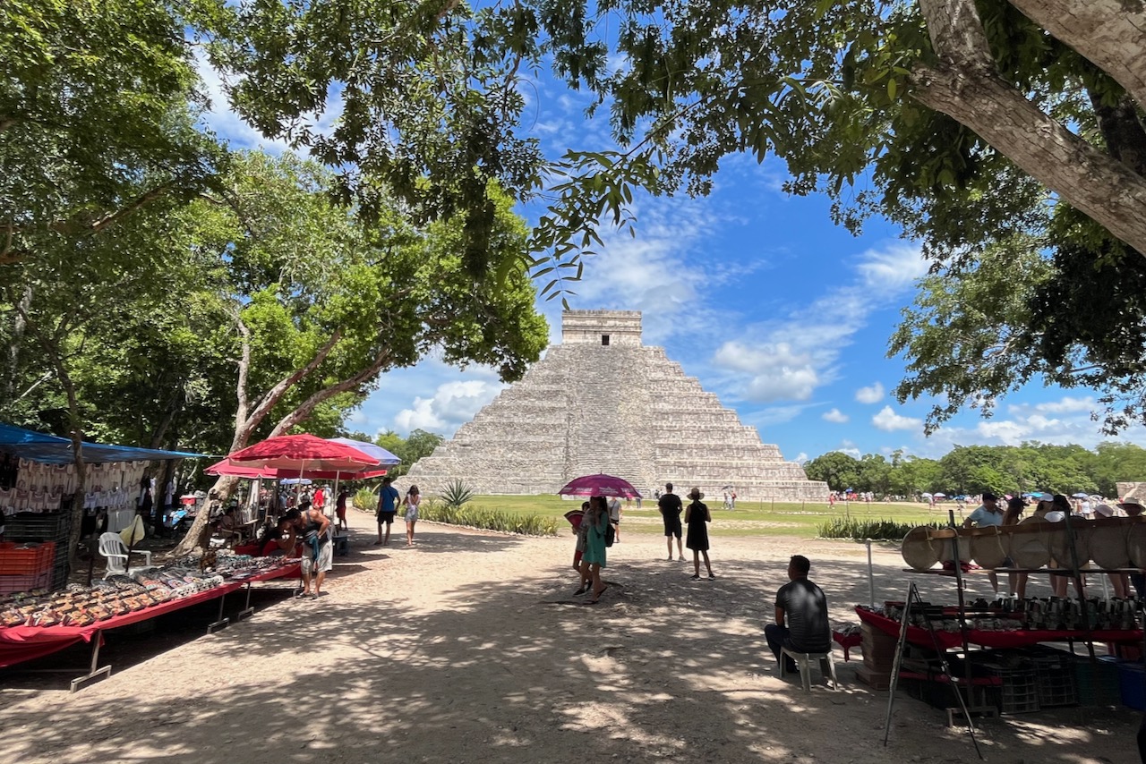
We had hired a car for our stay in Tulum and explored all the sites on our own. Chichen Itza was one of the largest Mayan cities in its day. It gets very busy with tourists with bus loads of cruise and coast visitors arriving to the site in mid morning. We tried to get ahead of the crowds (even in low season). Chichen Itza is about 2 hour drive from Tulum on a vary good road via the city of Vallabolid. Confusingly, but helpfully, Chichen Itza is in a different time zone from that of Tulum, an hour behind. So one has an extra hour to get to Chichen Itza early.
Chichen Itza ruins, Mexico
Chichen Itza was occupied between 7th and 13th centuries, and served as a major regional center at its peak. At its height, Chichen Itza population is estimated at over 50,000 people. There are huge temples and public spaces, a gigantic ball court, procession ways, and just stunning examples of Mayan architecture.
Chichen Itza ruins and traders, Mexico
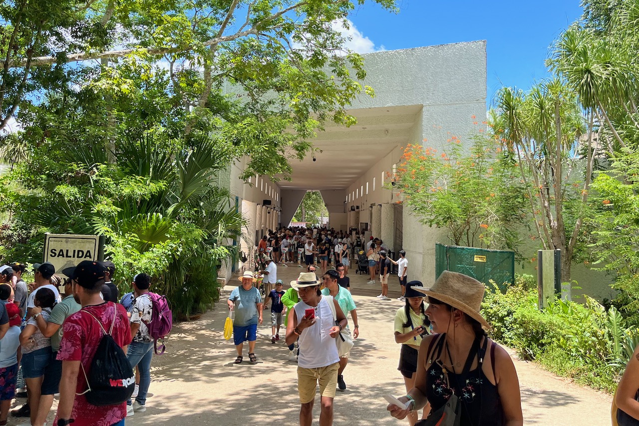
Having visited the site about twenty years before, the change was striking. Tourism is important for local economy. There are big areas with vendors selling every kind of Mayan souvenir one could imagine within the territory of the archeological site – though to be fair the stalls are in a distance from ruins themselves. One cannot climb any ruins anymore – and for a very good reason given the crowds. Despite the crowds, it is still an incredible site and definitely a must on Mayan history circuit.
Chichen Itza ruins entrance gate, Mexico
We were quite successful in beating the crowds in Chichen Itza and were departing as more and more buses with tourists were arriving. We headed to Vallabolid. A small city by Mexican standards, it has a historical city center with a nice square, cathedral, and pretty renovated historical buildings. We had a lunch in one of the restaurants on the square taking in the atmosphere.
Vallabolid main square, Mexico
Our plan then was to visit cenote Zaci in the town of Vallabolid and reportedly a good place to swim and cool down, which we felt we really needed after walking around in humid heat of Chichen Itza. We drove up to the cenote Zaci which had good facilities, well set up for visitors. But then solid rain started coming in so we decided that we should go to another Mayan site we saw on the map called Ek Balam and hopefully escape the rain by going there.
Ek Balam ruins, Mexico
It was the best decision ever to go to Ek Balam. Ek Balam is about half an hour drive north of Vallabolid on a good road. We had the site almost to ourselves with only a couple of other visitors. Ek Balam was a significant center, capital of its region and at its peak had a population of 12-18 thousands. It has defensive walls, impressive gate, a ball court and multiple temples and public structures. There is a huge 30m tall and 127m long acropolis and one is still allowed to climb it. The view from the top is absolutely breathtaking with jungle shrouding ruins of Ek Balam.
Ek Balam view from acropolis, Ek Balam, Mexico
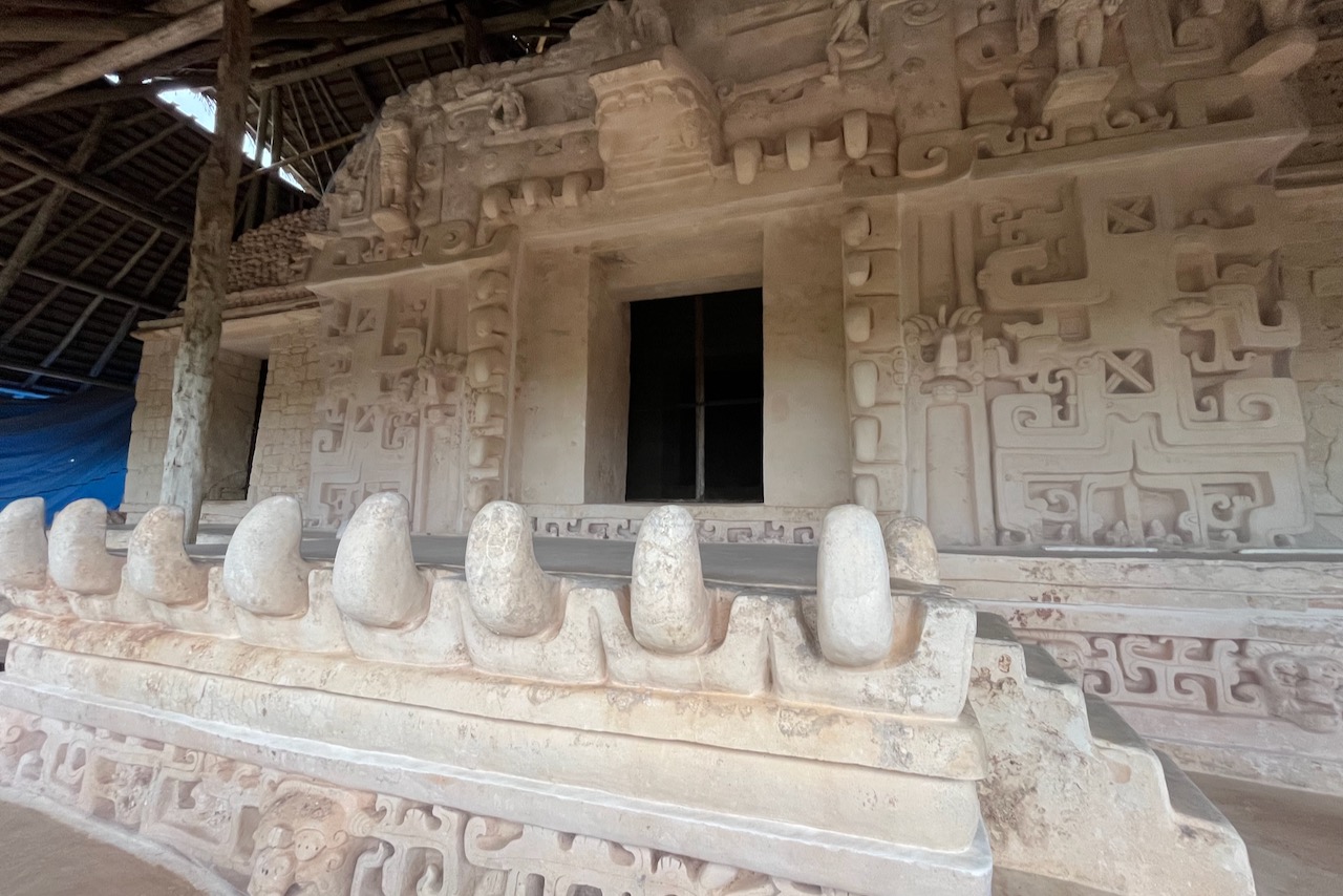
One of the more remarkable discoveries in Ek Balam was the tomb of the ruler Ukit Kan L’t Tok‘ located on the acropolis. For centuries the entrance was covered by a stone wall and as a result was not discovered, preserving the carvings and contents of the tomb. Archeological excavation in Ek Balam started in the late 1980s and the site was open to visitors in 1997. It is truly incredible to imagine all the secrets jungle in this region holds, and all the history yet to be discovered.
Ek Balam tomb on acropolis, Ek Balam, Mexico
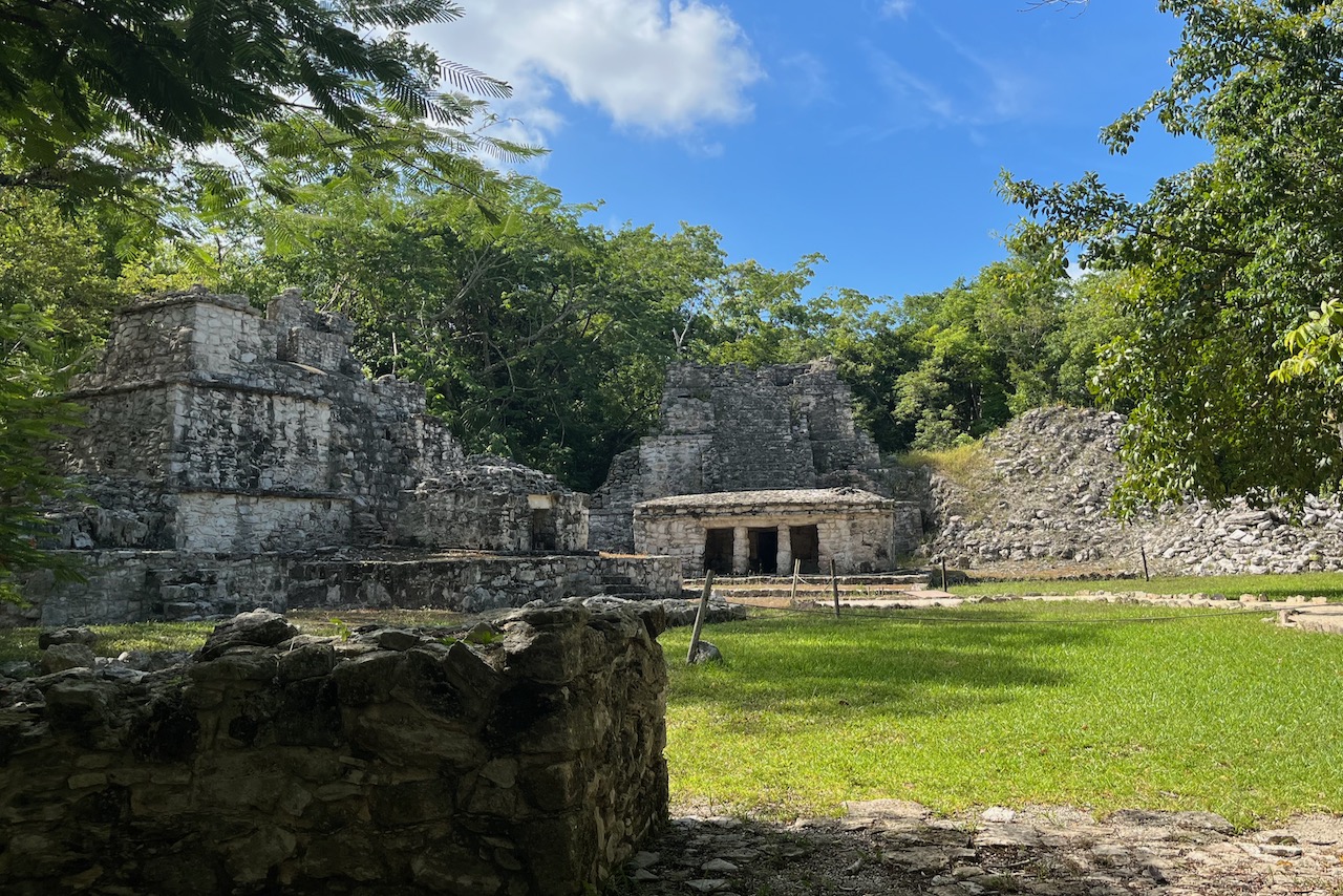
On our last day in Tulum we decided to explore another Mayan site – Muyil and lagoons next to it. When we visited in August 2023, Muyil was quiet and did not have many tourists. There are signs that the site is expecting to increase the number of visitors as now it is no longer possible to climb any of the structures. Muyil was a significant trade port in its day connecting the coast to Coba and other major cities inland. Only a few structures have been excavated and the work is continuing to uncover more. In the mean time with few visitors and buildings still covered by jungles it has a sense of mystery about it.
Muyil ruins, Mexico
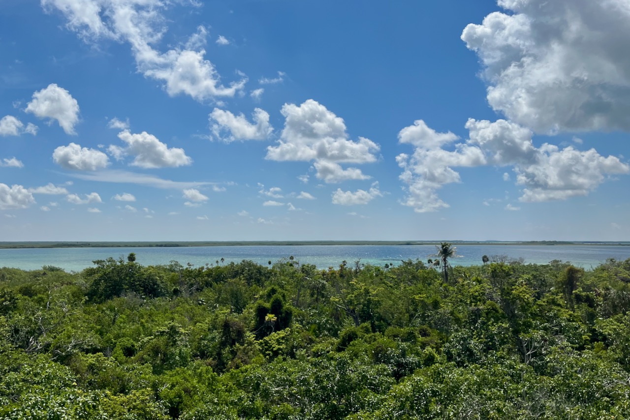
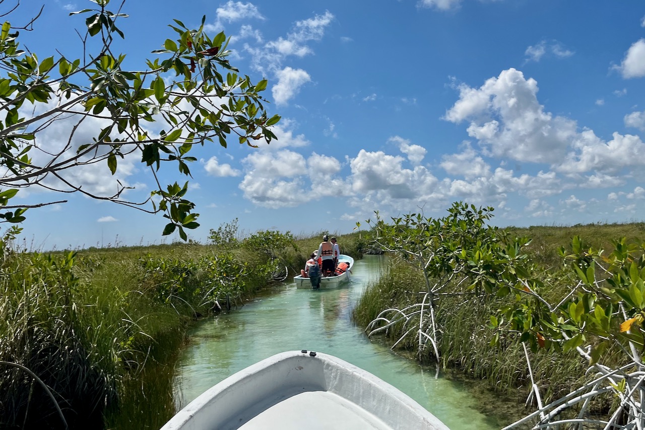
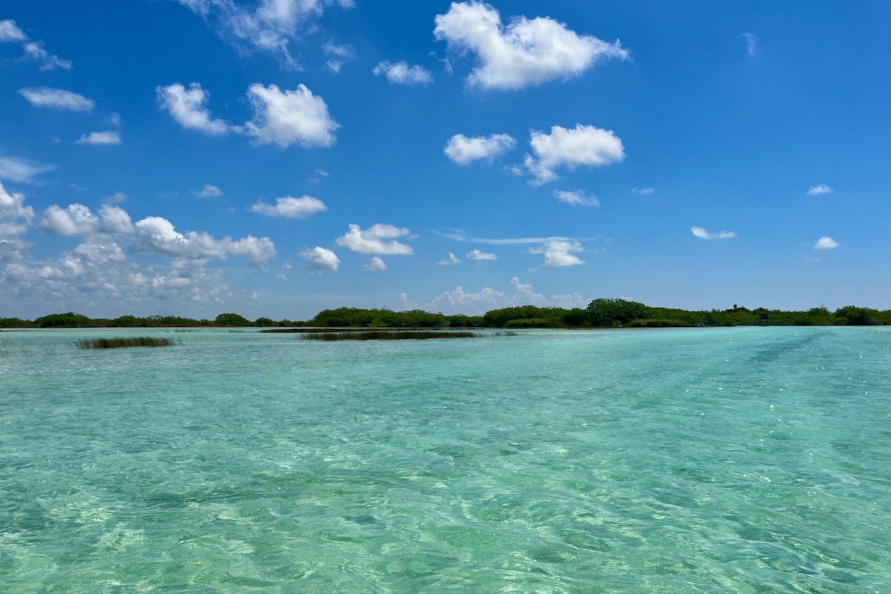
After visiting the site one can continue into the jungle and through a nice elevated walkway through a mangrove forest to Muyil lagoon. At Muyil lagoon there are private boat operators who take you on a tour on the lagoon, then through the canal connecting Muyil lagoon to a much larger Chunyaxché lagoon. And from there, one gets off the boat and floats on a canal through the mangroves, using life jacket as a flotation device. The lagoons are perfect turquoise blue. And the canals, are the same canals that Mayan people have used centuries before to transport goods from the coast inland to the port of Muyil. It was a really fascinating experience.
Muyil lagoon, MexicoChannel from Muyil lagoon to Chunyaxché lagoon, Mexico Chunyaxché lagoon, MexicoChannel in Chunyaxché lagoon, Mexico
We visited four Mayan ruins – two busy with tourists and two almost to ourselves, and explored the channels that Maya built through mangroves between lagoons. We felt we did pretty well on our Mayan emersion in Yukatan and resolved to visit more Mayan sites in Belize and Guatemala to learn more about this incredible civilization.
We stayed in town of Tulum itself as most of our activities were all around the peninsula. On the last day we finally made it to the beach where big resorts and beach bars are. At the time there was quite a bit of sargassum which has been arriving in larger quantities lately all over the Caribbean. But in Tulum, even if there is sargassum at sea, there are lagoons and cenotes to swim in and many land based adventures. Not to mention great food, huge range of accommodation options and very friendly people. We had amazing time.
While diving in Omanin November 2019 we also did some top side exploration around Muscat and a day trip to Wadi Shab. It took a while to write this up with the pandemic dampening the mood.
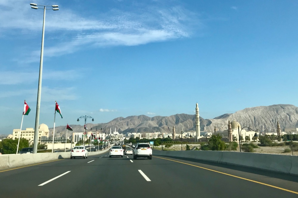
Muscat is the capital city of Oman. The city is wedged between the mountains and the sea. Distances are significant, temperatures are high and one must hire a car to get around. We stayed in one of the hotels along Qurum beach which is about half way between the old city center – Mutrah – and Al Mouj Marina where our diving boat was departing from. Roads are excellent, signs are in English and Arabic and it is pretty easy to drive around.
Highway around Muscat, Oman
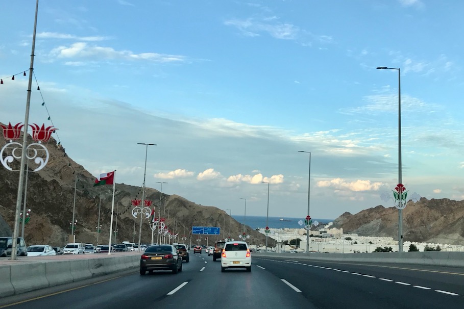
We were in Oman around the weekend of Oman’s National Day. National Day celebrates the birthday of Sultan Qaboos who was alive when we visited in November 2019. The streets were decorated with flags and lights and there were festivities everywhere.
Highway towards old town Muscat and harbor, Oman
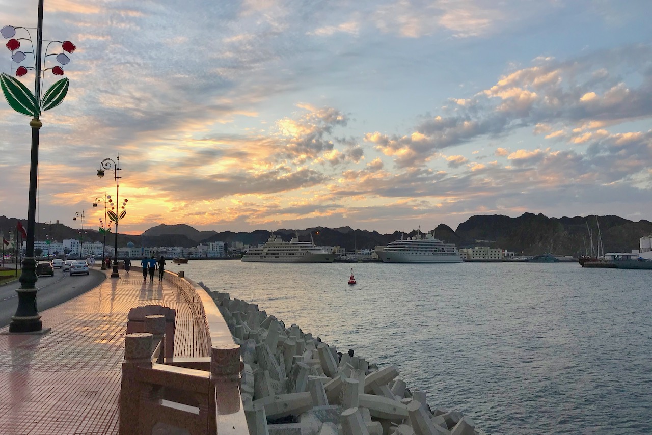
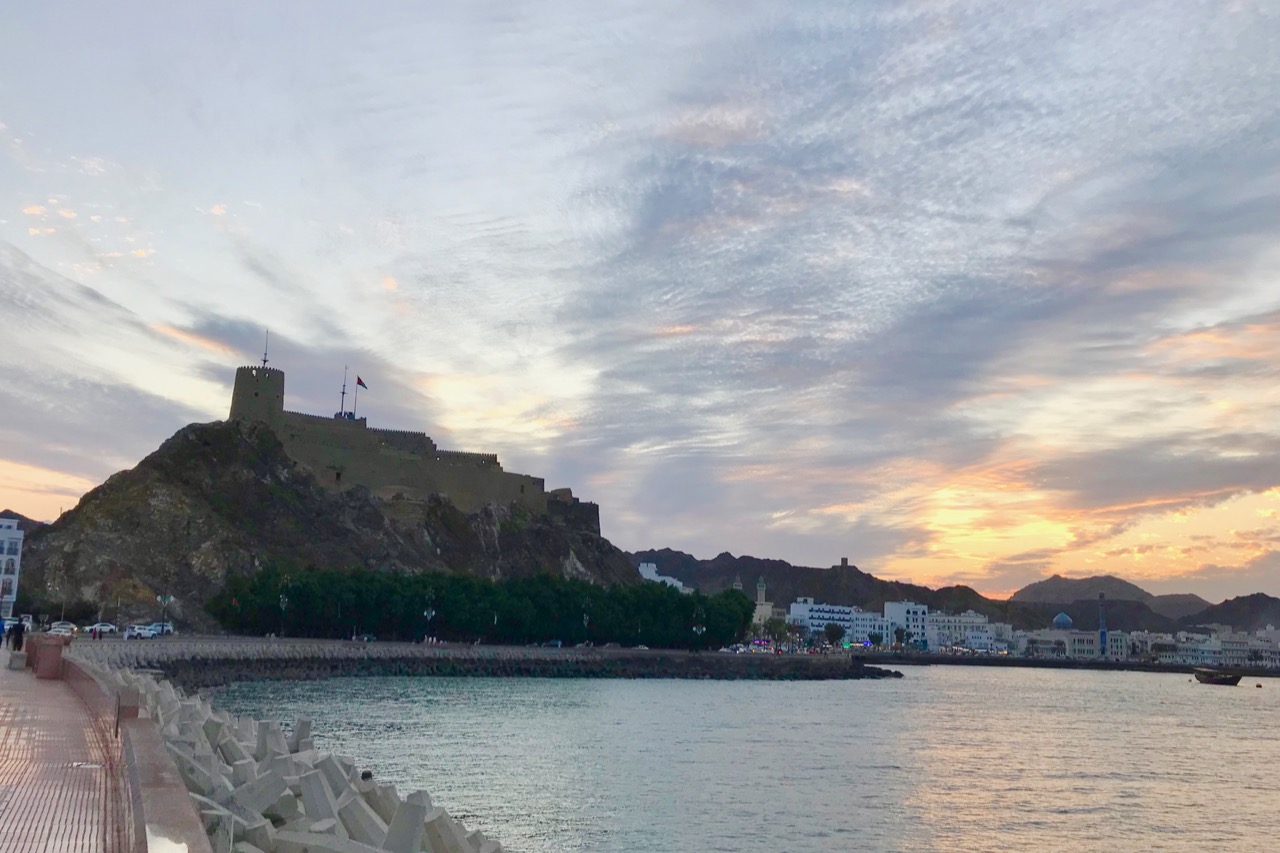
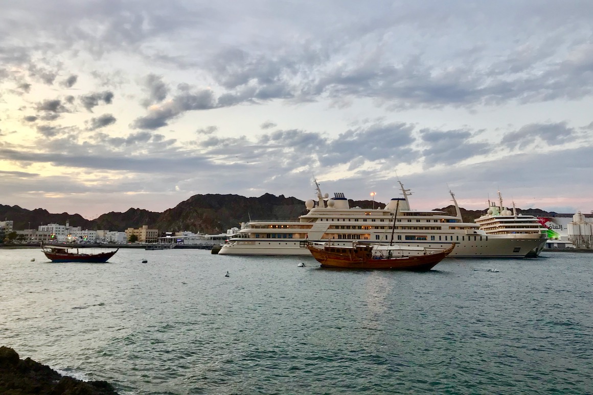
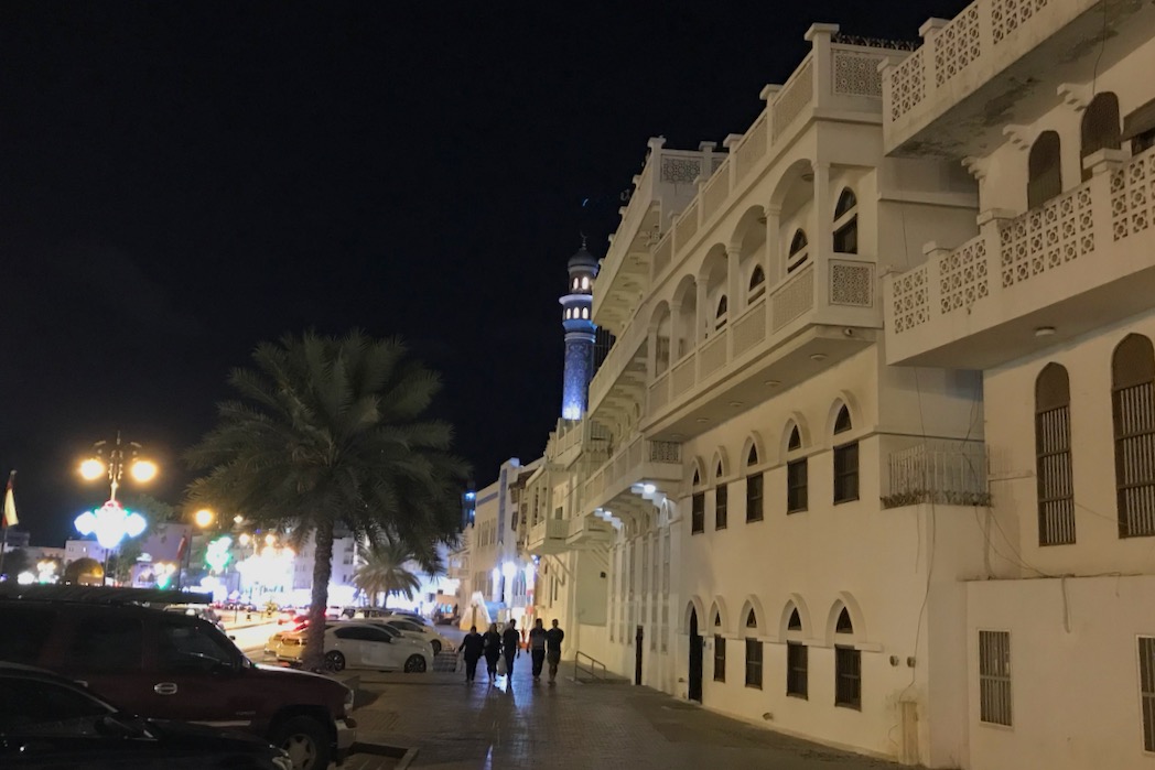
Mutrah is the district where old city center is located including the market – Mutrah Souq, the harbor with Royal yacht and where cruise ships dock, the beautiful promenade – Mutrah Cornische, restaurants, the fish market, the fort and other historical sites. One of the afternoons after diving we headed down to Mutrah to walk about, have a look at the souk and eat at one of the restaurants overlooking the harbor.
Mutrah Corniche, Muscat OmanMutrah fort, Muscat, OmanRoyal yacht in Sultan Qaboos port, Muscat, OmanStreet near Mutrah Souq, Muscat, Oman
Souq has quite a few shops with souvenirs that caters to tourists, but a big part of it really is a regular market where Omanis shop, even though of course they have huge modern malls where one can buy whatever one wants.
Shops inside Mutrah Souq, Musccat, OmanShops around Mutrah souq, Muscat, Oman
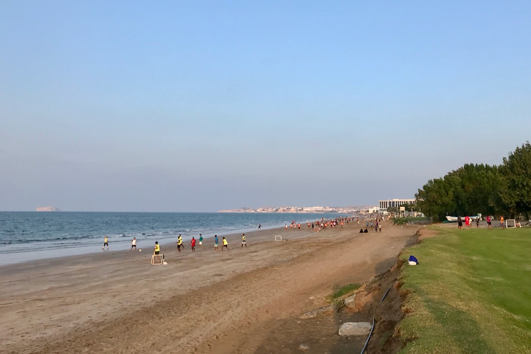
On another day in the afternoon after diving we walked along Qurum beach from our hotel. It was a weekend and lots of locals were playing football all along the beach. There are quite a few restaurants along the beach and nearby streets with fantastic food.
Qurum beach, Muscat, OmanQurum beach, Muscat, Oman
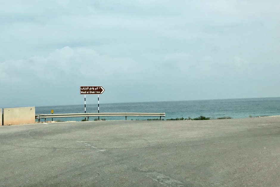
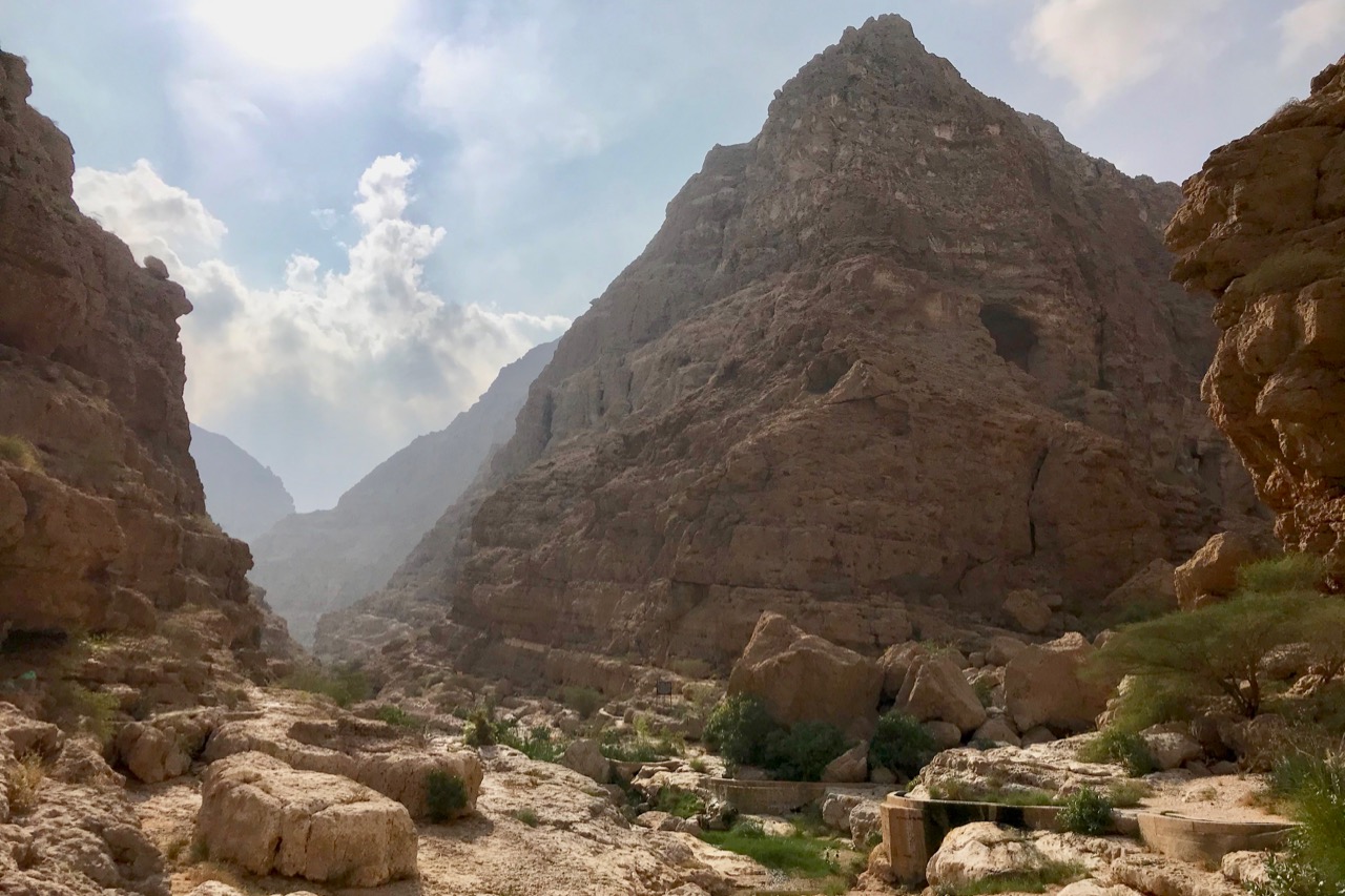
On the last day when we could not dive ahead of the flight, we went out of Muscat to visit Wadi Shab. Wadi refers to a valley and in this case it’s a stunning gorge with trees along a river hidden in the rugged desert mountains.
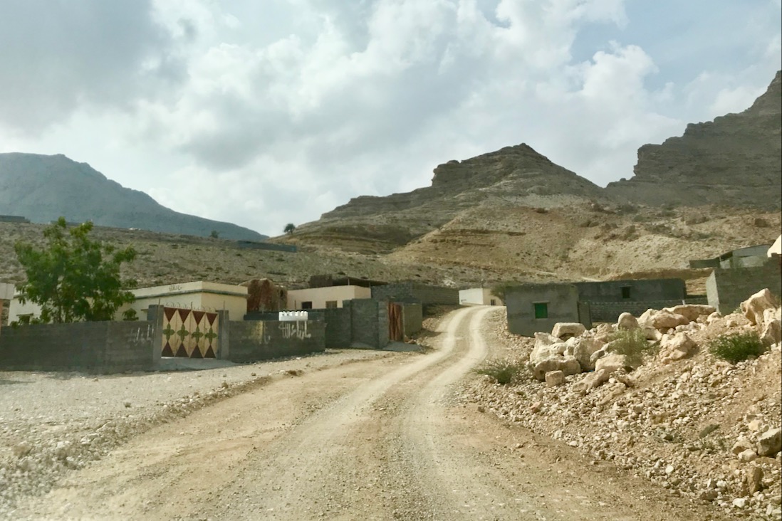
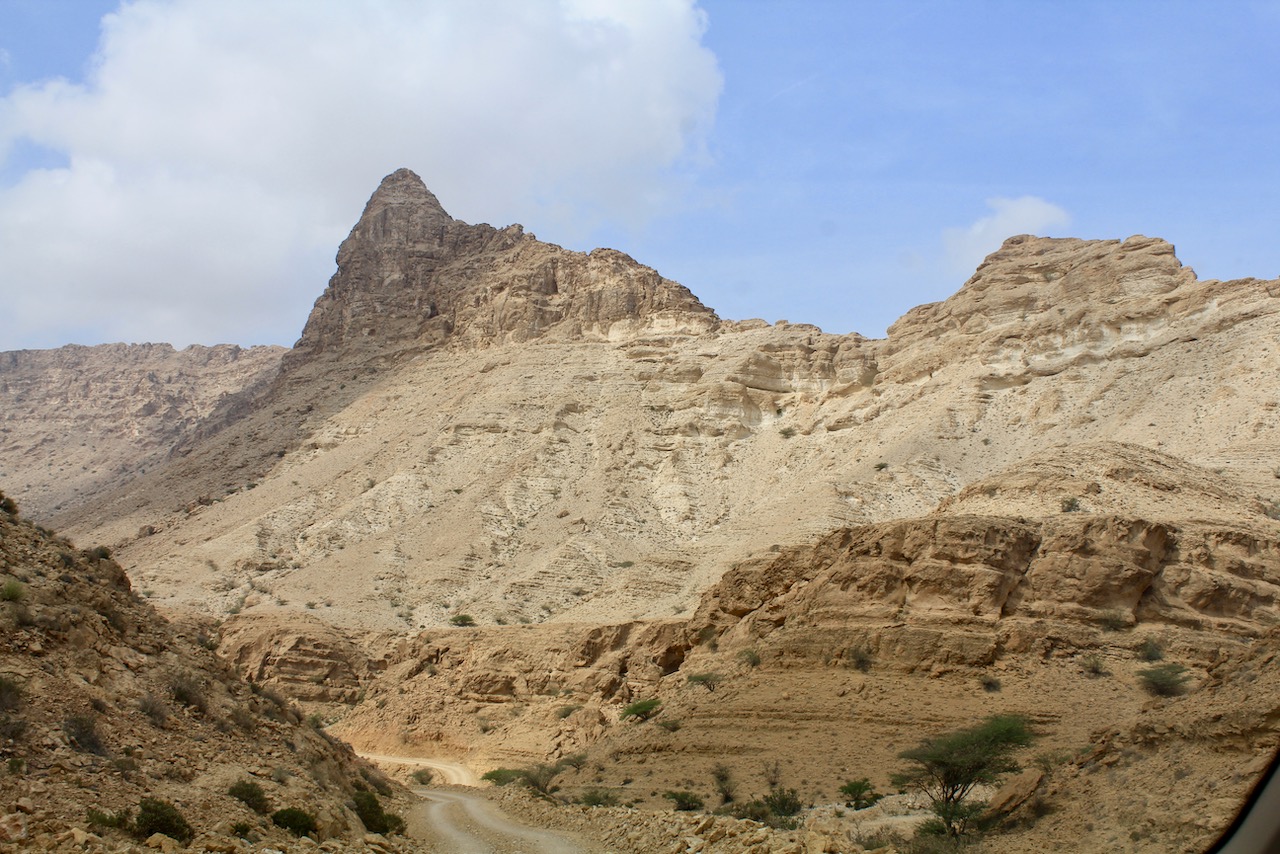
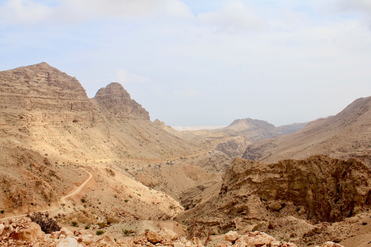
View on the road from Muscat towards Wadi Shab, Oman
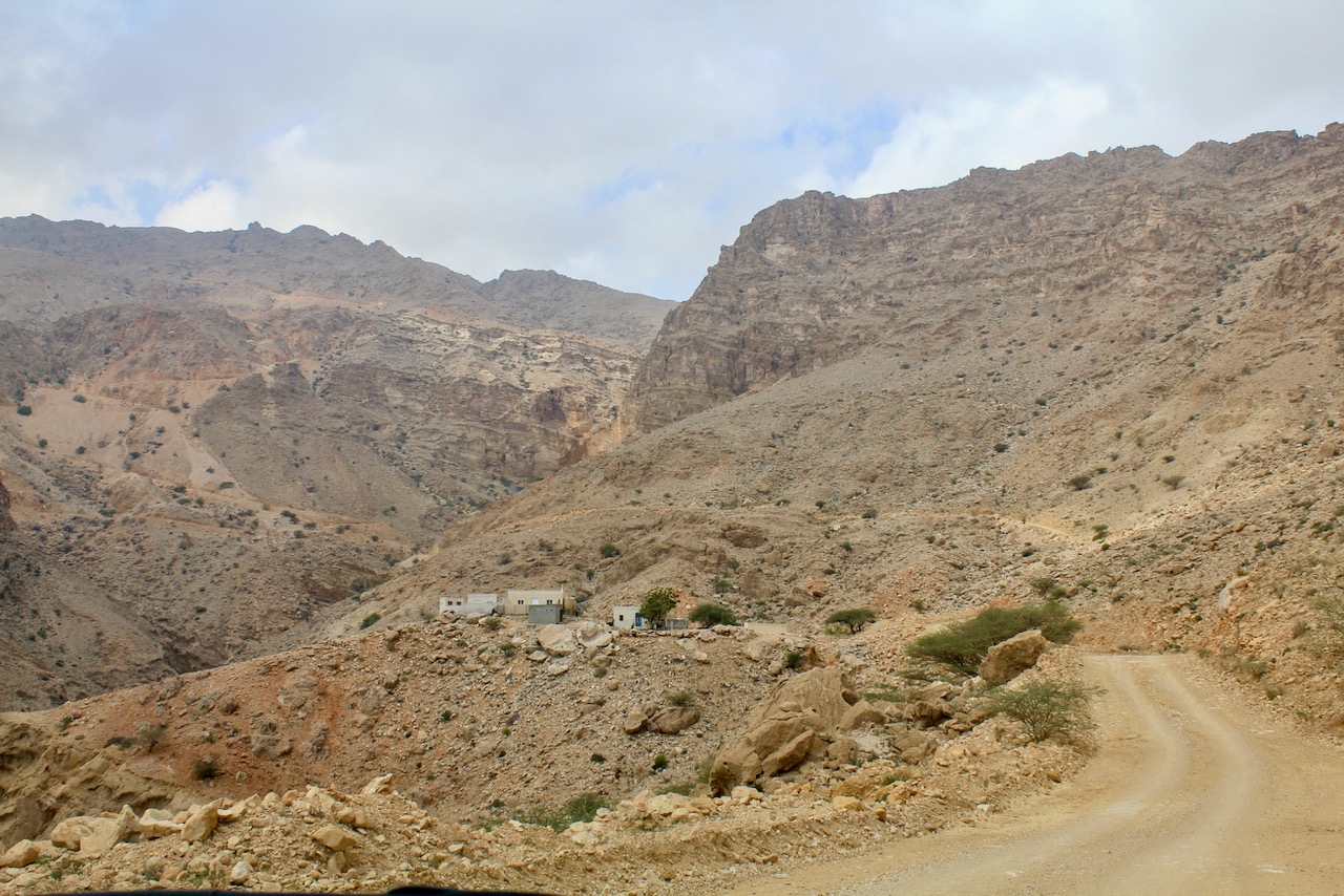
If you enter “Wadi Shab, Oman” in google maps it seems to send you to the source of the river up in the hills instead of the entrance to the Wadi near the sea where you want to go. To get to the correct place one must search for the directions for “Wadi Shab parking” or “Wadi Shab, Tiwi” and follow coastal road. In the spirit of adventure we have tried following the road up the hill. It’s a gravel road with steep incline and not to be attempted unless you are in a solid 4×4 and ready to drive along steep cliffs. We have gotten some stunning views of the mountains and isolated dwellings but before long had to turn around due to road conditions.
Road in the mountains near Tiwi, OmanDriving in the hills near Tiwi, OmanRoad in the hills near Tiwi, OmanMountains near Tiwi, Oman
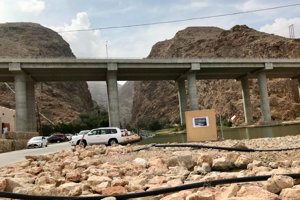
We returned back to the coastal road and pretty soon got to the sign for Wadi Shab parking.
Sign for Wadi Shab parking, OmanParking for Wadi Shab, Oman
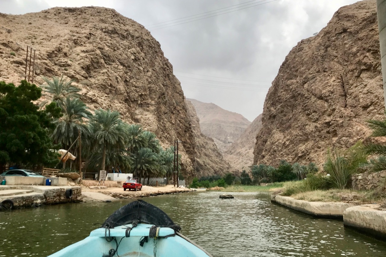
To start the walk into Wadi one first needs to cross the narrow river on the little boat.
Crossing the river at Wadi Shab, Oman
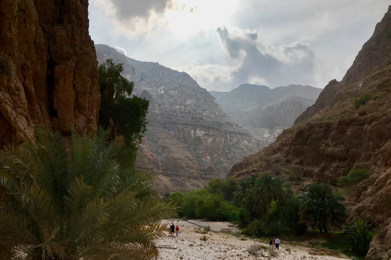
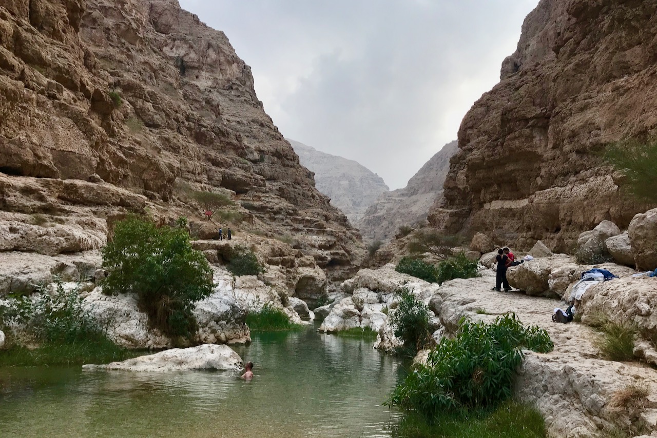
And then the hike starts along the river bed in the gorge.
Walk in Wadi Shab, OmanWadi Shab, OmanWadi Shab, Oman
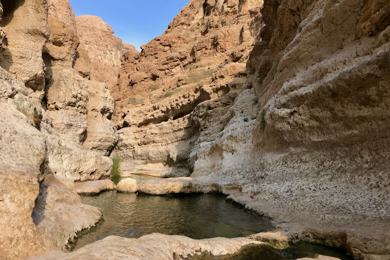
At the end of the walk after about an hour, the river widens into pools and then it is swimming through the pools with short walks to get from one pool to the next. When we were there water was not too deep and we could walk through all the pools if need be except the last one which was deeper. The surfaces between pools can be slippery so a pair of water shoes could be nice. We did the entire walk in flip flops, though in retrospect hiking shoes would have been better especially when scrambling on the rocks in some sections of the gorge.
A pool in Wadi Shab, OmanA pool in Wadi Shab, Oman
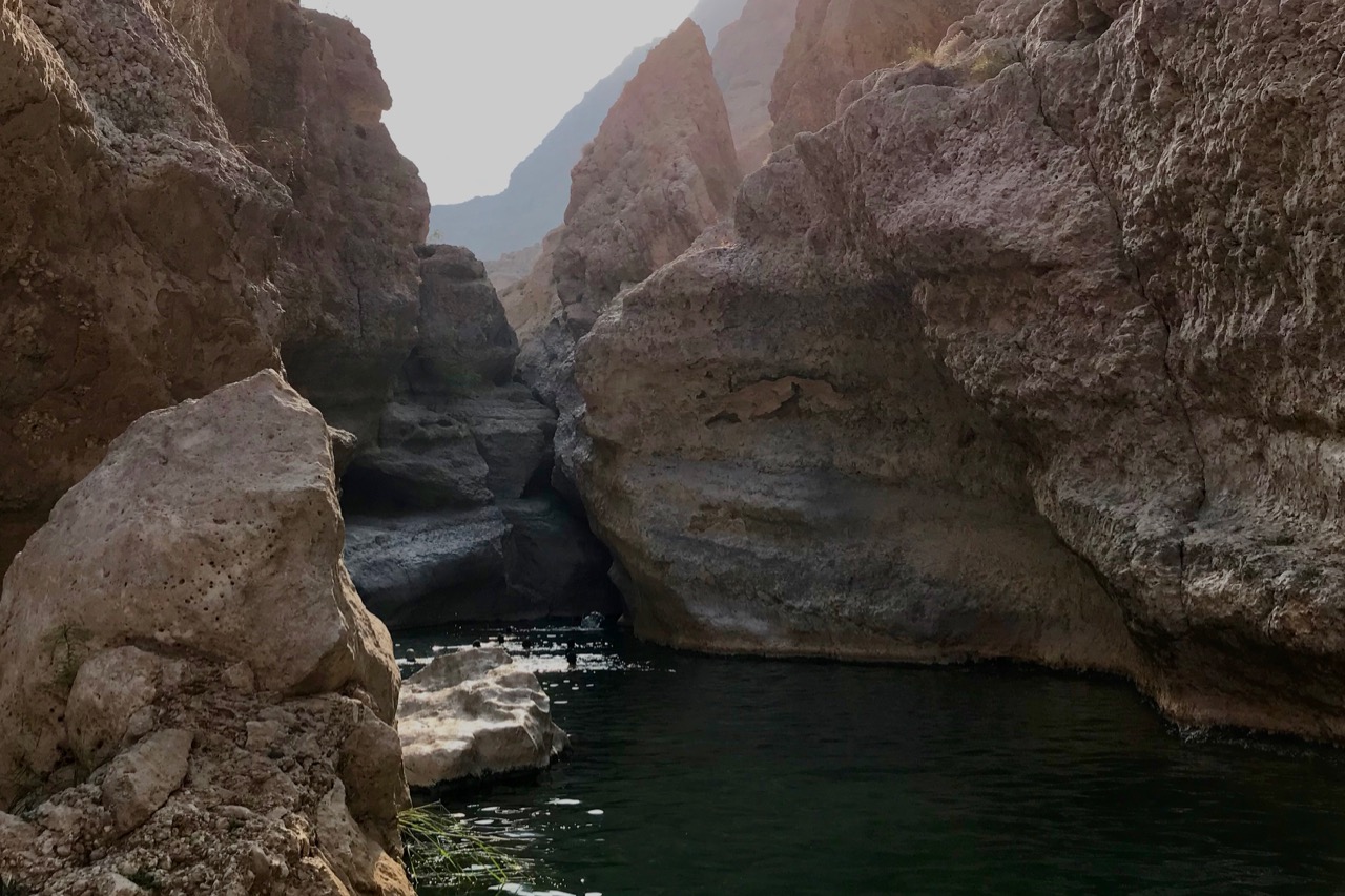
After swimming through the last pool there is a very narrow entrance to a cave and getting into is definitely worth it. The entrance is very narrow and deep so you need to swim through it. Once in the cave there is plenty of light as there is an opening in it and a beautiful waterfall. We don’t have any pictures of that though because we did not bring our waterproof camera and could not get our dry bag through the cave opening.
The last pool with the entrance to the cave in Wadi Shab, Oman
By the time we reached Muscat on the way back the sun set and we got a beautiful night view of Muscat as we descended from the mountains into the city. It was a great trip with good diving and hopefully we will be able to come back and explore more of Oman one day.
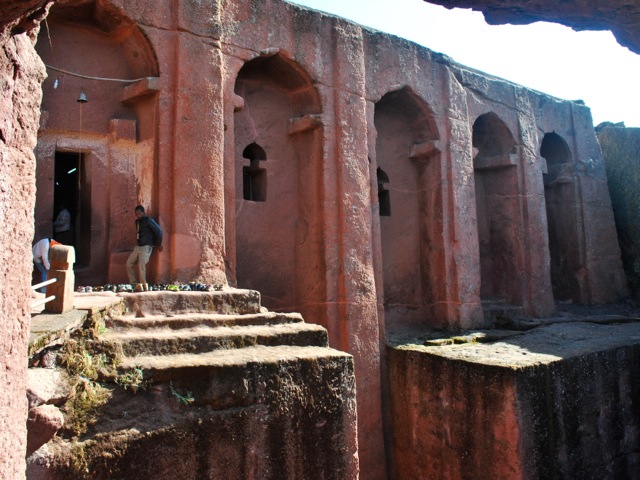
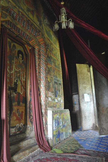
Lalibela is a town in Ethiopia famous for its medieval rock-cut monolithic churches. Cut from solid rock some of the churches are more than 10 meters tall. It is hard to imagine how much effort it required to excavate these churches and decorate them. No wonder a legend says that the churches were built with the help of angels overnight. Another story goes that the power of the Arc of covenant (still believed to be in Ethiopia by many) was used to help excavate the churches.
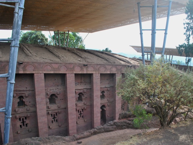
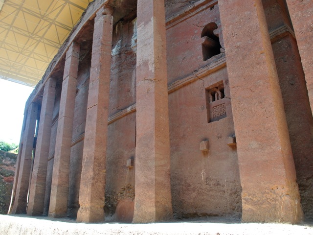
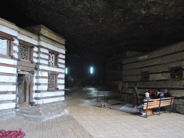
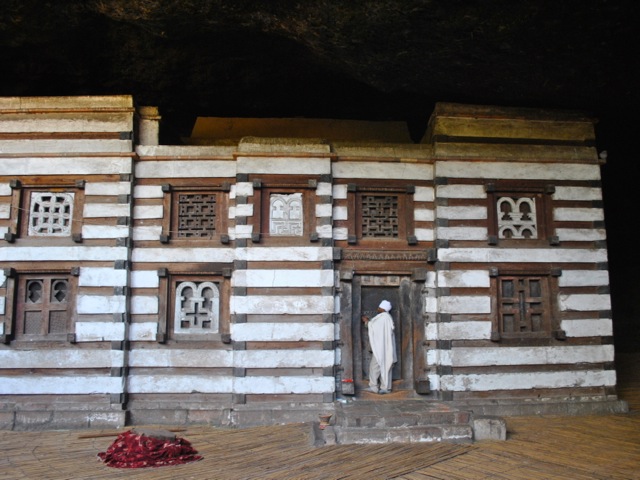
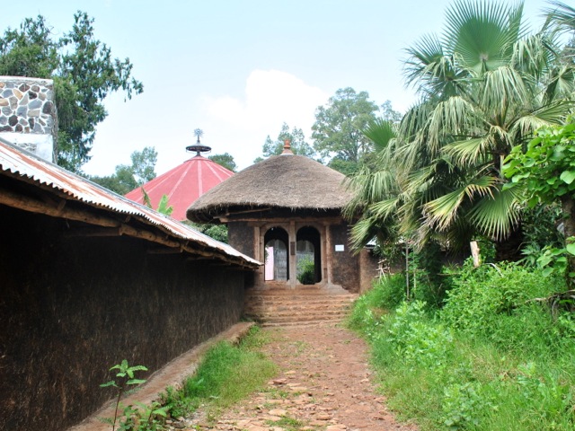
Bet Medhane Alem – the largest of Lalibela churches, Ethiopia
Modern historians say that the churches were build over a long period of time between 7th to 13th century AD. The churches are a UNESCO World Heritage site and most of them now are covered with roofs for protection against the elements. All the churches are still functioning and are the center for pilgrims especially during major Ethiopian Orthodox Church religious holidays. We visited in November 2017 and there were few tourists.
Bet Medhane Alem, Lalibela, Ethiopia
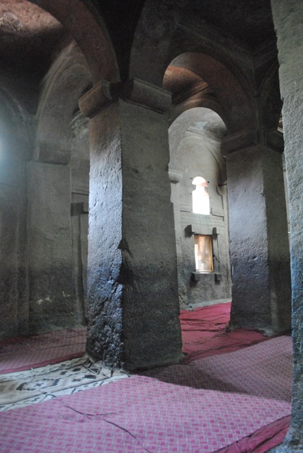
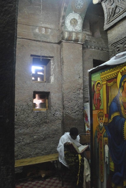
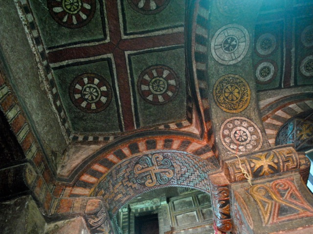
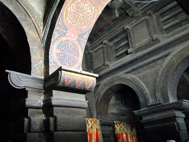
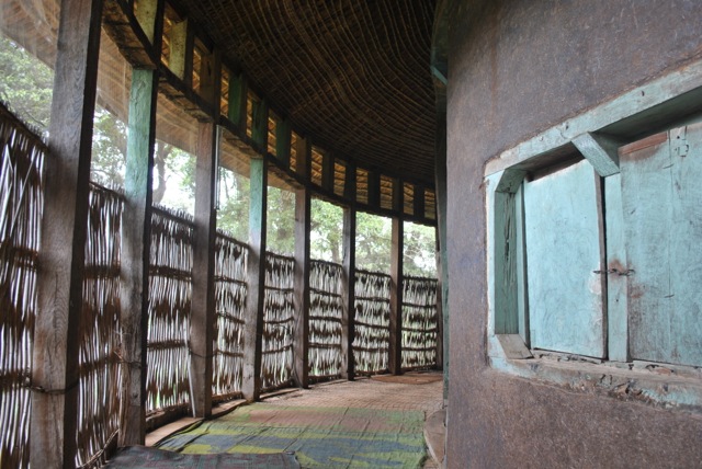
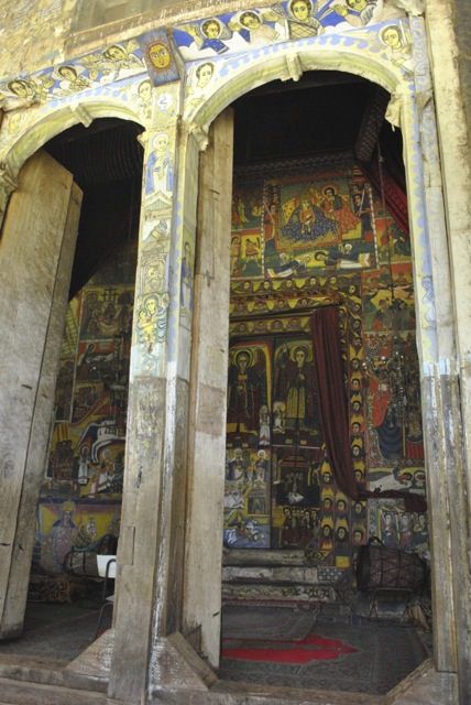
Each of the churches was carved out of the mountain first. Then windows and doors would be carved and then the entire interior with columns and variety of decorative elements. The interior then was painted with most churches having very impressive paintwork on ceilings.
Bet Medhane Alem, Interior, Lalibela EthiopiaPriest in Bet Medhane Alem, Lalibela Ethiopia
Bet Maryam painted ceiling, Lalibela, Ethiopia
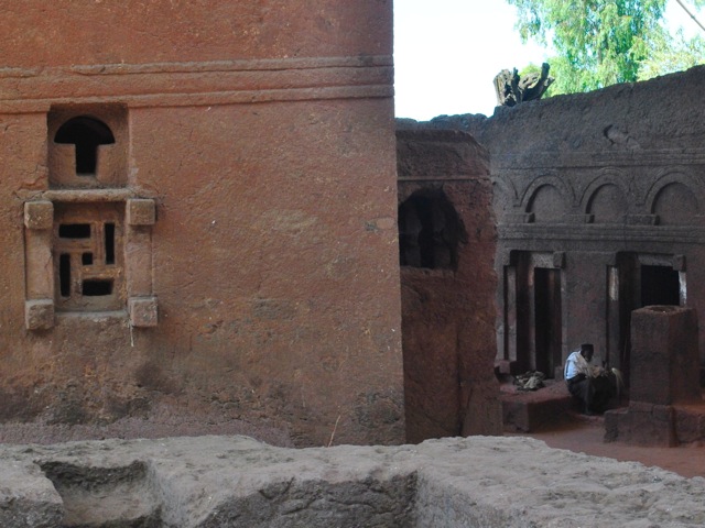
As we wondered around the churches we saw several monks and hermits who emerge from their cells for some light and warmth.
Bet Maryam and Bet Meskel, Lalibela, Ethiopia
Courtyard near Bet Maryam, Lalibela, Ethiopia
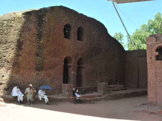
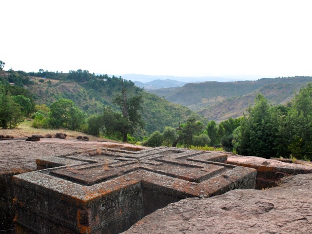
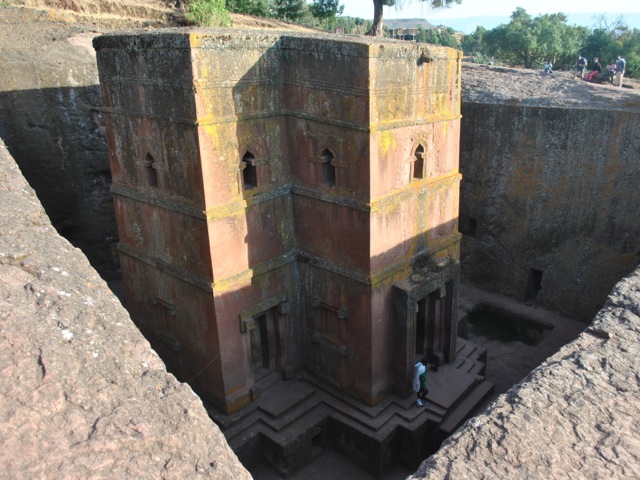
The churches are clustered in northern and southern cluster and Bet Giyorgis – the most famous cross-shaped church – is standing on its own. We arrived to Lalibela on the morning direct flight from Addis Ababa and after dropping the bags to the hotel went straight to visit the northern cluster. The churches close between noon and 2 pm so we headed back to the hotel for lunch. In the afternoon we did the southern cluster and St. Georgis which is particularly striking at sunset.
Bet Gabriel- Rafael, Lalibela, Ethiopia
Bet Giyorgis dedicated to St. George is the only church in Lalibela that does not have a protective cover over it. It is the most recognizable of all Lalibela churches and is particularly popular in low afternoon sun.
Bet Giyorgis, Lalibela, Ethiopia
Bet Giyorgis, Lalibela, Ethiopia
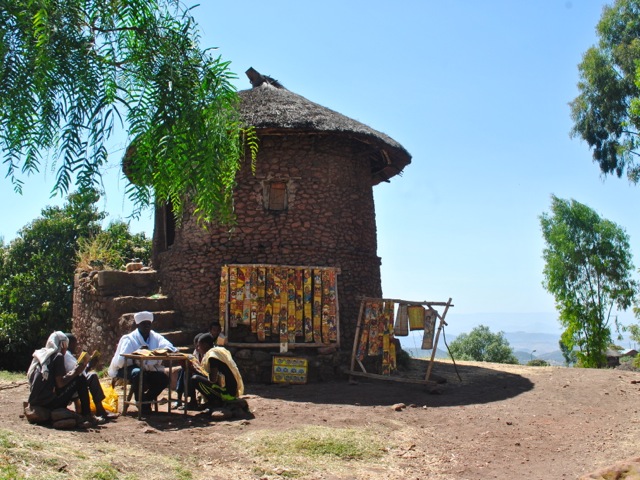
Students of religious education, Lalibela, Ethiopia
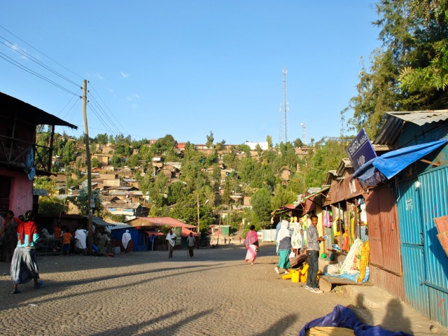
The town of Lalibela has a population of about 30 thousand. It sits on a small plateau at an altitude of 2,600 meters with stunning views of the valleys and mountains around.
Lalibela town, Ethiopia
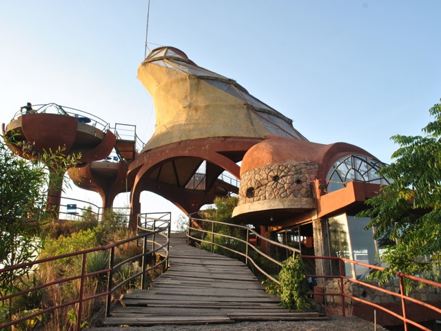
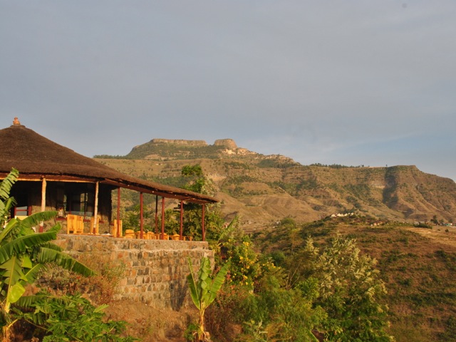
To get a good view of the landscape we headed for dinner to Ben Abeba restaurant. Ran by a Scottish-Ethiopian duo the name of the restaurant means mountain flower – ben being mountain in Gaelic and abeba – flower in Amharic. The structure looks odd but it does have excellent sitting to enjoy stunning views and sundowner in one of the “flower pods”. Once the sun set though it got pretty cold and eating inside was definitely the way to go. In the spirit of Scottish-Ethiopian fusion we got a shiro shepherd’s pie for dinner – basically a shepherd’s pie with Ethiopian traditional shiro (chickpea stew) inside.
Ben Abeba restaurant, Lalibela, Ethiopia
Views around Lalibela and women carrying wood, Ethiopia
Sunset view from Ben Abeba restaurant, Ethiopia
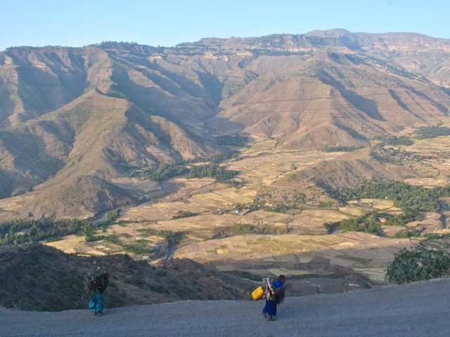
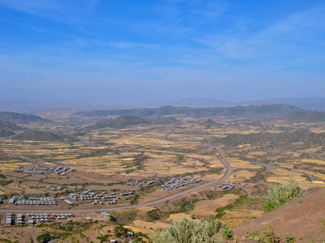
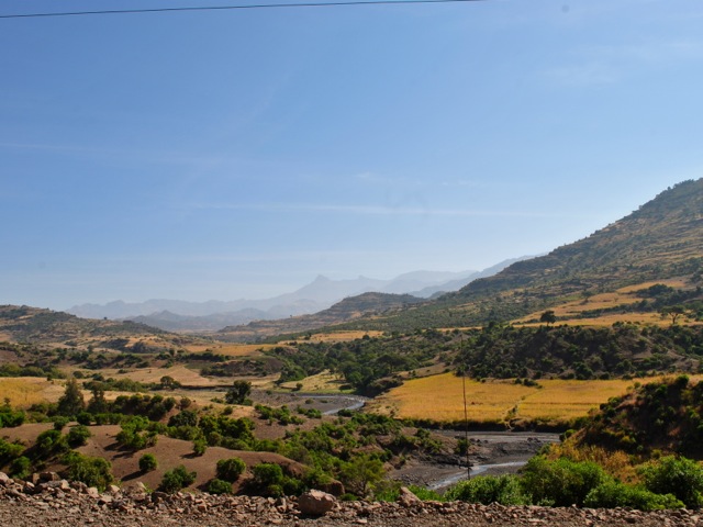
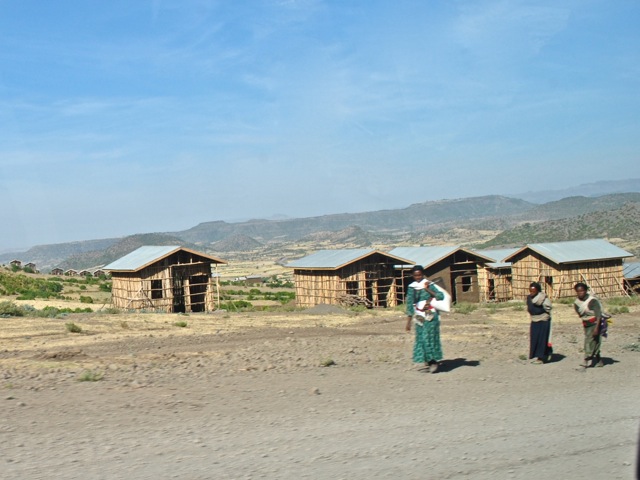
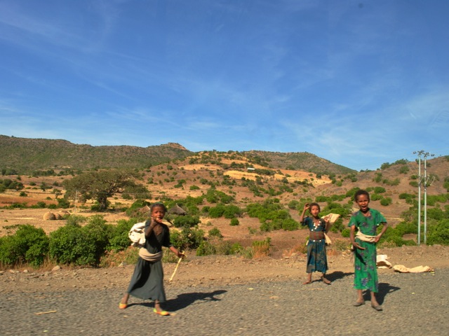
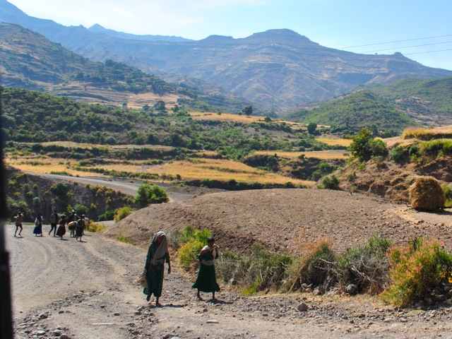
The next day we headed to Yemrehanna Kristos monastery. The trip starts with a descent from Lalibela town to the valley with stunning views on the way. In November when we visited all the fields were bright yellow with grains ready for harvesting. As we drove through the countryside we saw lots of farmers in the fields threshing grains. We travelled on Saturday and so also saw lots of people walking along the road to the market.
Descending from Lalibela, Ethiopia
Landscape near Lalibela, Ethiopia
Women walking along the road toward Lalibela, Ethiopia
Children along the road near Lalibela, Ethiopia
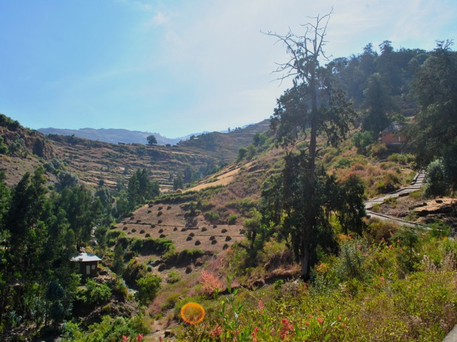
The road from Lalibela to Sekota that took us to the monastry was in the process of being paved at the time of the visit. About half way to the monastery the very nice freshly paved road turned into a gravel road. The trip definitely needed a 4×4 and in rainy season would be quite a track.
Road from Lalibela to Secota, Ethiopia
The monastery is located in a cave on top of the hill. There was a nice concreted path leading up to the cave through a beautiful forest with blooming flowers. In Ethiopia churches are protecting forests. Areas belonging to church often are the only places where any forested land is left as people in surrounding areas plow hilltops to plant grains.
Path to Yemrehanna Kristos monastery, Ethiopia
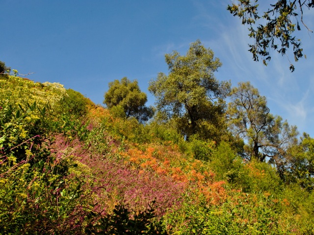
Flowers in the forest surrounding Yemrehanna Kristos monastery, Ethiopia
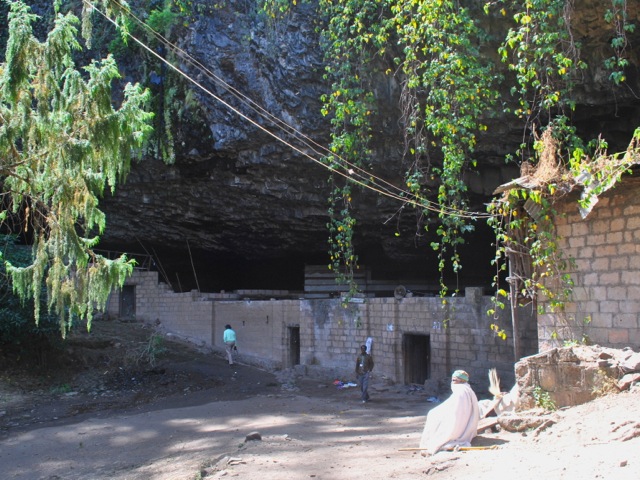
At the top of the hill there was the entrance to the cave where monastery was. The modern protective wall unfortunately did not follow the old elaborate architectural tradition that inspired the monastery inside. You have to take off shoes at the entrance of all churches and monasteries so wearing socks is a good idea.
Protective wall and entrance to Yemrehanna Kristos monastery, Ethiopia
Yemrehanna Kristos cave monastery, Ethiopia
The buildings inside of the cave are built in Axumite style with wood and rock. The main church has elaborately carved windows and finely painted interior. In the back of the cave there is an area full with mummified bodies of more than 10 thousand pilgrims who came to the monastery to die as it is a holy place.
Yemrehanna Kristos monastery main church, Ethiopia
Yemrehanna Kristos monastery main church interior, Ethiopia
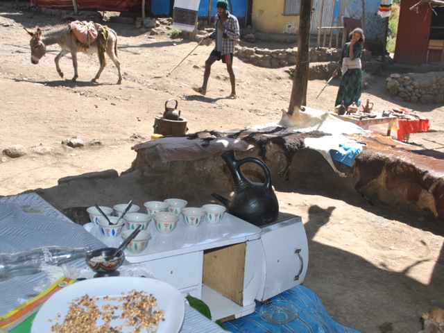
On the way back we stopped and had a coffee in a little coffee shop at the parking area. The setup is very basic with a half a dozen shops in mostly corrugated iron boxes selling souvenirs.
Coffee place at the parking of the Yemrehanna Kristos monastery, Ethiopia
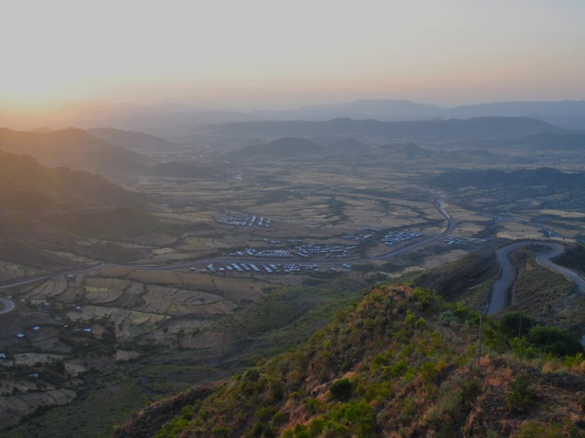
We headed back to Lalibela passing more harvest scenery along the way. There is a very nice view on the way of the striking hill on top of which Lalibela town is perched. One can understand why the builders of the churches selected this spot providing ample protection from attackers back in the day.
View along the road to Lalibela, Ethiopia
View towards town of Lalibela on tops of the hill, Ethiopia
Our next activity was a visit to the market in Lalibela. On the way to the market we passed a very impressive looking structure. We thought it was some sort of luxury new hotel being built with cascading pools but were told that this was a new honey museum – area being famous for its honey. The building was not finished at the time we visited but we wonder what came out of it and what would be in that massive honey museum.
Honey museum, Lalibela, Ethiopia
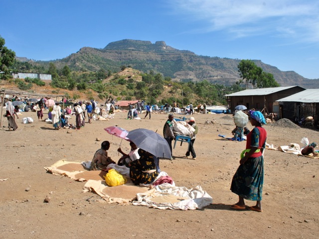
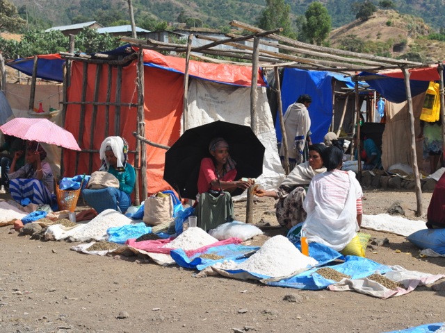
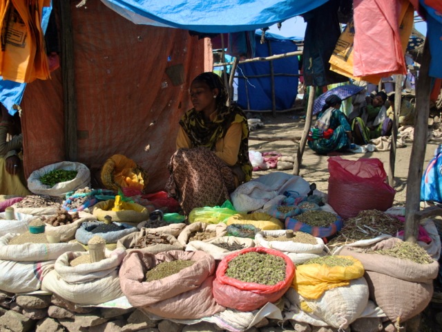
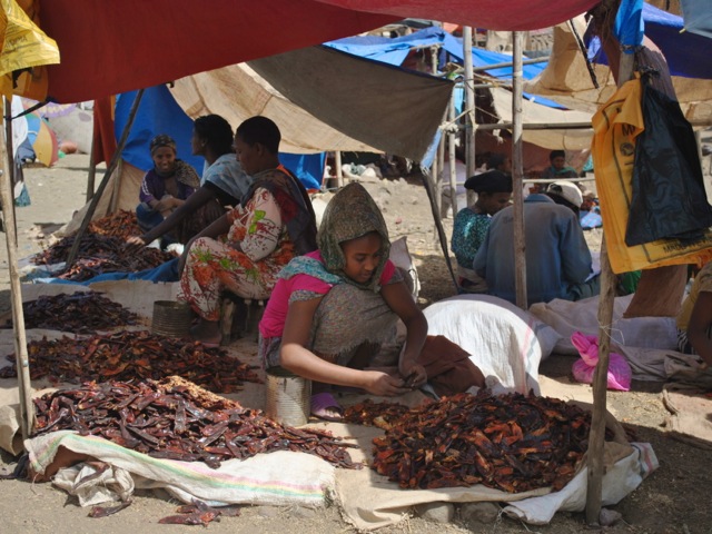
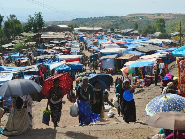
The market was colorful and chaotic. We arrived a bit late for the main action and most of the cattle was gone. But there were still many traders mostly women selling salt, honey, grains, spices, vegetables and all sorts of housewares.
Lalibela market, Ethiopia
Selling salt, Lalibela market, Ethiopia
Trader with spices and herbs, Lalibela market, Ethiopia
Selling chili peppers, Lalibela market, Ethiopia
Lalibela market entrance, Ethiopia
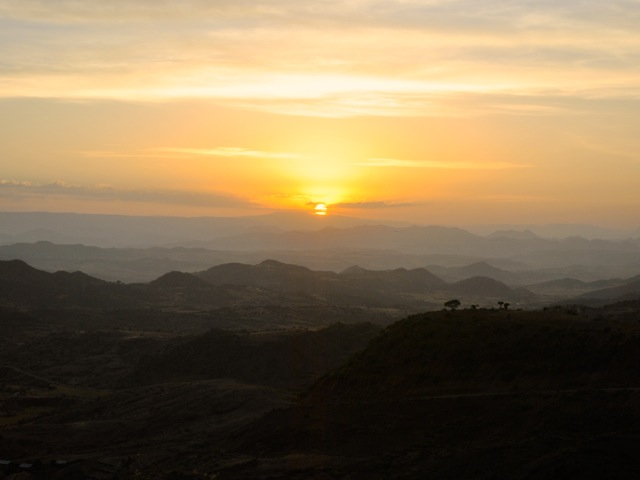
For our second day sunset viewing we stayed in our hotel – Sora lodge. It was perfect not only for the sunset but also for excellent bird viewing.
Sunset at Sora lodge, Ethiopia
Sunset view from Sora lodge, Ethiopia
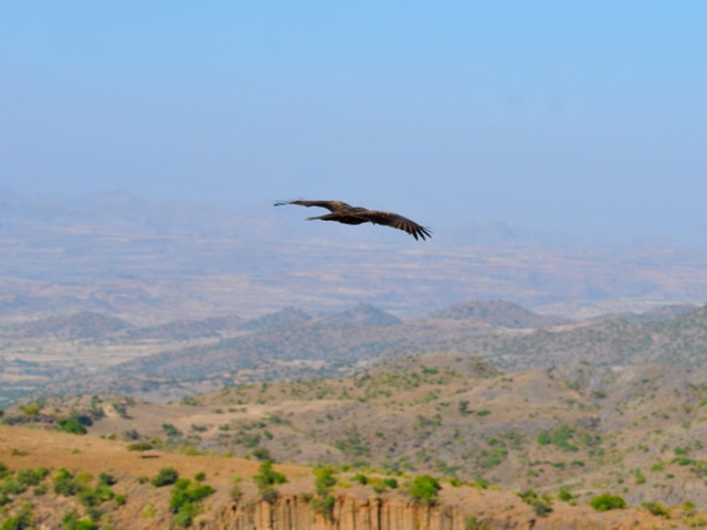
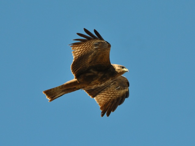
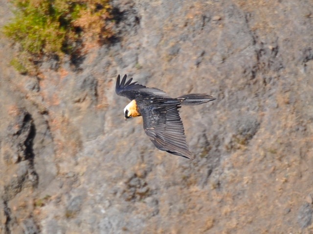
The next day Sunday was our day to go back to Addis Ababa. The latest direct flight to Addis Ababa goes at 1pm which leaves limited time for doing more tours. We decided to just stay at the lodge and watch birds and people going up and down the steep hills. We saw some really cool eagles and kites and even a lammergeier. Lammergeier or bearded vulture is the only bird specie that feeds on bone marrow. It extracts it by taking the bones of dead animals, flying up to 150m high and then dropping the bones so they crash and crack. The old name for the bird – ossifrage- literally means bone breaker. We also saw one in action in Semien mountains though on both occasions it was hard to get a good picture of them in flight.
Kite and scenery around Lalibela, Ethiopia
Kite near Lalibela, Ethiopia
Lammergeier near Lalibela, Ethiopia
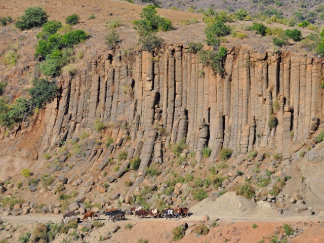
Columnar rock formation and cattle near Lalibela, Ethiopia
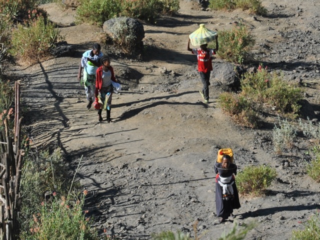
People walking uphill to the town, Lalibela, Ethiopia
Lalibela is a unique place with amazing history and spectacular landscapes. At a minimum it can be done on a weekend trip from Addis Ababa. If one has more time, tracking tours with Lalibela and surroundings sound very interesting. Tesfa tours does community tracking and we heard good feedback but did not have a chance to try – hiking at high altitude is no mean fit though. Many tours offer Lalibela trips as part of the so-called Northern circuit which depending on the operator includes Bahir Dar with Lake Tana and Blue Nile falls, Gonder and Simien Mountains, and Axum.
Lake Tana is the largest lake in Ethiopia and the source of Blue Nile. The city of Bahir Dar on the shore of lake Tana is a nice base to explore the lake with its wild life, islands with monasteries and to visit Blue Nile falls.
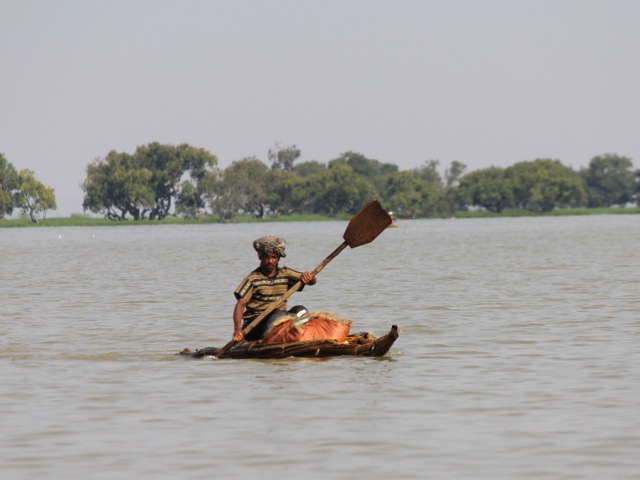
Fisherman, lake Tana, Ethiopia
There are about 20 monasteries scattered around the southern shore of the Lake Tana and the islands on the lake. The Ark of Covenant was kept for 800 years at Tana Chirkos on one of the islands after is was brought from Jerusalem and before it was taken to Axum, at least according to the theory explored in Sign and the Seal by Graham Hancock.
ferry taking worshippers to one of the monasteries, lake Tana, Ethiopia
A couple of churches are a short boat trip away from Bahir Dar but many are on further away islands. We visited Ura Kidane Mihret where women are allowed. We tried to go to a further away island (Tana Chirkos being the objective) but were told that it was too far, would take a full day and could be somewhat risky considering the state of the boats and the likelihood of storms as we were visiting at a tail end of the rainy season. Besides women are not allowed in those monasteries as we understood.
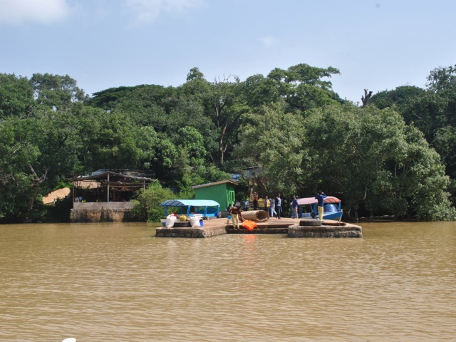
Ura Kidane Mihret is located on a Zege Peninsula. We reached by boat from our hotel in Bahir Dar. It took about 40 minutes. The boats taking tourists around the lake are comfortable small flat bottomed ones, with a roof, cushions and life vests. Engines are not exactly the fastest – but enough to reach the nearby monasteries and to explore the marshes with hippos and birds.
Jetty at Zege Peninsula to reach Ura Kidane Mihret, Ethiopia
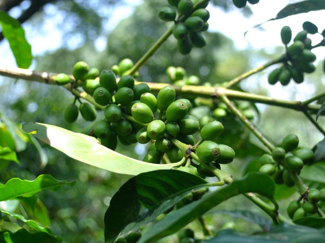
Once out of the boat, we walked on a nicely maintained path through a beautiful thick forest with wild coffee trees. Zege peninsula supports what is reportedly the largest tract of natural forest left around lake Tana. In Ethiopia most forests have been cut out over the years to make way for agriculture and only about 5% of the territory is covered in forests compared to 45% a hundred years ago. The pockets of forests that remain more often than not would have a church or a monastery in the middle -preserving the forest as a symbol of heaven on Earth and home for God’s creatures.
Wild coffee tree, Zege peninsula, Ethiopia
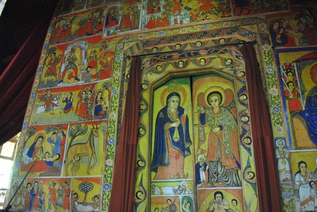
Ura Kidane Mihret was founded in the 14th century and is reportedly one of the most beautifully decorated churches around Tana lake. The round church was built first in 16th century and then renovated multiple times. The outside walls and outer gallery of this round church are not decorated. But the square holly of holies is richly decorated with some beautifully restored paintings.
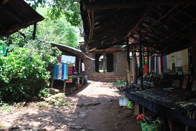
souvenir shops near the entrance to Ura Kidane Mihret compound, Ethiopia
Ura Kidane Mihret entrance and church in the back, Ethiopia
stone “bells” near Ura Kidane Mihret church, Ethiopia
Outer gallery of Ura Kidane Mihret church, Ethiopia
The inner sanctuaries of Ethiopian churches contain the copy of talbot – the Tablets on which Ten Commandments are inscribed. The original is in the Ark of the Covenant. Ethiopians believe that the Ark of the Covenant was brought to Ethiopia by Menelik, son of King Solomon and Queen Sheeba and that the Ark of the Covenant is now in St Mary of Zion Church in Axum. Only priests are allowed in the holly of holies. But talbots are taken out for procession and ceremonies such as during Timket in January.
Doors opening to the view of holly of hollies in Ura Kidane, Mihret, EthiopiaOne of the walls of the holly of hollies, Ura Kidane Mihret, Ethiopia
Fragment of the wall of the holly of hollies at Ura Kidane Mihret, Ethiopia
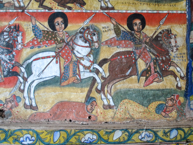
The elaborate paintings decorate the walls of holly of hollies. The guide provides a very good explanation on the meaning of the drawings. After visiting a few other churches there seemed to be a standard set that one can find in most Ethiopian churches. The paintings mostly depict the life of Christ and various conquests of Ethiopian kings defeating the enemies in all medieval glory.
fragment of painting, Ura Kidane Mihret, Ethiopia
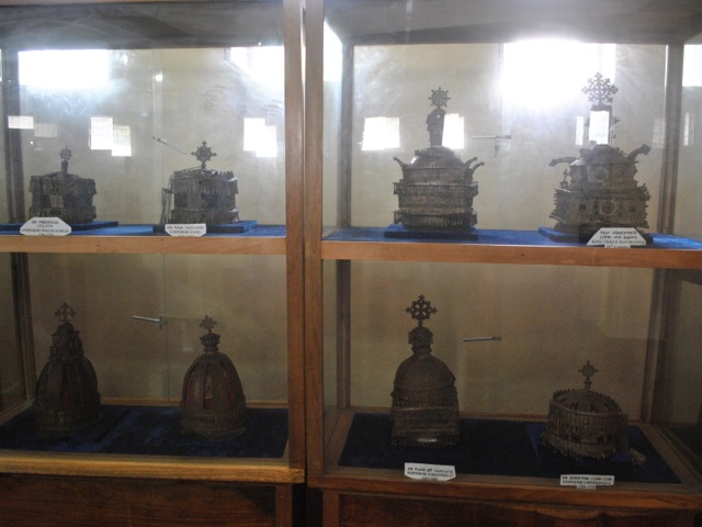
In addition to the church there is also a small museum in the compound that has religious books, imperial dress and crowns for kings and emperors since 17th century.
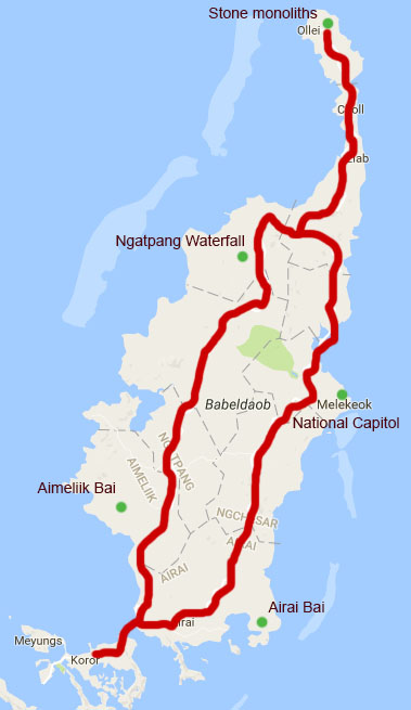
Having two days in Koror waiting to get on our liveaboard we decided to rent a car and explore the big island of Babelboab. We used a local car rental info for which we got from the hotel (DW Motel). Conveniently car rental guys dropped and picked up the car from the hotel. We ended up with Nissan Cube – the only car available at the time – and first were skeptical but it did a good job including driving on gravel roads.
There is main excellent quality circumference road called Compact road in Babelboab connecting to Koror. Most tourist sites however are off this road and are only accessible by gravel roads. We got a map with all the sites from the hotel and generally were able to find our way quite easily. At first we thought the compact road was called so because it is a proper compacted road, but it turned out the name is derived from the Compact of Free Association – the agreement governing the relations between the U.S. and Palau ratified in 1994. The funding available under the Compact presumably paid for the road – hence the name.
To learn more about Palau and other islands in Micronesia history there is an informative documentary called History of Micronesia. Palau is believed to be first settled about 3,000 years ago. It was “discovered” by westerners in late 17th century. In 19th century Palau became part of Spanish East Indies, then after Spanish-American war it was sold to Germany, then in 1914 after WWI peace agreement control over the islands went to Japan. During WWII major battle was fought in Pelelliu between Japanese and U.S. forces. After the WWII Palau became part of Trust Territory of the Pacific Islands with administrative control of the US. In 1994 Palau became independent after ratification of the Compact of Free Association.
The view on the platform with monoliths and the ocean
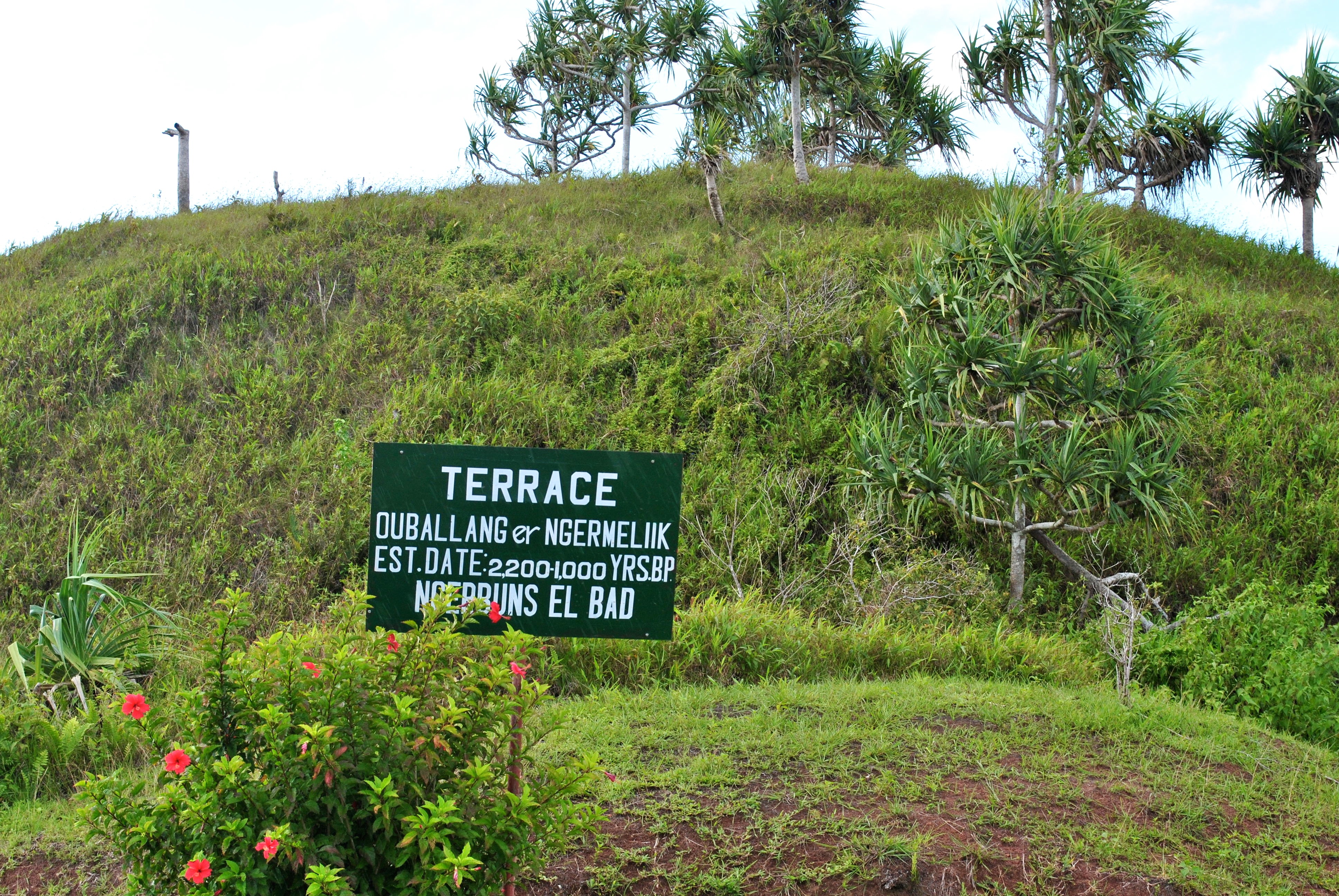
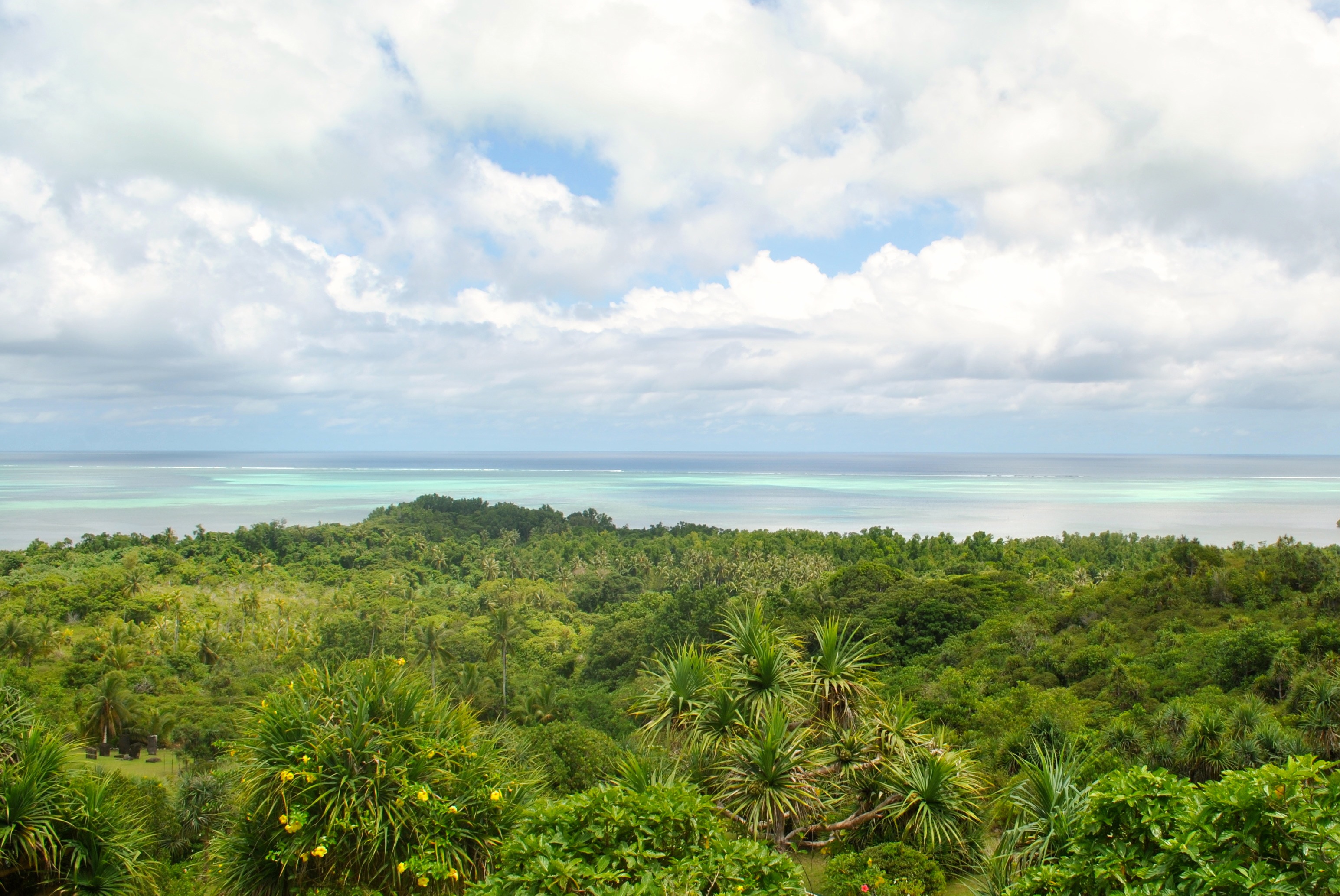
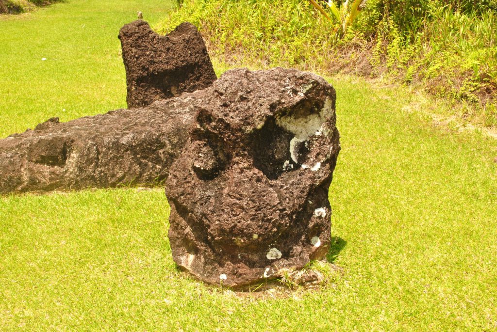
From the early historical period, there are terraces dating to more than a thousand years used for growing food (there is not much agriculture now in Palau and about 90% of food is imported). Badrulchau monoliths are large stone structures dated to 160 AD and located in the northern tip of the island offering spectacular ocean views.
monoliths
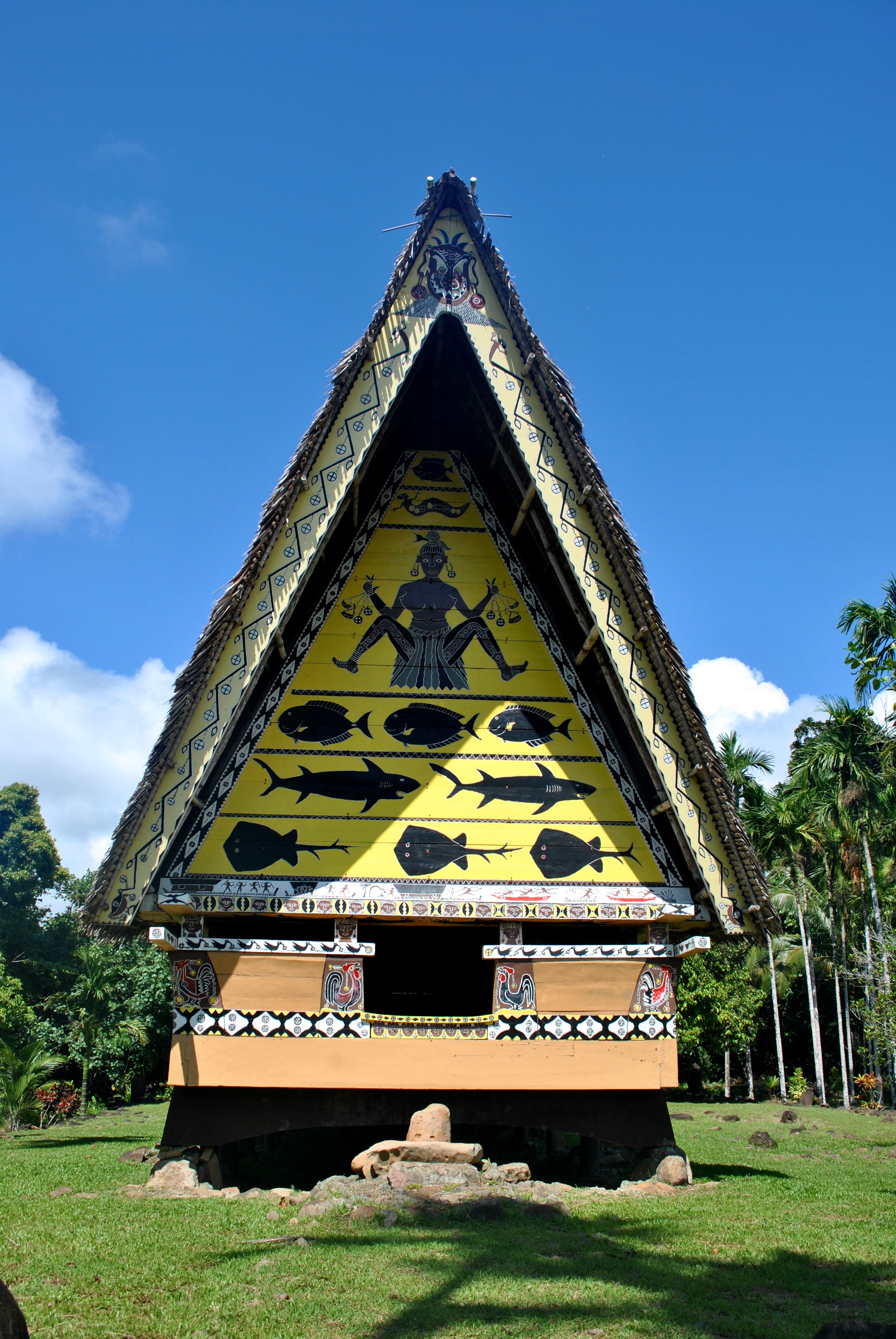
Bai are traditional meeting houses where men would sit down to discuss matters of significance (and it seems party while at it). The houses are beautifully decorated by paintings depicting events of importance such as fishing expeditions, or fights between clans. At Ameliik Bai there was a guide/tourist officer/fee collector who gave us a tour of the Bai and shares the stories.
Ameliik Bai
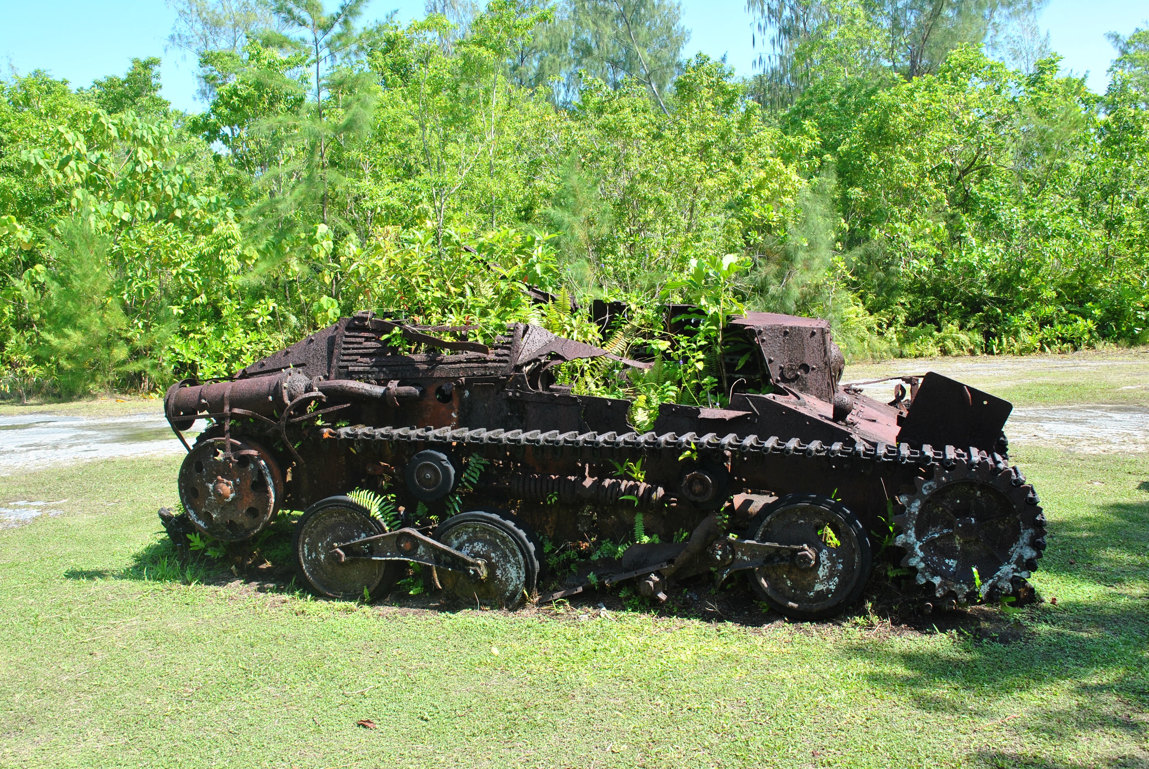
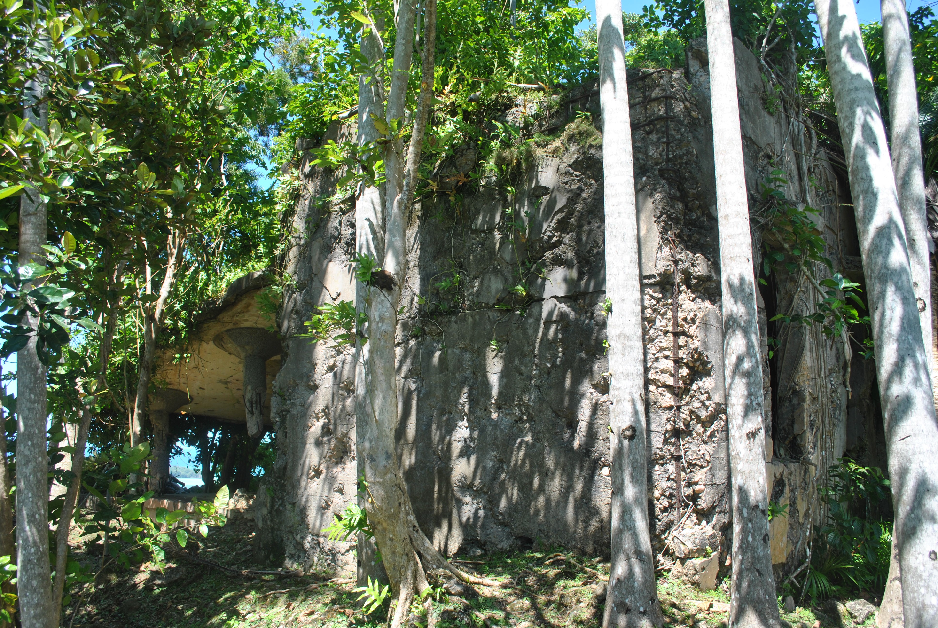
From Japanese and WWII period there are several destroyed buildings. The lighthouse/communication tower at the very northern tip of the island has the ruins and also offers a spectacular view. More WWII history is on Peleliu island. We did a land tour on Peleliu as part of our liveaboard trip offered by Aggressor. There is a good museum documenting the war and the battle on Peleliu and memorials, fortifications, tunnels, tanks and artillery scattered around the island. Peleliu is now a sleepy island with population of about 700 and no hotels or other tourist infrastructure. It is hard to believe that more that 20,000 troops were fighting there one day. Our local guide was explaining that people of Peleliu (who left for a neighboring island ahead of the battle) could not quite understand why did these foreign people come to their island to fight between themselves.
Japanese WWII tank, Peleliu
Japanese control tower WWII, Babeldaob
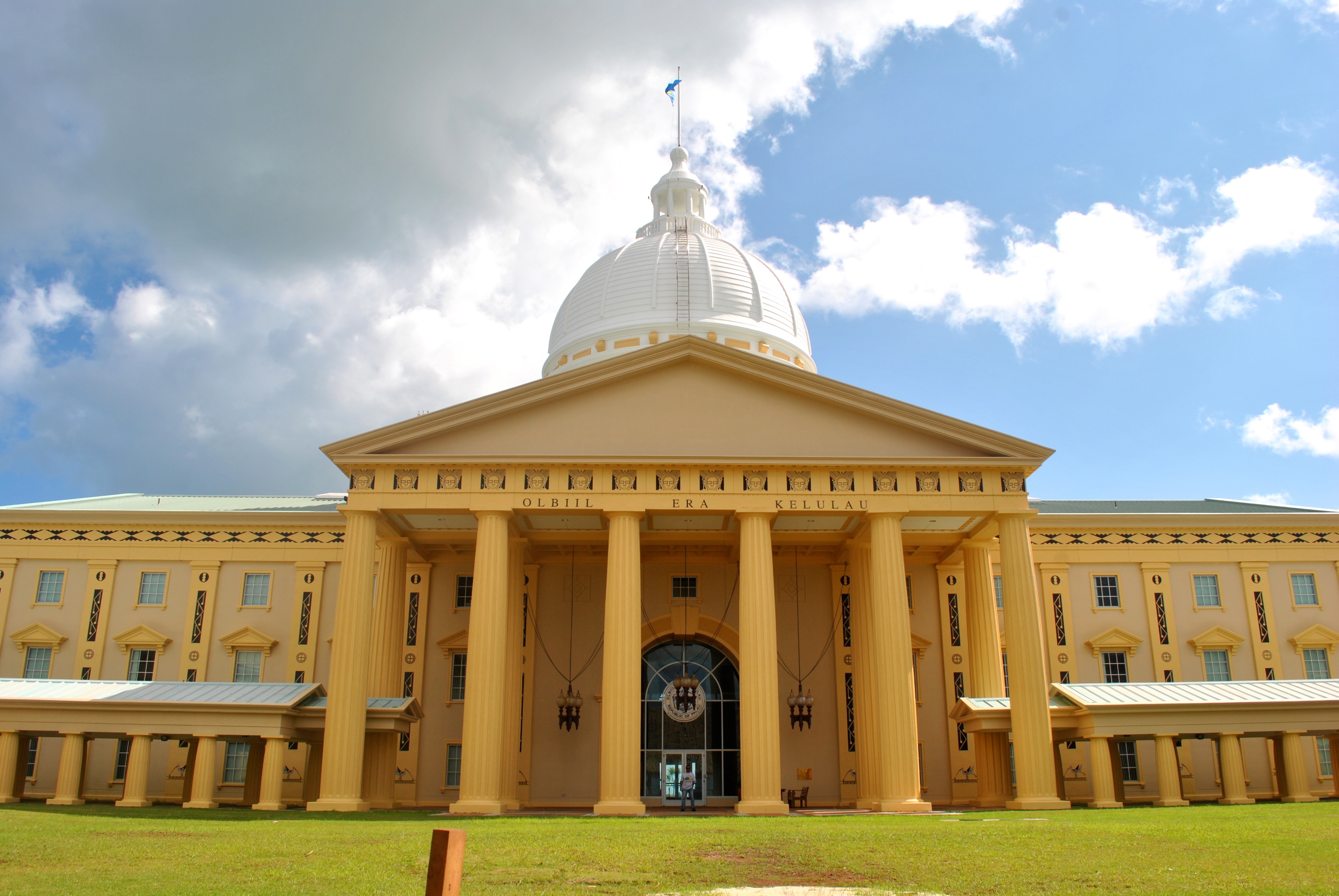
National Capitol, Melekeok
The most resent addition to Palau tourist attractions is the National Capitol building in Melekeok. There is apparently unsettled argument as to where exactly the capital of Palau is after the decision was made to move it from Koror. The huge capitol building reportedly costed a fortune (including borrowed money) and now appears not heavily used. Melekeok population is about 300 with most employees presumably commuting from Koror.
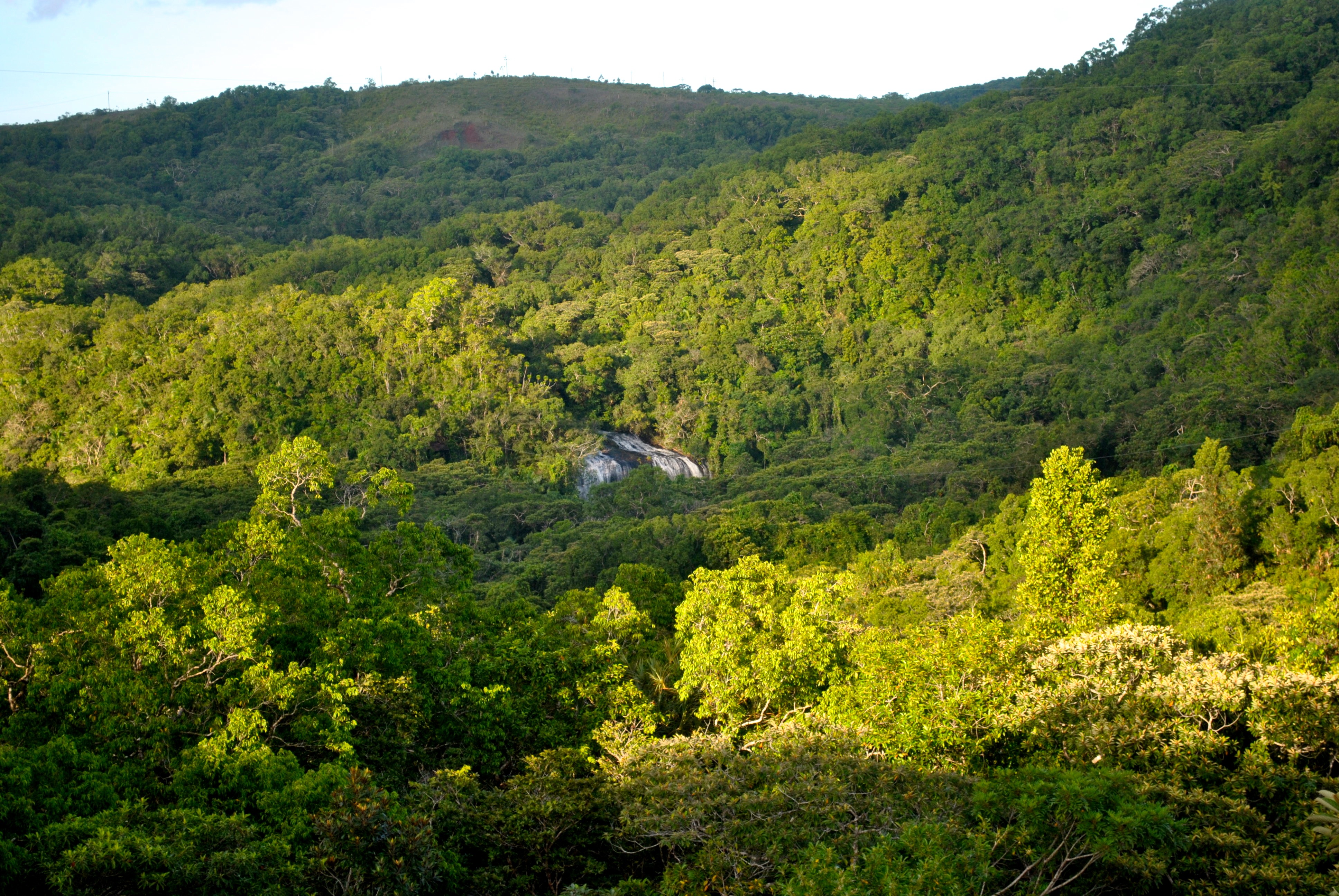
Of the natural attractions, aside from beaches and stunning views, there is a Ngatpang waterfall. There is a zipline over jungle which gets you about half way to the waterfall but we arrived late in the afternoon and it was closed for the day. Instead we hiked all the way to the waterfall – about an hour each way through the jungle. The hike is easy (we walked in flip-flops) and you pass an old rail line from Japanese times now covered by Jungle and have nice views of the waterfall and jungle from the hill before you descend. The waterfall is refreshing after a walk through steamy jungle. We were the only tourists around.
In our trips around Babelboab we did not see any restaurants and only a couple small convenience stores so it is best to bring along snacks and get a good breakfast in Koror. We liked Rock Island Cafe for generous breakfast. For dinner we headed to Drop Off Bar&Grill. They have excellent seafood and you can swap tories with other travelers and locals over a pint of Red Rooster (Palau’s own beer!). Crucially, Drop Off is located at/near the marina from which the liveaboards depart.