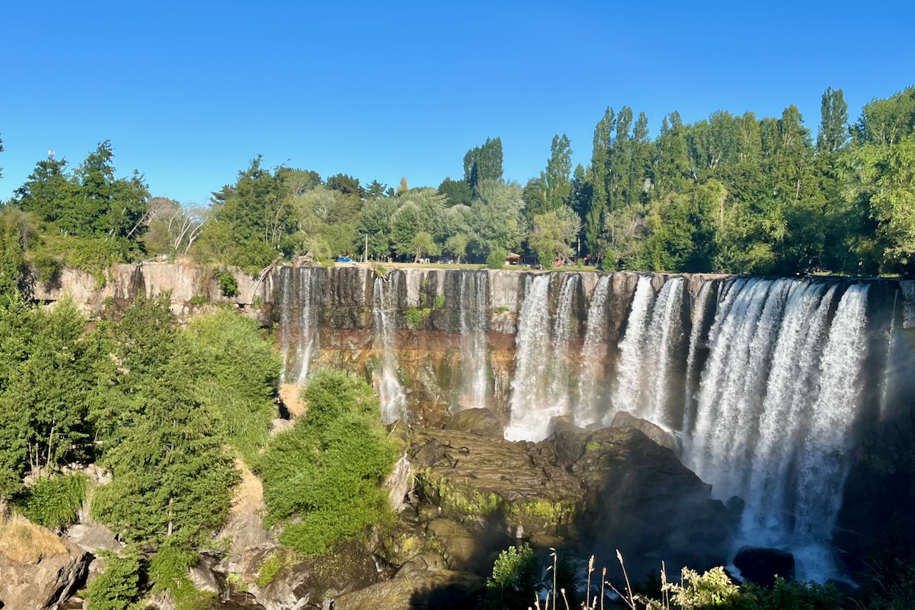
After enjoying our Santiago stay, we hired a car and drove south to the Lake District. It is nearly 800km from Santiago to Pucon and we stoppd for the night at Salto del Laja. Hotel Salto del Laja is located right next to the waterfalls and one can sit on a balcony and watch the waterfall and many birds around. It was a very good spot to break the long trip.
Salto del Laja waterfall, Chile
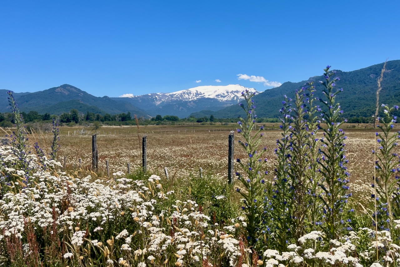
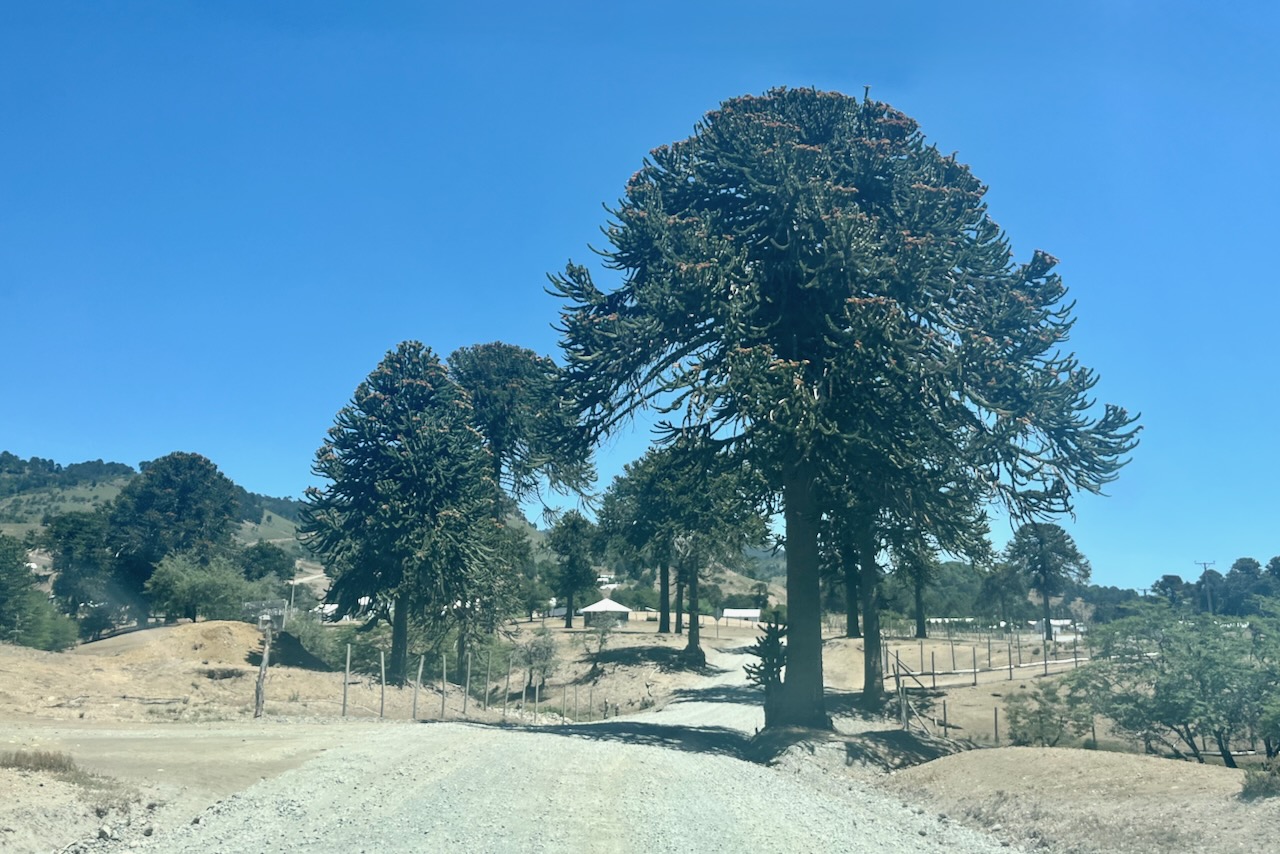
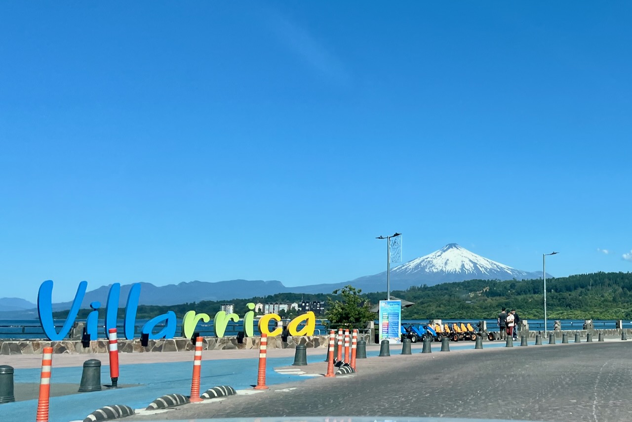
Rather than continuing driving along the highway we decided to take a turn towards the mountains at Victoria and drive on paved country roads. The scenery around was absolutely spectacular. We went through Las Raices Tunnel drilled more or less under Sierra Nevada and almost reached Argentina border. At this point the road turned to gravel which we did not quite expect. But we continued on our detour. It was fascinating to drive through this more remote area. The mountains and valleys are very beautiful and there are araucaria trees everywhere. We eventually made it to Villarica, probably adding at least 2 hours to our trip compared to if we took the highway. But it was a fun drive.
Sierra Nevada, ChileAraucaria trees, Chile Villarica city sign, lake and volcano, Chile
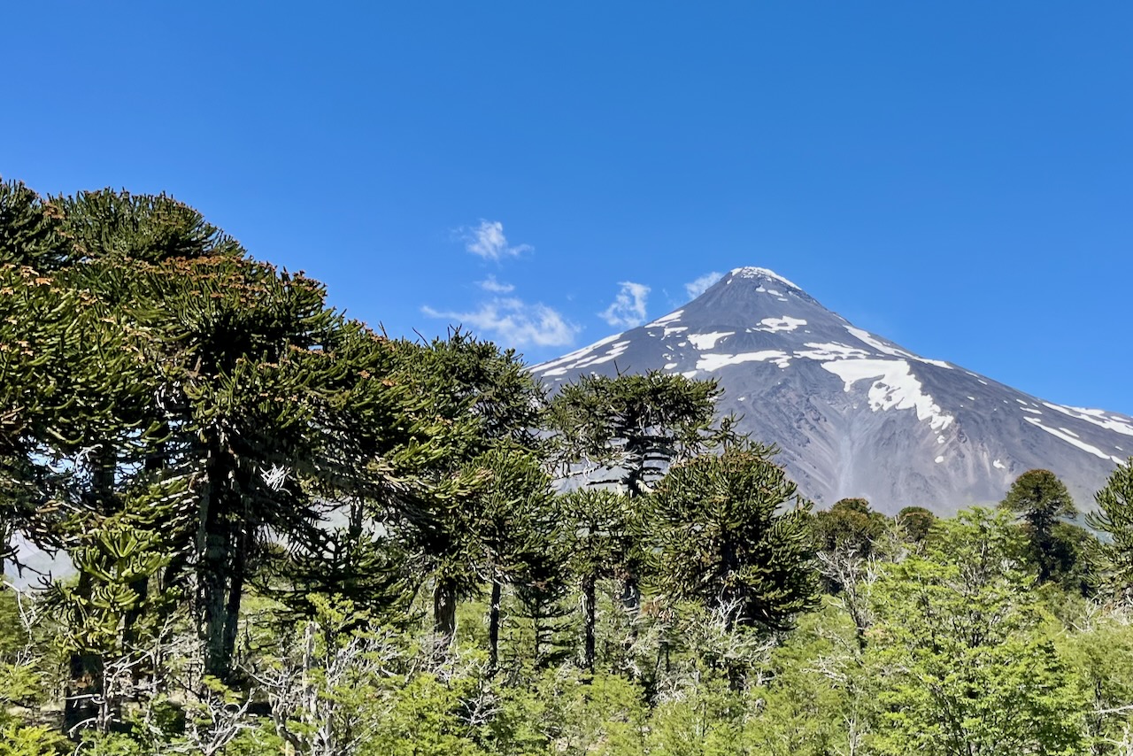
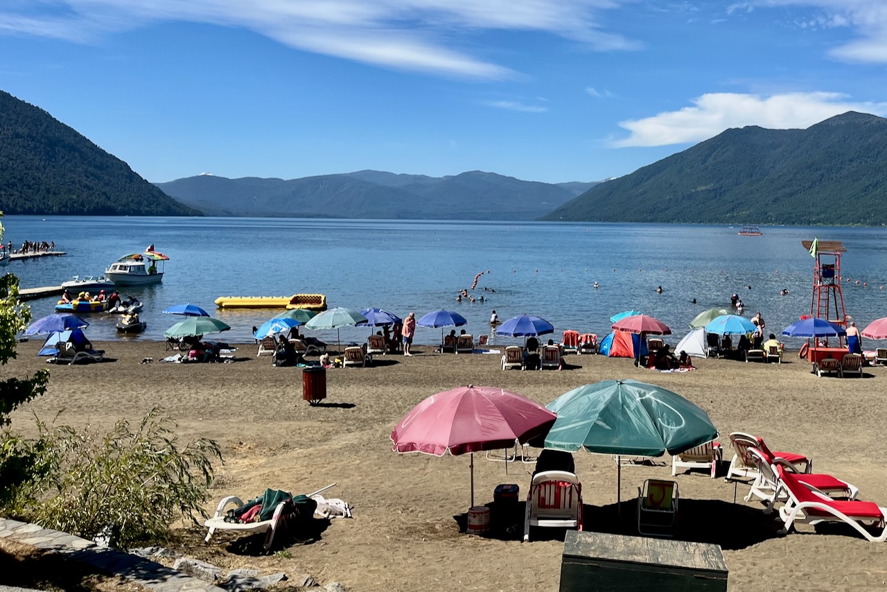
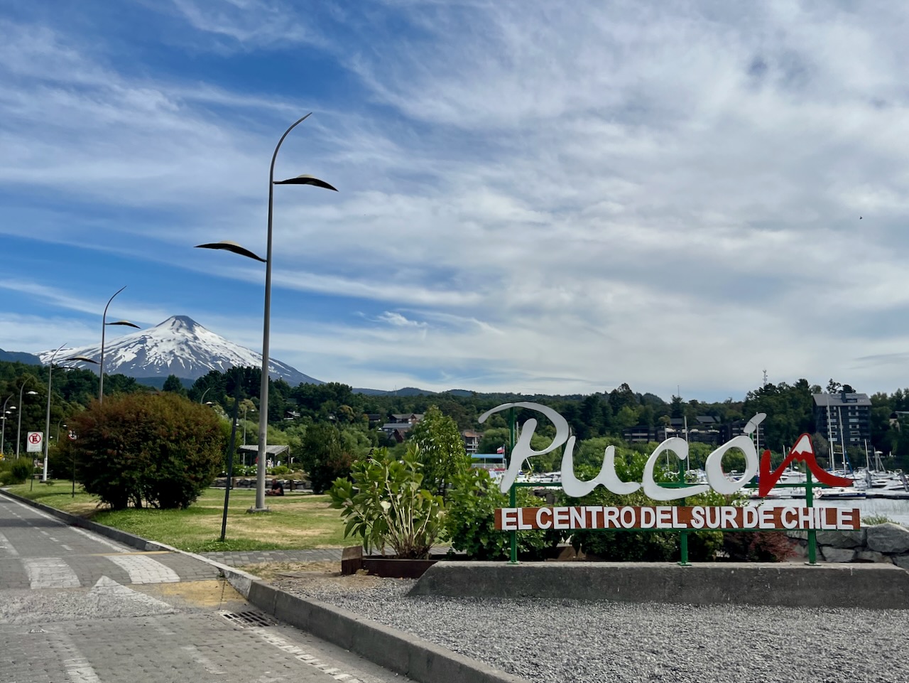
We drove through Villarica town and headed to Pucon along the lake Villarica while admiring the views of Villarica volcano. In early January traffic was very busy. It seemed that half of Chile decided to move to the lakes to enjoy beautiful weather. Beaches were packed and people were swimming in water that was barely reaching 20 degrees. It won’t be long before the entire road from Villarica to Pucon is built up with vacation homes and condos, but not yet! We stayed in an airbnb with nice lake views not too far from Pucon town.
View of Villarica volcano, Chile
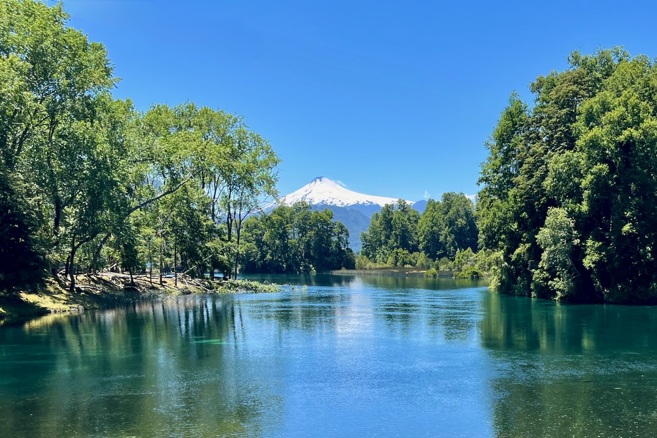
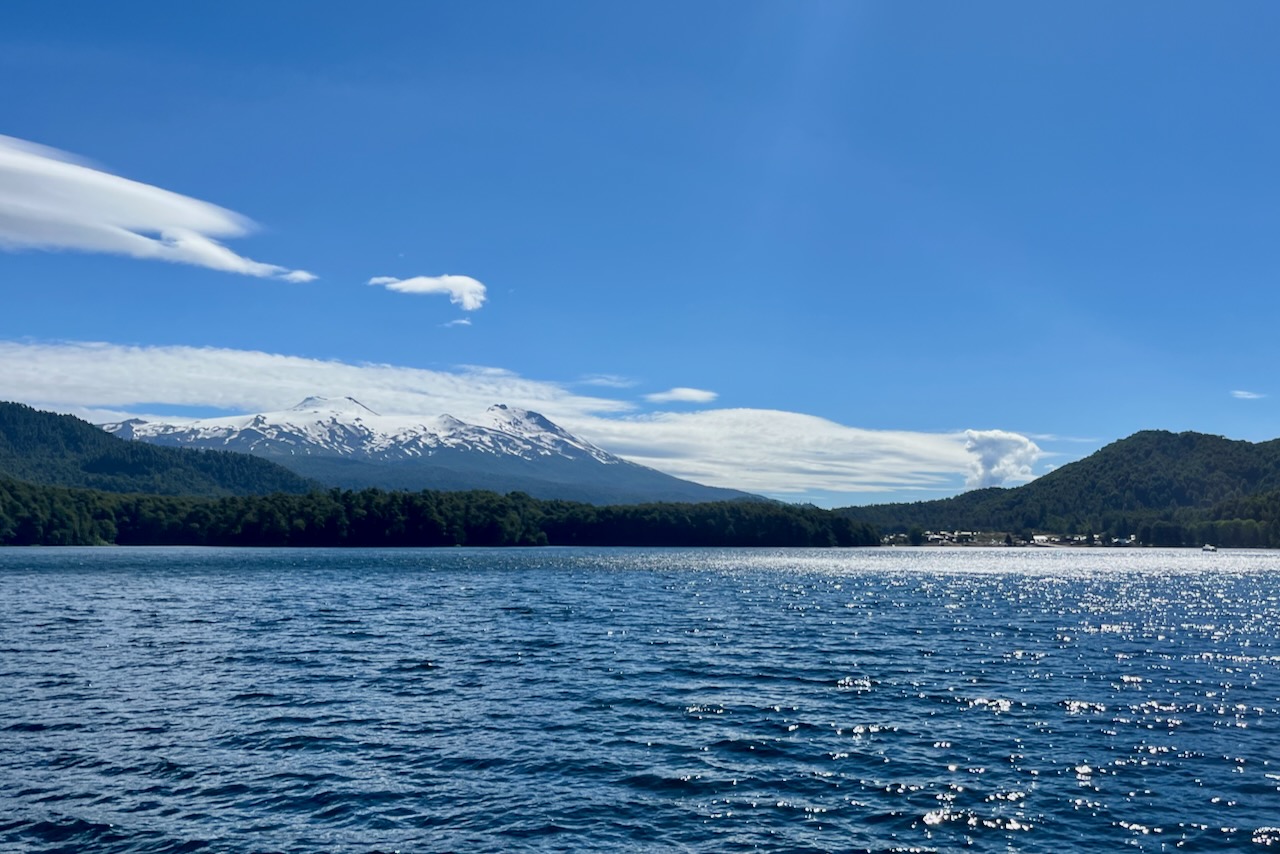
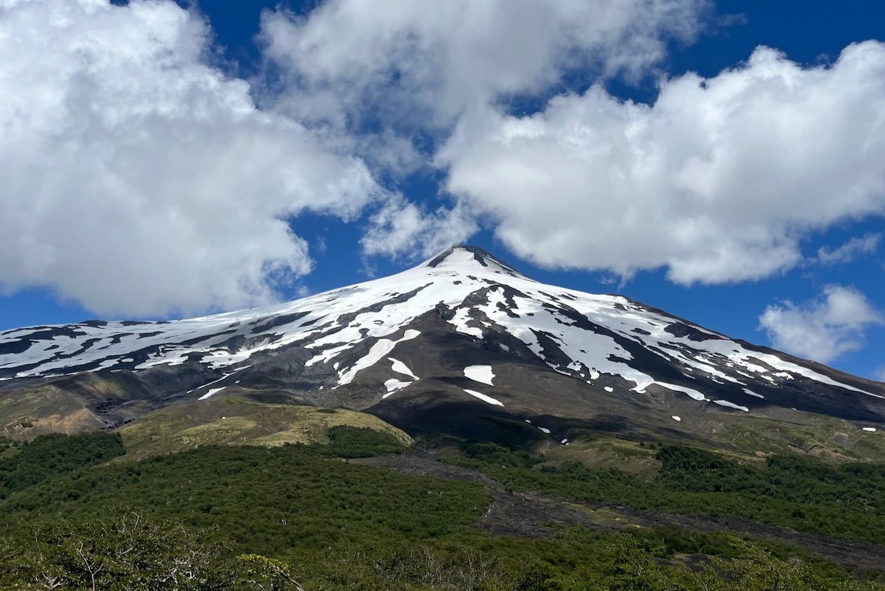
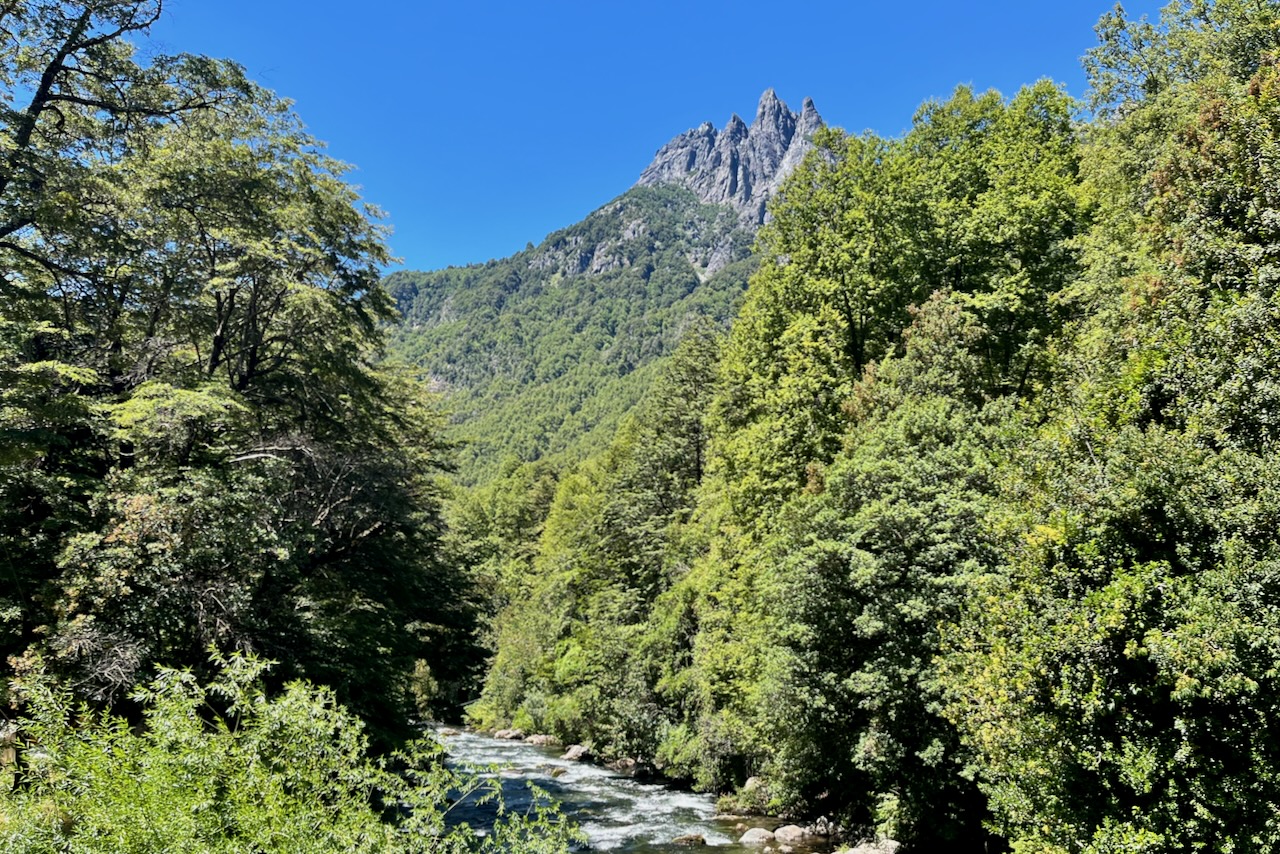
During the day we explored the area driving around and hiking. In the evening we would go to our airbnb and make a barbeque admiring beautiful sunsets over the lake. It was definitely a very nice way to unwind and enjoy Chilean summer. We drove to Puerto Fuy and took a boat tour on Lago Pirigueico with views of Mocho Choshuenco volcano. We hiked up to Villarica volcano mirador (not braving popular volcano hike itself). We also drove up to see Lanin volcano. It is quite an experience to be surrounded by so many volcanoes.
Mocho Choshuenco volcano view from a boat on Lake Pirigueico, ChileVillarica volcano view from Mirador los Crateres, ChileLanin volcano and araucaria trees, ChileCerro las Peinetas and Trancura river, ChilePlaya Negra and Caburgua lake, ChilePucon town and Villarica volcano, ChileSunset over Villarica lake, Chile
After 4 days in Pucon it was time to start going back and getting ready to fly home. We drove from Pucon to Santa Cruz. All along the way we saw many volcanoes in the distance. And there are national parks and waterfalls and so many things to do all around the area. We had a nice late lunch at a Viu Manent winery and stayed the night in Santa Cruz. The next day it was drive back to Santiago and a flight out at night. What a great trip this was.
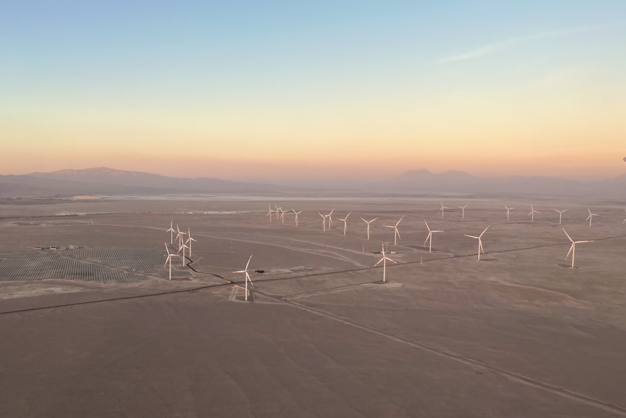
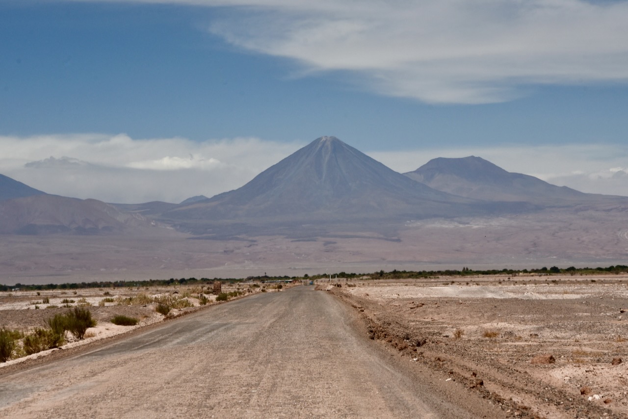
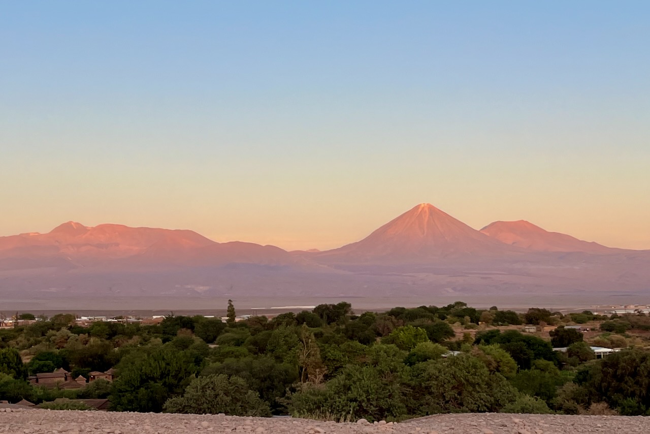
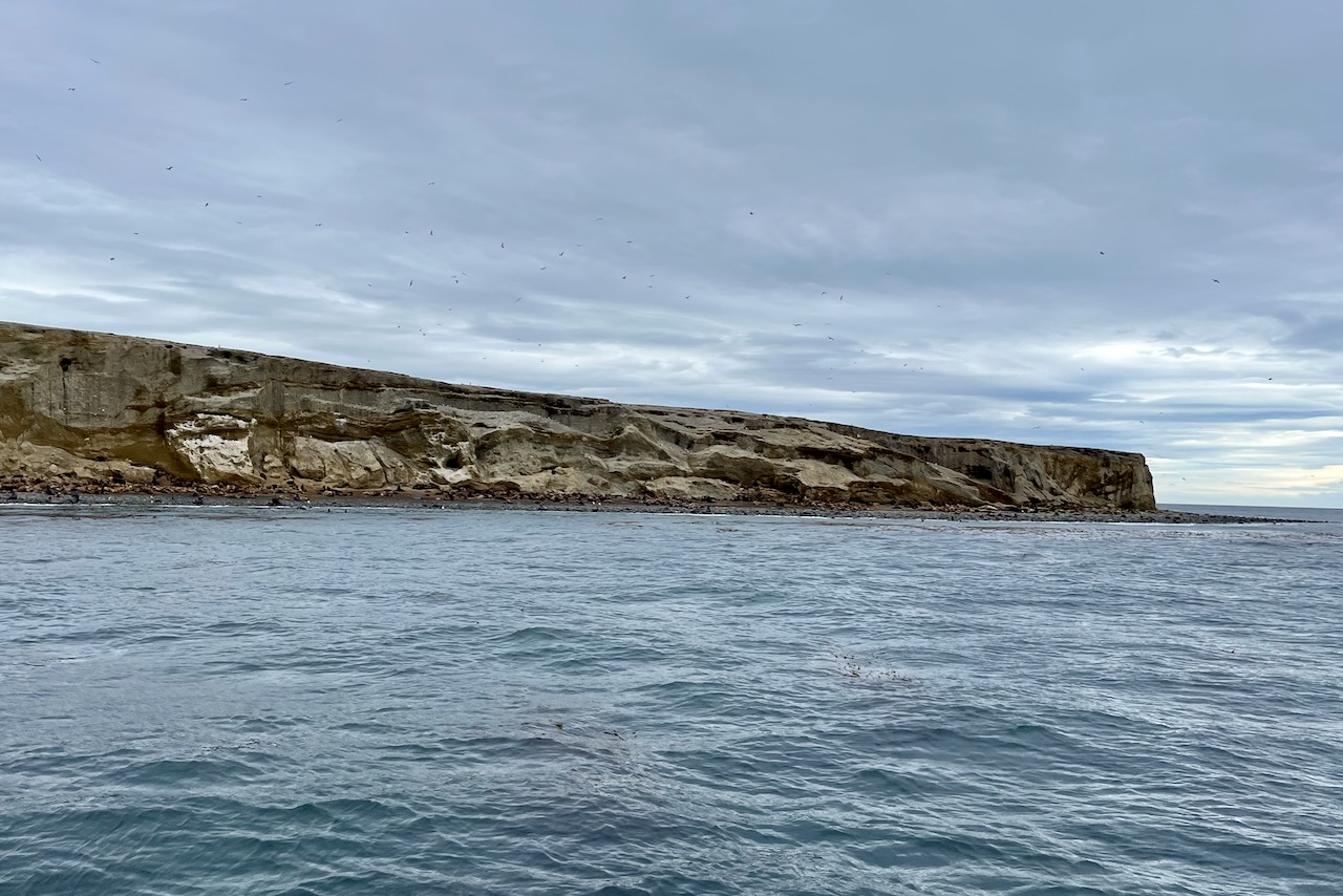
After our wonderings iin southern Patagonia, we flew over to a completely different climate and landscape of Atacama desert. We flew from Puerto Natales to Santiago and then connected to a flight to Calama. Calama is a significant mining town. Chuquicamata copper mine is the largest open pit copper mine in the world in terms of excavated volume. Flight passengers were a mix of mining employees with their families and tourists. As we were approaching Calama we also saw huge wind and solar farms stretching across the desert.
Wind and solar farms on approach to Calama, Chile
We were arriving on the last flight late in the evening and decided that we should not try to rent a car and drive 100km in the dark to San Pedro. Instead, we took a van transfer from Calama to our San Pedro hotel and then hired the car in San Pedro the next day. We were very happy about this choice as driving at night on an unfamiliar road with fair bit of truck traffic would have been challenging.
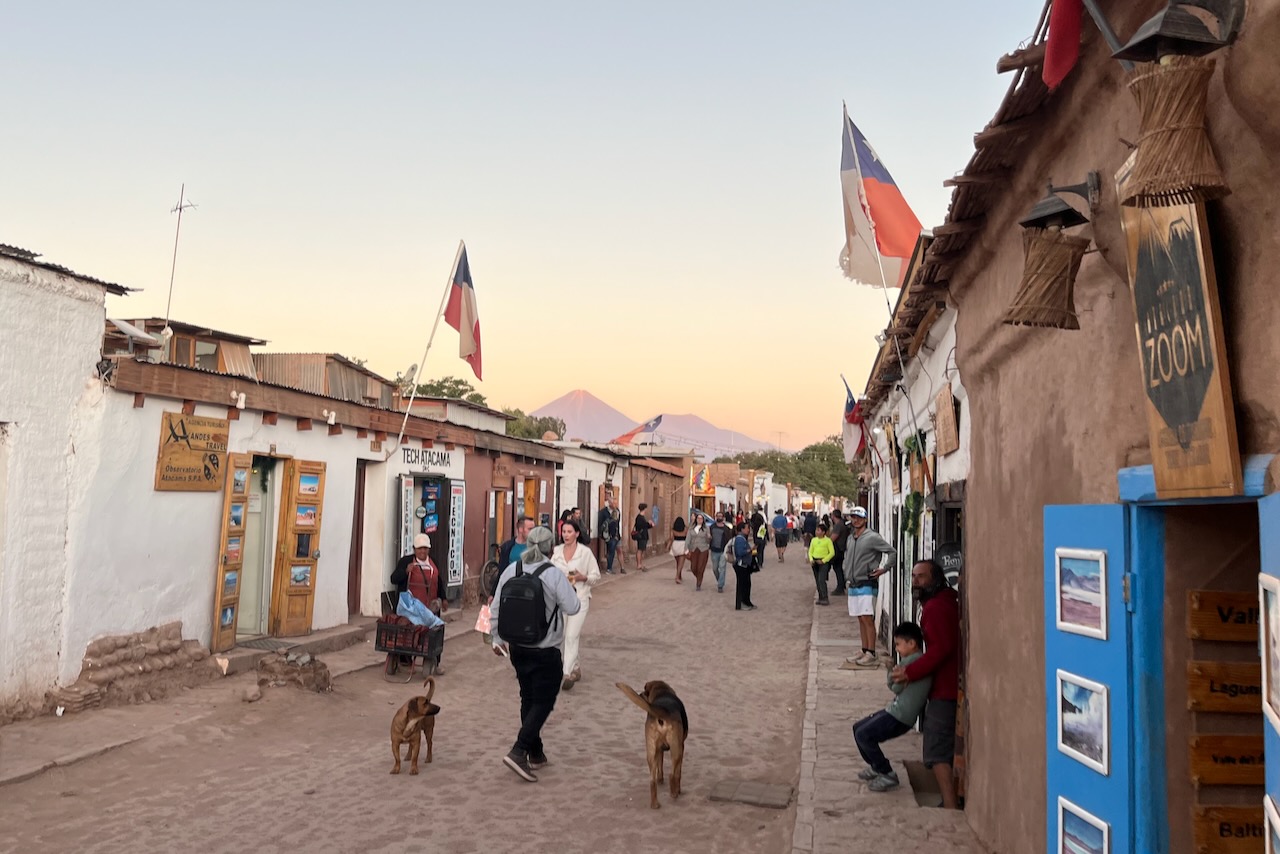
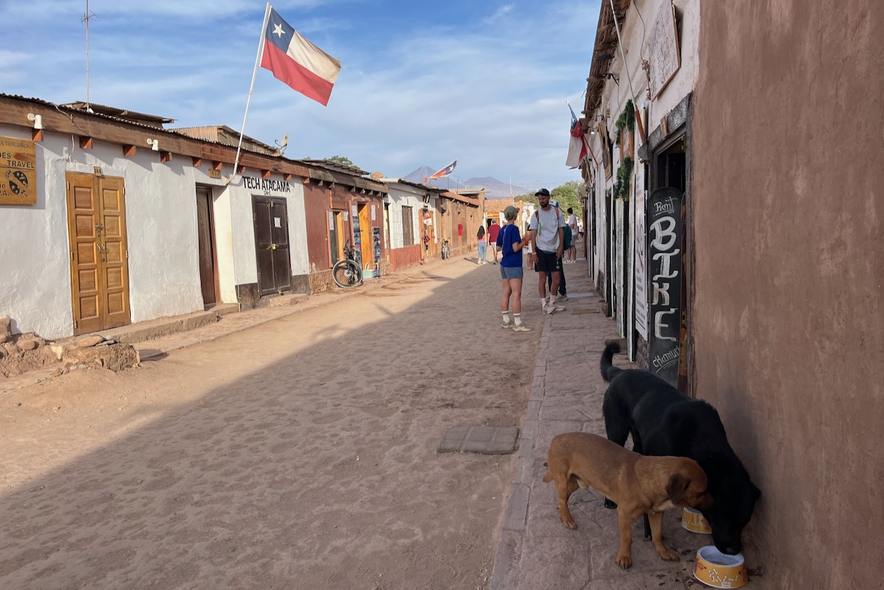
San Pedro de Atacama main street, Atacama, Chile
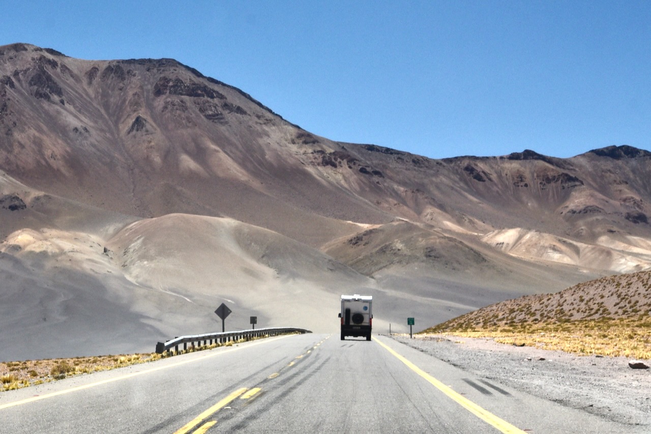
San Pedro de Atacama is a tiny oasis town in the middle of the desert and is the main base for tourists coming to explore Atacama desert. One option is to take day tours to various attractions in the desert, including trips to Bolivia’s Uyumi salt flats. The main street of San Pedro is full of travel agencies organizing trips. Another alternative is to self-drive. We hired a compact SUV and drove around ourselves. Roads we were on were mostly paved and in a very good condition.
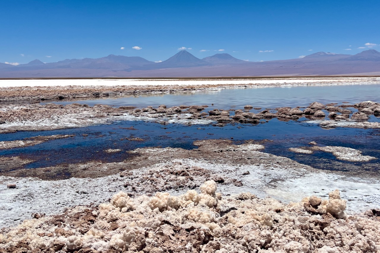
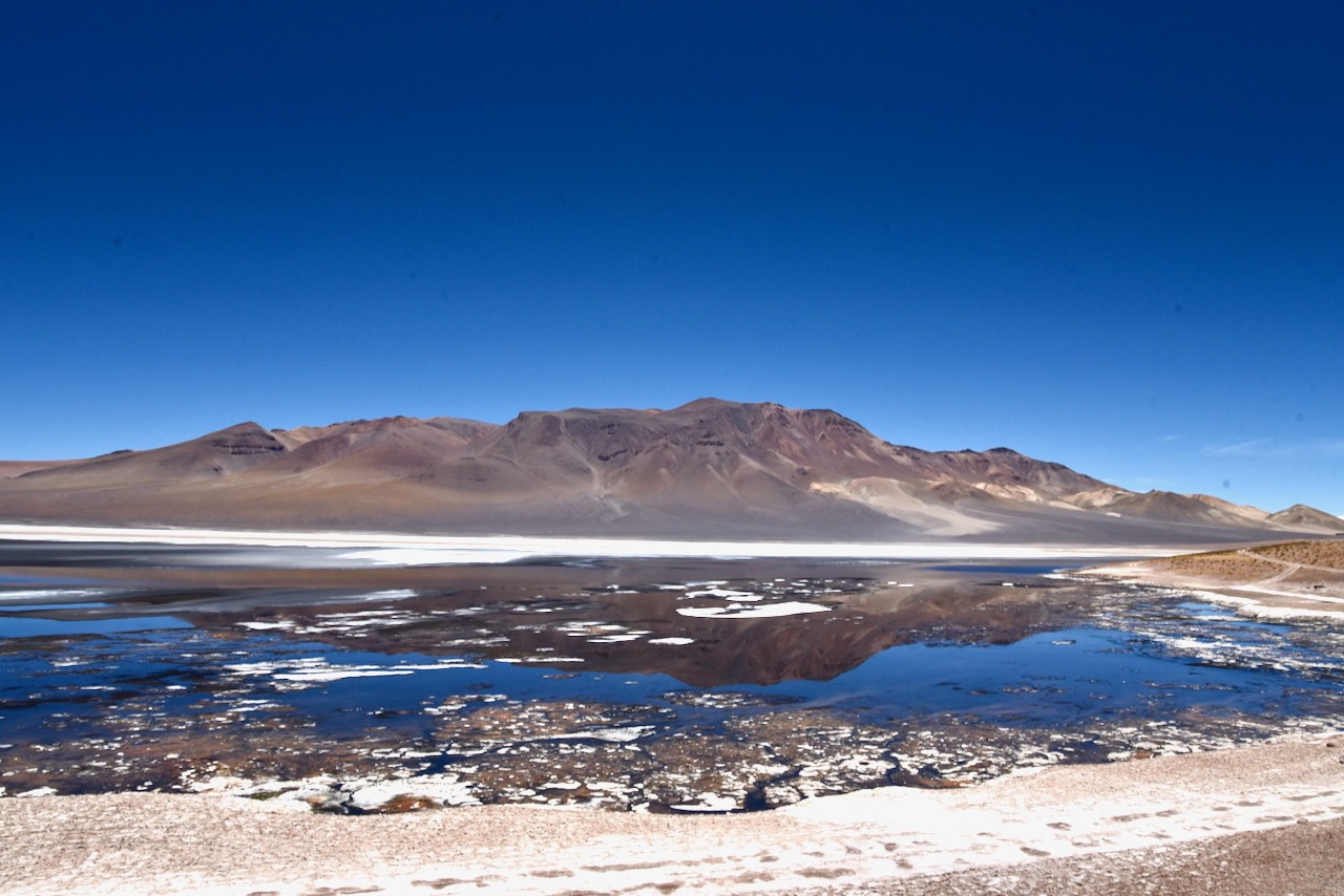
Laguna Chaxa, Salar de Atacama, Chile
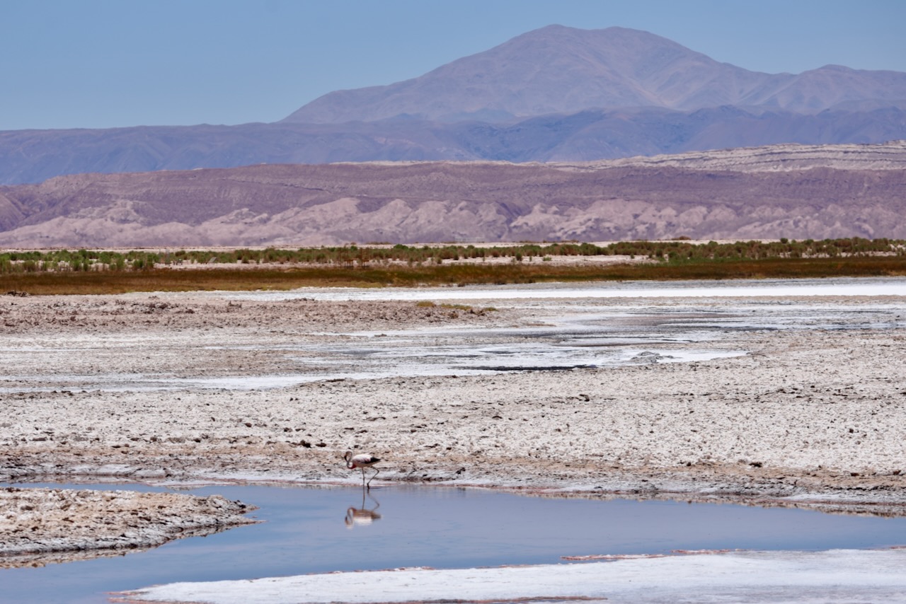
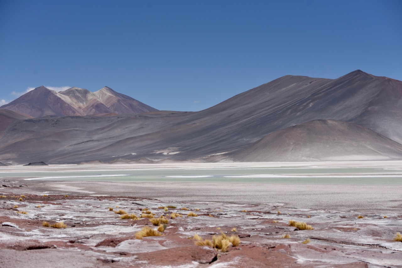
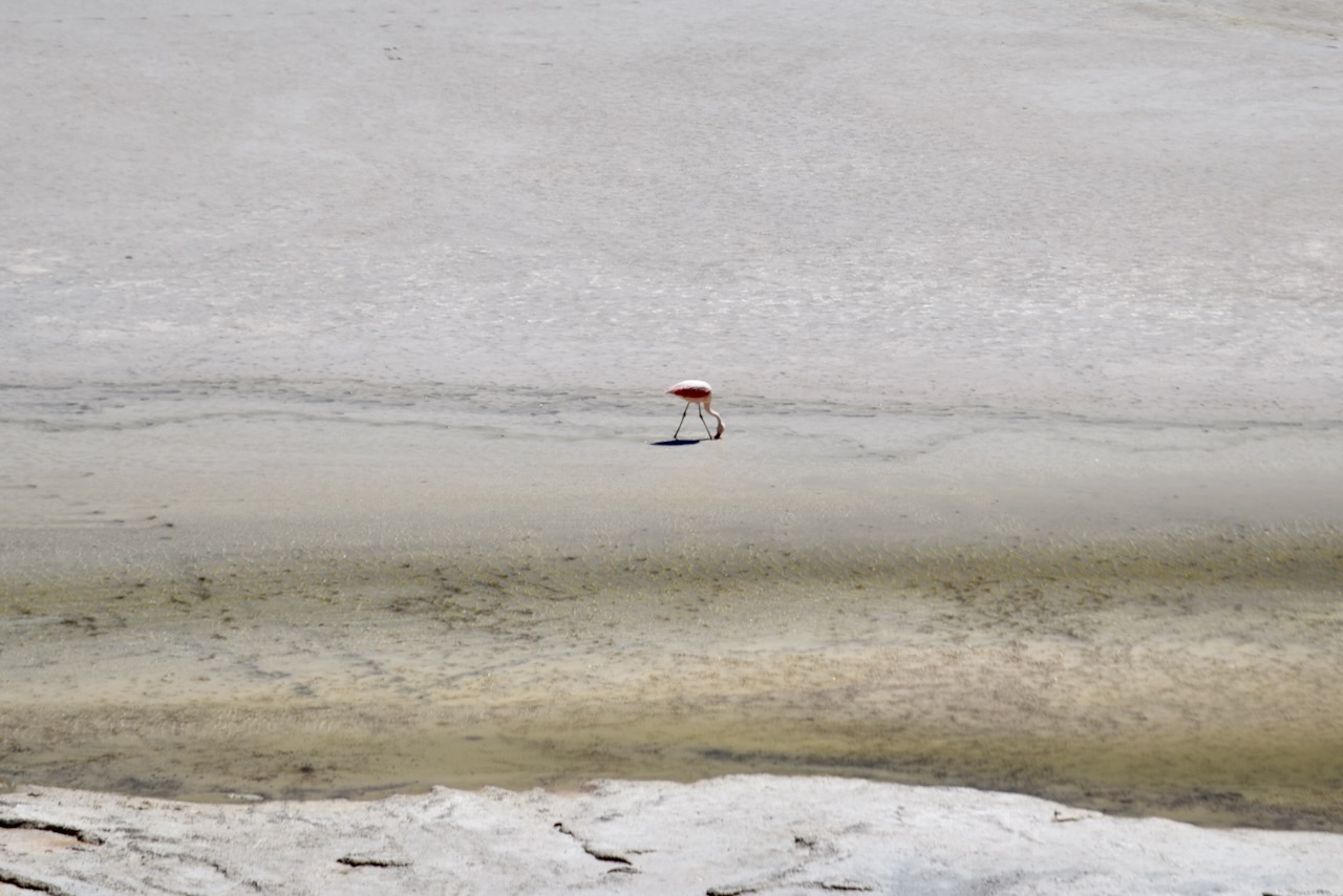
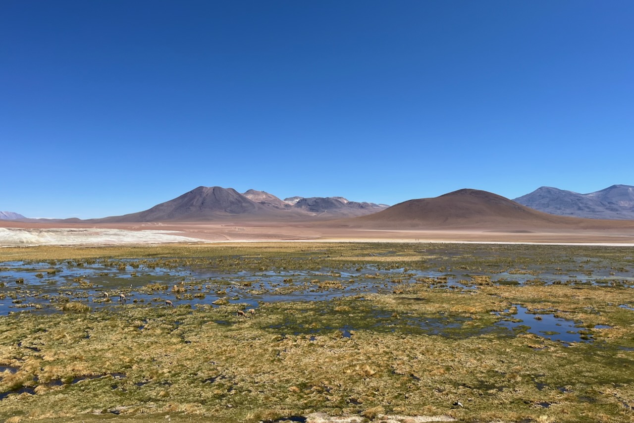
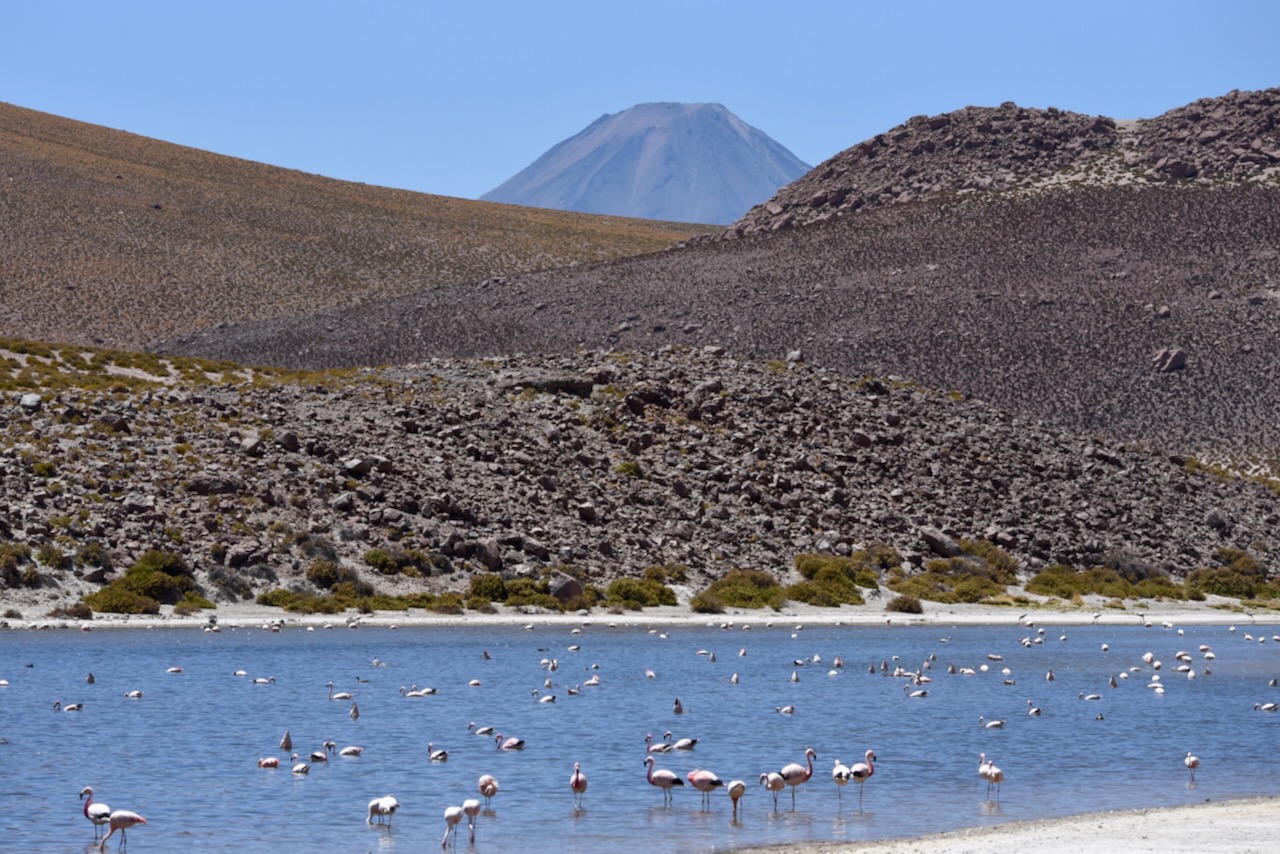
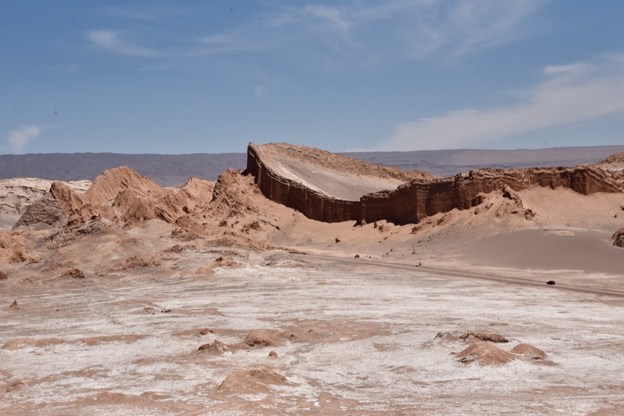
Atacama is the driest and likely the oldest desert on Earth. Stuck between two mountain ranges it does not get any moisture from either Atlantic or Pacific ocean. It has surreal landscapes with volcanoes and salt flats. On the first day we headed to Laguna Chaxa about 50km from San Pedro. The water in this lagoon is very shallow and salty. You can see salt formations all over. Despite inhospitable environment, flamingos live at this lagoon. We saw only one flamingo roaming around when we visited.
Flamingo in Laguna Chaxa, Salar de Atacama, Chile
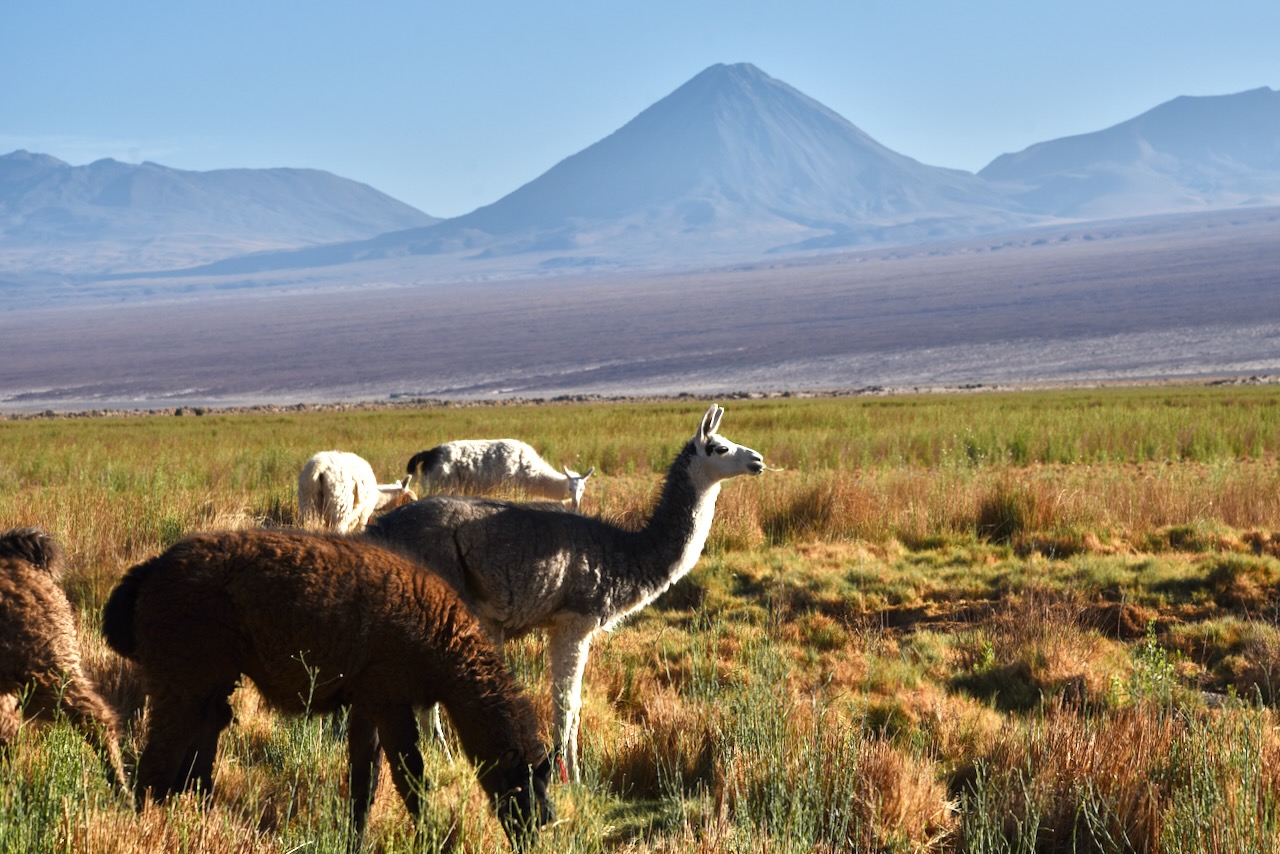
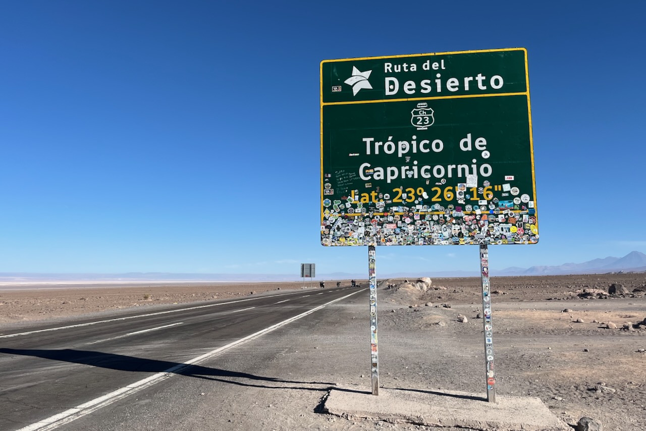
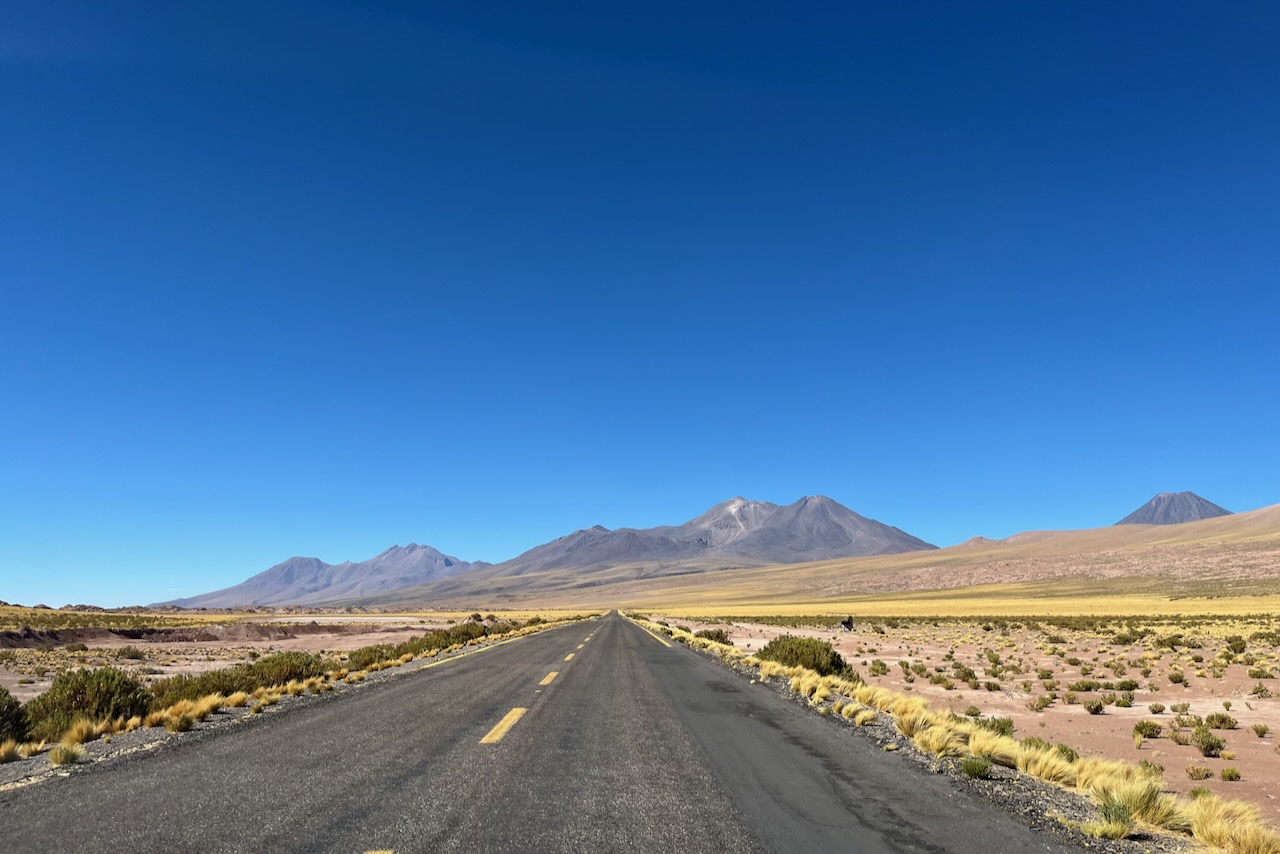
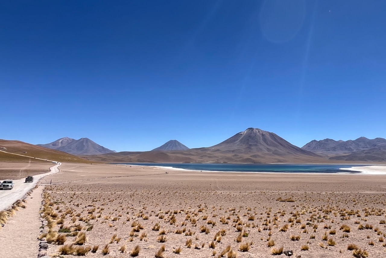
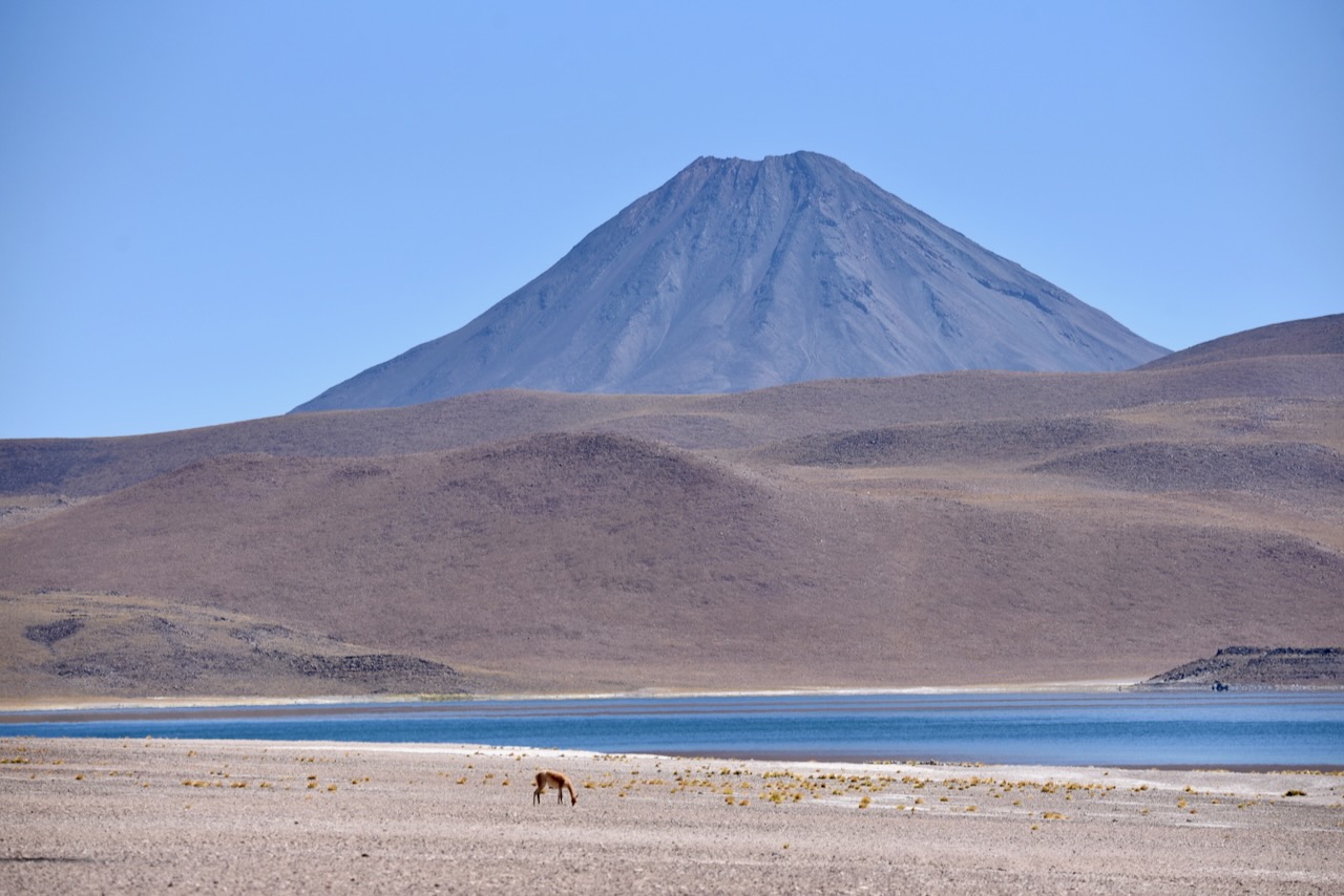
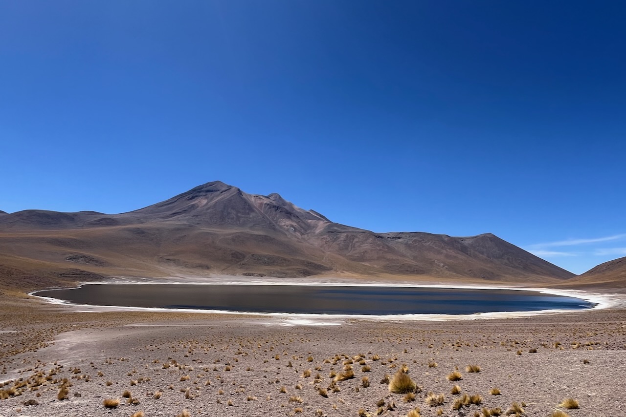
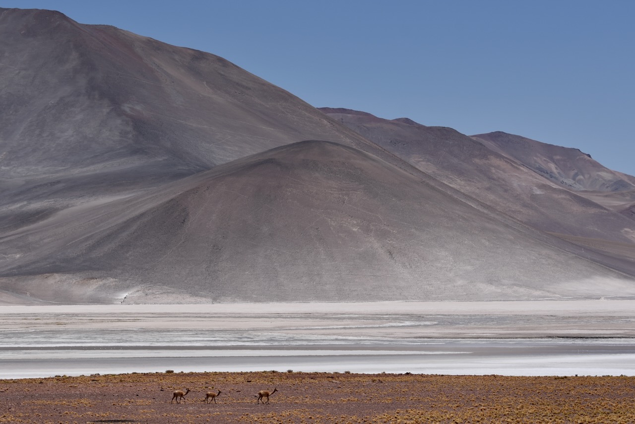
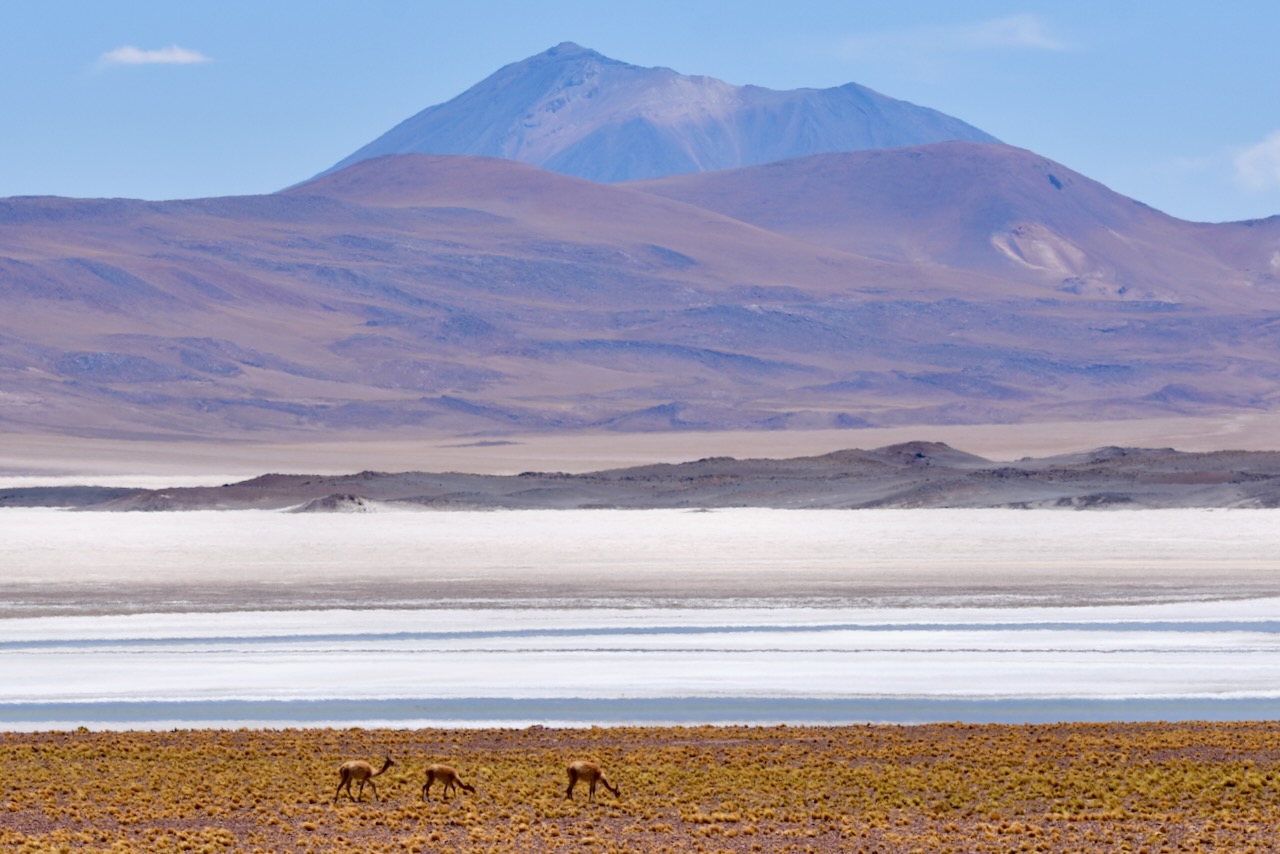
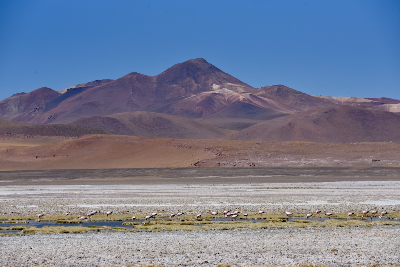
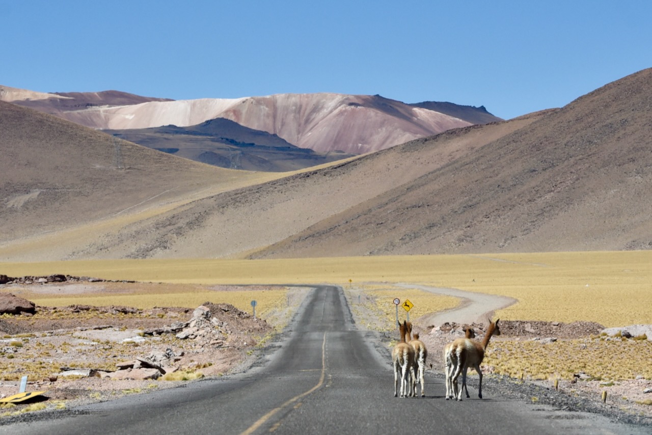
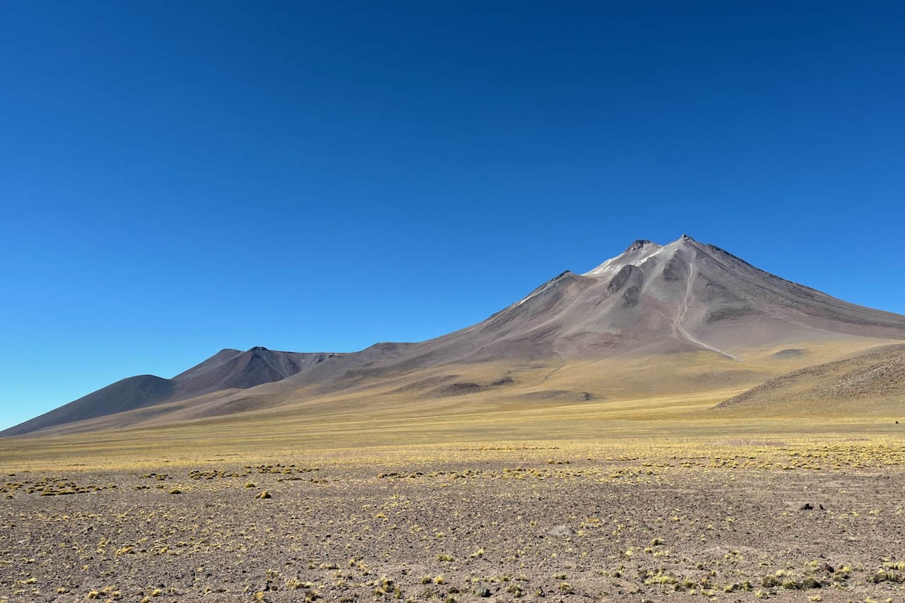
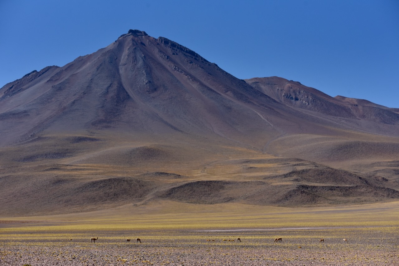
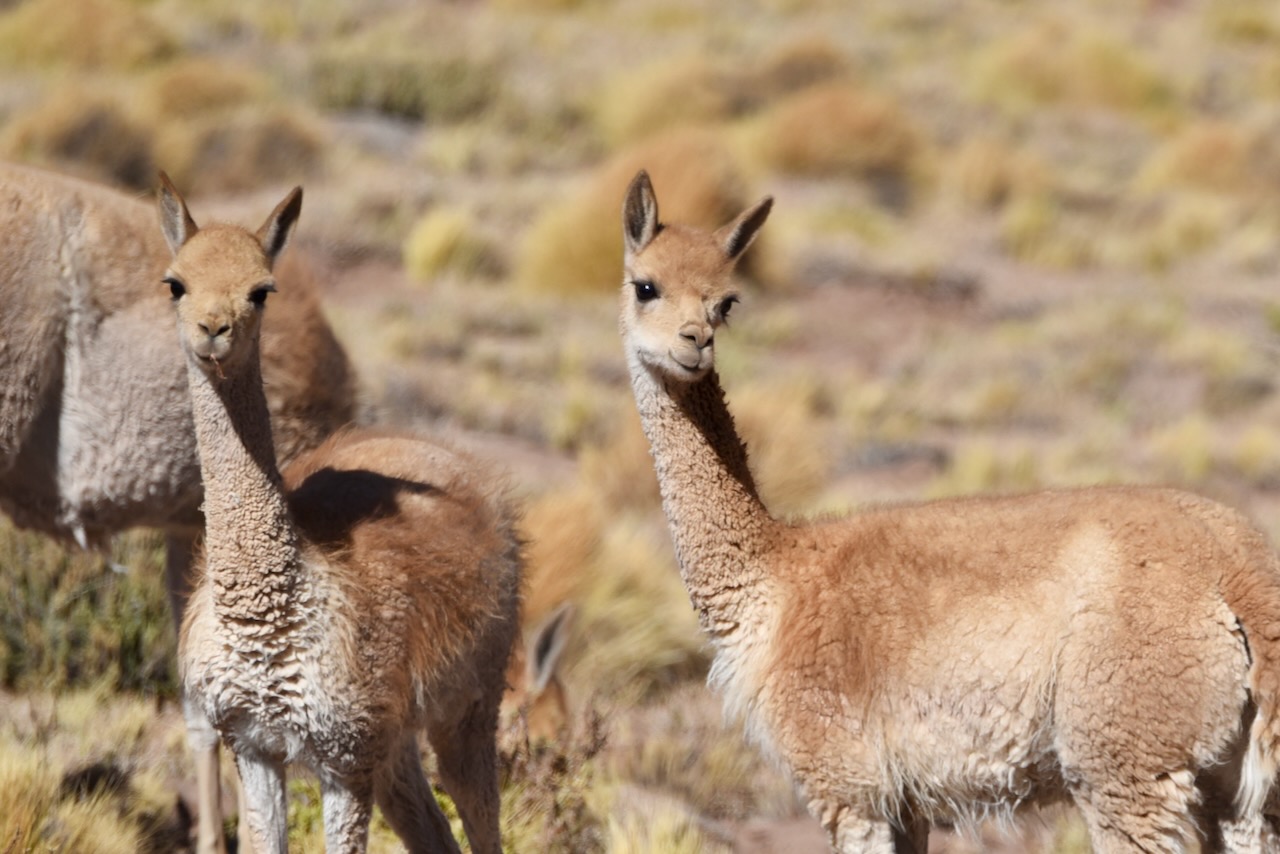
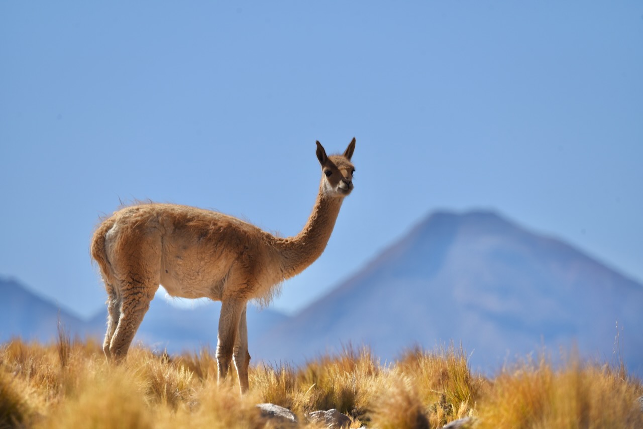
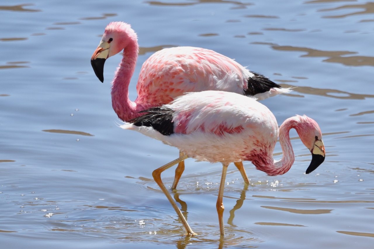
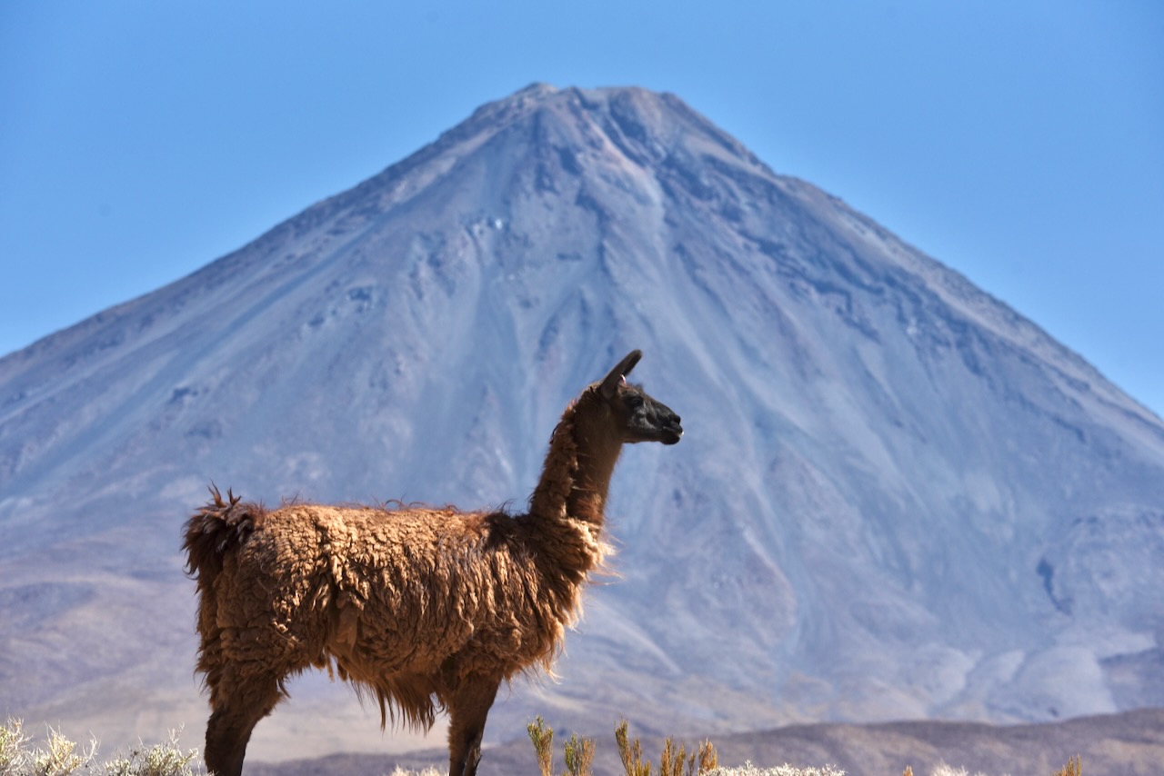
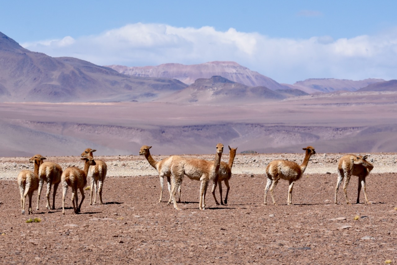
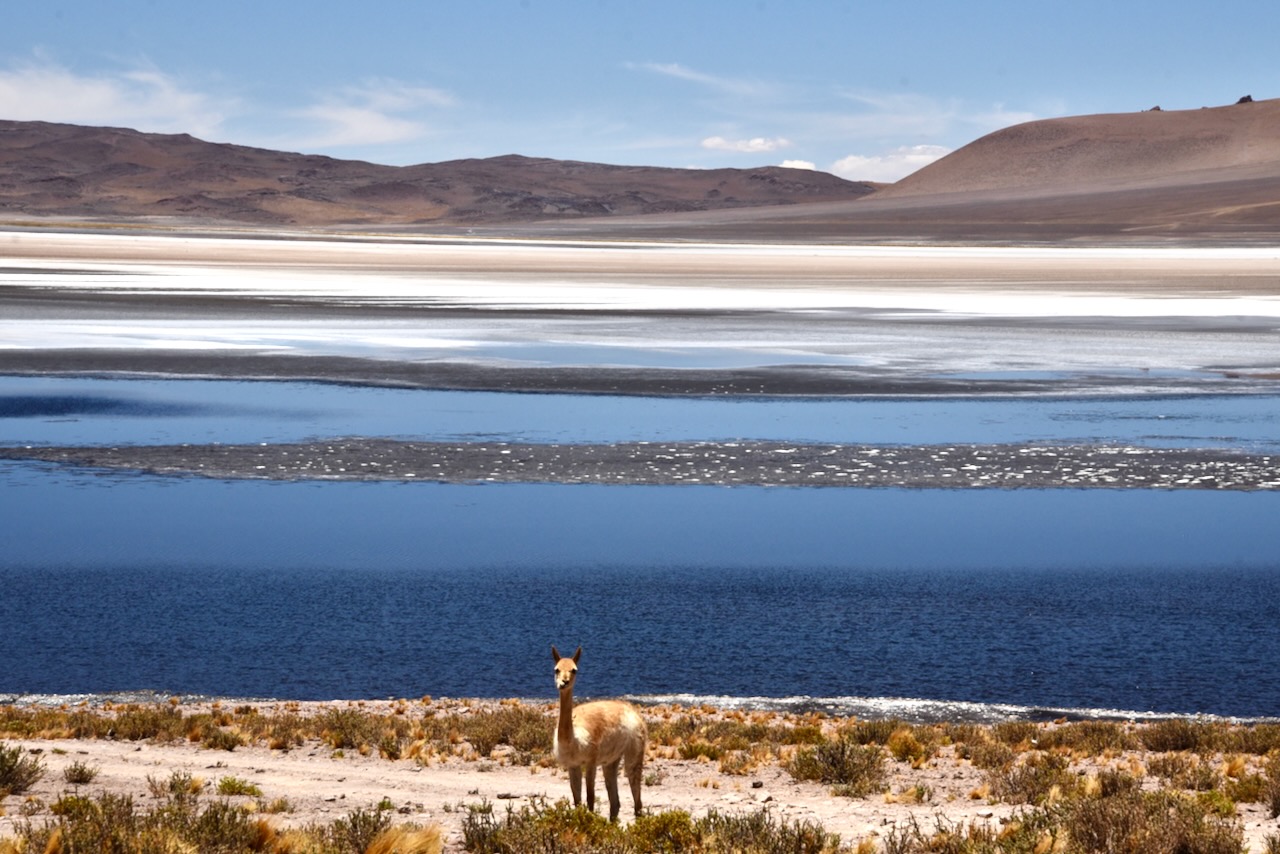
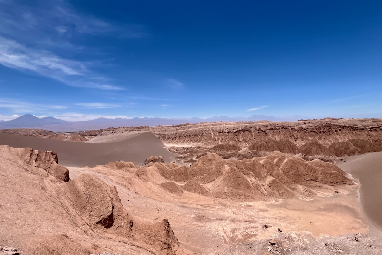
The next day we headed south along ruta 23 to Laguna Miscanti, Piedras Rojas and Aguascalientes. The road is paved and in a very good condition ultimately going to Argentina border. The views along the way were phenomenal. We crossed the tropic of Capricorn. We saw some lamas (not wild) near town, some vicunas (wild and very skittish) and some flamingos.
Lamas with Licancabur volcano in the background near San Pedro de Atacama, ChileCrossing topic of Capricorn on ruta 23, ChileViews along ruta 23 in Atacama, ChileLaguna Miscanti, Atacama, ChileLaguna Miscanti and vicuna, Atacama, ChileLaguna Miniques, Atacama, Chile
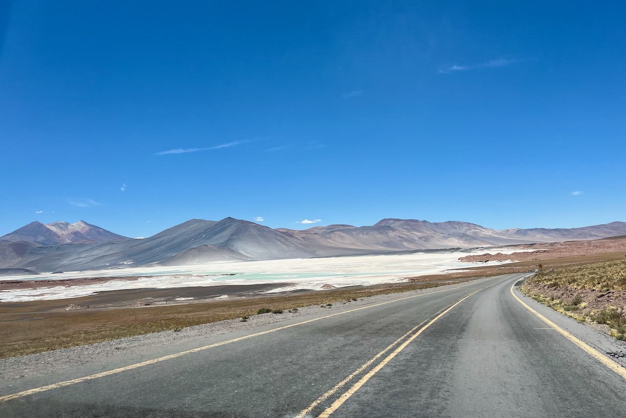
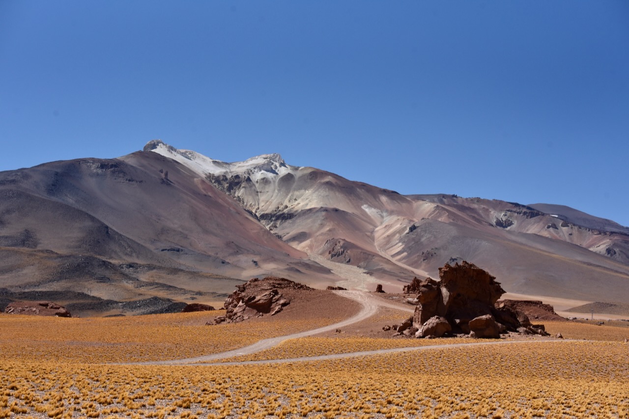
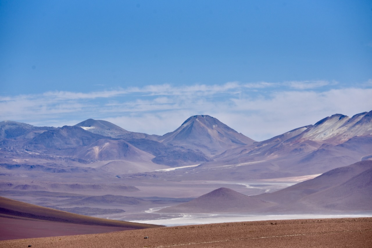
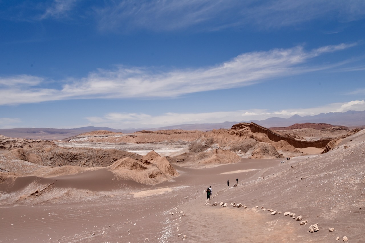
The scenery along the route was breathtaking but as we riached Piedras Rojas/Aguascalientes it just hit an entire new level. Important to note that Piedras Rojas sits at about 4,000-4,200m elevation and one can get altitude sickness symptoms. There is an organized parking and a walking trail around Piedras Rojas and when we were there there were quite a few visitors – both van and tour bases and self-driving. The beauty of the place is unreal. We were just staring in ave of nature able to create such marvels.
road to Piedras Rojas, Atacama, ChilePiedras Rojas and Aguascalientes, Atacama, ChilePiedras Rojas, Atacama, ChilePiedras Rojas and vicunas, Atacama, ChilePiedras Rojas and Vicunas, Atacama, ChileFlamingo at Aguascalientes, Chile
We decided to drive a little further past Piedras Rojas to see what we see, without reaching Argentina border. We reached Laguna Tayajto which had quite a few flamingos. Flamingos must have flown from the more touristy lagoons to this one – we were the only ones there.
Laguna Tayajto, Atacama, Chile
We then headed further and saw very cool rock formations with what looked like a volcano at the back. There was no traffic, vicunas were roaming on the road and argentina border was about 30km away.
Vicunas on ruta 23 in Atacama, ChileViews from ruta 23 near laguna Tayajto, Atacama, Chile
It was time to turn around and start heading back to San Pedro de Atacama.
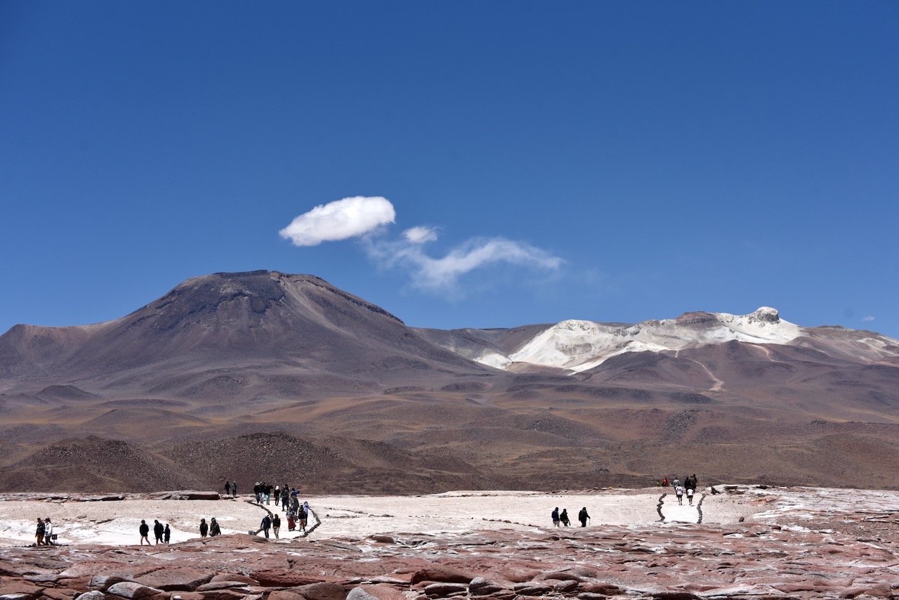
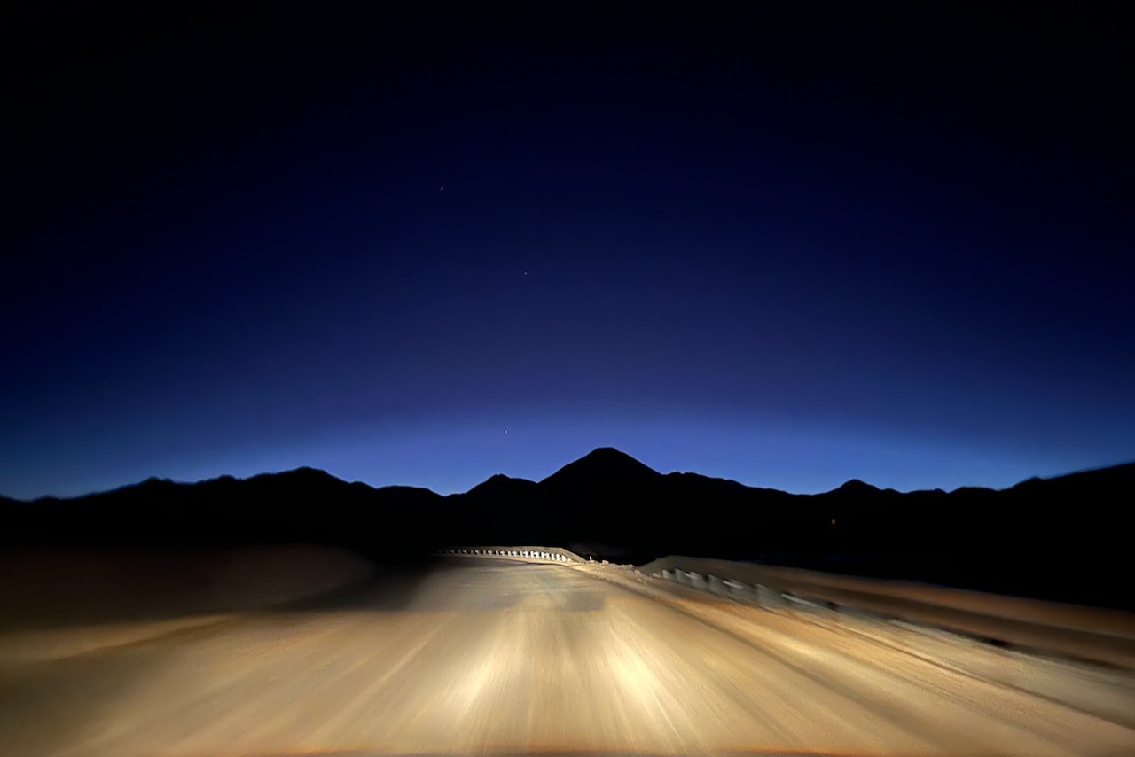
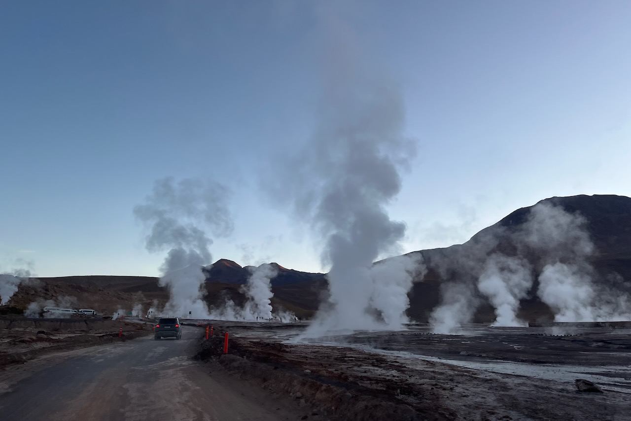
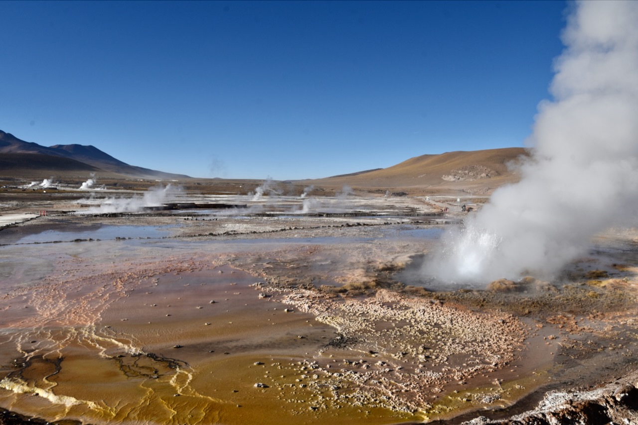
The next day we were going to El Tatio geysers. The geysers are 90km away from San Pedro. They sit at 4,320 elevation and there is more than 80 active geysers. Anything one reads about it says that one has to go early in the morning to watch them at sunrise. So there we were waking up at 4:30 am and driving off into darkness. We were worried about driving in the dark on very windy roads. But turns out El Tatio is quite an attraction.There was a stream of vans and cars heading towards it. It felt like driving in a gigantic convoy of a hundred vehicles.
Road from san Pedro de Atacama to El Tatio geysers, Atacama, Chile
It was very cold in the mountains. Car thermometer at some point said it was 10 degrees celsius below zero. Despite a huge number of visitors the site was very orderly and organized. Cars were directed to the parkings and then to tickets office. We got the tickets and then drove over to the far car park where most geyser activity seemed to be on that particular day. We then put on all the warm clothes we had, as it was 5 below zero celsius, and went to wait for the sunrise while warming up by geysers’ steam.
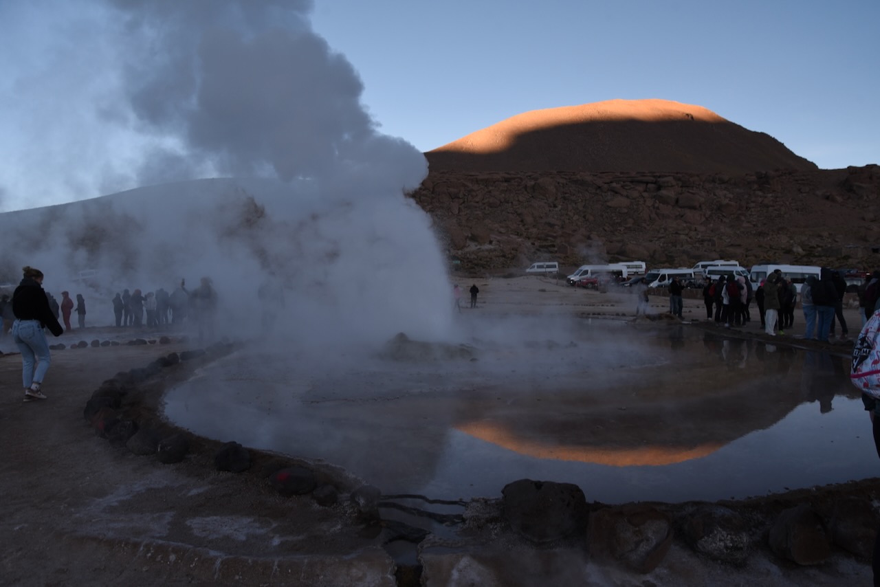
El Tatio geysers, Atacama, ChileSunrise at El Tatio geysers, Atacama, Chile
It was impressive to see so many geysers all around bubbling away. Makes one reflect on the fact that we all live on a giant liquid burning spinning ball with a super thin crust. Puts things in perspective.
Sunrise at El Tatio geysers, Atacama, Chile
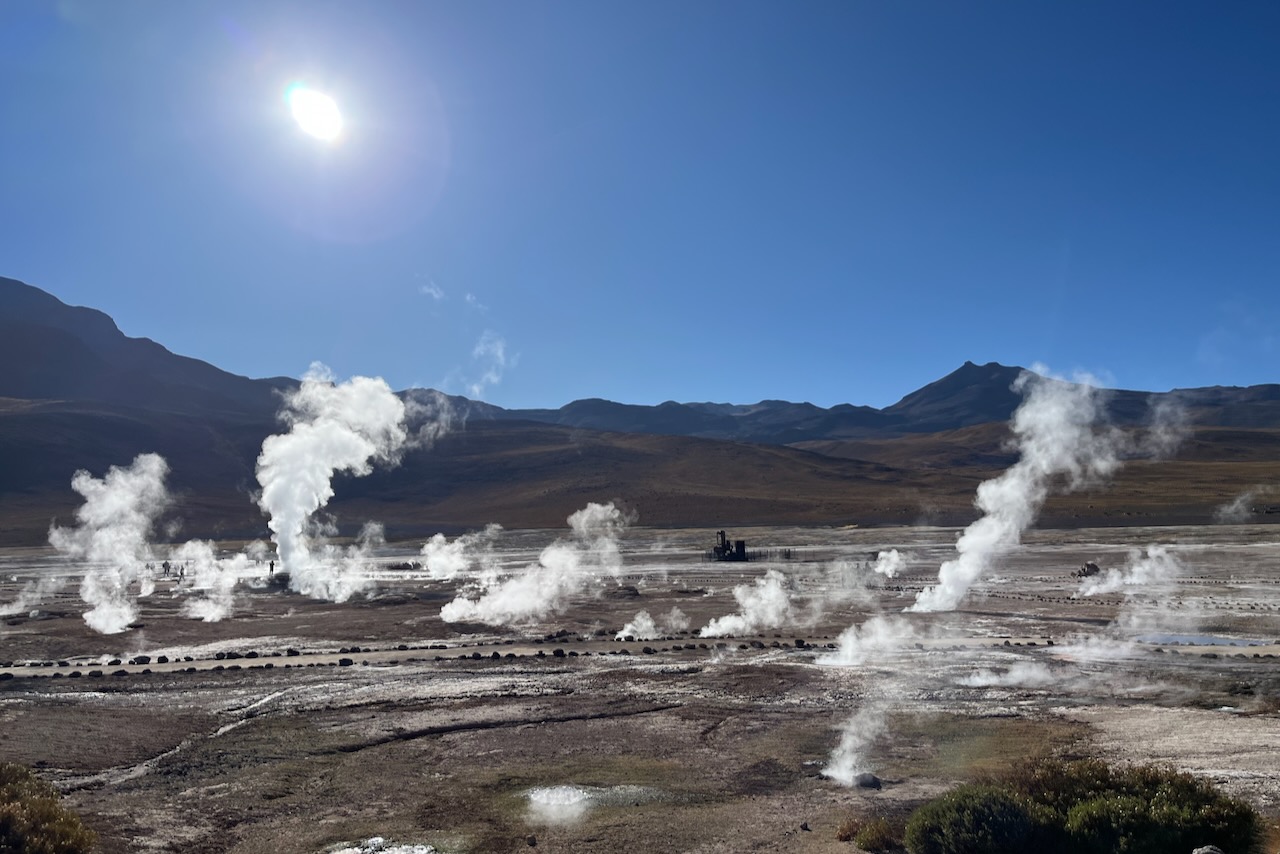
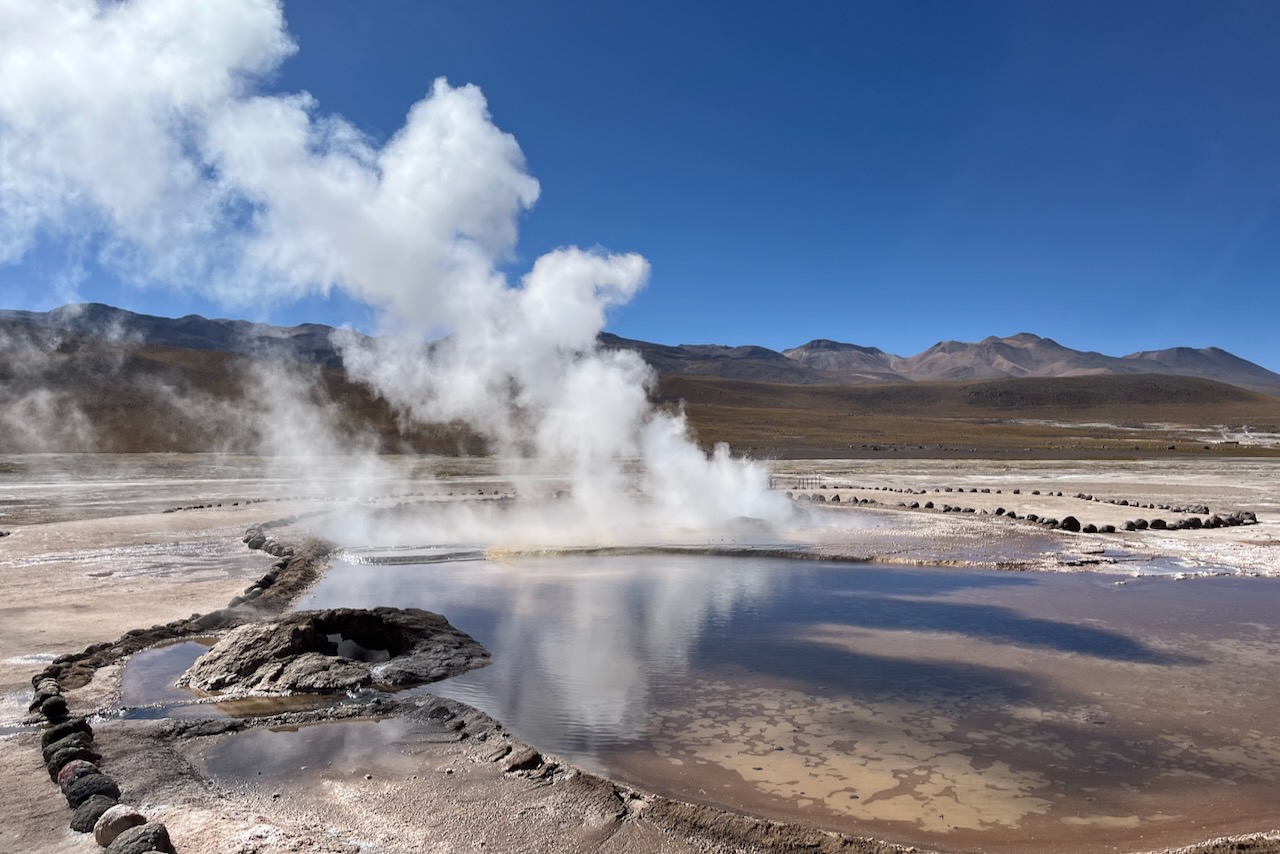
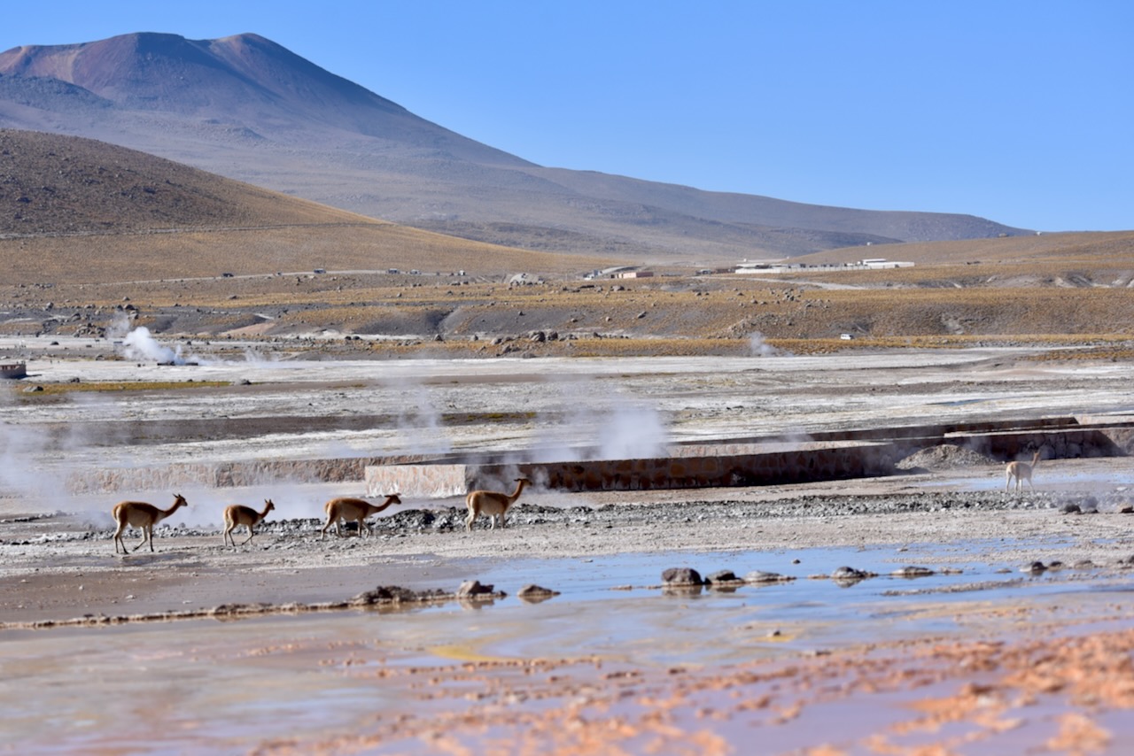
Definitely one could see steam coming from geysers more clearly before sun came up. Waking up early and driving in the cold dark night is worth it. But even with the sun up geysers were still there making plenty of visible steam even if it warmed up fair bit. Soon after sunrise most tour buses left and by 9am we were left almost with nobody around. Once people were gone, vicunas showed up.
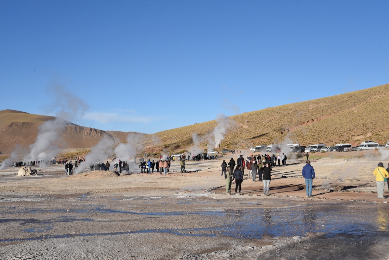
Tourists at El Tatio geysers, Atacama, ChileEl Tatio geysers, Atacama, ChileEl Tatio geysers, Atacama, ChileVicunas at El Tatio geysers, Atacama, Chile
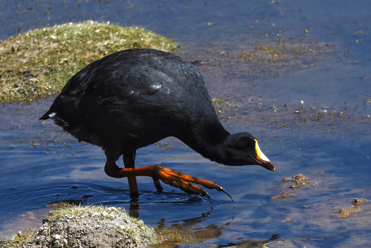
At 10am we started our scenic drive back to San Pedro curious to see what did we drive past in the darkness before. We saw volcanos, lagoons, vicunas and many flamingos.
Vicuna, Atacama, ChilePutana river and Putana volcano, on the way from el Tatio to San Pedro, Atacama, ChileGiant coot, Atacama, ChileFlamingos in Rio Grande at Mirador Machuca, Atacama, ChileFlamingos, Atacama, Chile
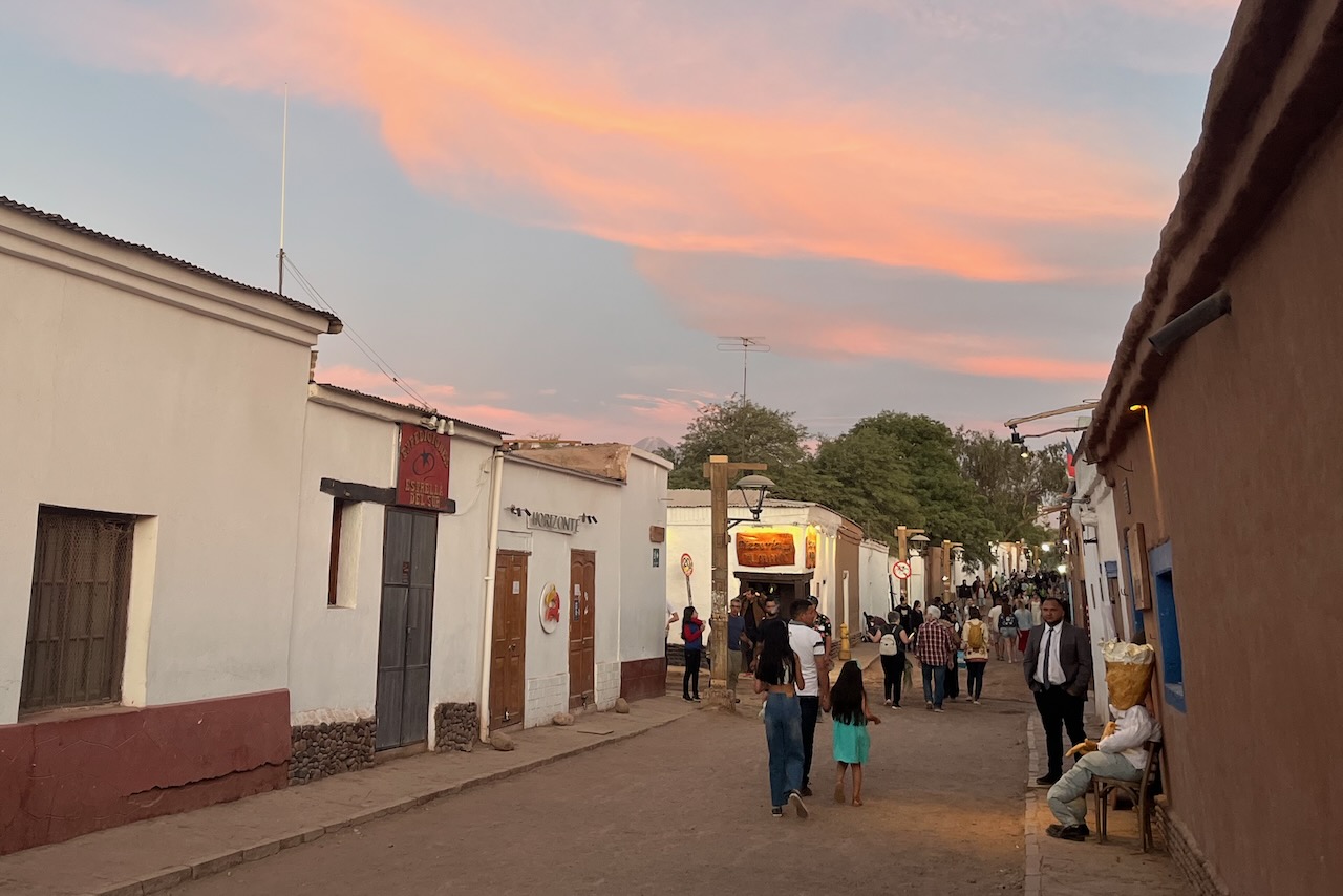
After returning to San Pedro and taking a nap, it was time to prepare for new year celebration. San Pedro is a popular place for celebrating new year it turned out. Accommodation was very limited. There were quite a few travelers from Brazil. Many of them seemed to be motor clubs doing a rally in their well equipped SUVs or on motorbikes. At times it seemed there were more people speaking Portuguese than Spanish around us in San Pedro.
San Pedro de Atacama main street, Atacama, Chile
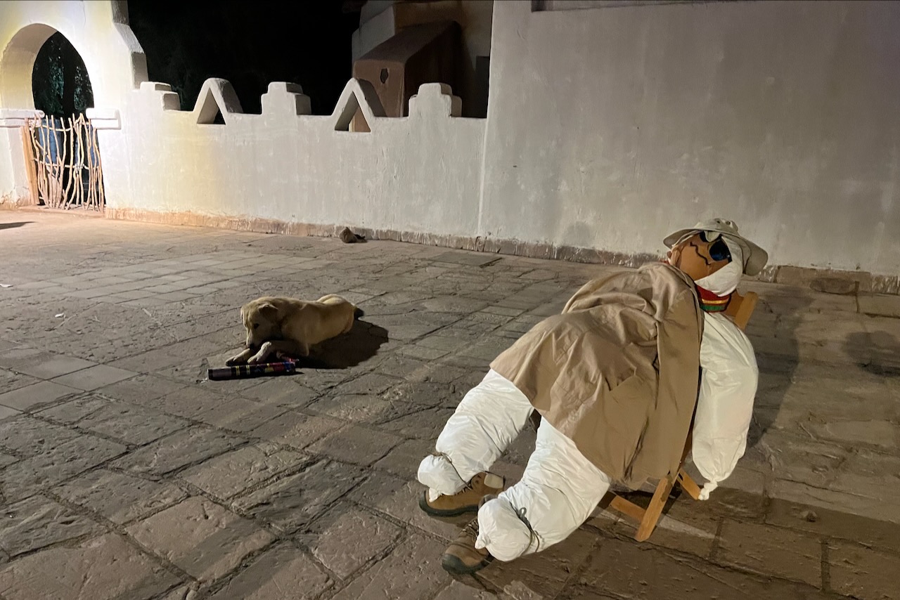
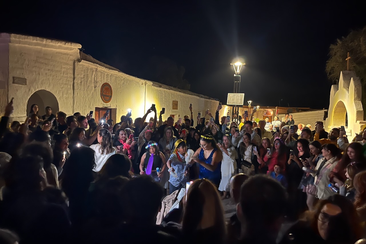
Burning Ano Viejo (old year) dolls is New Year tradition in San Pedro. Several restaurants had one outside of their door prepared. And there was also one on the main square. The idea is to burn it so that all bad things stay in the year that ended. As midnight approached many people gathered around the main square waiting for the Ano Viejo to be burned followed by fireworks. It was great fun to be in what sounded like a very international crowd. There were quite a few parties going music blasting from different directions. But we greeted the new year and went to. bed, as more adventures were awaiting us the next day.
San Pedro de Atacama at sunset on New Year’s eve with an Ano Viejo in a chair waiting to be burned, ChileAno Viejo in the main square waiting to be burned, San Pedro de Atacama, ChileFiring up Ano Viejo at San Pedro de Atacama main square to celebrate New Year, Chile
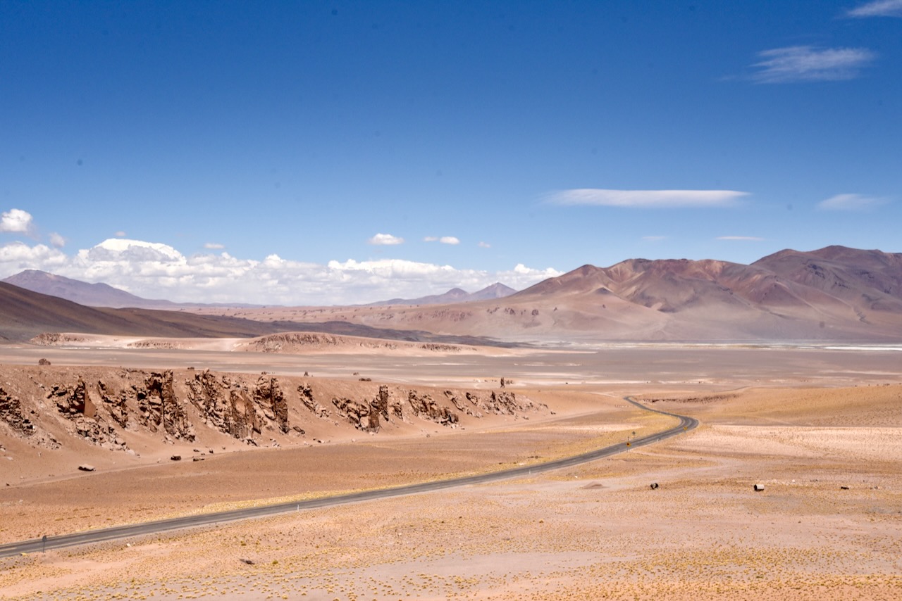
On our last full day in Atacama we headed east on ruta 27 to see Salar de Tara and lagoon. This was another spectacular drive with volcanoes and otherworldly colors. We passed the turn off to Bolivia border crossing that takes one to Uyumi in Bolivia. We did not make it there this time but definitely something for the next trip.
Lama and Licancabur volcano in the background, Atacama, ChileScenery along ruta 27 looking to Bolivia side, Atacama, ChileVicunas along ruta 27, Atacama, ChileCampervan heading to Argentina border on ruta 27, Atacama, Chile
It was a sunny day without wind and we were lucky to get reflection from the surrounding mountains in Laguna Tara. WE saw some flamingoes far in the distance and a couple of vicunas feeding on shore of the lagoon.
Laguna de Tara, Atacama, ChileVicuna at Laguna de Tara, Atacama, Chile
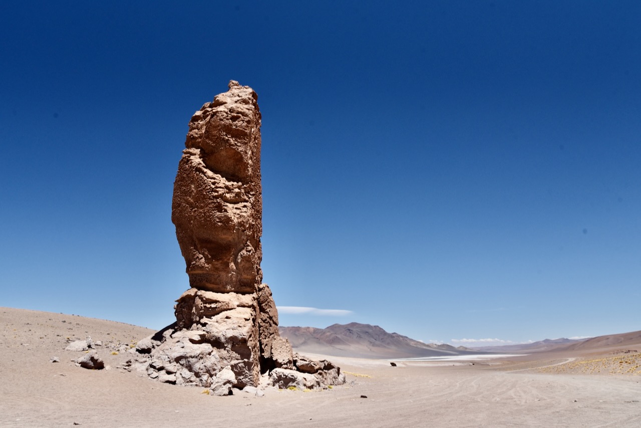
We then drove up to Salar de Tara with its strange rock formations. Softer rock is eroded away over many years and only harder rock remains in strange forms.
Salar de Tara, Atacama, ChileRock formations in Salar de Tara, Atacama, Chile
On our last day we were taking an evening flight out of Calama so we had time in the morning to go and visit Valle de Luna (Moon valley) before returning our car at midday.
Valle de la Luna, Atacama, ChileAmphitheater in Valle de la Luna, Atacama, ChileValle de la Luna, Atacama, ChileRoad to San Pedro and Licancabur volcano, Atacama, ChileSunset over San Pedro de Atacama and Andes, Atacama, Chile
We had fantastic 5 days in San Pedro de Atacama. It was great to explore the area and warm up. And now after exploring wild and rugged side of Chile in Patagonia and Atacama, we were heading to Santiago for some good food, wine and city life.
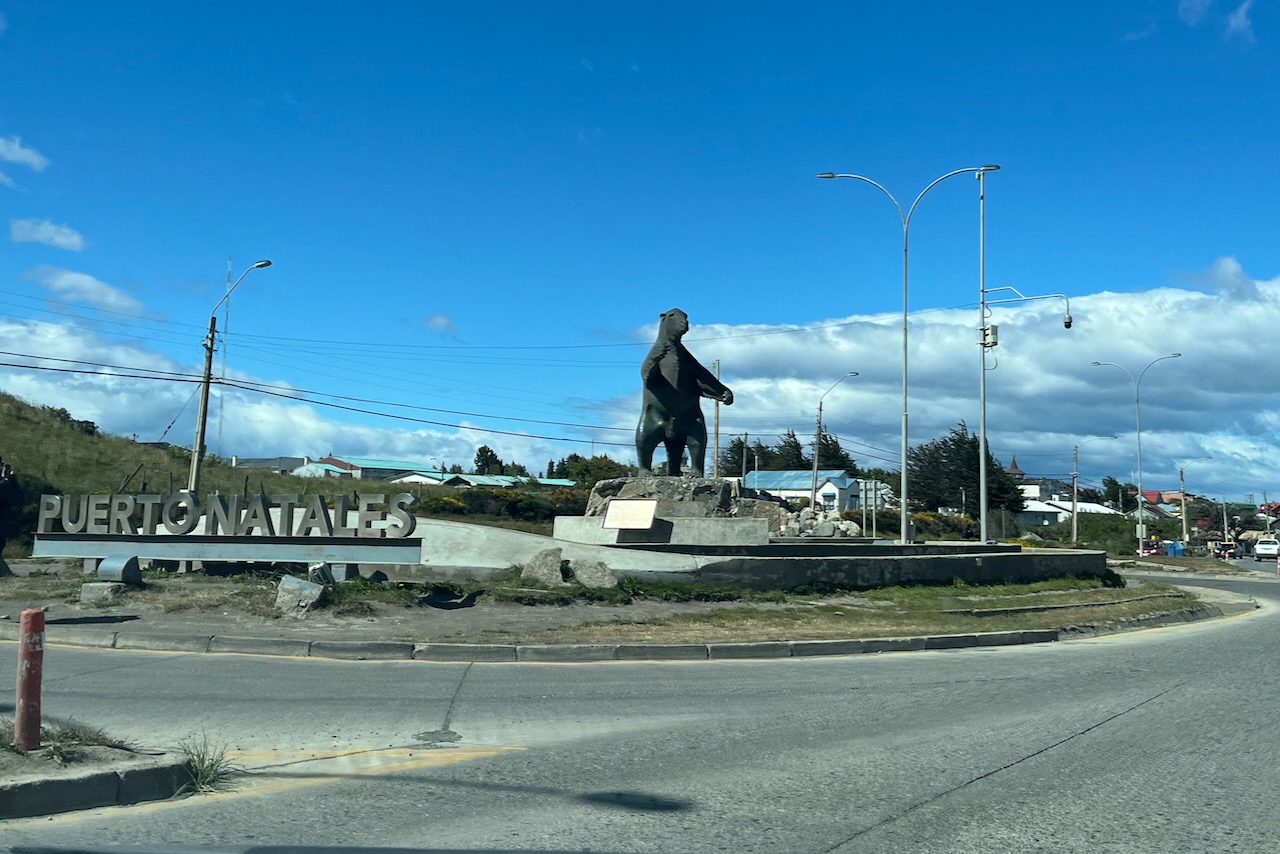
After our hiking adventures in Torres del Paine in Chile and around Mount Fitz Roy in Argentina, we were back to Puerto Natales to start exploring Patagonia by sea. We joined a 5 day 4 nights cruise operated by Skorpios around fjords and glaciers of Souther Patagonia Ice field. Before getting on the ship we had a full day in Puerto Natales.
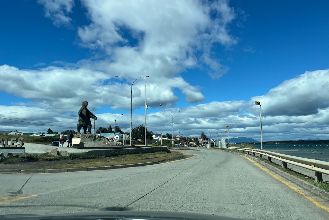
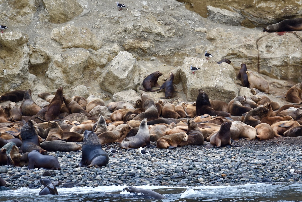
Entrance to Puerto Natales with Milodon statue, Chile
We drove up to Milodon cave – a very impressive cave where remains of a pre-historic giant sloth – Mylodon – were found. The animal was up to 4m long and went extinct about 10,000 years ago. The site is very well organized and informative. There are also fossils of other pre-historic animals and evidence of human occupation. we then went around Puerto Natales a little bit.
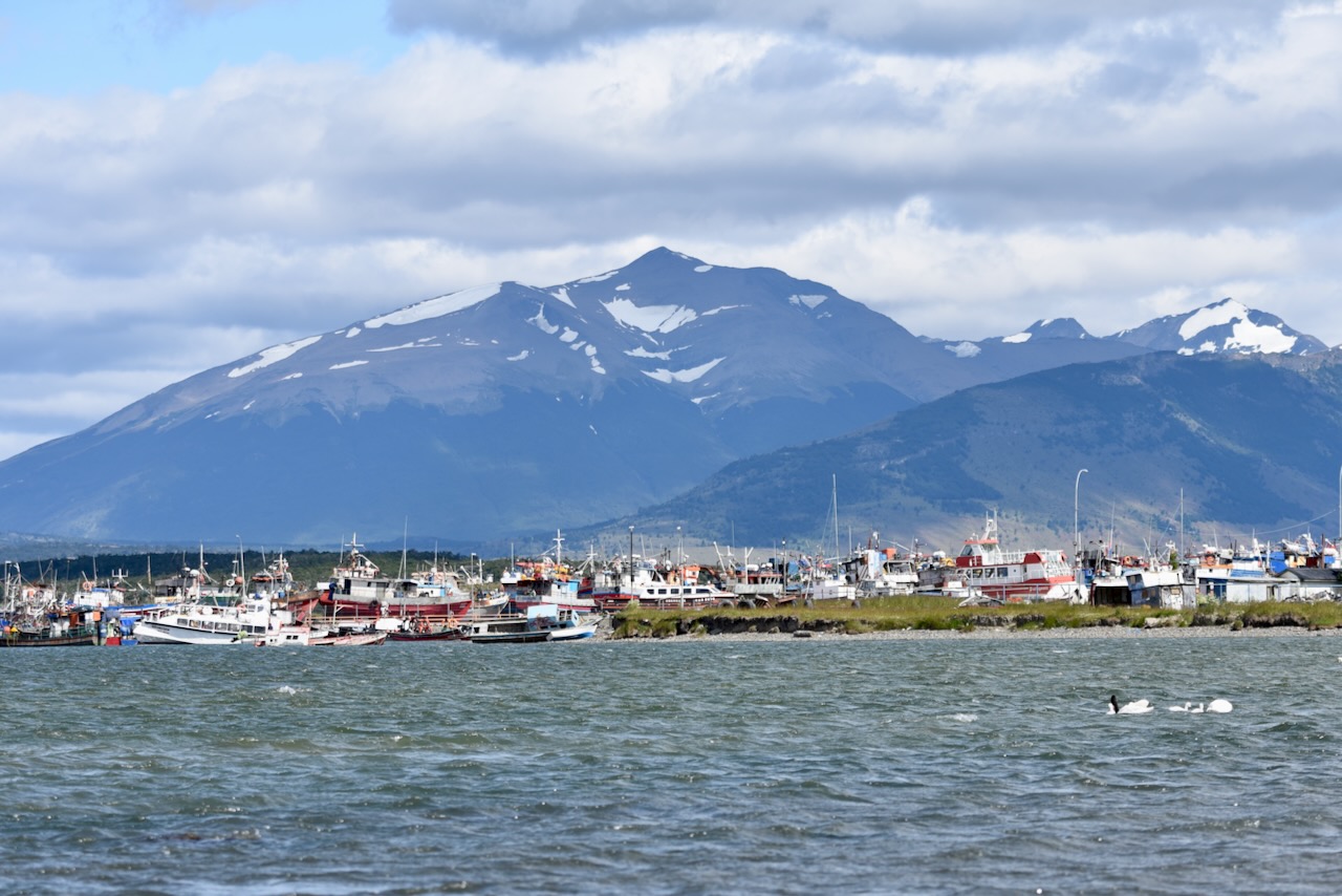
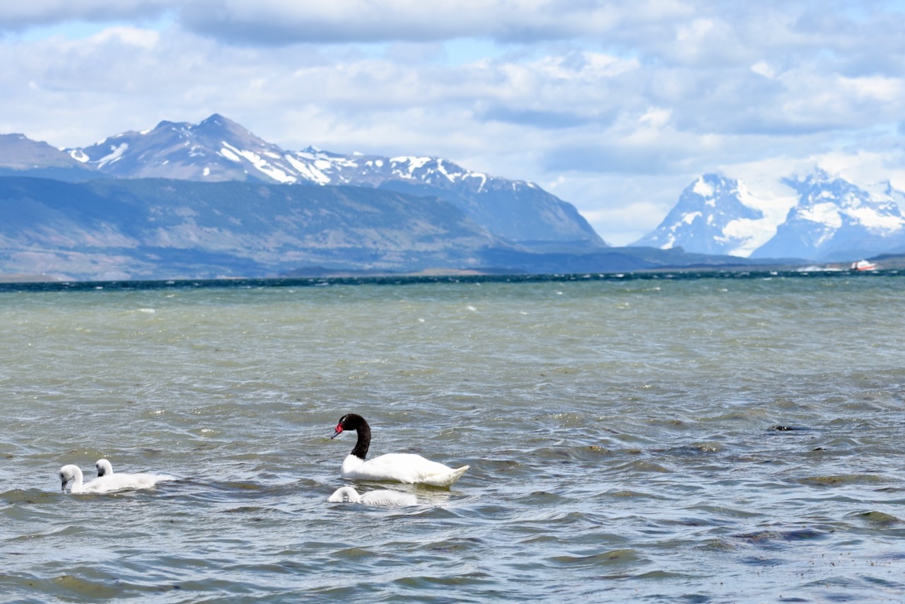
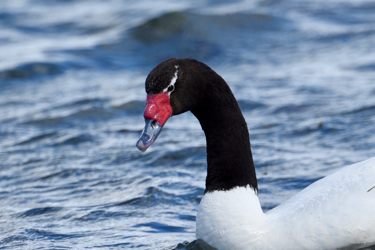
Fishing boats in Puerto Natales, ChileBlack-necked swans and mountains in Puerto Natales, ChileBlack-necked swan close up, Puerto Natales, Chile
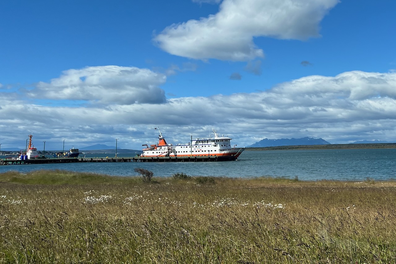
Then we dropped off our car and got ready for the cruising adventure. We never went on a cruise before but felt that this one would not really be like a cruise – but more like a liveaboard just with going on shore excursions instead of diving.
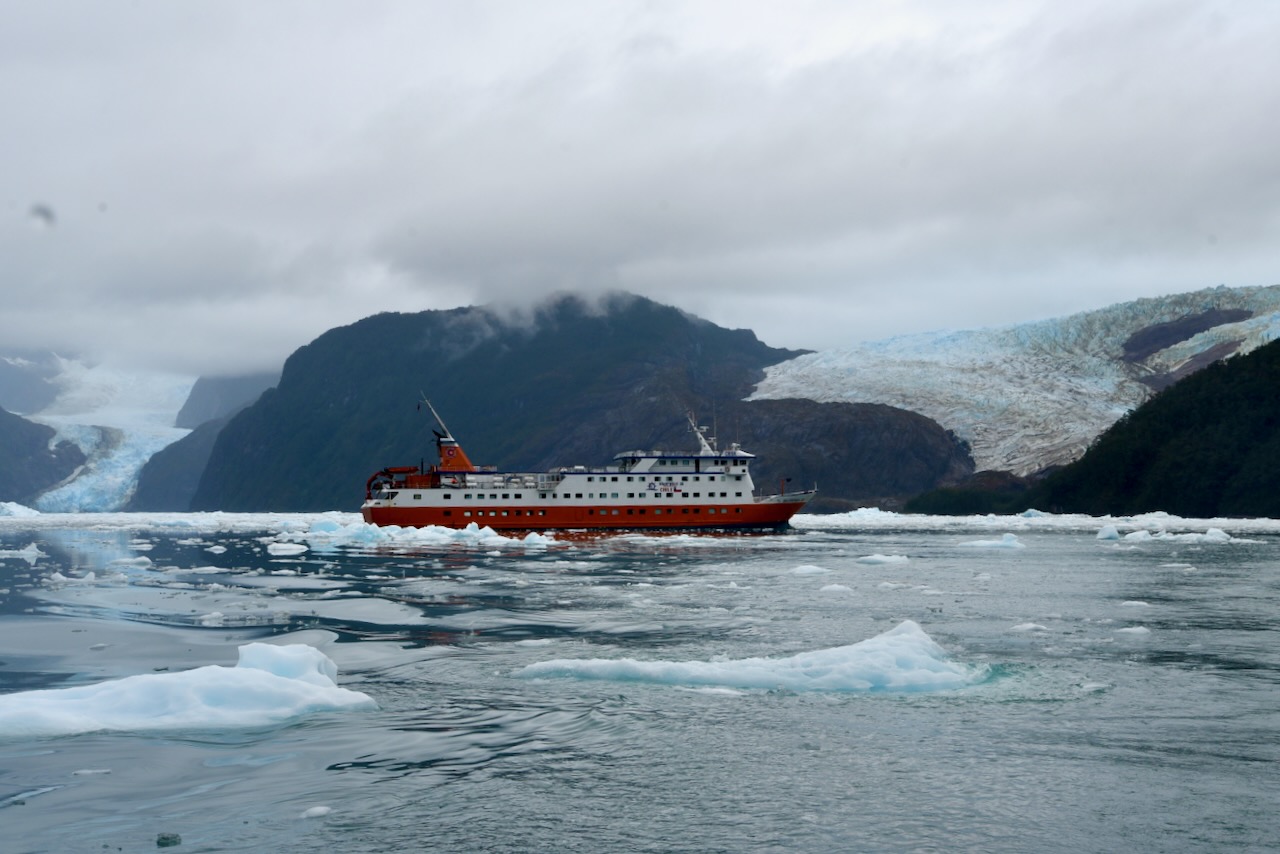
Skorpios III ship awaiting passengers at Puerto Natales, Chile
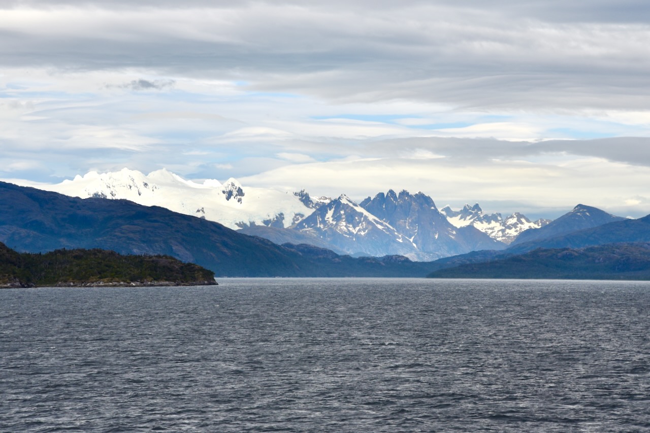
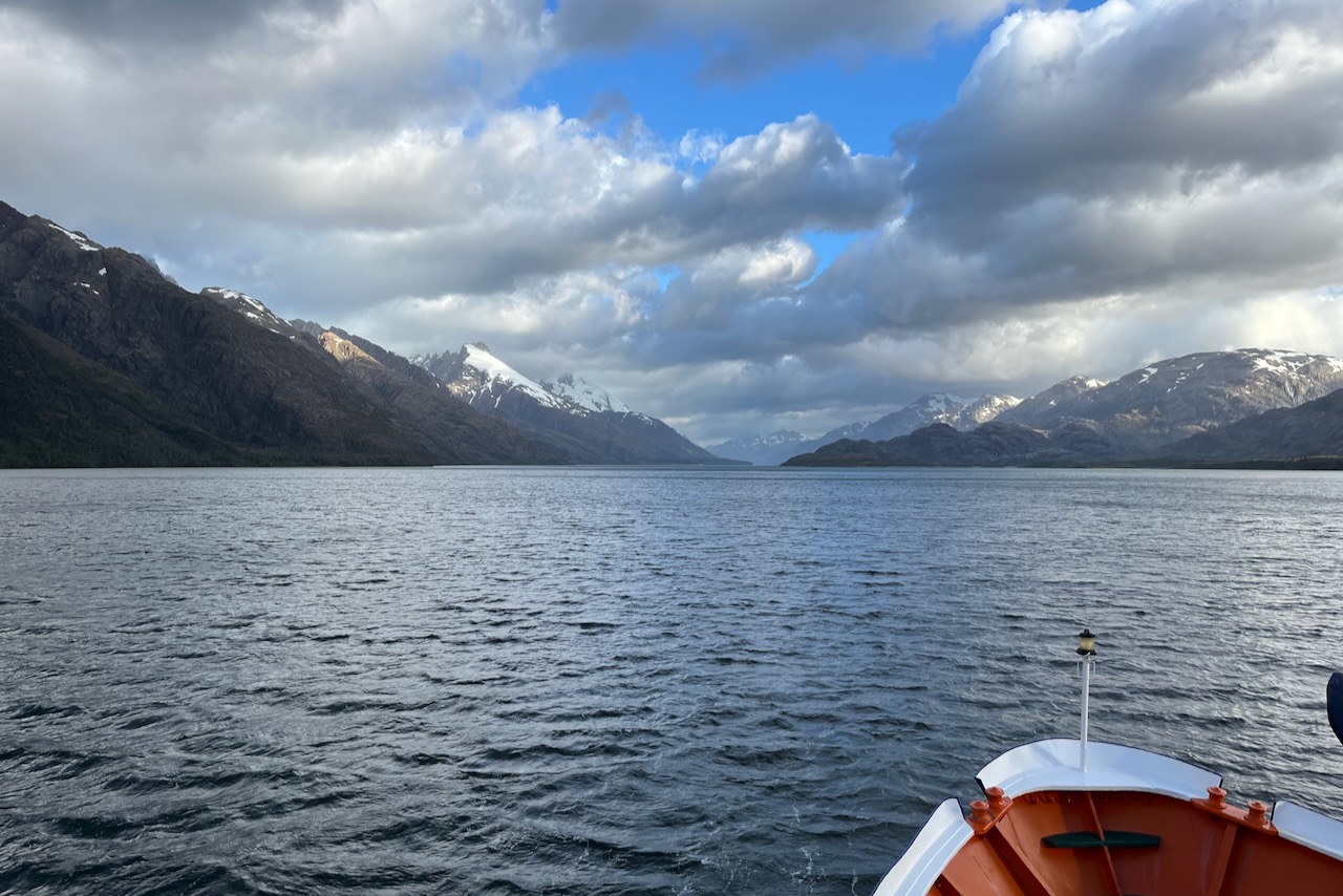
We joined a 4 night 5 day Kaweskar route on Skorpios. The route is 505 miles and visits the largest number of glaciers in the region: Guilliard, Amalia, El Brujo (the Warlock), and the glaciers of Calvo, Bernal, and Herman fjords. Our ship Skorpios III was 70m long and had a capacity for only 90 passengers plus crew. We had a fantastic experience potentially opening our mind to more cruising – though only on smaller vessels like this. The crew was wonderful. The food was excellent – fancy restaurant good. And they had tea time – tecito in Chilean – with the best tasting cakes we ever had. We added a couple of kilos from the tecito no doubt, but there was just no way to resist. The cabins were very comfortable and common areas inviting. And the most important part of course were shore excursions and scenic navigation through fjords. We were definitely very happy we went on this trip. Maybe Antarctica next time. Here are some highlights from the route.
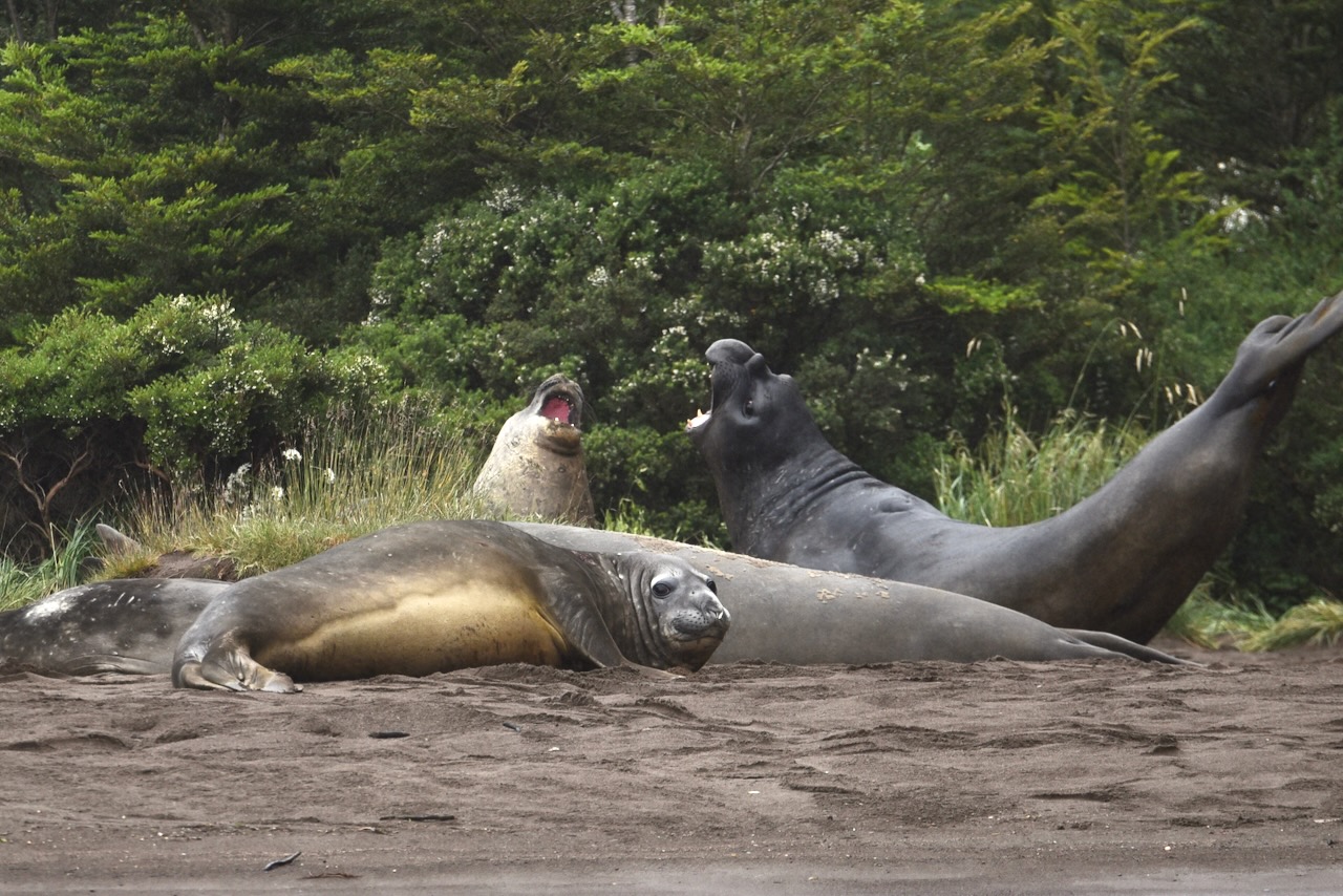
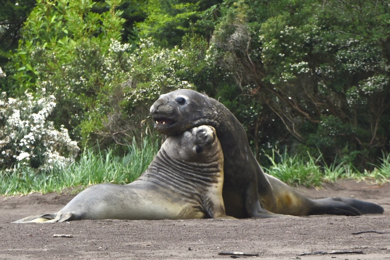
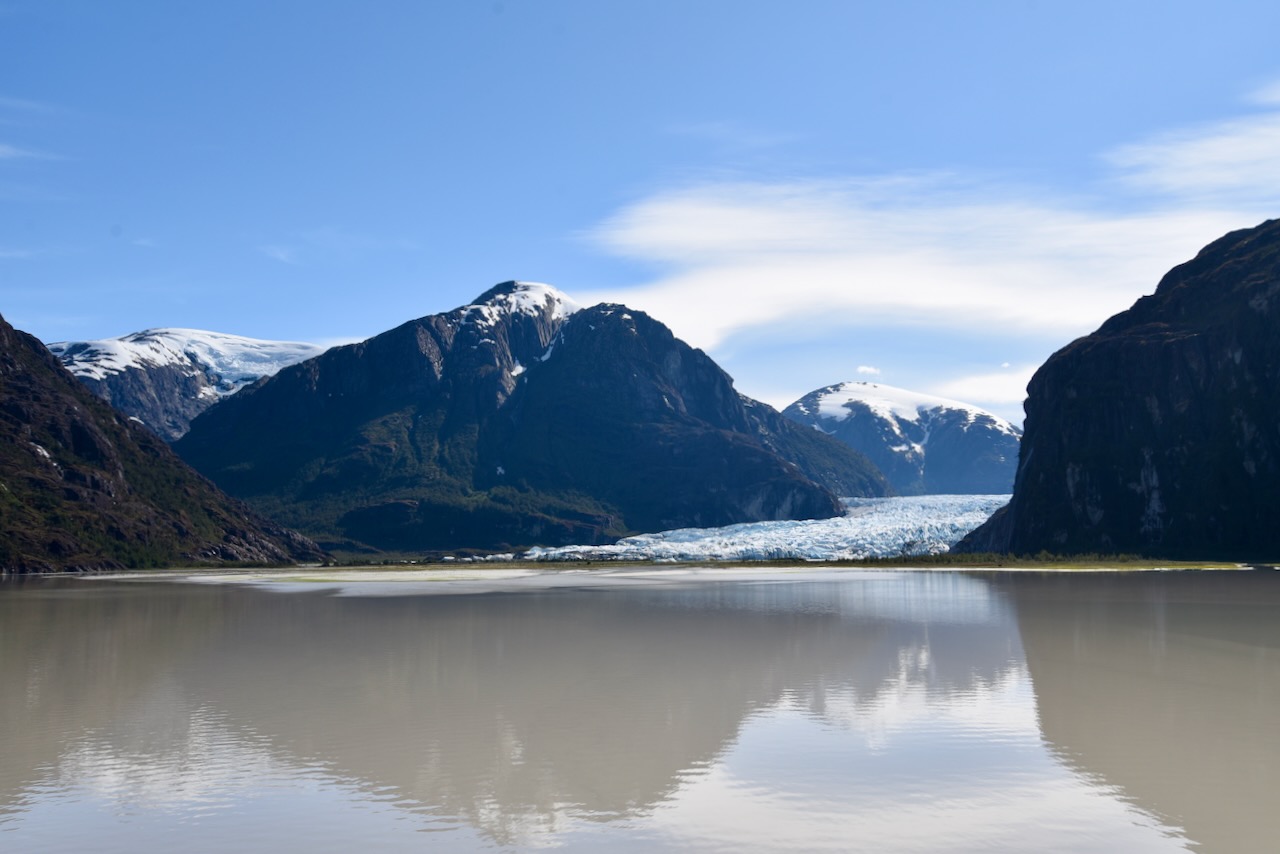
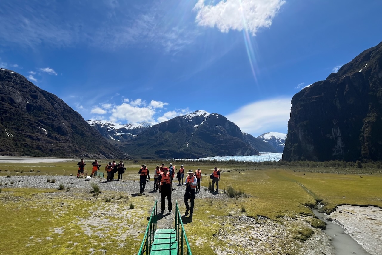
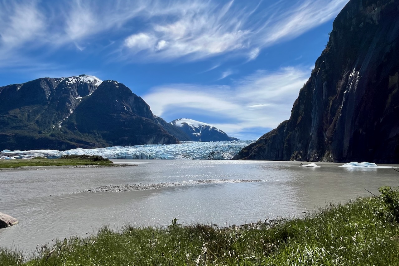
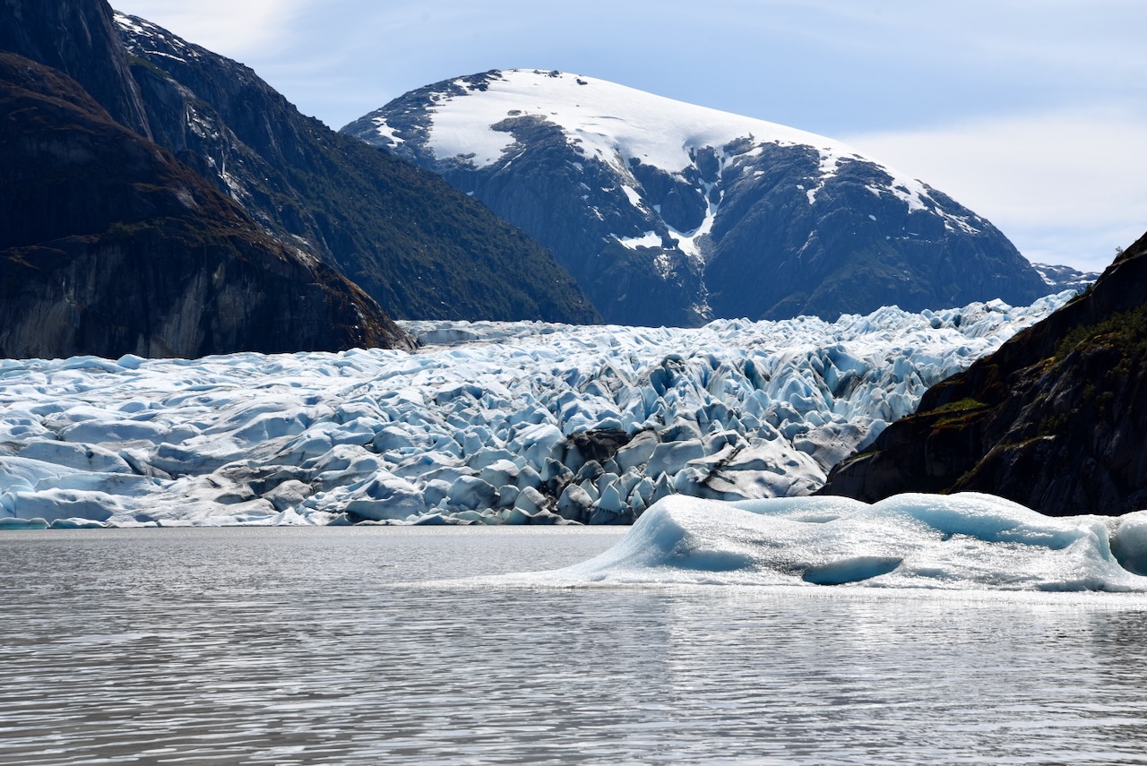
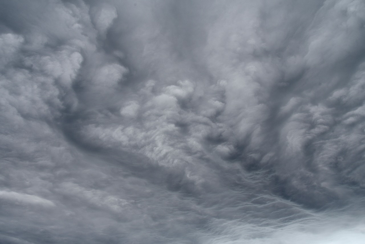
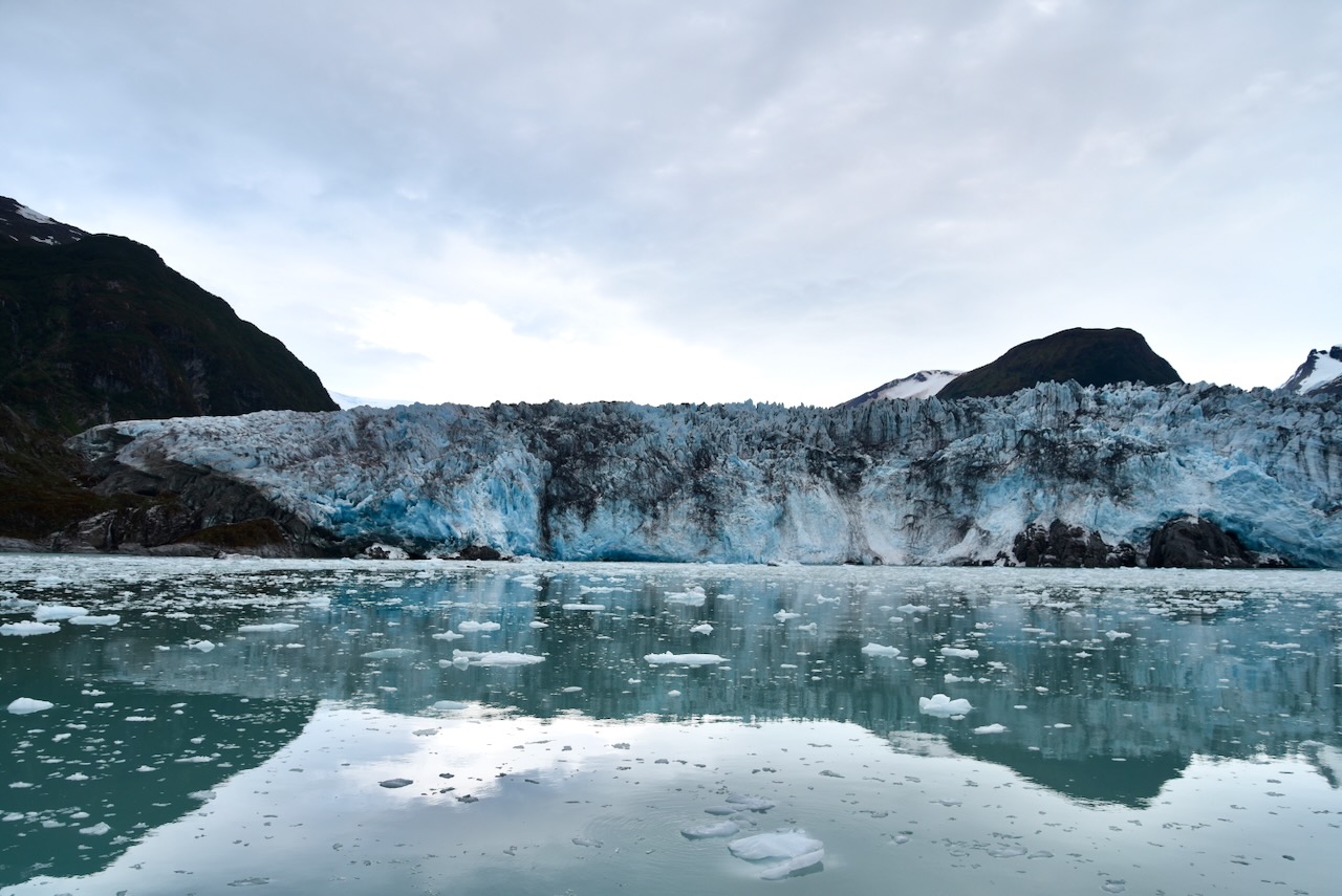
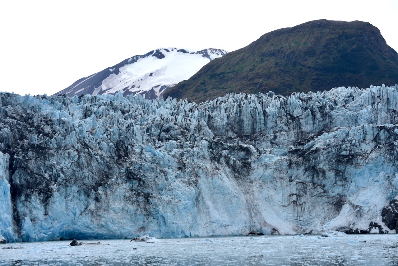
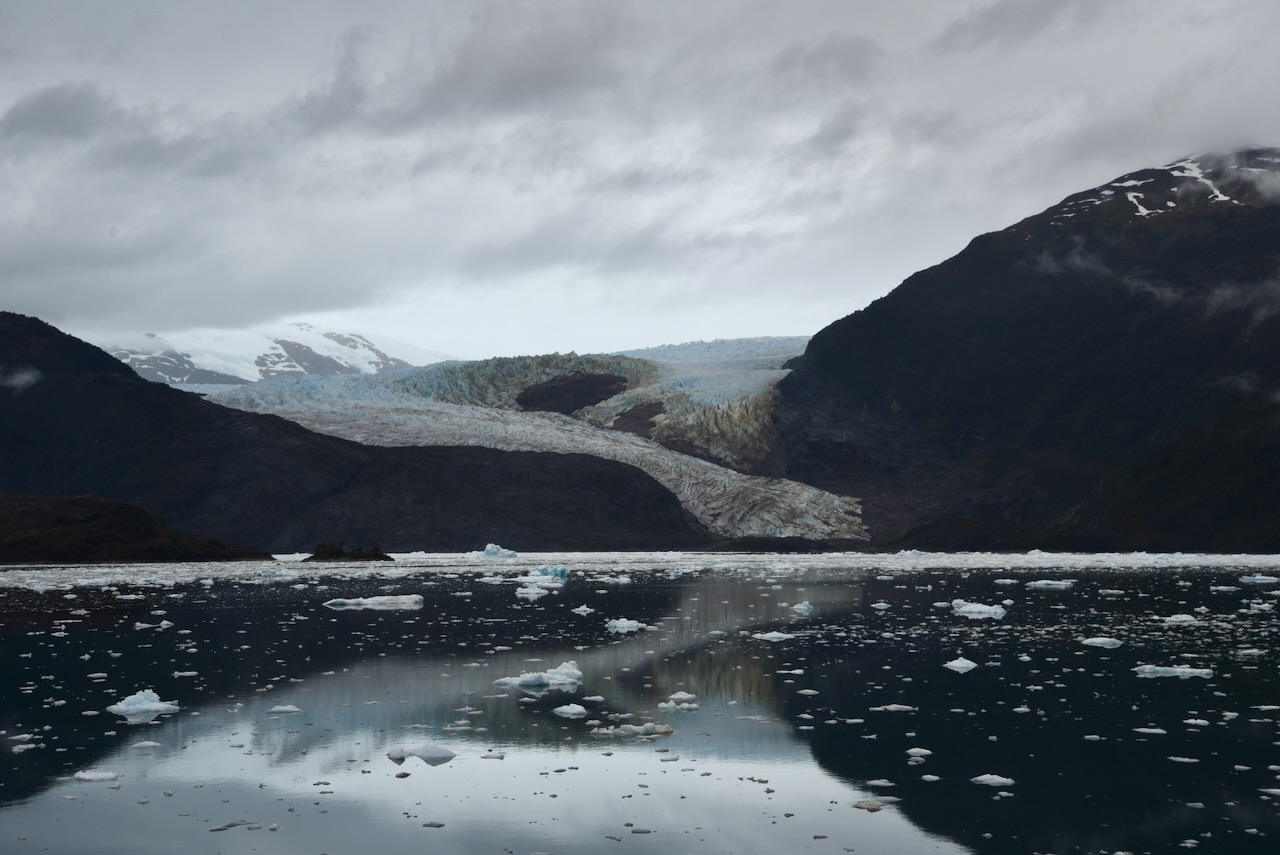
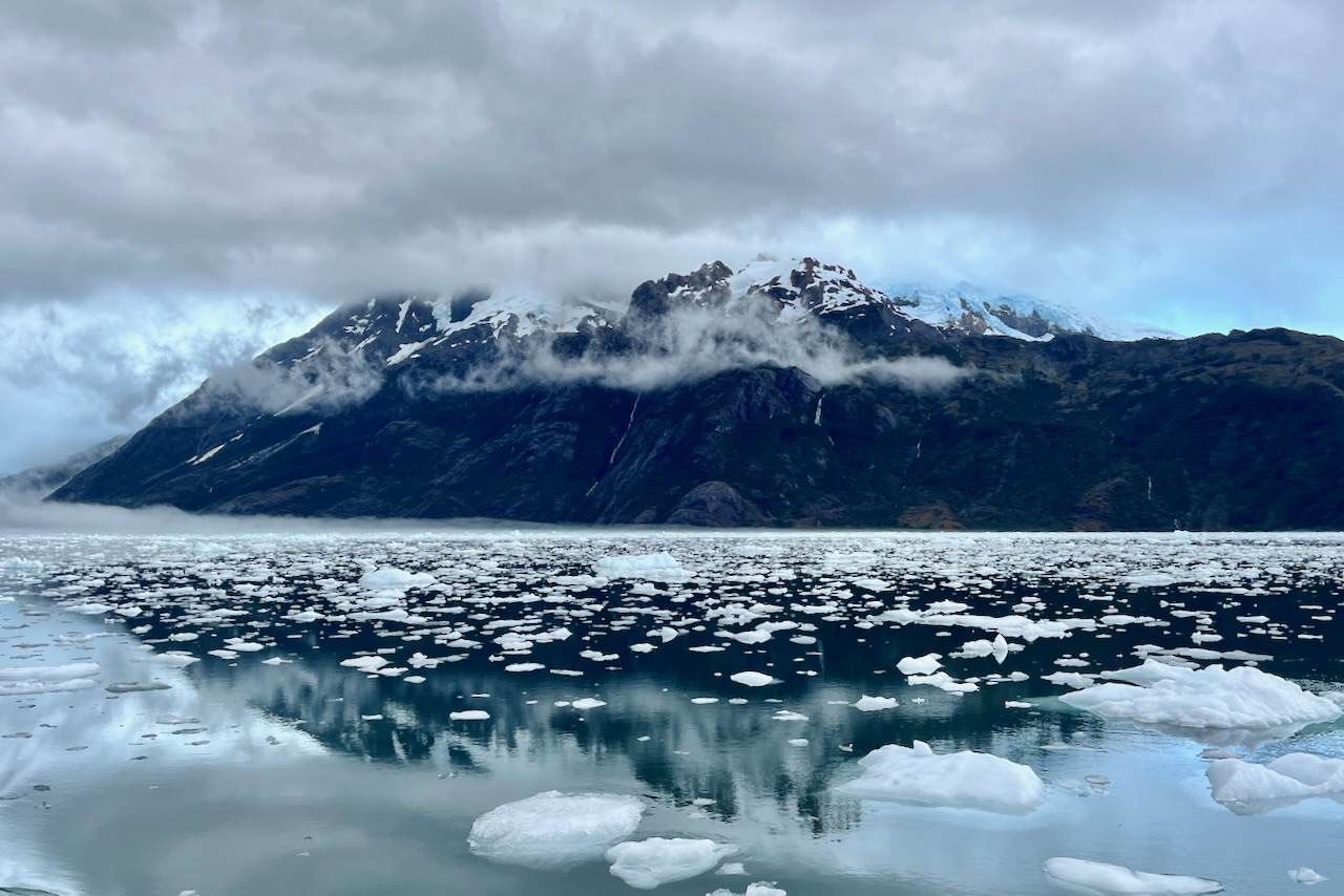
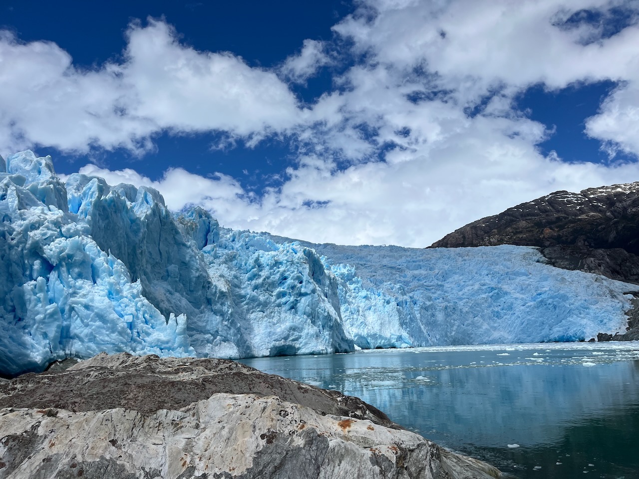
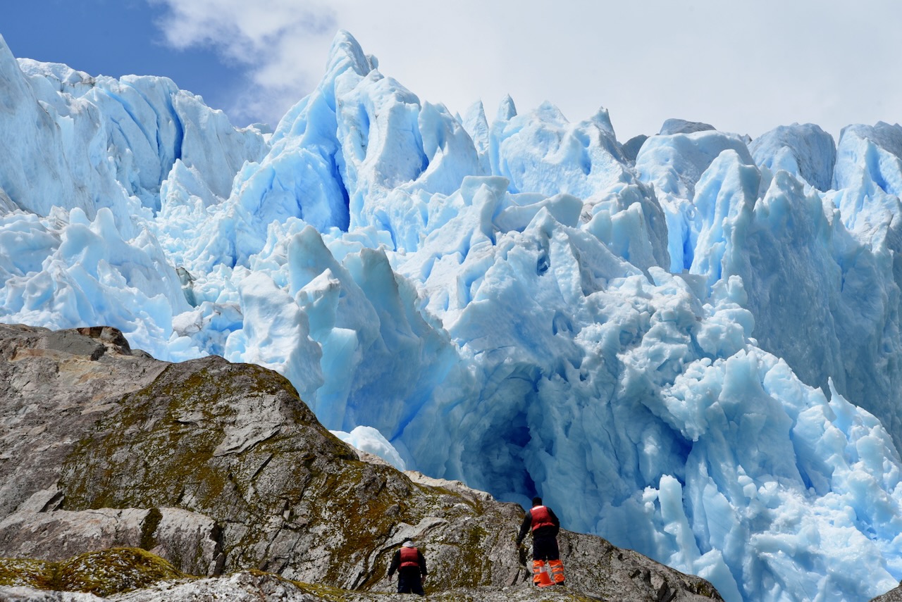
Starting navigation on Kaweskar route with Skorpios, ChileElephant seals at Caleta Juarez, ChileElephant seals at Caleta Juarez, ChileGuillard Fjord and Guillard glacier, with Skorpios cruise, ChileDisembarking to see Guillard Glacier, Scorpios cruise, ChileGuillard glacier, ChileGuillard glacier close up, ChileViews sailing on Skorpios on Kaweskar route, ChilePatagonian sky on Kaweskar route with Skorpios cruise, ChileAmalia glacier on Kaweskar route with Skorpios cruise, ChileAmalia glacier on Kaweskar route with Skorpios cruise, Chile
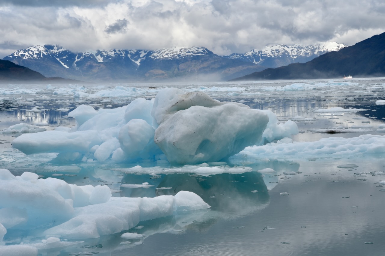
Amalia glacier is retreating rapidly retreating 7km over the past half a century. The glacier scrapes Reclus volcano and volcanic sediment mixes with ice to make it look black and blue.
Amalia glacier on Kaweskar route with Skorpios cruise, ChileCalvo Fjord, on Kaweskar route with Skorpios cruise, Chile
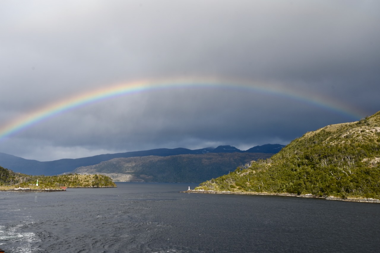
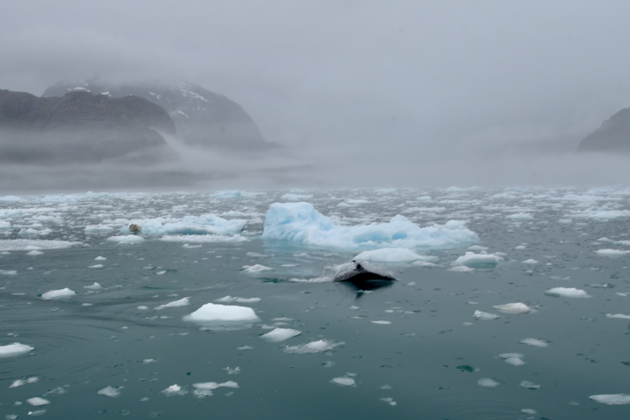
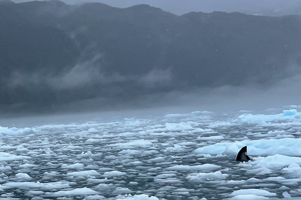
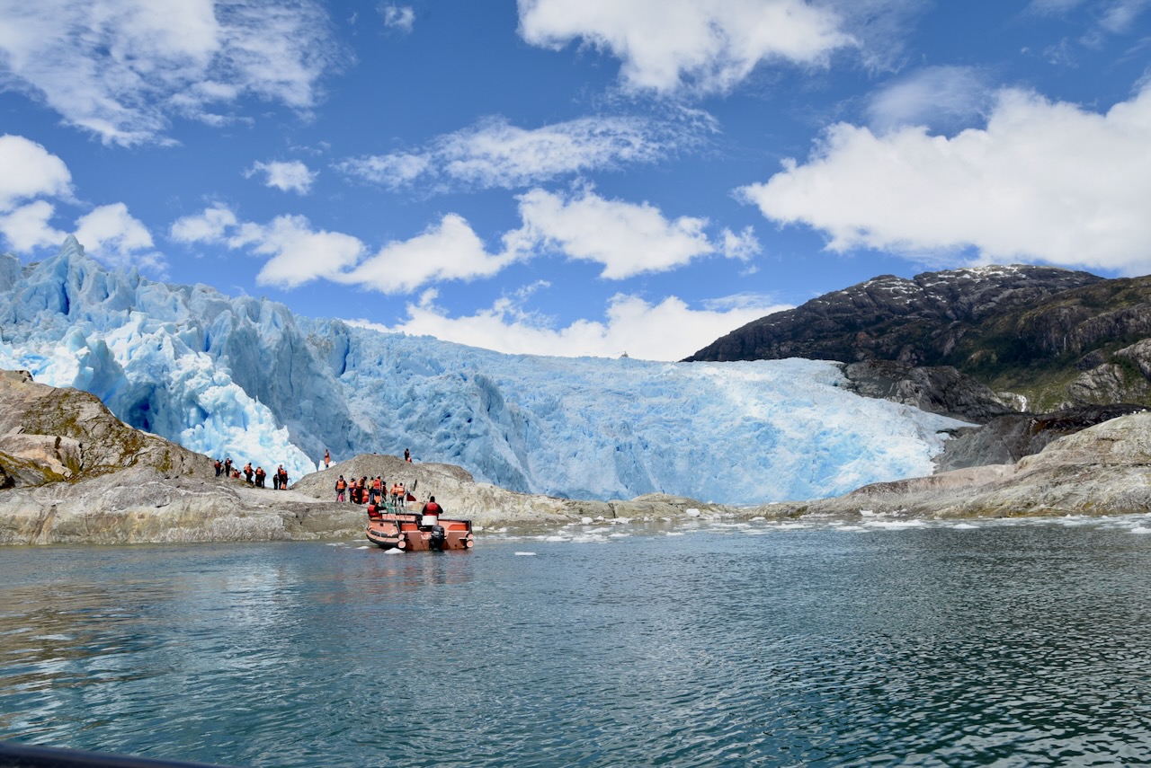
On a visit fo Calvo Fjord we moved into special small boats that can move through ice and went deap into fjord to see waterfalls, glaciers, floating ice, and dolphins poking through it. The cloud was very thick with some drizzle. To start with we could not see very much as we made our way through mist and cloud. But actually this going through mist and clouds seemed a properly Patagonian thing to do. As day progressed clouds slowly lifted.
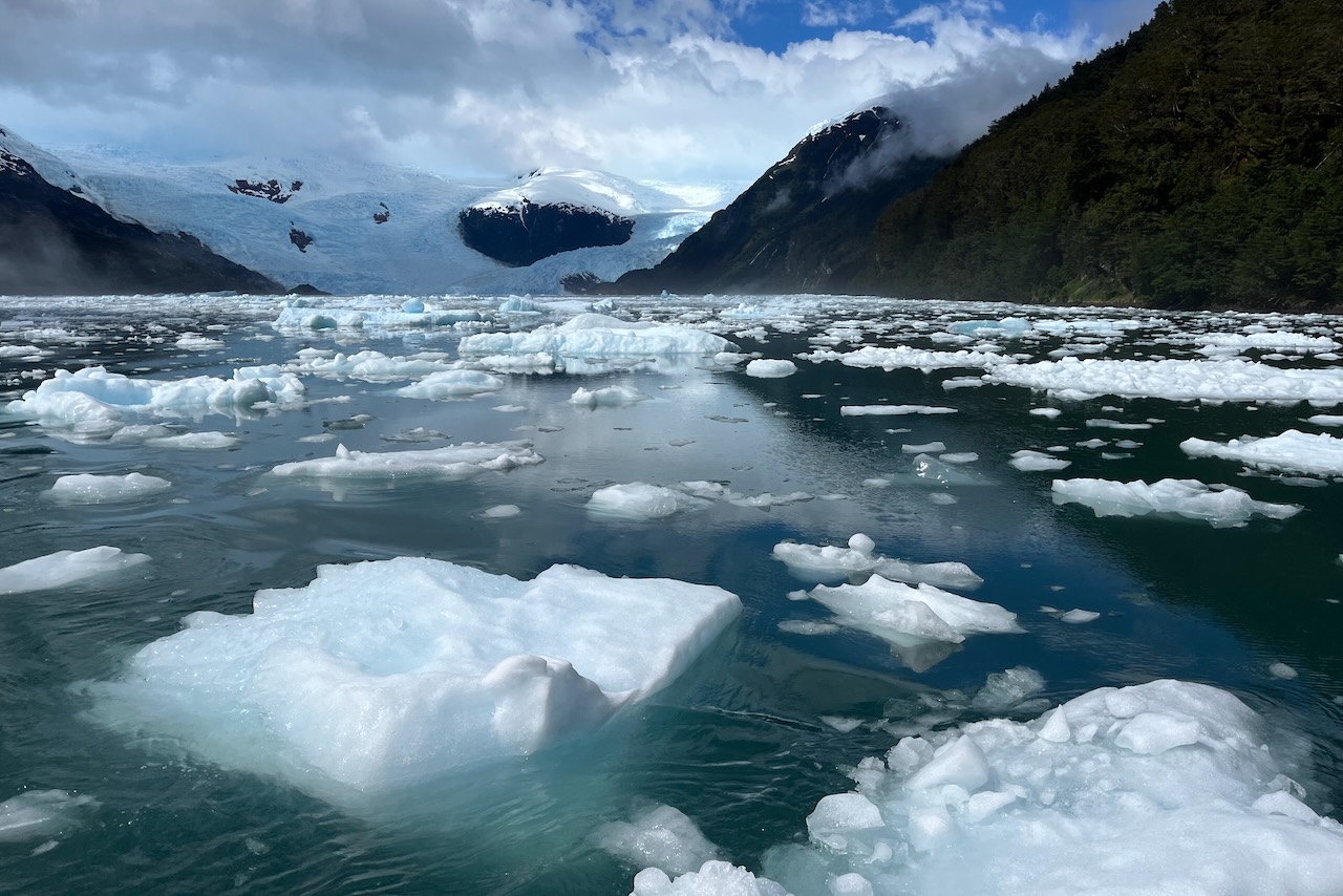
Skorpios III in Calvo Fjord as we go out on small boats into ice, ChileDolphin and floating ice in Calvo Fjord, ChileDolphin and floating ice in Calvo Fjord, ChileCalvo fjord on Kaweskar route with Skorpios cruise, ChileIce in Calvo fjord on Kaweskar route with Skorpios cruise, ChileCalvo fjord on Kaweskar route with Skorpios cruise, ChileEl Brujo glacier on Kaweskar route with Skorpios cruise, ChileEl Brujo glacier on Kaweskar route with Skorpios cruise, ChileEl Brujo glacier on Kaweskar route with Skorpios cruise, ChileSunset while sailing on Kaweskar route with Skorpios cruise, ChileHeading to Mountains fjord on Kaweskar route with Skorpios cruise, ChileBernal Glacier on KAweskar route with Skorpios cruise, ChileBernal glacier and lagoon, ChileBernal Glacier, Chile
And then it was time to return to Puerto Natales. Of course, the day we were disembarking all the clouds disappeared and we had a perfect blue sky unlike the previous 4 days. But we still were very happy we did this navigation and got to see glaciers and fjords.
Arriving back to Puerto Natales on Skorpios cruise, Chile
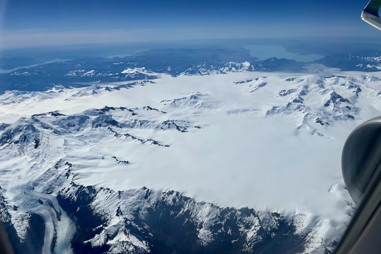
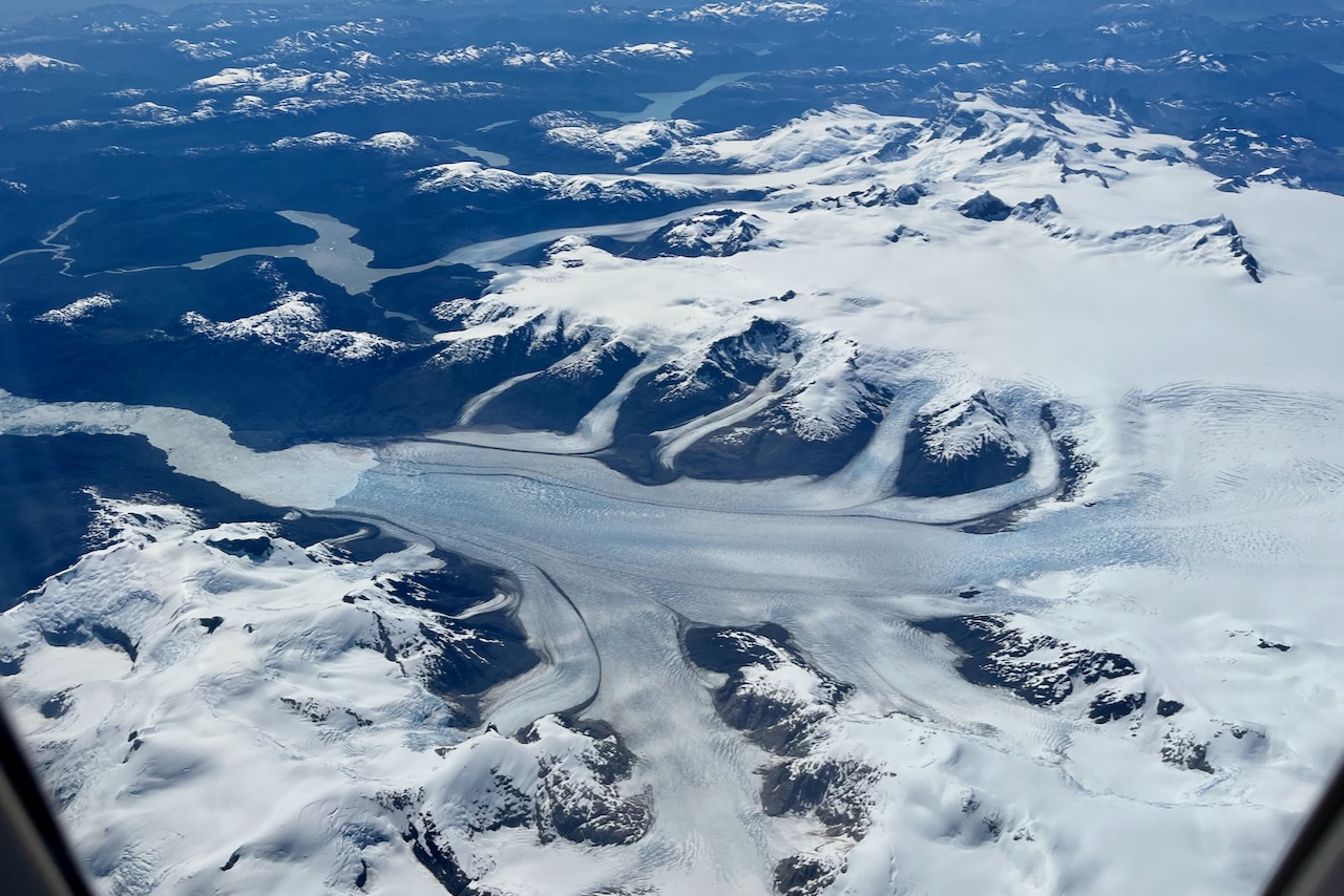
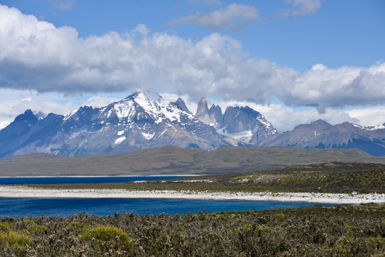
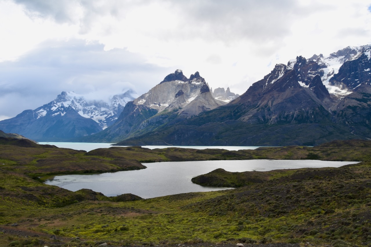
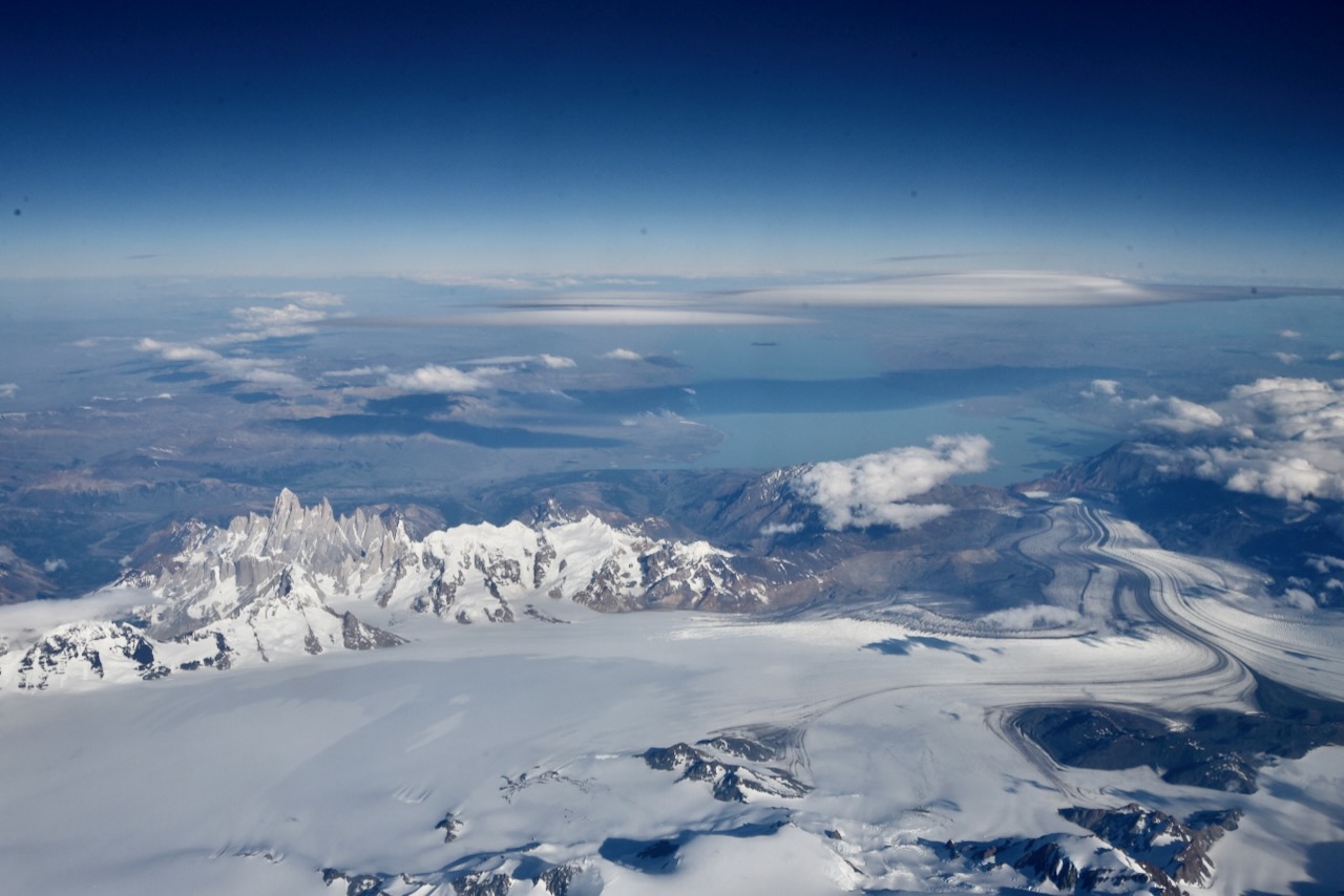
On the bright side, having this perfect clear sky meant that we had amazing views from the plane as we were flying north from Puerto Natales to Santiago. We set on the right side (F window) and saw clearly Torres del Paine massif and many glaciers and mount Fitz Roy in the distance. It was a perfect end for the Patagonia part of our trip.
Torres del Paine massif view from airplane, ChileSouthern Patagonian Ice Field with Mount Fitz Roy in the distance view from plane, ChileGlaciers in Southern Patagonian Ice FIeld, Chile
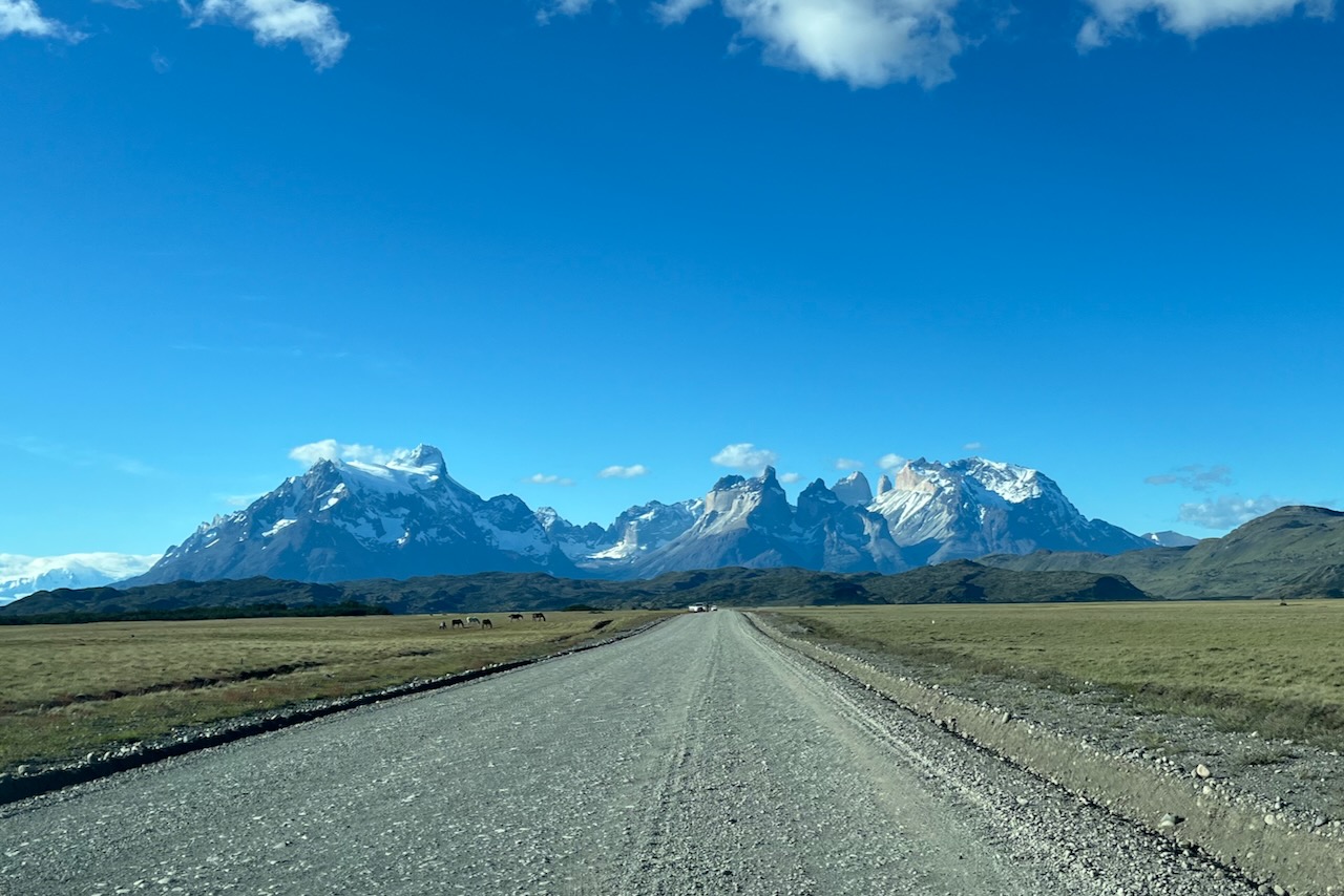
After the half day penguin tour in Punta Arenas, we picked up our rental car, stocked up in the supermarket and headed to Torres Del Paine National Park. All the research we did indicated that roads are paved, or a very good gravel when inside of the park. We hired a small two wheel drive, little Toyota Yaris, and it did really well on the trip.
Heading north on Ruta 9 from Punta Arenas to Puerto Natales, Chile
As we headed up Ruta 9 towards Puerto Natales we started to see snow cap mountains in the distance. It took about 3 hours to get from Punta Arenas to Puerto Natales. We fueled up in Puerto Natales and continued driving.
Heading from Puerto Natales to Torres del Paine National Park, Chile
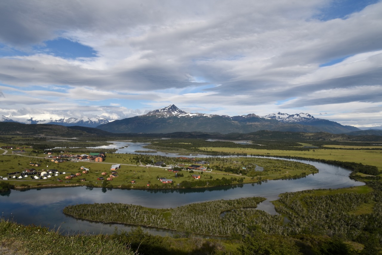
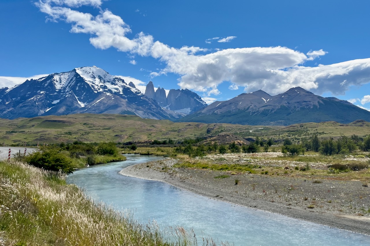
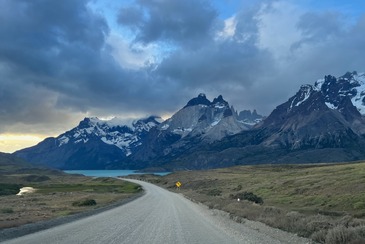
We decided to base ourselves close to the national park in Rio Serrano instead of staying in Puerto Natales and driving to the park every day. To get to Rio Serrano, After Puerto Natales we took road marked Y290 on google maps. This is definitely a much less popular route than longer but fully paved Ruta 9. The route we took was partially paved but in a very good condition. We made it absolutely fine in our compact two wheel drive. The views along the way were stunning and it was definitely worth trying this route.
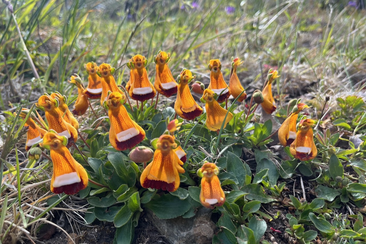
Flowers along the road to Rio Serrano, Torres del Paine, ChileLago el Toro, Torres del Paine, ChileTorres del Paine view from the road, Chile
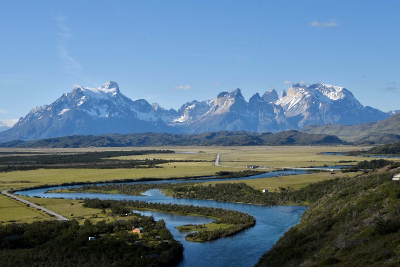
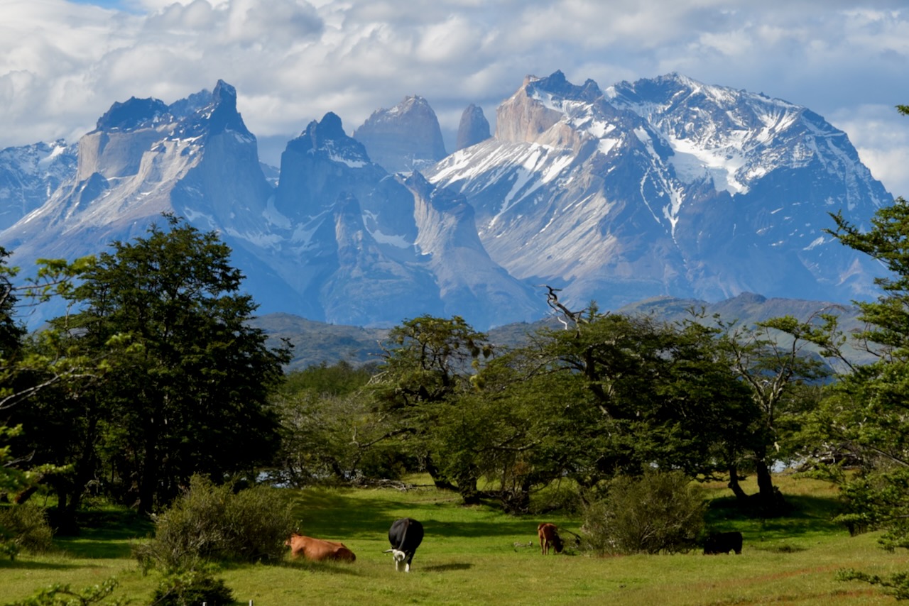
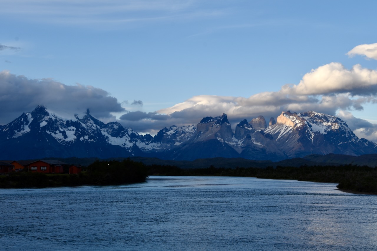
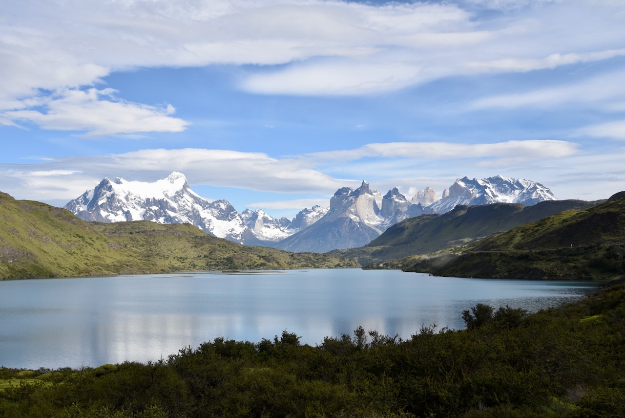
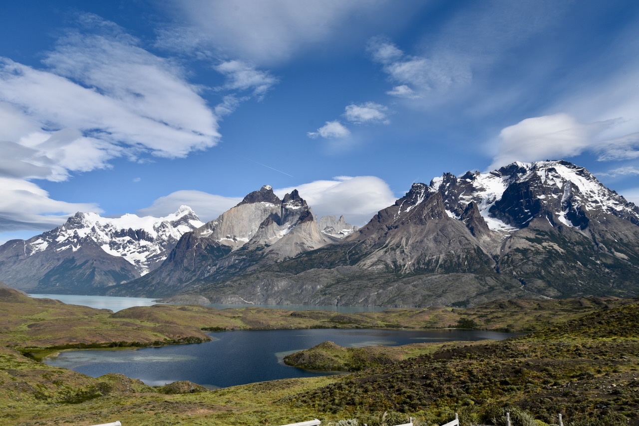
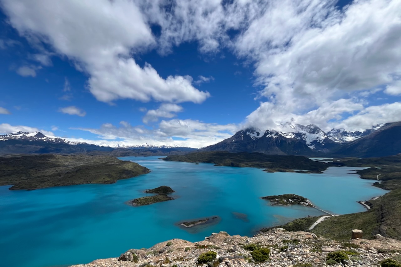
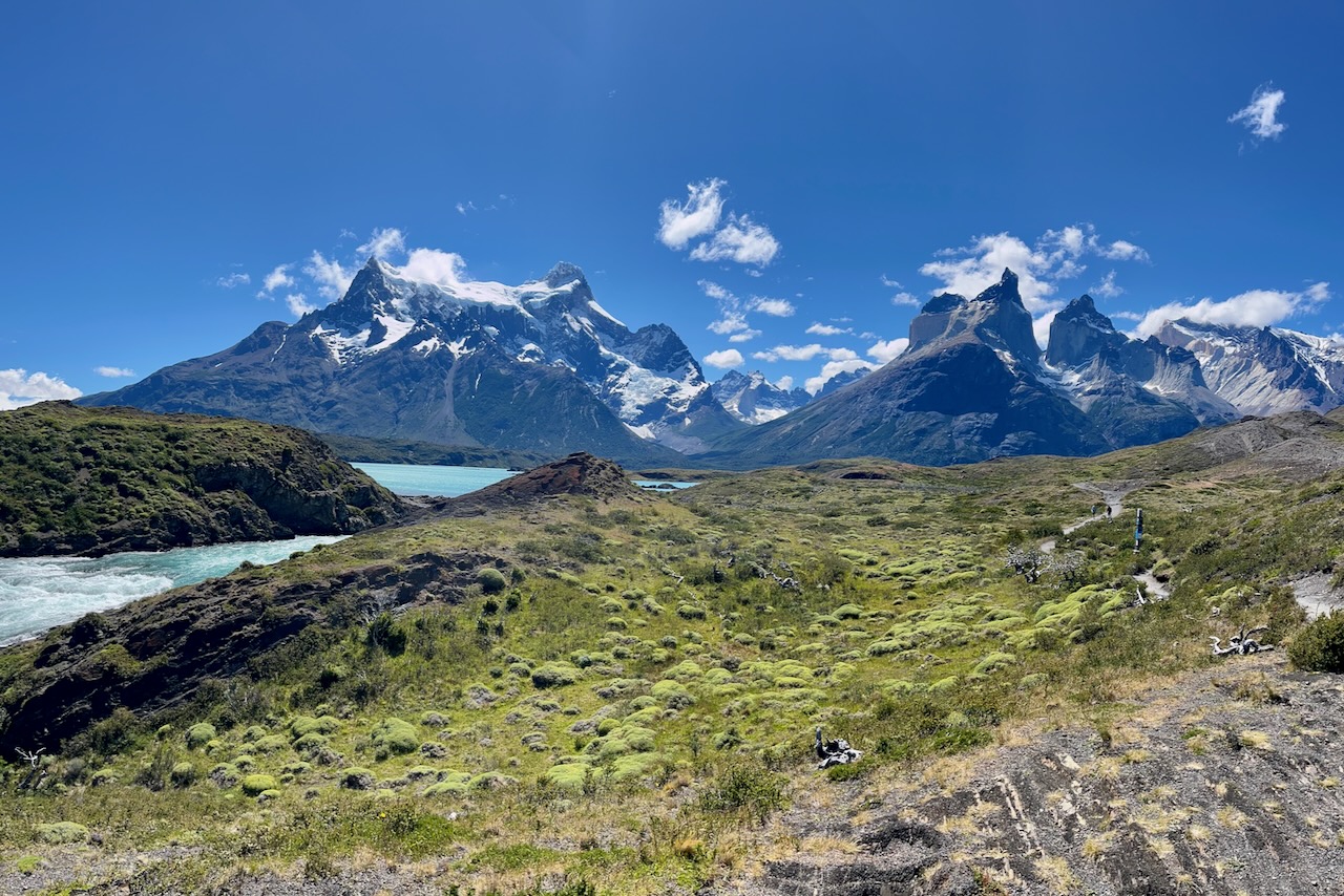
In a little over 2 hours we reached Rio Serrano view point offering breathtaking panoramic views of Torres del Paine and surroundings. There are several lodges and hotels in Rio Serrano area. We stayed at Hotel del Paine. Accommodations in Rio Serrano are not cheap but for us it was definitely worth it. We woke up every morning with the view of Torres del Paine and ended the day watching sun reflecting on the mountains. Food was very good and the restaurant has Torres del Paine and Rio Serrano views. We were definitely very happy we decided to stay in Rio Serrano area.
The view of Rio Serrano hotel area and Torres del Paine range, ChileThe view from Rio Serrano lookout to Torres del Paine and road leading to the National Park, ChileThe view of Torres del Paine from our hotel room window, Chile
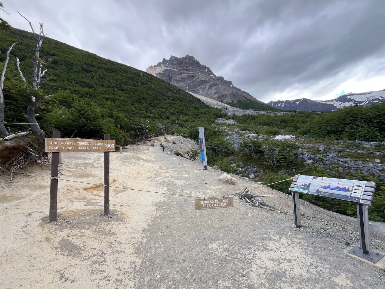
On our first full day in Torres del Paine we decided to start with two short hikes. We went to Condor Lookout and Cuernos Lookout with Salta waterfalls.Here is a write up on Condor and Cuernos hikes.
The next day we decided to tackle the 20km Torres base lookout hike. It was the hardest hike we ever did (we are not exactly hikers to be honest) but it was really rewarding.Here is more on Torres base hike.
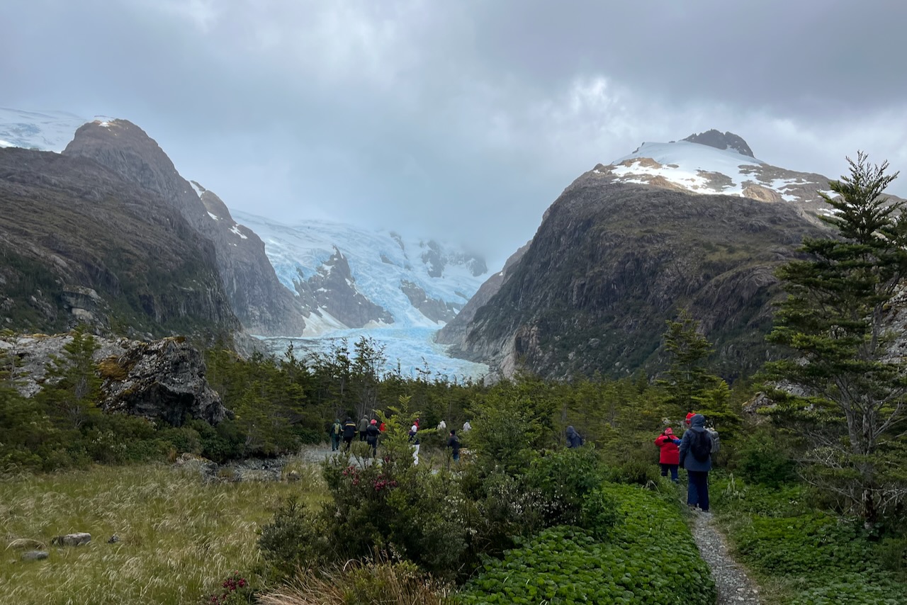
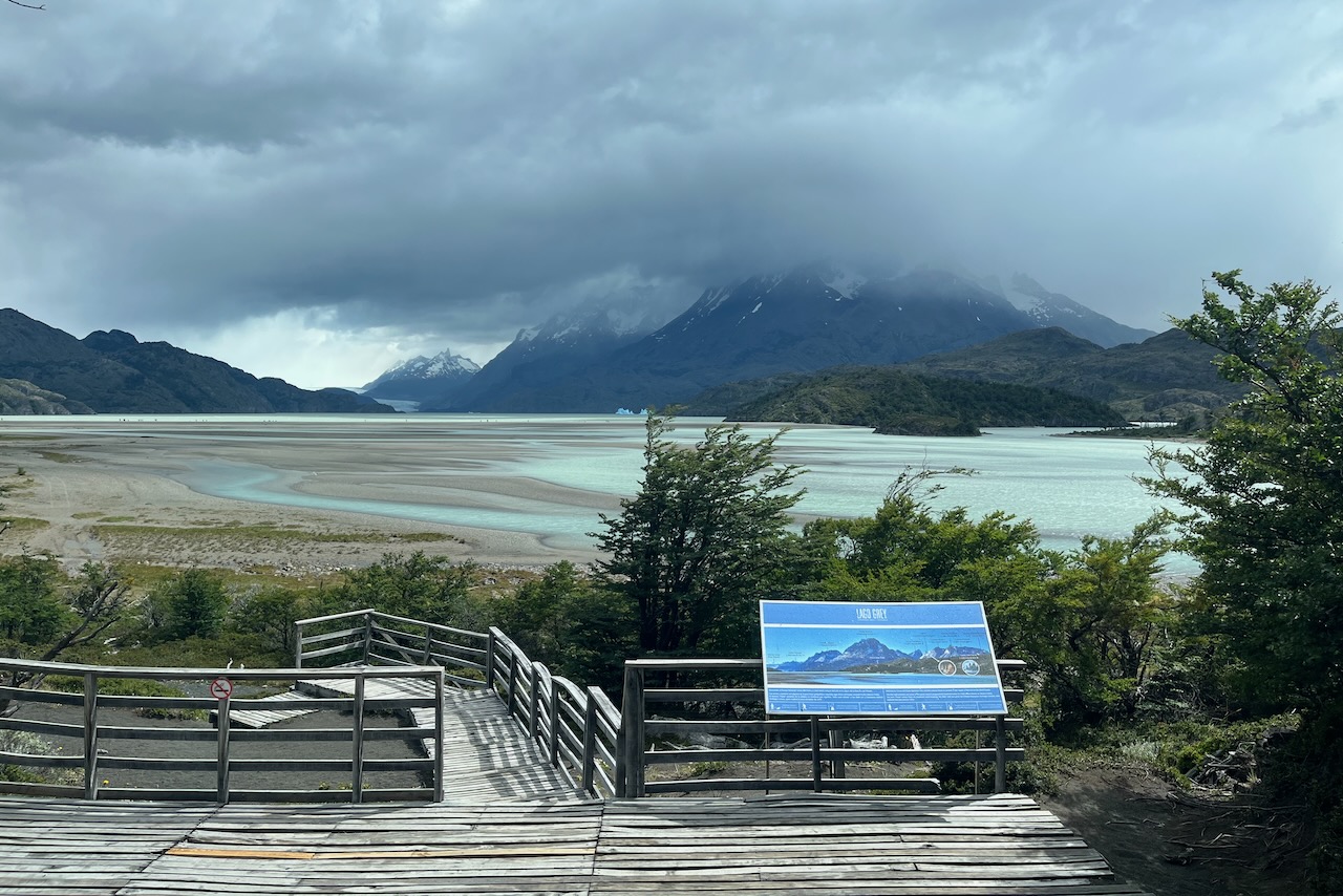
After Torres base we needed a recover so on the third day we headed to Lago Grey hotel and took a boat ride to see Glacier Grey. Here is more on Glacier Grey trip.
On the last full day and still suffering from the consequences of our big hike (resulted in a bit of a knee problem), we went for a drive around the park and to Laguna Azul (Blue lagoon) in search of wild life. We saw many guanacos and birds and even a puma! More on our Rio Serrano to Laguna Azul drive and wildlife here.
After 4 full days it was time to head to the next adventure. We got up early and headed one last time through the Torres del Paine National Park to Ruta 9, Puerto Natales and on to Argentina border.
View back on Torres del Paine massif from outside of the park heading to Ruta 9, Chile
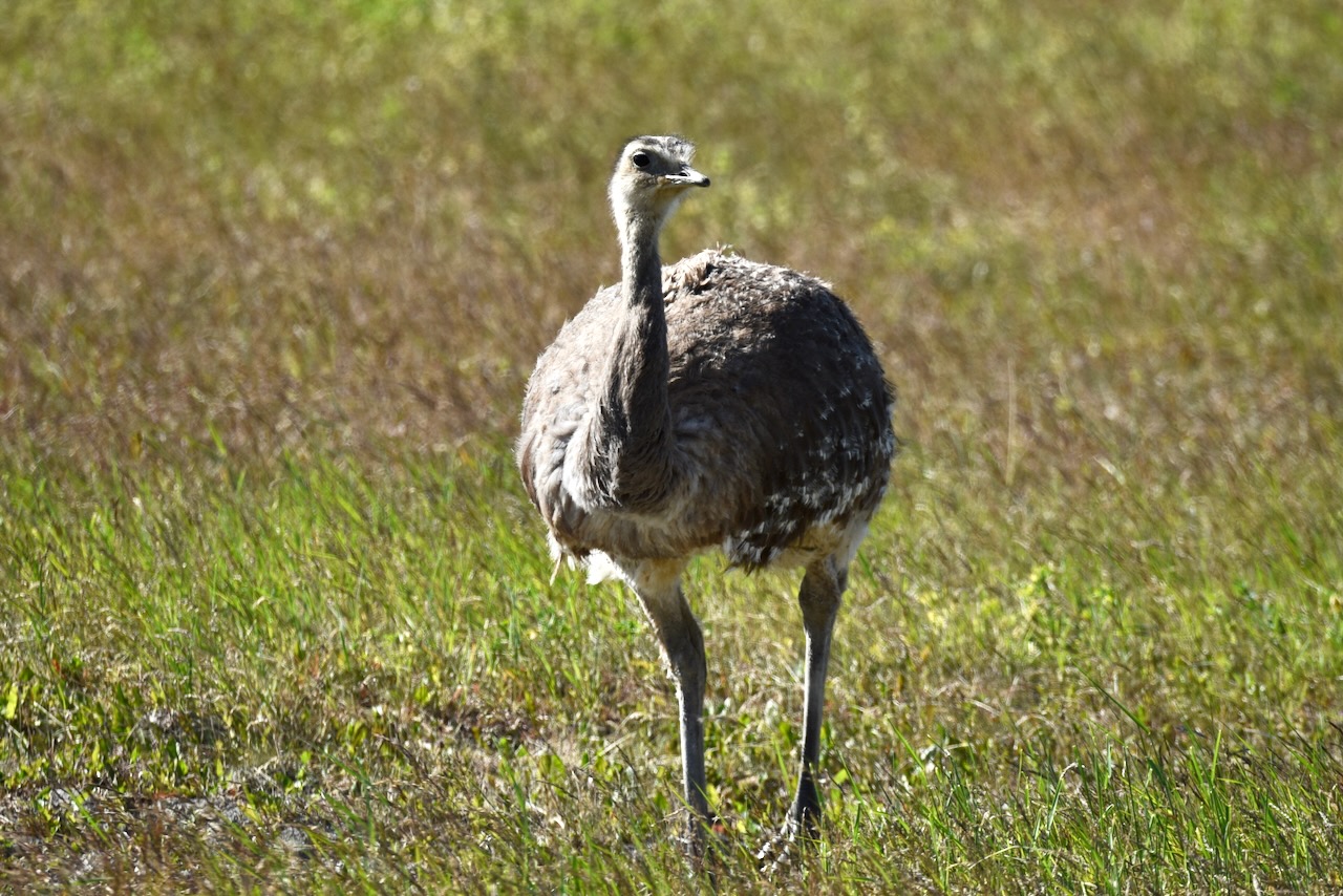
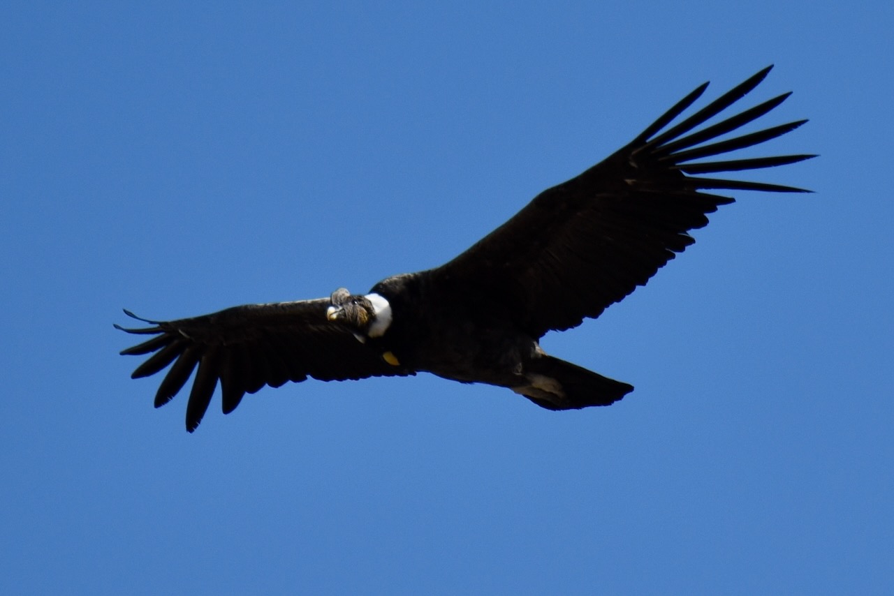
The drive along Ruta 9 is not as scenic, we felt, as the one we took into the park towards Rio Serrano but it was definitely faster and with new to us beautiful views. We saw cattle, condors (in the distance) and vultures, and even a rhea – South American relative of ostrich and emu.
Rhea, en route from Torres del Paine to Puerto NatalesApproaching Puerto Natales and Almirante Montt Gulf, Chile
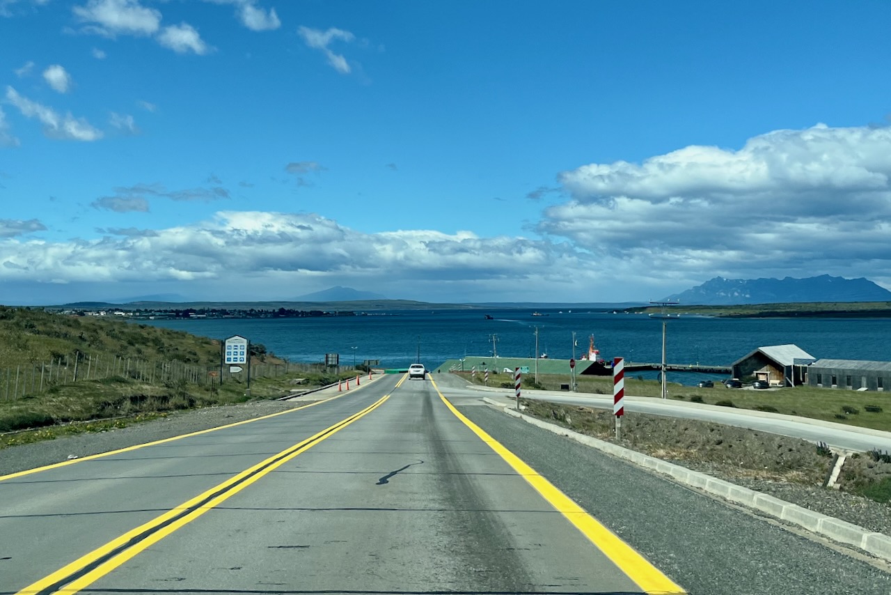
We left hotel in Torres del Paine in Rio Serrano at 8 in the morning and made it to Puerto Natales by 11am. We fueled up and continued driving, leaving the stay in Puerto Natales till later when we come back from Argentina and go on our fjords exploration navigation.
In the morning of our fourth and last full day in Torres del Paine we decided to drive around to the other side of the park to Laguna Azul and search for wild life on the way. The sun was shining the clouds were mostly high. We started from Rio Serrano and as we drove by, we admired Cuernos and Cerro Grande which we hiked before, and headed further into the park. The views over Paine river near Amarga gate were beautiful and we could clearly see Torres in the back.
Rio Paine and Torres view near Laguna Amarga entrance, Torres del Paine, Chile
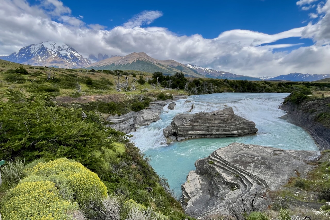
Further along on our way towards Laguna Azul we stopped at Paine river waterfalls. A spectacularly beautiful waterfall with lots of water and torres view in the distance.
Rio Paine waterfall, Torres del Paine, Chile
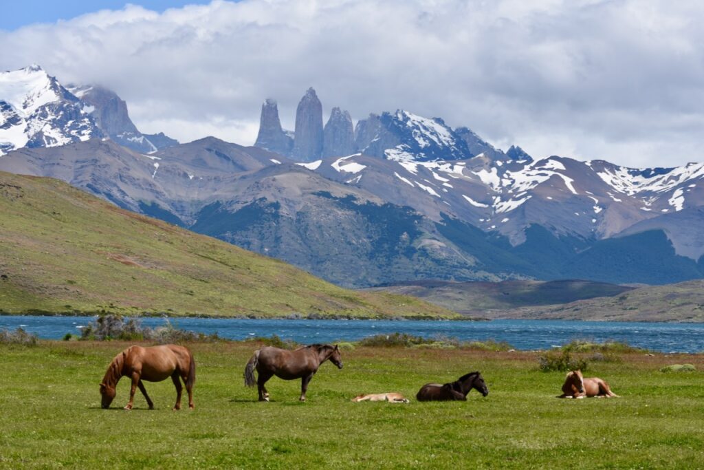
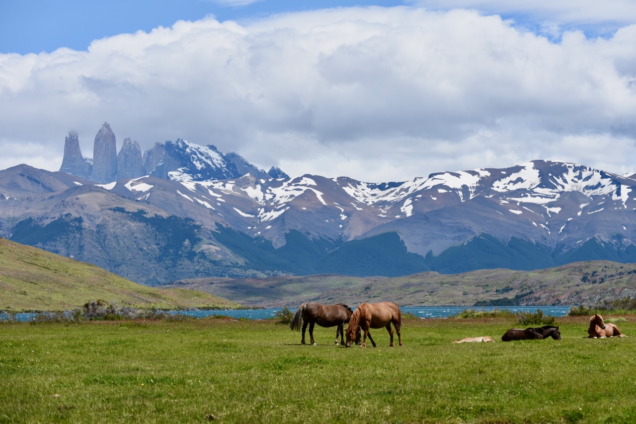
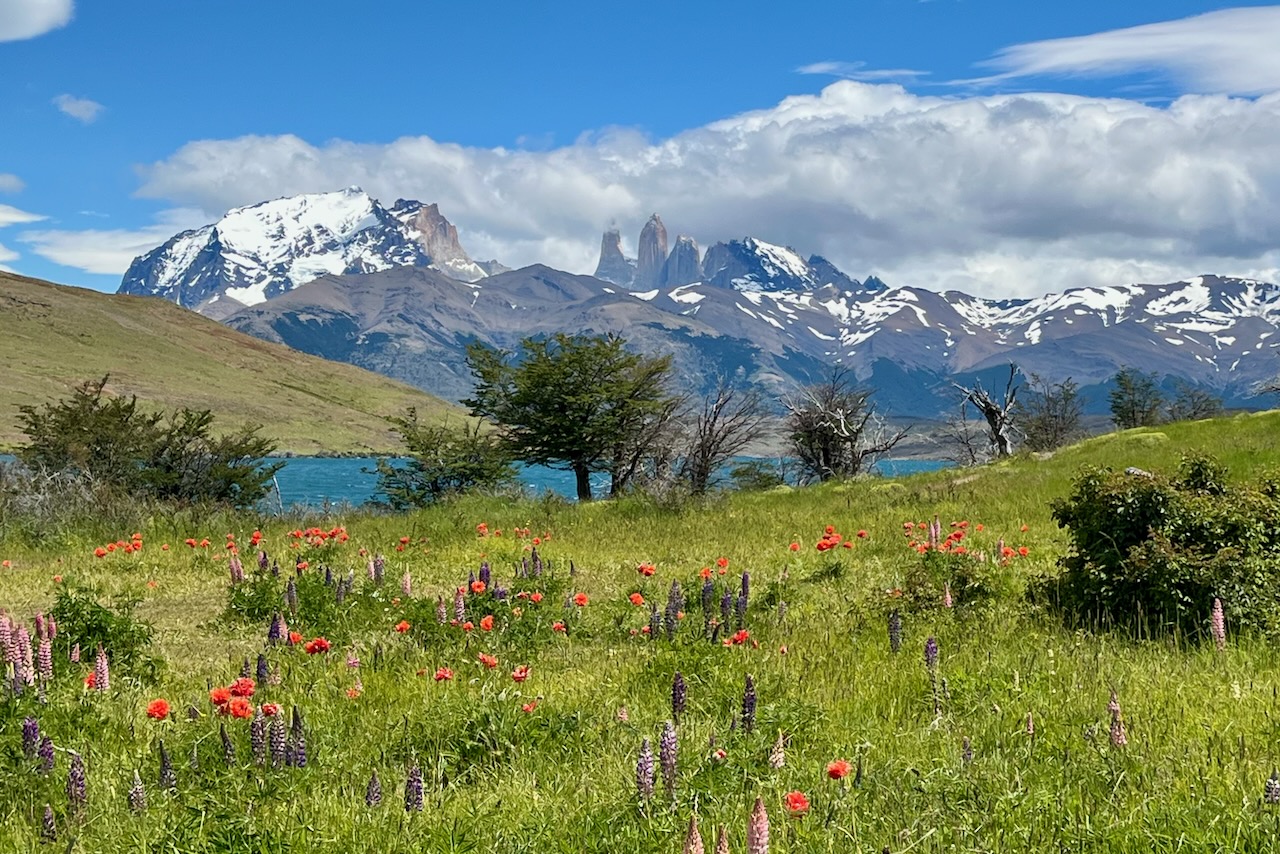
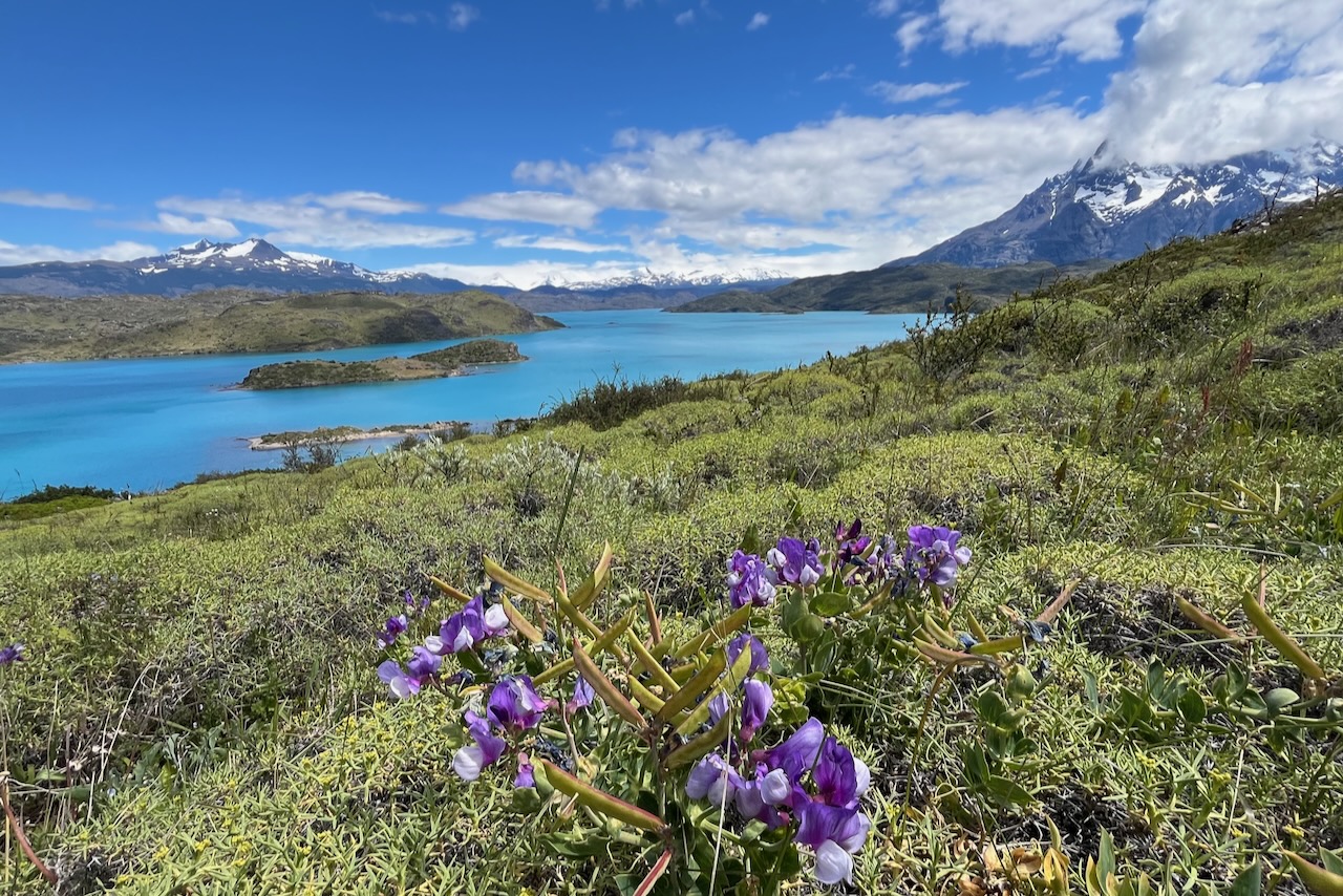
When we reached Laguna Azul we had a beautiful view of the mountains and lagoon and even horses. We drove over to the parking lot (there is a trailhead here too) and had our little lunch picnic with stunning views and surrounded by flowers.
Laguna Azul, hortses, Torres del Paine massif, Torres del Paine, ChileLaguna Azul, flowers, and Torres del Paine massif, Torres del Paine, Chile
We thought we would also hike around the lagoon a little but by the time we got their it was a bit too late to start. It took us a few hours to get to Laguna Azul because of all the wild life we were stopping to watch and take pictures of. Which was a good thing.
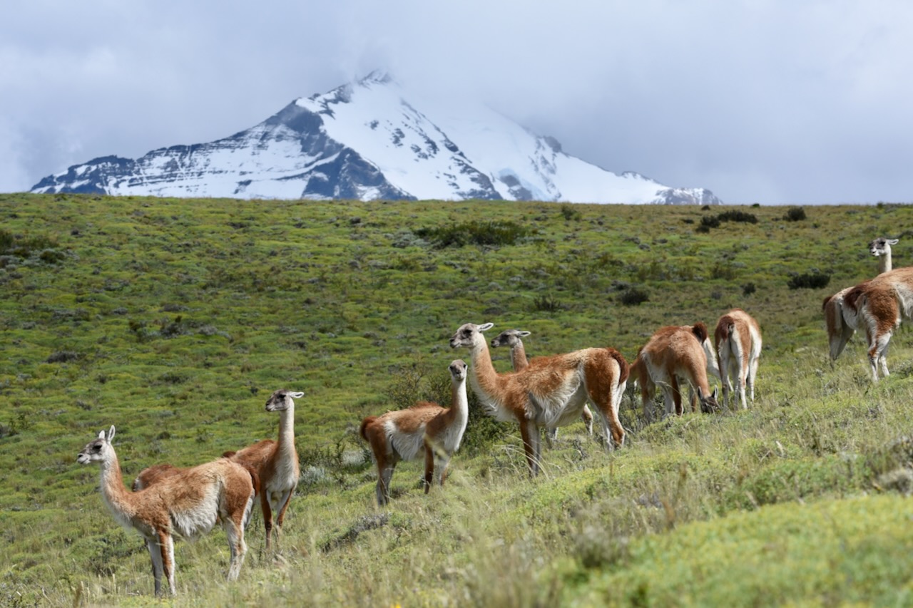
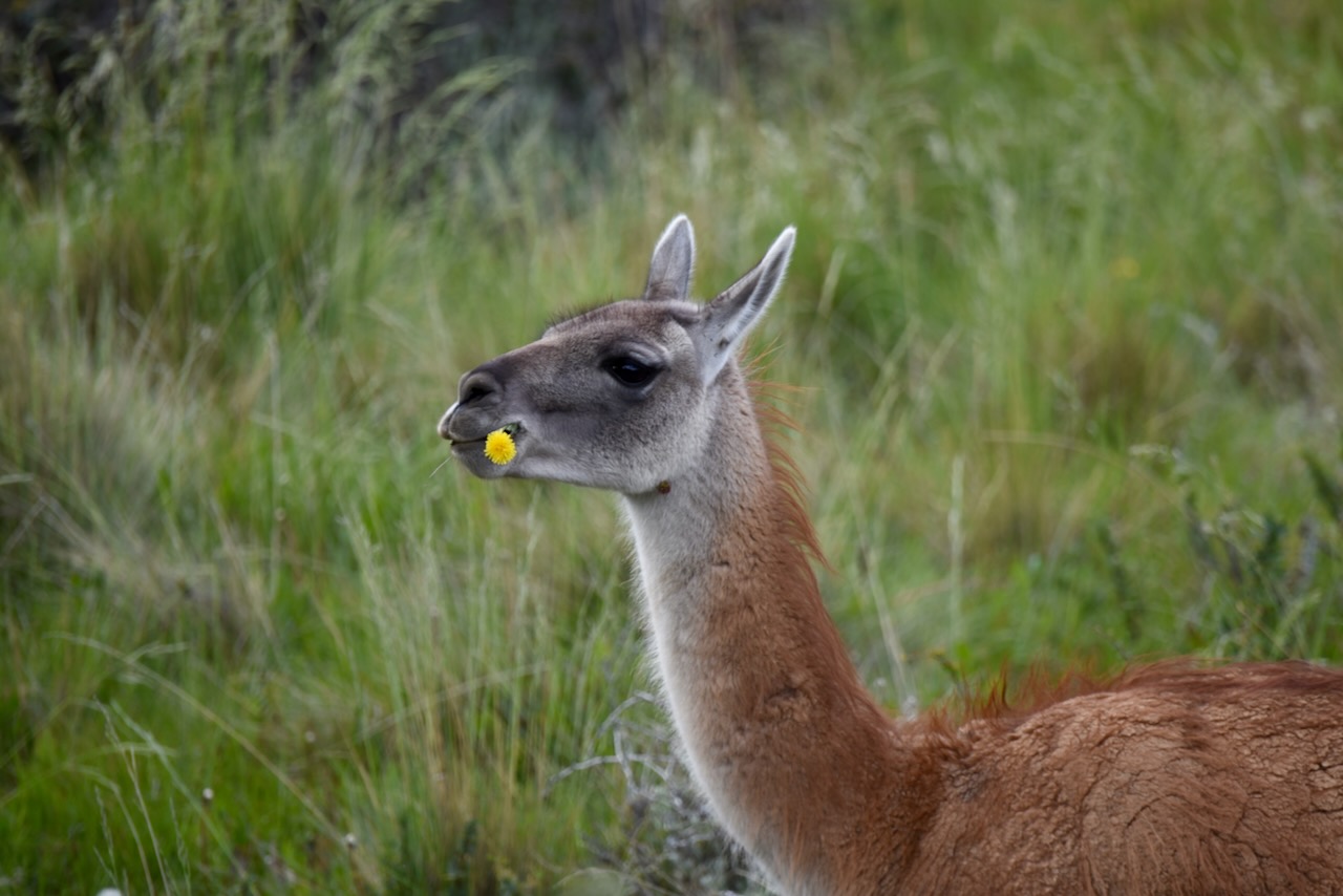
Guanacos and Torres del Paine mountains in the background, Torres del Paine, Chile
We saw many guanacos. Guanacos crossing the road, guanacos eating, guanacos alone and in big groups, guanacos chasing each other, guanacos watching out for puma. Many guanacos.
Guanaco eating flowers, Torres del Paine, Chile
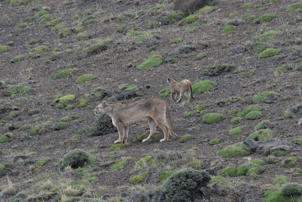
As we were driving a couple km past Mirador Lago Nordenskjold we saw several cars stopped on the side of the road and watching something with the scopes. It turned out there was a puma in the area. We also stopped and joined the watching. We saw a puma with a cub! They were in the distance and according to the guides the mother puma was hunting so everyone was hoping to see that. But there were no guanacos around. Then mother puma with the cub started walking. We tried our best to get a good picture but it was hard as they were really far. Regardless, it was so exciting to see a puma. We did not expect to see one. We though it would be a difficult thing to do – them being so elusive and all. But there they were!
Puma and a cub, Torres del Paine, Chile
We later learned from another guide that this puma’s name was Rupestre (she was a very famous puma) and she had 3 cubs. They had not seen her for a while and the fact that it was only one cub on the day we saw them was worrisome. Male pumas sometimes kill cubs that are not theirs because they want to mate with a female puma and dont want competition for territory from others. Does not seem like a very good specie survival strategy but thats the way pumas roll apparently.
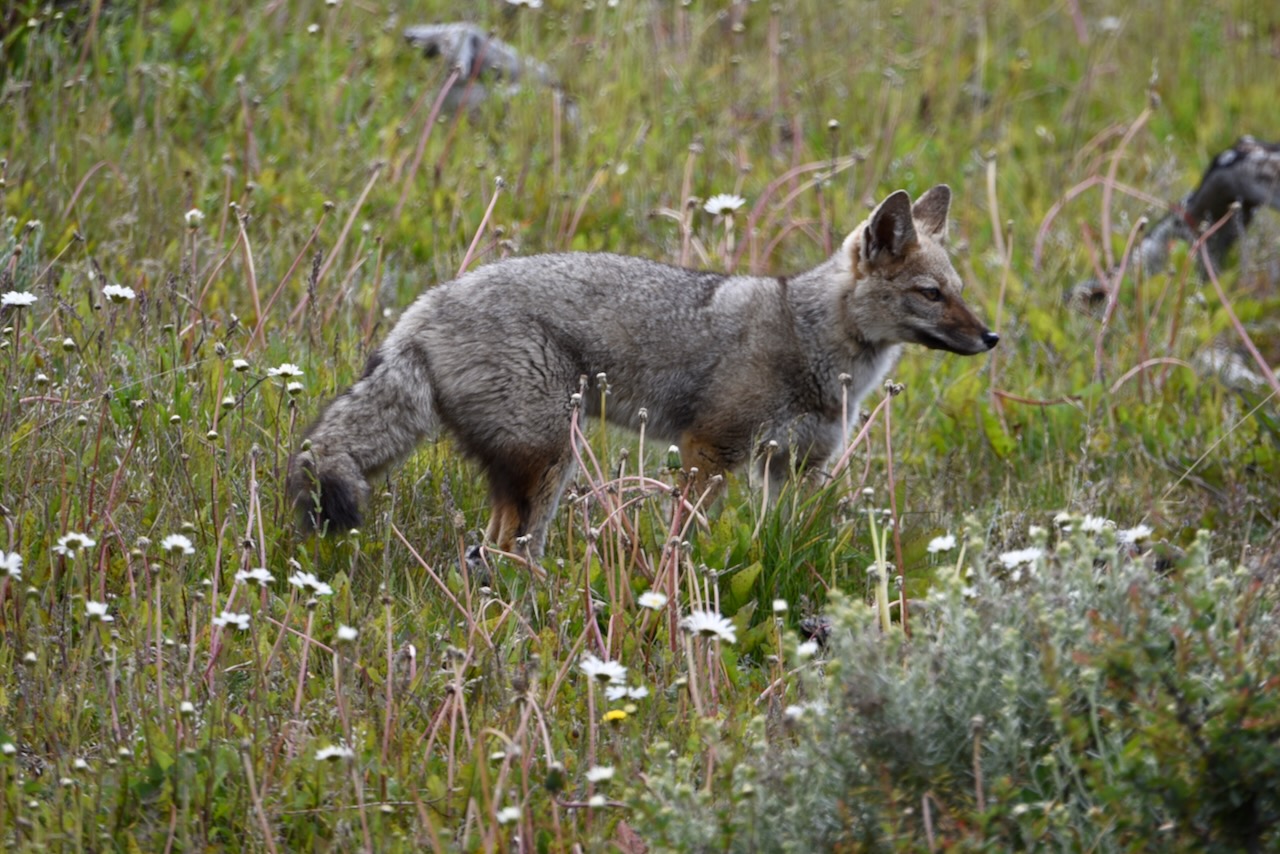
Southern grey fox, Torres del Paine, Chile
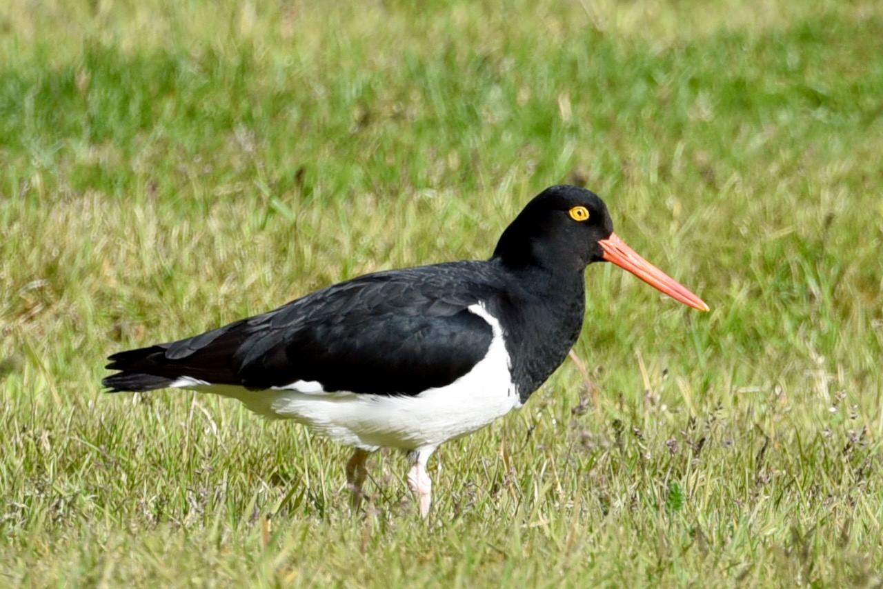
As we were driving around we also saw a few foxes. And many birds.
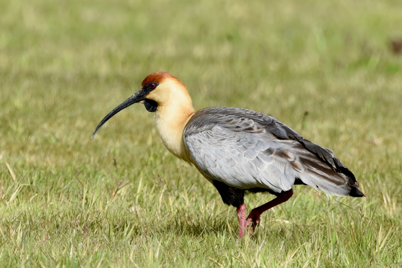
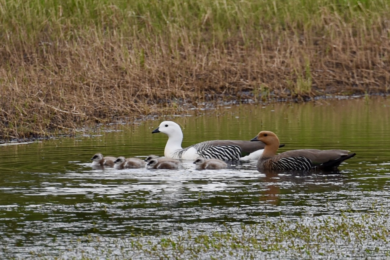
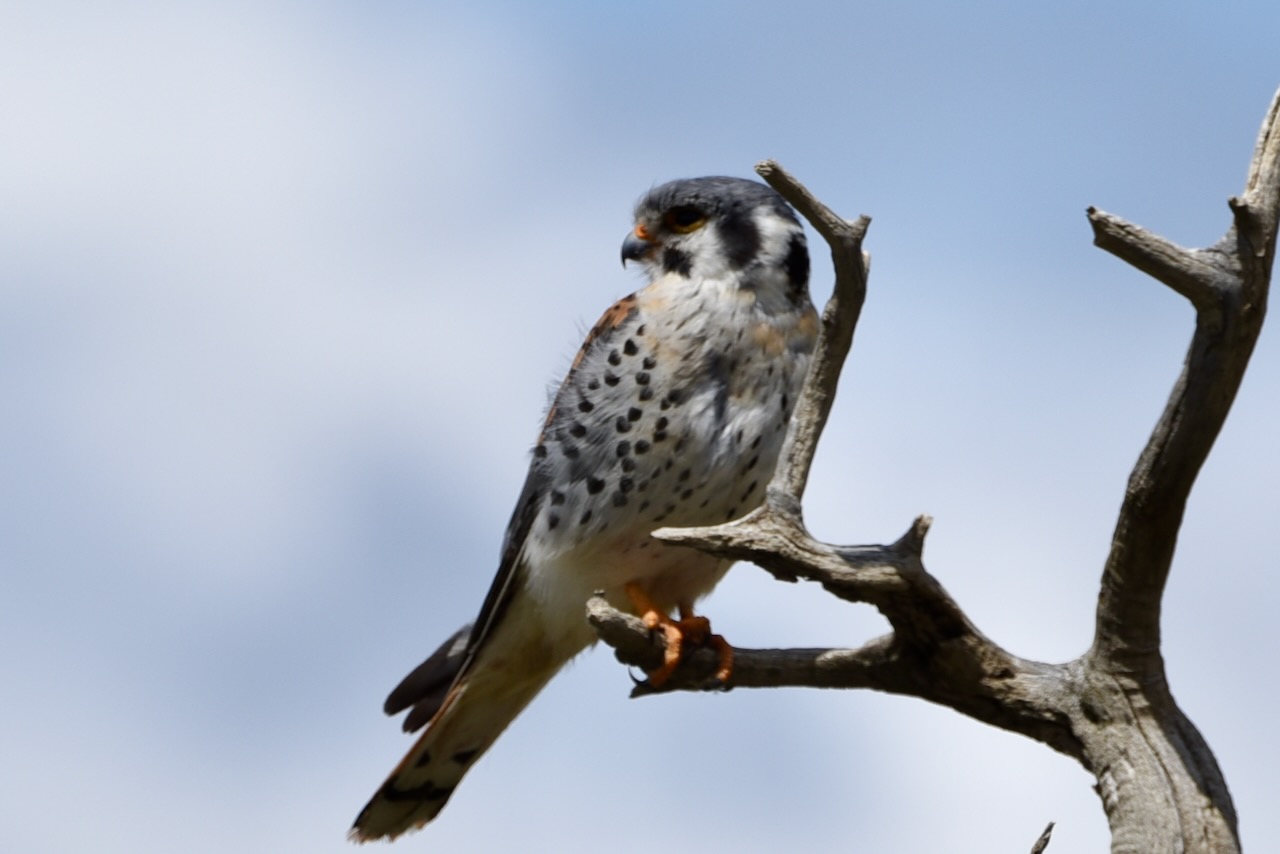
Magellanic oystercatcher, Torres del Paine, ChileBlack faced ibis, Torres del Paine, ChileUpland geese with chicks, Torres del Paine, ChileAmerican kestrel, Torres del Paine, Chile
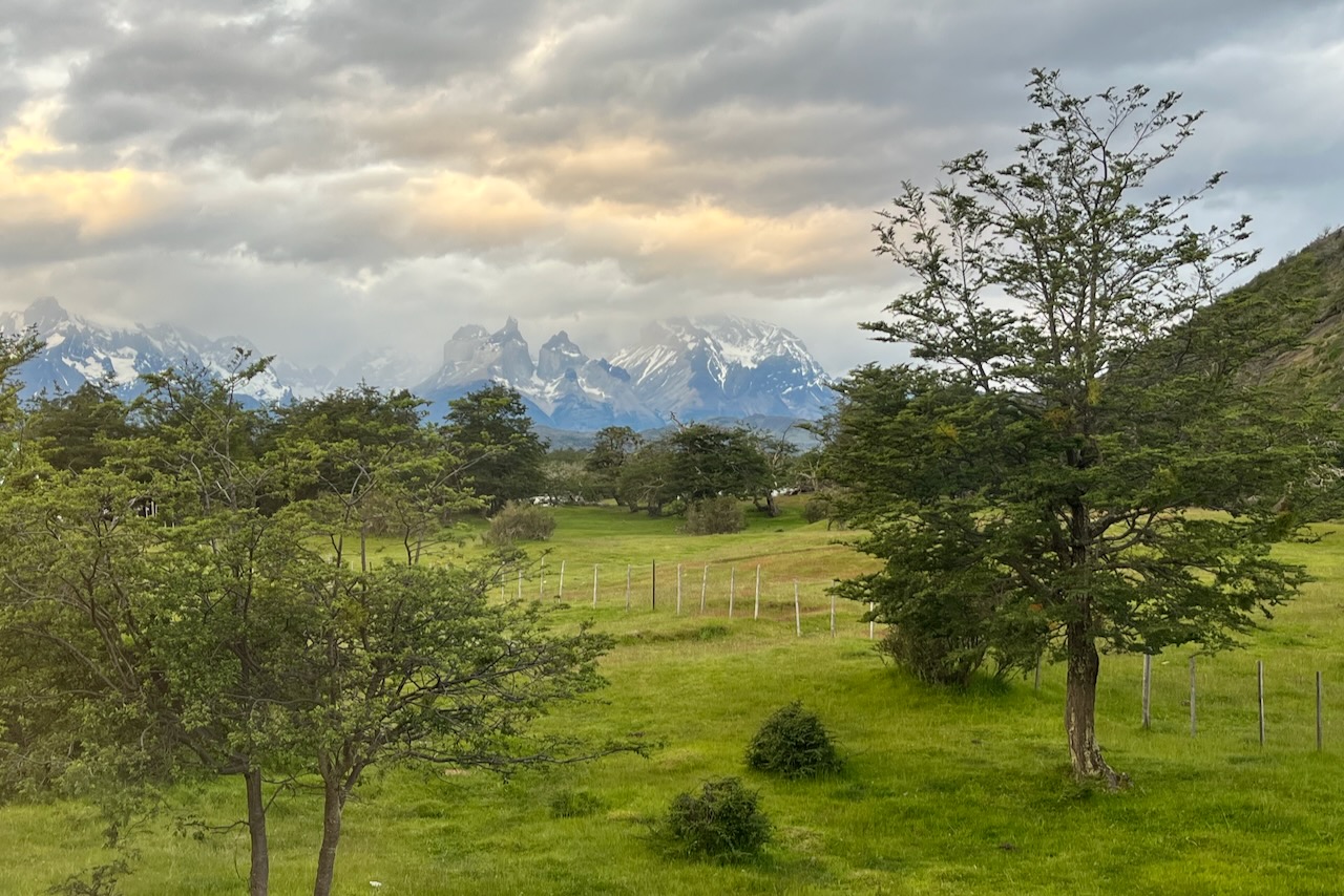
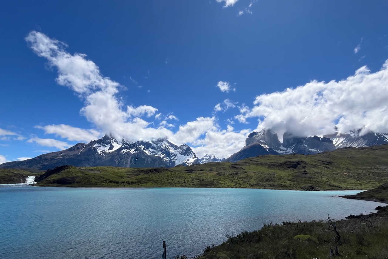
As we were heading back to our hotel in Rio Serrano clouds were building over Cerro Grande, it must have been snowing up there.
Torres del Paine driving from Amarga gate to Rio Serrano, Torres del Paine, ChileCerro Paine Grande with clouds close up, Torres del Paine, Chile
And then we settled in our very nice Hotel Del Paine in Rio Serrano watching beautiful sunset on our last night in Torres del Paine, at list on this trip.
Cuernos view in Torres del Paine and cows, Torres del Paine, ChileSunset over Torres del Paine and Rio Serrano, Torres del Paine, Chile
The next day we left early in the morning for one more drive through the park, to Amarga gate and then on to Ruta 9, Puerto Natales and Argentina border. It was time to see Patagonia’s Argentine side.
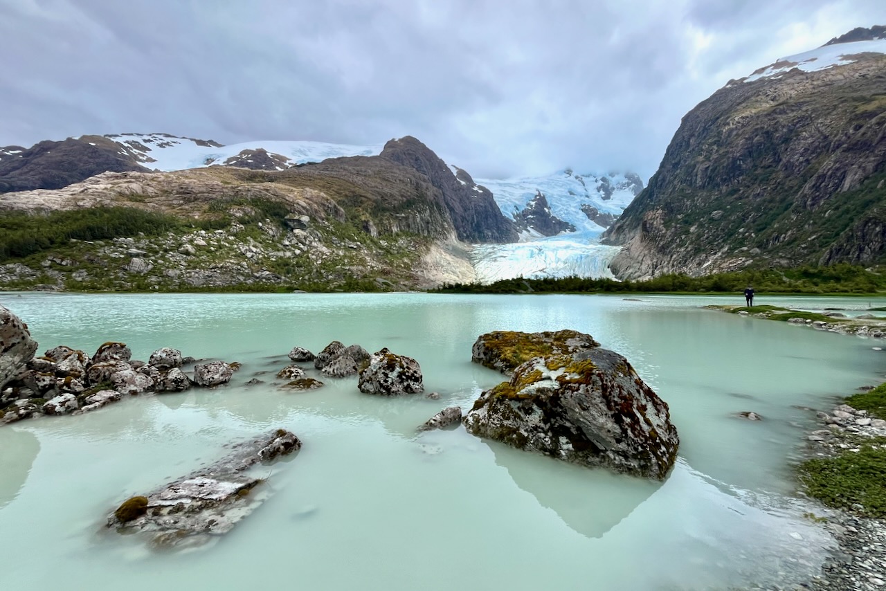
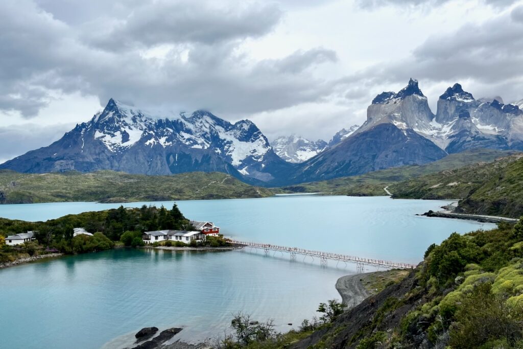
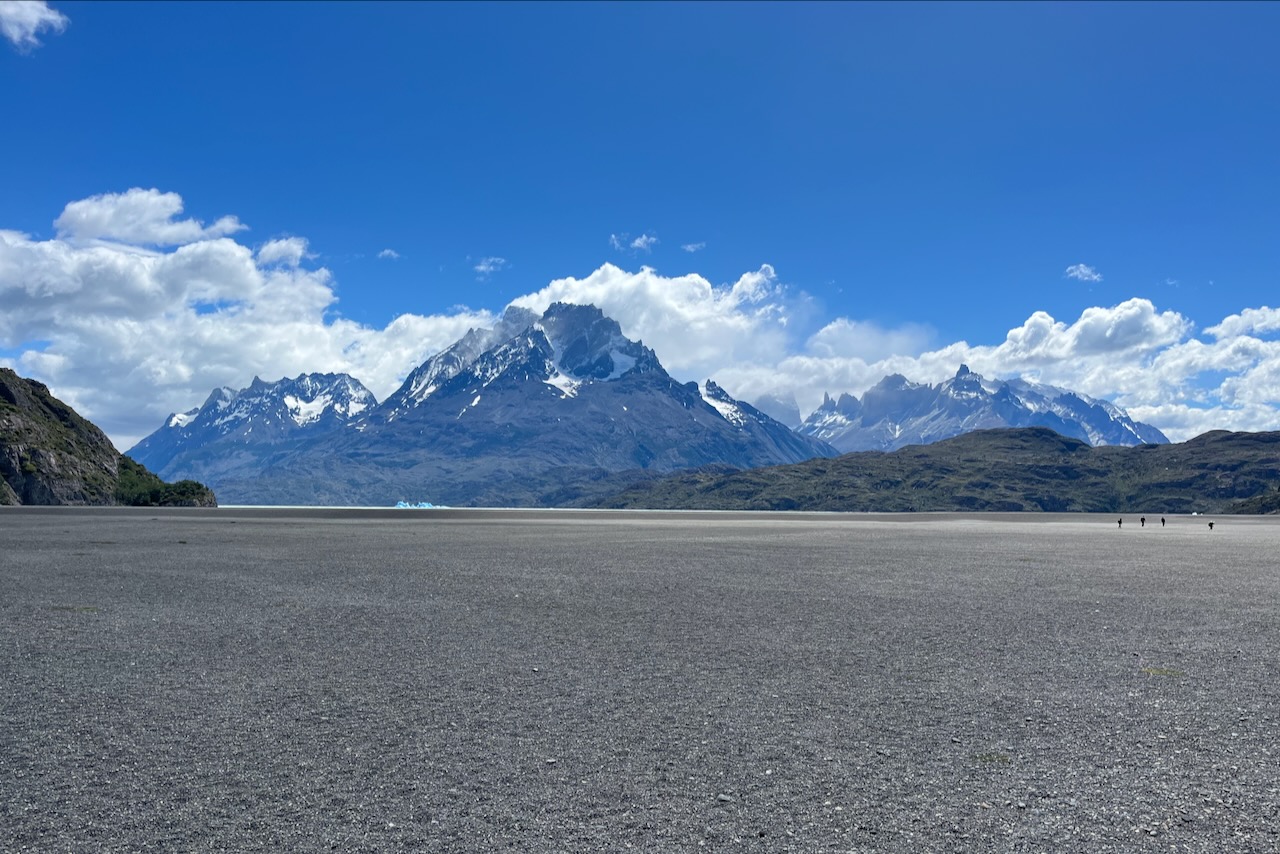
After our two days of hiking to Condor and Cuernos lookouts and full day 20km Torres base, it was time to let our legs rest a little bit. On our third day we headed to Lago Grey and its glacier. The boat tour is about 3 hours and departs from the beautiful Lago Grey hotel.
View of Torres del Paine mountains from Lago Grey hotel, Chile
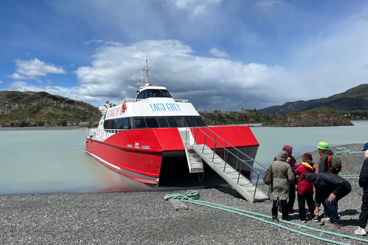
Lago Grey hotel was a short half an hour drive from Rio Serrano where we stayed. We were able to buy tickets right there at the hotel and then had a nice beverage in the beautiful hotel lobby bar. It has huge wall sized windows overlooking Torres del Paine and the lake. Boat embarkation is about 30min walk from the hotel across flat gravel (lake stones?) surface.
View to Torres del Paine massif on the way to embarking a boat for Lago Grey navigation, ChileBoat for Lago Grey navigation, Torres del Paine, Chile
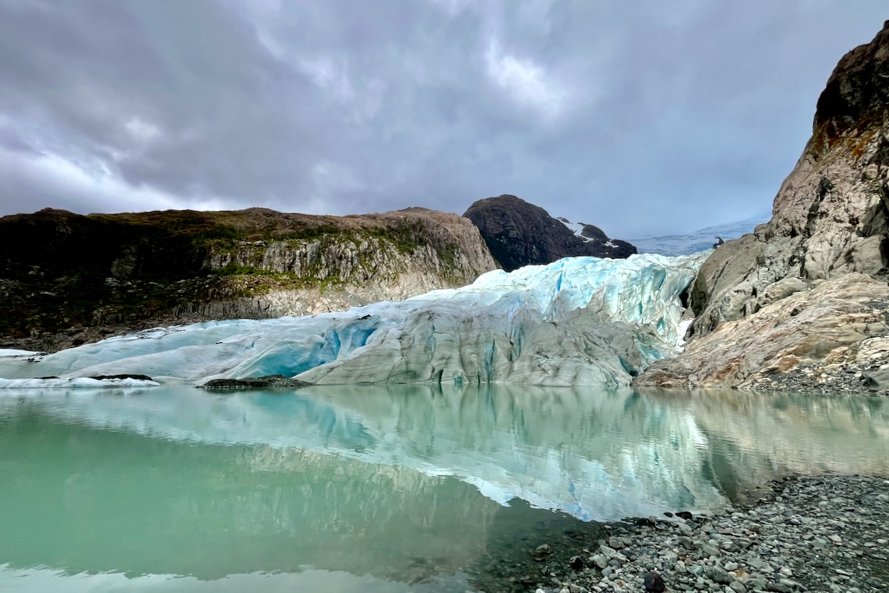
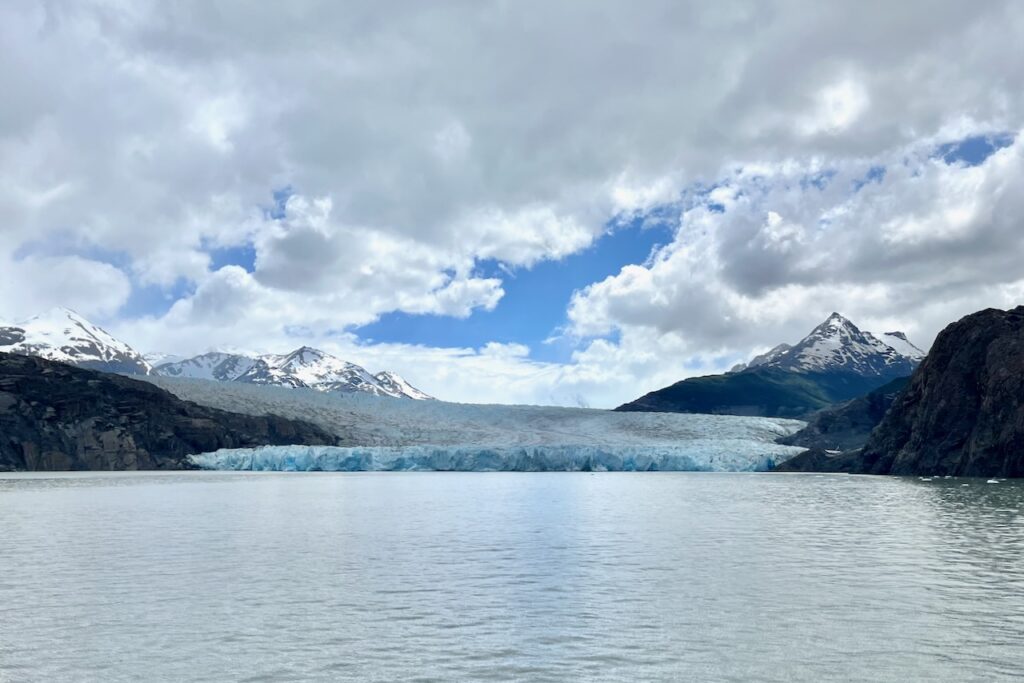
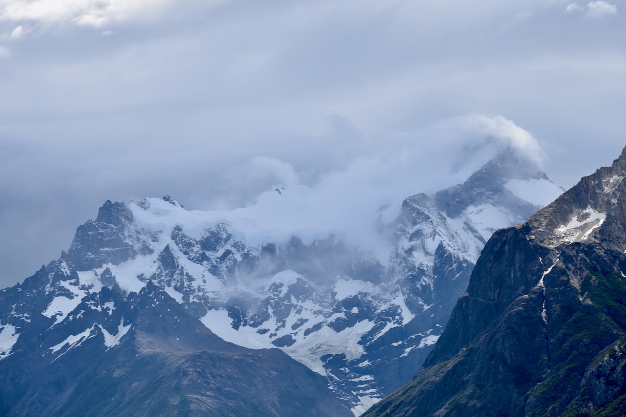
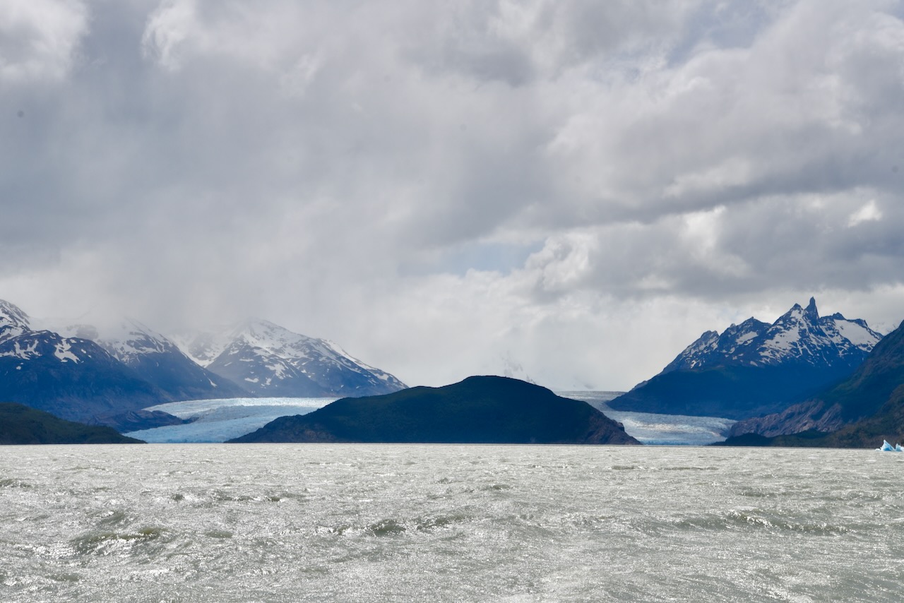
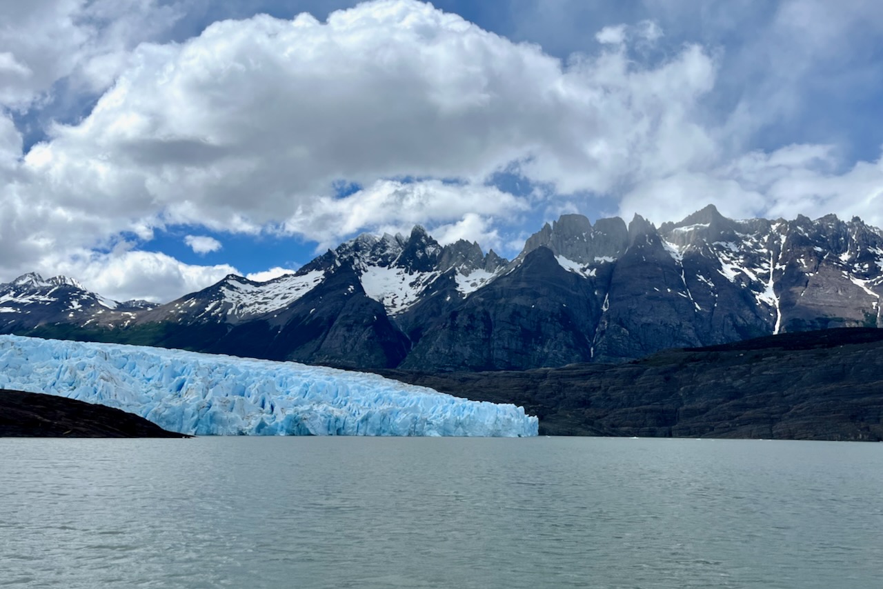
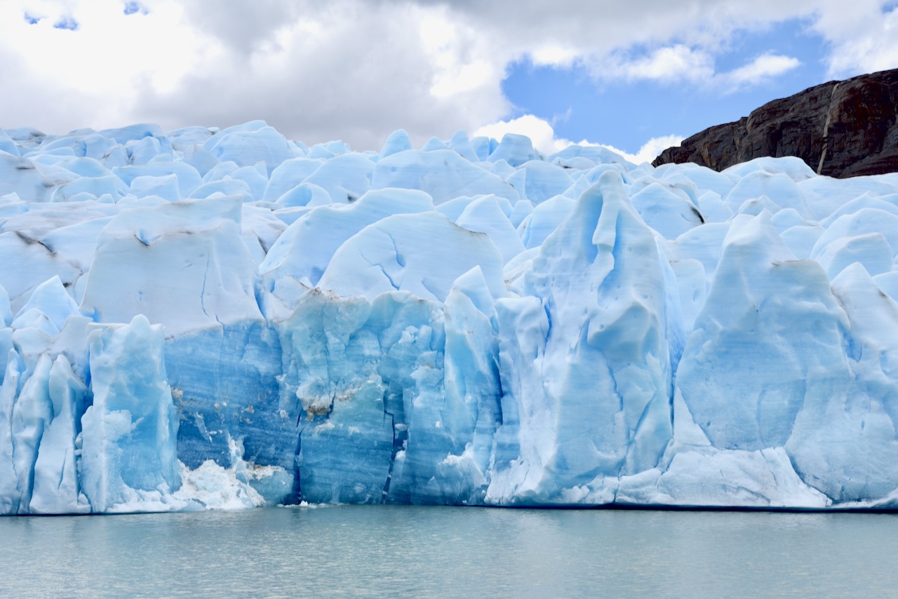
This was the first glacier that we ever saw up close and we were duly impressed. Glacier Grey is 6km wide and 30m tall. In December when we were there we only saw a couple of small icebergs or floating ice pieces close to shore. We also had a pretty solid cloud cover and could not get those beautiful photos of sun reflecting from the ice. But it was still a majestic site and one did not have to hike! We thought it was a great start as we had many more glaciers ahead of us on the upcoming cruise around fjords in Chile and Perito Moreno in Argentina.
View of Glacier Grey, Torres del Paine, ChileView of Glacier Grey, Torres del Paine, ChileClose up view of Glacier Grey, Torres del Paine, Chile
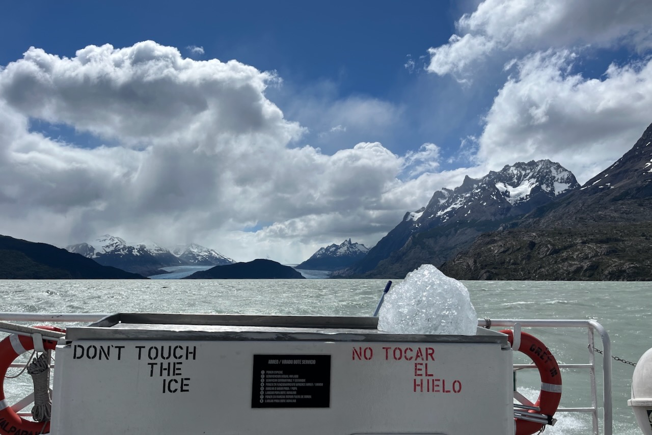
The cruise includes a pisco sour (or non-alcoholic beverage if one wishes) served with glacier ice. It is quite impressive to think that one drinks beverage part of which was frozen for thousands of years.
Glacier Grey and its ice for drinking, Torres del Paine, Chile
After the cruise we headed back to our hotel in time for excellent dinner and beautiful sunset views.
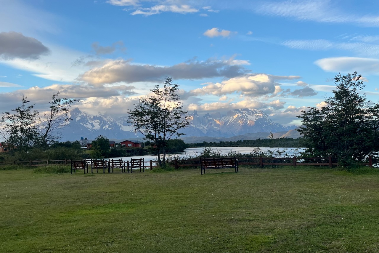
Sunset at Hotel del Paine, Torres del Paine, Chile
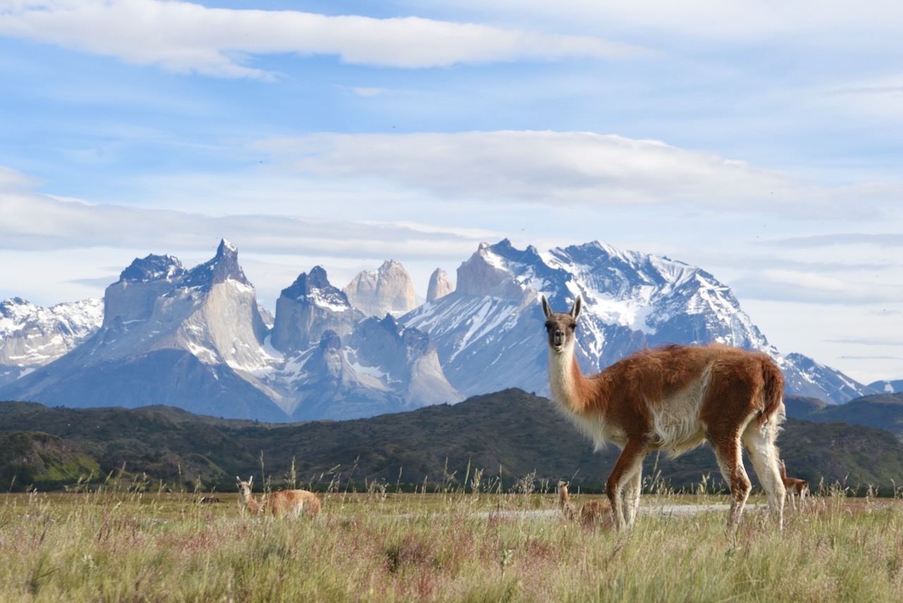
On our second day in Torres del Paine we headed out early to do the Torres base hike. The trailhead for this hike is on the other side of the park closer to the Laguna Amarga entrance gate. As we passed our park entrance gate and were driving to the park we saw guanacos in good position for the pitcture with Torres del Paine.
Torres del Paine and guanacos, Chile
The weather was beautiful and no low clouds on the mountains so we ended up stopping fair bit to take photos as we drove across the park.
Cerro Paine Grande and cuernos Torres del paine range, Chile
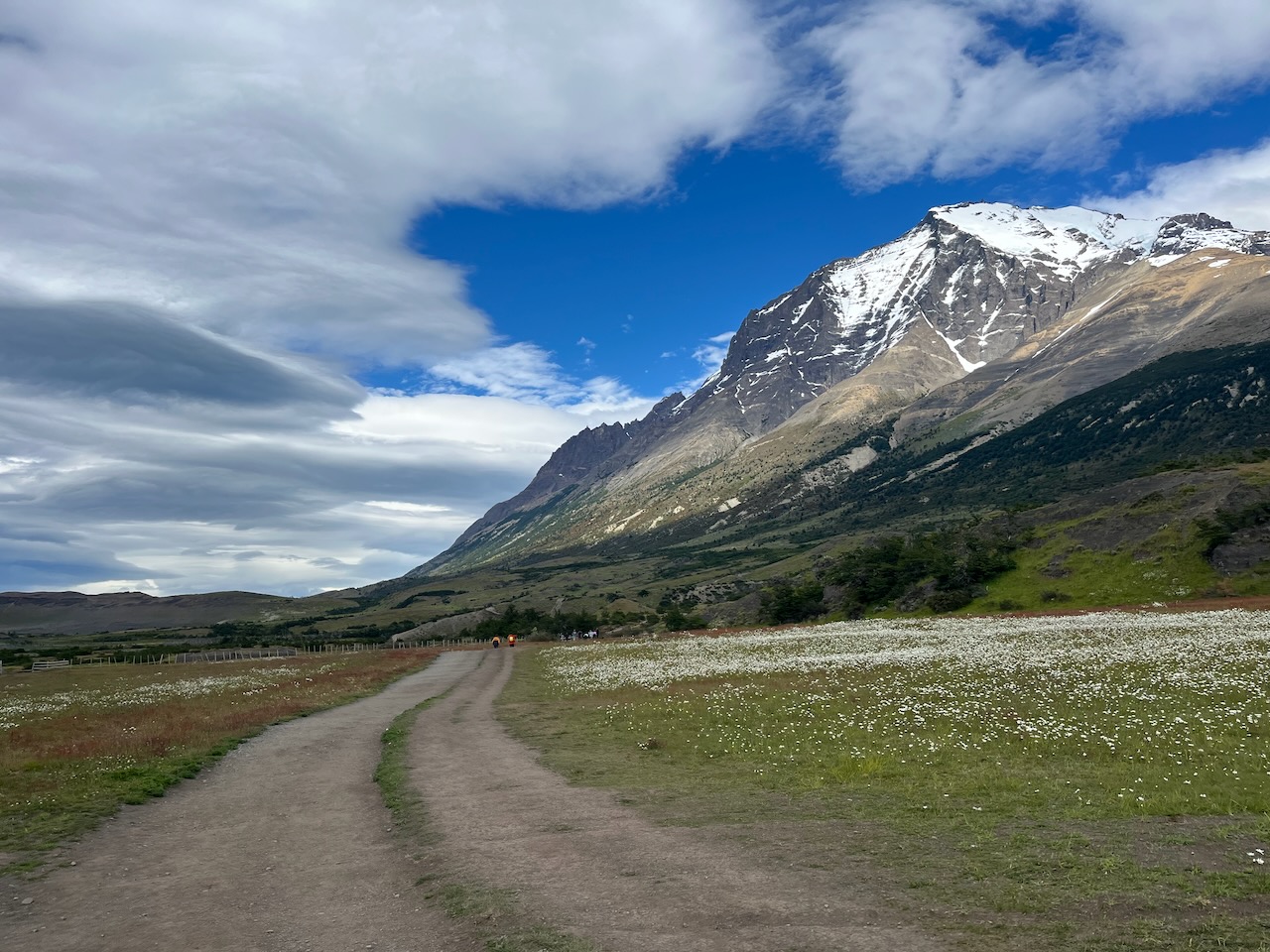
By the time we reached the parking lot and started hiking it was 10:30am. At the bottom it was all sunshine and flowers and plenty of blue in the sky. As we started making our way up, the clouds started building over the Torres.
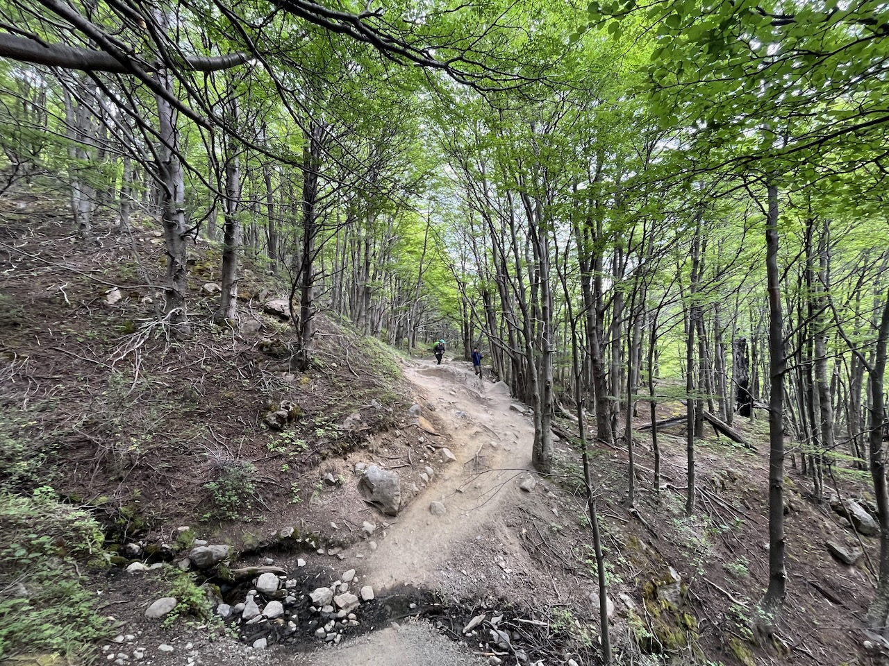
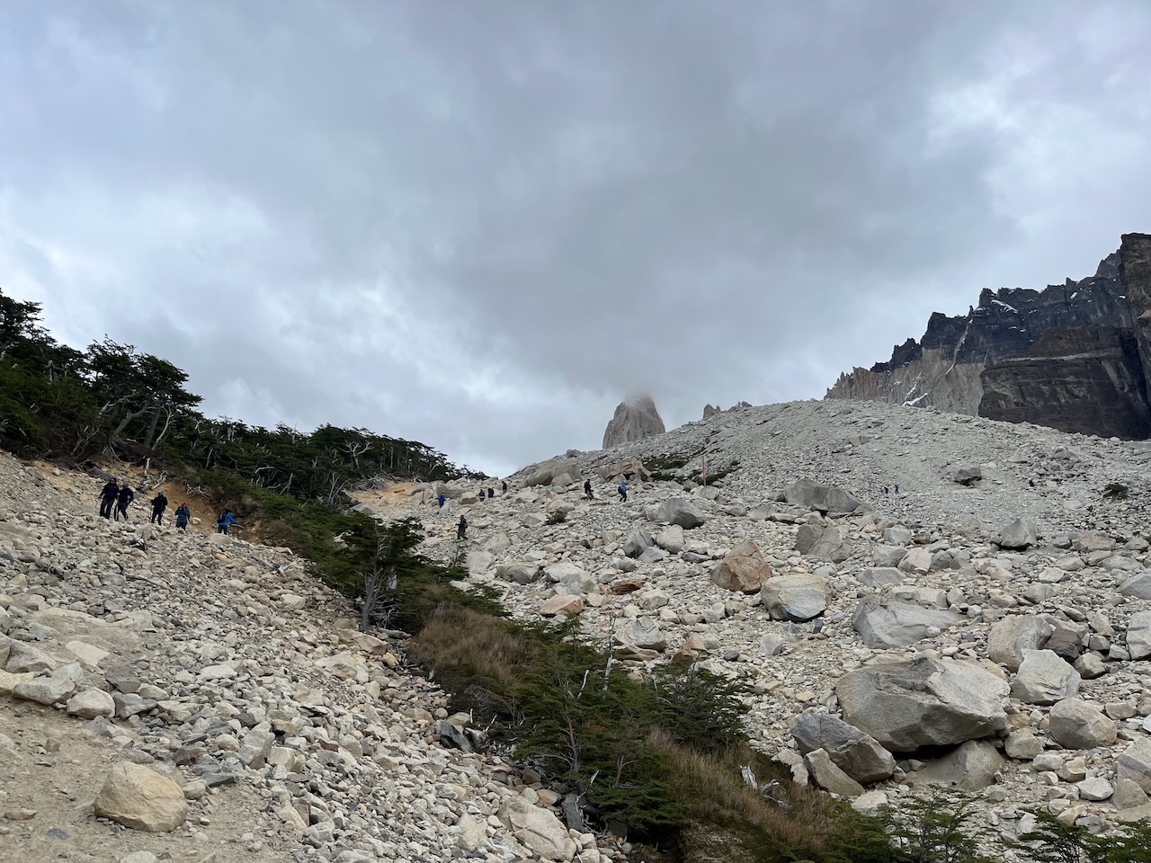
Start to the hike to Torres base lookout, Torres del Paine, ChileThe view of the Torres at the start of the hike to Torres base lookout, Torres del Paine, ChileWindy pass – and it was very windy on the Torres base hike, Torres del Paine, ChileTrail to Torres base lookout, Torres del Paine, ChileGaucho with a horse and Torres in the back with clouds, Torres del Paine, ChileScenery along the trail to Torres base, Torres del Paine, ChileRefugio Chileno and torres in the back covered in thick cloud, Torres del Paine, ChileScenery on the trail to Torres base lookout, Torres del Paine, Chile
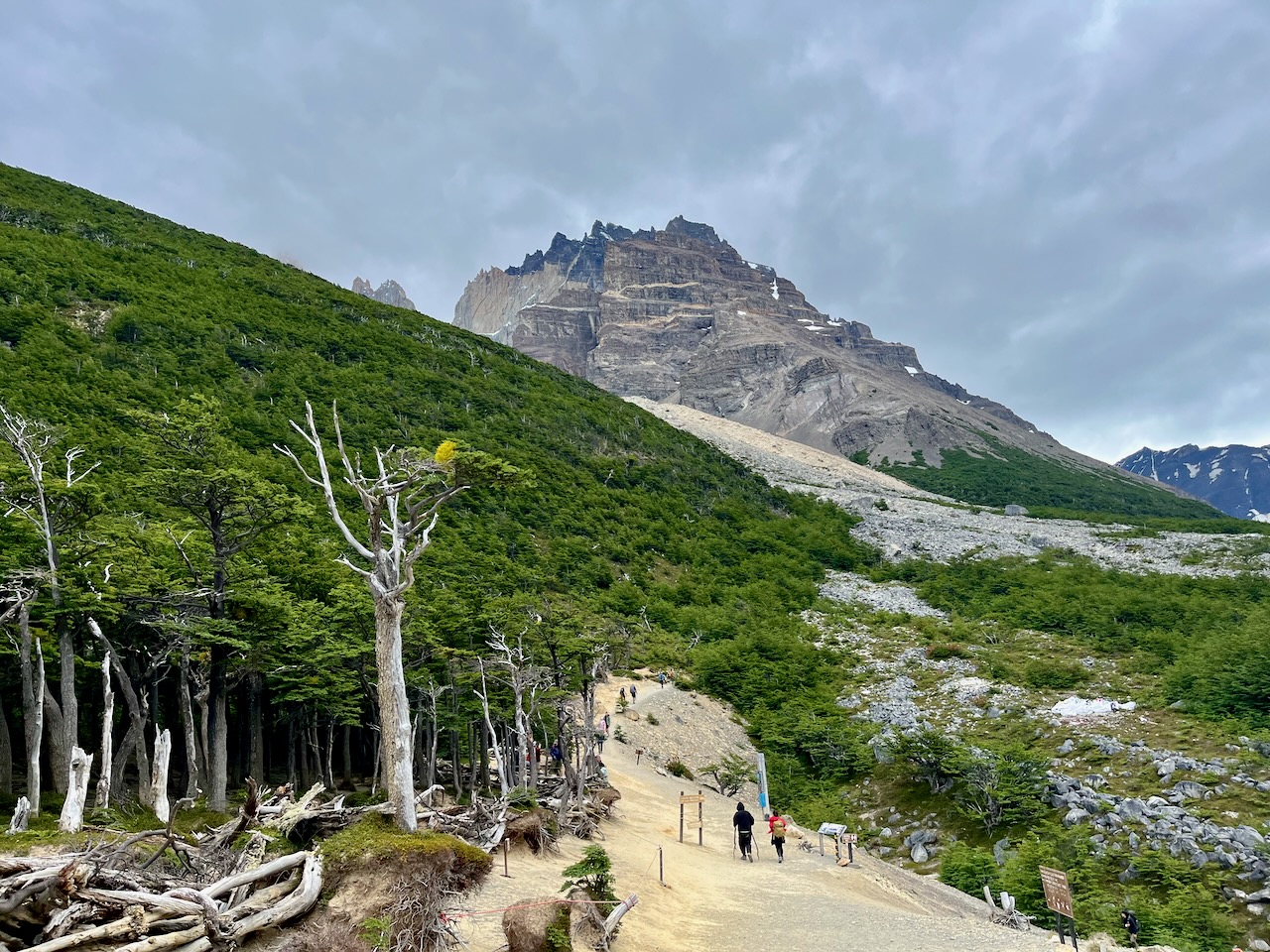
The entire trail is up and down there are no flat sections really except for the very start part near the parking lot. By 2pm we made it to the point where the very steep last part of the track starts. This is also the point where the trail gets closed at 3pm. We made it just in time and could proceed to the base despite our late start.
Start of the steep ascent section of the Torres base hike, Torres del Paine, ChileTorres peaking through the clouds, Torres lookout hike, Torres del Paine, ChileSteep ascent to Torres base lookout over rocks, Torres del Paine, Chile
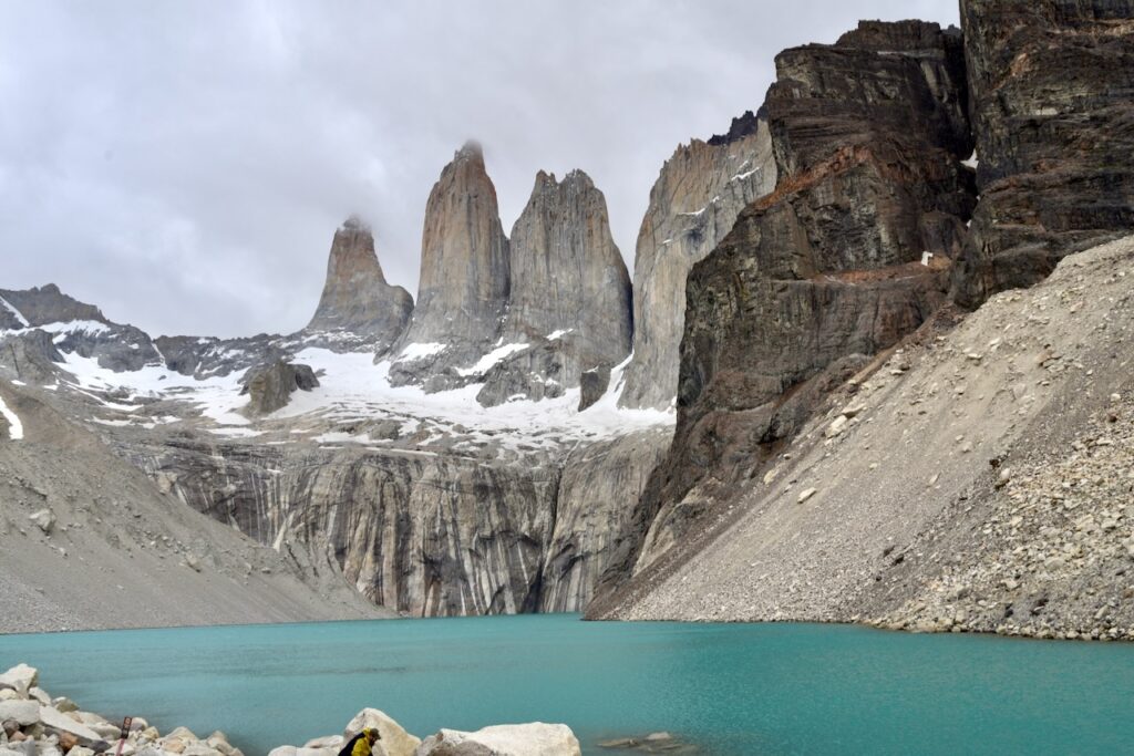
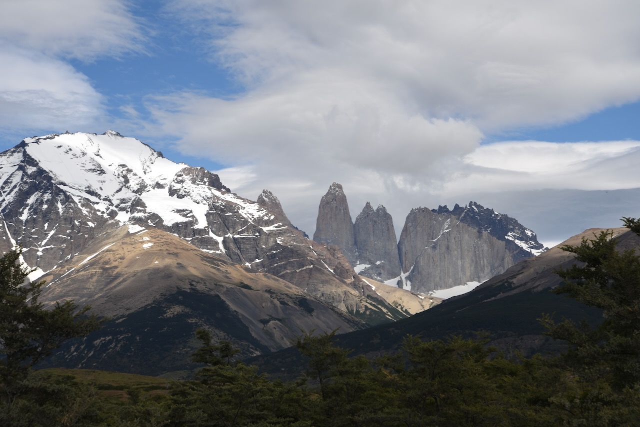
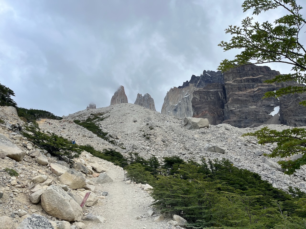
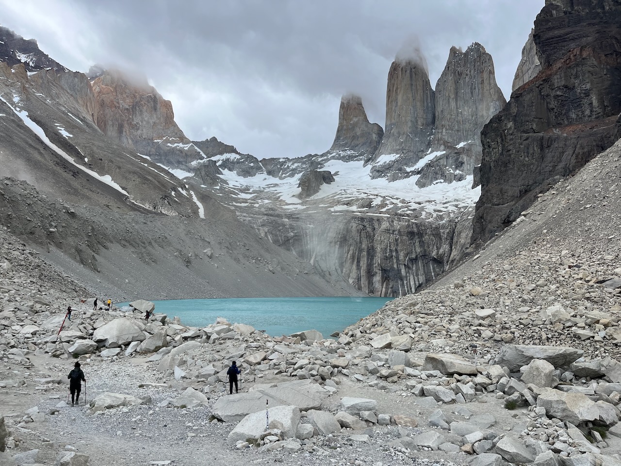
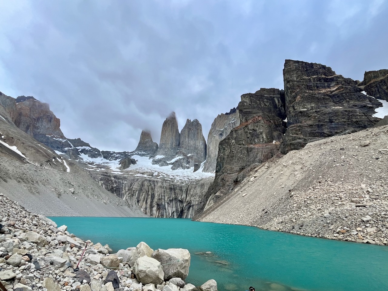
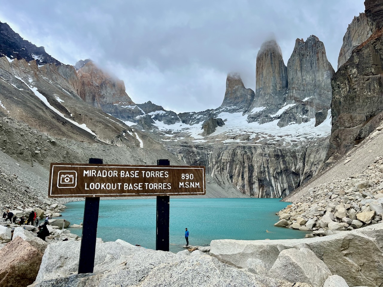
We were very happy when we finally made it to the top. It was very cold. There even was a tiny mix of rain or snow. But clouds cleared just enough for us to fully see torres. Spectacular site. We admired the view. Ate our sandwiches, got very cold and started heading back down. Descent was in some ways harder than ascent, very punishing on the knees even though we used sticks.
Torres base lookout and lagoon, Torres del Paine, ChileTorres base and lagoon view, Torres del Paine, ChileTorres base sign and clouds coming back in to cover torres, Torres del Paine, Chile
By the time we got back to the checkpoint torres were fully covered by clouds and the mountain was closed as it was past 3pm.
Trail to Torres base lookout closes at 3pm, Torres del Paine, Chile
By the time we made it back to the parking lot it was past 8pm. A very long day. We had a celebratory Patagonia beer from the souvenir shop and started heading back to the lodge. The views were beautiful all along the way again. We were super tired, we missed the dinner, and legs hurt a lot but we were also very happy we made it to the top and that clouds parted and we were able to see torres and the lagoon.
Road through Torres del Paine park at sunset, Chile
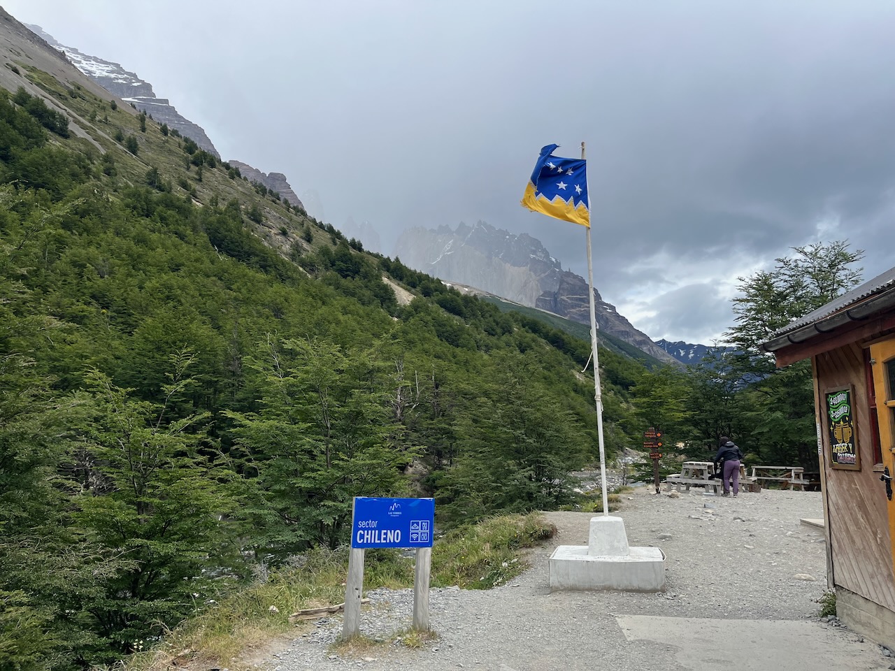
In the morning we had a great breakfast at our hotel in Rio Serrano and went to the Torres Del Paine to hike. We reached the entrance in about 5 minutes. Scanned in with our multi-day passes that we bought online on the official site and headed in.
Torres del Paine access road from Rio Serrano side, Chile
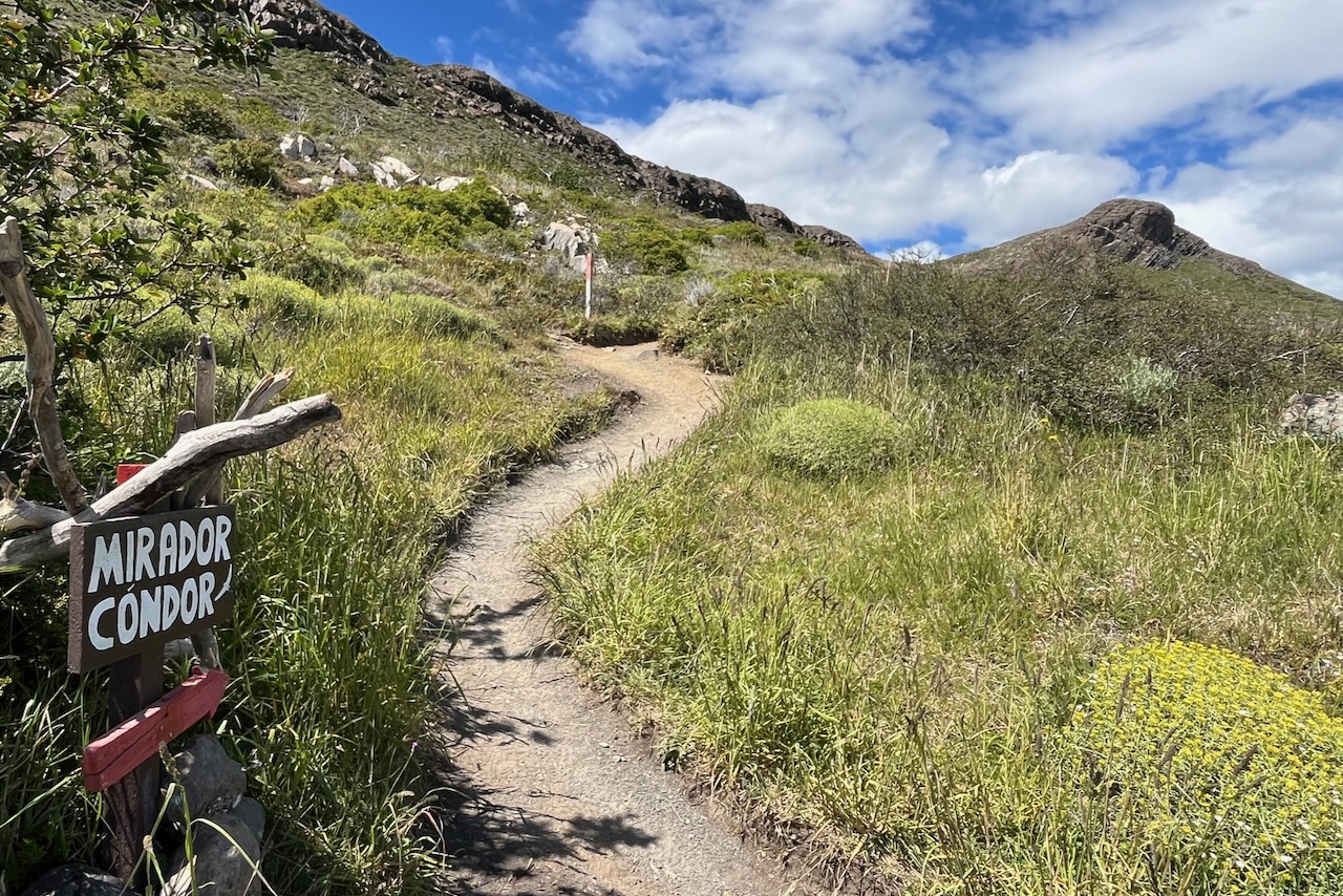
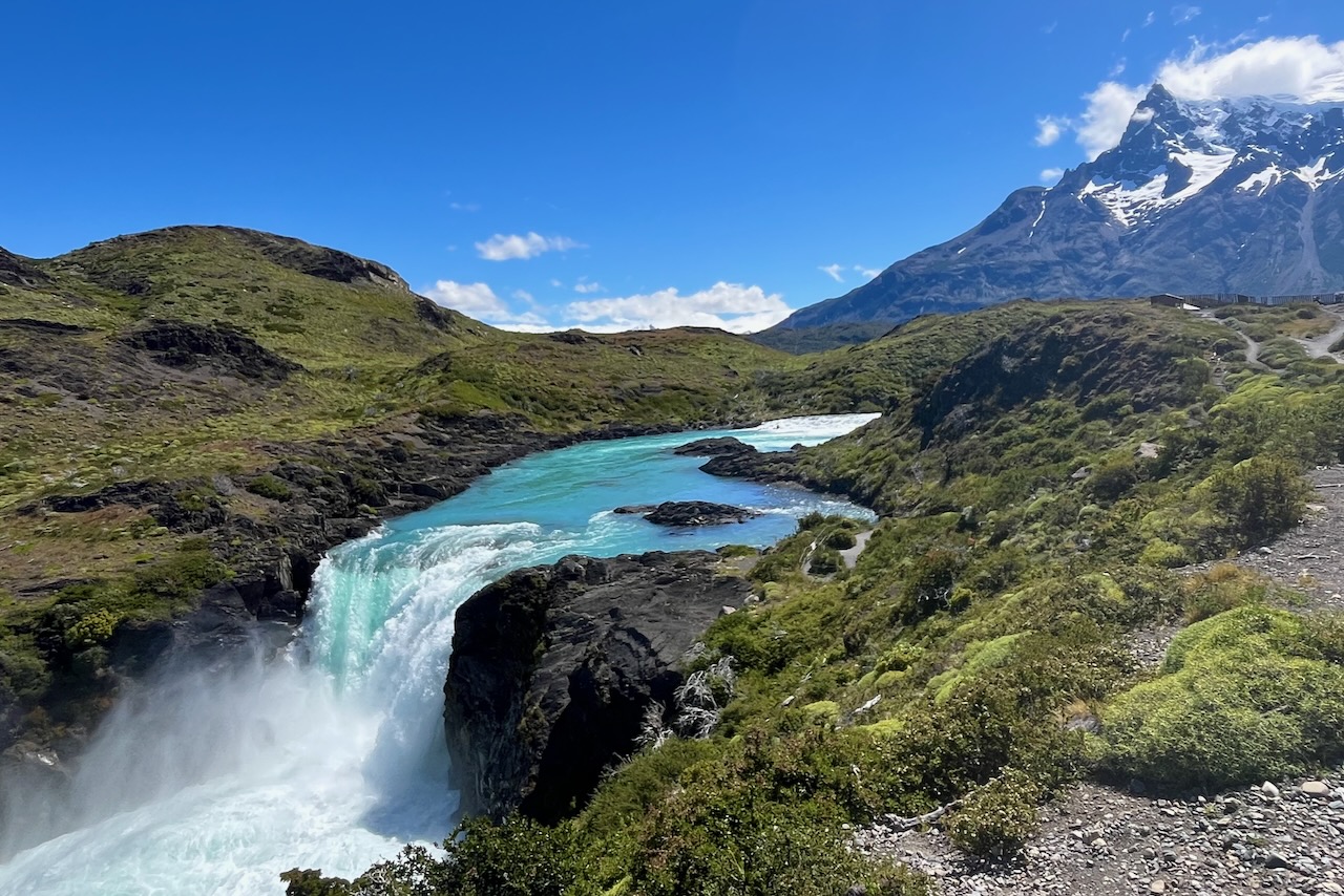
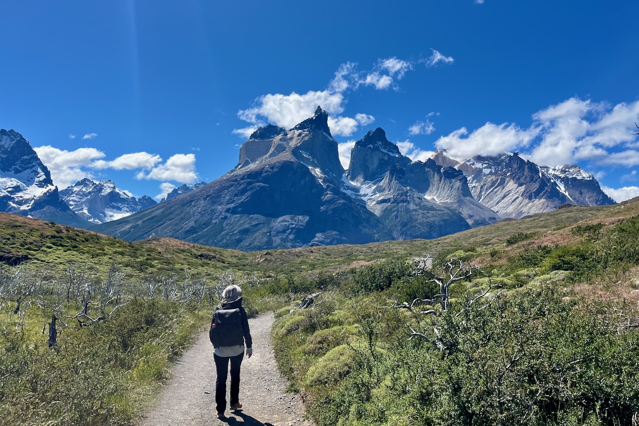
We first went up to Condor lookout. The trailhead is about 12km from the entrance gate. It is a very scenic drive. Mirador Condor hike is 2.4km return with 200m of elevation gain. It took us less than an hour to go up, we spent half an hour at the top and another half hour going down. We did stop alot to admire the scenery and take pictures.
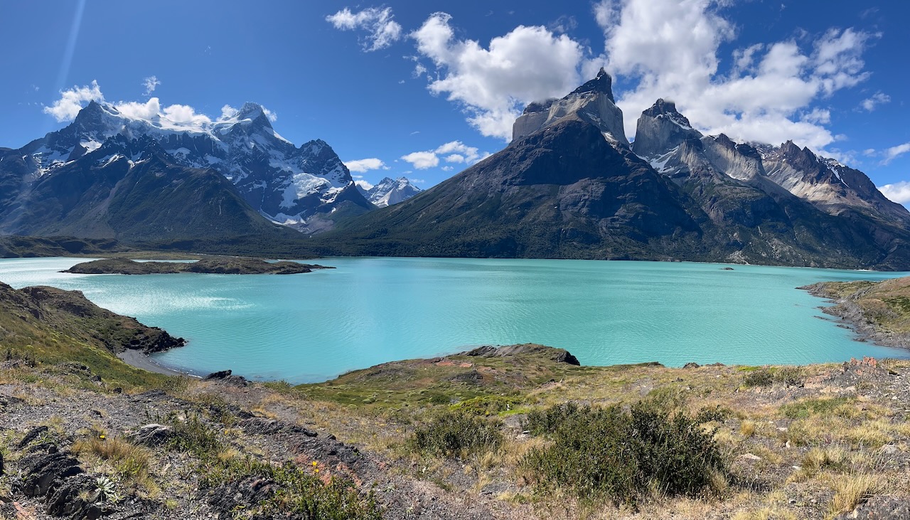
Condor lookout is the knob on the left, Torres del Paine, ChileView of Lake Pehoe from Condor lookout, Torres del Paine, ChileFlowers along the hike to Condor lookout, Torres del Paine, ChileLake Pehoe and flowers, view from Condor lookout, Torres del PaineView of lake Pehoe, Cuernos, Cerro Paine Grande, and Salto Grande (waterfall), Torres del Paine, Chile
After Condor hike we headed to Estancia Pudeto to start our hike to Cuernos lookout. Pudeto is the departure point for catamarans that take trackers across Pehoe lake to start their multi day O and W hike. Some people also take day trips on catamaran across the lake. When we arrived we saw many cars and buses parked along the road. We were worried the hike would be very busy but turned out most of these vehicles were for the people who took the catamaran across.
Salto Grande waterfall on Cuernos lookout hike, Torres del Paine, Chile
Cuernos means horns in English. Idea being that the mountains look like horns with their glacier chiseled sharp shapes. We felt the hike was easy. It is a bit over 6km return with about 200m elevation gain. But it is mostly very gentle up and down rolling trail. Views are really pretty with cuernos, Cerro Grande and lakes. By this time the clouds mostly have cleared and we had a good clear view of the mountains.
The start of the Cuernos lookout hike, Torres del Paine, ChileCuernos lookout trail, Torres del Paine, Chile
It took us about 1.5 hours to get to the lookout making many stops to look around and take pictures. We made it back in about an hour. Magically beautiful scenery all along.
Cuernos lookout, Torres del Paine, Chile
We finished the hikes well in time to get back to our hotel, have a nice dinner and get a good rest before our big hike to Torres base next day.
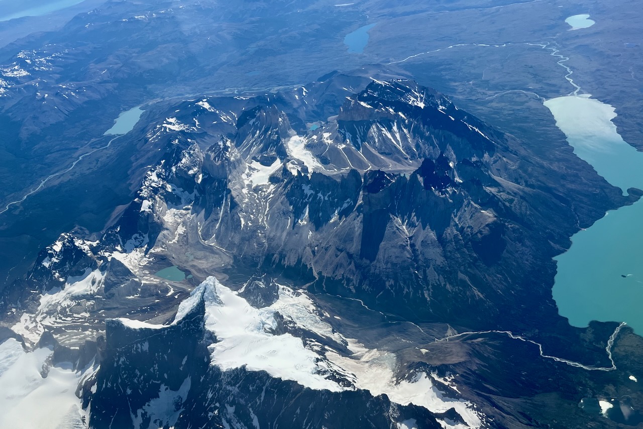
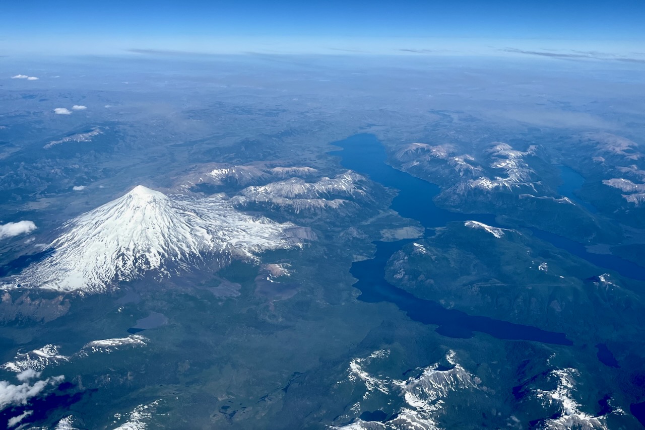
As we started our flight from Santiago towards Punta Arenas, clouds cleared and we were able to see Patagonian landscape from above including Fitz Roy mountain range and glaciers around it. We set on the left side of the plane (A window).
Lake district and volcanoes from airplane, ChileFitz Roy mountain range, Southern Patagonian ice field and Viedma glacier, Chile and ArgentinaFitz Roy mountain close up, Argentina and Chile
As we got closer to Punta Arenas scenery changed and it was all flat lands, bare landscapes in low sun with long shadows.
Landscape near Punta Arenas, view from plane, Chile
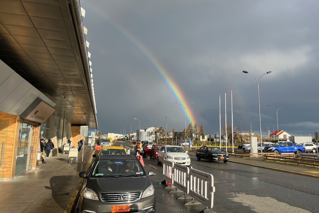
As we exited airport rain shower just ended and rainbow showed up. We started adjusting to fast changing Patagonian weather. It rains and shines and wind blows most of the time. At the beginning of December, start of southern hemisphere summer, it was cold. We needed a heater in the hotel room and wore all of our warm (and water proof) layers outside.
Rainbow at airport arrival, Punta Arenas, Chile
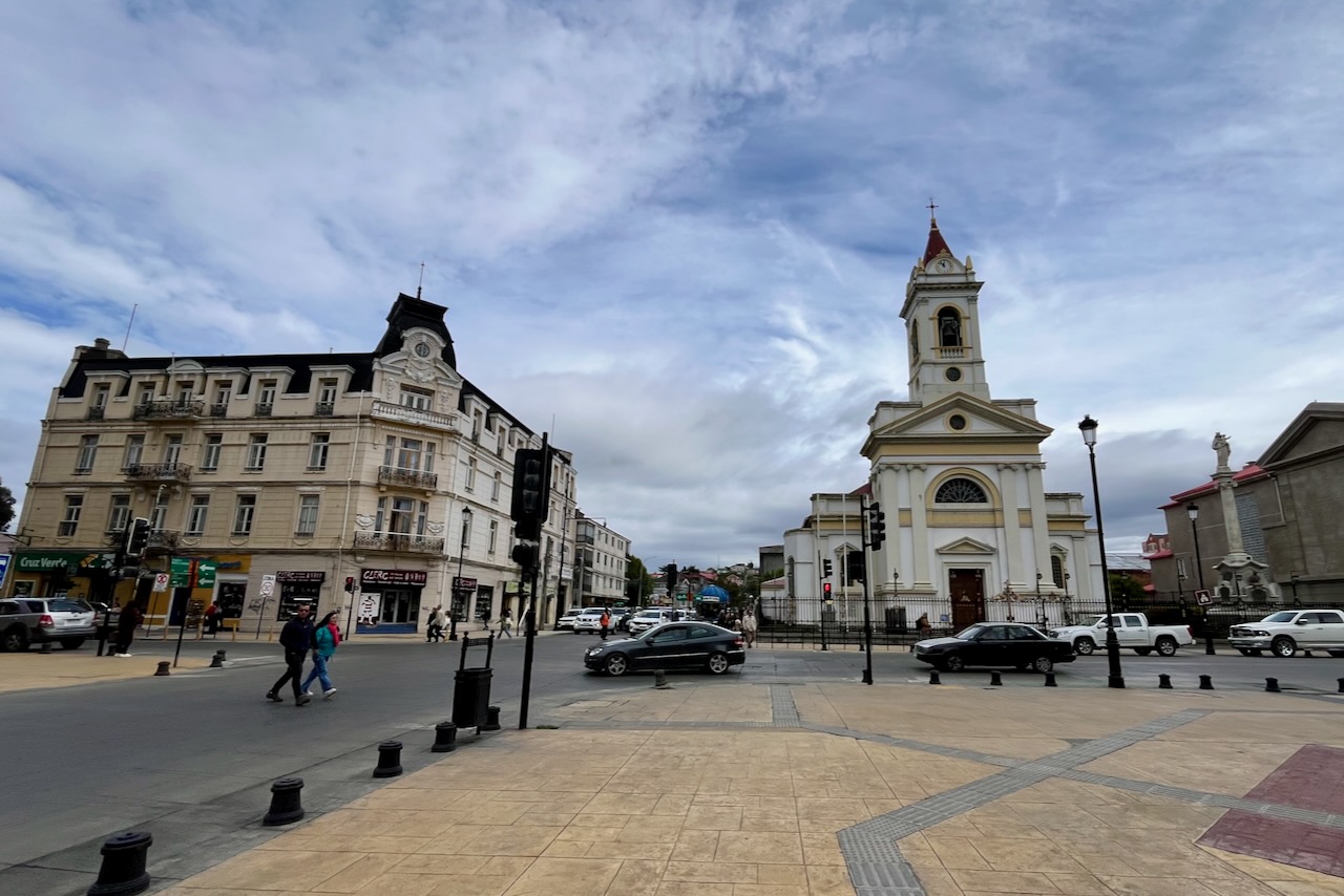
Punta Areans is the largest city in the south of Chile with 130,000 residents. Downtown has a pretty square with historical buildings dating from early 20th century when Punta Arenas was a boom town profiting from sheep wool. There is a nice promenade along the ocean to walk around. Restaurants are very good and we had excellent meals both seafood and asada (grilled meat). We tasted and loved loco – local sea snail. If seafood is your thing, we recommend visiting fish market and stocking up on all sorts of seafood delicacies.
Punta Arenas city center, Chile
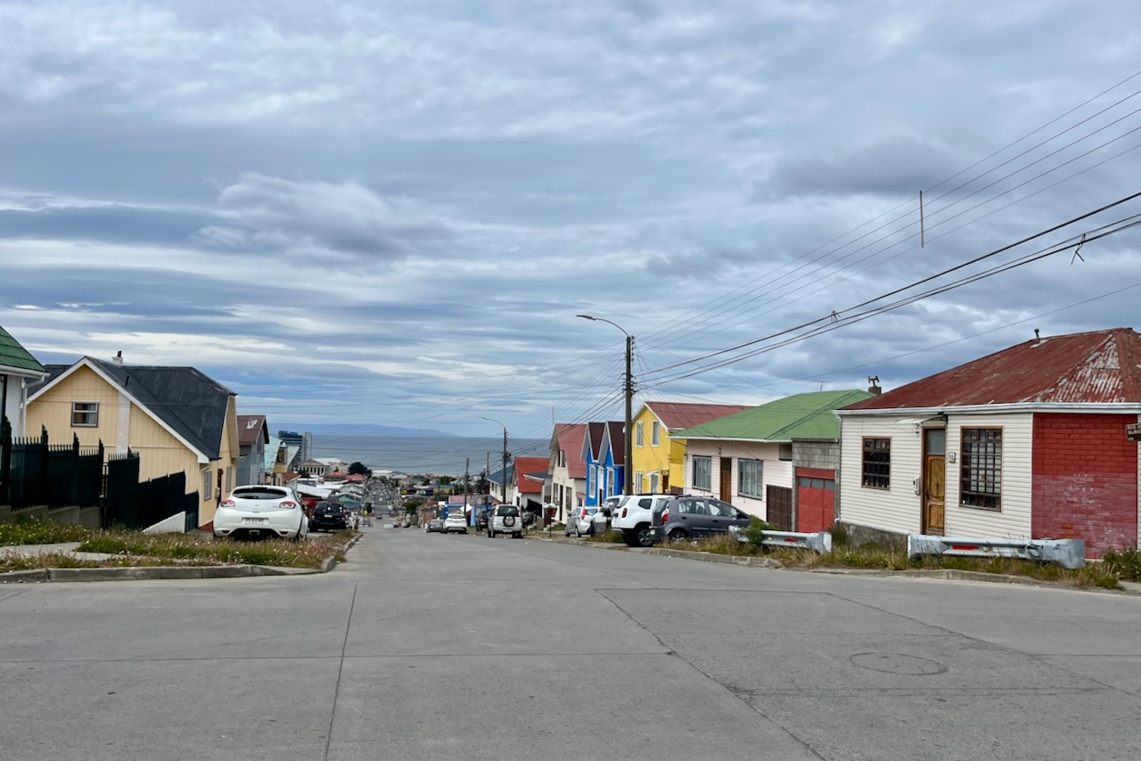
Outside of the city center Punta Arenas is a tidy town with small neat houses, many painted bright colors, and with big windows to catch all the sun that they can get.
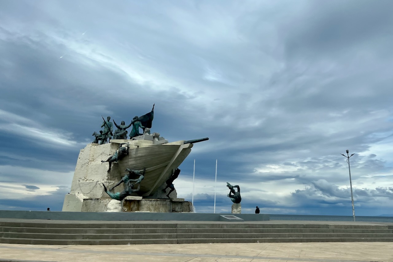
Punta Arenas street view, ChileMonumento a los Tripulantes de La Goleta Ancud, the boat that claiming straight of Magellan for Chile
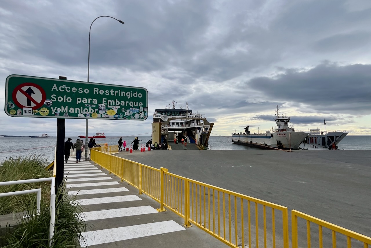
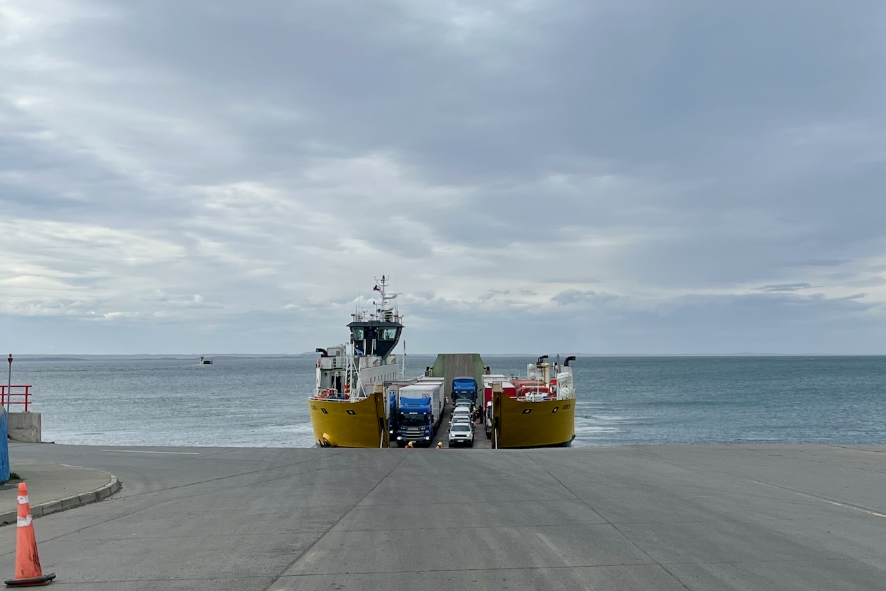
The next day we were picked up in the morning by a tour company van to take us to Tierra del Fuego to see king penguins and learn more about the original people and history of Tierra del Fuego. Several tour companies in Punta Arenas offer this type of tour. We booked through Todo Patagonia. The tour involved taking a public ferry from Punta Arenas to Porvenir in Tierra del Fuego. Then driving around Tierra del Fuego and visiting penguins. Then going to a different ferry, in the north of the Tierra del Fuego to cross Magellan straight at a narrower point, and then drive back to Punta Arenas.
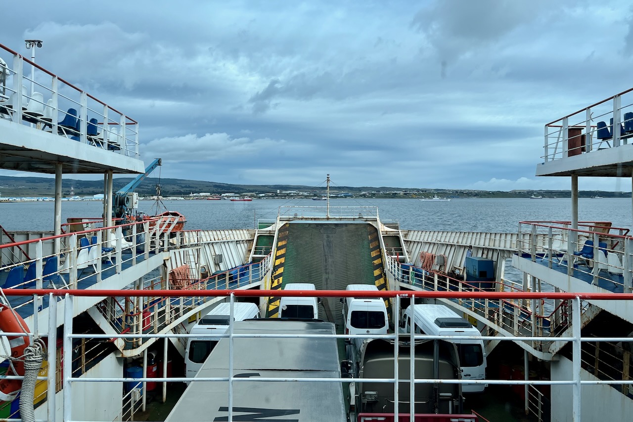
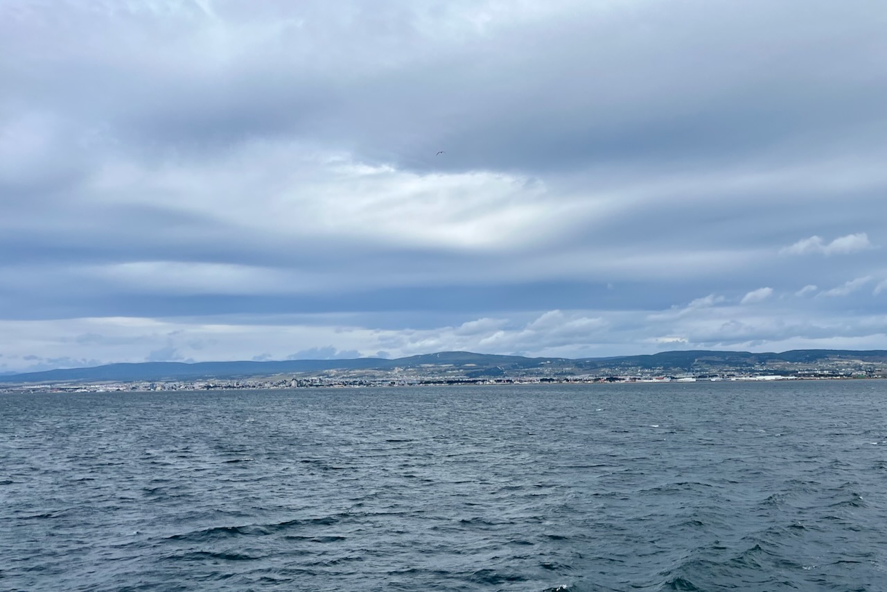
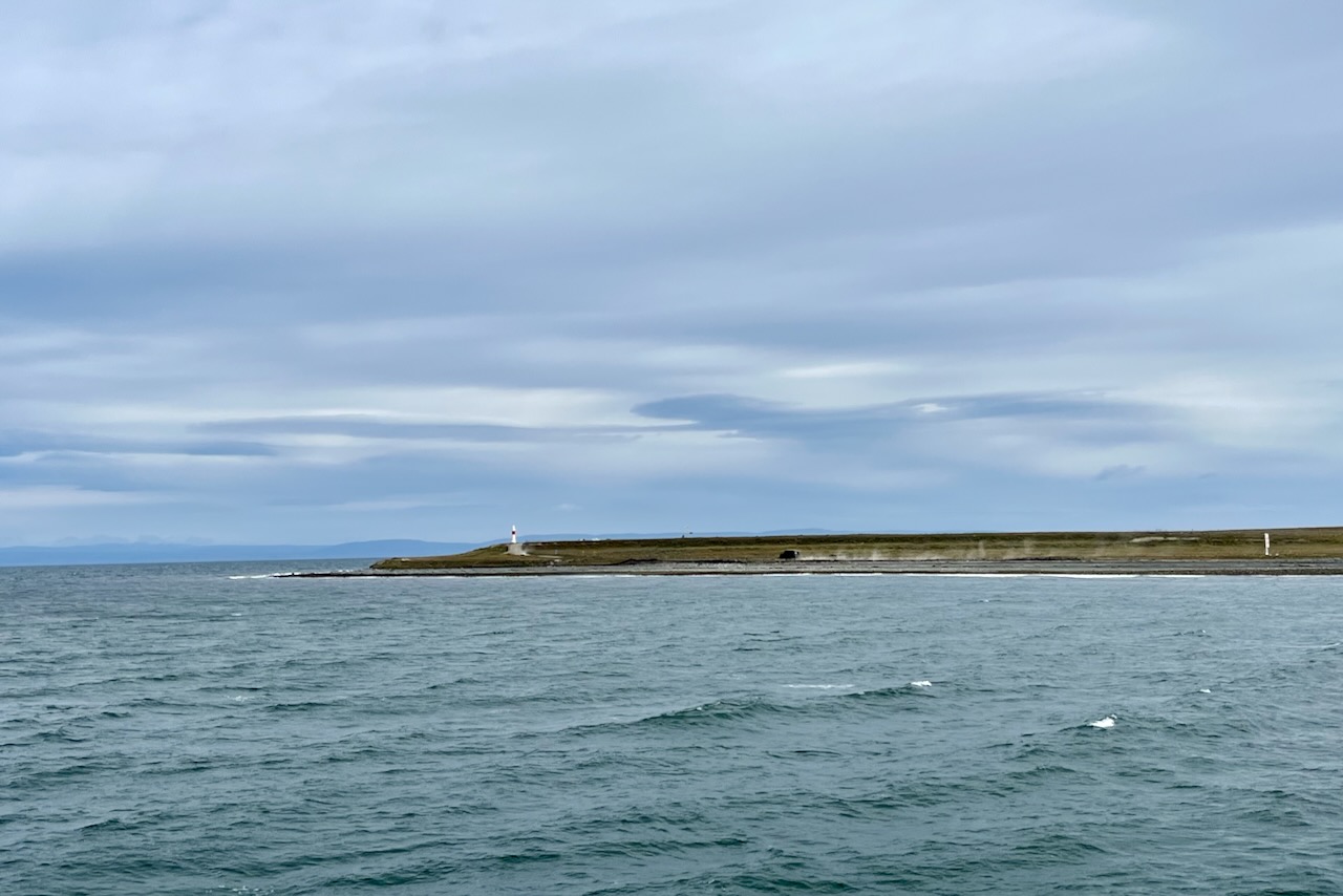
Boarding a ferry from Punta Arenas to Tierra del Fuego Ferry from Punta Arenas to Porvenir in Tierra del Fuego, ChileView over Magellan straight to Punta Arenas, Chile
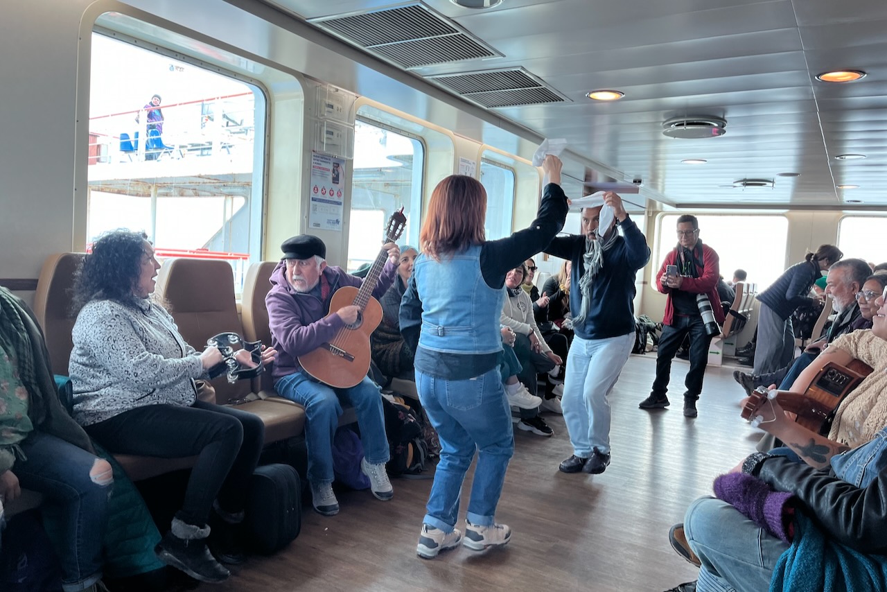
Ferry had a mix of locals and tourists. There was also a group with a video crew. Not quite sure who they were but at some point they started playing music and doing traditional dances with the rest of the passengers enjoying the performance. The sea was calm on the day we travelled but it is not hard to imagine that this is not always the case. The crossing takes about two hours.
People dancing on a ferry crossing from Punta Arenas to Porvenir, ChileTierra del Fuego, Chile
Our tour guide was great and we learned a lot about Selknam people who populated the area before European arrival. It is hard to imagine that people were able to survive and thrive in these inhospitable conditions. They were hunters depending on guanaco and had complex beliefs and rituals. Selknam people were exterminated by new migrants as Tierra del Fuego became an important and lucrative location for sheep farming and wool.
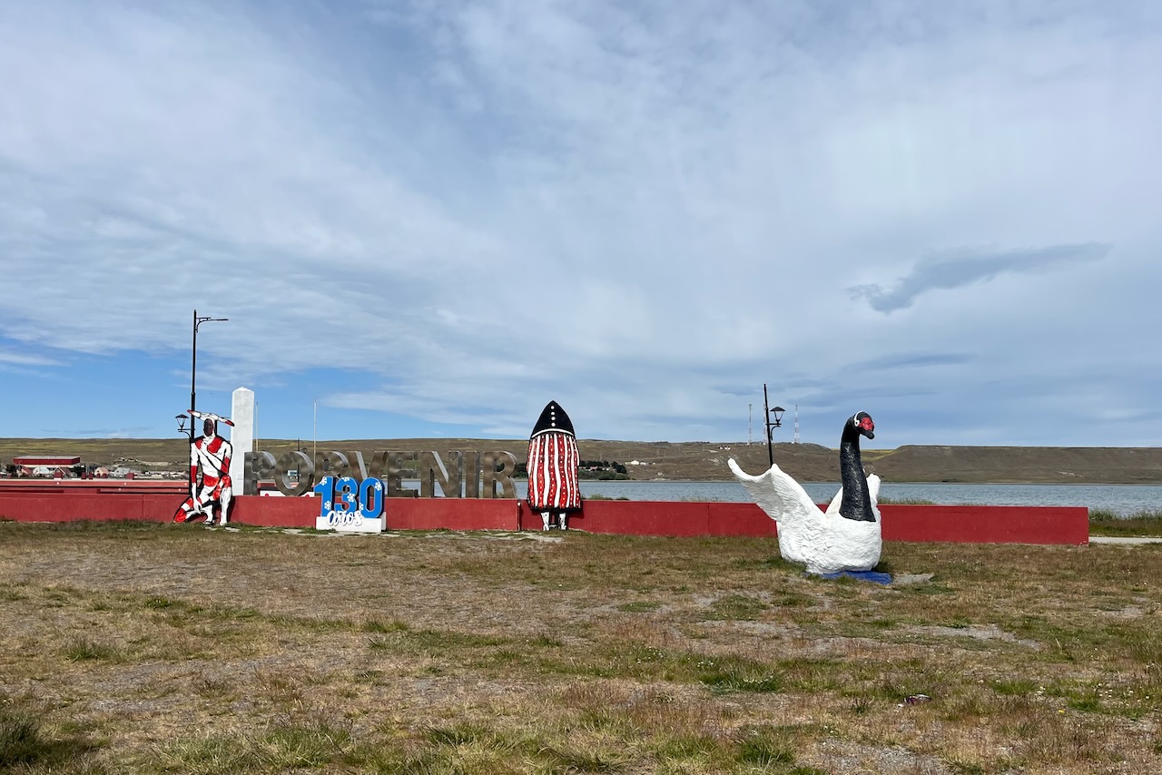
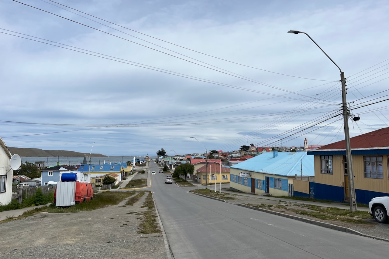
Porvenir – capital of Tierra del Fuego, ChilePorvenir – capital of Tierra del Fuego, Chile
We had a great lunch in one of the local restaurants in Porvenir. Food was very delicious. We felt we must try their grilled meats, but also pastel de choclo, and there was a crab dish, and had to have salad, and there was a desert too. That was a bit of an overestimate of our food absorption capacity, but it was so good and we justified overeating on the basis of needing nourishment to take on rough nature of Tierra del Fuego.
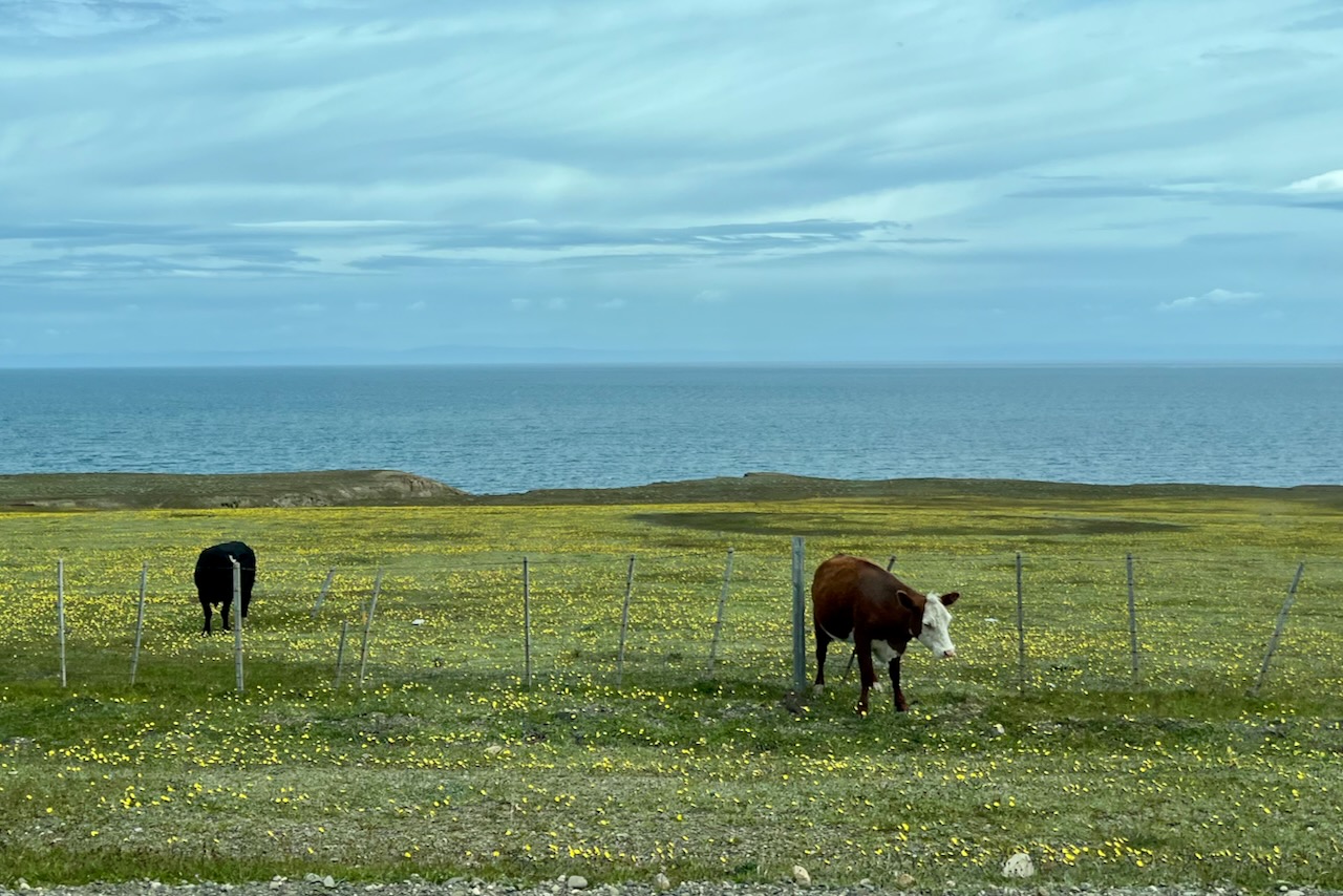
Cattle and flowers, Tierra del Fuego, Chile
From Porvenir we headed down south to the king penguin colony. Along the way we learned more about history and nature of Tierra del Fuego. Even though we read up on the region’s history ahead of our trip we did not quite appreciate the scale of Chile-Argentina rivalry and border disputes. We had no idea that Argentina and Chile nearly came to war in the late 1970s. Driving around this beautiful wild land at the edge of the world we saw abandoned tanks and learned that there were minefields left over all around. Anti-tank and anti-personnel mines are scattered not just in Patagonia but also in Atacama in areas close to the border. It was profoundly sad to contemplate that war and conflict made its way even to a place so far away and with almost no people. Good thing is that for now at least the region is at peace.
Sheep, Tierra del Fuego, Chile
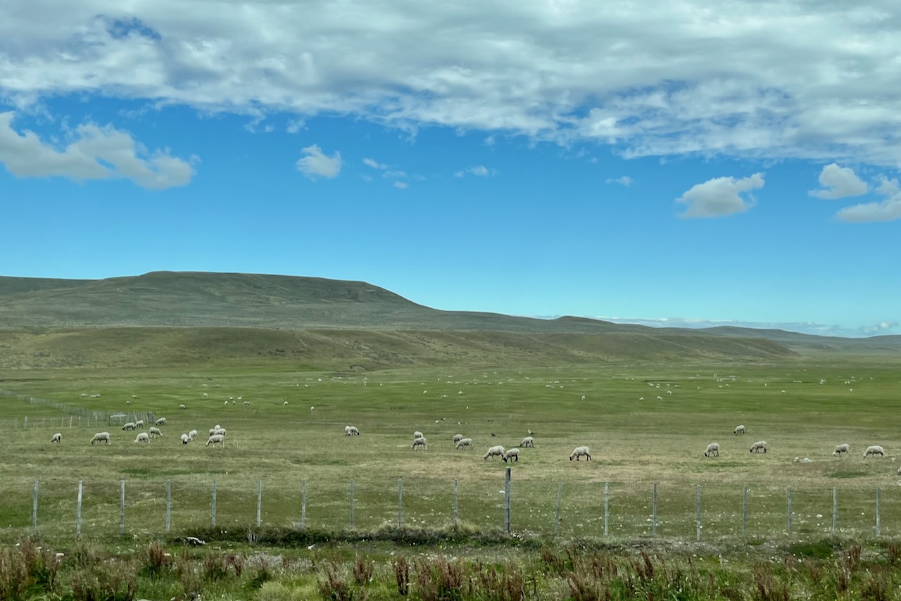
We drove through endless hilly planes with cattle, sheep and guanacos. We learned that beavers are a big problem. They were introduced to estblish fur trade – but have no natural predators. They have been building their dams, messing up water flows and deforesting fragile ecosystem that is Tierra del Fuego. They are trying to control the population now. Another introduced predator is a fox. That one has been eating penguin eggs. Even in the nature reserve for penguins fox is a problem.
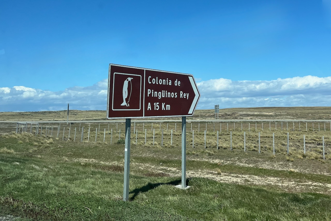
Sign to king penguin colony, Tierra del Fuego, Chile
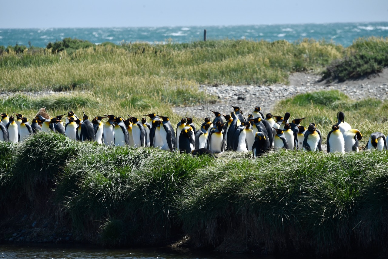
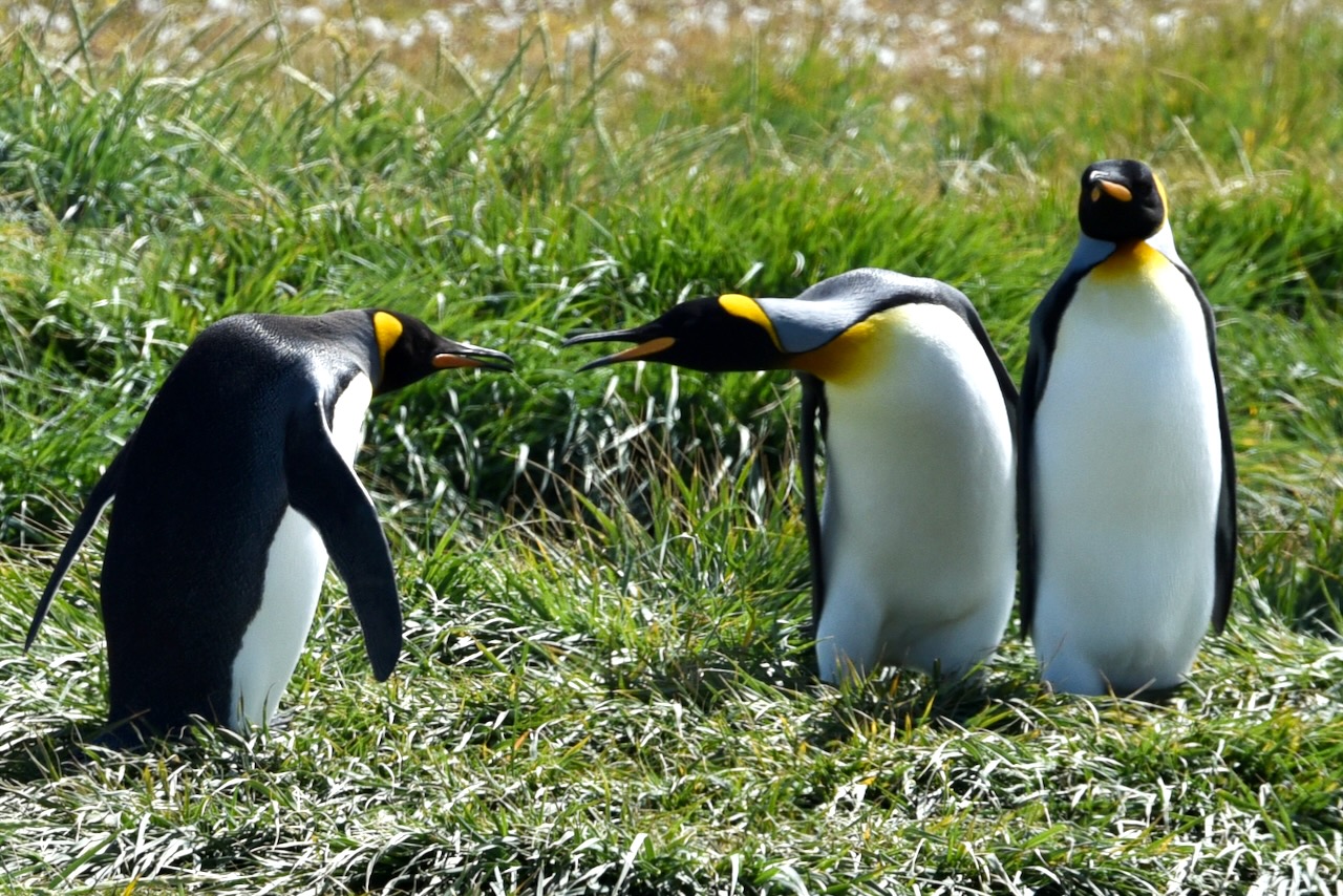
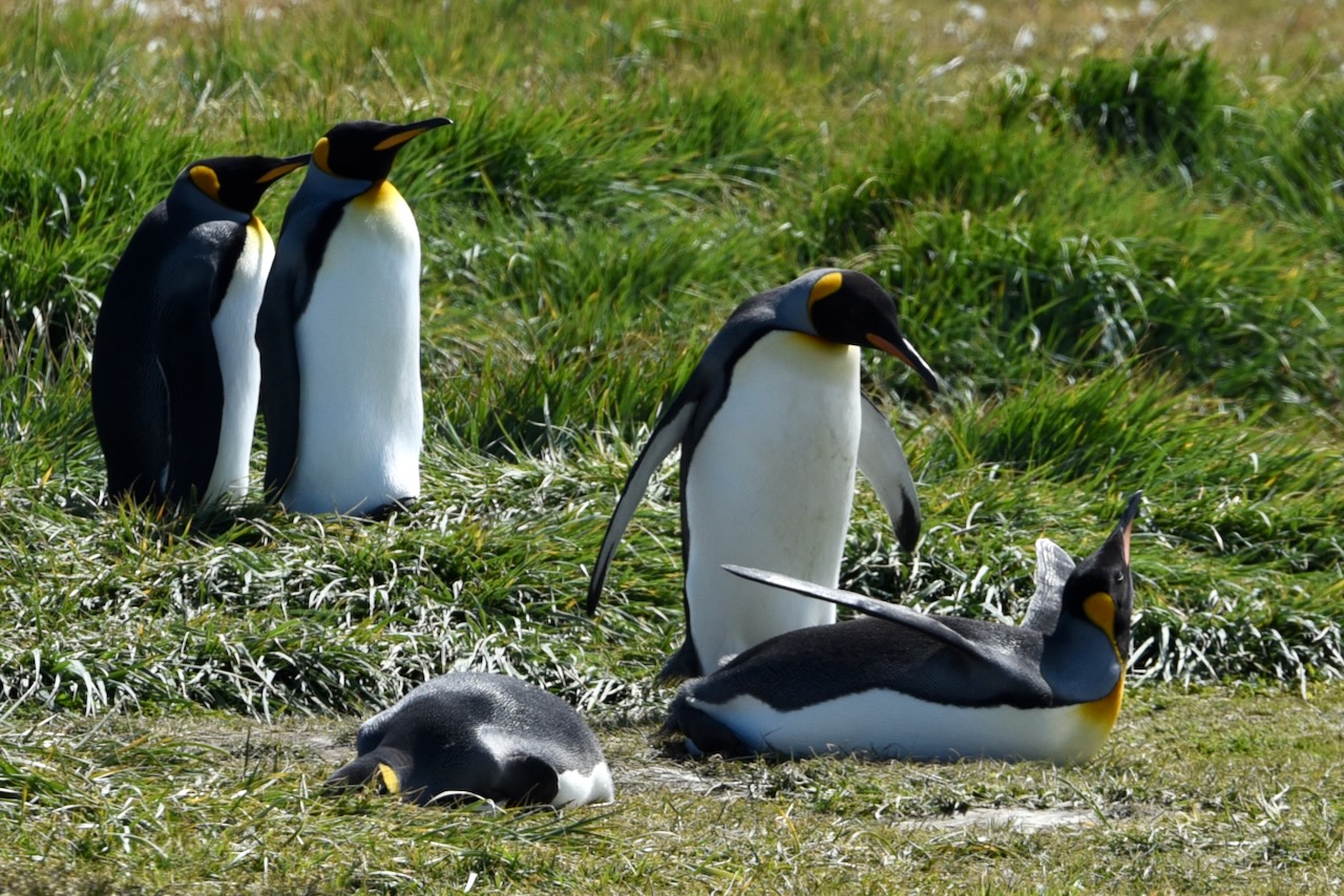
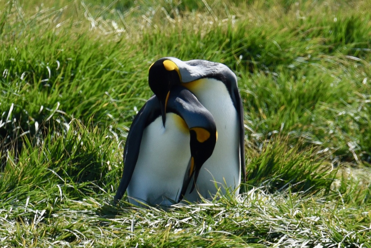
King Penguin Nature Reserve is located in Bahia Inutil (Useless Bay – Patagonia has a fare share of poetic names like this). This is the only place in South America to see king penguins. The penguins were visitors till about 2010 when they decided to settle and establish a colony. Now there are about 200 penguins in the colony. The park is well managed. Penguin viewing hides are across a stream and good 50m away from where penguins hang out. We spent about an hour with them and it was really fun to watch them go about their day, fishing, arguing – or at least it looked like that. There is a scope at the observation deck and we had binoculars and big lens to take pictures.
King penguins, Tierra del Fuego, ChileKing penguins, Tierra del Fuego, ChileKing penguins, Tierra del Fuego, ChileKing penguins, Tierra del Fuego, Chile
After watching the penguins we headed north of the island to catch another ferry to the mainland at Punta Delgada.
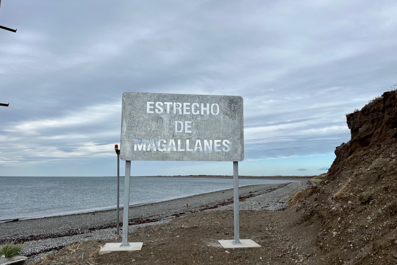
Tierra del Fuego landscape, ChileThe Straight of Magellan sign, Tierra del Fuego, ChileFerry from Tierra del Fuego to Punta Delgada, Chile
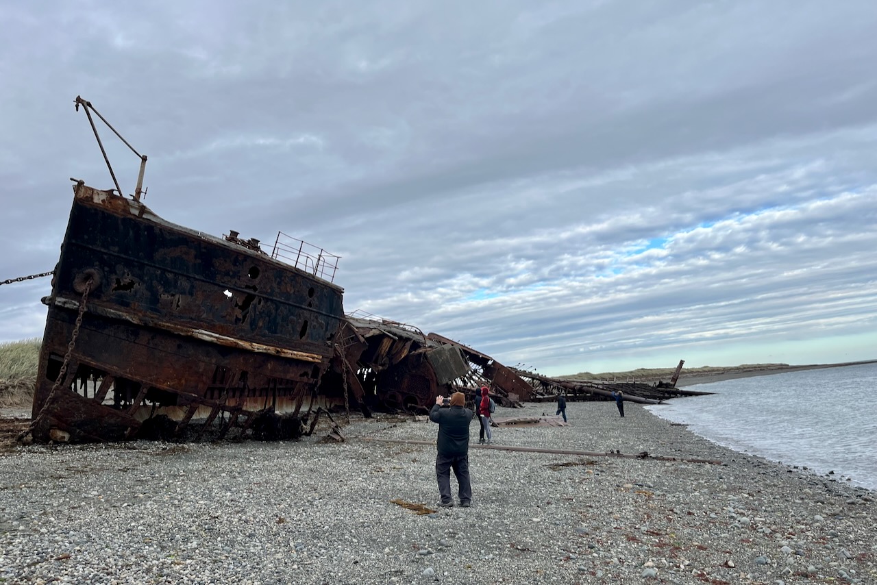
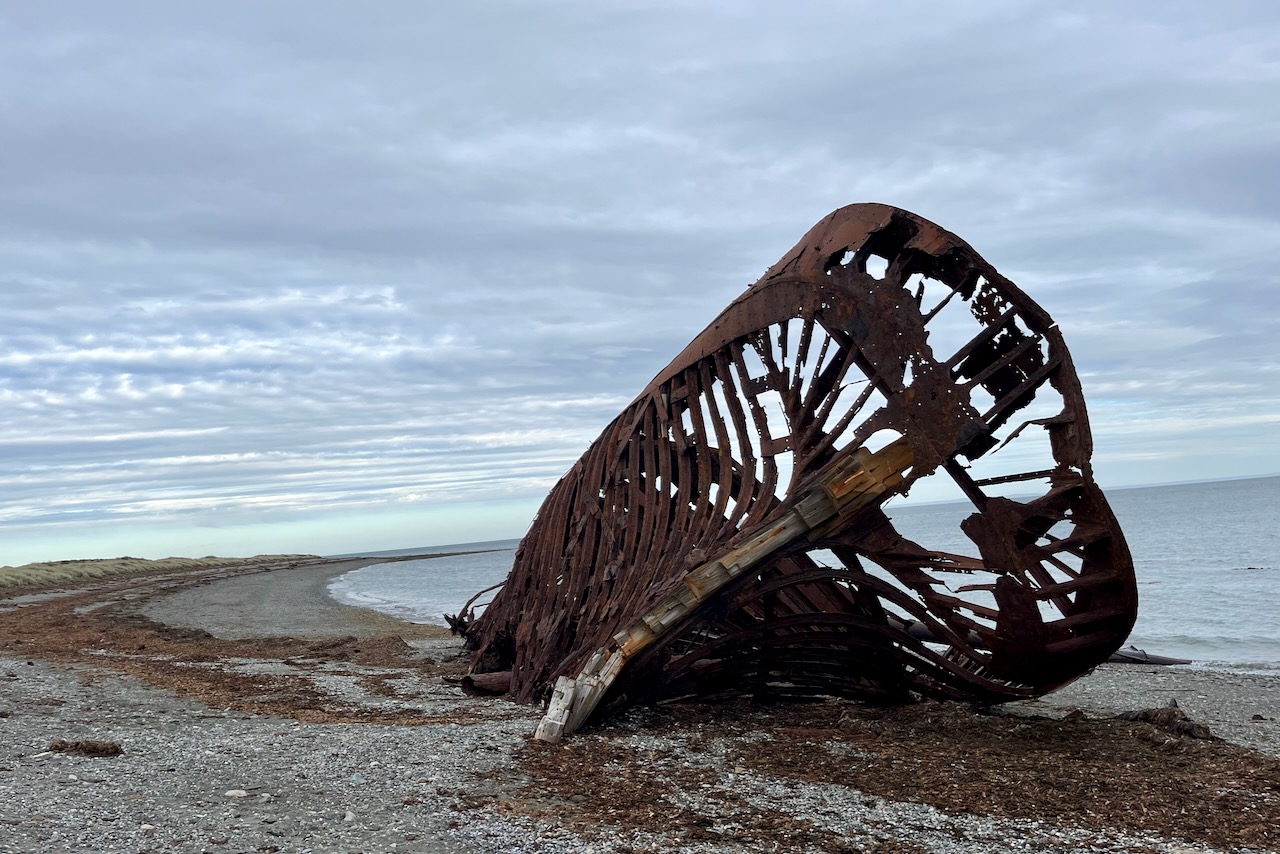
The crossing here only took about half an hour as the straight narrows at this point. We then headed back to Punta Arenas with stops along the way to see ship wrecks and a ghost town – remnants of boom times in early 20th century.
Shipwreck of steamboat Amadeo, near Punta Arenas, ChileShipwreck of barge Ambassador, near Punta Arenas, Chile
We got back to Punta Arenas close to 9 at night. Good thing is Chileans take their dinner late and we still made it for a phenomenal asada dinner at Parilla Los Ganaderos.
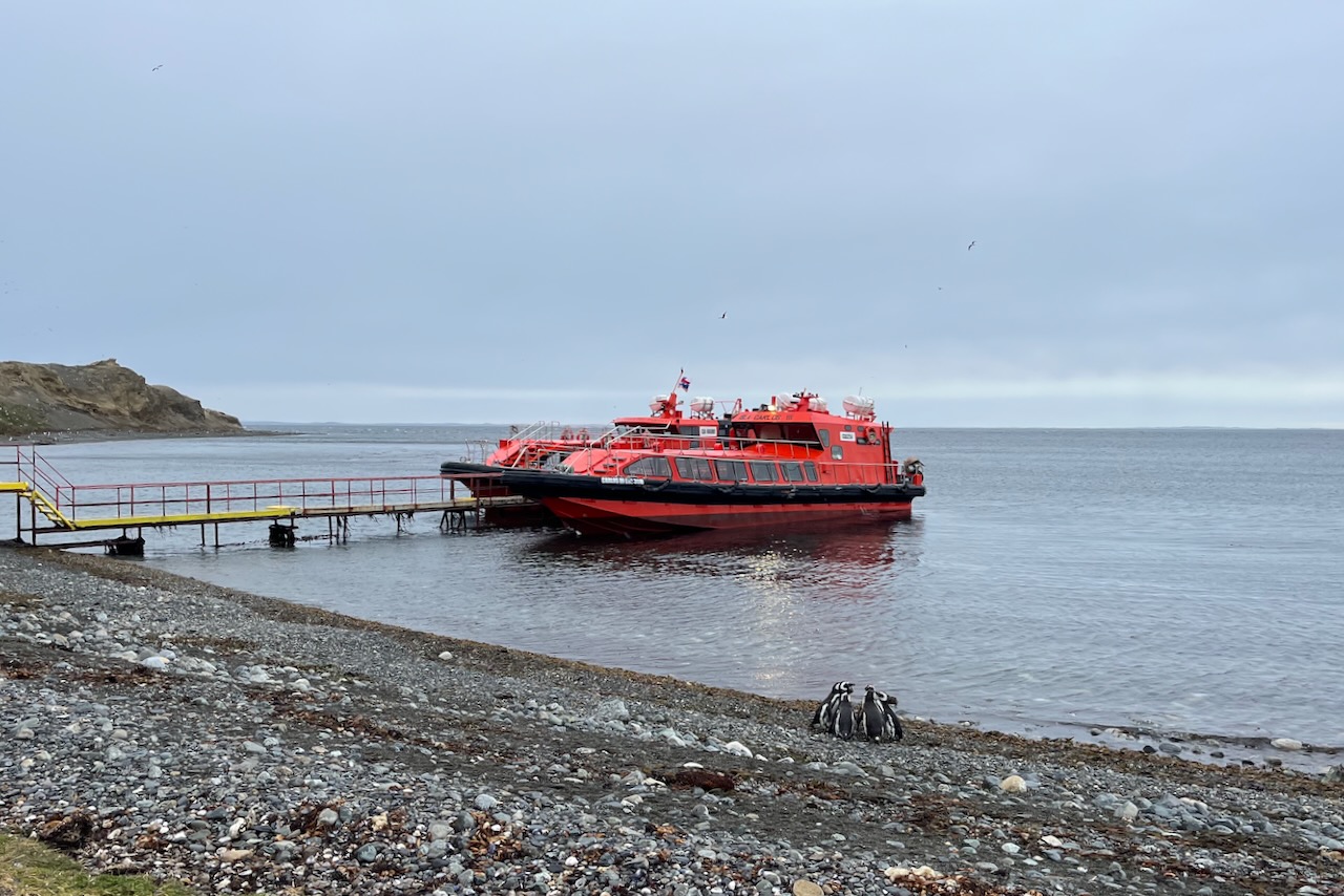
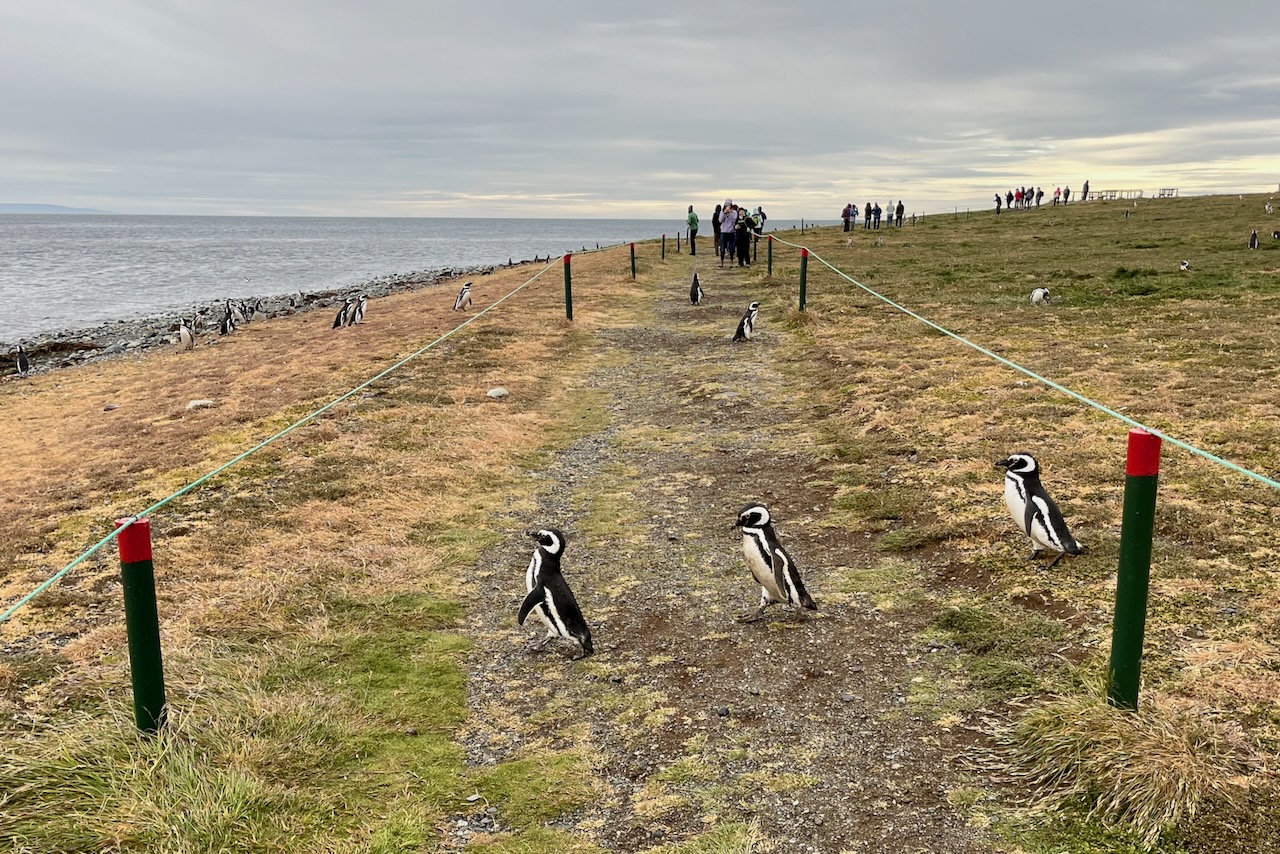
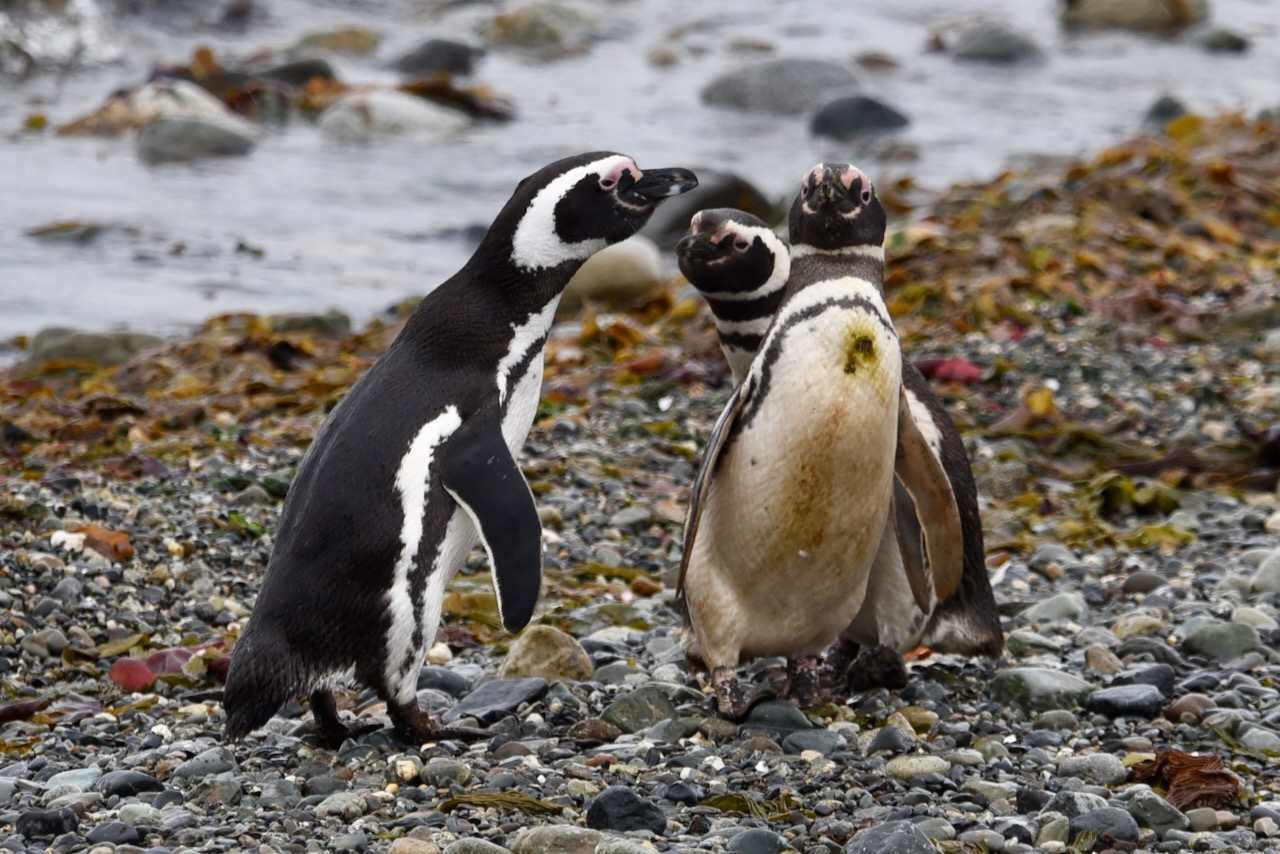
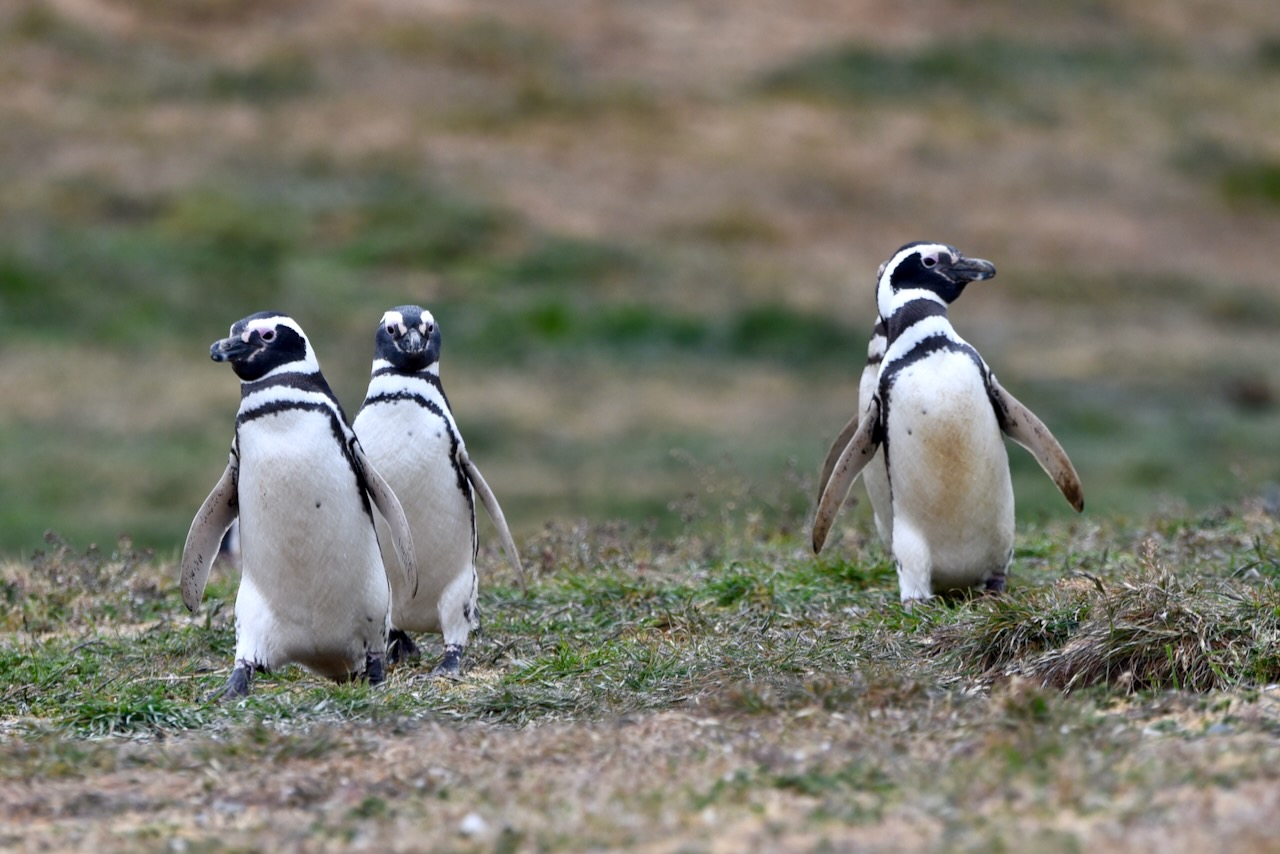
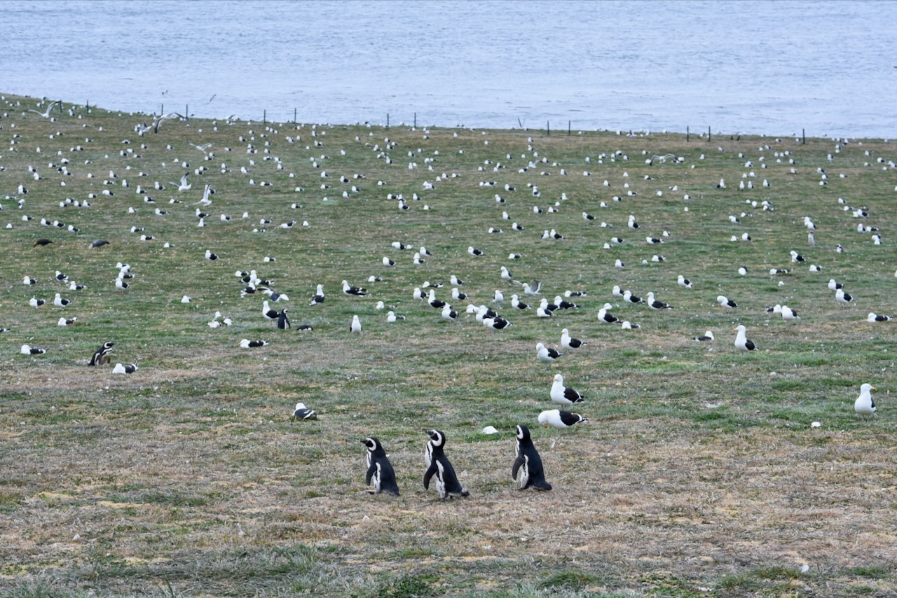
Next day we were up early in the morning again this time to see Magellanic penguins on Magdalena Island. Solo Expediciones runs daily tour to Magdalena and Marta islands to see penguins and sea lions respectively. We walked over to their offices, bought the tickets and loaded on big tourist buses to go to the pier to catch the boat. We were impressed with the scale and efficiency of the operation and attention to safety. Once on Magdalena island, we had 1 hour to roam around and hang out with penguins. There is a trail that visitors must strictly adhere to and give way to crossing penguins. Penguins seem not to care for tourists going about their day catching fish, building their nests, arguing with neighbors, we even saw a couple of them steeling building material from neighbor nests! In early December during our visit baby penguins were just starting to hatch and we only saw a couple of chicks still hidden in their nests. Besides penguins, who number up to 60,000 in the colony, there are also thousands of seagulls and other birds. Magdalena is a noisy and happening island.
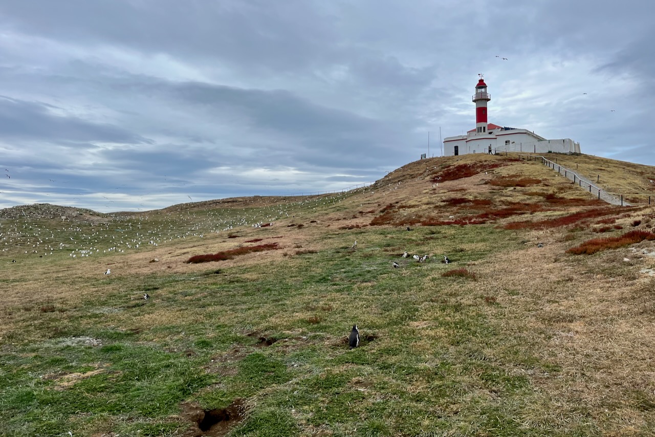
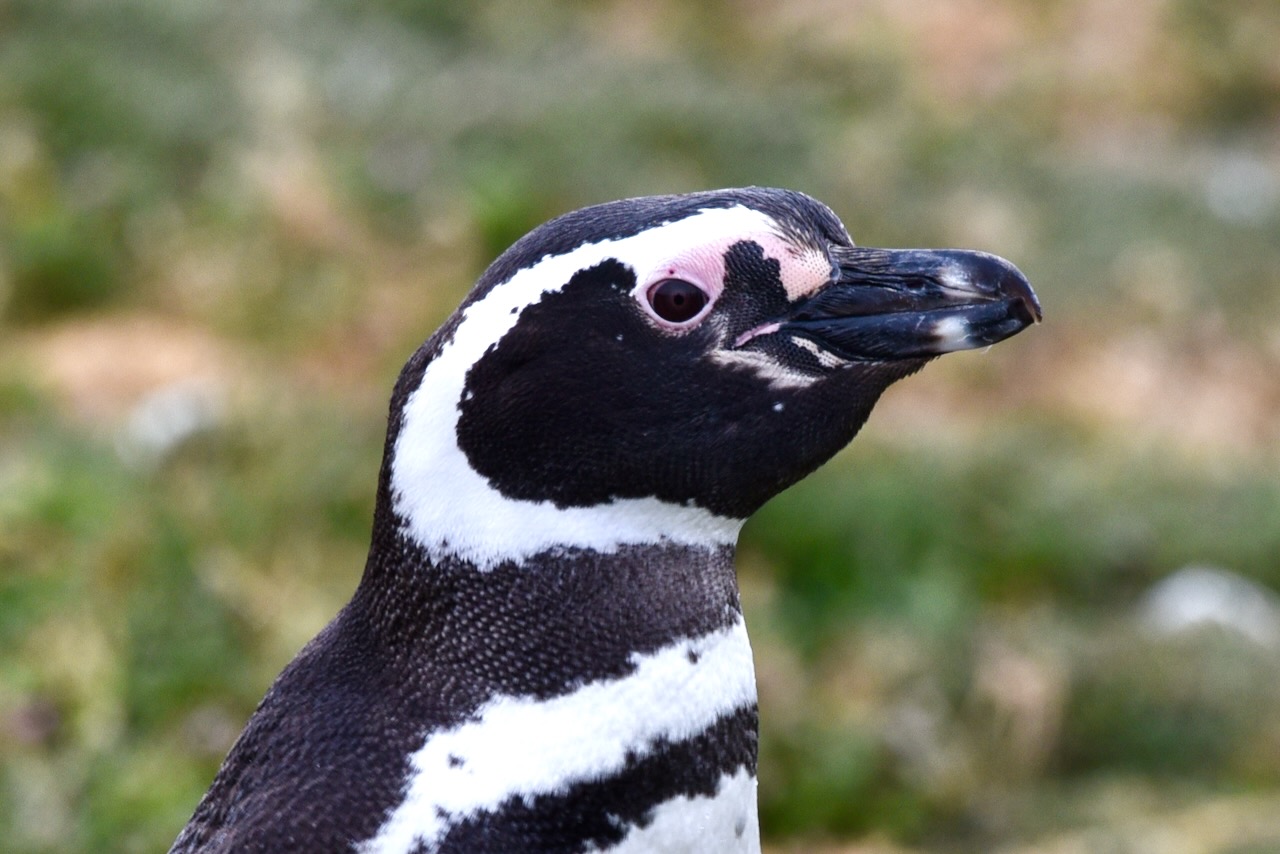
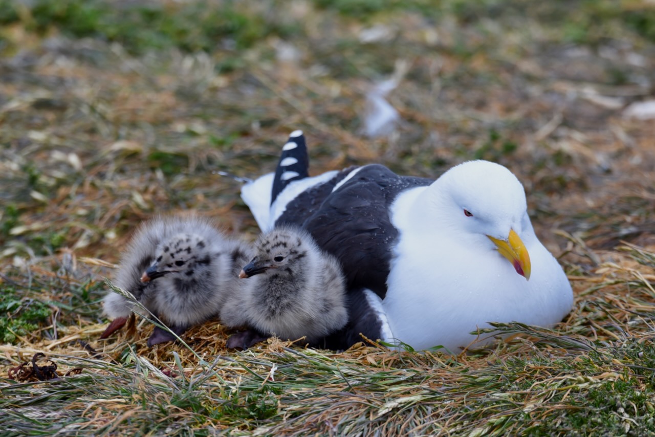
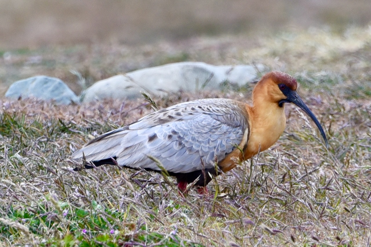
Penguin tour boats at the pier on Magdalena island, ChilePenguins crossing the trail, Magdalena island, ChileLighthouse, penguins and birds, Magdalena island, ChileMagellanic penguins, Magdalena island, ChileMagellanic penguin close up, Magdalena island, ChileMagellanic penguins heading to fish, Magdalena island, ChilePenguins and seagulls, Magdalena island, ChileKelp gull with chicks, Magdalena island, ChileBlack faced ibis, Magdalena island, Chile
After Magdalena island we headed to Marta island to have a look at sea lions there. The viewing is from the boat, no disembarkation.
Marta island, ChileSea lions on Marta island, Chile
After this we headed back to the mainland and then by bus back to Punta Arenas returning around midday. For us it was time to pick up our rental car and start the roadtrip portion of our trip in Patagonia heading next to Torres del Paine National Park.
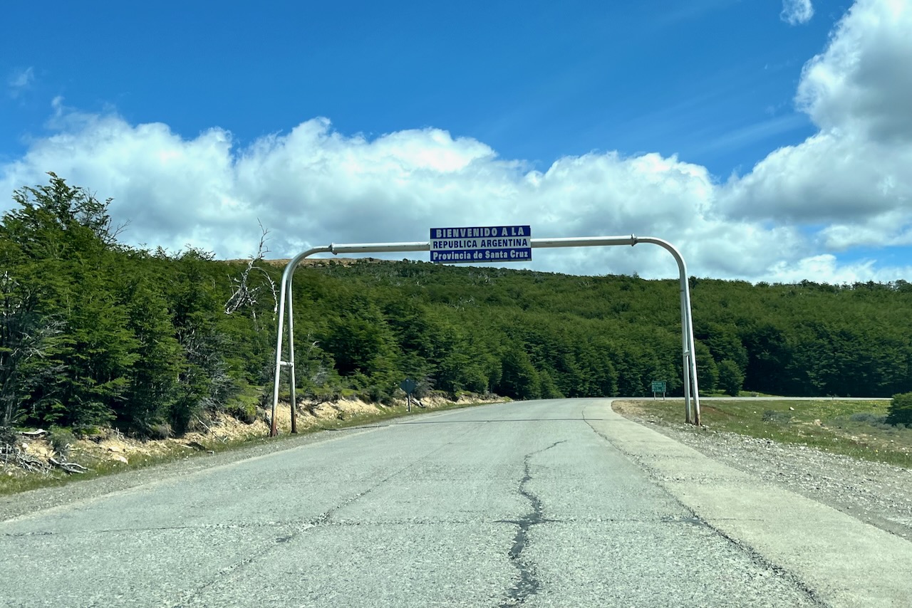
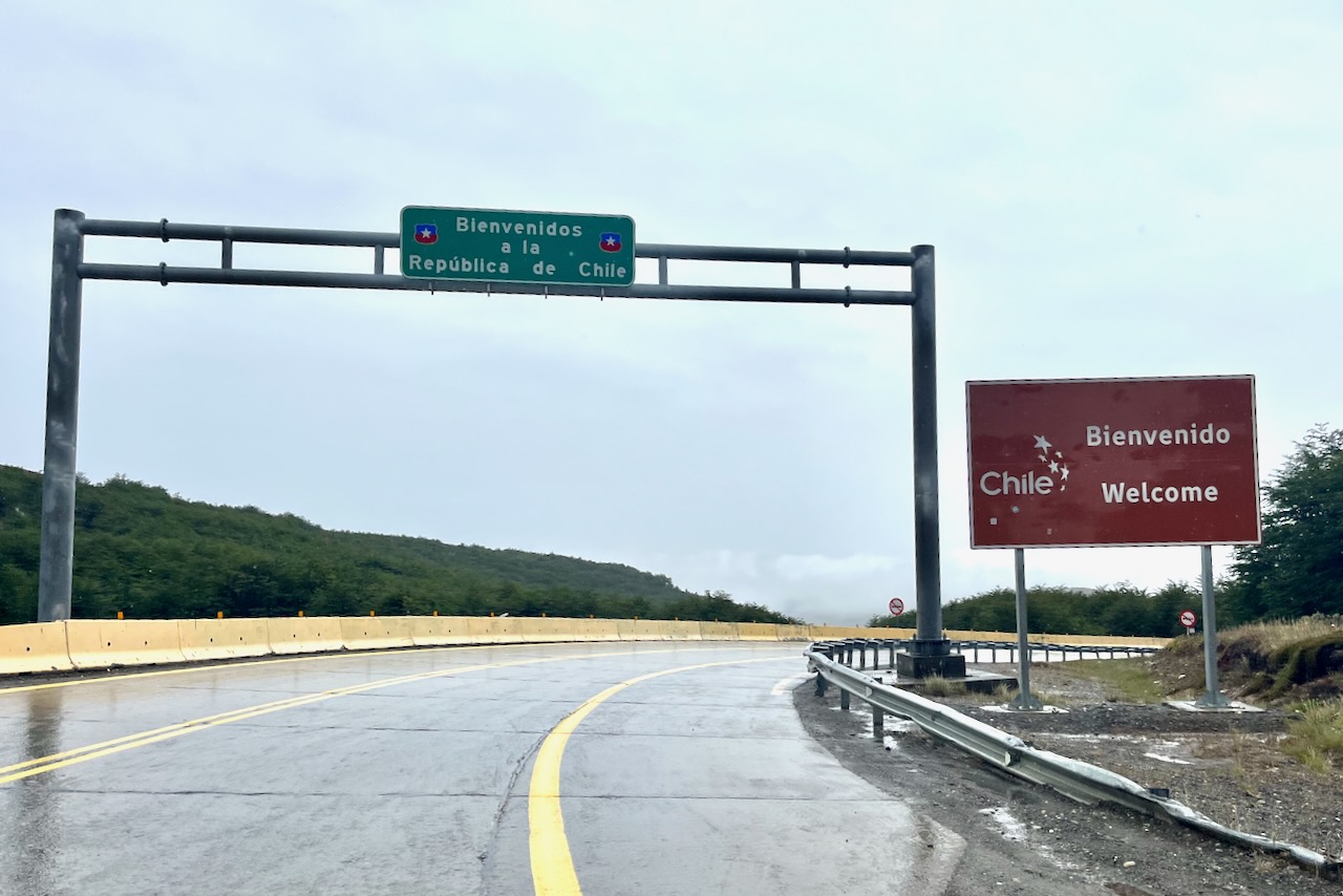
We crossed into Argentina by car at Dorotea border crossing coming from Torres del Paine National Park in Chile in December 2024 and headed for El Calafate and El Chalten for more hiking. The border crossing was pretty straightforward. Car rental company in Chile arranged all the documents to take the car over the border and come back. Chile border crossing side was very orderly and organized. Argentina side was less orderly with a longer queue and dilapidated facilities. The road quality on Argentina side was also somewhat inferior to the Chilean one in places. All the roads we took were paved and we did not have any issues in our compact two wheel drive.
Welcome sign entering Argentina by road from Chile at Dorotea crossing, Argentina
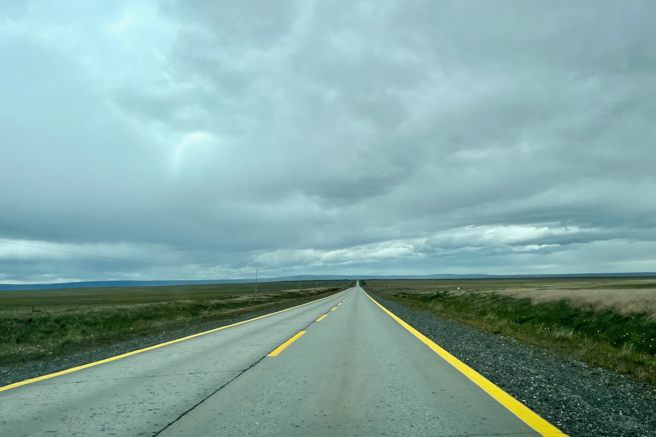
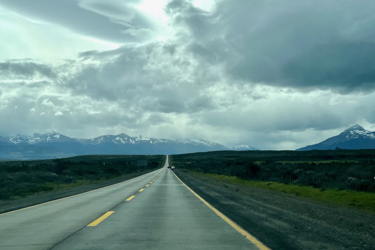
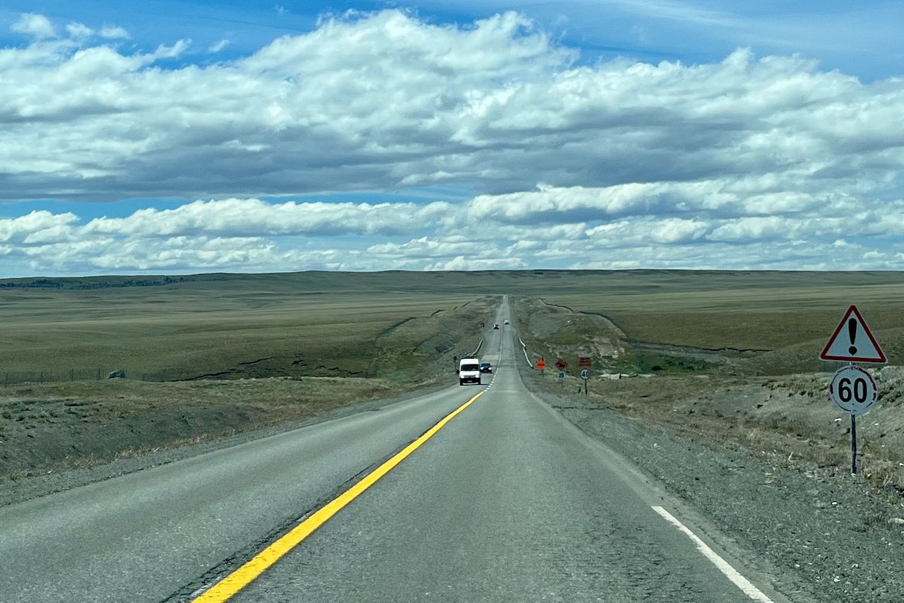
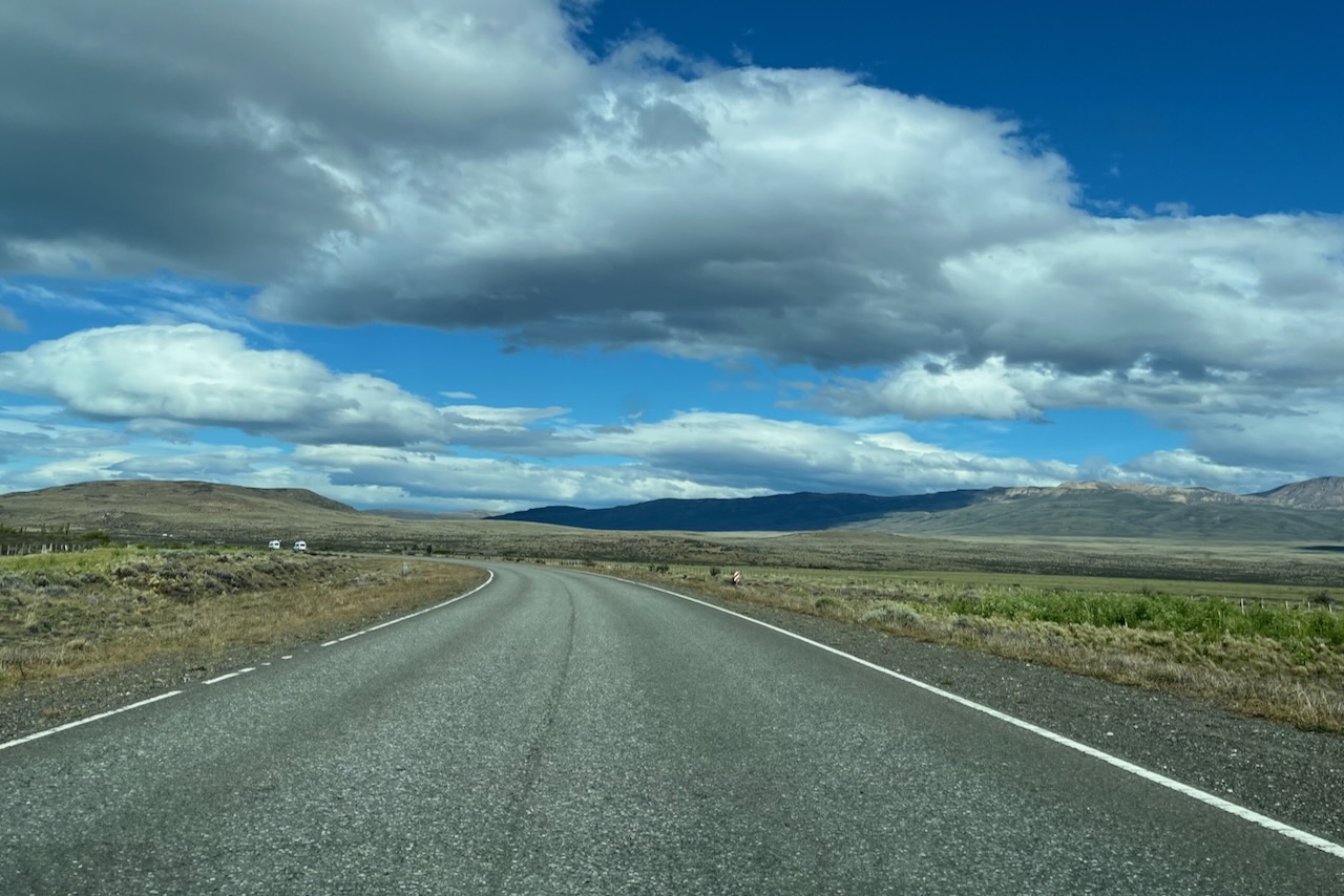
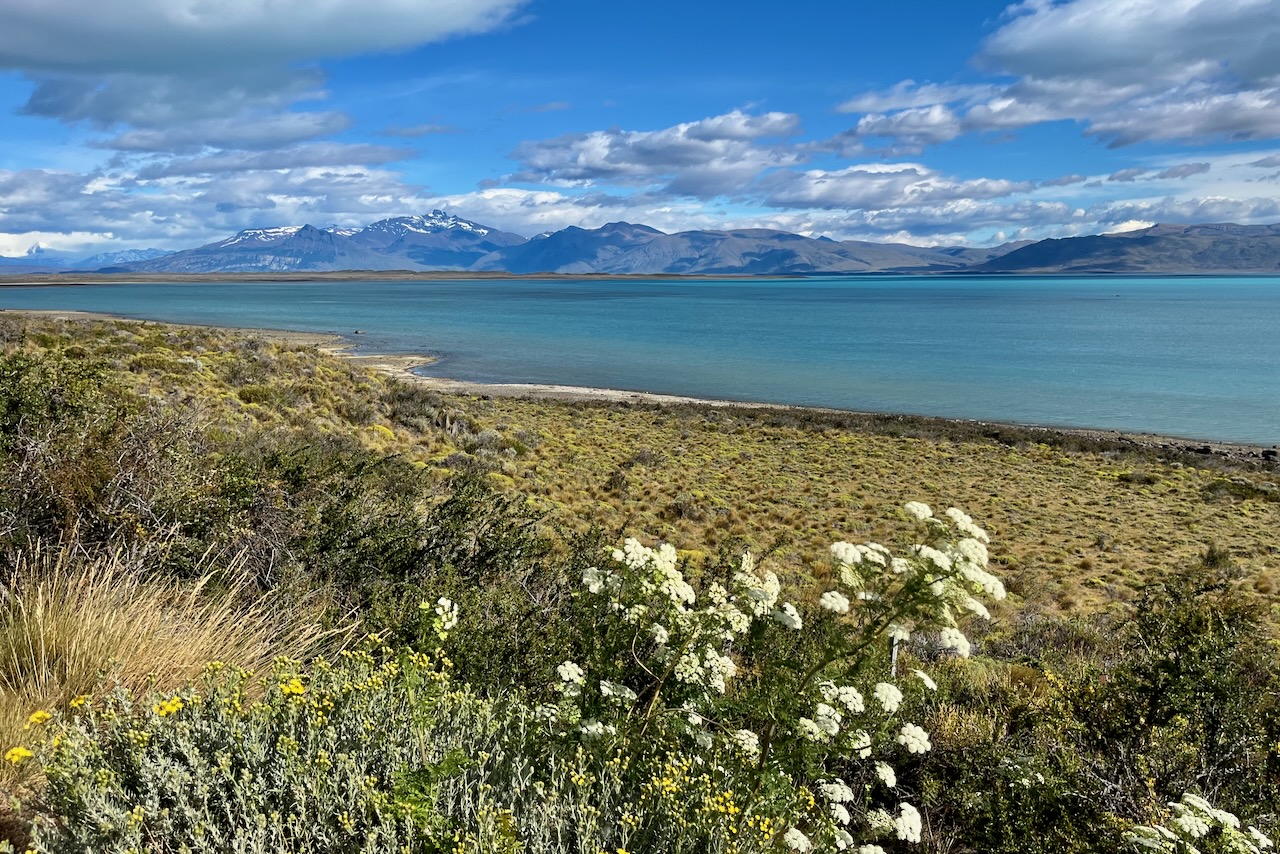
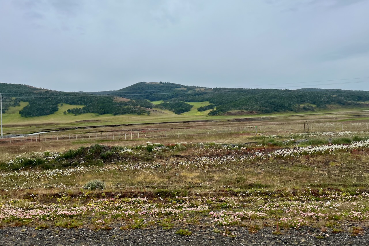
Once we crossed the border we headed north on Ruta 40 to El Calafate. We followed Ruta 40 all the way instead of taking a shortcut on Ruta 7. We saw cars driving off onto Ruta 7 and understand it is fine but with a small rental two wheel drive we did not want to risk it on an unpaved road. The views along the way on Ruta 40 is rolling planes as far as eye can see, quintessential Patagonia one could say.
Driving north on Ruta 40 to El Calafate, ArgentinaLago Argentino lookout on the way to El Calafate, Argentina
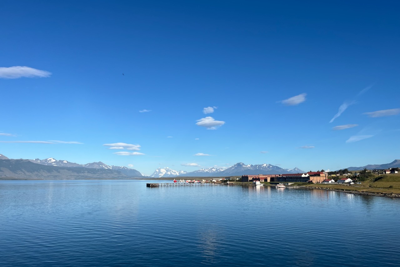
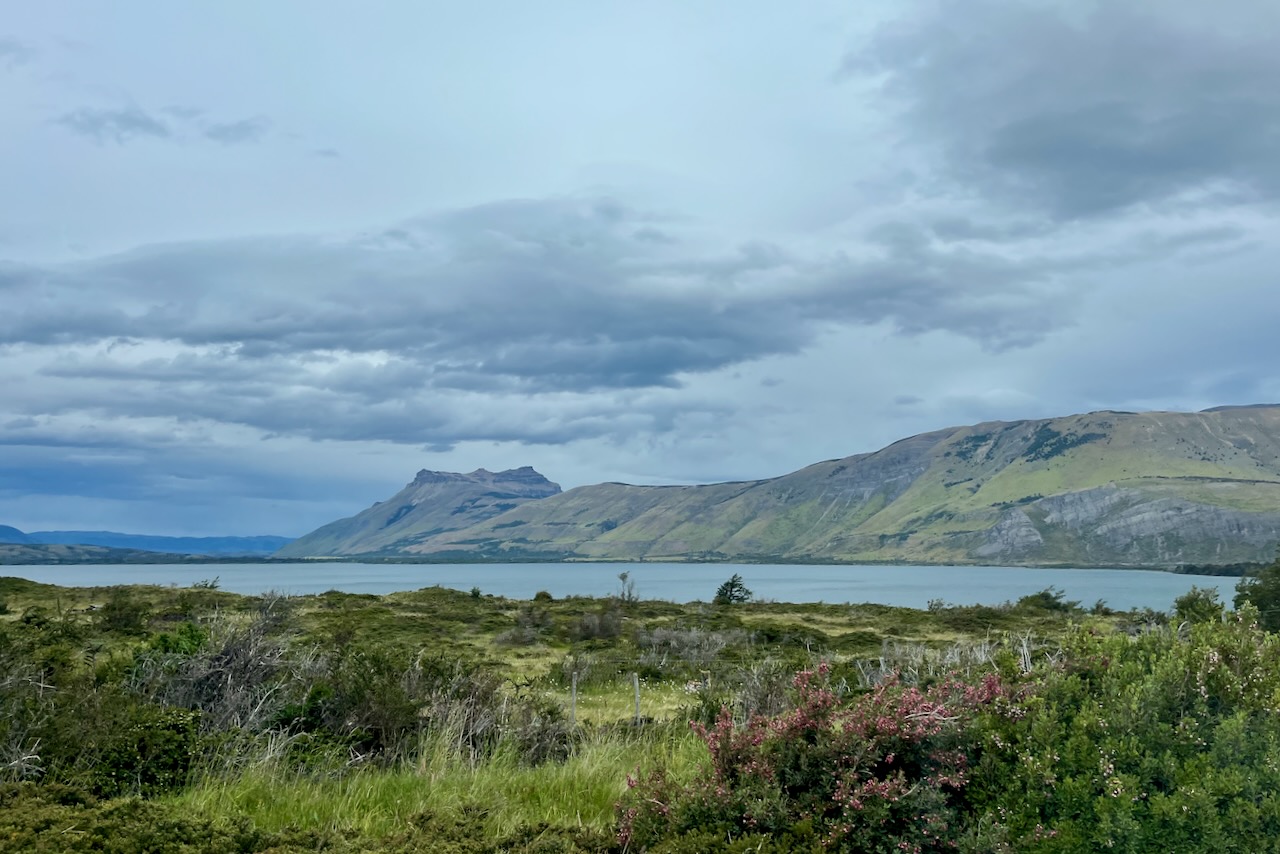
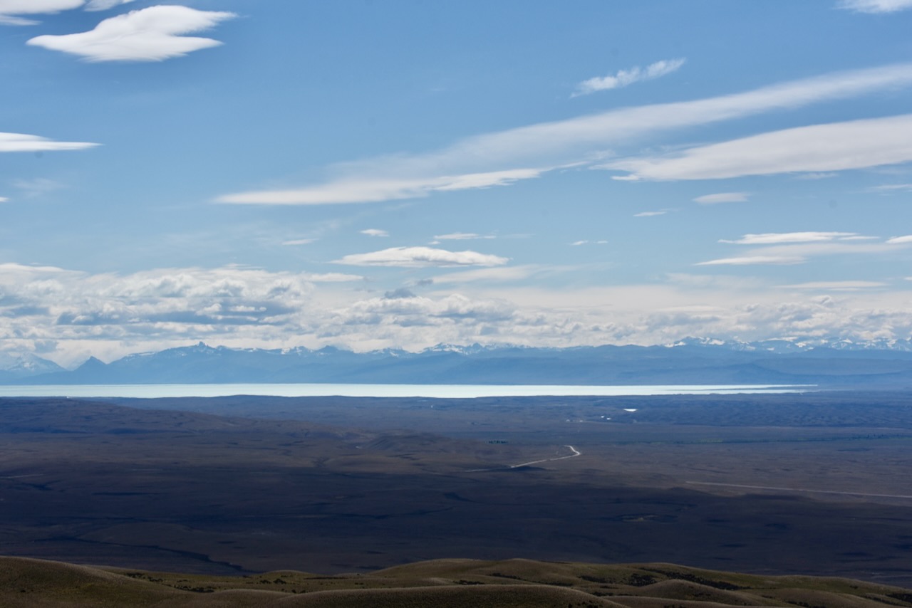
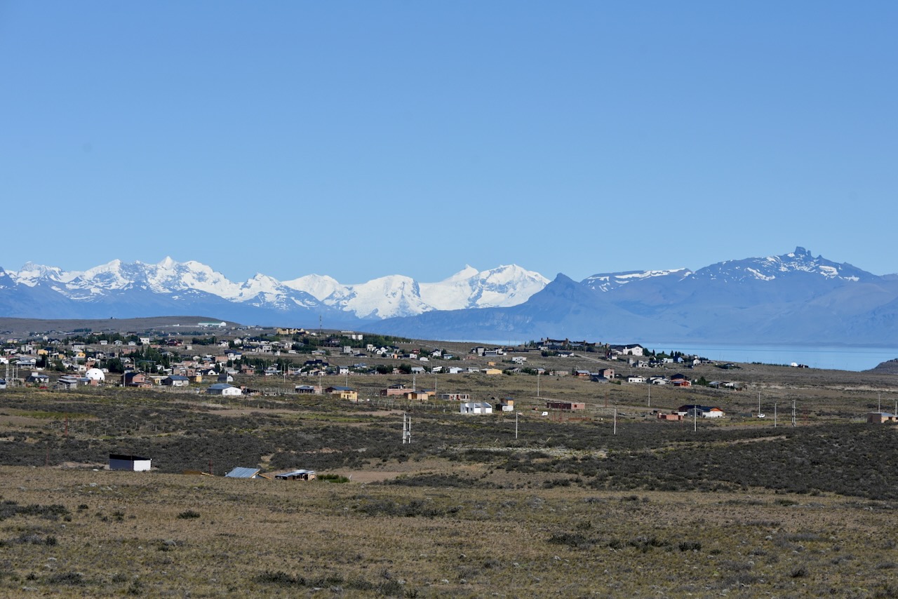
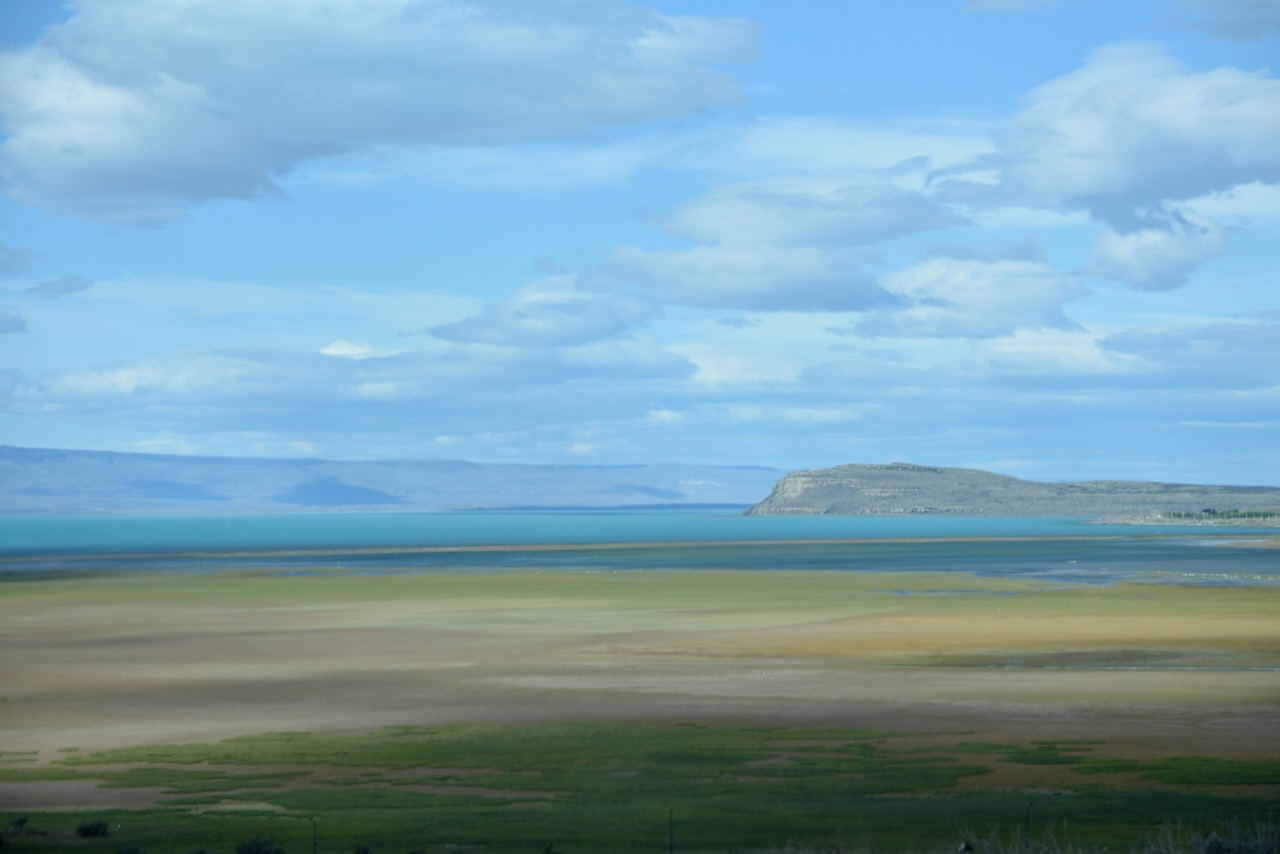
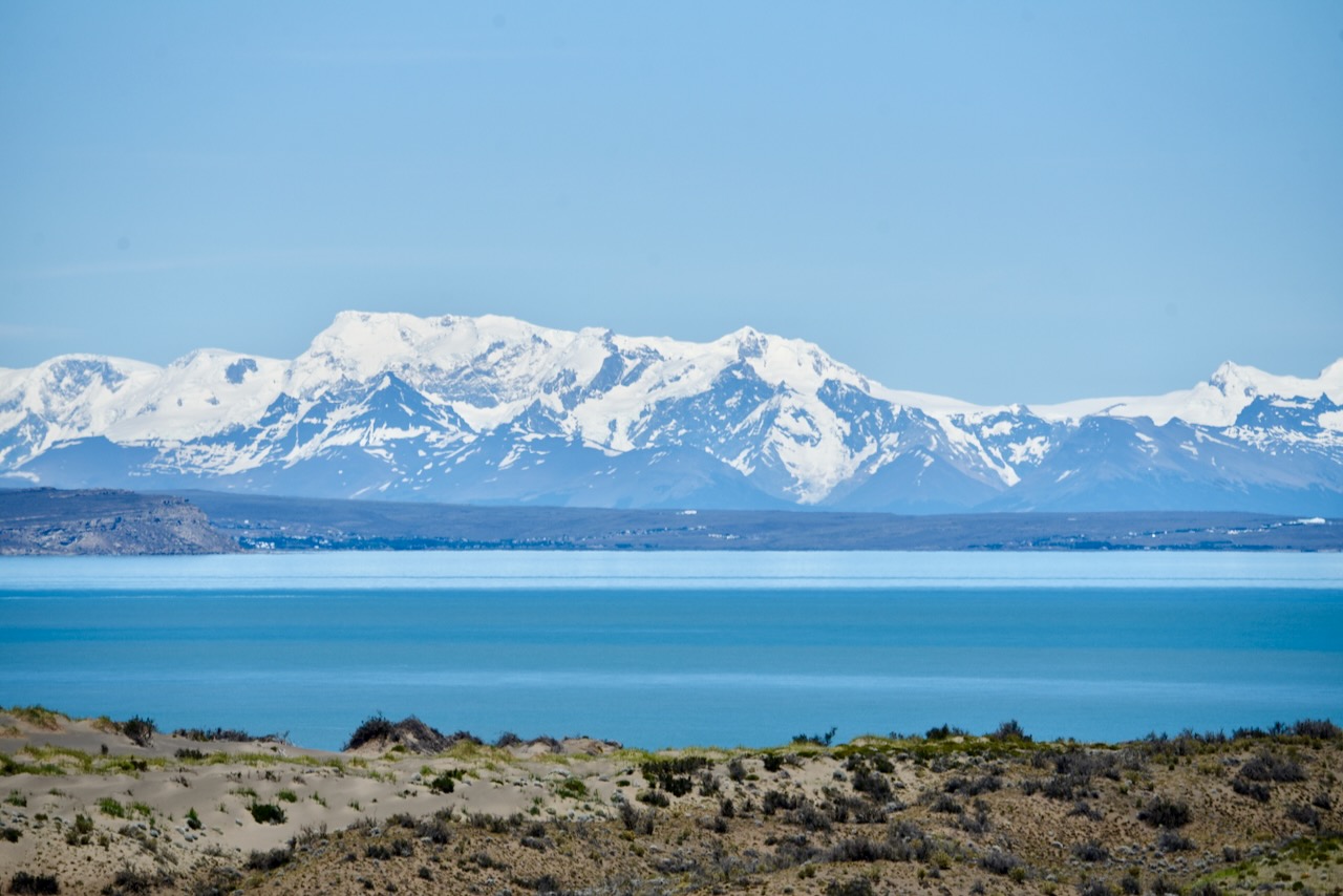
We reached El Calafate at about 5pm. The scenery around with the snow cap mountains in the distance and turquoise blue Lago Argentino was very beautiful. El Calafate is a major holiday place for Argentinians and international travelers. It has a very lively main street with many restaurants and bars with great food and all sorts of essential shopping one could need.
El Calafate with Lago Argentino and mountains in the background, Argentina
The next day we headed to Perito Moreno Glacier and our first part of exploration of the Los Glaciares National park.
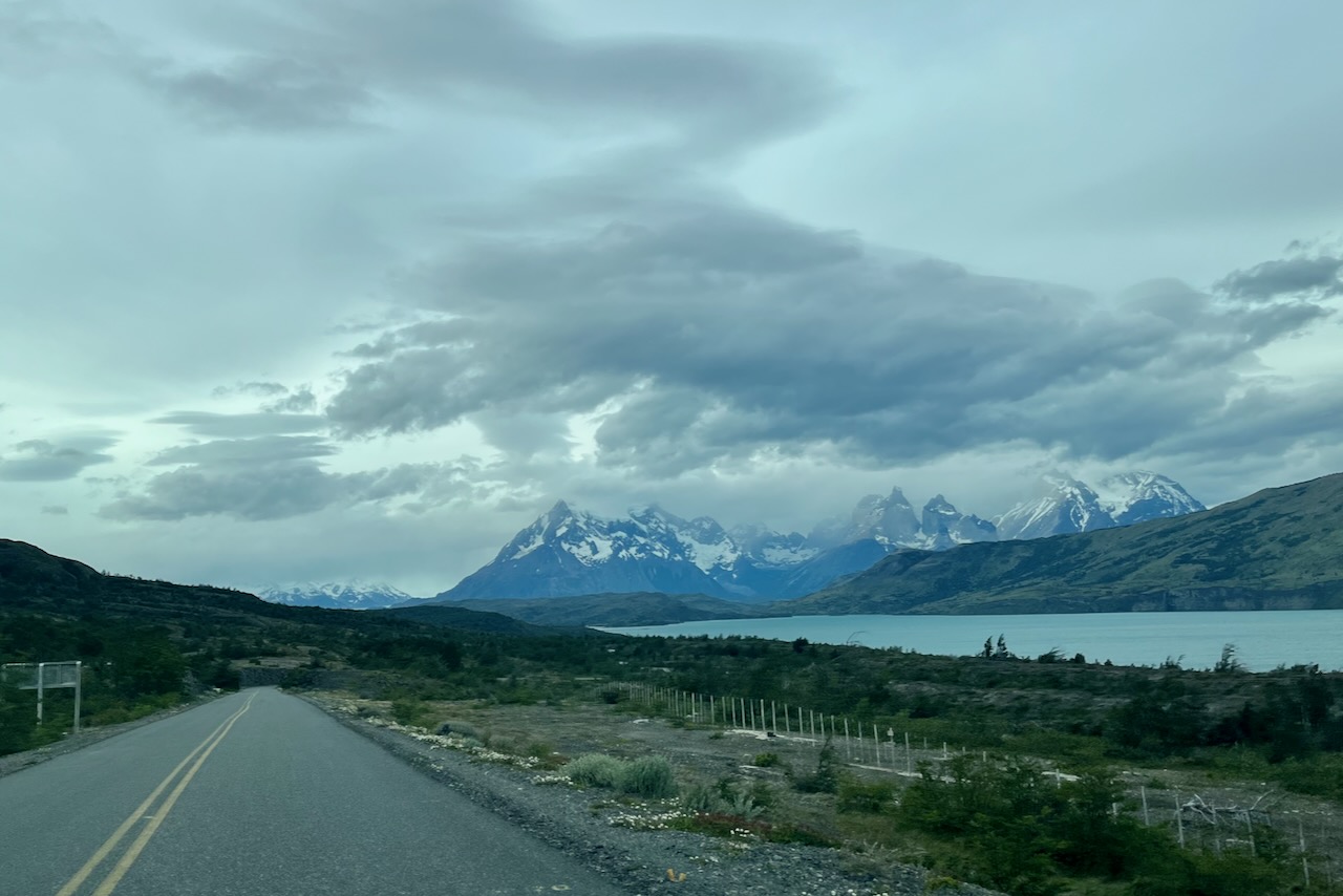
Road from El Calafate to Perito Moreno Glacier, Argentina
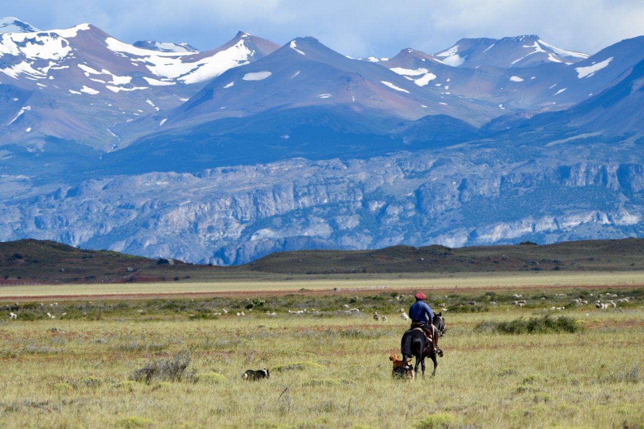
The drive from El Calafate to Perito Moreno is very scenic passing through agricultural lands where we saw gauchos and even had a condor flying by very low over our car. Part of the drive goes along beautiful Lago Argentino.
Gaucho and mountains in the background en route from El Calafate to Perito Moreno, ArgentinaCondor, en route from El Calafate to Perito Moreno, ArgentinaLago Argentino, ArgentinaLago Argentino, Argentina
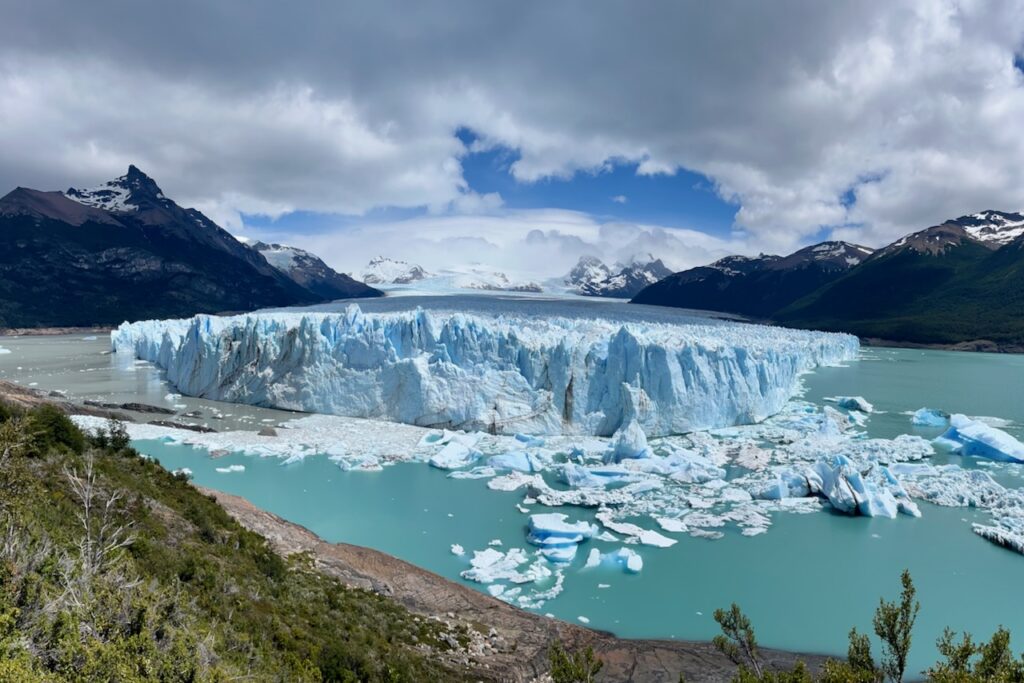
Perito Moreno Glacier is 30km long, 5km wide and up to 60m high. It has a well developed tourist infrastructure around it making it one of the more accessible glaciers to visit. We spent most of the day walking around, admiring the glacier and watching it calve. It is a spectacular site. Here is more on our day at Perito Morreno
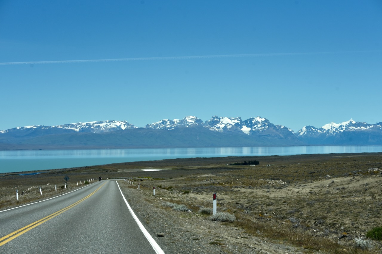
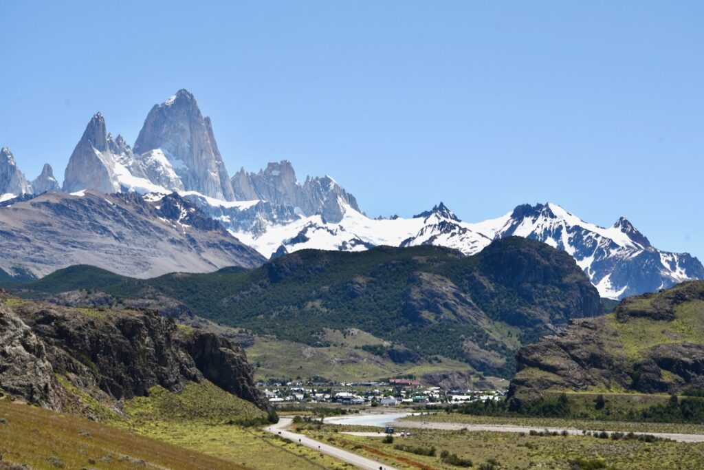
On the next day, after spending two nights in El Calafate, we stocked up in the supermarket, got fuel and headed north to El Chalten. El Chalten is a small village and is the best base to explore Mount Fitzroy and surroundings. We were very lucky with the weather on the day we drove. There was no cloud in the sky and we had phenomenal views of the mountains all along the way.
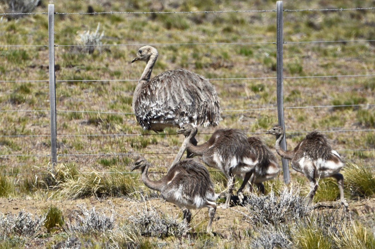
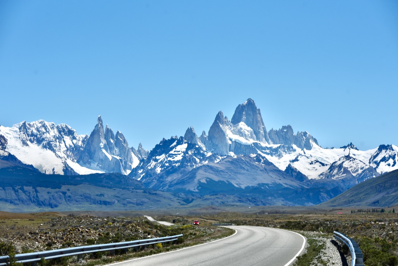
Lago Argentino and mountains in the distance, Heading north from El Calafate to El Chalten, ArgentinaRhea with chicks along the road from El Calafate to El Chalten, ArgentinaLago Viedma, approaching El Chalten, ArgentinaFitz Roy mountain and the road to El Chalten, Argentina
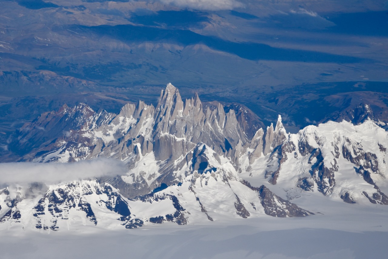
It was fascinating to see the view of Mount Fitz Roy on the ground and then look at the photo we took from the airplane while flying over it on our way to Punta Arenas in Chile. The rugged sharp edges on the side where ice field ends. And much more smooth looking surfaces that we were looking at from the planes.
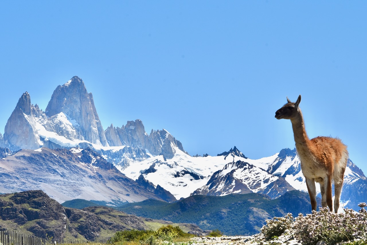
Mount Fitz Roy and surrounding mountains aerial view, ArgentinaFits Roy mountain and guanaco near El Chalten, Argentina
We stayed for 6 nights in El Chalten to give ourselves time to explore the area. Since weather changes a lot and often we thought it was important to have a couple of extra days in case it rained or snowed and stopped us from hiking. Here is a write up on our stay in El Chalten and hikes around Mount Fitz Roy.
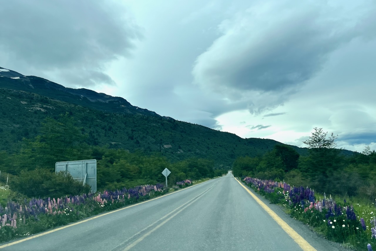
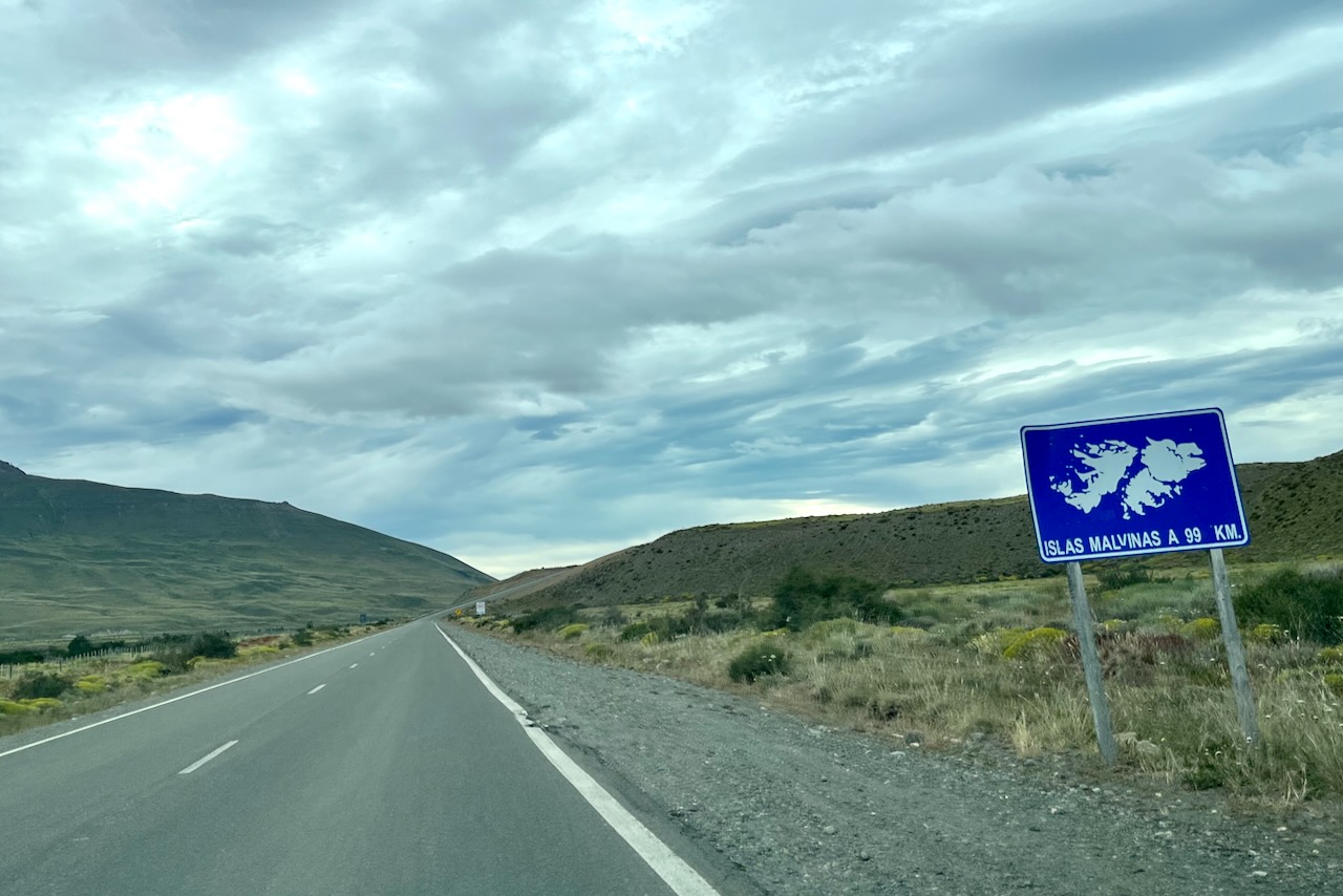
After 6 nights in El Chalten it was time to go back to Chile. As we were leaving El Chalten we again saw Malvinas sign as the one at Perito Moreno Glacier. The 99km mark must be missing a zero though. On our drive back we had a very thick cloud cover and it was quite a contrast to the views we had on the way to El Chalten a week earlier. This time we had striking menacing sky completely changing the landscape. But it was spring in Patagonia and flowers were everywhere and they seemed to have come up just within this past week since our drive.
Driving out of El Chalten to El Calafate and Malvinas sign, ArgentinaDrive from El Chalten to El Calafate, Viedma lake and mountains in the distance, ArgentinaFlowers in Patagonia en route from El Calafate to the border with Chile, ArgentinaWelcome sign when entering Chile from Argentina at Dorotea pass