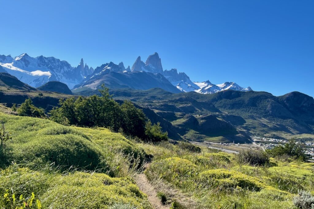
The drive from El Calafate to El Chalten took us about 3 hours. We arrived at lunch time and checked into our airbnb. The weather was phenomenal for El Chalten hiking, especially for Patagonia. No wind, sunshine and no clouds so we went right away for a short hike. Here is more on the hike to Condor lookout and Aguilas (eagles) lookout.
After the hike we had a very nice dinner at one of the restaurants in El Chalten. El Chalten has a surprisingly good collection of restaurants, bakeries and cafes for such a small place. On this first evening in El Chalten it seemed every house had a barbeque going (parrilla to be correct) on the occasion of warm beautiful weather. Butcher almost ran out of meat!
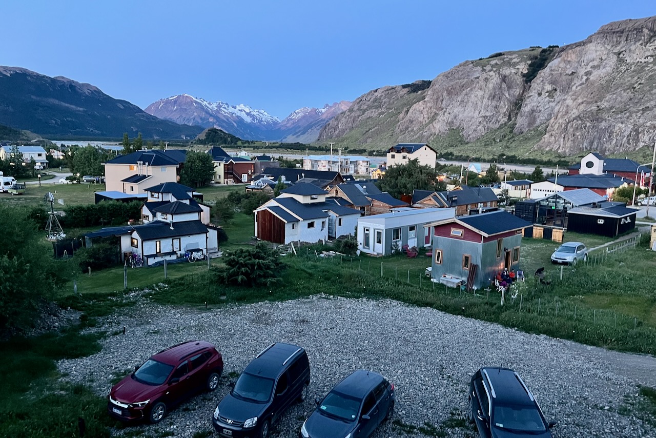
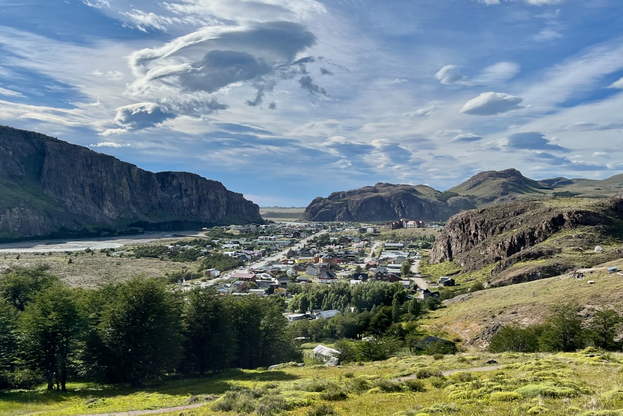
View over El Chalten from our Airbnb, El Chalten, Argentina
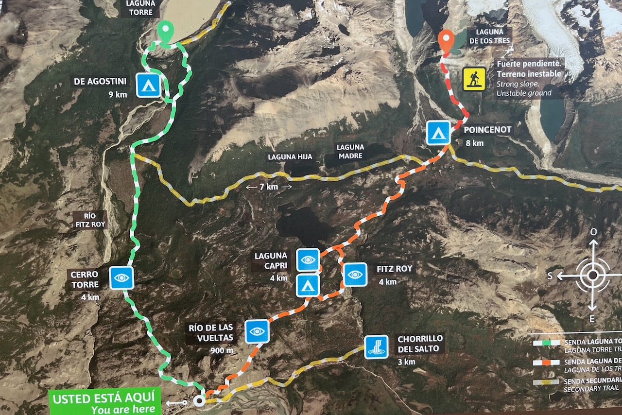
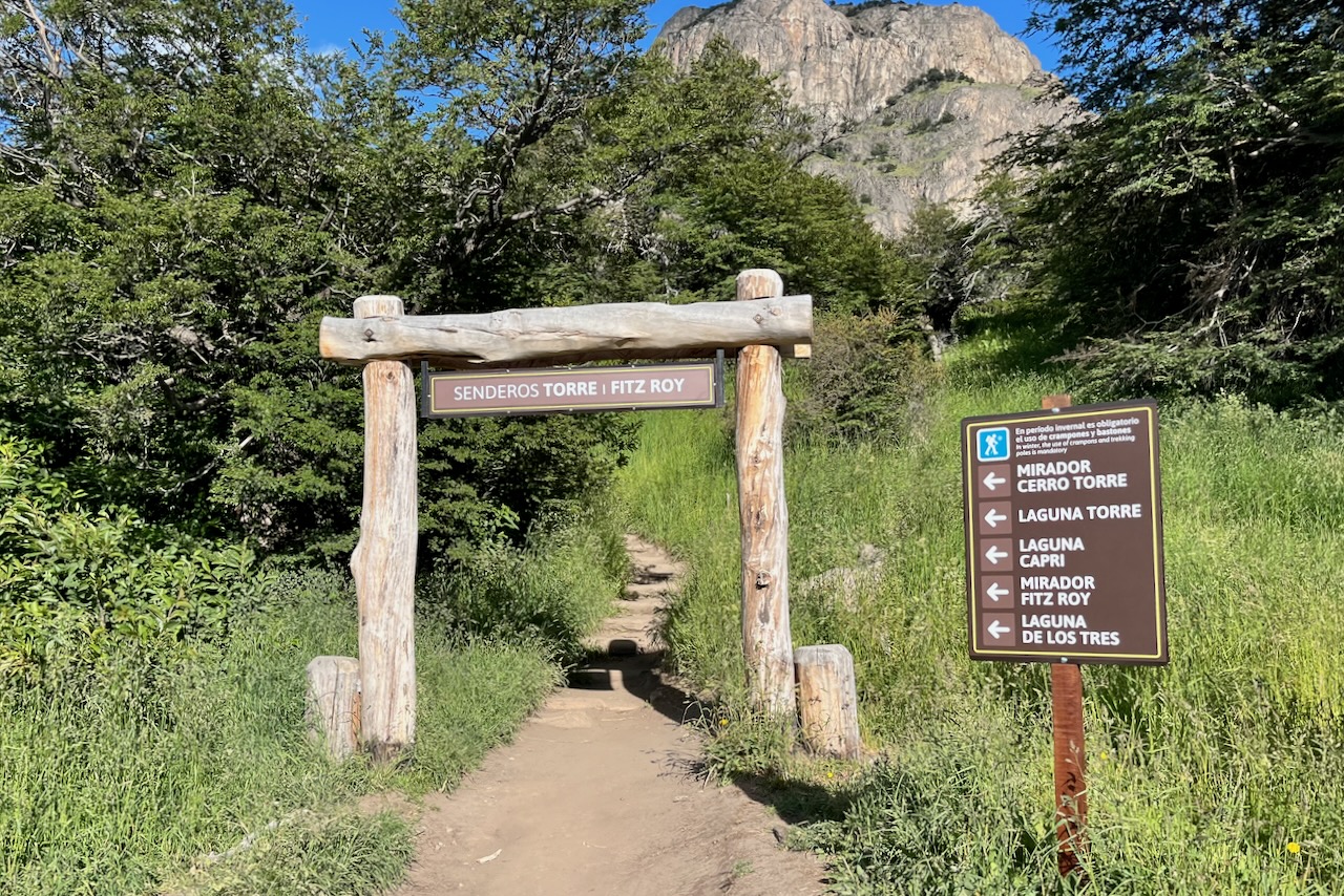
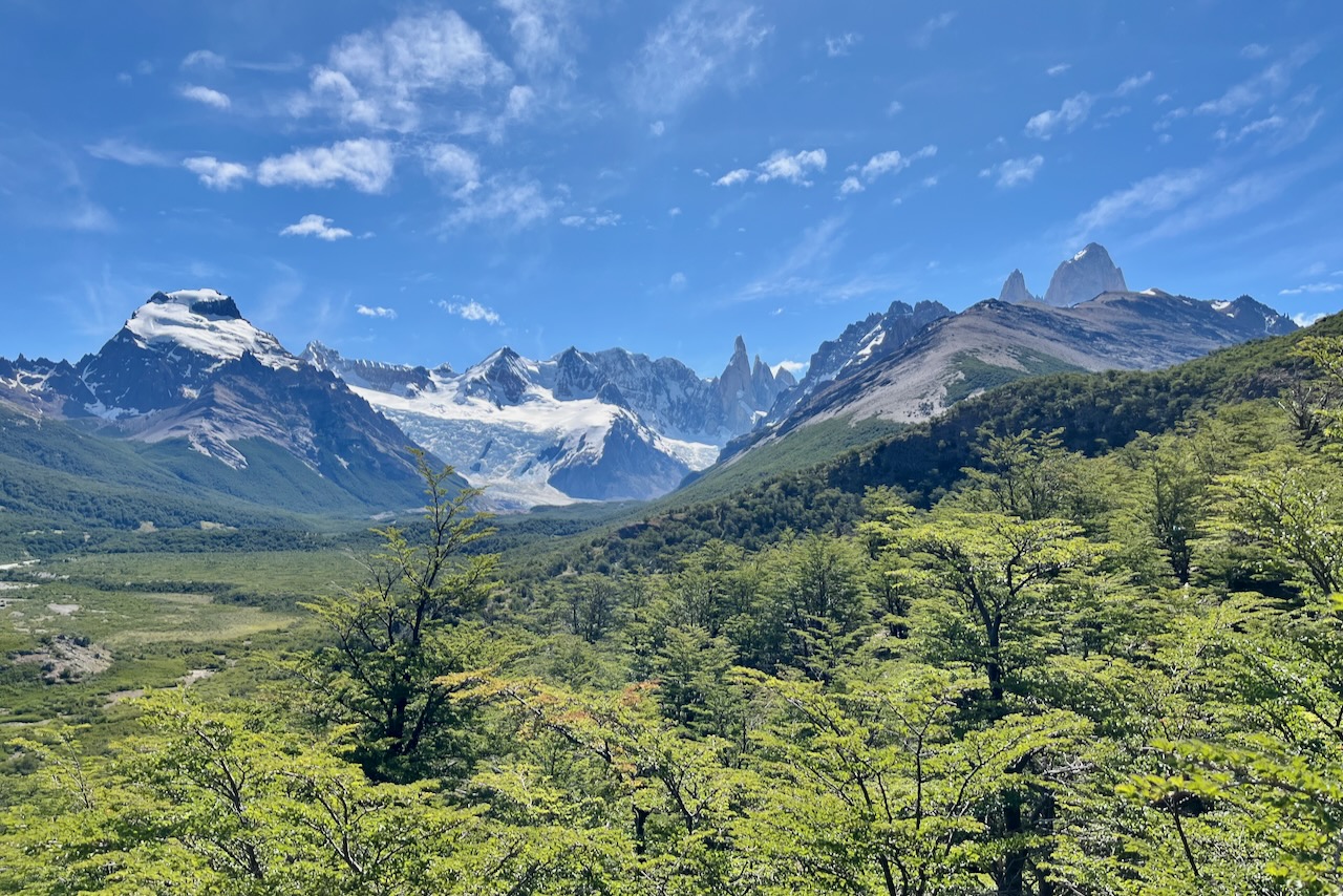
There are two major full day 20km plus hikes from El Chalten to consider. Laguna Torre (overlooking Cerro Torre the tallest of the 3 skinny mountains) and Laguna de Lost Tres (overlooking Fitz Roy). Many other hikes are a part of or connecting to these two main trails.
Map of the hiking trails from El Chalten, Argentina
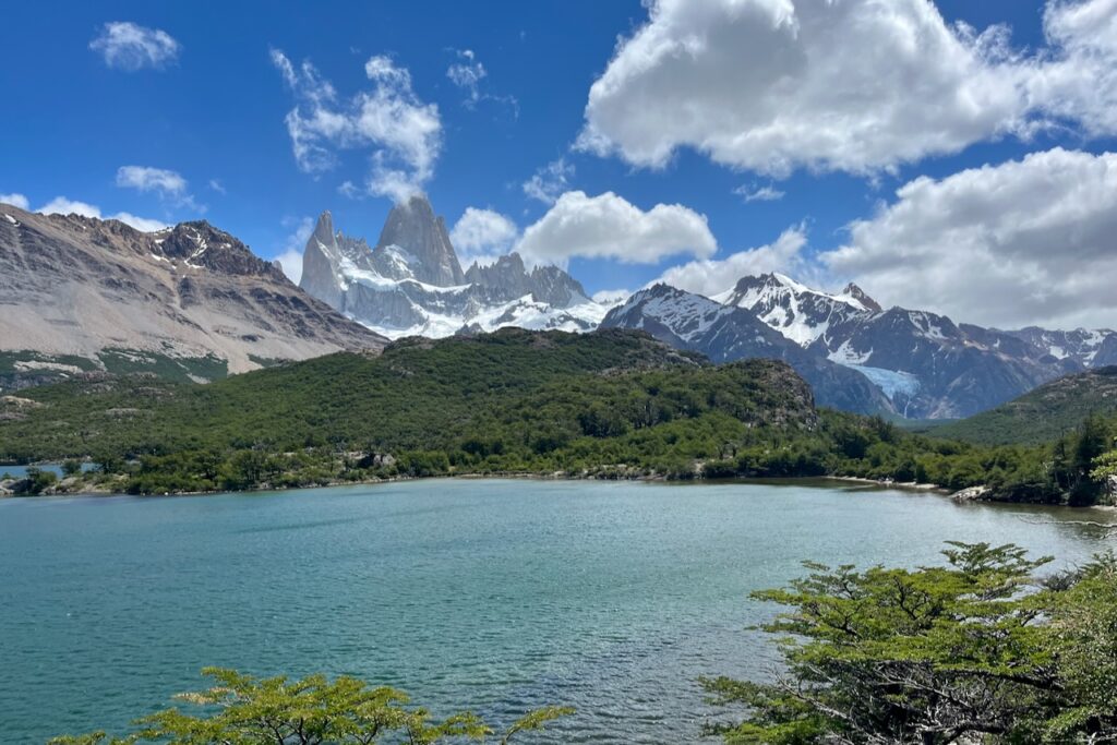
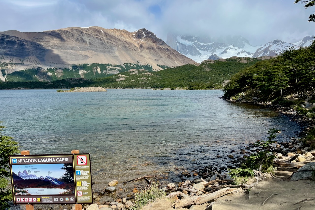
On our first full day in El Chalten we thought we would go to Laguna del Los Tres. But as we reached Laguna Capri along the trail, the cloud cover was very thick and we decided that we would try Laguna del Los Tres another day. We had a nice hike to Laguna Capri, then went to Ftz Roy lookout, had our sandwiches and watched clouds moving and slowly lifting from Fitz Roy. Here is more on our hike to Laguna Capri and Fitzroy lookout.
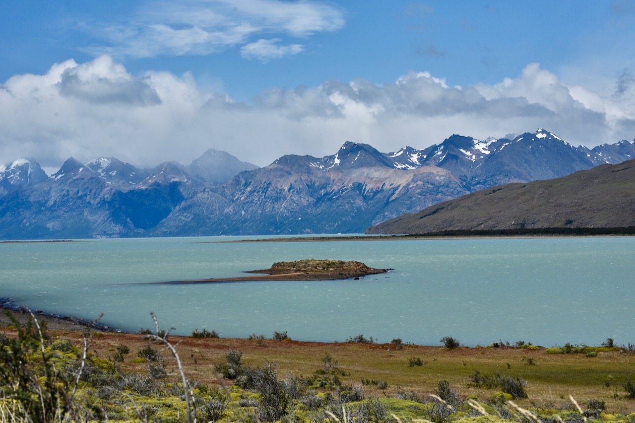
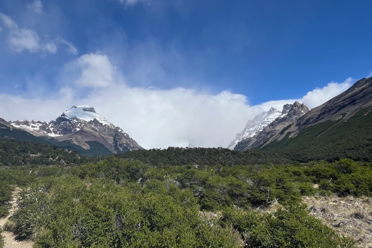
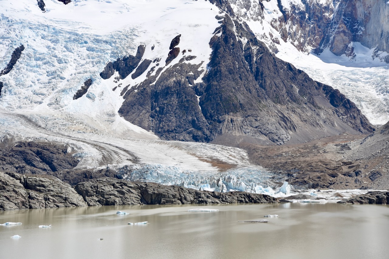
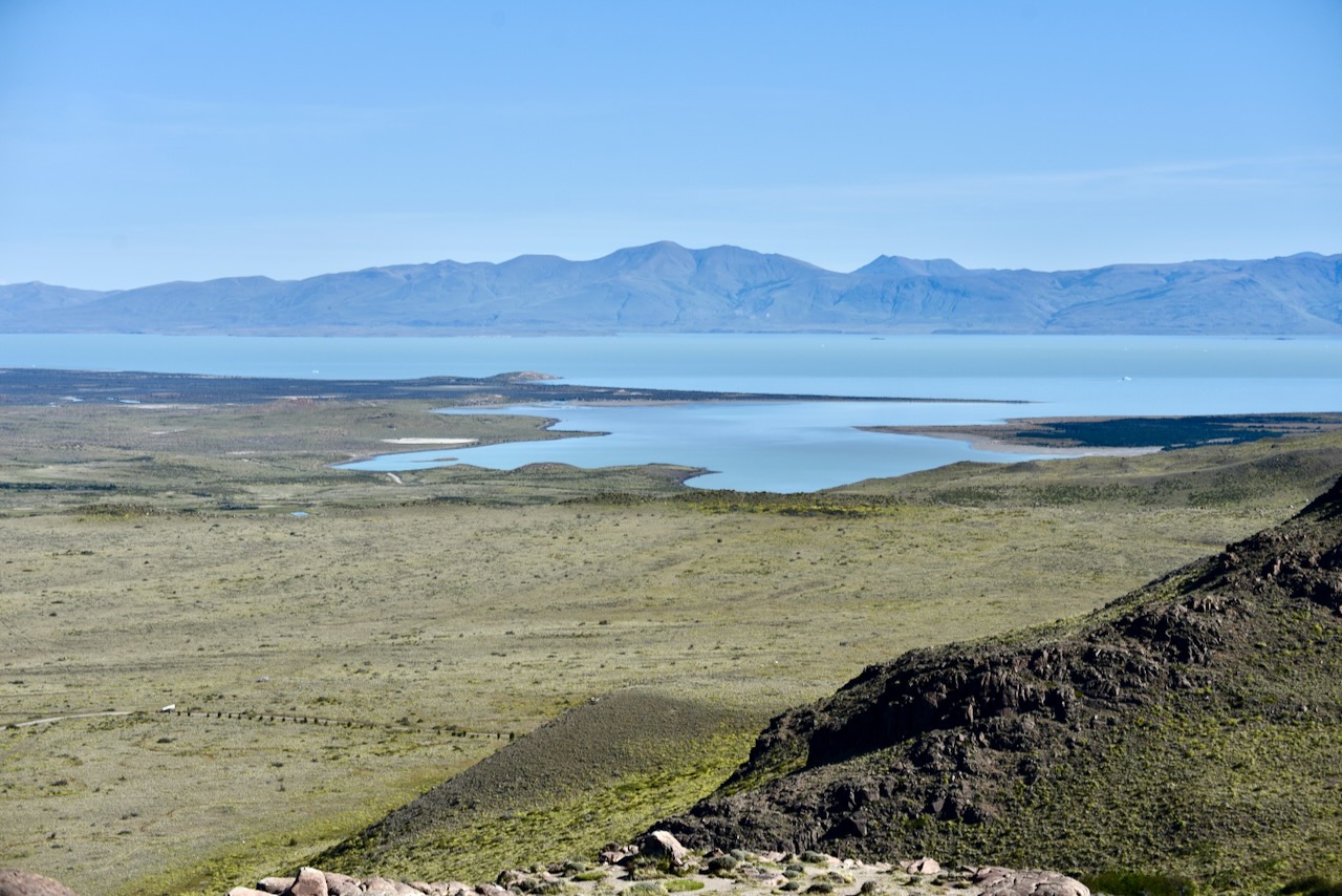
The next day the weather deteriorated. It was windy, very cloudy with rain in the forecast. Instead of hiking we drove around. First we went to Lake Viedma. One cannot see Viedma Glacier because of how the mountains are, but the lake and birds around it are good. Then we went up towards Rio Electrico to check access to the alternative route for Laguna Los Tres hike via Piedras Blancas glacier lookout that we were considering.
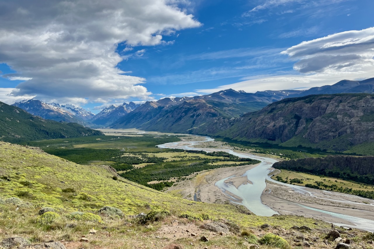
Lake Viedma view near El Chalten, Argentina
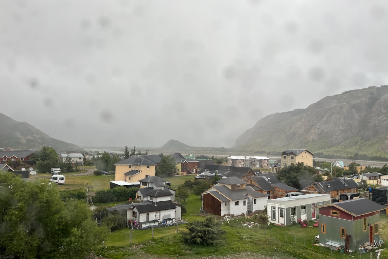
The weather kept getting worse. Winds were blowing at over 40kmh and rain started. There was no point driving around as we could not see much of the scenery. We went back to our airbnb to watch the storm from inside and enjoy some Argentinian vino.
View on El Chalten from our room with weather deteriorating, El Chalten, Argentina
On our third day in El Chalten sun came back and we went hiking to Laguna Torre. It is a 20km mostly flat hike. The hike was great and skies mostly blue. But Cerro Torre was covered by solid cloud that was not lifting. Good thing is that we had a few days in El Chalten so we went to Laguna Torre again on our fifth and last day, after we made it to Laguna de Lost Tres.Here is more on our Laguna Torre hikes.
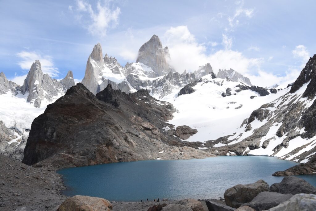
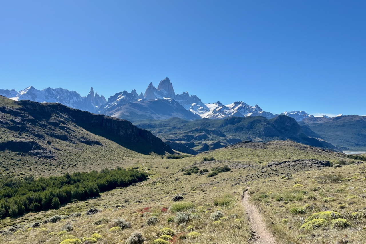
On our fourth day in El Chalten we finally headed to Laguna de Los Tres. Since we already did half of the trail when we went to Laguna Capri, we decided to take a different route. We started at Rio Electrico near Hosteria El Pilar and hiked past Piedras Blancas Glacier lookout point. This route is slightly shorter arguably flatter. Except for the steep last section of the hike to Laguna de Los Tres that one has to do no matter what. We felt that this hike was more difficult than Laguna Torre, but not as difficult as Torres Base lookout in Torres del Paine in Chile. The view at Laguna de Los Tres was definitely worth it. Here is more on Laguna de Los Tres hike.
We had excellent stay spending full five days in El Chalten. It has a really nice vibe and just feel slike a very happy place. It is also helped by the fact that El Chalten has some phenomenally good restaurants. We made our own sandwiches for lunch for all the hiking but ate out every night. Our favorites were La Tapera, La Oveja Negra, and Fuegia Bistro.
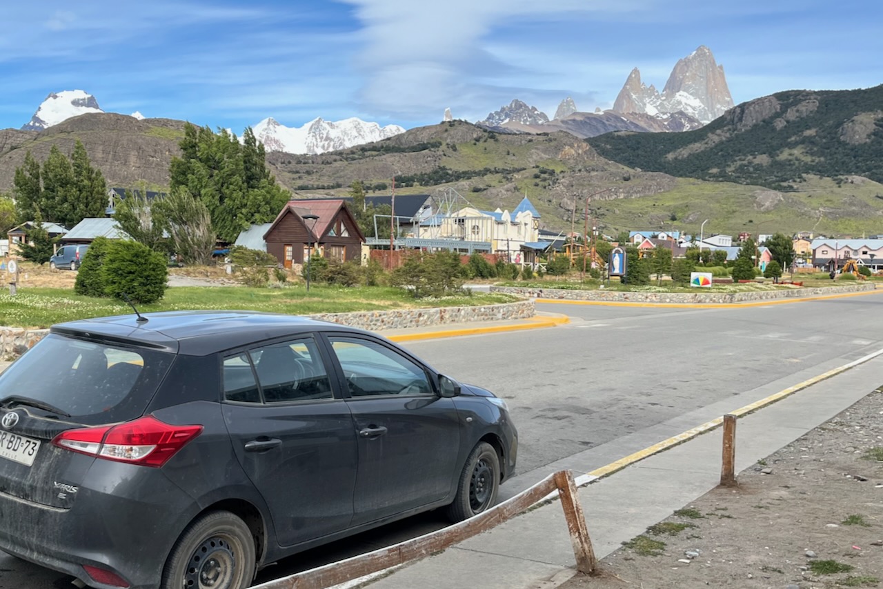
El Chalten street view with mount Fitz Roy in the background, Argentina
Perito Moreno is a very large beautiful glacier with excellent tourist infrastructure making it easy to visit. Until recently the glacier also was quite an exception in that it was a stable glacier, not retreating like many other glaciers around the world. However a recent study shows that that is changing now and Perito Moreno is shrinking away too.
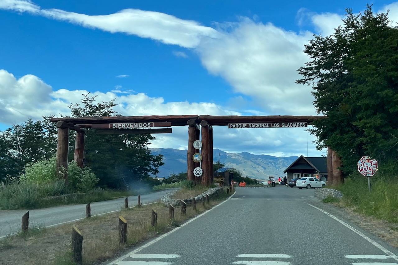
Entrance to Los Glaciares National Park, Argentina
Perito Moreno is part of Los Glaciares National park, also including Fitzroy mountain and area around it. We bought online a multiday permit that enabled us to go to Perito Moreno and later to all our hikes in El Chalten. The rates for the park entrance tickets are here.
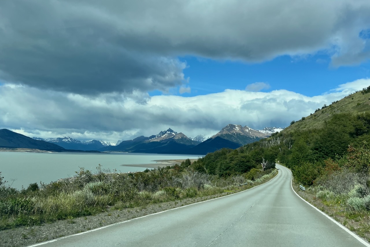
Road to Perito Moreno Glacier, Los Glaciares National Park, Argentina
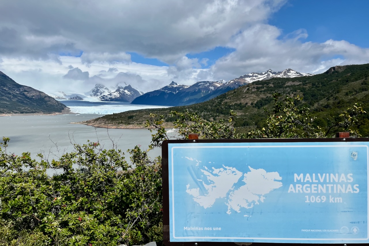
Mirador de Los Susperos is the first lookout point of Perito Moreno Glacier that one reaches. It has a beautiful view of the glacier and Lago Argentino around it. As at some other major tourist sites, we saw Malvinas Argentinas sign. We also saw it near El Chalten and at Iguazu falls with respective distances to the islands. Malvinas other name is Falkland islands, British overseas territory that Argentina and UK fought a war over in 1982. It is clearly not a closed question in Argentina.
View of Perito Moreno Glacier and Malvinas Argentinas sign, Argentina
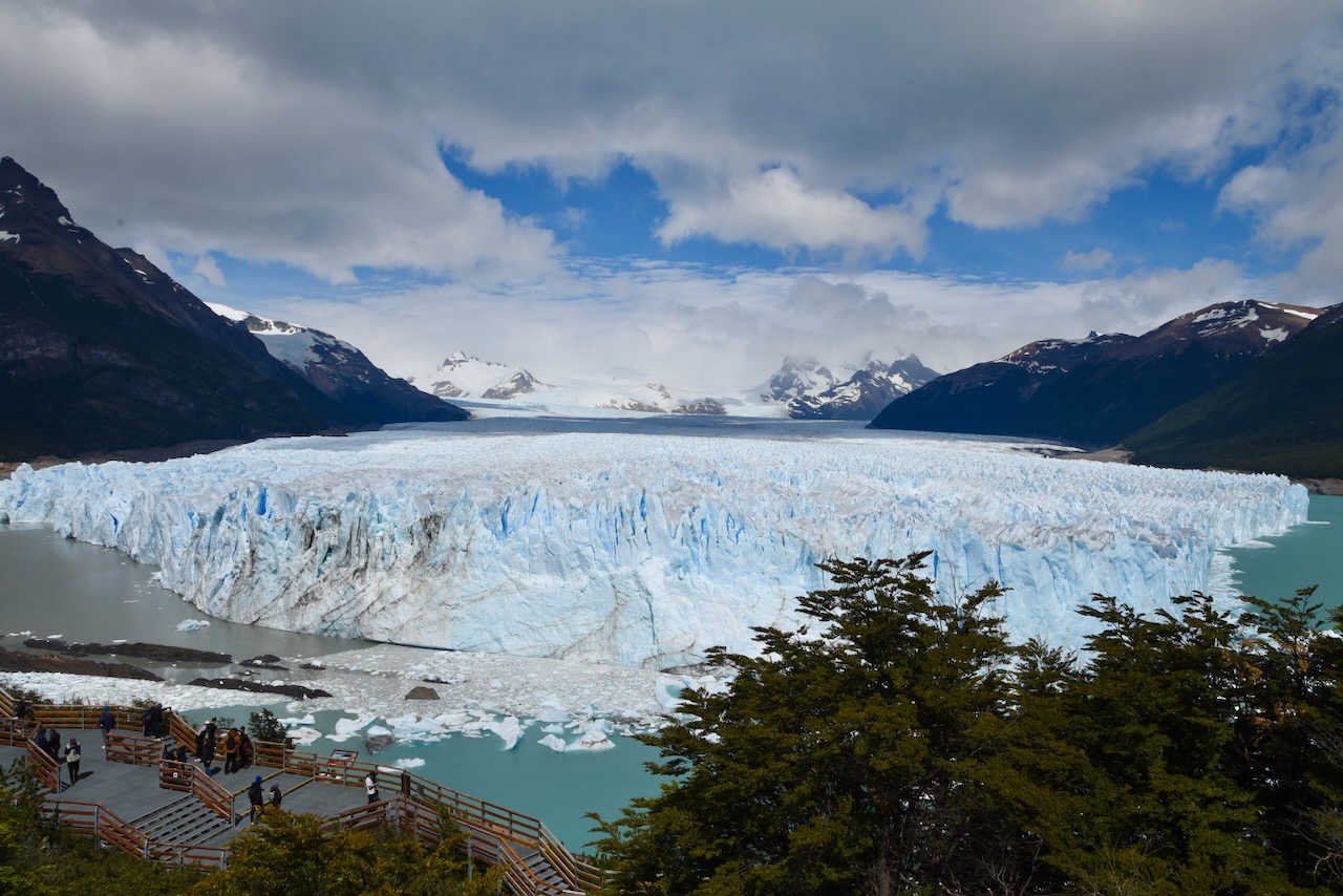
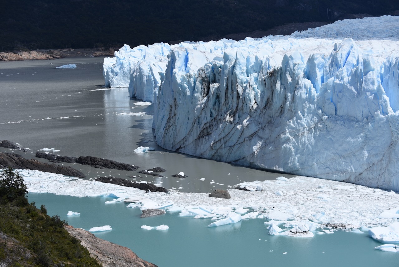
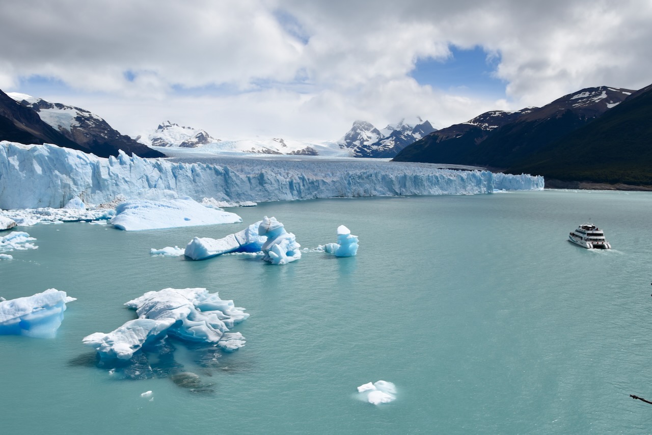
After the lookout point we headed to the parking lot for the Perito Moreno Glacier. Parking lot is very large and is far from the Glacier walking trails and platforms. One can walk it (uphill to the glacier visitor center) or take a shuttle. We took a shuttle. There are extensive walkways and viewing platforms to admire the glacier. It was busy with many tourist buses but the platforms have a lot of space to view the glacier. We have seen several chunks of ice breaking off, calving, while we were there. It is a very impressive spectacle.
Perito Moreno Glacier, ArgentinaPerito Moreno Glacier closer view, Argentina
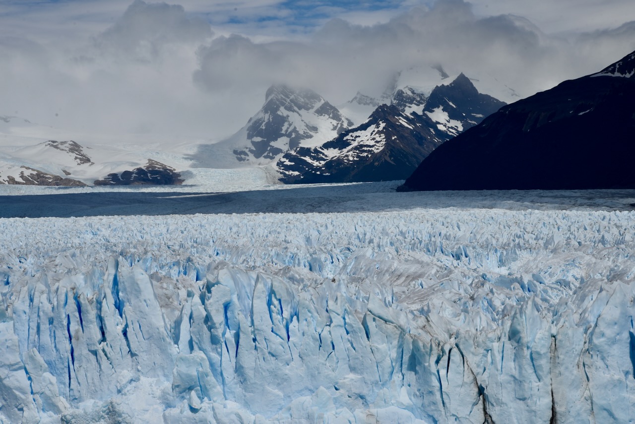
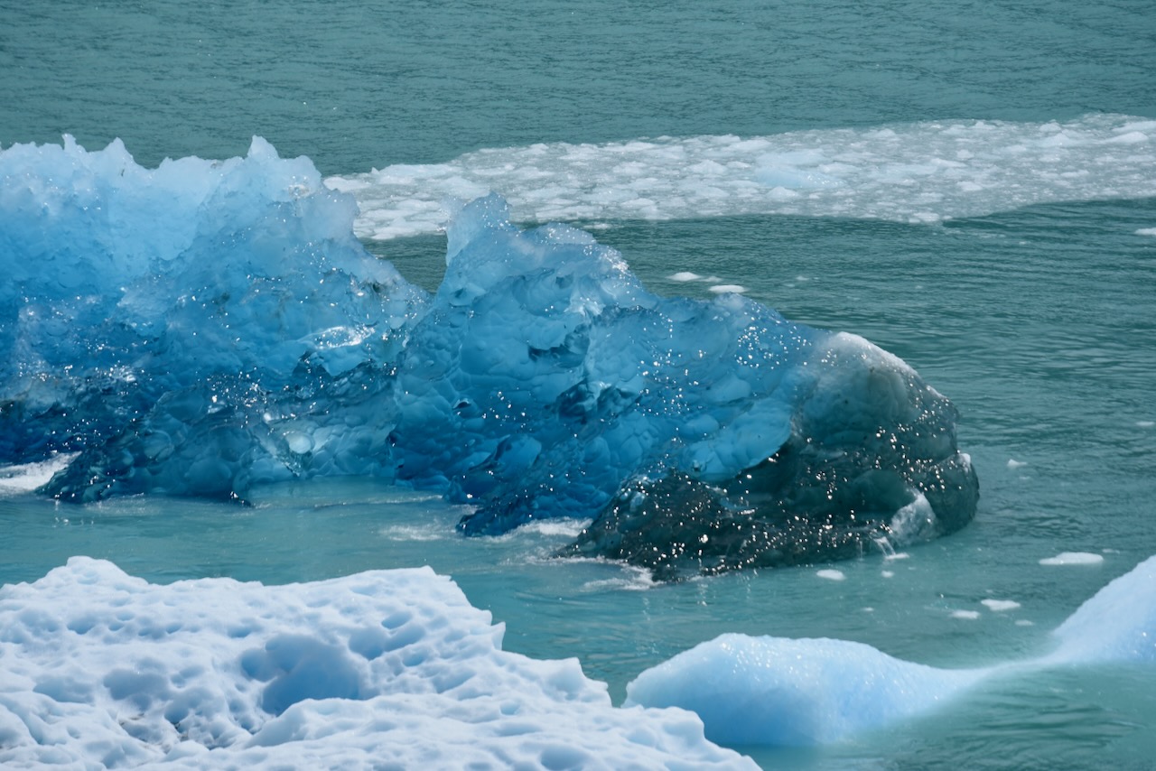
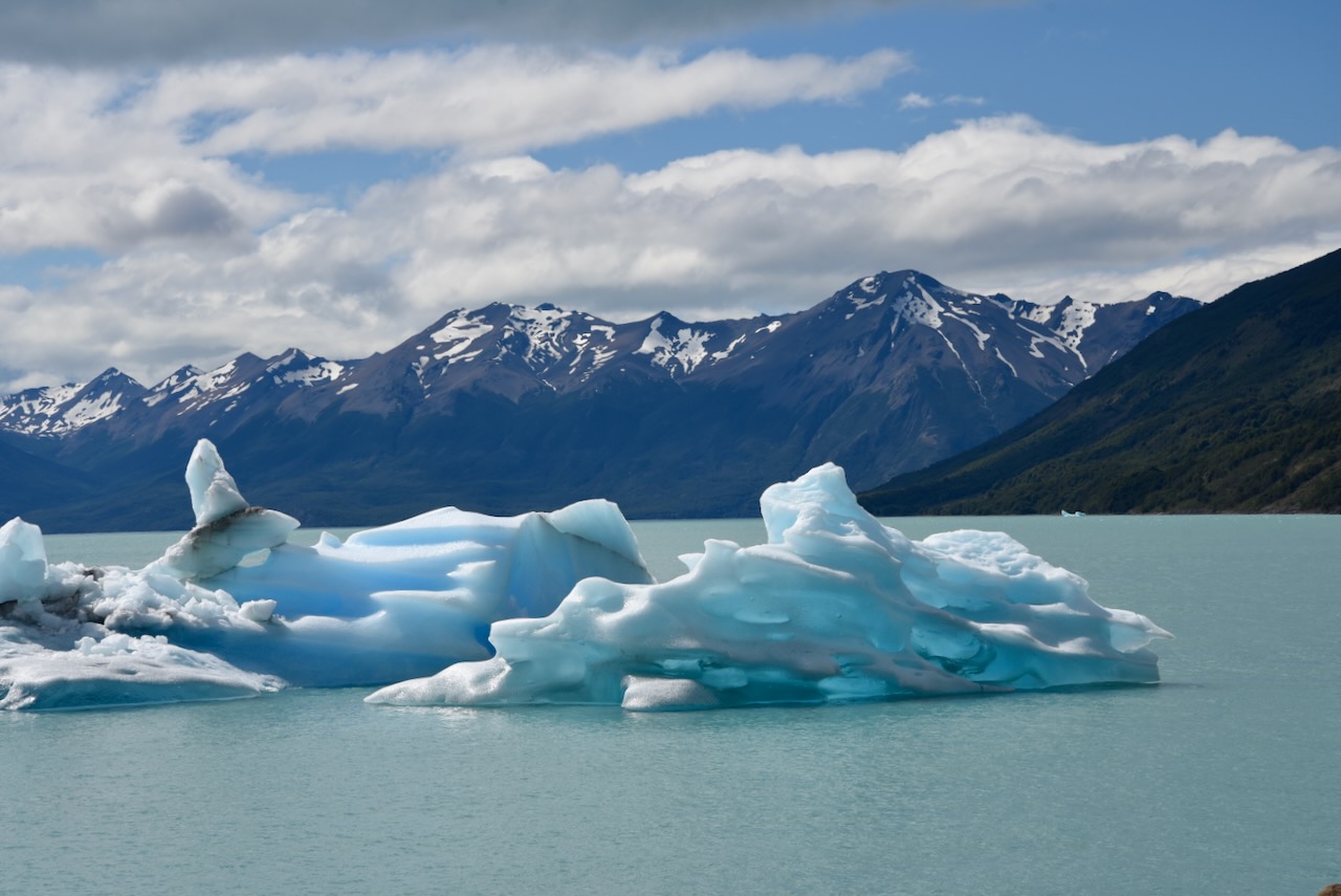
Unexposed and submerged part of the glacier has a different very blue color, because of its higher density. When pieces of glacier break off and flip over one can see this very beautiful, blue ice. Over time it cracks and starts to look white, like regular ice.
Freshly flipped piece of glacier with its blue ice, Perito Moreno, ArgentinaWater color changes near Perito Moreno glacier, ArgentinaPerito Moreno Glacier and tourist boat, ArgentinaFloating pieces of ice that broke off glacier, Perito Moreno, Argentina
We walked all the platforms to appreciate different view points. We had our sandwich lunch admiring the glacier. And by the time we were leaving, most tour bases have departed and we enjoyed the Glacier without crowds.
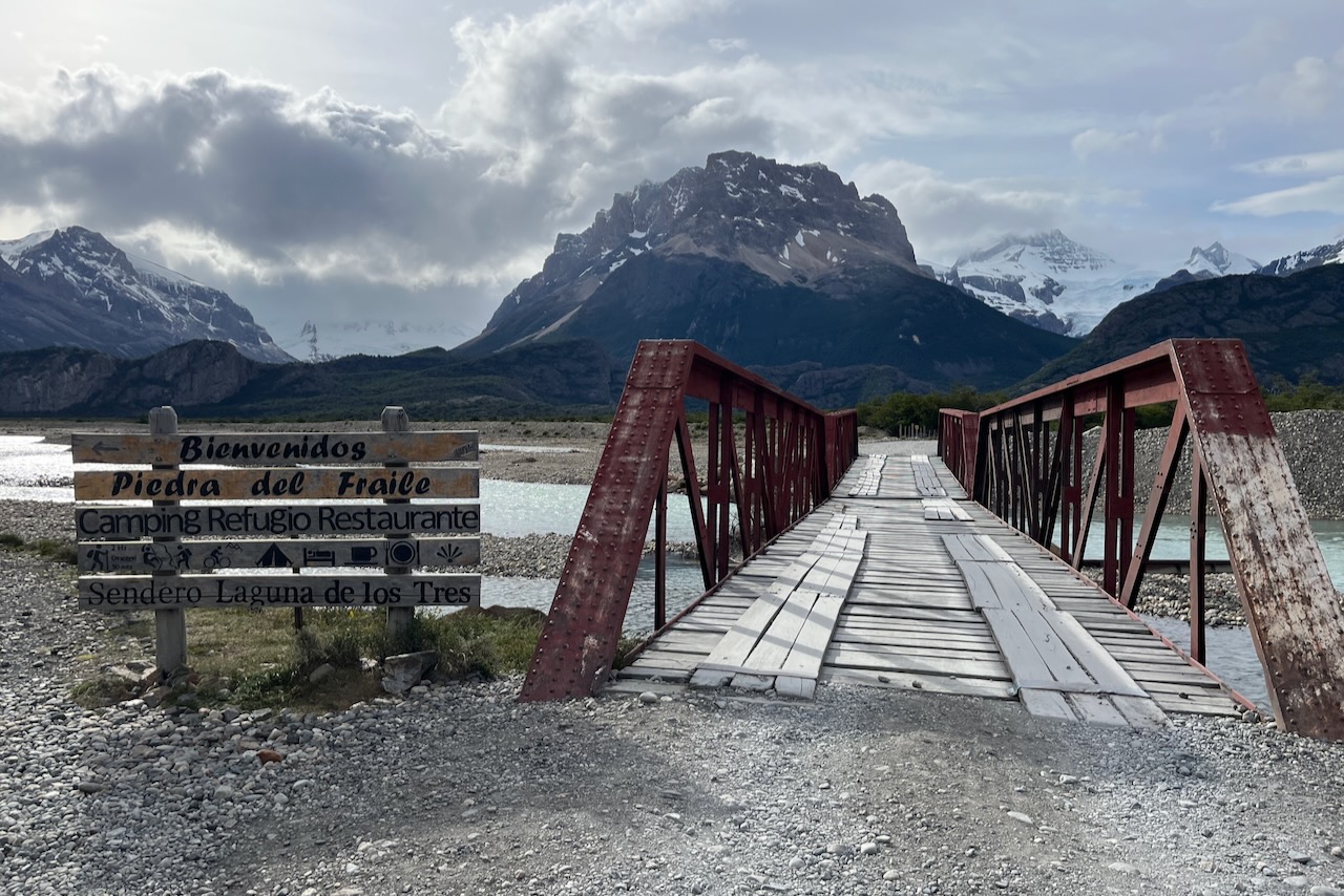
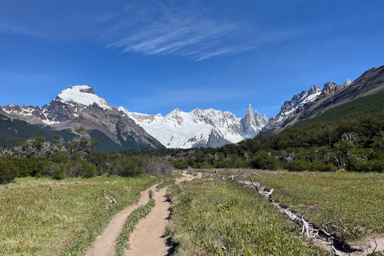
Laguna de Los Tres is the most famous hike from El Chalten. We did this hike from Rio Electrico and via Piedras Blancas glacier lookout. The more common route is from El CHalten via Laguna Capri. But since we already did Laguna Capri we wanted to try this different route. It was also meant to be marginally shorter and maybe flatter. We drove to the parking lot near Rio Electrico and started the hike along the river valley. The hike is about 22km return.
Parking lot near Rio Electrico to start hiking to Laguna de Los Tres, ArgentinaSign to Laguna de Los tres near Rio Electrico bridge, Argentina
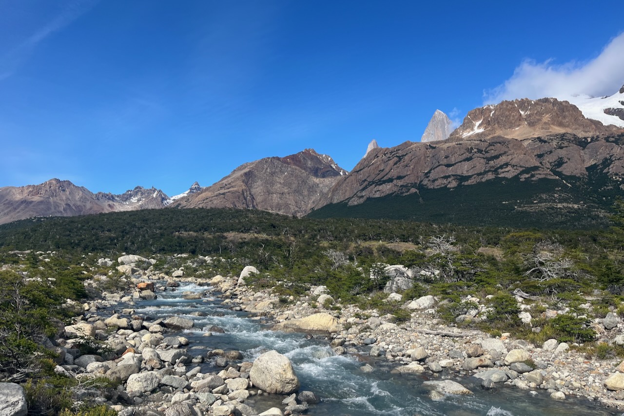
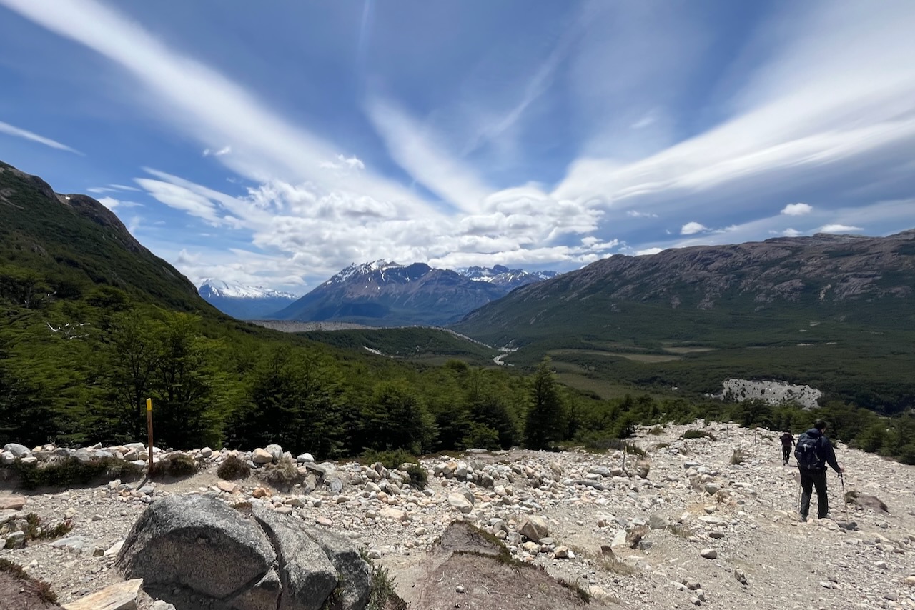
The first part of the trek is along the river bed. We did not see many people on the hike. The trail was well marked. The views are beautiful.
Views along the Rio Blanco river valley on trek to Laguna de Los Tres, Argentina
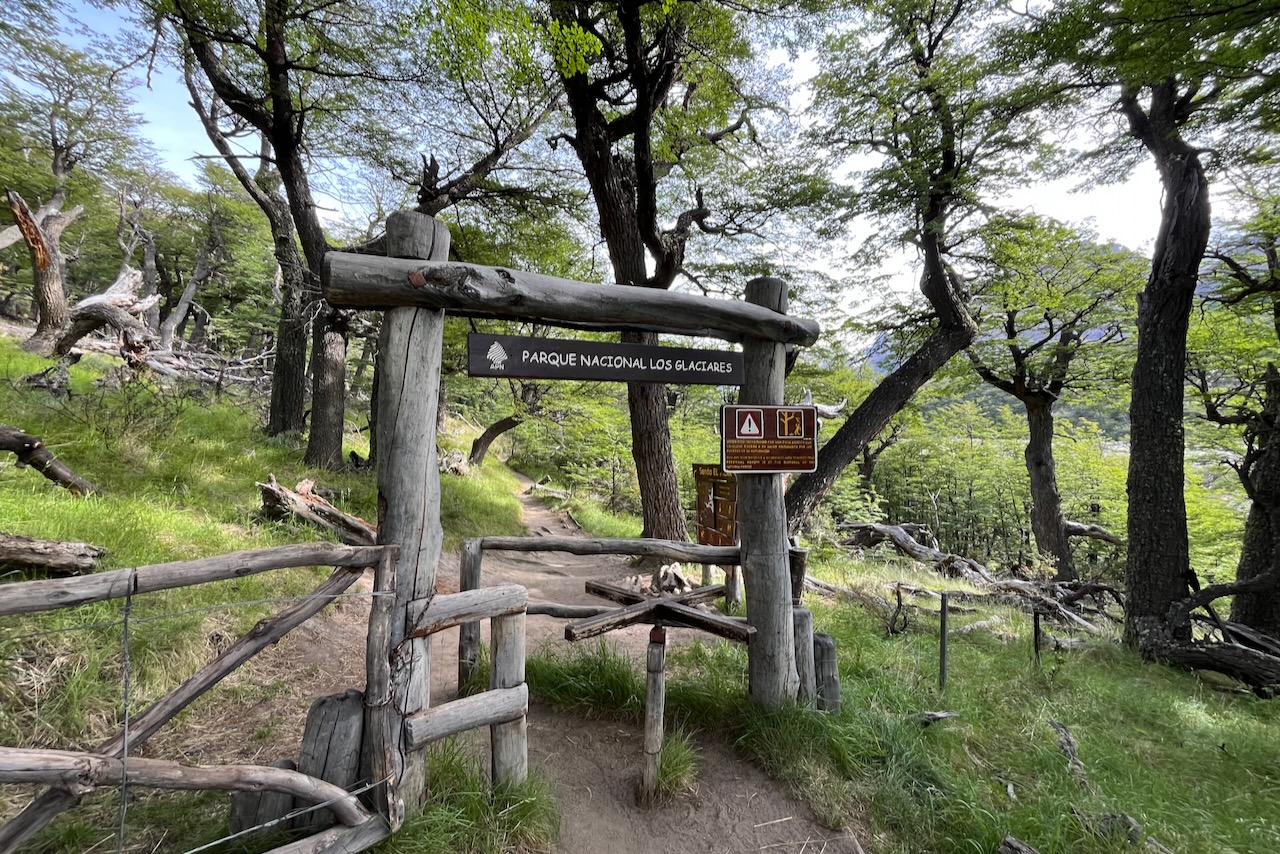
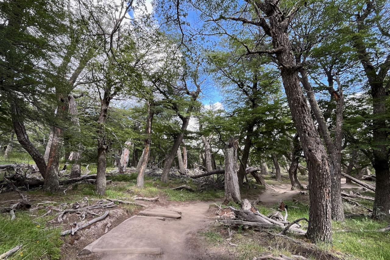
The trail then turns up and continues in the woods along the valley with ocational views of the mountains in the distance through gaps between the trees.
Entrance to the trail on the hike to Laguna de Los Tres and Piedras Blancas glacier, ArgentinaPiedras Blancas glacier and Mt Fitzroy, Argentina
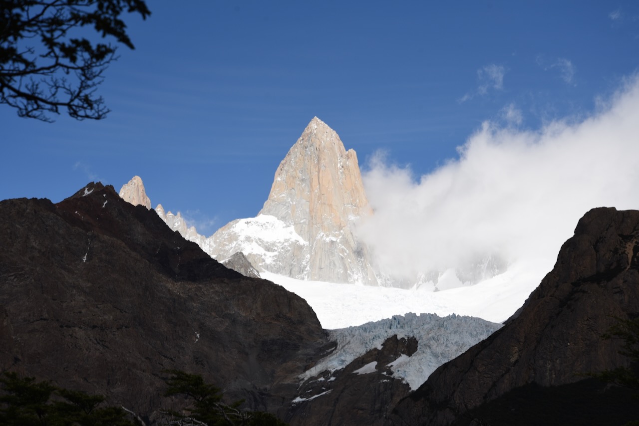
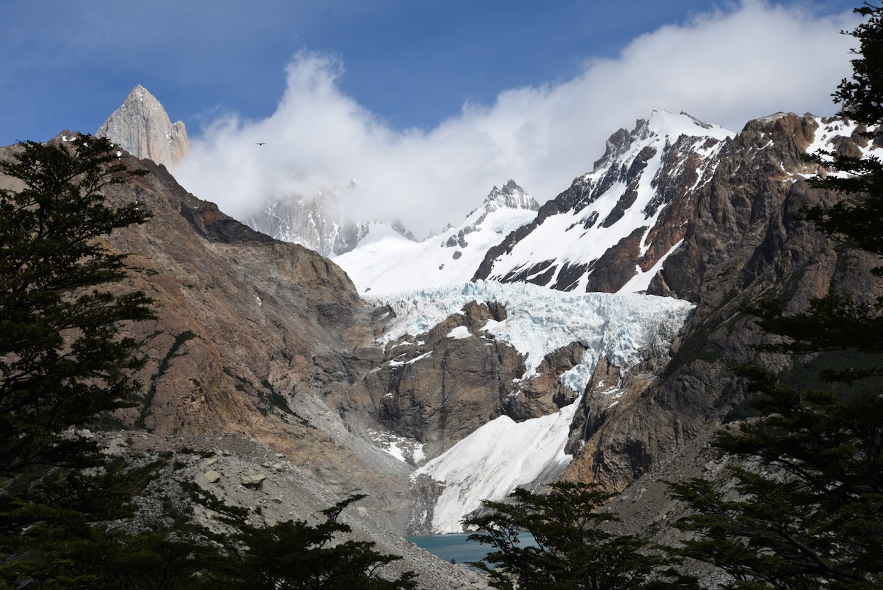
When we reached the lookout of the Piedras Blancas glacier the mountains in the back were partially covered by clouds. The glacier is a little bit far but a very beautiful site with waterfalls of melting water coming down. There were also some condors flying around but very high up.
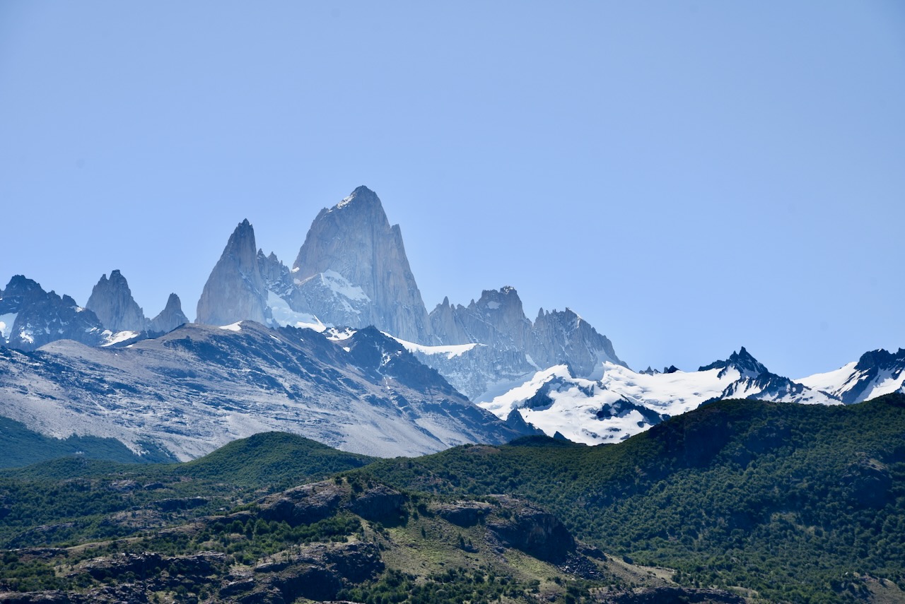
Piedras Blancas glacier lookout, ArgentinaView of Mount Fitz Roy on the trail to Laguna de Los Tres, Argentina
The final part of the trek is a very steep ascent gaining about 400m of elevation over 1km. It was the busiest section of the hike partly because it is slow moving partly because there are no trees so you can see more.
Views from trail to Laguna de Los Tres, ArgentinaSteep ascent section of the trail to Laguna de Los Tres, ArgentinaThe fnal section of ascent over to the Laguna de Los Tres lookout, ArgentinaMount Fitz Roy, Argentina
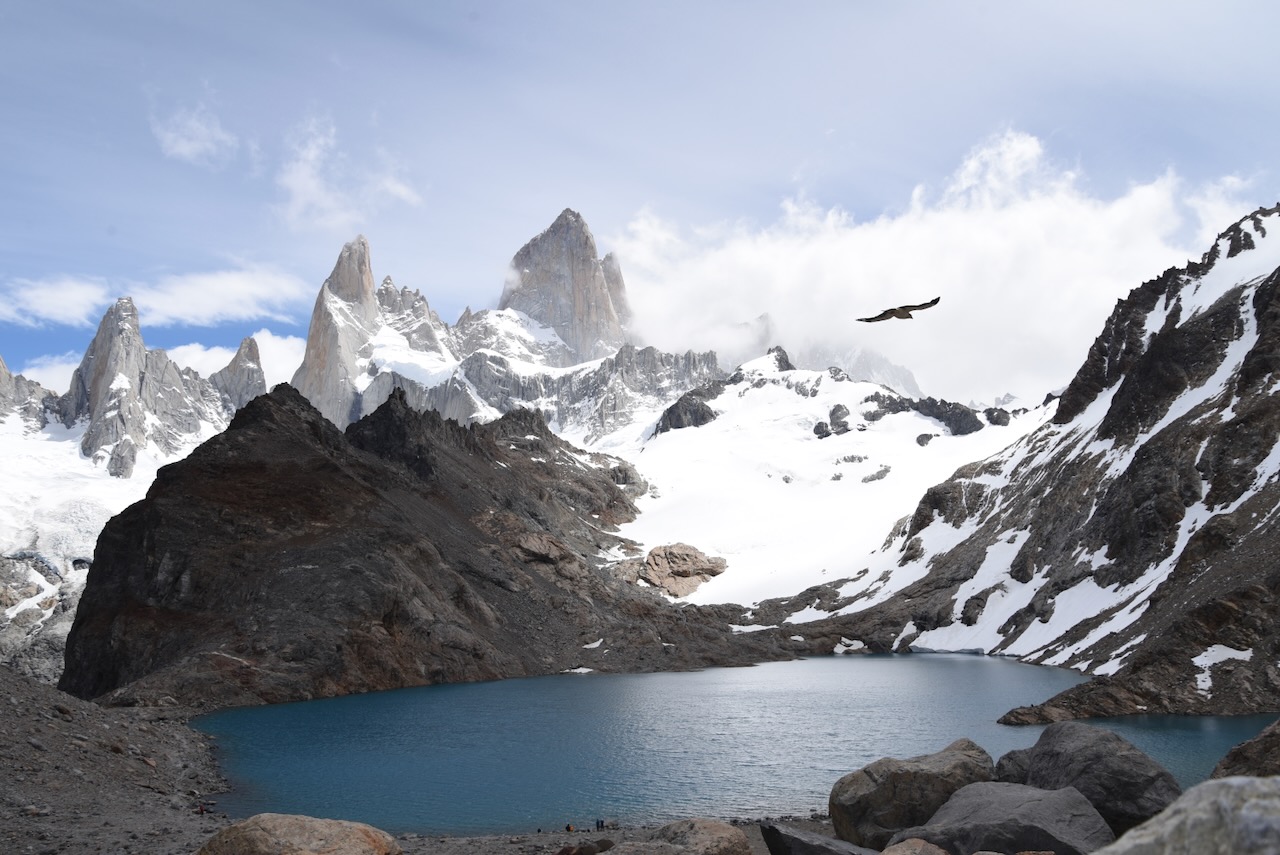
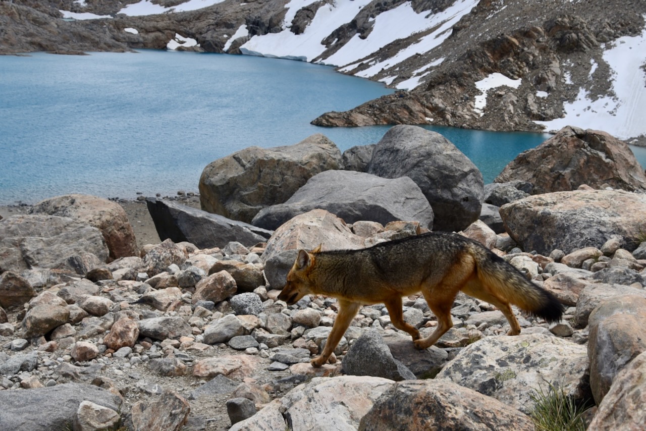
Once we reached the top though all the hard work climbing up was worth it. Again we were lucky and clouds parted just enough for us to see Mount Fitz Roy peak. We spent some time at the top hiding among the rocks as it was very windy up there. Had our sandwiches. Saw the fox that it appears frequents the site as some hikers give it food (should not). And just took in the beauty before heading back all the 11km to the parking lot.
Laguna de Los Tres and Mount Fitz Roy, ArgentinaFox at Laguna de Los Tres, Argentina
The first time we hiked Laguna Torre, we started this 20km hike from the same point as Laguna Capri hike.
Start of hiking trails near El Chalten, Argentina
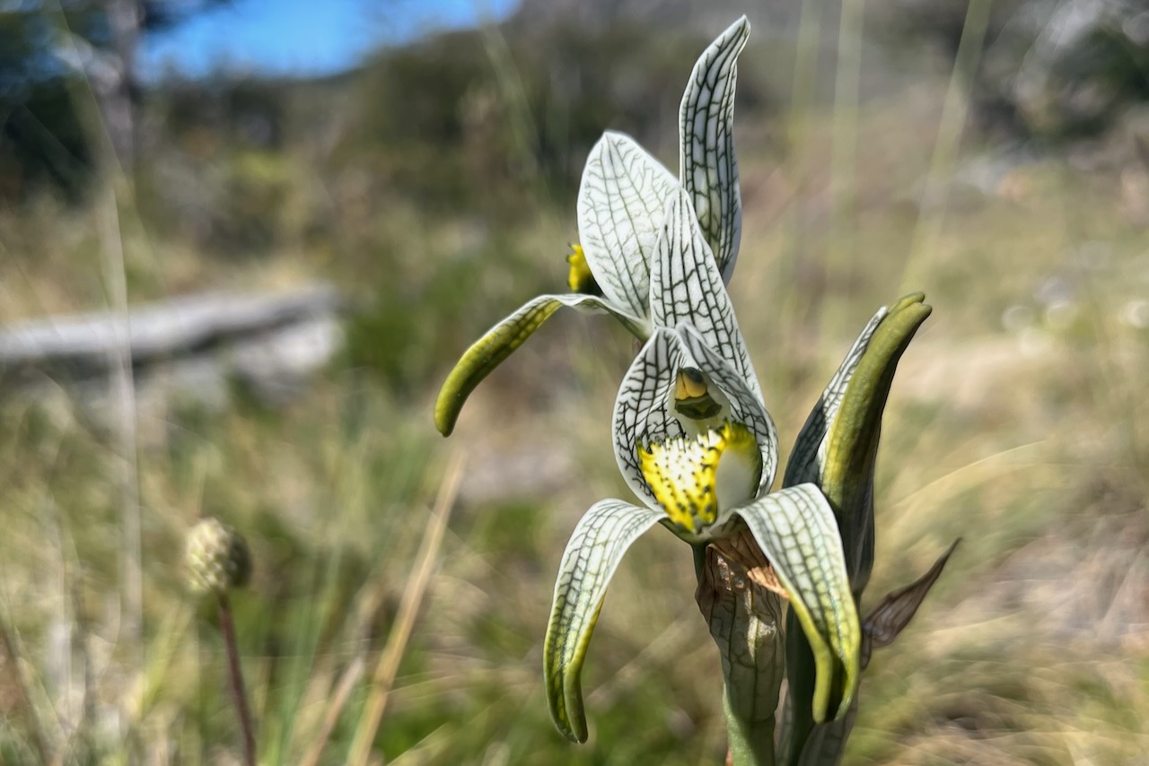
After the trail split we continued through the forest on a mostly flat trail. We were spotted an orchid which was very exciting.
Porcelain orchid, Chloraea Magellanica on the trail to Laguna Torre, ArgentinaSign at Mirador Cerro Torre, Argentina
Mirador Cerro Torre is mean to provide the view of Cerro Torre. But on the day we arrived that part of the range was covered by a very thick cloud. We could se Cerro Solo very well, but no Cerro Torre. We still decided to go ahead and see what we see at the lagoon.
View of Cerro Solo and obstructed by clouds Cerro Torre over Fitz Roy river valley, ArgentinaViews on the trail to Laguna Torre along Fitz Roy River, Argentina
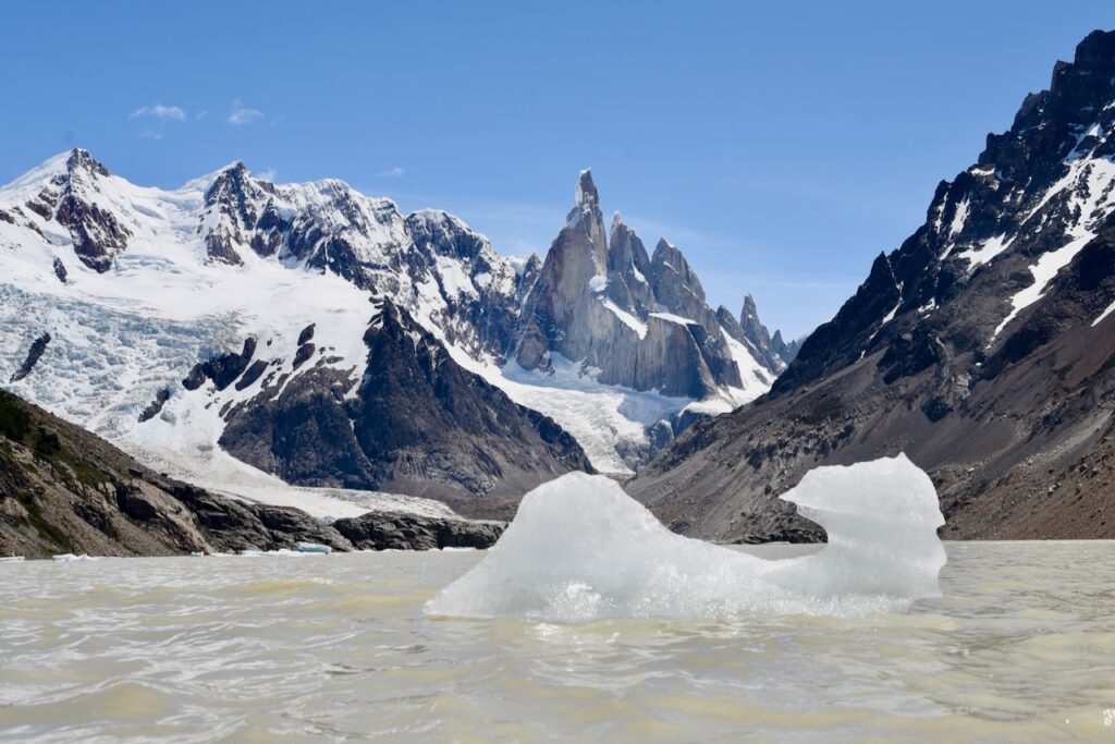
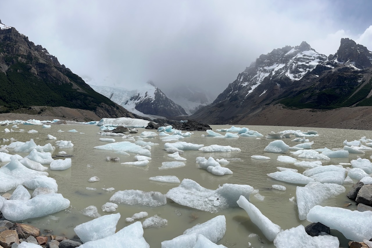
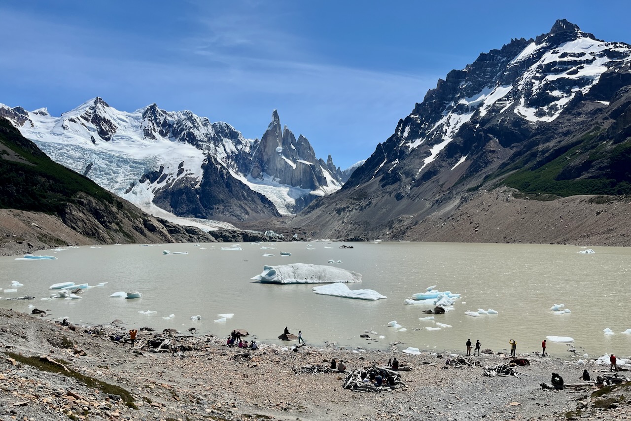
At the lagoon there was a lot of floating ice that broke off the glacier. Cerro Torre was still covered by thick cloud and there was no any sign of it lifting, unlike on our Laguna Capri hike.
Laguna Torre with ice and cloud covered Cerro Torre, Argentina
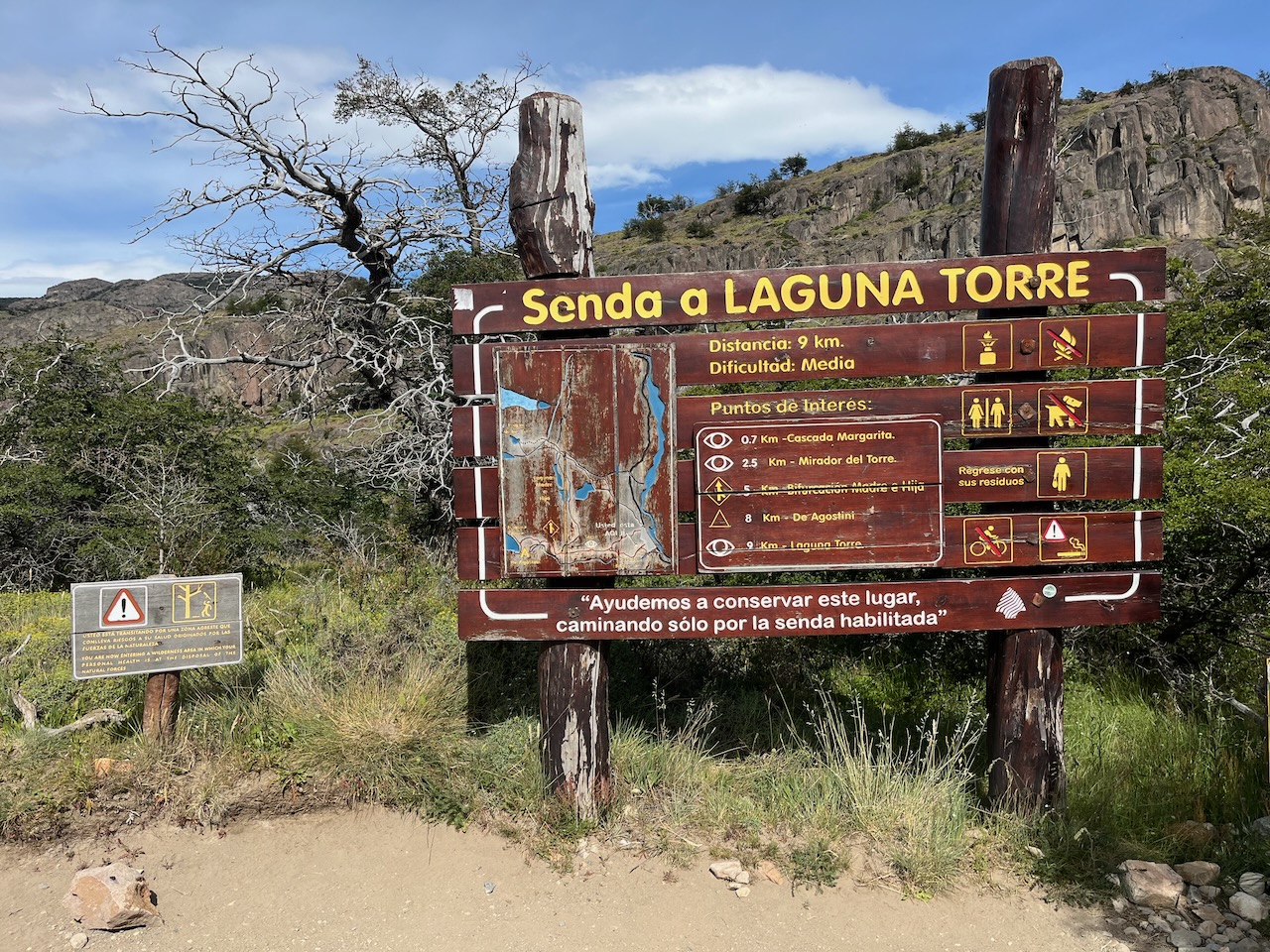
We still enjoyed the hike and did not find it too difficult. On our last full day in El Chalten we decided to do Lagune Torre hike again as weather looked much better. This time we started from a different point. This one is also in El Chalten and not too far to the one with all other trails that we used before. It provides a slight shortcut it seems at the start of the hike. Or maybe it is an older trailhead because the sign looked older and there were no guards checking passes. But there were many hikers heading through.
Sign for the Laguna Torre hike, El Chalten, ArgentinaSign on Laguna Torre hike, Argentina
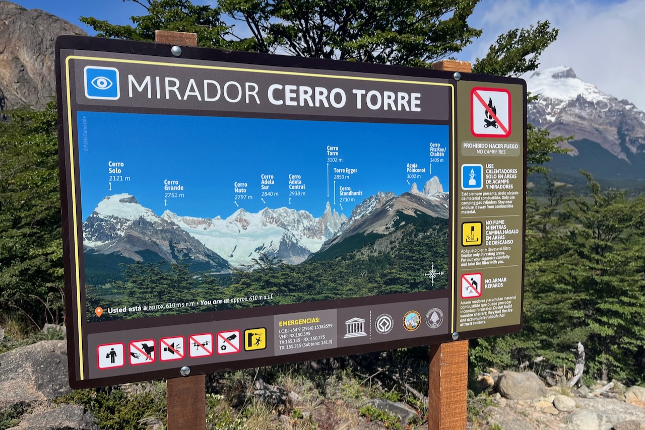
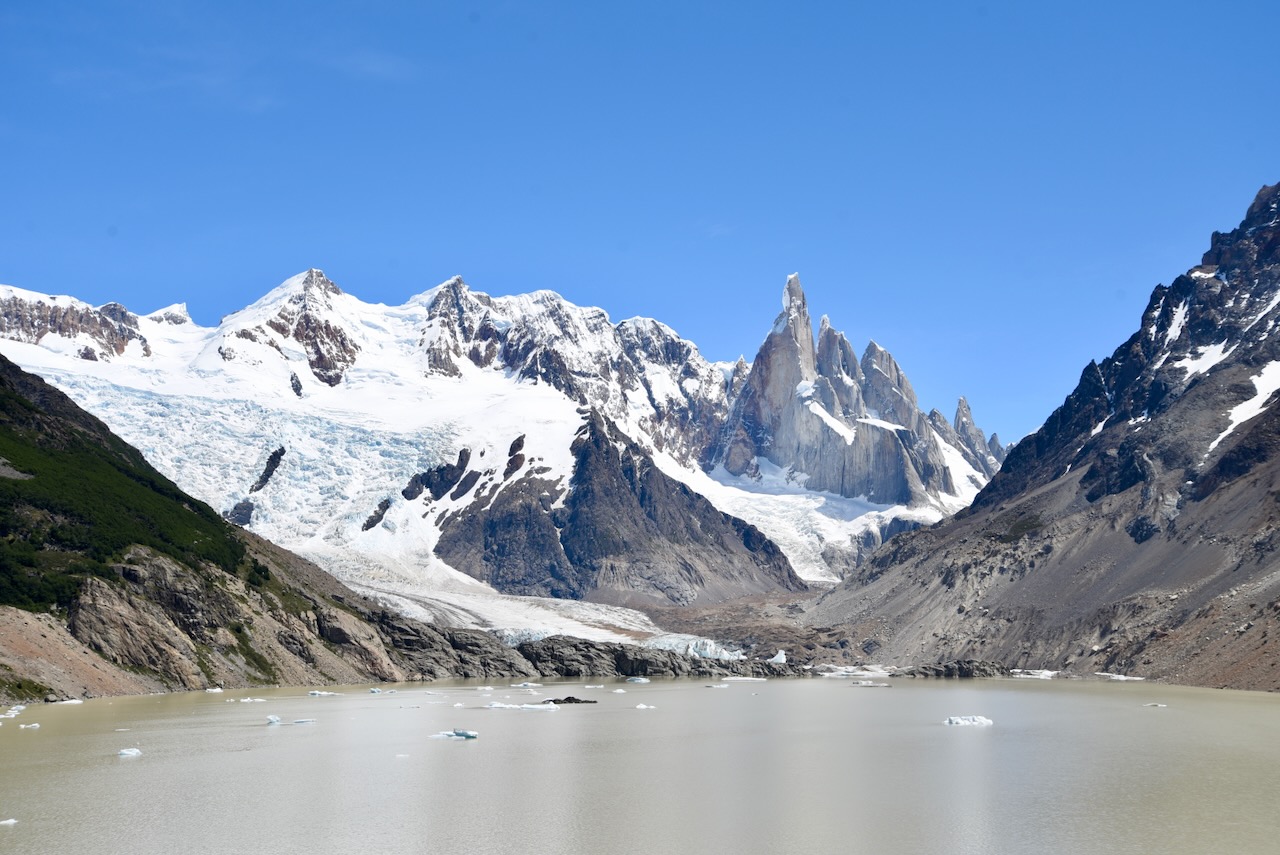
What a difference. Now at Mirador Cerro Torre we had a clear view of the Cerro Torre and glacier next to it.
Mirador Cerro Torre, ArgentinaView over Fitz Roy River valley to Serro Torre and Cerro Solo, Argentina
We spent some time at the lagoon eating our sandwiches and enjoying the view and nice weather. There seemed to be less ice than the first time in the lagoon. And more hikers.
Laguna Torre and Cerro Torre, Los Glaciares National Park, ArgentinaLaguna Torre and Cerro Torre, Los Glaciares National Park, ArgentinaGlacier at Laguna Torre, Los Glaciares National Park, ArgentinaCerro Solo, Cerro Torre, Mount Ftiz Roy view, Chile
We returned back to El Chalten through the same “shortcut” route. Laguna Torre is very nice and not difficult full day hike.
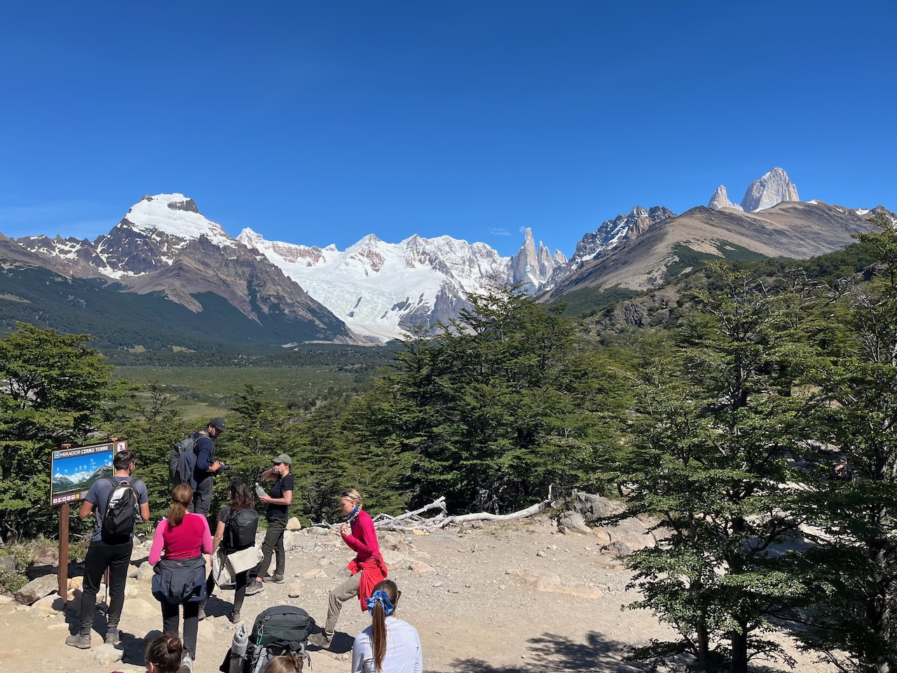
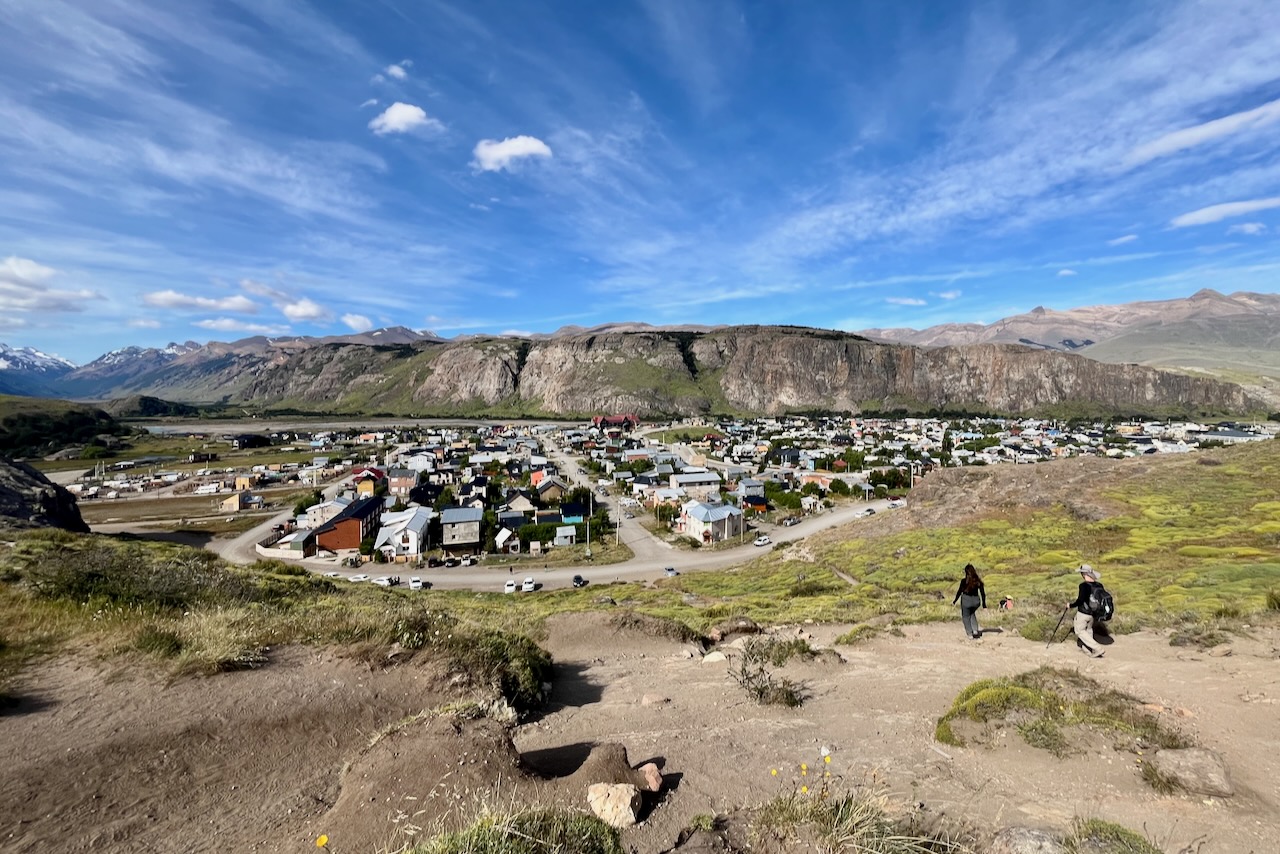
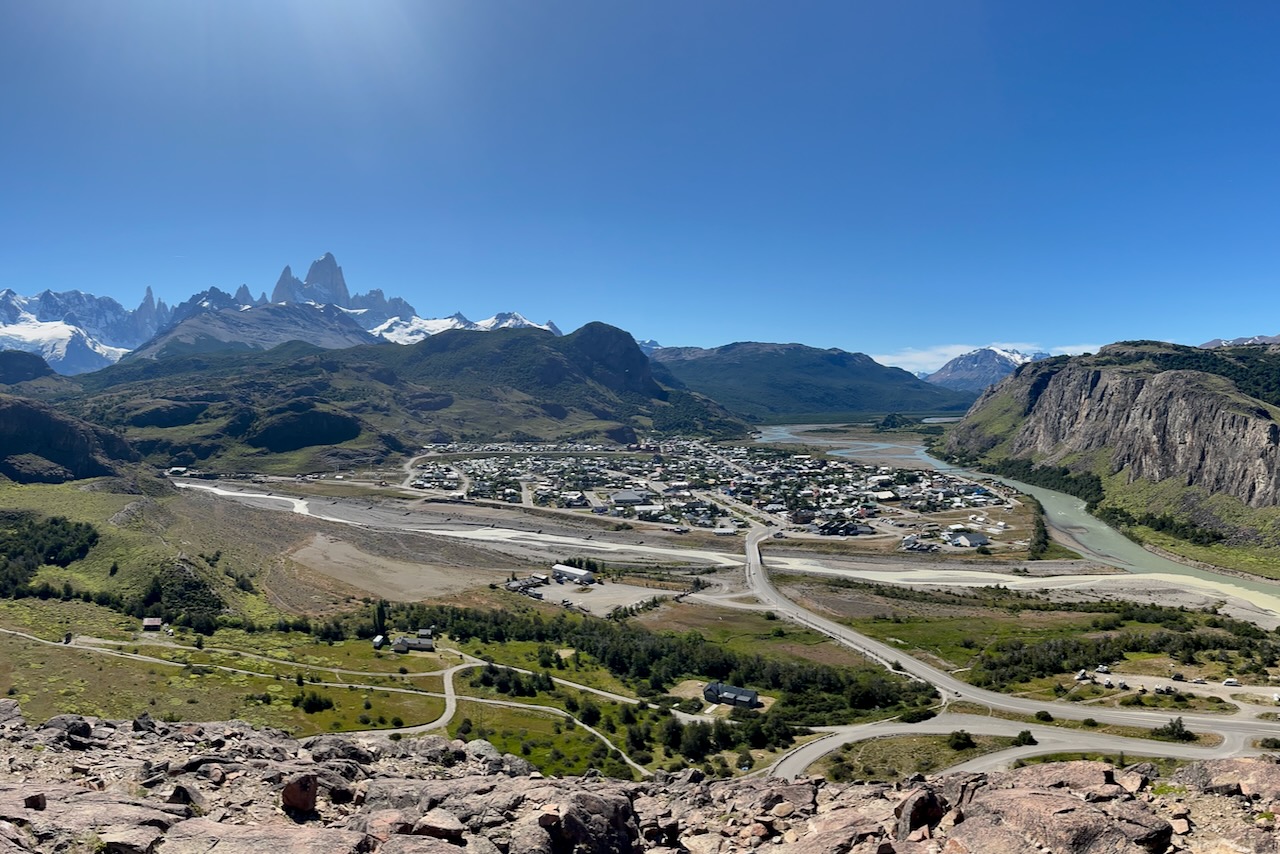
The hike to Los Condores lookout starts at the visitor center. It is a somewhat steep but shork walk up to a rocky outcrop with spectacular views of El Chalten village and Mount Fitzroy in the distance
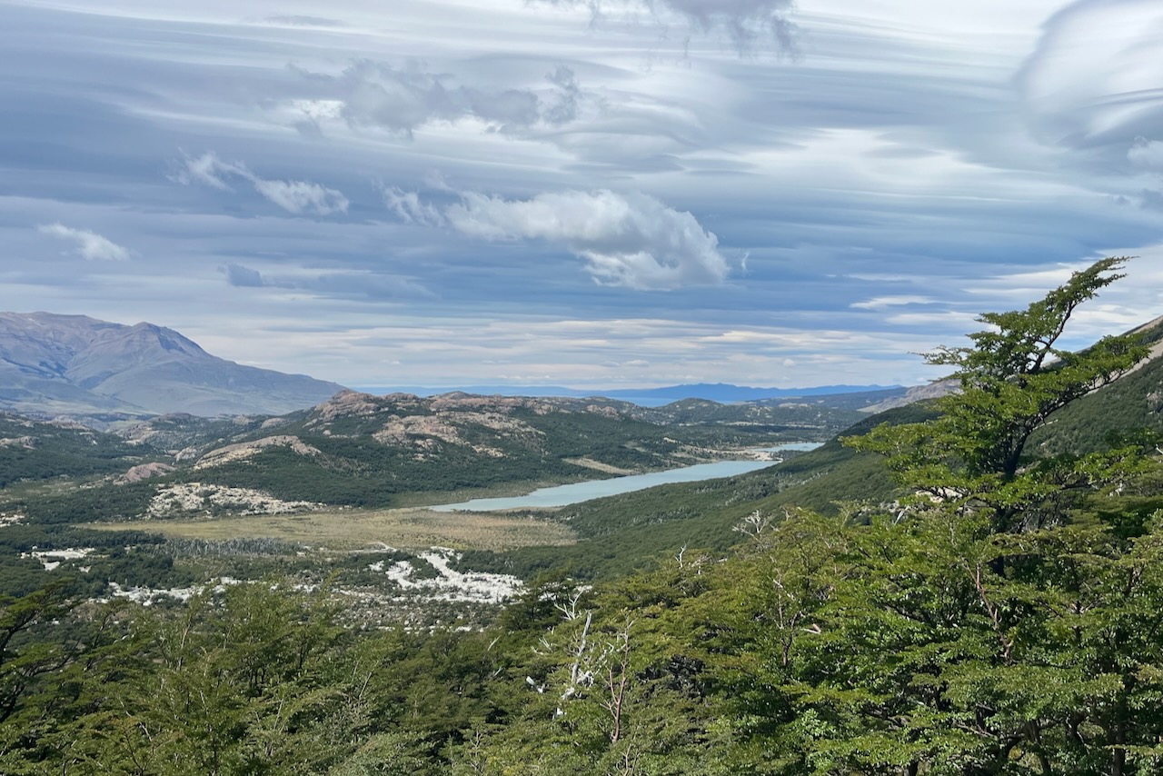
After admiring the view one can go to Aguilas (eagle) lookout. This is mostly flat slightly rolling half an hour walk around the top of the hill. It has the view of the Viedma lake. One cannot see Viedma glacier as it is behind the hill.
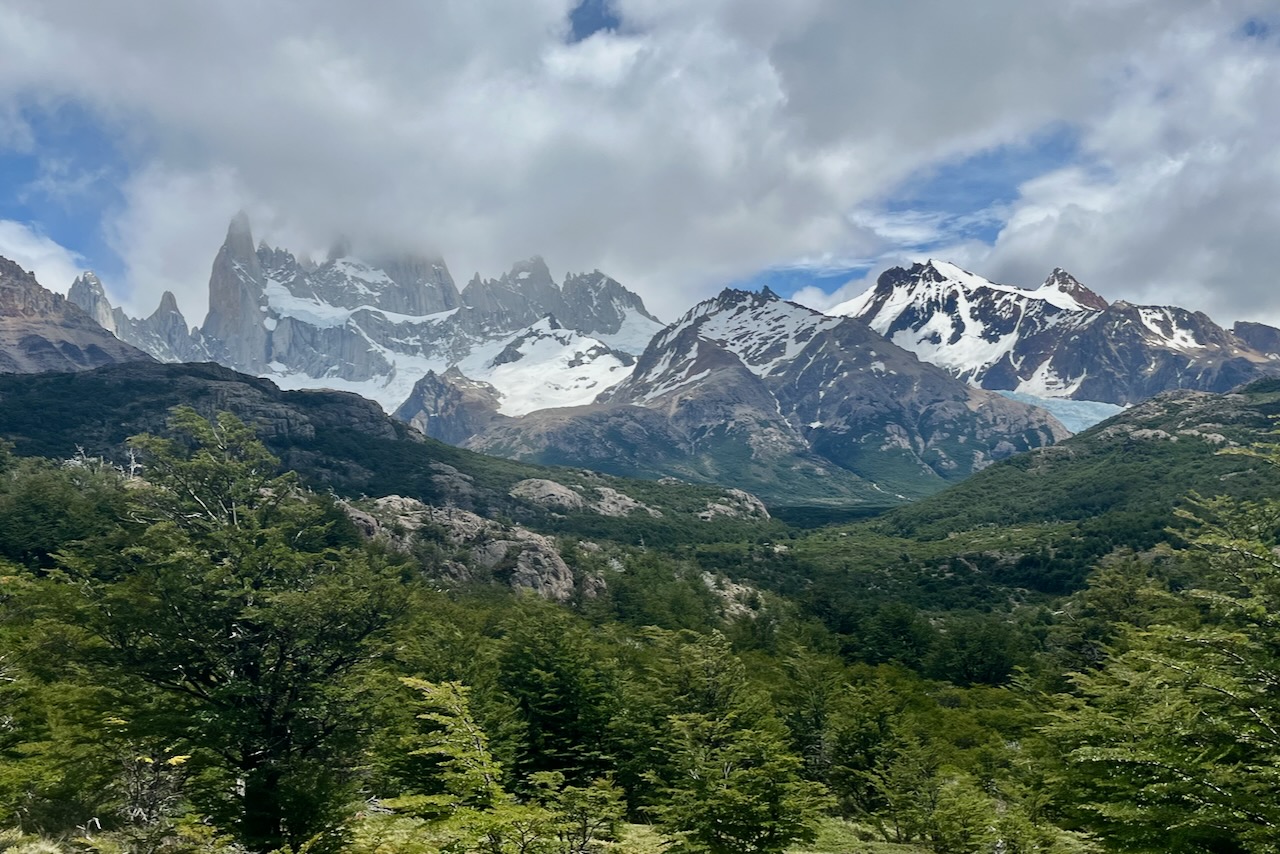
Walking back from Aguilas lookout there are more beautiful views of the Mount Fitzroy, Torres, and other mountains in the range.
We had a perfect day without clouds. Since this was our first day we did not realize how lucky this was as tops of the mountains are often covered by clouds.
We took awhile admiring the views at both lookouts and waiting for condors. We did not get condors (maybe because there was no wind at all). But we enjoyed the scenery and spent around 3 hours walking around and sitting at lookouts.
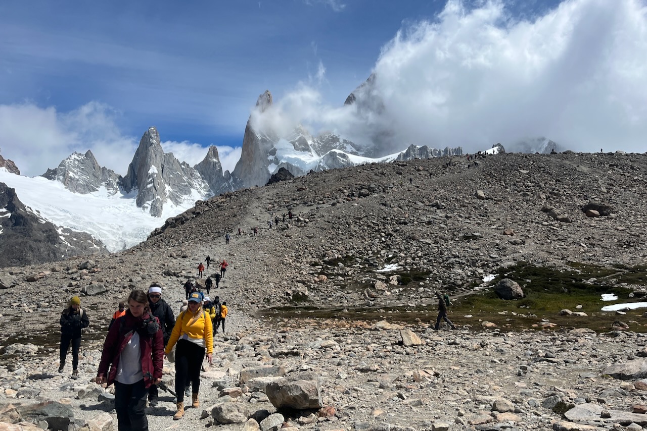
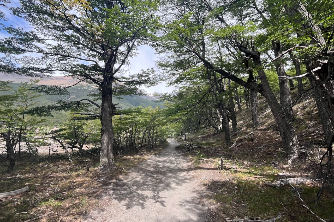
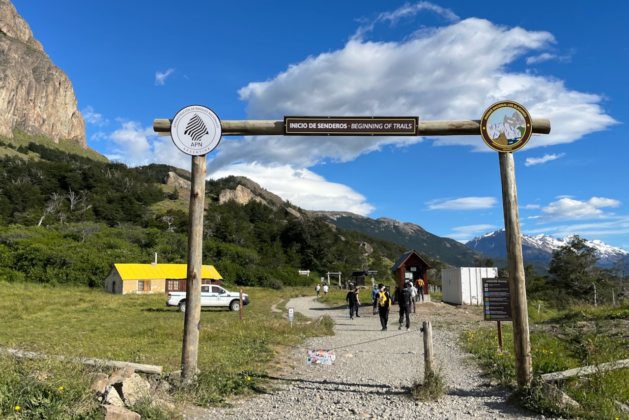
Most hikes around Fitzroy mountain start from the edge of town in El Chalten. We walked down from our airbnb, showed our multi-day passes to the guards at the gate and headed up the hills.
The gate to trails around Mount FitzRoy, El Chalten, ArgentinaTrails head to Laguna del Los Tres and others, El Chalten, Argentina
Th trail to Laguna Capri (all of them actually) starts with a steep assent that reaches a nice view point of El Chalten. Later trails diverge. After the initial steep assent, the trail to Laguna Capri is mostly rolling flat – some ups and downs but nothing too strenuous.
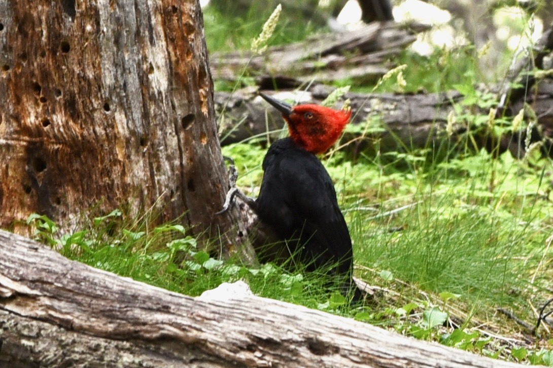
View of El Chalten from the trail to Laguna Capri and others, El Chalten, ArgentinaView from Mirador rio de las Vueltas on trail to Laguna Capri, El Chalten, ArgnentinaTrail to Laguna Capril ,El Chalten, ArgentinaMagellanic Woodpecker, male, on trail to Laguna Capri, El Chalten, Argentina
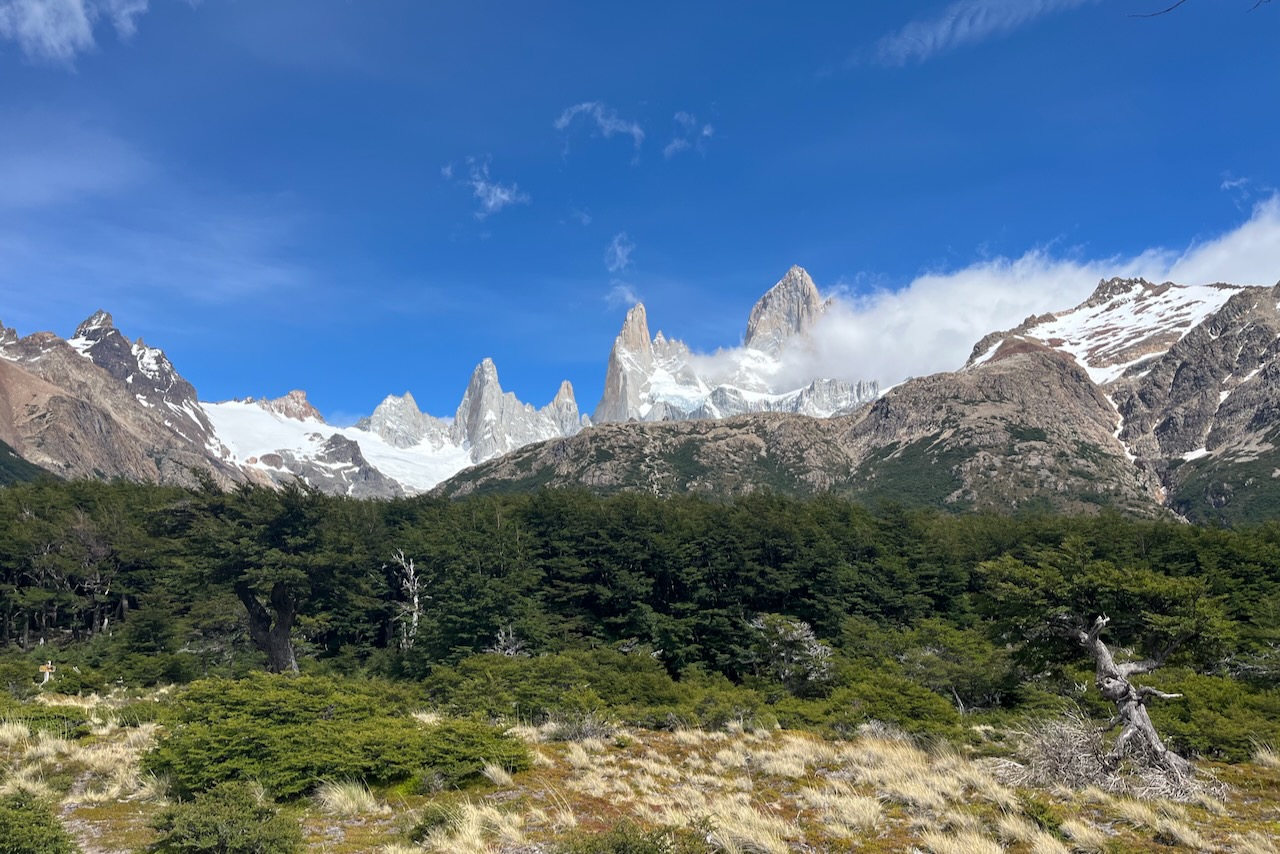
When we reached Laguna Capri, Fitz Roy peak was covered by thick clouds. The cloud cover was moving all around and there was a threat of drizzle coming in. We decided not to proceed to Laguna de Los Tres which was a very steep hike up to the beautiful lagoon with a view of Fitz Roy mountain, if clouds did not cover it.
Laguna Capri view with Fitzroy covered by clouds, ArgentinaFitz Roy mountain covered by clouds, view from Laguna Capri, Argentina
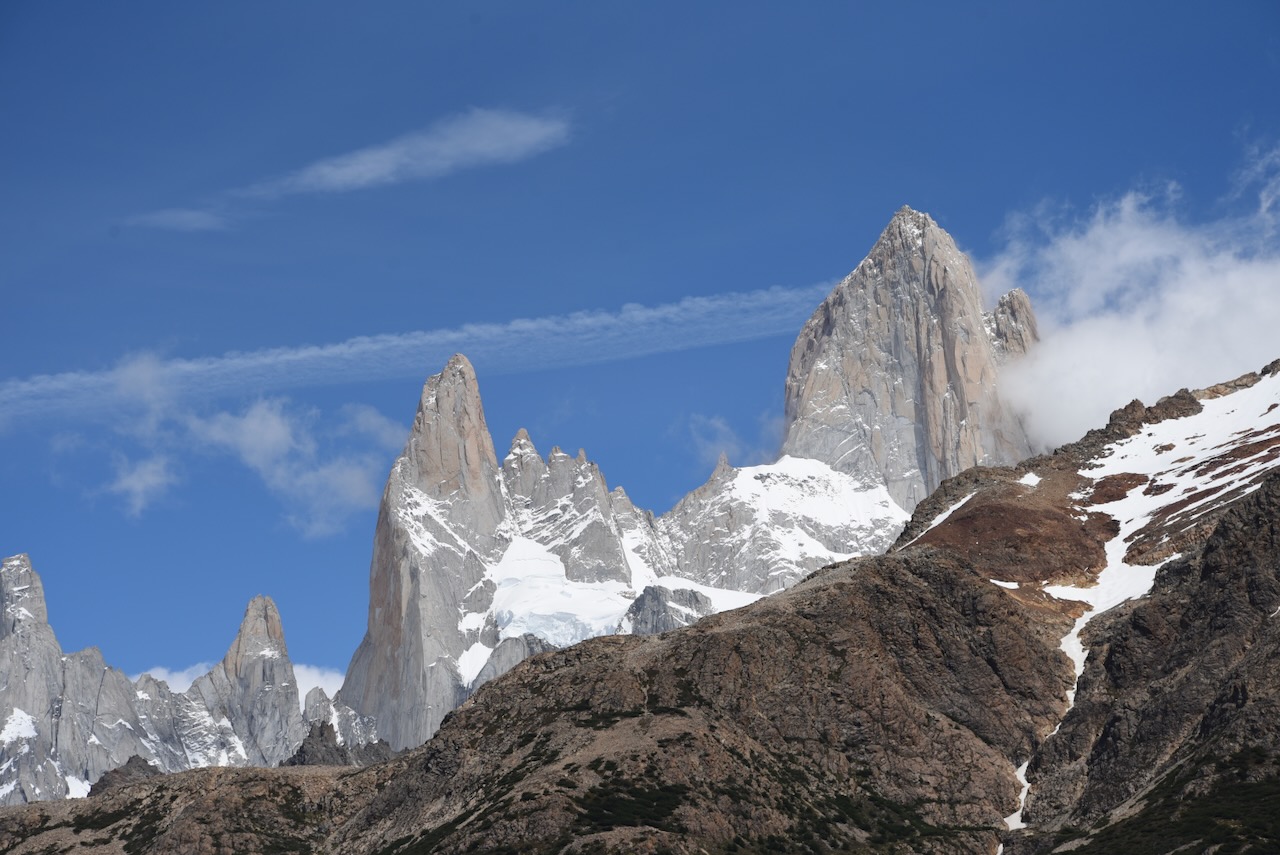
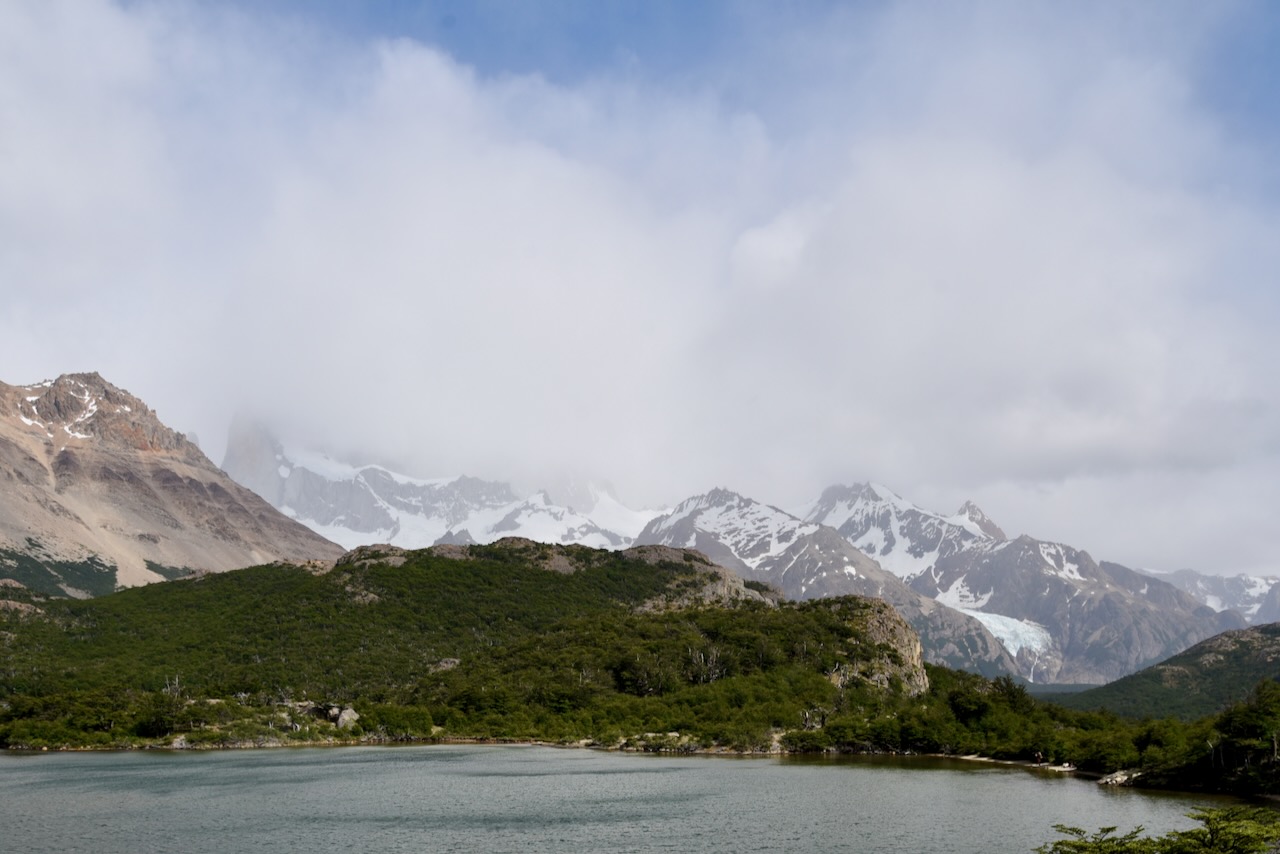
We then headed back on the trail stopping at Fitz Roy lookout. At this point we decided to eat our lunch, watch clouds shifting over Fitz Roy and wait for Condors (it was a windy day). We saw several condors cruising around though all of them pretty high up and too far for a photo. Then clouds started lifting and we could see almost the entire mountain range. We decided to walk back to Laguna Capri again and get a photo of Laguna with Fitzroy.
View of Mout Fitz Roy with clouds lifting, Argentina
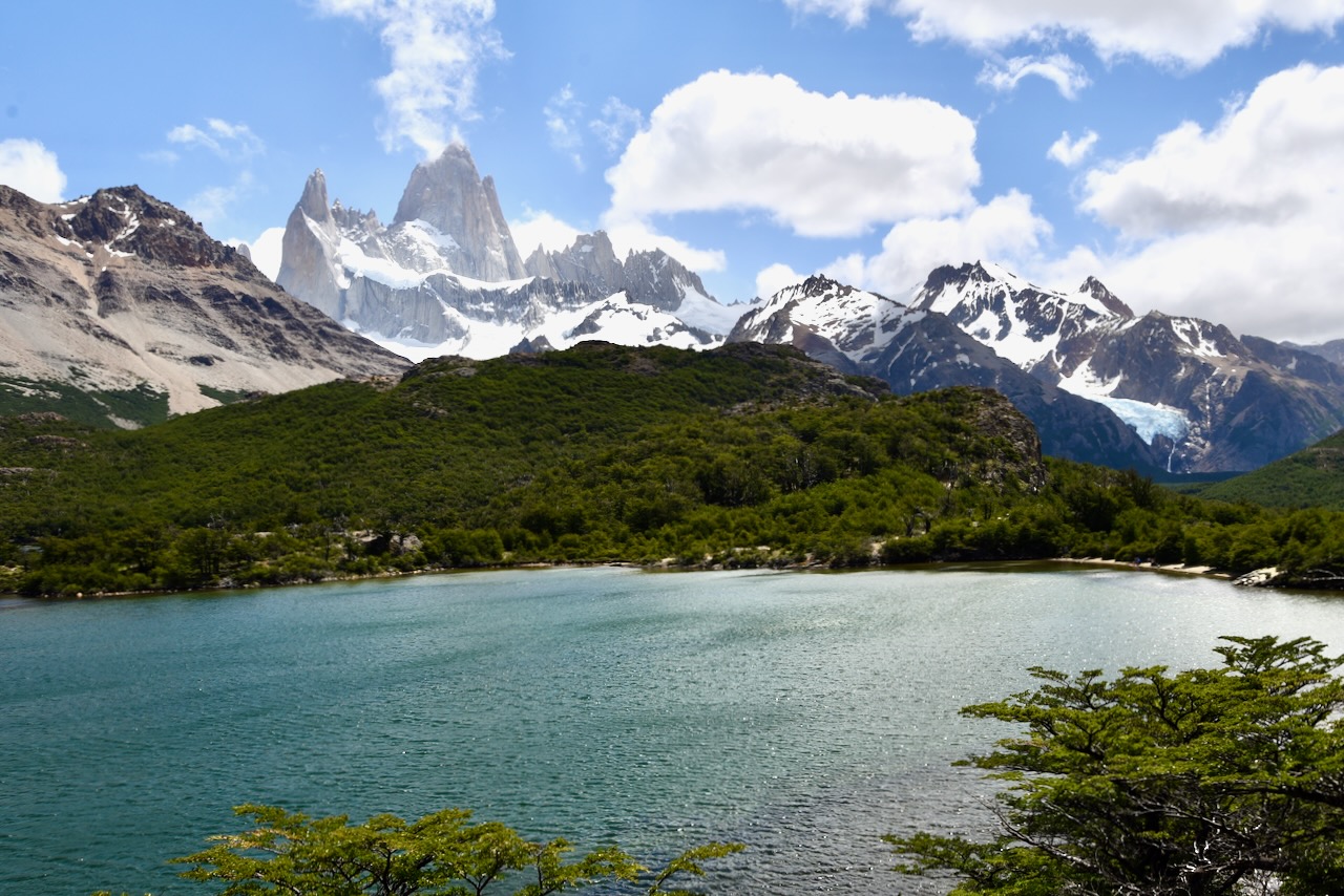
It was a completely different scene at Laguna Capri – sun shining and a beautiful view of the mountain. We learned our lesson for Patagonia – weather always changes, four seasons in a day. If you wait clouds might lift (or not), but all landscapes are beautiful in their own way.
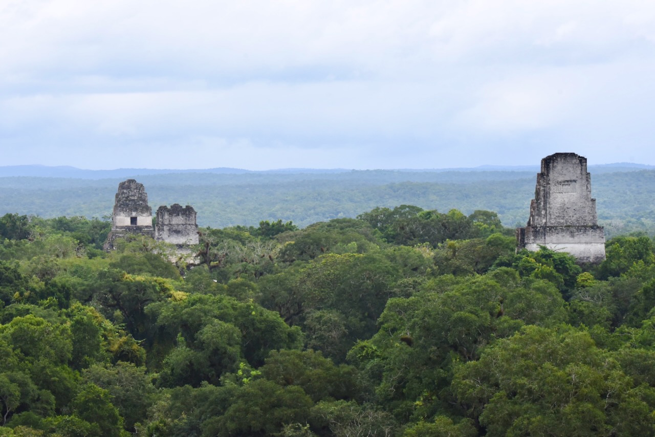
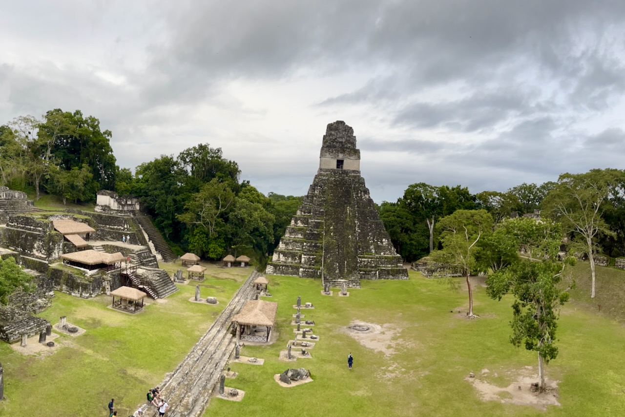
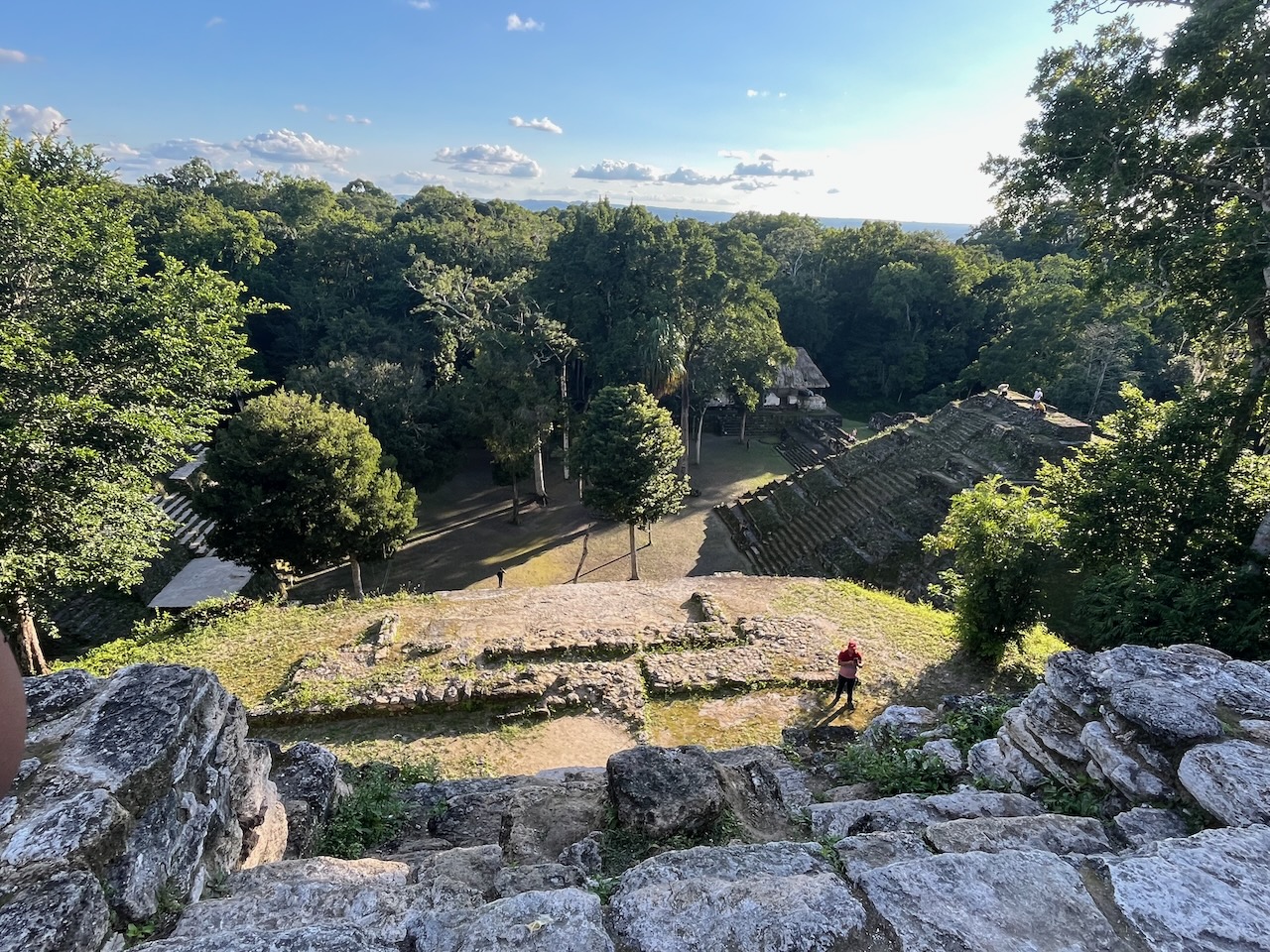
Tikal was a major political and economic center of Maya civilization inhabited between 600BC and 900AD. The urban zone of Tikal is 400 hectares and has palaces, temples, ceremonial squares and various other structures. Tikal national park is part of Maya Biosphere reserve covering more than 21 thousand square kilometers or one fifth of Guatemala. Wondering through TIkal one almost feels like an explorer discovering sites not seen before. Jungle is everywhere, many structures are not excavated, wild life is plentiful and the area is huge. Tikal was a great addition to our collection of Mayan temples that we visited in Belize and Mexico.
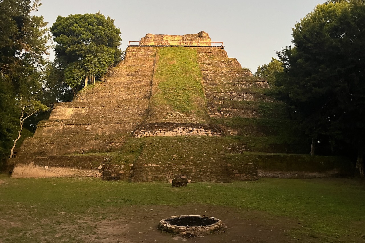
View over Tikal from Temple IV, made famous by star wars movie
Tikal’s otherworldly scenery impressed George Lucas so much that he decided to use it as a filming location for Star Wars Episode IV. Tikal’s Temple IV was the rebel base in the film. Temple IV has a great view over Tikal – with various temples poking out from the jungle. One can not only climb up to Temple IV but view sunrise over Tikal from there. We decided that we should experience that. If one is staying in Flores or other locations outside of the park it would mean a pick up at 3am. We chose to stay for a night at Tikal Jungle Lodge inside of the national park. The lodge is very nice with an excellent restaurant. It also arranges transport to and from airport and Flores.
Tikal temple, Guatemala
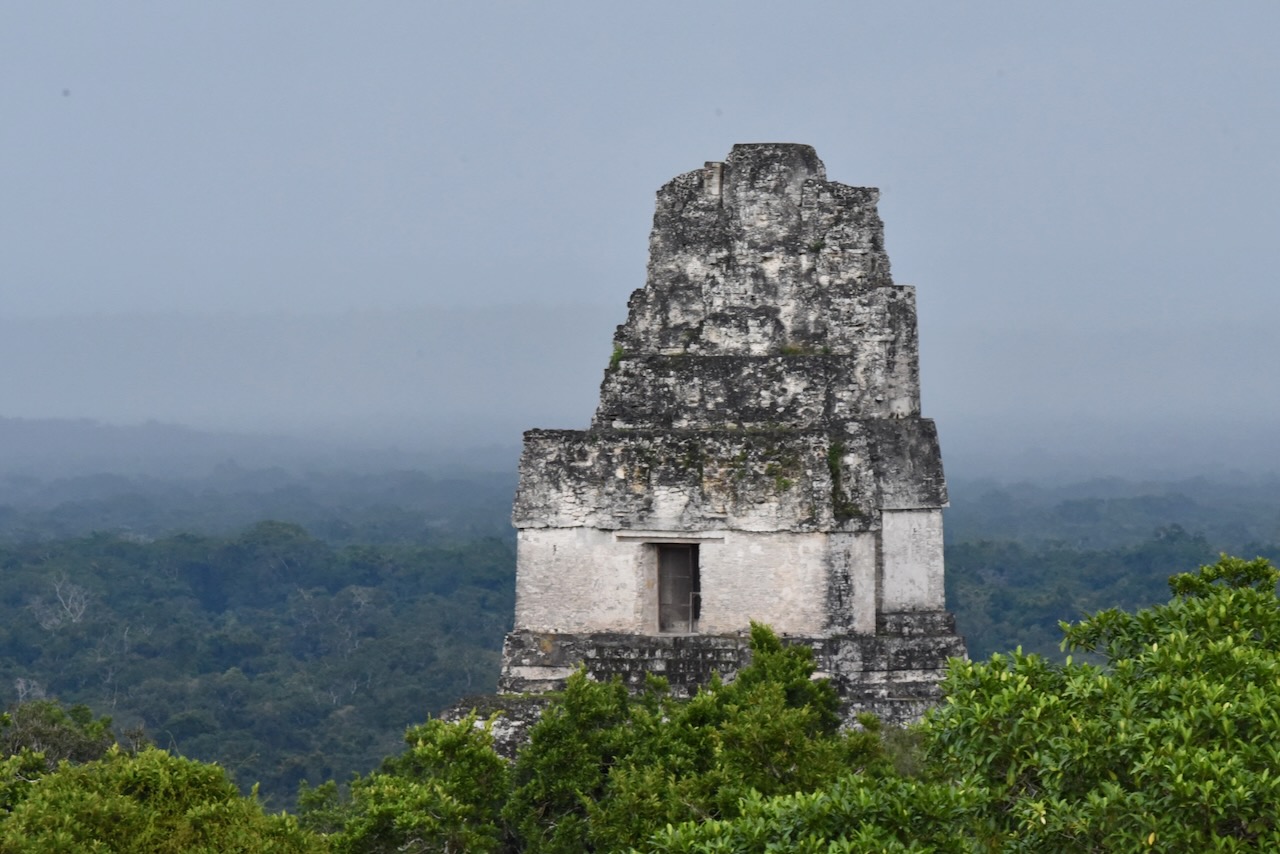
We arrived to Tikal around midday and went to explore the site. The next day we woke up early to hike to the Temple IV for the sunrise. The walk is in the dark with headlamps. It is also an opportunity to see a variety of nocturnal wildlife.
Our sunrise was not too great unfortunately due to very thick fog. We could barely see the edge of the platform. Later in the day the fog lifted. But we did not get that perfect sunrise photo. Though I must say, even in thick fog the experience of sunrise over this beautiful and spiritually very important place for so many people (over time) was worth it.
Tikal, Guatemala
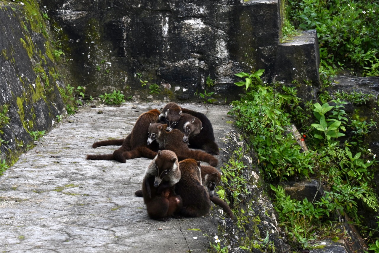
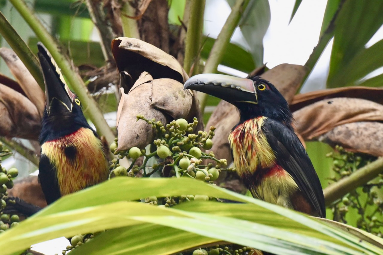
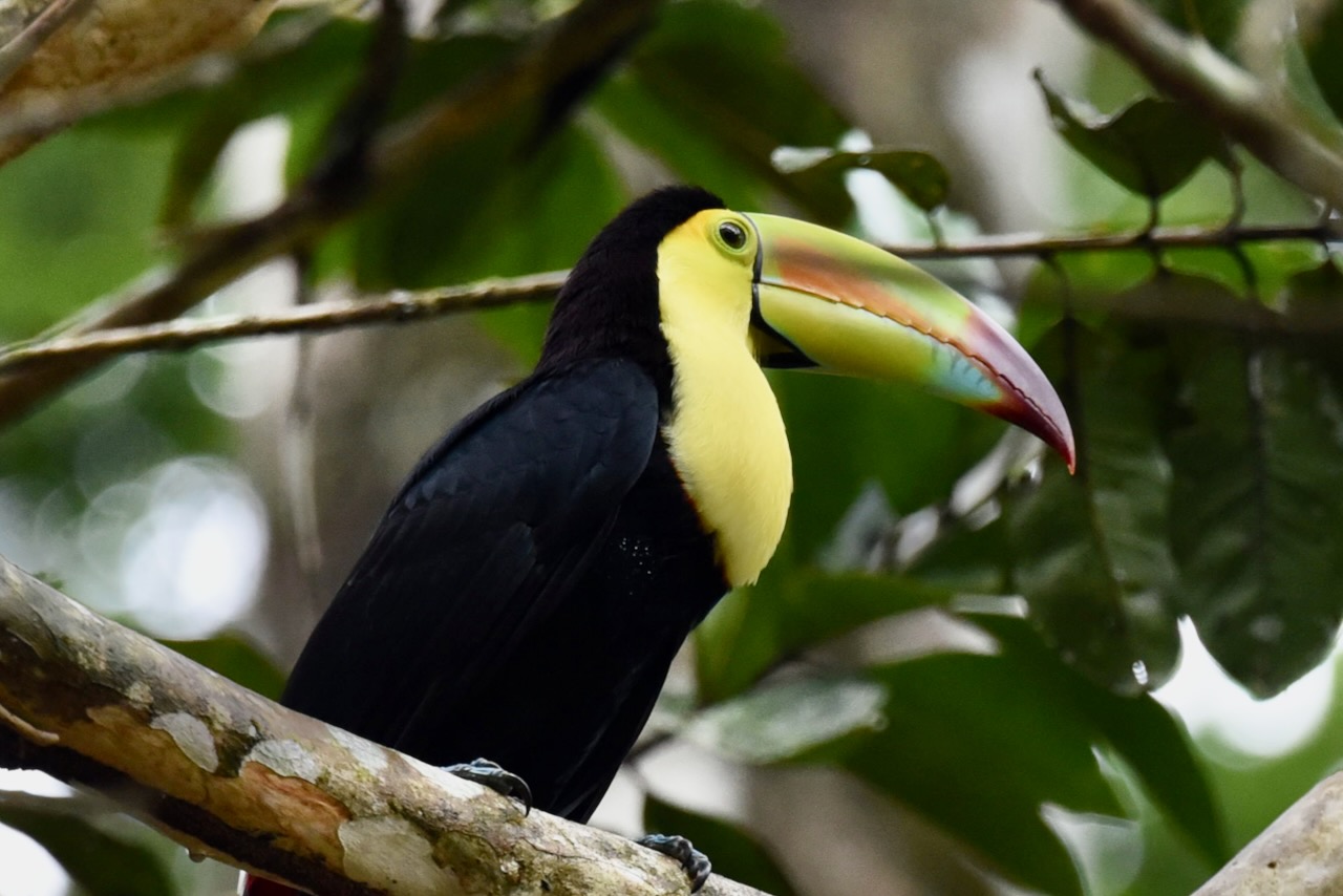
In the jungles around the ruins there are all sorts of wildlife. We saw monkeys, birds and bands of coatis. We came across aracaris and toucans quite close in the trees and saw plenty of them flying around up in the canopy.
Band of coatis on the steps of one of Tikal templesCollared aracari, Tikal, GuatemalaKeel-billed toucan, Tikal, Guatemala
In the afternoon we headed back to Flores. All in all we were happy we decided to overnight in the park and felt that two half days was a good amount of time. Though one could roam around and explore Tikal and beyond endlessly!
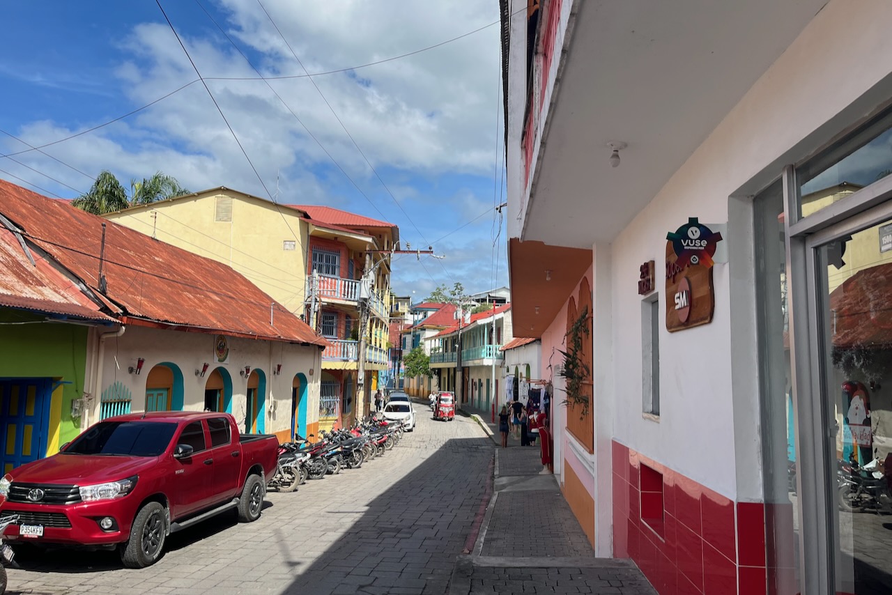
Small town of Flores is a popular base for exploring Tikal and many other sites in Peten region of Guatemala. The old part of town is located on a tiny island which is connected by a short causeway to the coast and the main Flores city. There is plenty of accommodation and many restaurants with delicious food on the island.
Town and island of Flores, GuatemalaA street on Flores island, Guatemala
The vibe on the island is very relaxed and happy. The streets are narrow and cute and very clean. Art and creativity seems to be everywhere – like those toucan planters made of used tires below.
Toucan shaped planter made from used tires, Flores, Guatemala
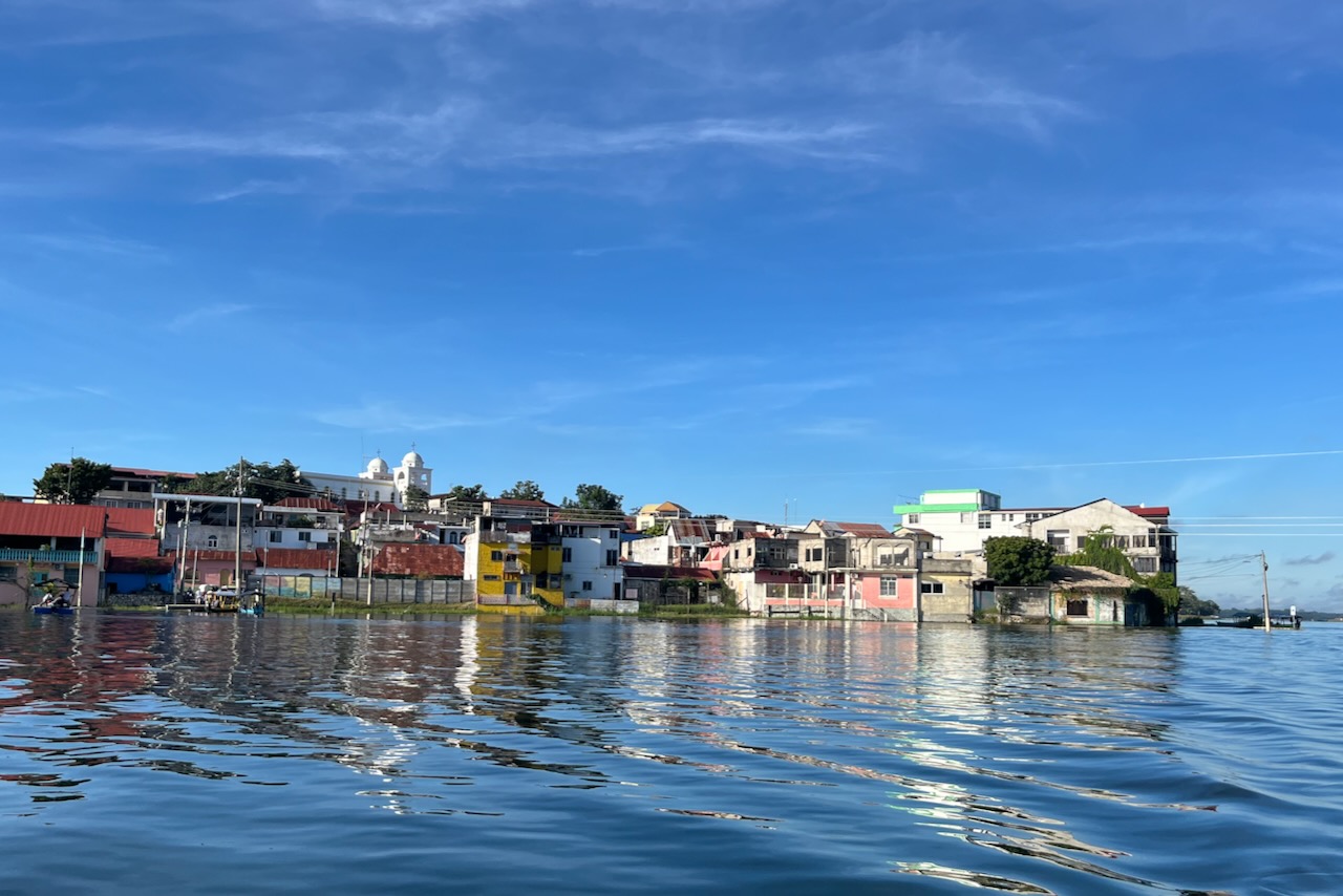
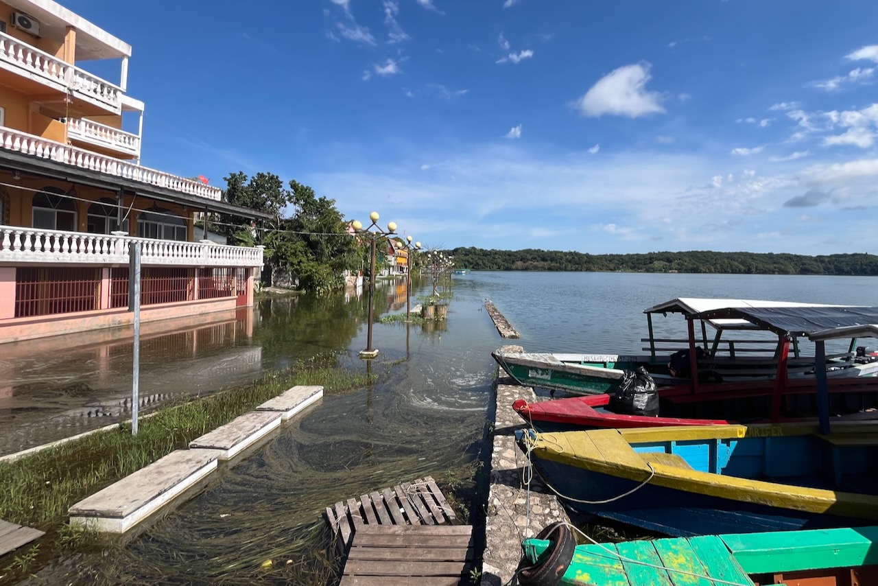
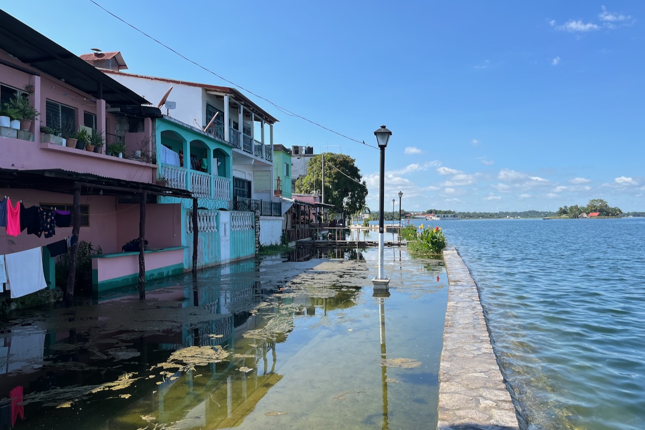
Water level in Peten Itza lake fluctuates a lot and lately has been rising. Some say it is a regular cycle. Some say it relates to climate change. Some say drainage is not working as it should. When we were there in December of 2023 lower side of the island and its Malecon (main waterside promenade) were under water. Amazingly people just seem to have moved on to higher floor (or built an extra floor?). A fair bit of more recent building happened around the lakeshore (not on the island) including quite a few guesthouses. Some say that local people always knew that water comes up and down and hence never built on the lakeshore. But then with tourism newcomers bought land and built on the shore and now are under water.
Flores island malecon under water, GuatemalaFlores island houses and pavement under water, GuatemalaFlores island landing, Guatemala
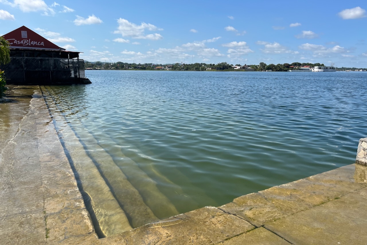
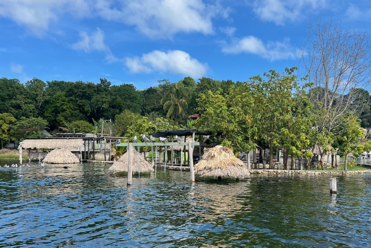
We hired a boat and went around the lake to see some wildlife and more of the coast areas.
A guesthouse lake beach area under water, Peten Itza lake near Flores, Guatemala
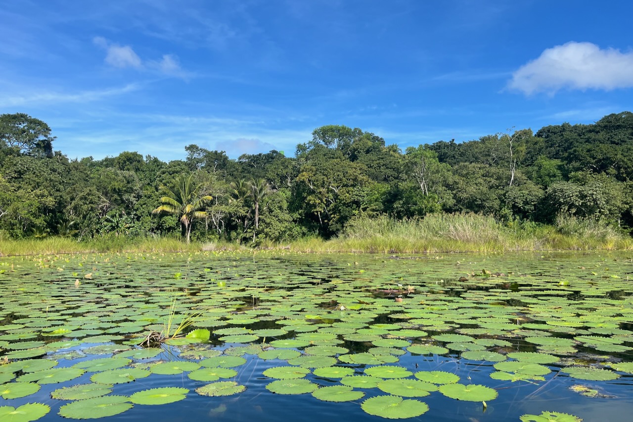
The scenery is beautiful. The lake has many little and not so little lagoons. We went into a couple covered in beautiful water lilies and with iguanas sitting on trees warming up in the sun. Lots of water birds around too.
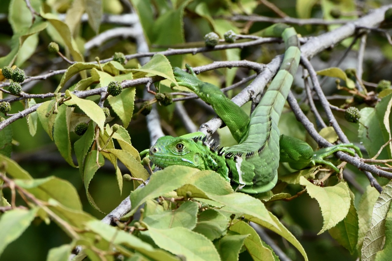
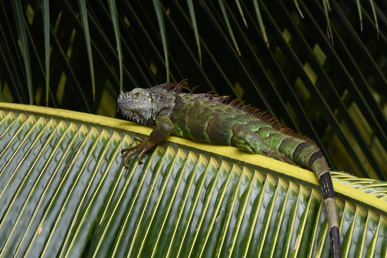
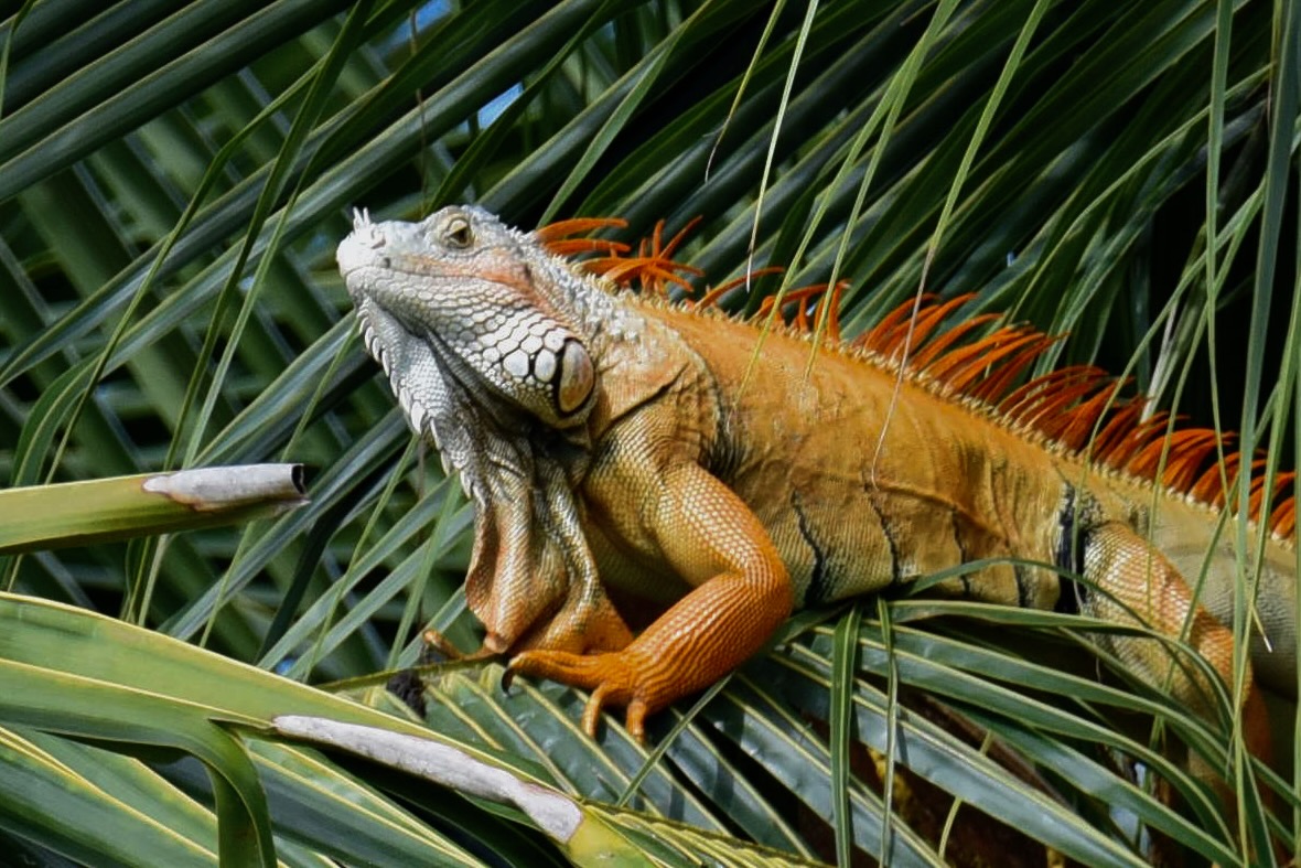
Around lake Peten Itza, GuatemalaJuvenile green iguana, Peten Itza lake near Flores, GuatemalaGreen iguana adult, Peten Itza lake near Flores, GuatemalaGreen iguana adult male in mating season turns orange, Peten Itza lake near FLores, Guatemala
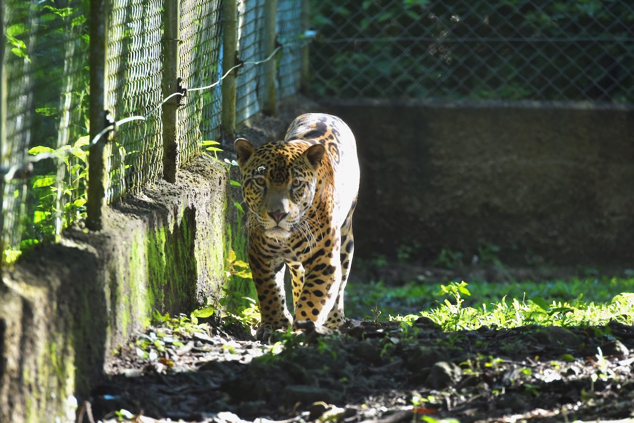
On our little boat trip we stopped at the ARCAS Wildlife Rescue Center. It was very informative about the challenges and scale of wildlife trafficking in Guatemala and the region. The center receives between 300 and 600 animals per year. It is, sadly, one of the few places other than a zoo where one can see jaguars or scarlet macaws in Guatemala. It is a large sanctuary with many animals waiting for their chance to get back to the wild.
Jaguar at ARCAS wildlife sanctuary on lake Peten Itza near Flores, Guatemala
We also went to see one more Mayan site. After all the Mayan ruins in Belize, Mexico and TIkal we just could not stop. Every tour agency in Flores sells a tour to Yaxha. A major site it was the third largest city in the region in its day between 250-600AD. The site is huge, covered in jungle and is only partially excavated. It has 500 structures, including 9 temple pyramids! Walking through trails which used to be causeways connecting various parts of this ceremonial center, one can only feel amazement and awe at Maya civilization.
Mayan ruins at Yaxha, Guatemala
The tours are mostly afternoon tours and include a sunset view over the lake Yaxha from the top of one of the pyramids named (not very poetically) structure 216. It is the tallest of the structures with fantastic view of the lake and the site.
Structure 216 – 30m temple at Yaxha with stunning sunset views, GuatemalaSunset view over Yaxha lake from structure 216 of Yaxha Mayan site, Guatemala
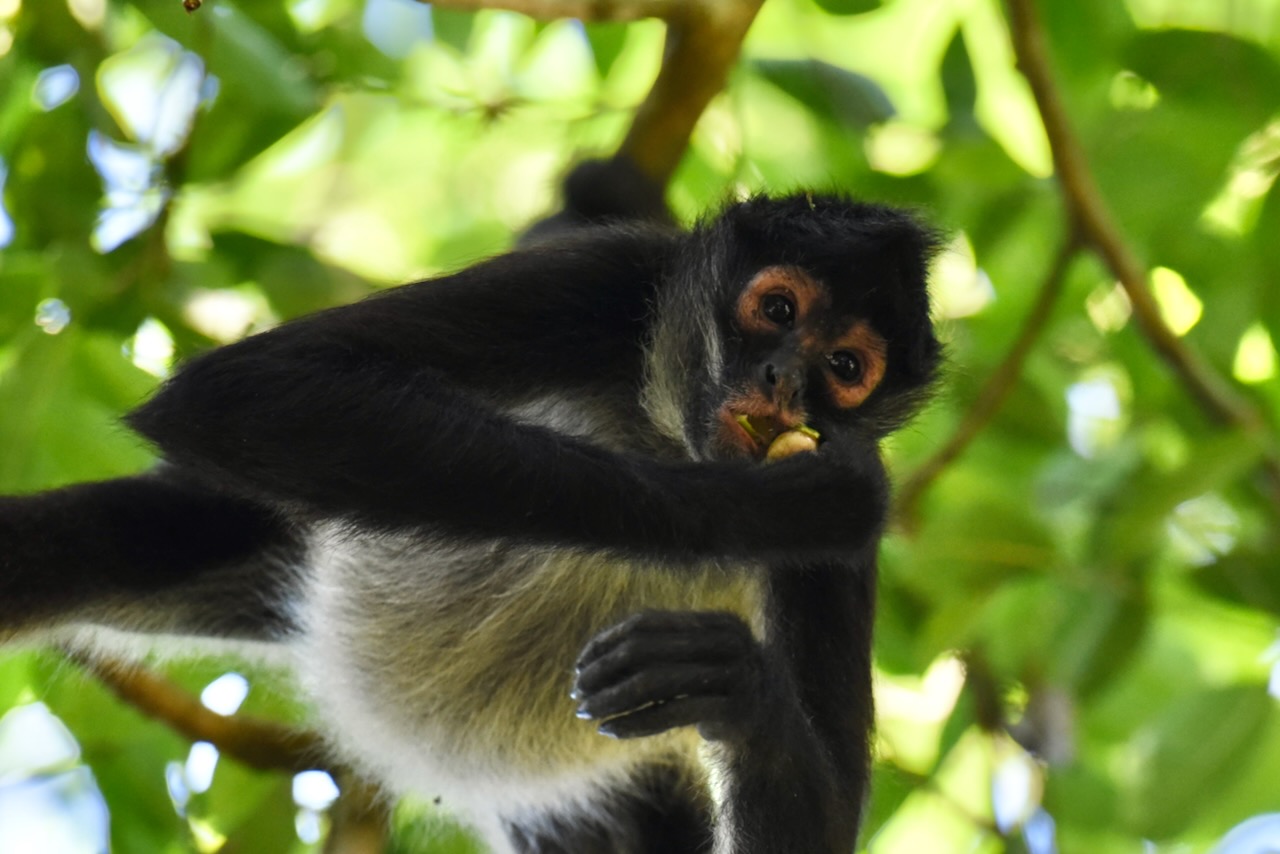
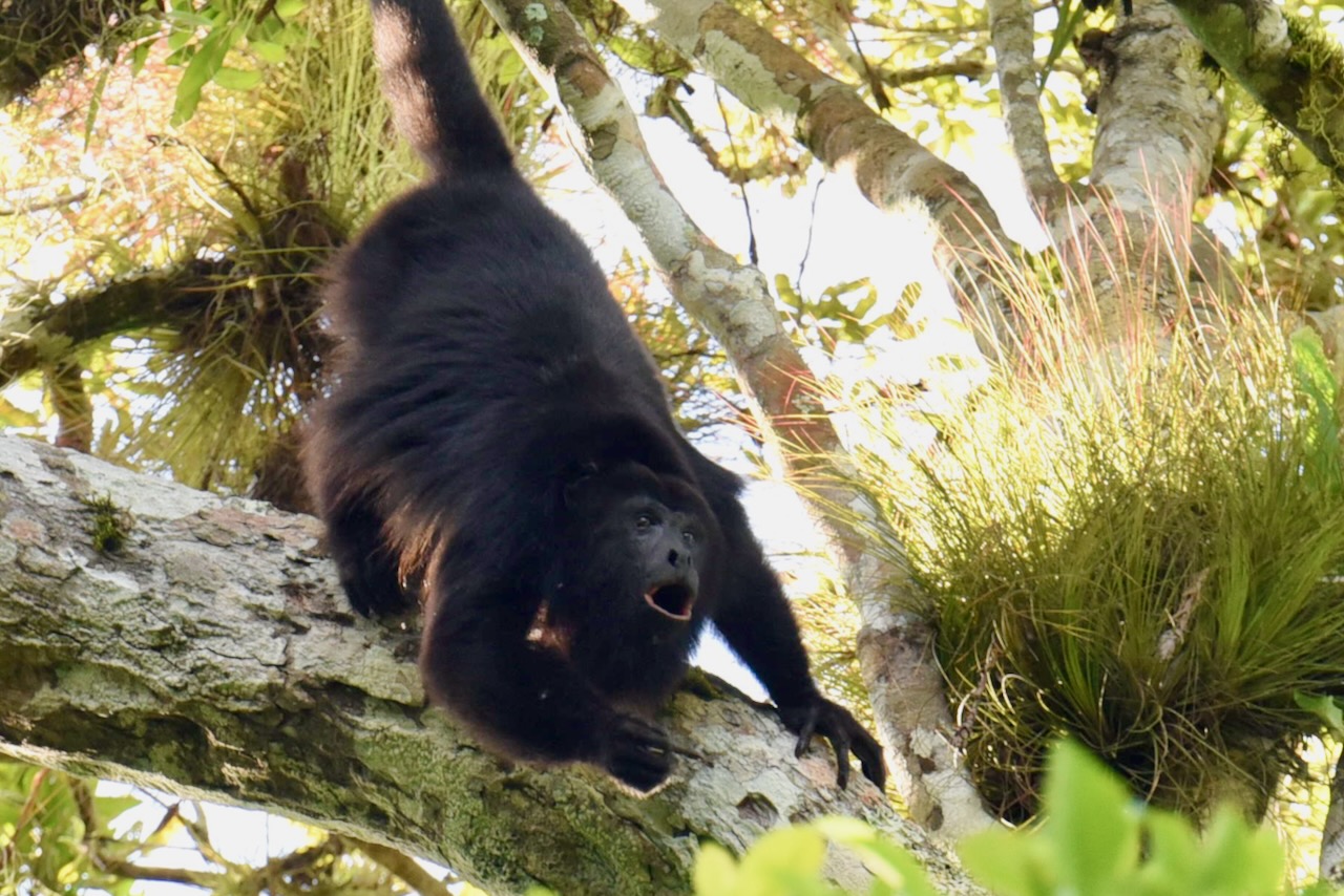
Wildlife on the site is plentiful and during our visit was very active. Spider monkeys were feeding and hopping around trees. Howler monkeys were in an extended howling match. It was a special experience to stand right next to Mayan pyramids, listen to and watch howling monkeys and trying to imagine what was it like in around 500AD.
Spider monkey eating at Yaxha Mayan site, GuatemalaHowler monkey at Yaxha Mayan cite, Guatemala.
The distance from Flores to Yaxha is 70km and it should not take more than 2 hours to get there. The group tour takes a fair bit longer though as the bus drives around to pick up all the visitors in Flores and in the area. It is not exactly a chicken bus – as Guatemalan public buses in rural areas are known, as it is a modern comfortable bus. But it does take a while and they do fill the bus, including by picking up friends who need a ride to Flores and are ok with standing. If time is a constraint maybe it is better to get a private or smaller tour. We had time and did not mind the slow trip and got a few laughs along the way in that high density transport.
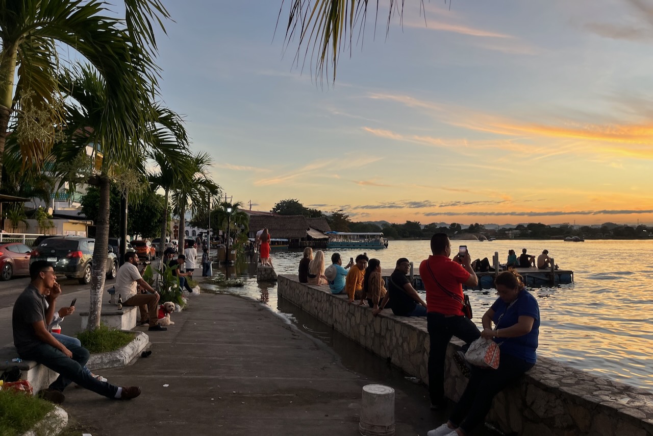
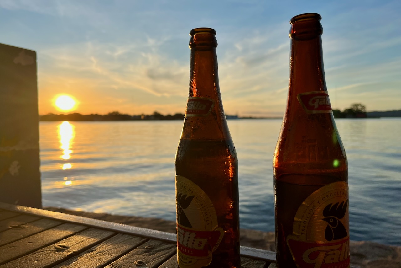
We really enjoyed our stay in Flores. It is a very relaxed happy place to base oneself at to explore Tikal and other wonders of Peten region. After our daily explorations it was highly enjoyable to join the locals and tourists watching sunset and drinking Gallo (english translation “rooster”) – excellent Guatemalan beer.
Watching sunset from Flores island waterfront, Flores, GuatemalaSunset and Gallo beer, Flores, GuatemalaSunset and a ferry over Peten Itza, view from Flores Island, Guatemala
From here we flew back to Guatemala City and headed to explore highlands of Guatemala in Antigua and lake Atitlan.
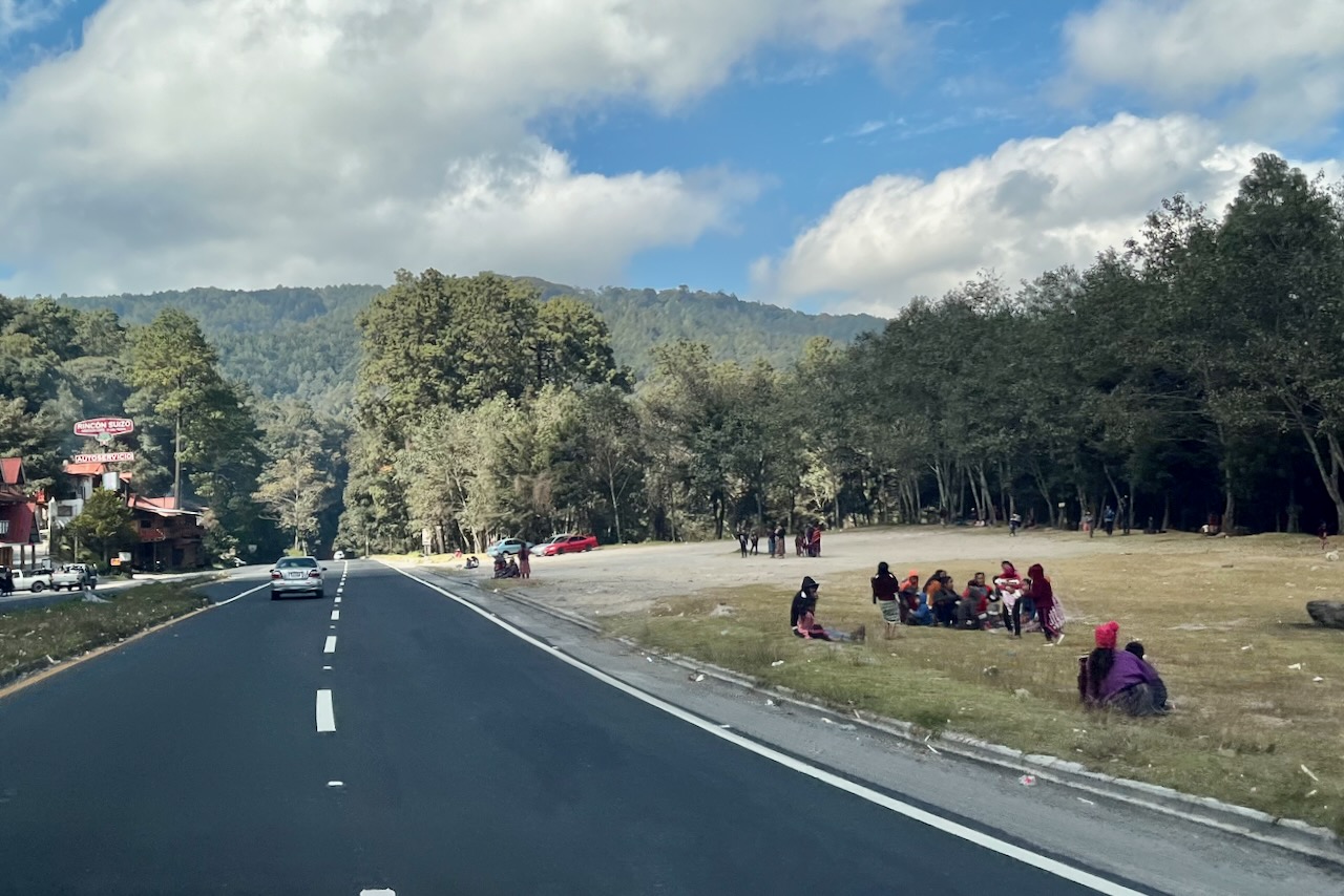
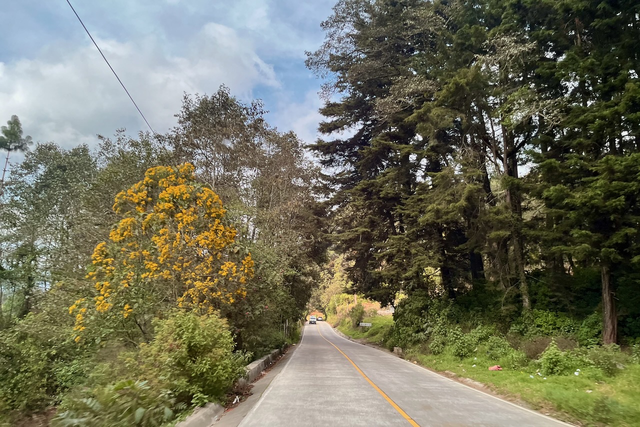
We headed from Antigua towards lake Atitlan on the 30th of December. The road is very good. Oddly, all along the way we saw people sitting by the side of the road in small groups. According to our driver they were “having a picnic” while waiting for the passing buses since everyone was traveling some place for the new year celebrations/ returning from Christmas celebrations.
People waiting for buses along the road from Antigua toward lake Atitlan, Guatemala
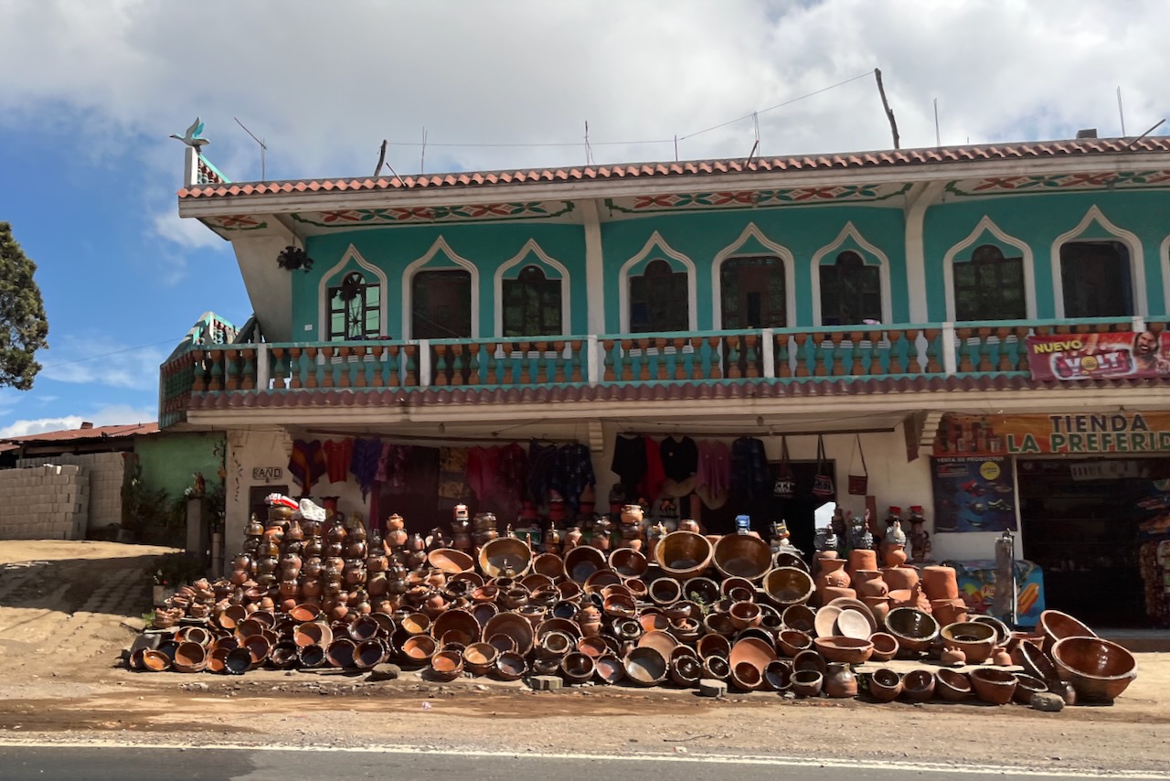
People of Guatemala are very industrious and at times it does seem that the entire population is either embroidering or making pottery. All along the way there were shops selling all manner of crafts and pottery.
Pottery and souvenir shop along the way from Antigua to lake Atitlan, Guatemala
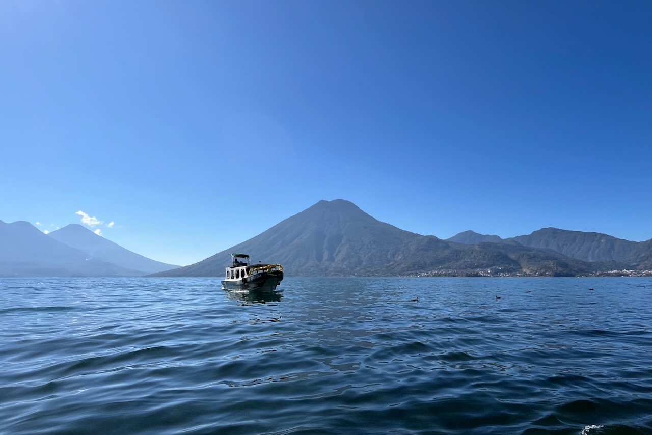
After researching about various villages around lake Atitlan, we decided to stay in San Marcos La Laguna on the western side of the lake. To get there we first arrived by road to Panajachel and then took a boat. Panajachel is developing fast and even has high rise hotels. We felt we wanted a more quiet place. The drive from Antigua took about 2.5 hours. We then took a public water taxi – the lake version of a chicken bus. The water taxi stops by various villages dropping off and picking up passengers making a circle around the lake. We were traveling in the early afternoon and the waves were starting to pick up a little bit. Prepare to get splashed a little though they do have curtains to block of the spray. The luggage goes on top of the boat and also may get some spray on it.
One of the villages on Lake Atitlan shore between Panajachel and San Marcos, Guatemala
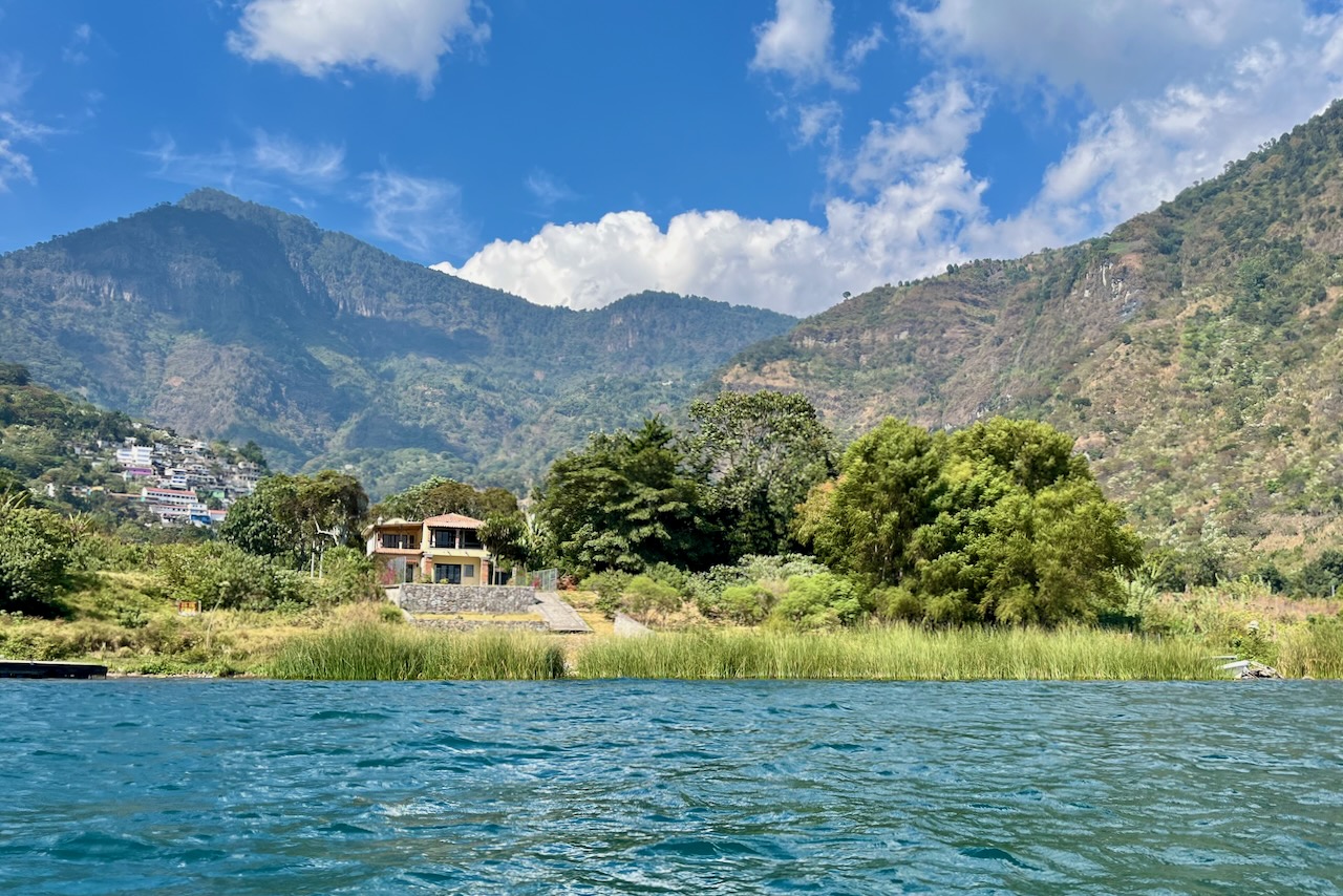
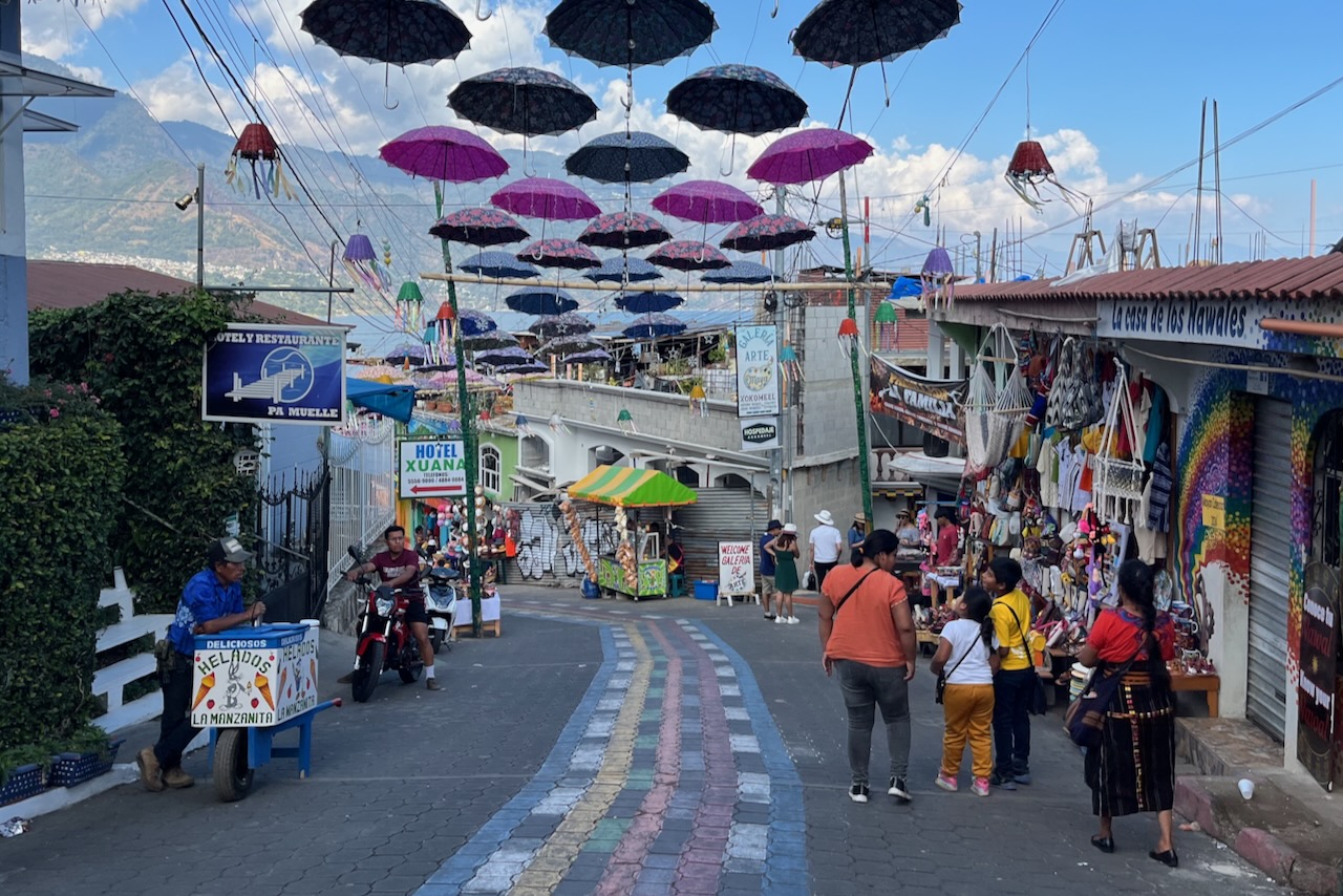
We stayed in an airbnb just outside of San Marcos. Main transportation in the area, once one gets off the boat, is tricycle. We found them to be readily available and reliable. A couple of times our tricycle drivers looked like they were 12, but they drove very well! The development has reached lake Atitlan with a construction boom visible. There are quite a few cottages built around and many airbnbs. There is also a number of small hotels and yoga retreats as San Marco is known to be the “hippie” village. Our airbnb had phenomenal views over the lake and we were very happy we decided on this option rather than busy Panajachel.
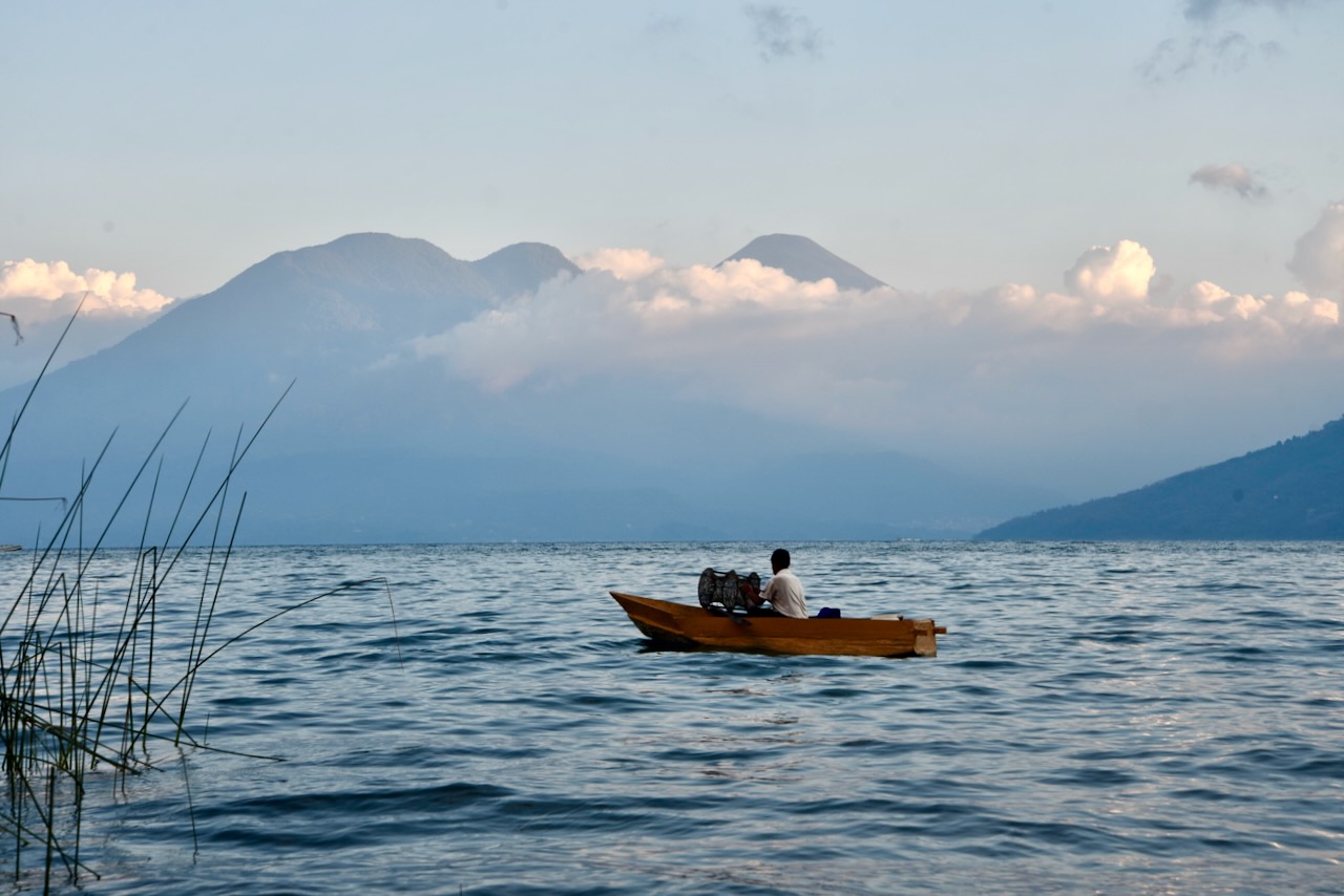
Lake Atitlan view, San Marcos la Laguna, GuatemalaFisherman on Lake Atitlan, near San Marcos La Laguna, Guatemala.
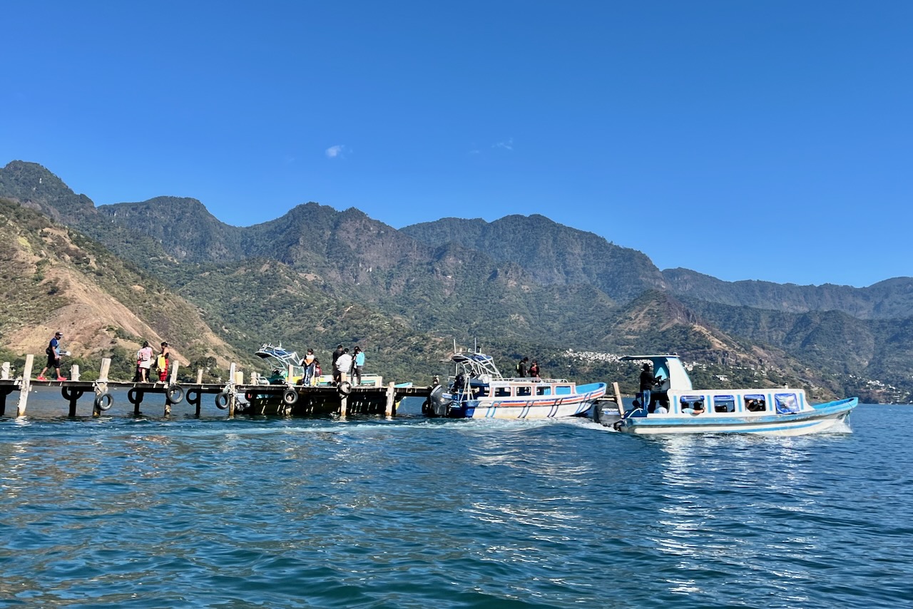
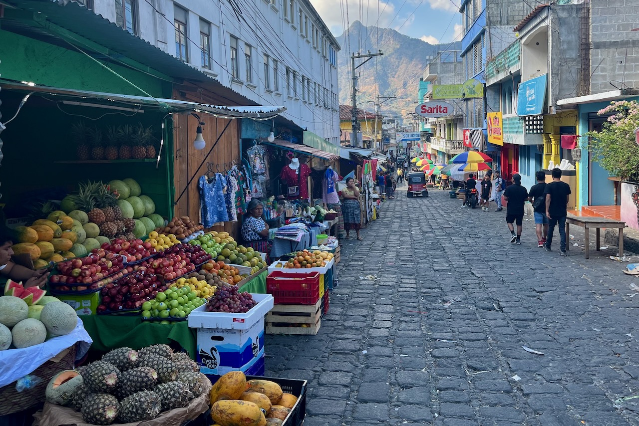
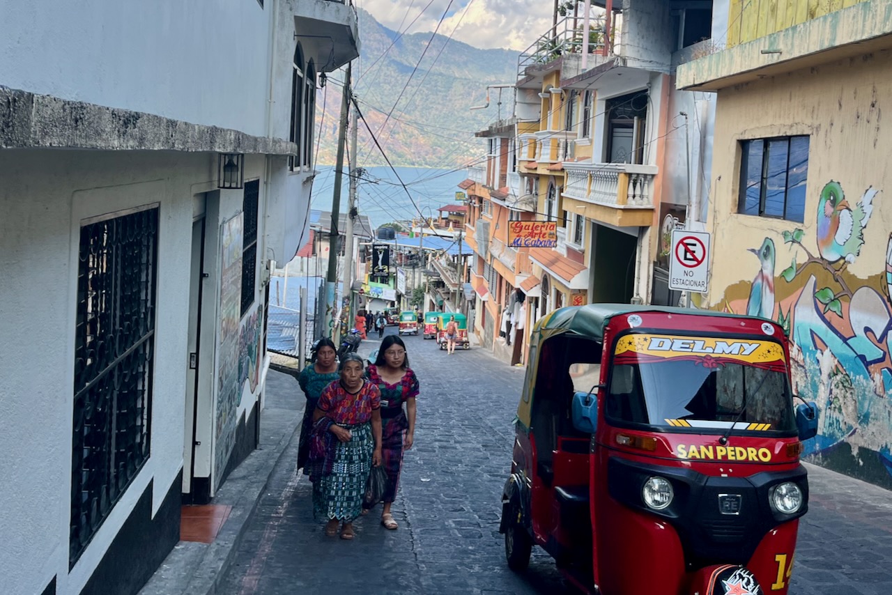
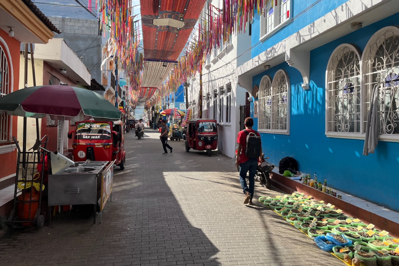
A short and very scenic boat ride from San Marcos are San Pedro and San Juan. We took the water taxi boat to San Pedro – a lively village with many restaurants and bars and a popular base for backpackers on lake Atitlan.
Jetti in San Pedro La Laguna, Guatemala
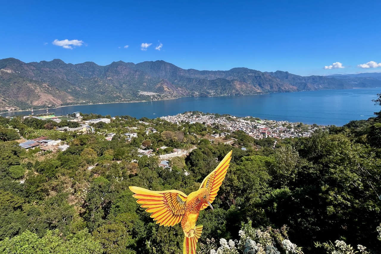
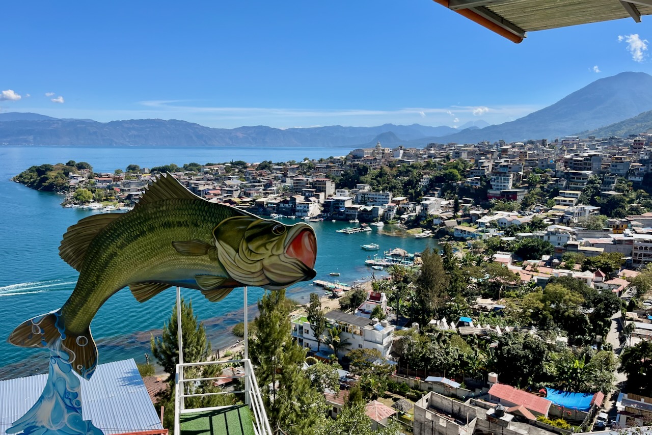
In San Pedro we took a tricycle for the scenic route to three view points of the lake. Each viewpoint has a restaurant or two with multiple viewing platforms at it. Local and foreign tourists alike are fans of selfies and photos with stunning views. Most of these restaurants/ view point also have special attractions to take photos with, like a giant colorful hummingbird or a giant fish, in case lake view is not enough. We also walked around the town and had a nice lunch.
Lake Atitlan and San Pedro La Laguna, GuatemalaLake Atitlan and San Pedro La Laguna, GuatemalaStreet market in San Pedro La Laguna, GuatemalaStreet view in San Pedro La Laguna, Guatemala
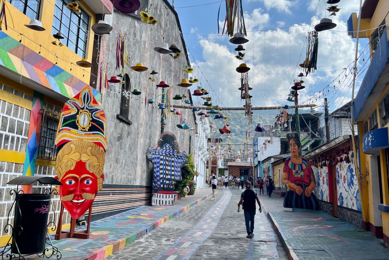
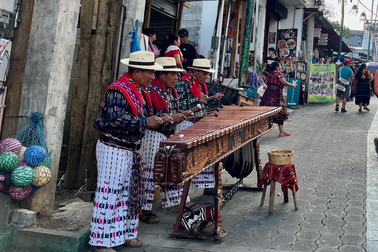
We then took a short tricycle ride to San Juan La Laguna known for its artistic side. The streets in San Juan were creatively decorated with murals, hanging hats, umbrellas and textiles. There are plenty of workshops selling all variety of handicrafts. It had a very cheerful vibe. Since we were there on 31 of December many locals seemed to be shopping for this celebrations. And the main road to the pier was busy with musicians and street food vendors.
San Juan La laguna street view, GuatemalaSan Juan La laguna street view, GuatemalaTraditional musicians San Juan La laguna, GuatemalaSan Juan La laguna street view, Guatemala
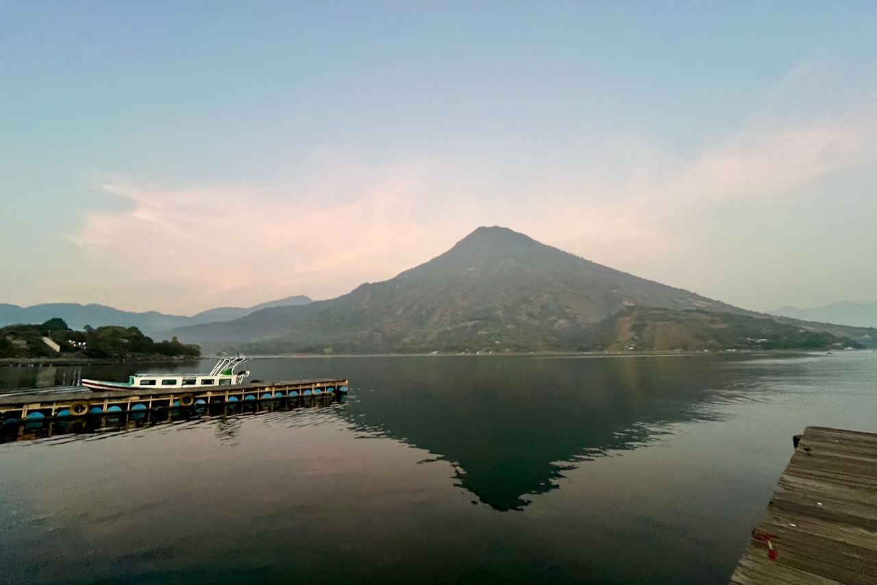
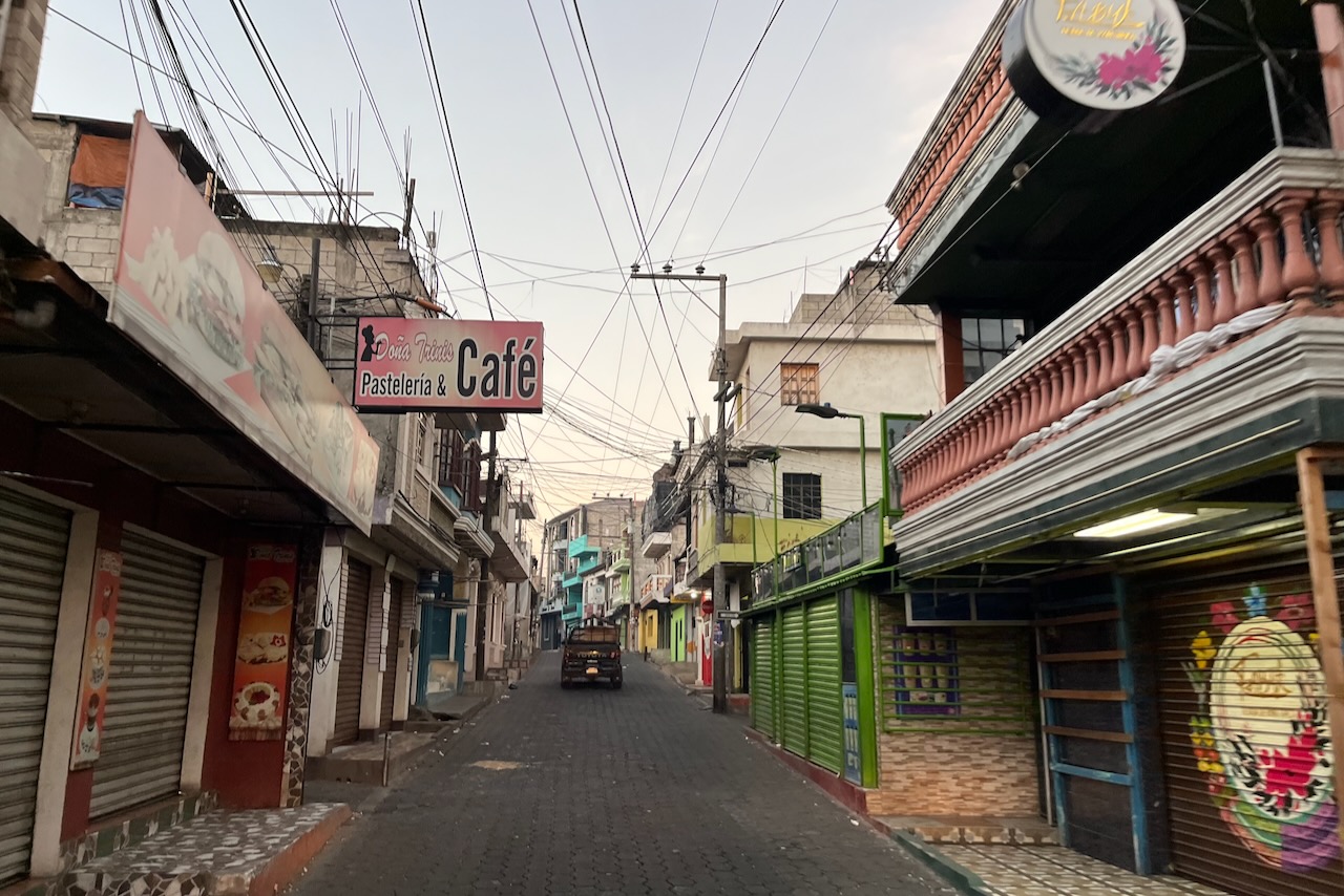
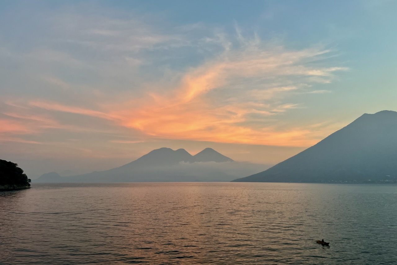
Not too far away from San Marcos, across the lake, is a Mayan town of Santiago Atitlan. We headed there one early morning for a birdwatching tour at Rey Tepepul Municipal Nature Reserve to search for resplendent quetzal. Quetzal is a national bird of Guatemala and even its currency is named after it. It is a very beautiful bird living in cloud forest. Quetzal population is declining due to habitat loss despite its protected status.
Santiago Atitlan jetty with the view of Atitlan volcano, Guatemala
We arrived by boat at sunrise at Santiago jetty and then headed up the hills to the cloud forest on the slopes of Atitlan volcano in the back of a pick up truck. A very authentic experience.
Santiago de La laguna street view in early morning, Guatemala
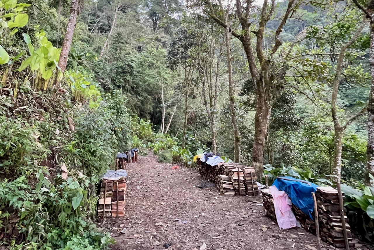
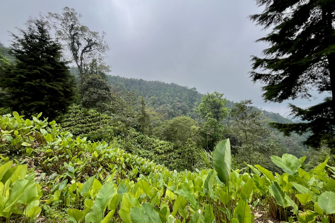
We hiked for an hour or so through beautiful forest to the spot where quetzals were sited. This is a working forest and there are stacks of harvested wood and plantations of pampano (calathea lutea) along the way. Our guide pointed out several bird species along the way. With 700 species Guatemala is a major draw for birdwatchers.
Wood harvested along the trail near Santiago La Laguna, GuatemalaPampano plantations in cloud forest near Santiago La Laguna, Guatemala
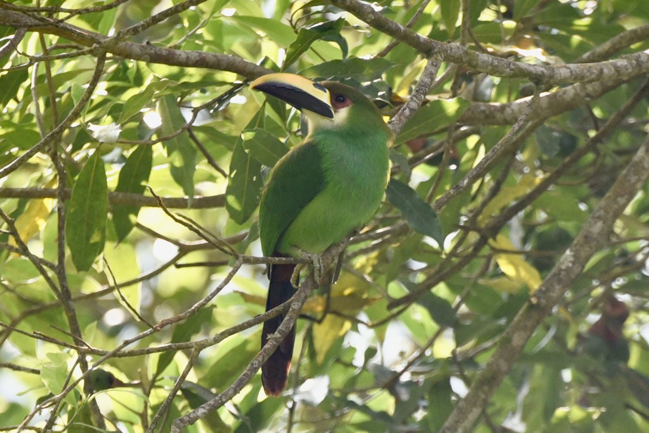
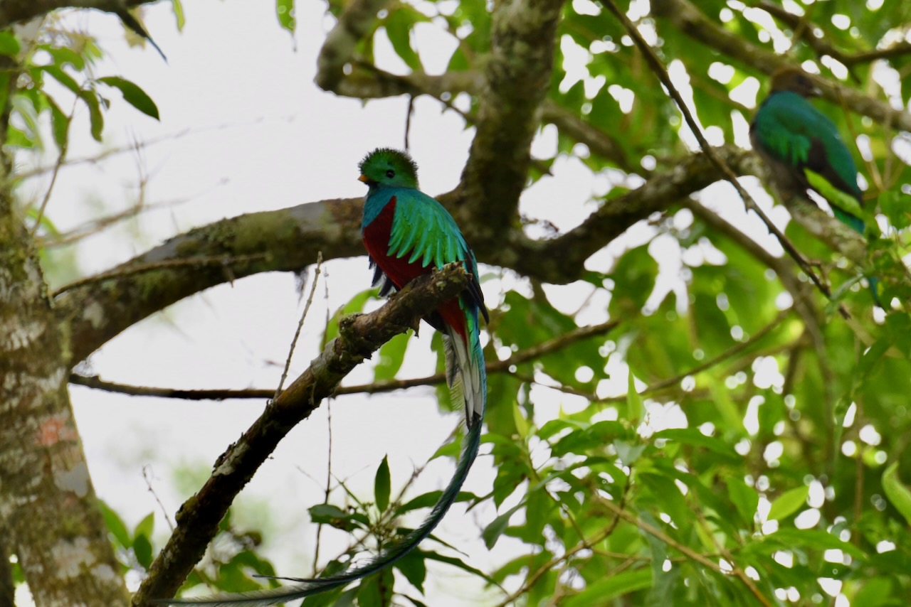
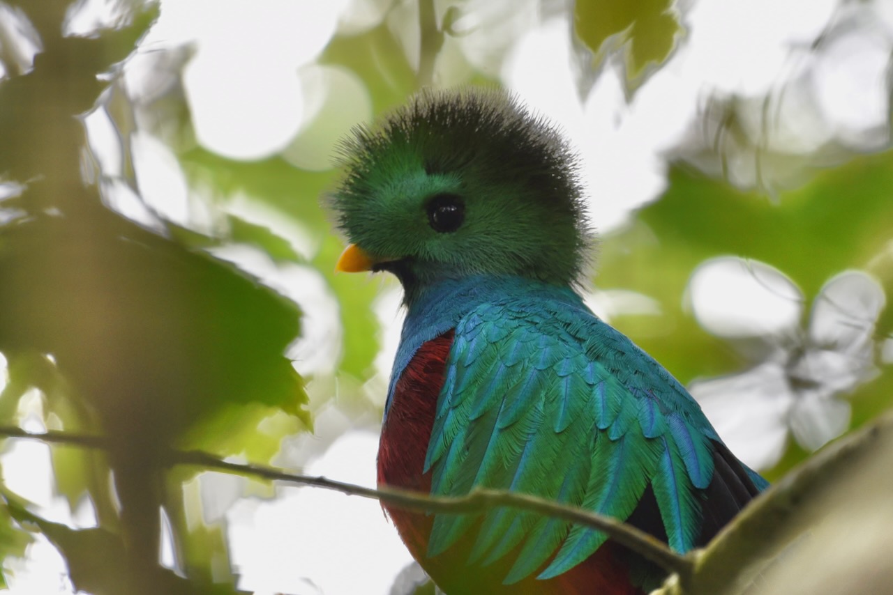
First we found emerald toucanet. Soon after quetzals arrived to the same tree. we were lucky to see several pairs of quetzals and had really great sightings. It is a really strikingly beautiful bird, especially the male with brights feathers and long tail. We were very happy we went for this bird watching tour even though we are not exactly birders.
Northern emerald toucanet, Rey Tepepul Municipal Nature Reserve near lake Atitlan, GuatemalaResplendent Quetzal, Rey Tepepul Municipal Nature Reserve near lake Atitlan, GuatemalaResplendent Quetzal, Rey Tepepul Municipal Nature Reserve near lake Atitlan, Guatemala
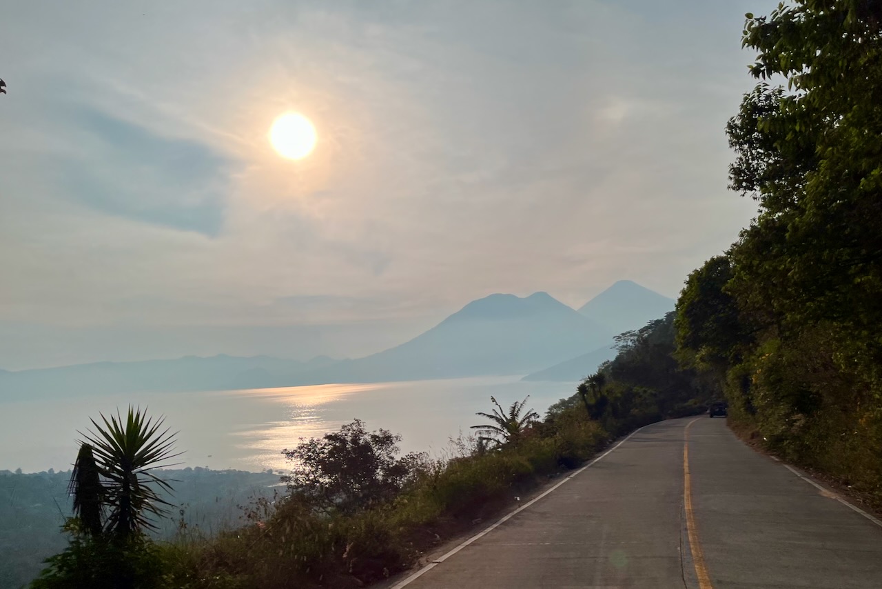
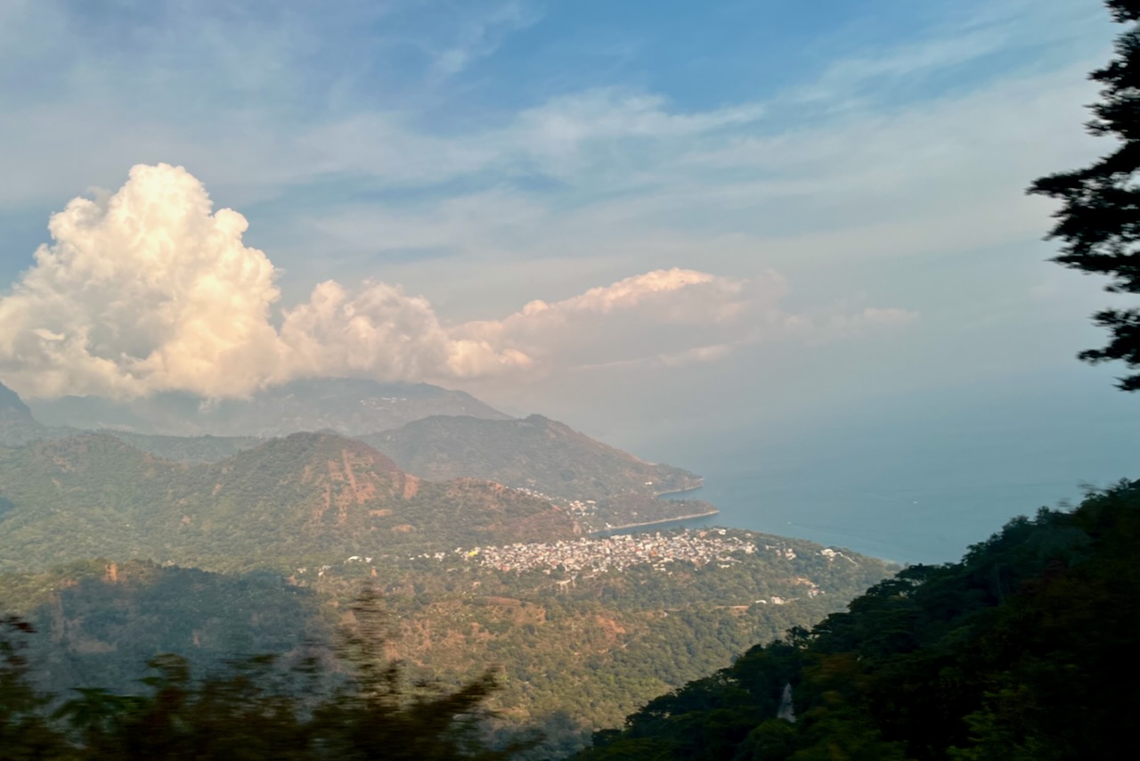
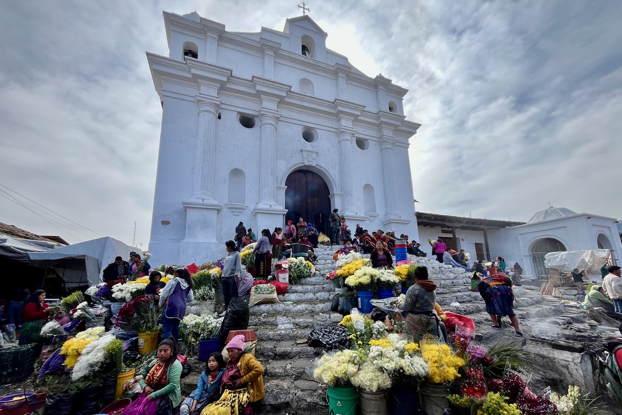
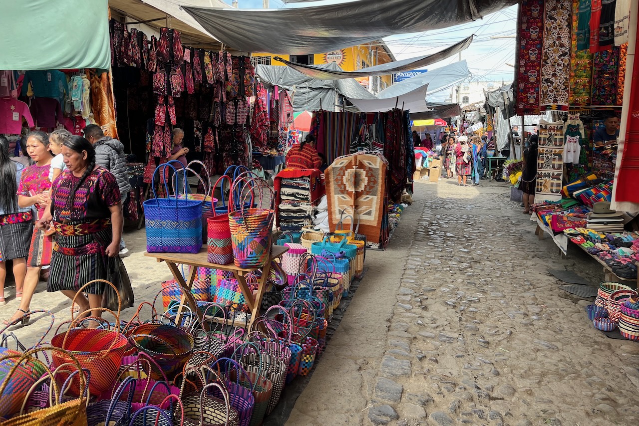
A town of Chichicastenango nearby is well known for its market. Most tourist operators offer tours on market days (Thursday and Sunday). It is only 60km from San Marcos but takes about 2 hours zigzagging on mountain roads.
Atitlan lake views on the road from San Marcos to Chichicastenango, GuatemalaAtitlan lake views on the road from San Marcos to Chichicastenango, GuatemalaPine forest in highlands along the road from lake Atitlan to Chichicastenango, Guatemala
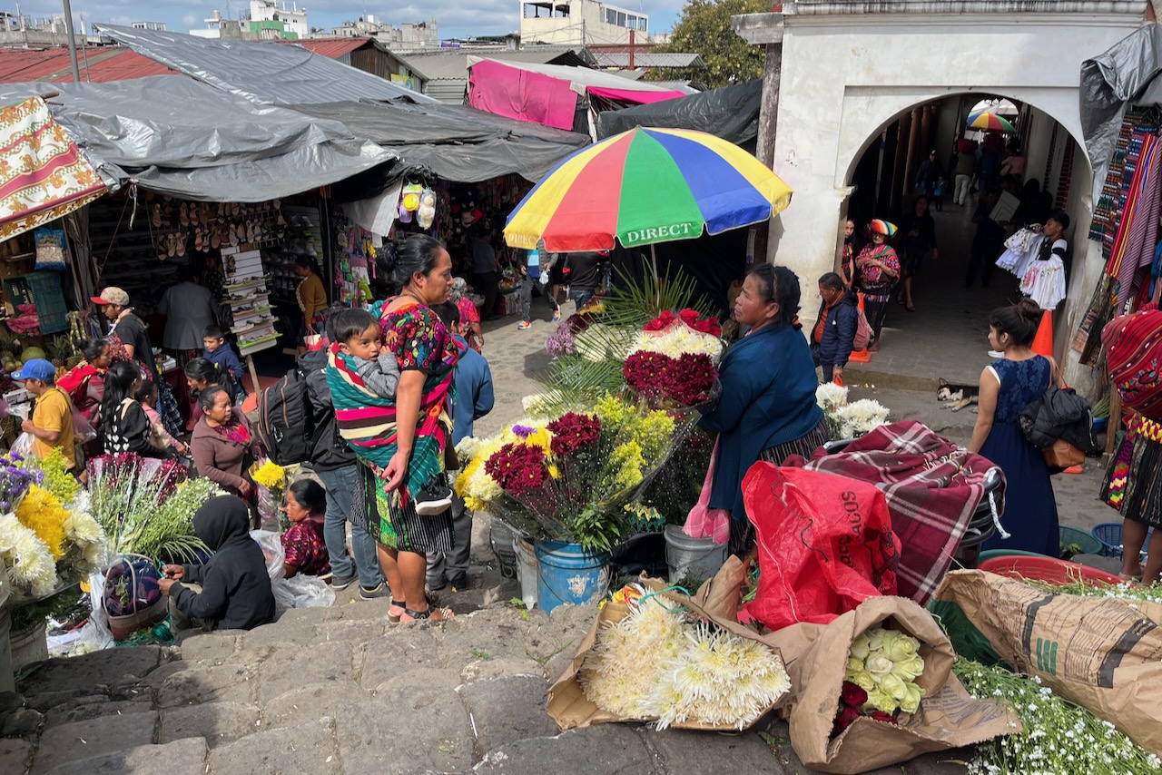
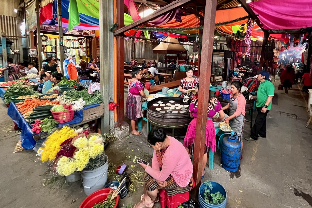
Chichicastenango market is a huge area selling everything. While there ae quite a few tourists coming to have a look and a large area where handicrafts are sold, for the most part it is a regular market for Guatemalas to buy stuff. There is food, appliances, clothes, household items, basically everything one could possibly need more or less. The main Church Santo Tomas is at the edge of the market and has a blend of pre-Colombian and Catholic worship. The stes of the church are increadibly colorful due to all the flower sellers there. Worshipers buy flowers and insents to make offerings. The inside is fascinating offering a glimpse of this world that mixes so diverse influences. It is absolutely not allowed to take pictures inside out of respect for people’s beliefs. But one is welcome to enter and have a look. Fascinating.
Santo Thomas church, Chichicastenango, GuatemalaFlower sellers, Chichicastenango market, Guatemala“Food court” with fresh vegetable sellers and tortilla makers, Chichicastenango market, GuatemalaTextiles for sale at Chichicastenango markets, Guatemala
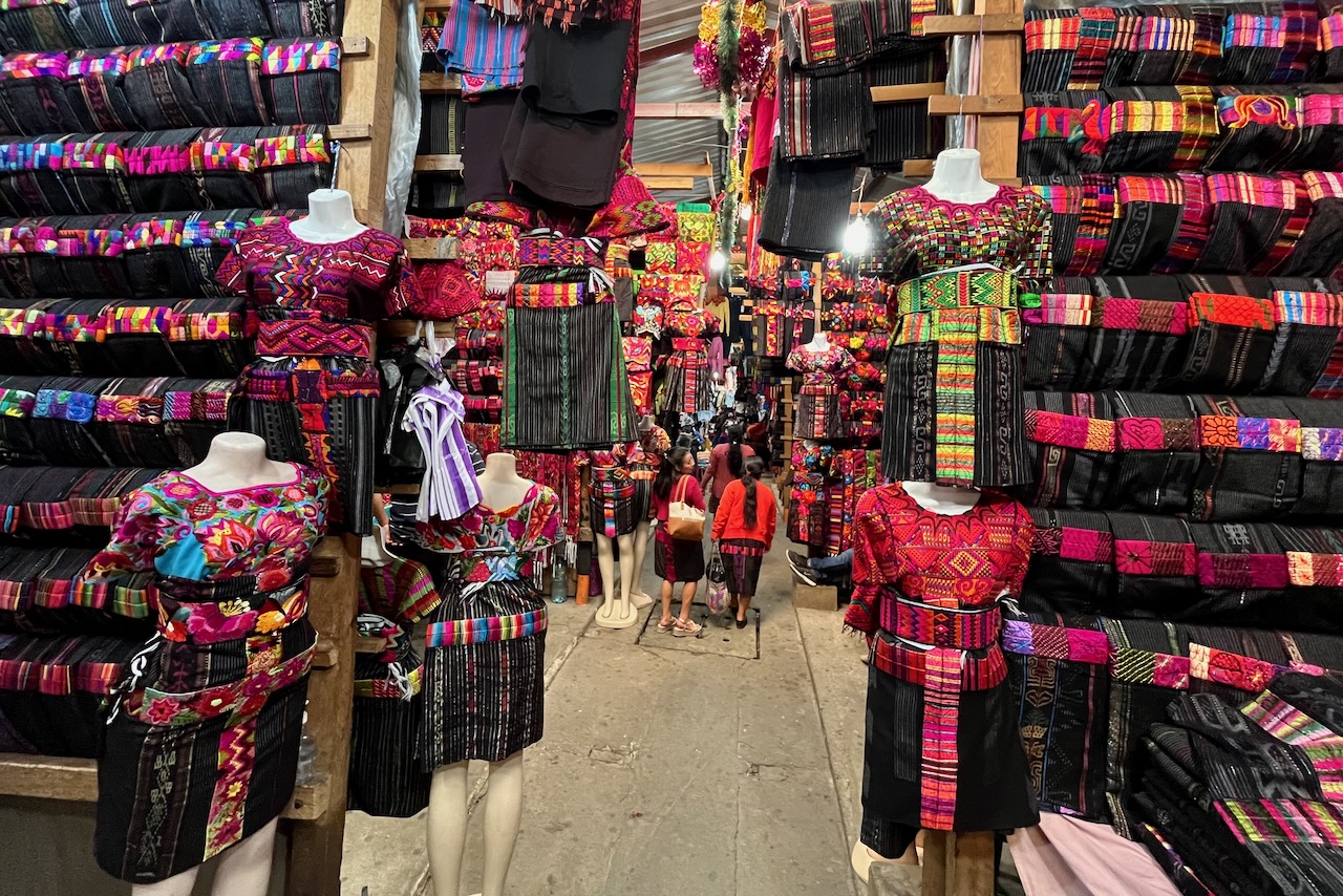
We were very limited by our luggage size and had to exercise maximum willpower at Chichicastenanho markets. There are were so many beautiful things to buy. Very beautiful decorative textiles and all manner of handicraft. It is also increadible to see all the traditional clothes, mostly women’s. It seems men have moved on to western style clothing mostly but women wear elaboarate beautiful traditional outfits. The quantity and quality of these beautiful textiles is overwhelming. Guatemalan women making them must be the most hard working and productive women in the world.
Textiles and fashions at Chichicastenango market, Guatemala
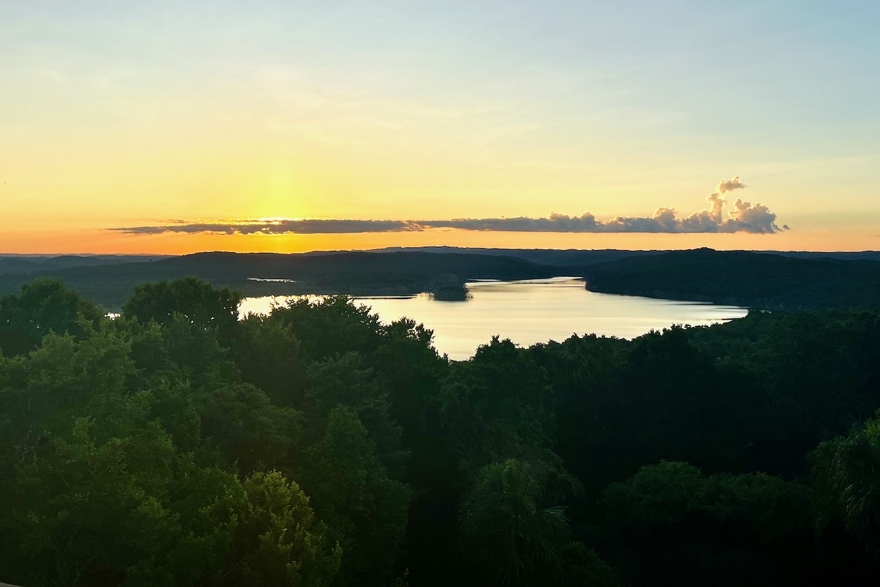
We had fantastic several days at lake Atitlan. And after days of exploring nearby sites, or paddling around the lake it was wonderfully relaxing to just sit on our airbnb verandah taking spectacular views of volcanoes. Including far away Fuego, still visible and still fuming.
From here we headed back to Guatemala City to pick up a rental car and start our self driving portion of the trip to Monterirco on the Pacific Coast.
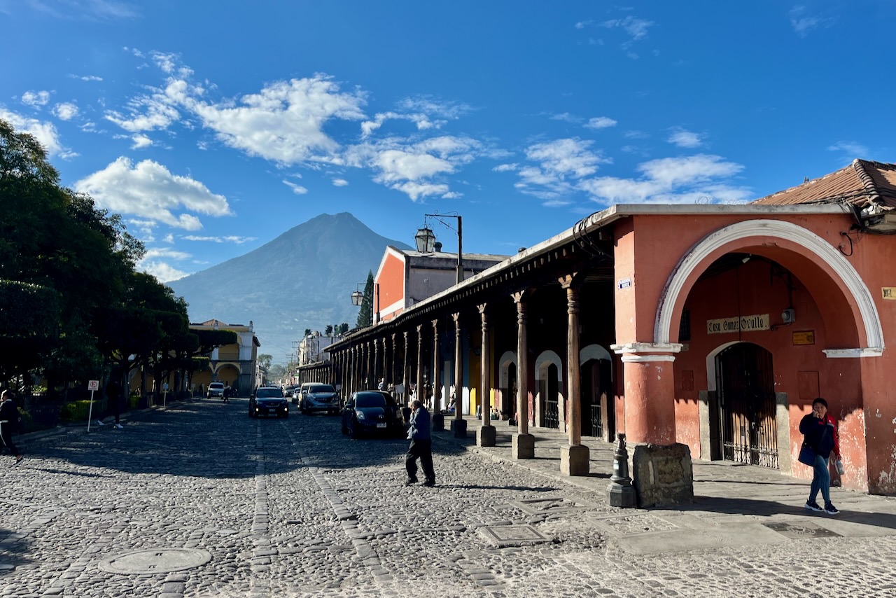
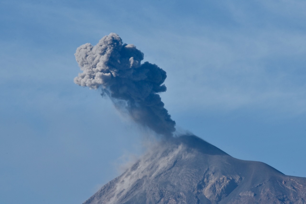
Antigua was a capital of colonial Guatemala, which included all of Central America and Mexican Chiapas, from 1543 through 1773. A major administrative, business and religious center it had many palaces, grand houses, churches and convents. Antigua sits in a beautiful valley surrounded by 3 volcanoes, one of which – Fuego, has been continuously erupting for more than 20 years.
In 1773 a major earthquake destroyed Antigua and it was decided to move the capital to Guatemala City. Antigua was depopulated but not abandoned. The city was listed as a UNESCO World Heritage Site in 1979 which helped with preserving its unique architecture and culture. Today, Antigua is a major tourist attraction for its architecture and culture mix, and as a great base to hike nearby volcanoes.
Buildings framing Parque Central with volcano views, Antigua, Guatemala
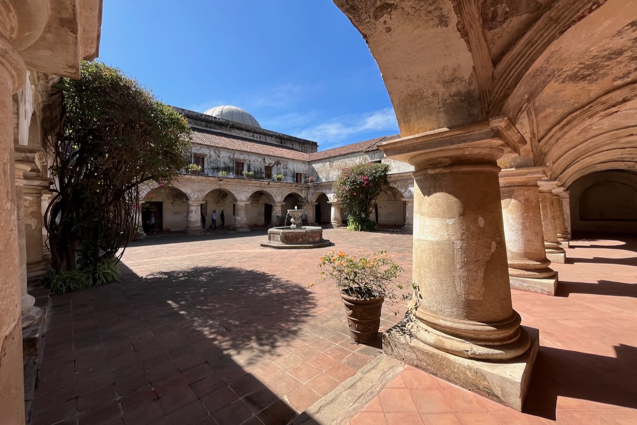
We spent several days in Antigua basing ourselves in one of many boutique hotels in old converted buildings in the city center. We walked around and visited the many museums and ruins. We checked out the many art galleries and craft markets, as well as the regular market. We ate delicious food.
Hiking Acatenango volcano, the third highest in Central America at 3,976m with spectacular close up views of erupting Fuego, was definitely something we considered. But it is a serious hike and an overnight one. We decided we were not exactly fit for it. Maybe one day. We met many travelers who did it and were happy they did, even if sore. We did go for a day hike of Volcano Pataya.
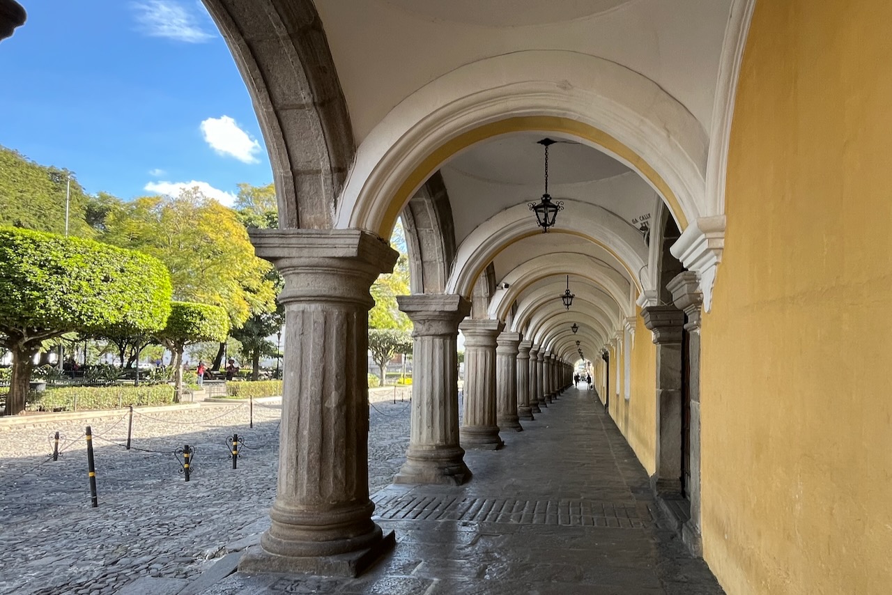
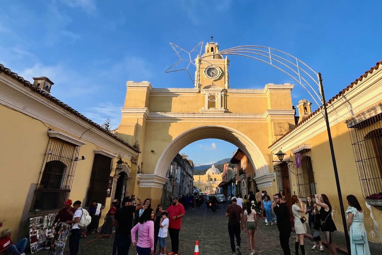
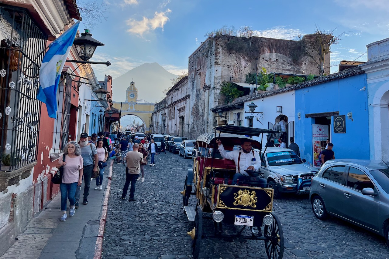
Palacio de los Capitanes Generales at Parque Central, Antigua, GuatemalaSanta Catalina arch, Antigua, Guatemala5Th Avenue north with Santa Catalina arch and Agua volcano view, Antigua, GuatemalaLa Merced Church, Antigua, Guatemala
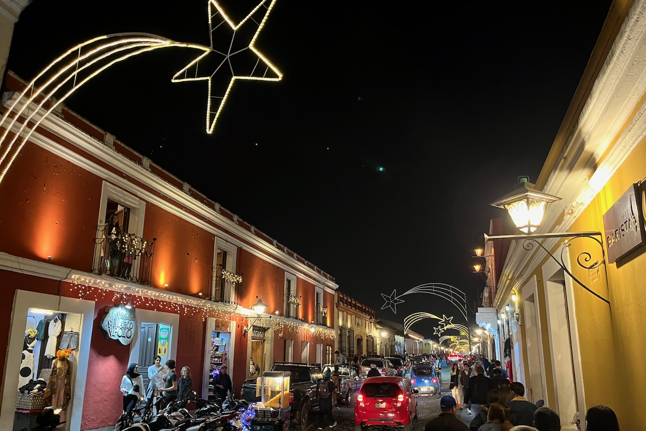
We were visiting in December between Christmas and New Years and the city center was very busy with Christmas market, illuminations and cheerful crowds of locals and visitors. We felt completely safe walking around town at night.
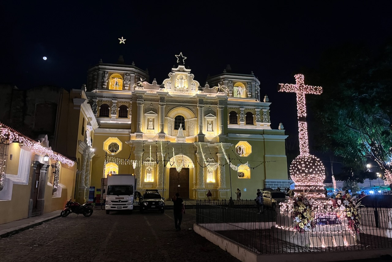
One of the streets in the city center at night, Antigua, GuatemalaLa Merced church illuminated at night, Antigua, Guatemala
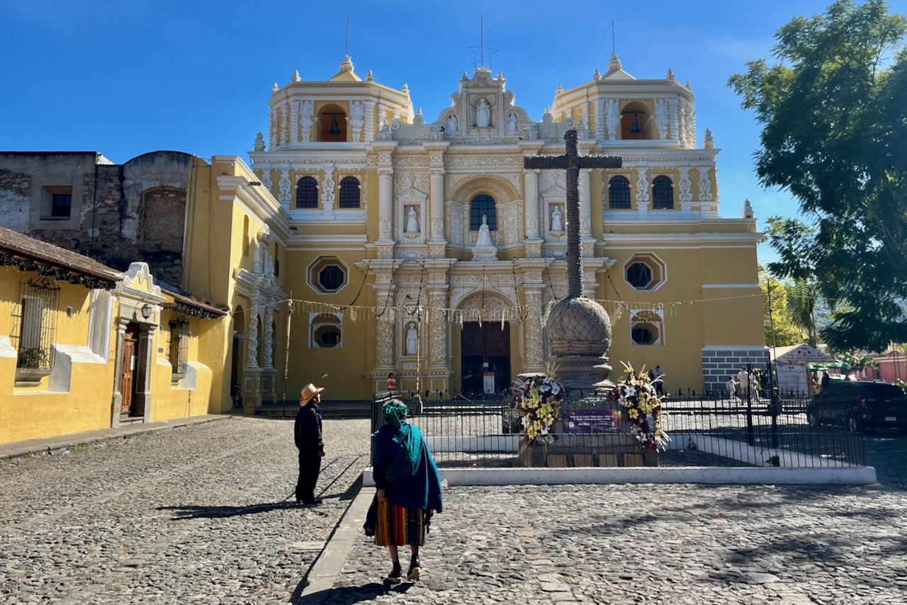
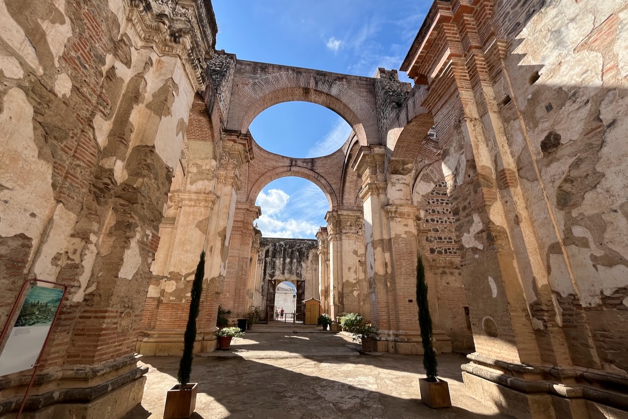
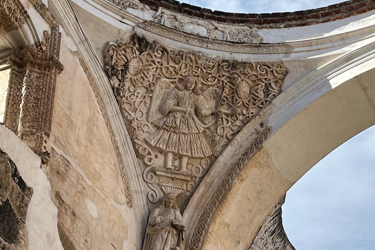
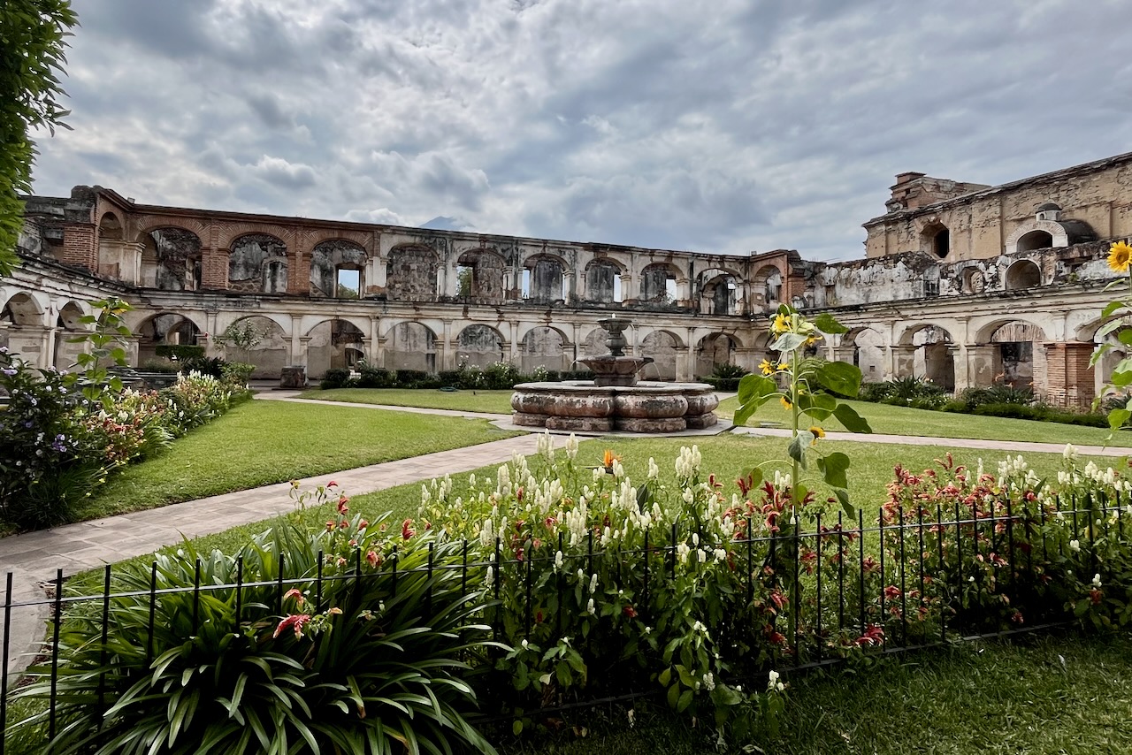
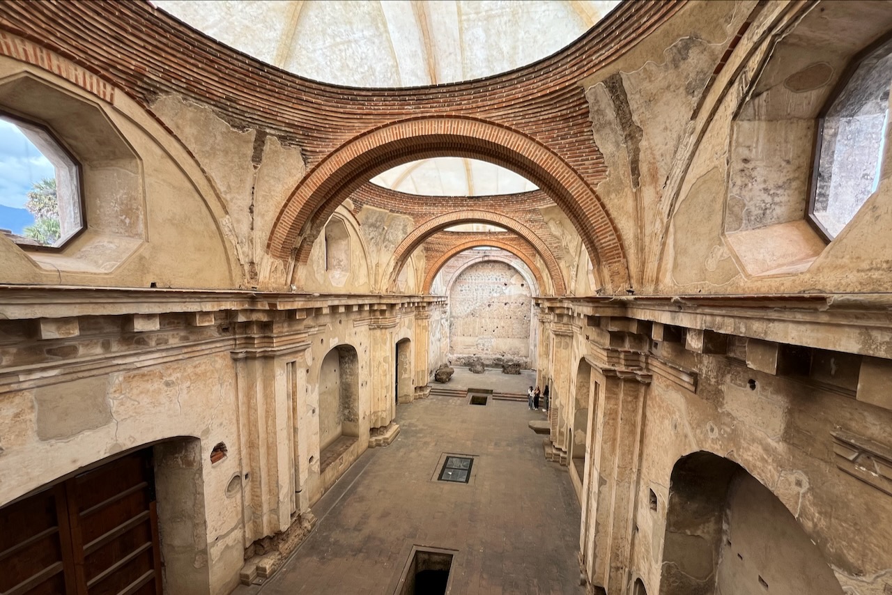
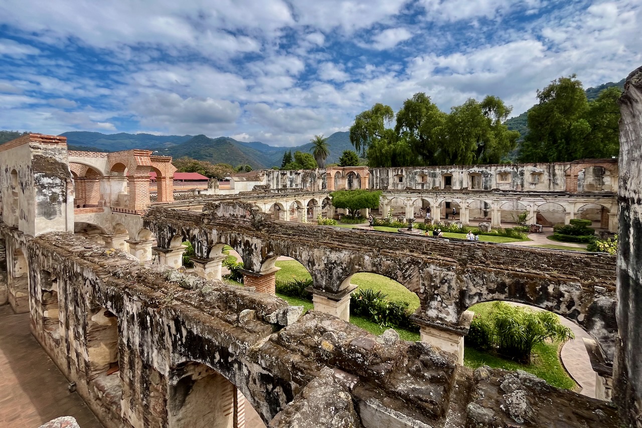
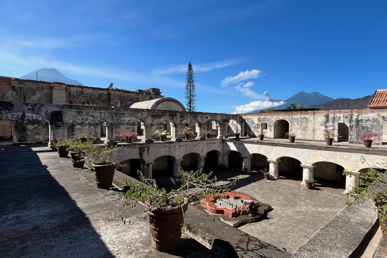
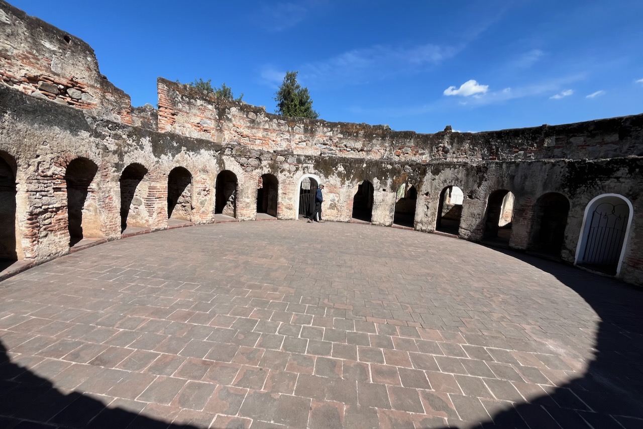
Antigua has an impressive collection of churches, cathedrals, convents and other religious buildings. It seems every monastic order came and set up a base in Antigua. Most of these buildings were severely damaged by the 1773 earthquake. Quite a few have been restored and are now museums or functioning religious entities.
Ruins of Antigua Cathedral, Antigua, GuatemalaRuins of Antigua Cathedral, detail, Antigua, GuatemalaSanta Clara convent, Antigua, GuatemalaSanta Clara convent, Antigua, GuatemalaSanta Clara convent, Antigua, GuatemalaSan Jeronimo ruins, Antigua, GuatemalaLas Capuchinas convent ruins, Antigua, GuatemalaLas Capuchinas convent ruins, Antigua, Guatemala
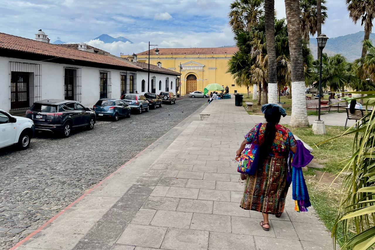
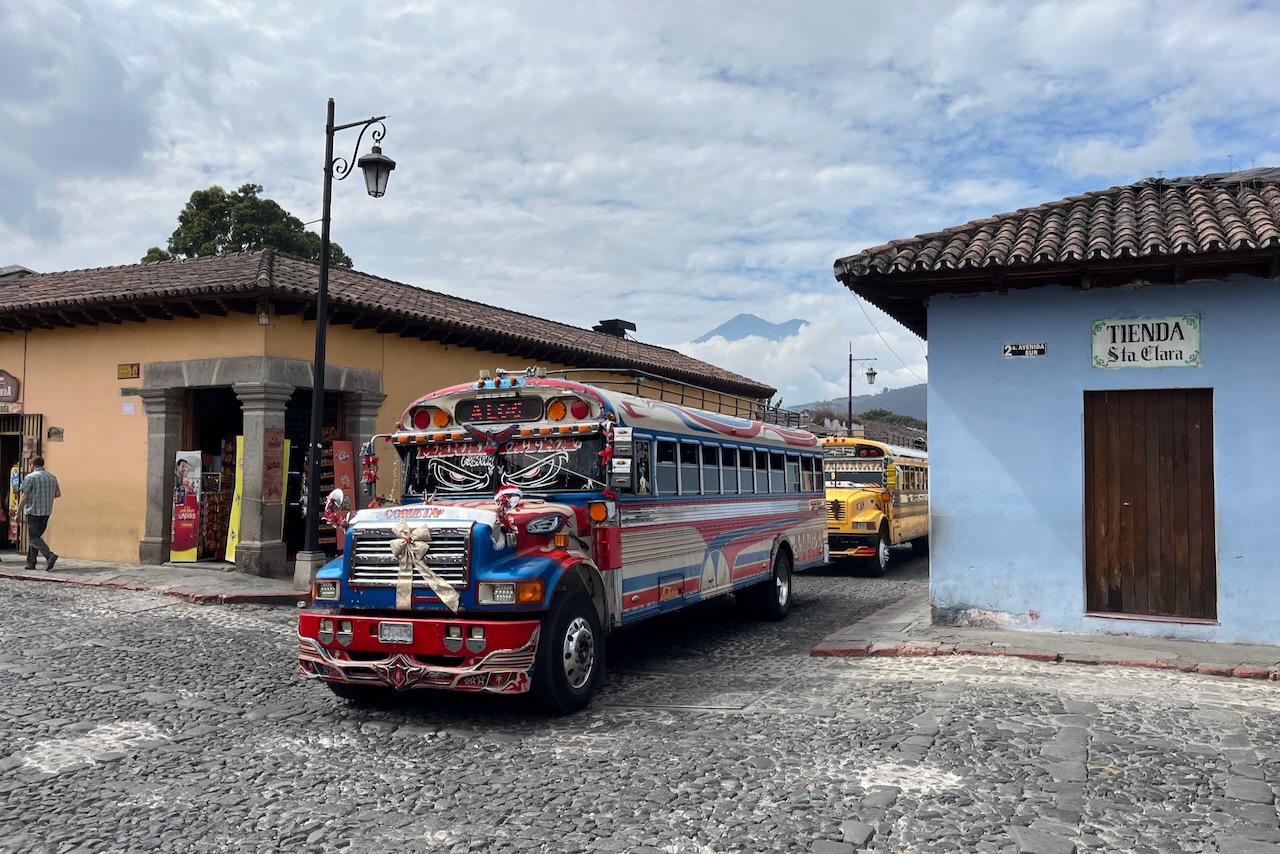
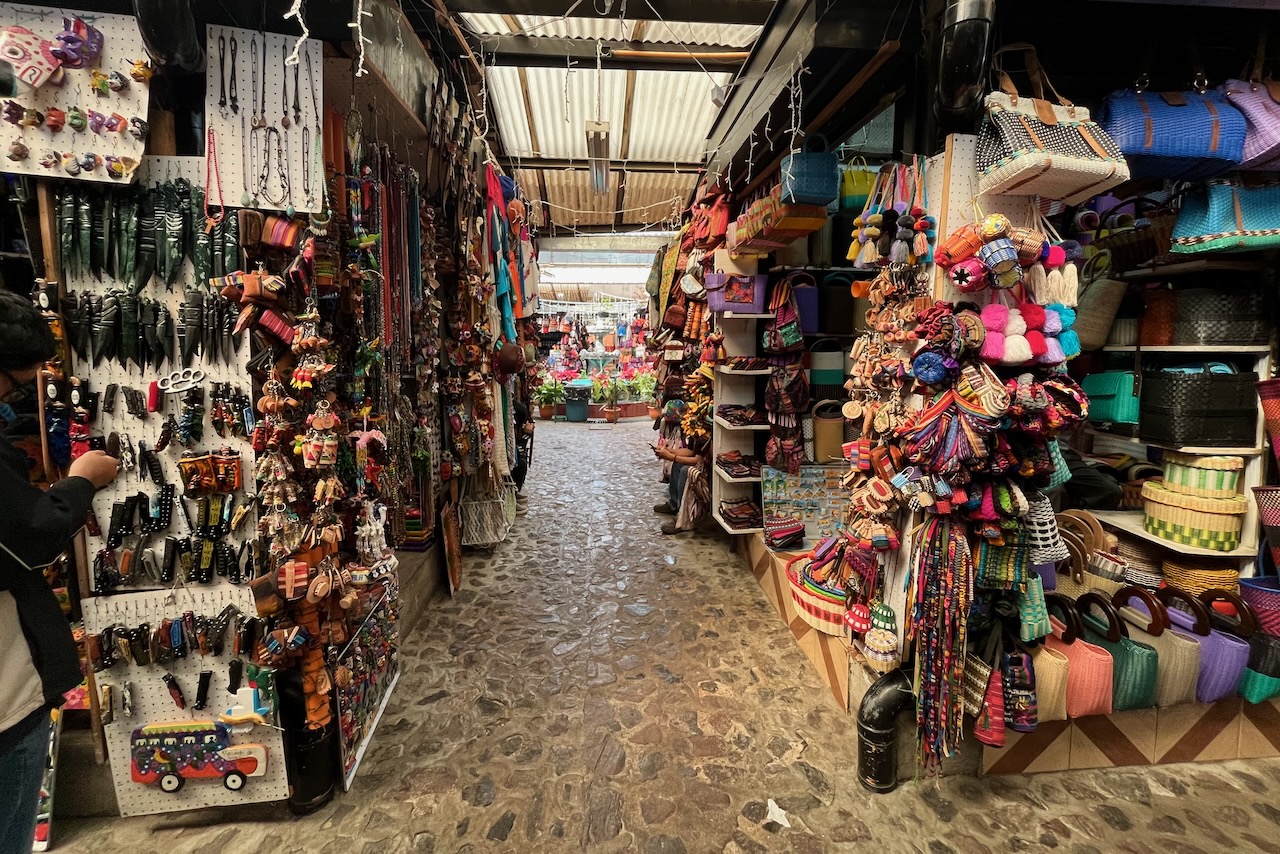
Streets of Antigua are very colorful. Many women wear traditional clothes elaborately embroidered in bright colors. Buses and tricycles are highly decorated too. And there are shops selling all kind of handicrafts and paintings everywhere one looks.
A woman selling souvenirs wearing traditional clothes on a street in Antigua, Antigua, GuatemalaDecorated “chicken bus”, Antigua, GuatemalaHandicrafts market, Antigua, Guatemala
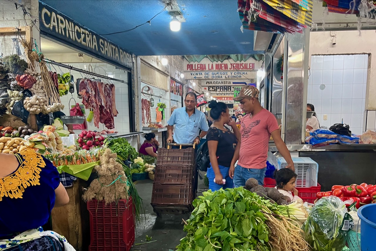
We visited the main fresh market in town located next to the handicrafts market. We were very impressed with the quality of vegetables and fresh produce in Guatemala. It must be that wonderful volcanic soil. It was just a little bit odd that in a market stalls are all intermixed. One would see vegetables sold right next to meat.
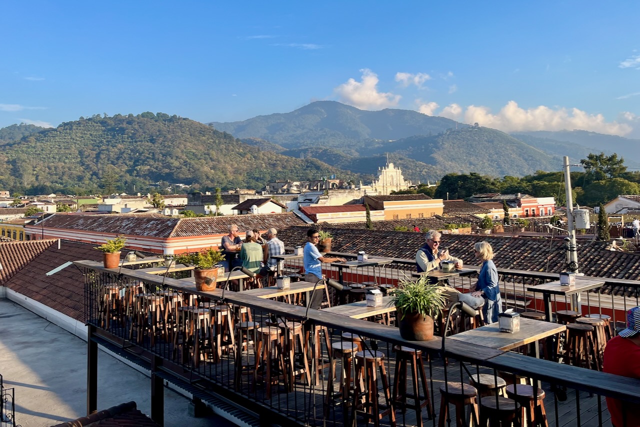
After a day of exploration it was good to watch the sunset in one of the many rooftop bars, taking in spectacular surroundings.
A rooftop bar in Antigua, Guatemala
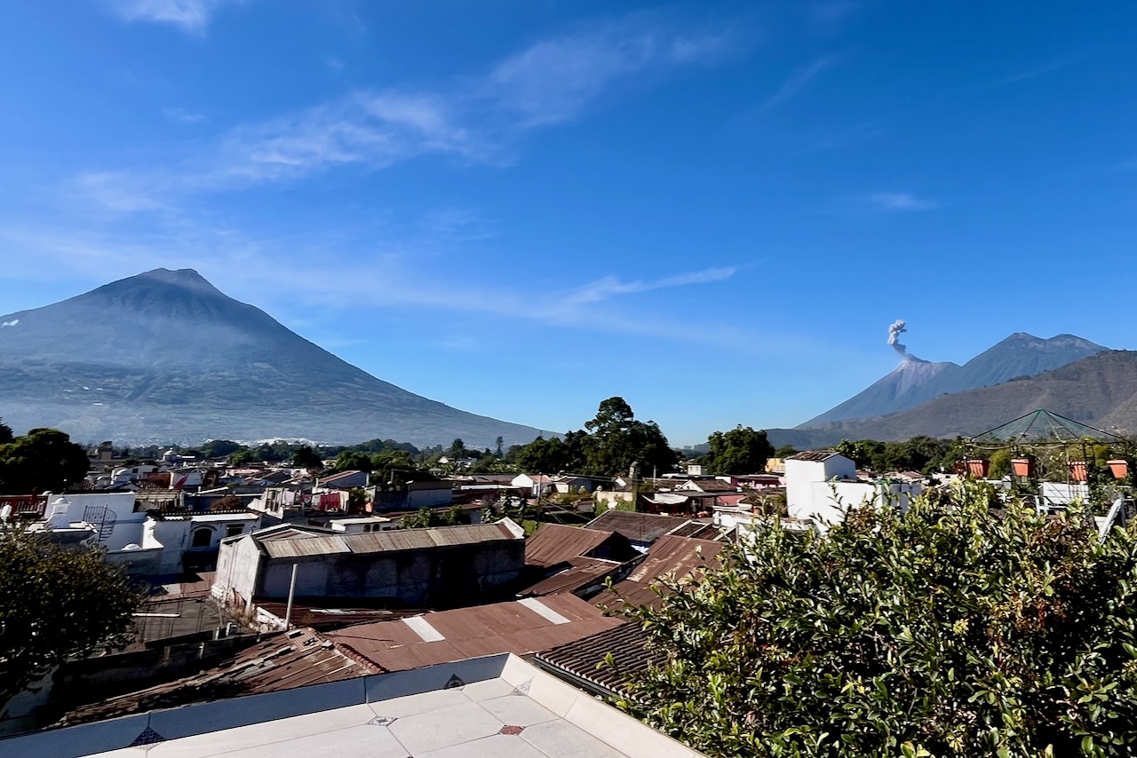
Our hotel also had a little rooftop and it was really nice to sit and watch all three volcanoes, including slowly erupting Fuego while sipping morning coffee.
Volcanoes view from hotel rooftop, Antigua, GuatemalaFuego volcano close up, Antigua, Guatemala.
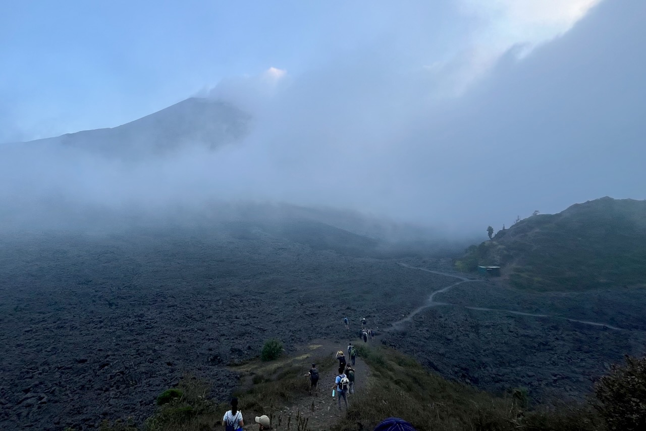
It would have been good to hike Acatenango, but we just did not think we were fit for that. Instead we went for a short half day hike to Pataya volcano on a group hike with OX Expeditions. One is meant to see stunning views of the other volcanoes on this hike. The day we went though, by the time we reached the top view point, the cloud descended and we could not see anything. We were in the cloud. On the way down it got a bit better and we could see silhouette of one of the volcanoes. It was still fascinating to walk through lava fields. We also did have marshmallows cooked over hot lava. We may need another trip to properly explore Guatemala’s magnificent volcanoes.
Pacaya volcano hike through lava fields, Antigua, Guatemala.
After spending several days in Antigua we headed for our next stop – the beautiful Atitlan lake.