El Chalten – fantastic hiking around Mount Fitz Roy and great restaurants, Argentina

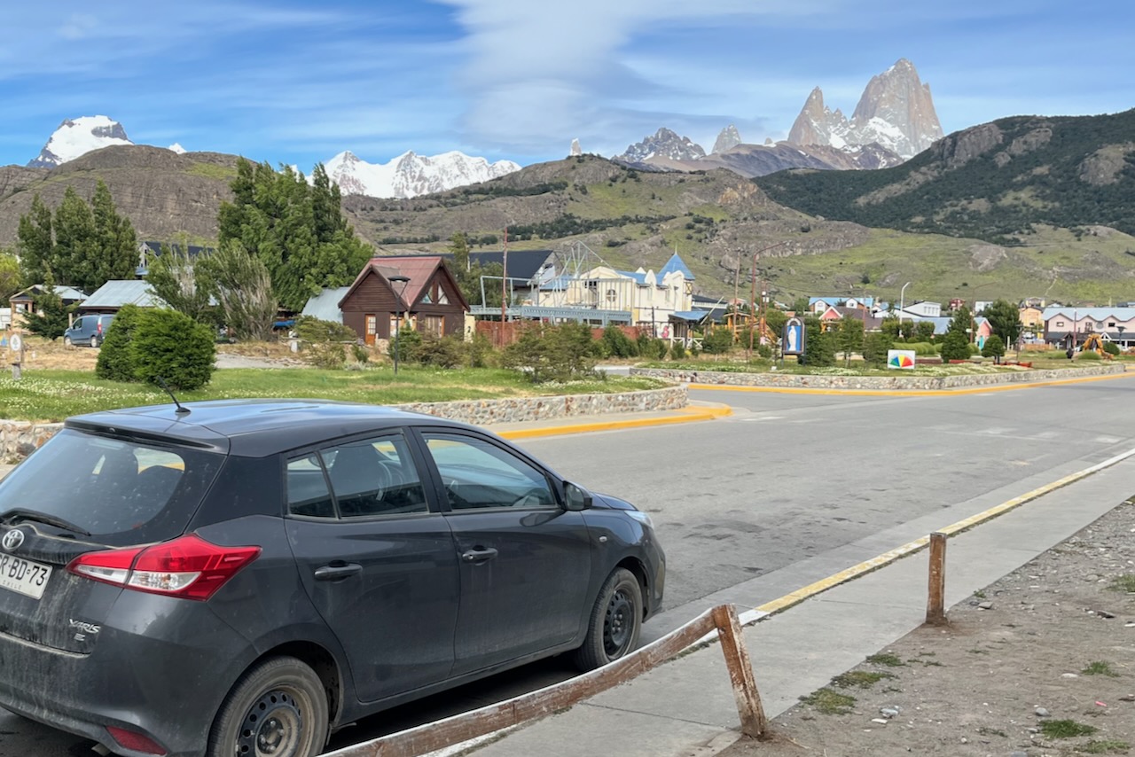
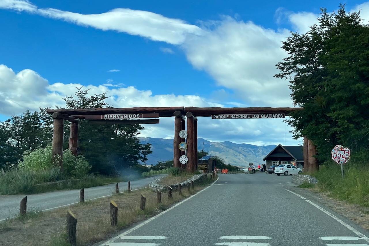
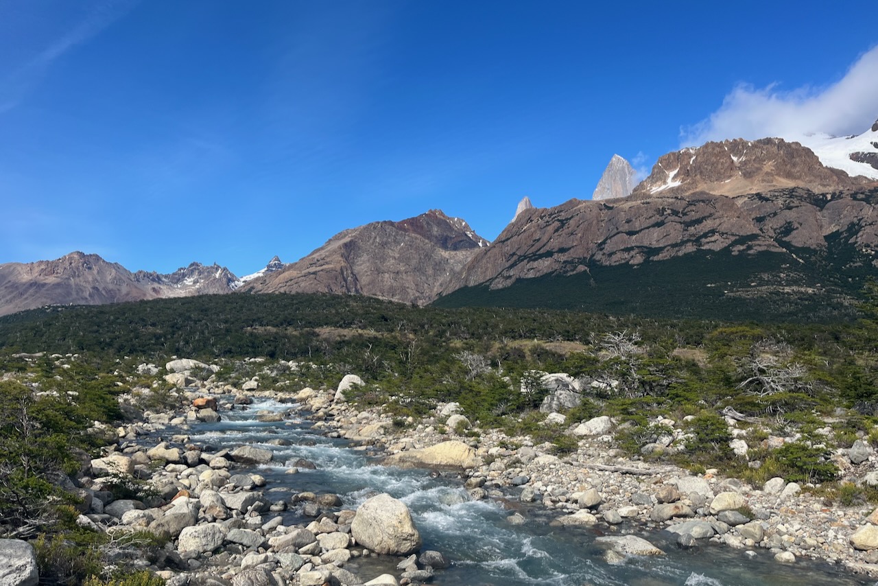
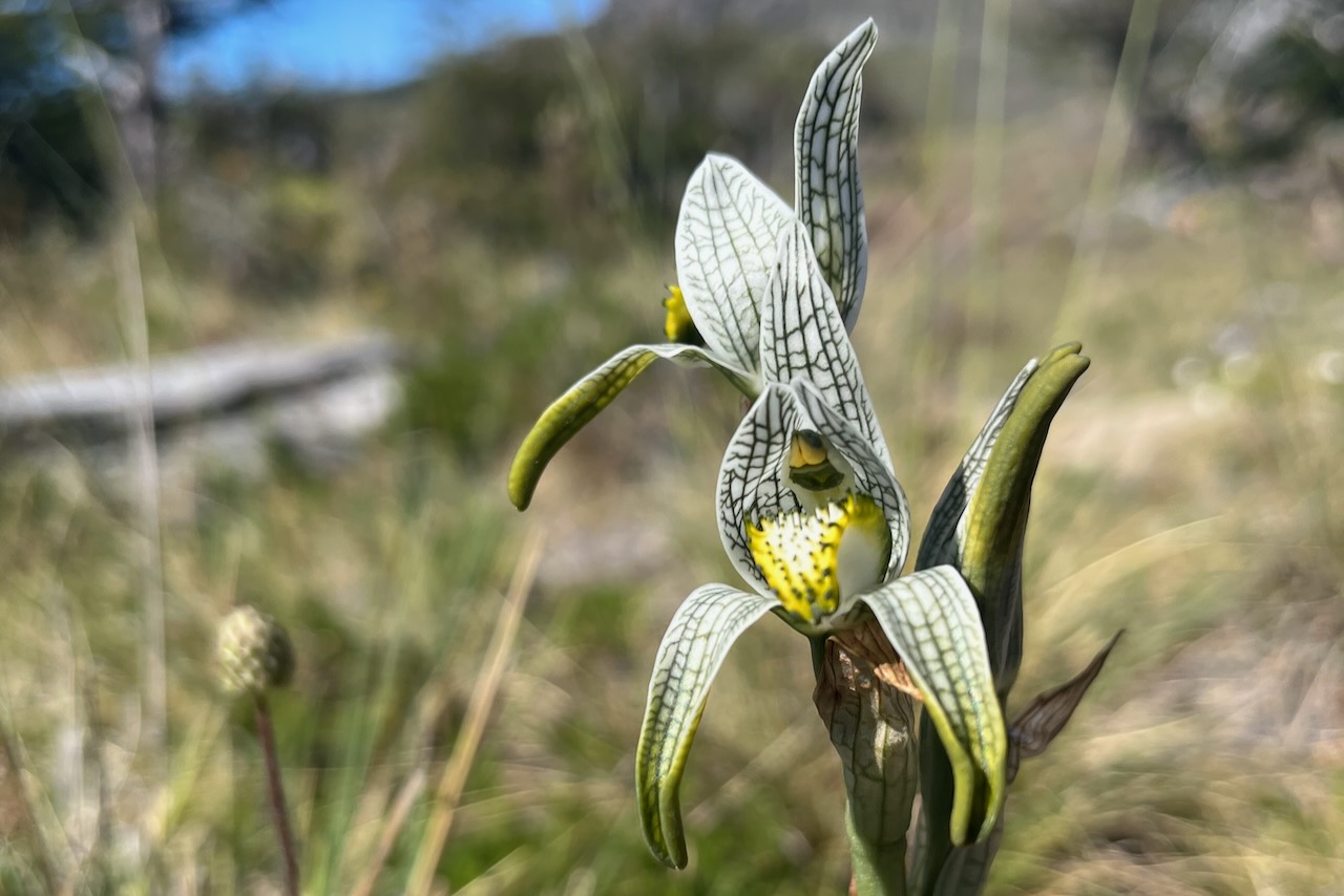
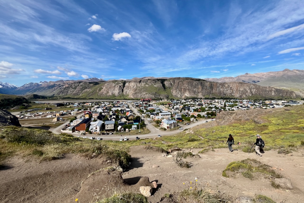
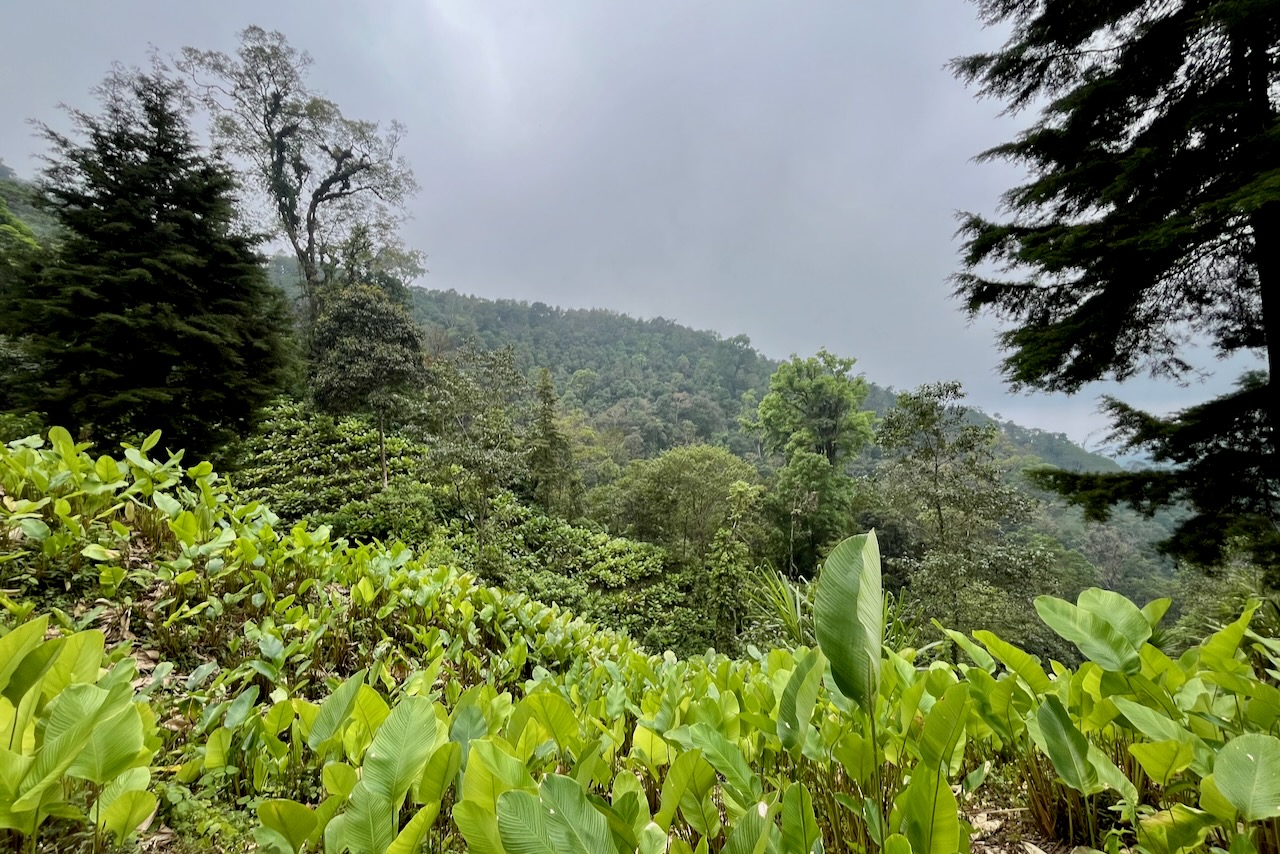
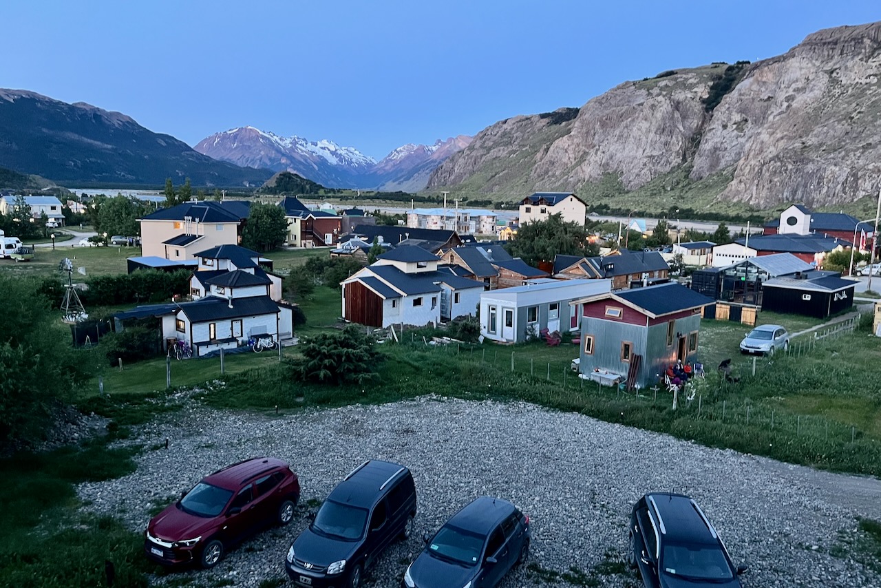
The drive from El Calafate to El Chalten took us about 3 hours. We arrived at lunch time and checked into our airbnb. The weather was phenomenal for El Chalten hiking, especially for Patagonia. No wind, sunshine and no clouds so we went right away for a short hike. Here is more on the hike to Condor lookout and Aguilas (eagles) lookout.

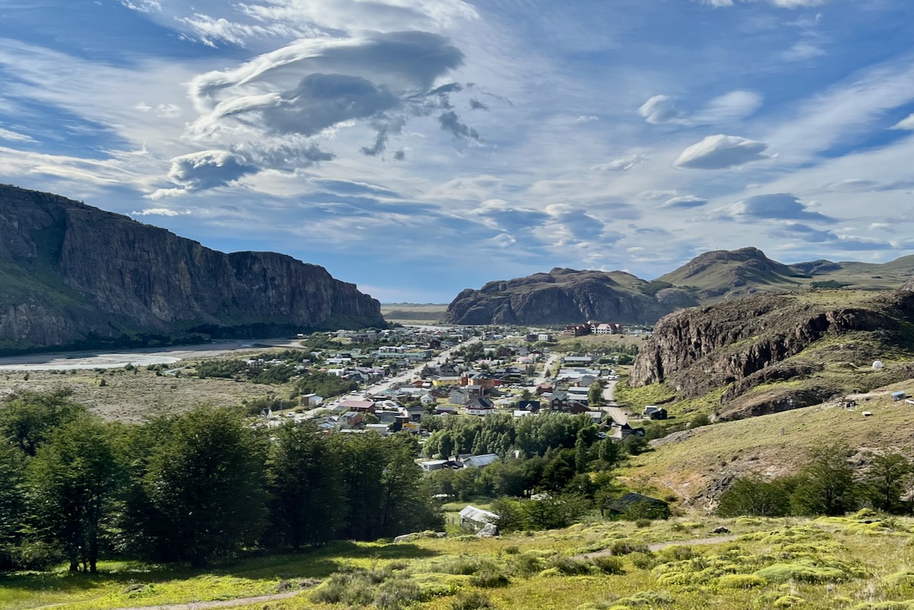
After the hike we had a very nice dinner at one of the restaurants in El Chalten. El Chalten has a surprisingly good collection of restaurants, bakeries and cafes for such a small place. On this first evening in El Chalten it seemed every house had a barbeque going (parrilla to be correct) on the occasion of warm beautiful weather. Butcher almost ran out of meat!

View over El Chalten from our Airbnb, El Chalten, Argentina

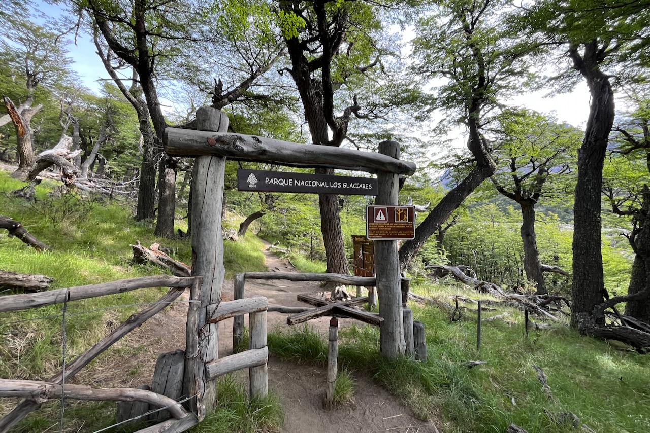
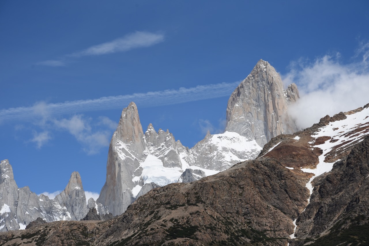
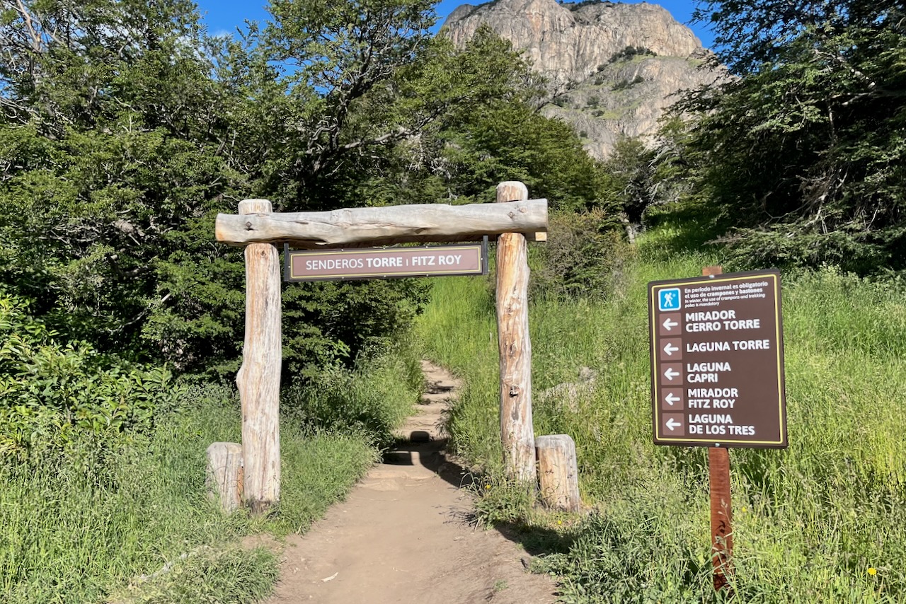
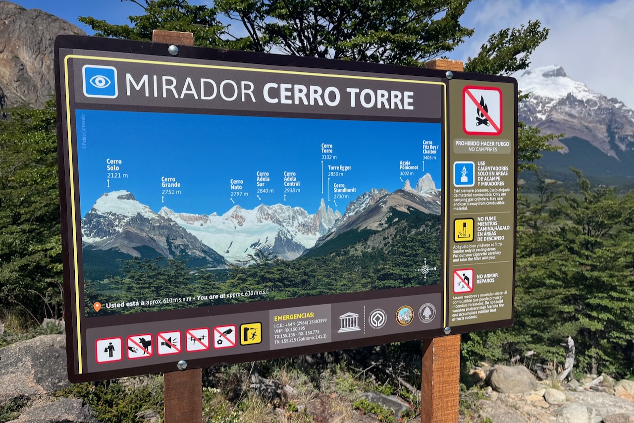
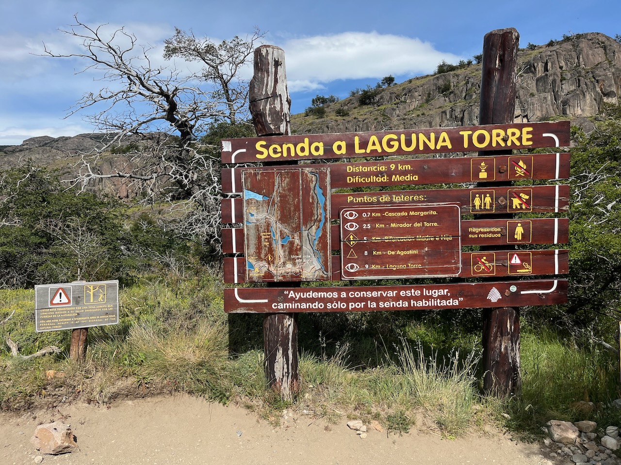
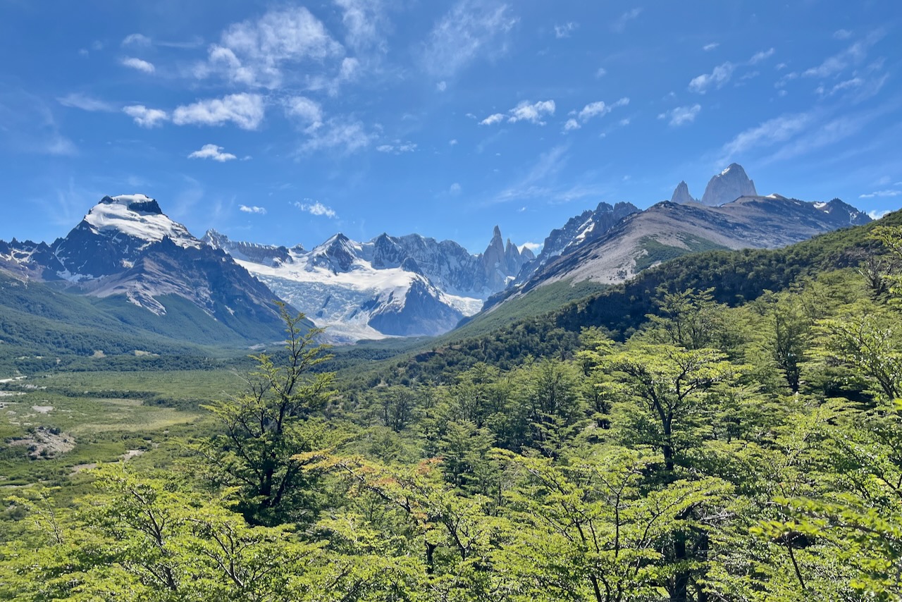
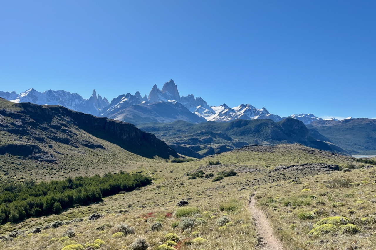
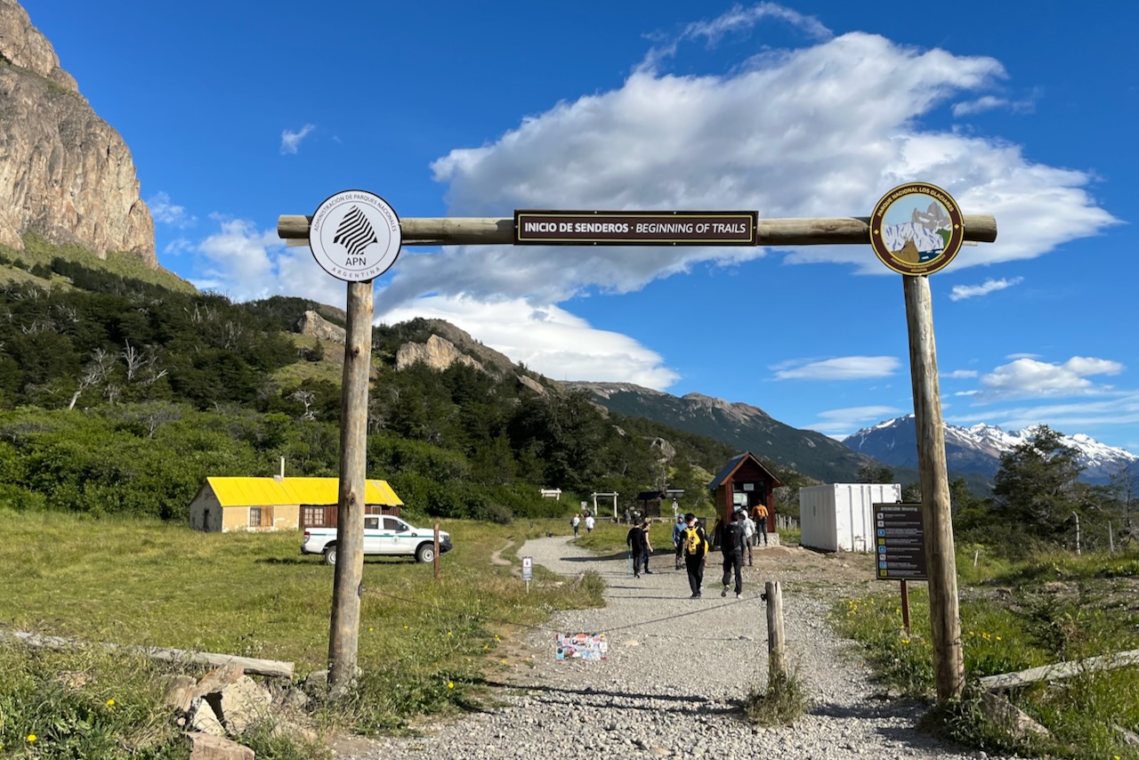
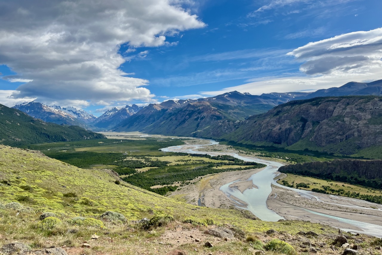
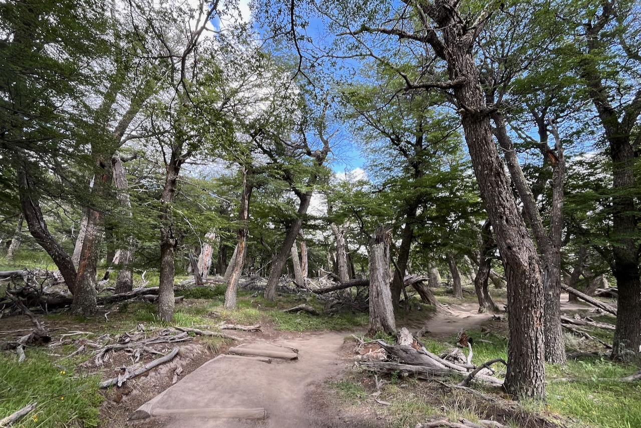
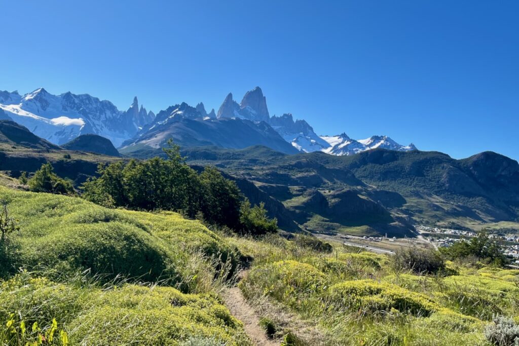
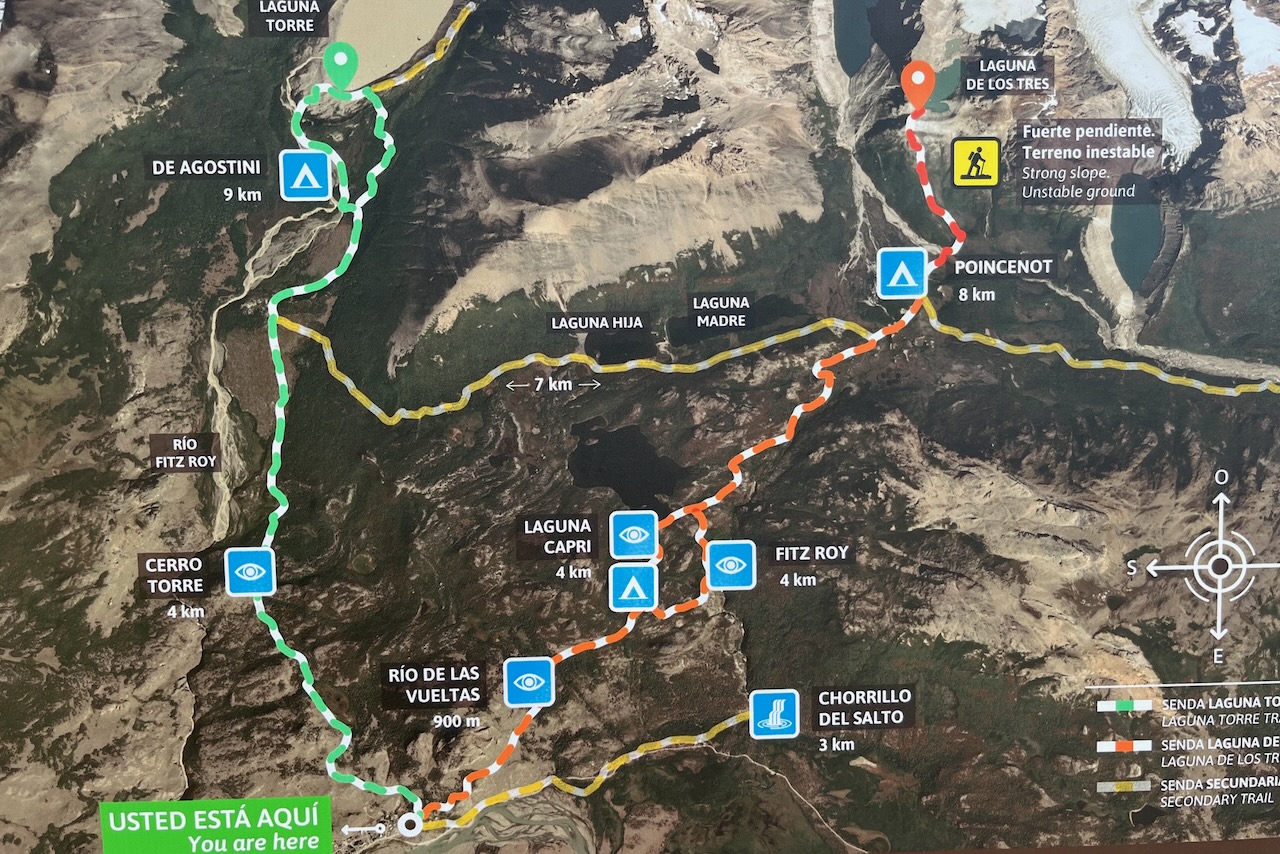
There are two major full day 20km plus hikes from El Chalten to consider. Laguna Torre (overlooking Cerro Torre the tallest of the 3 skinny mountains) and Laguna de Lost Tres (overlooking Fitz Roy). Many other hikes are a part of or connecting to these two main trails.

Map of the hiking trails from El Chalten, Argentina

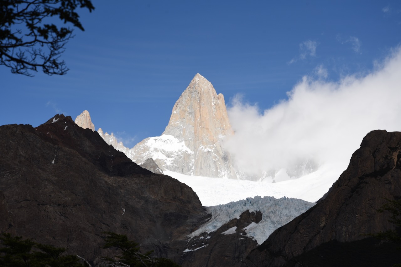
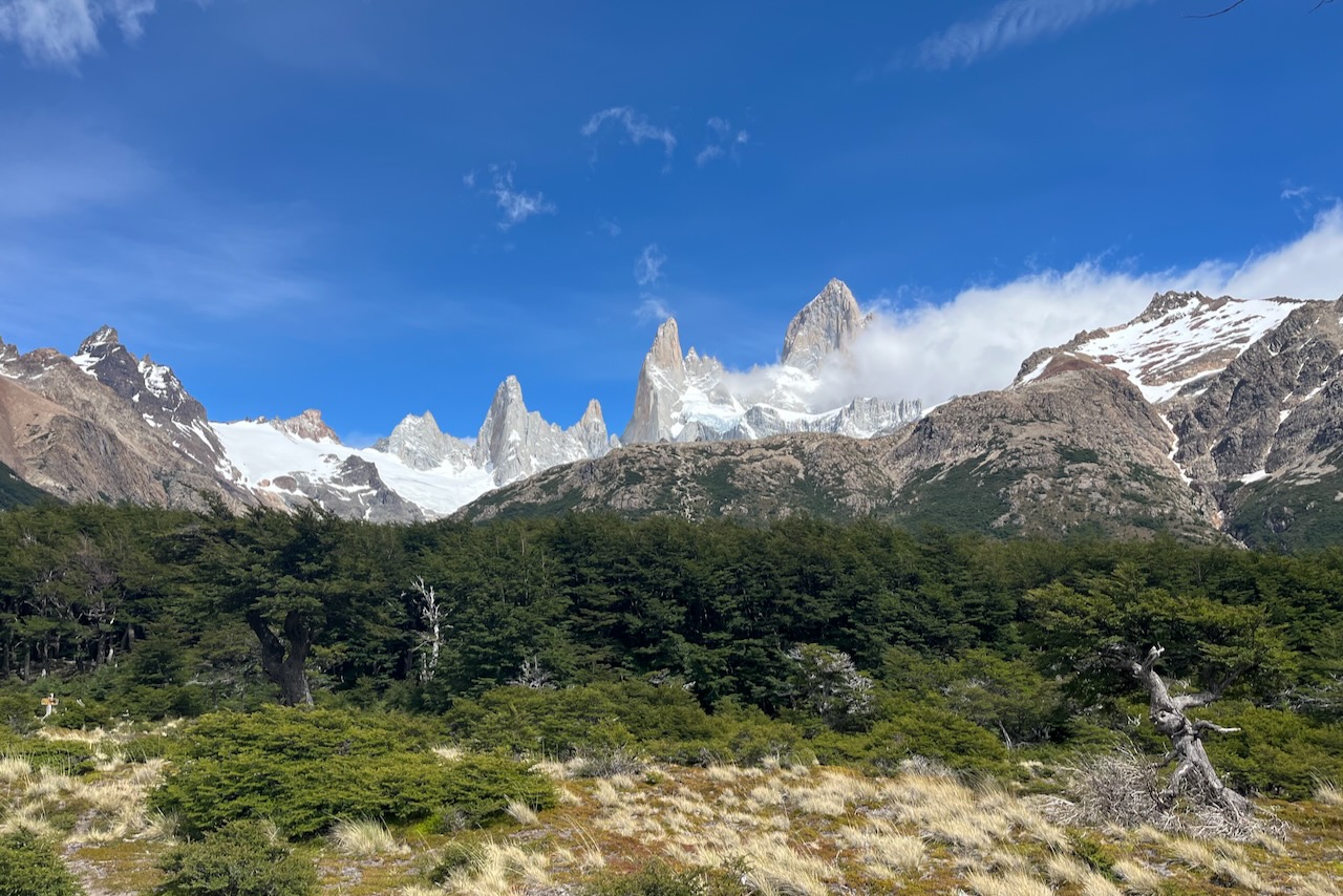
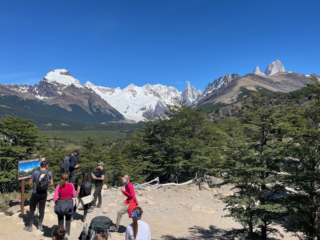
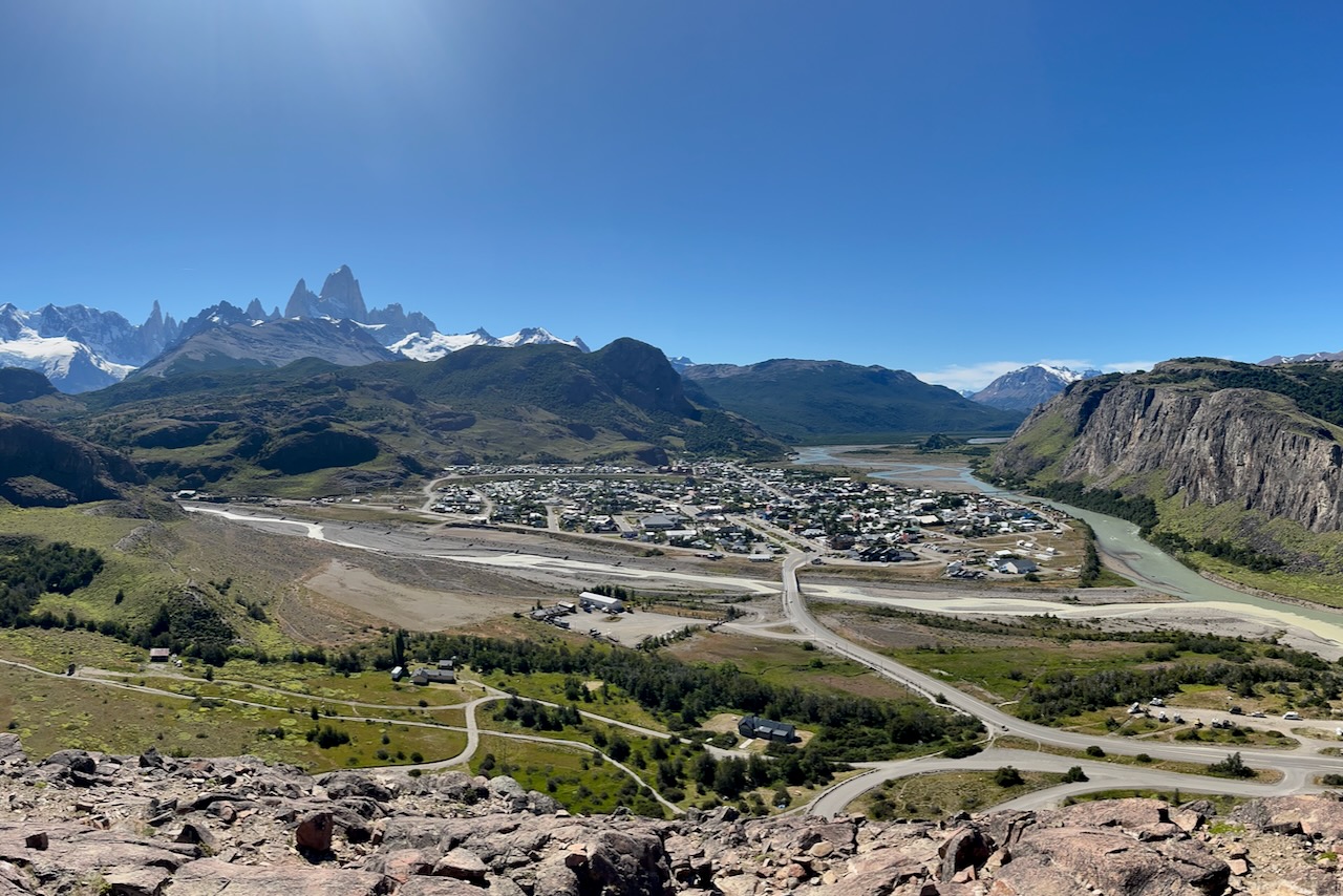
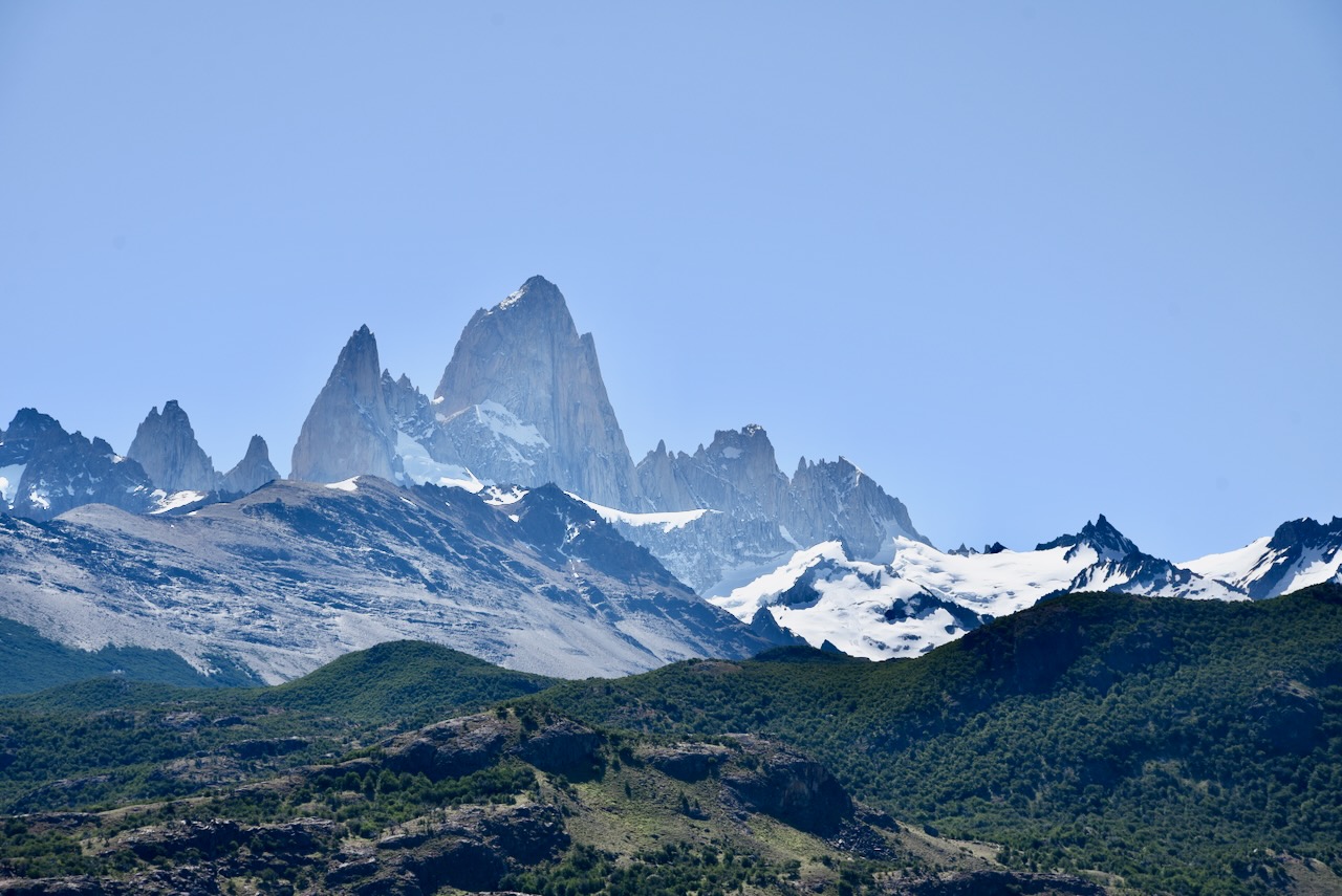
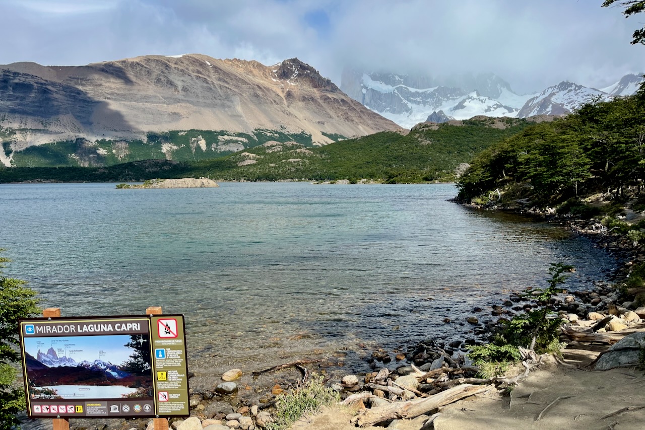
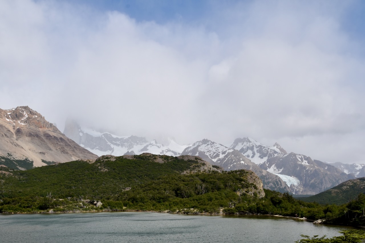
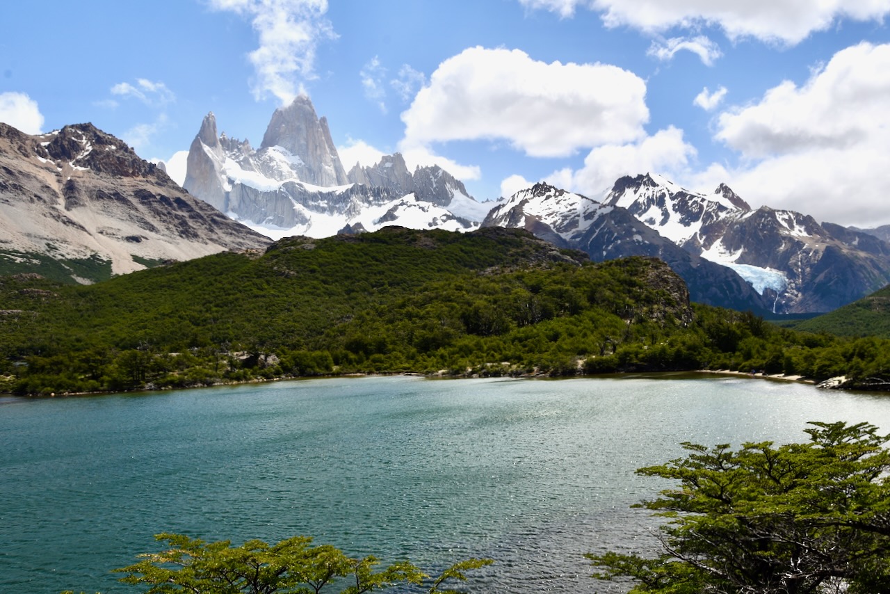
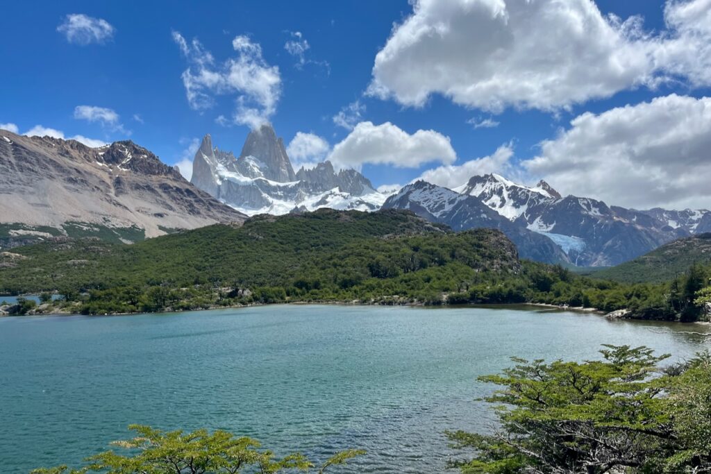
On our first full day in El Chalten we thought we would go to Laguna del Los Tres. But as we reached Laguna Capri along the trail, the cloud cover was very thick and we decided that we would try Laguna del Los Tres another day. We had a nice hike to Laguna Capri, then went to Ftz Roy lookout, had our sandwiches and watched clouds moving and slowly lifting from Fitz Roy. Here is more on our hike to Laguna Capri and Fitzroy lookout.

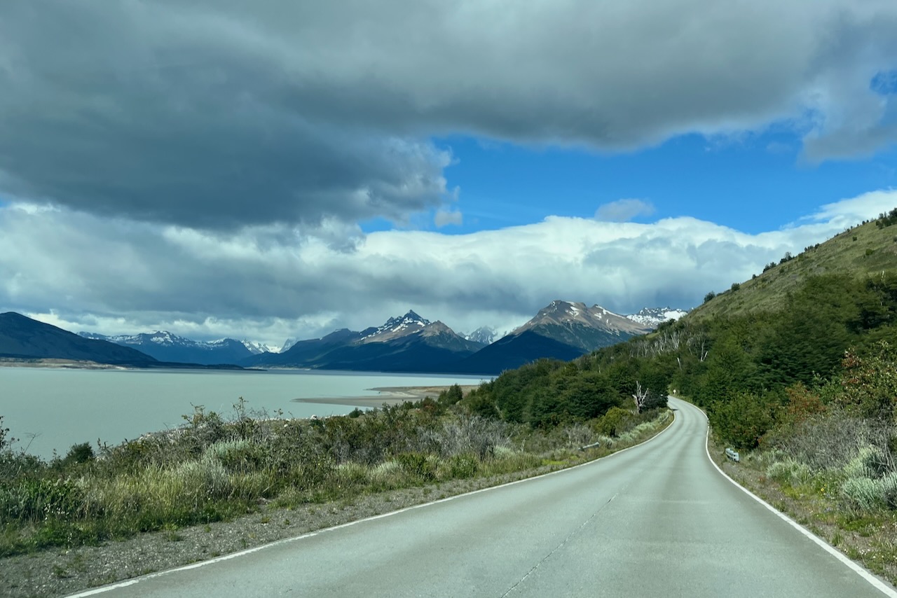
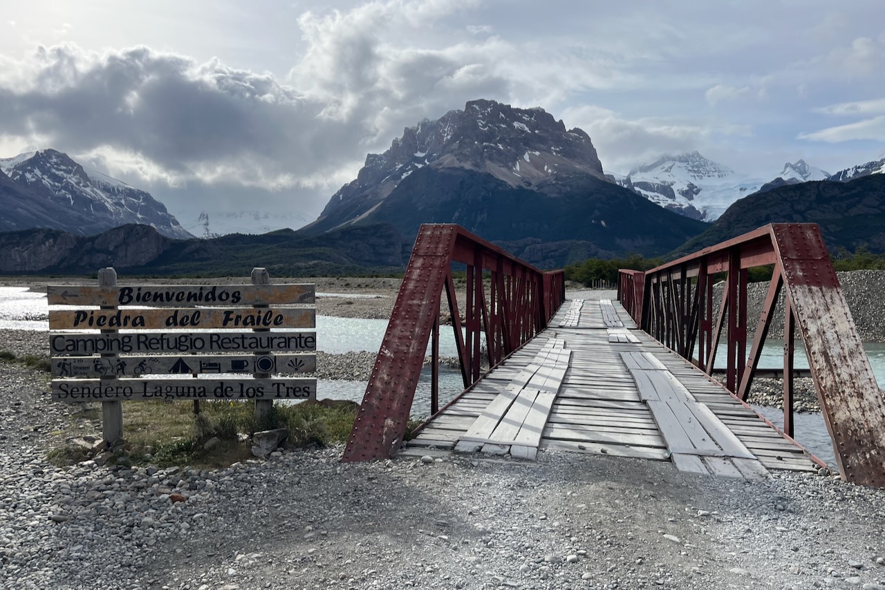
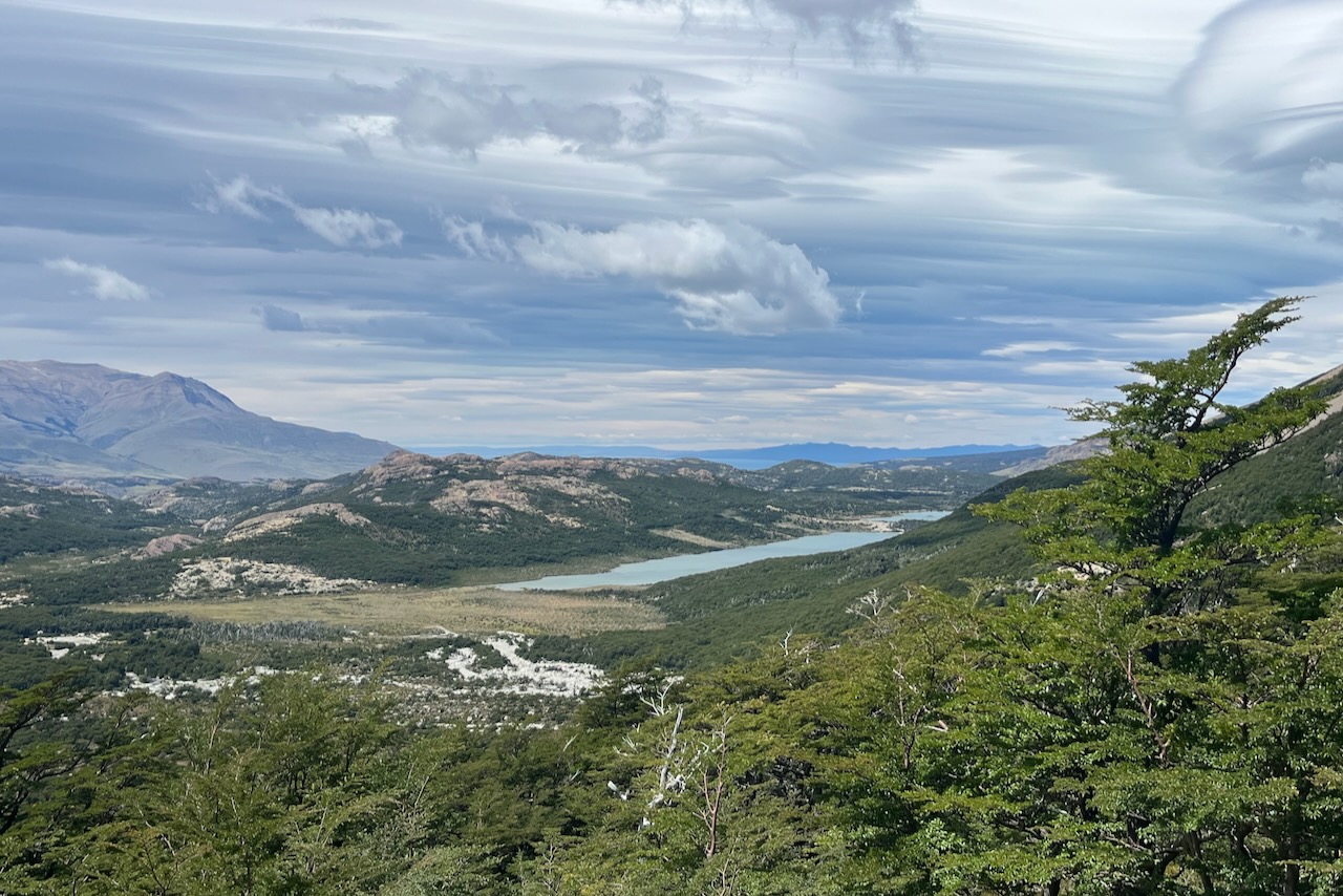
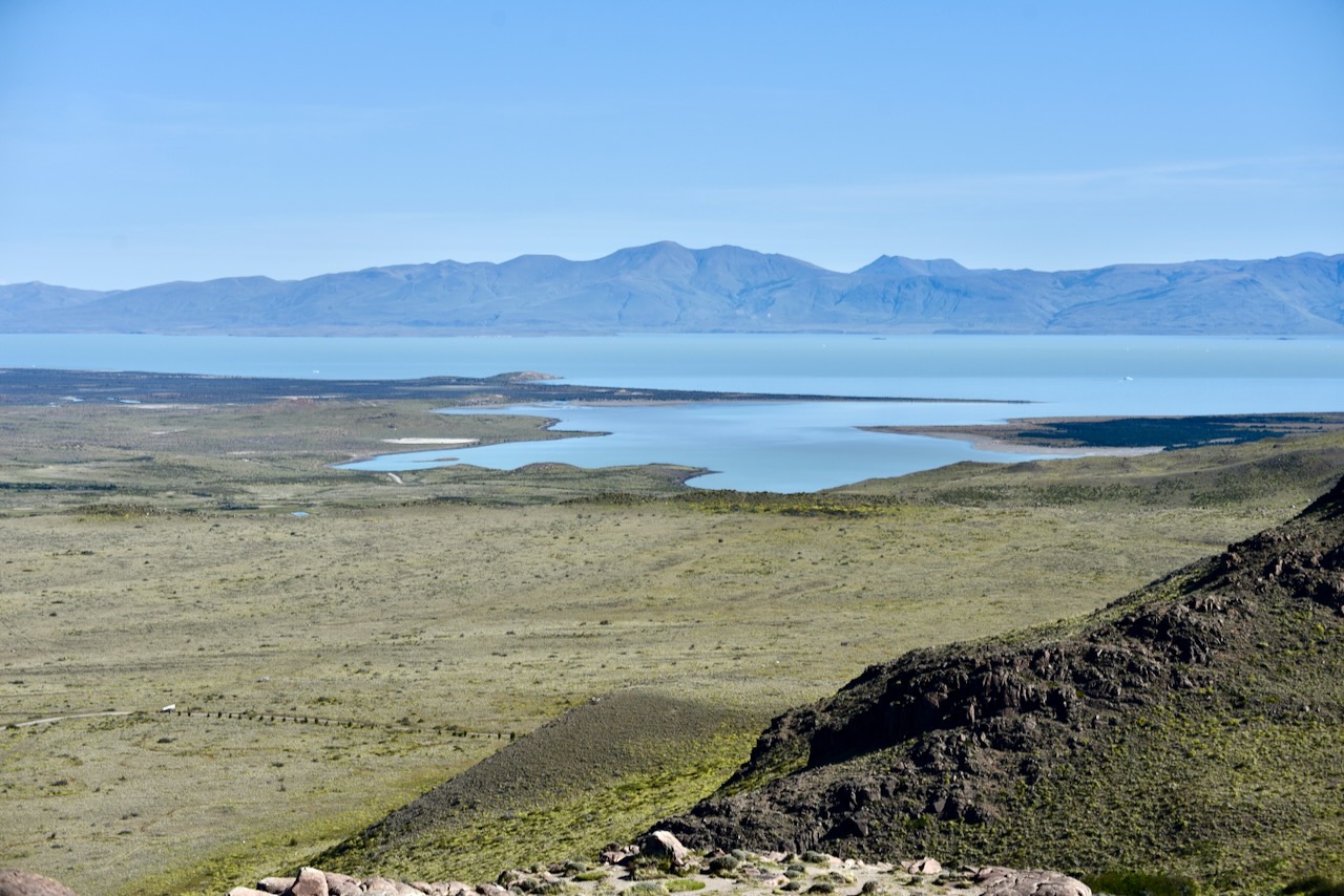
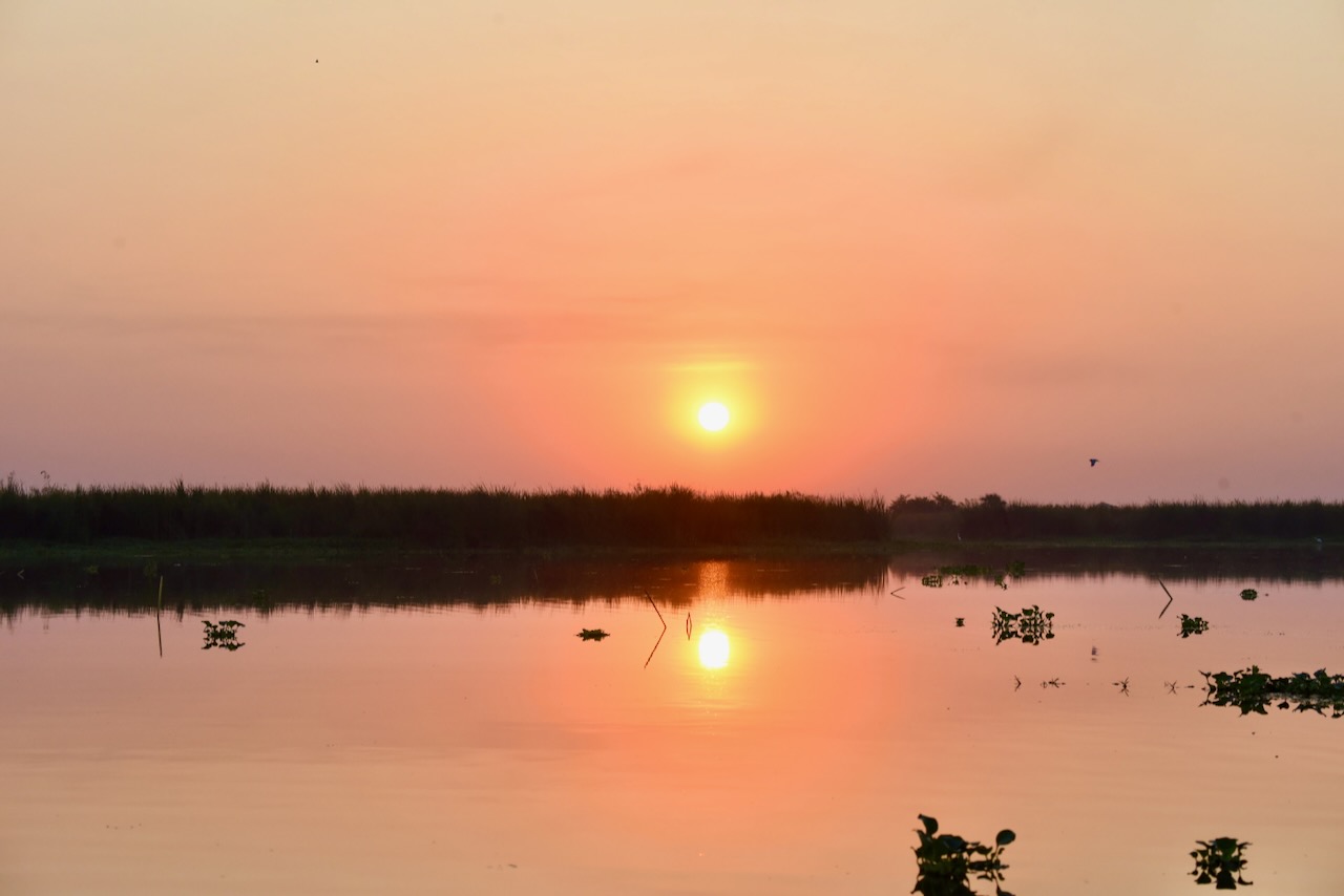
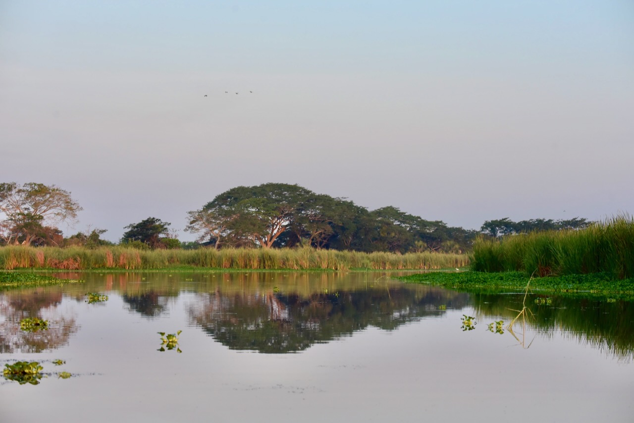
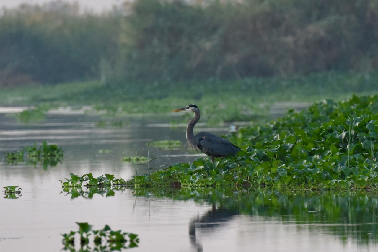
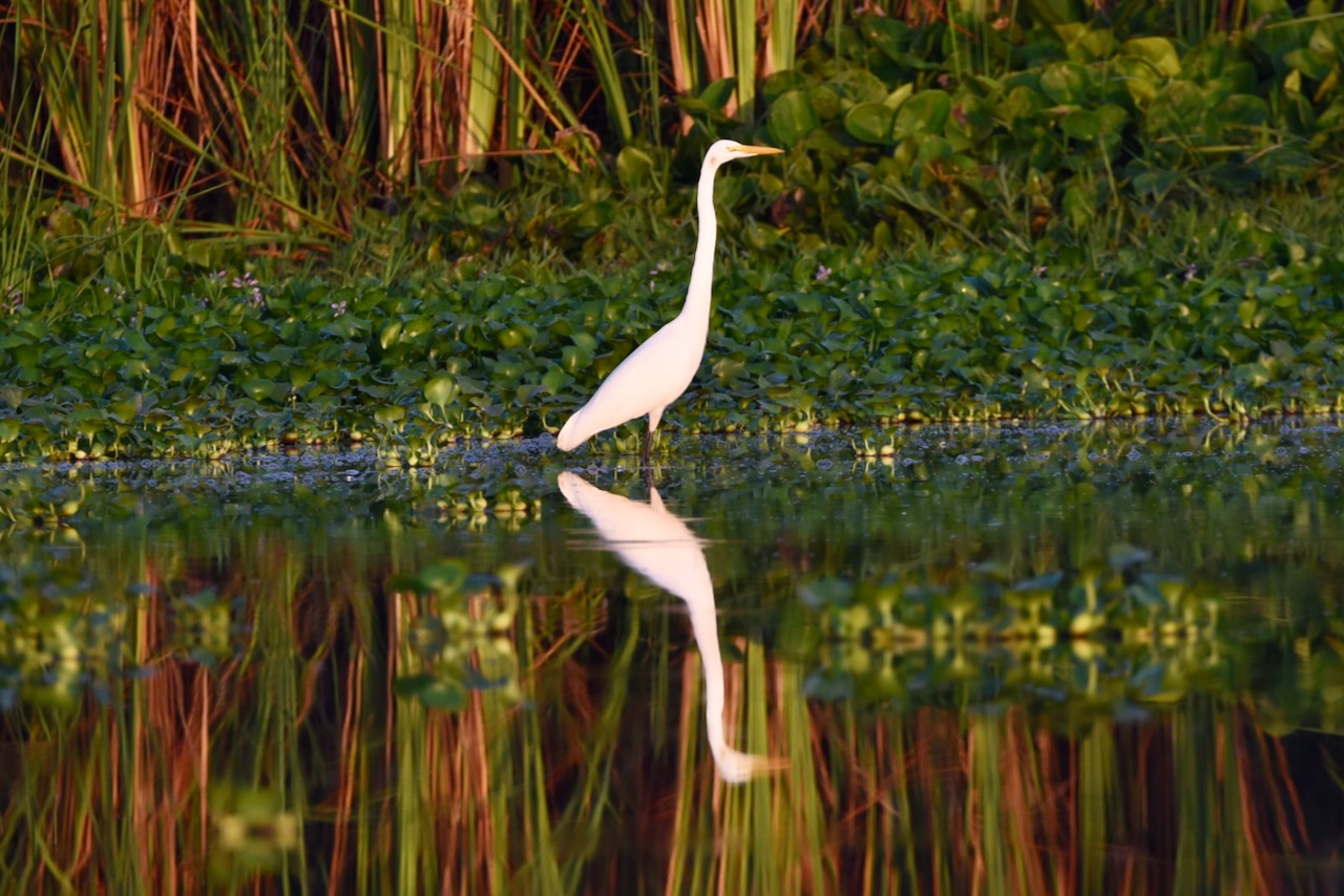
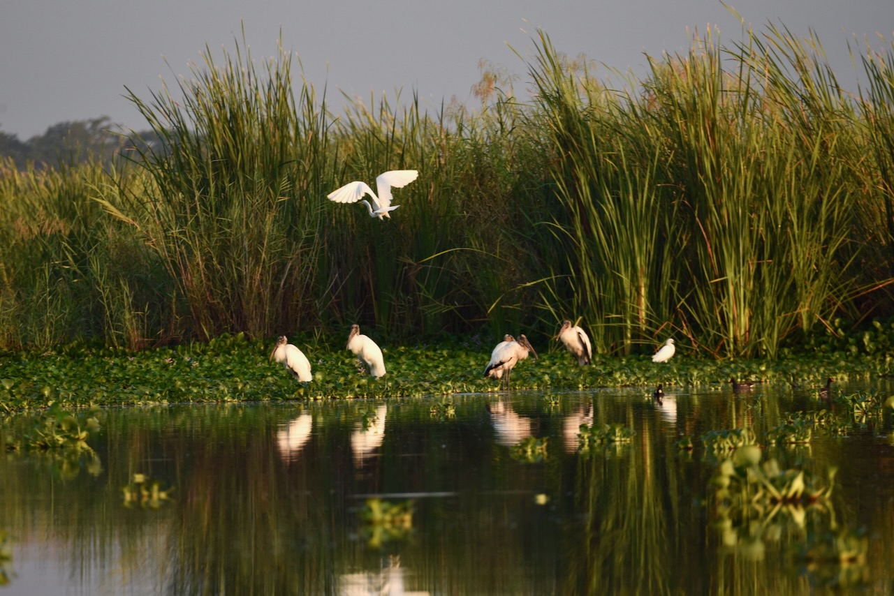
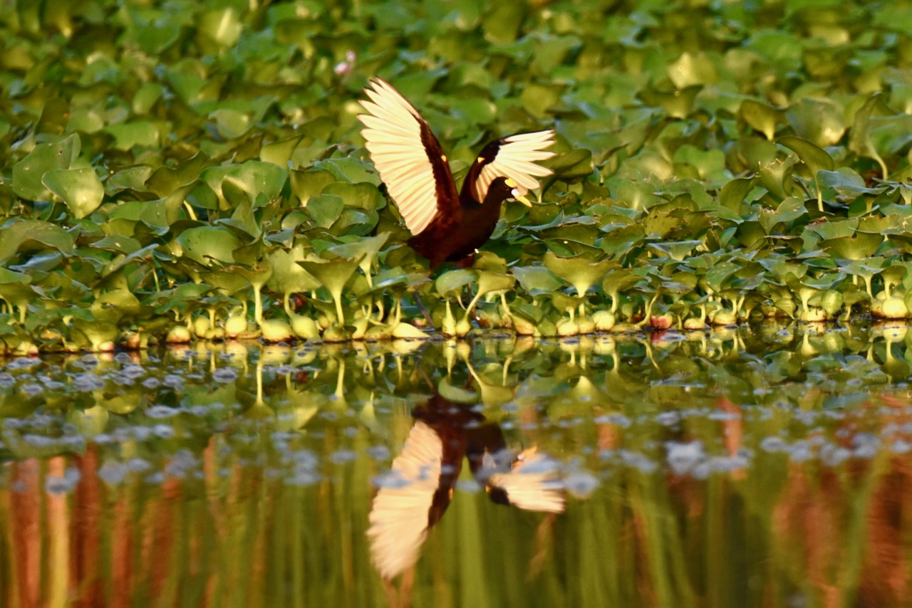
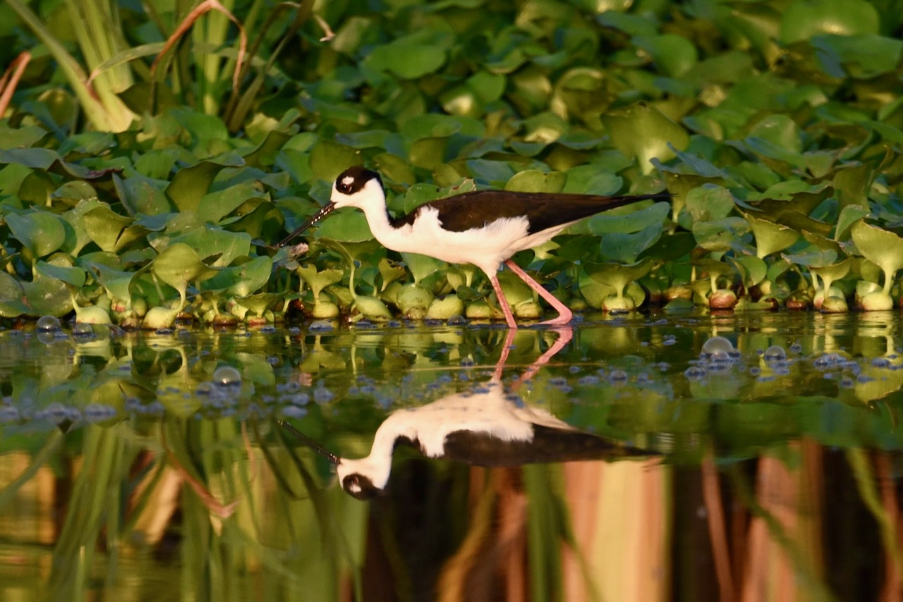
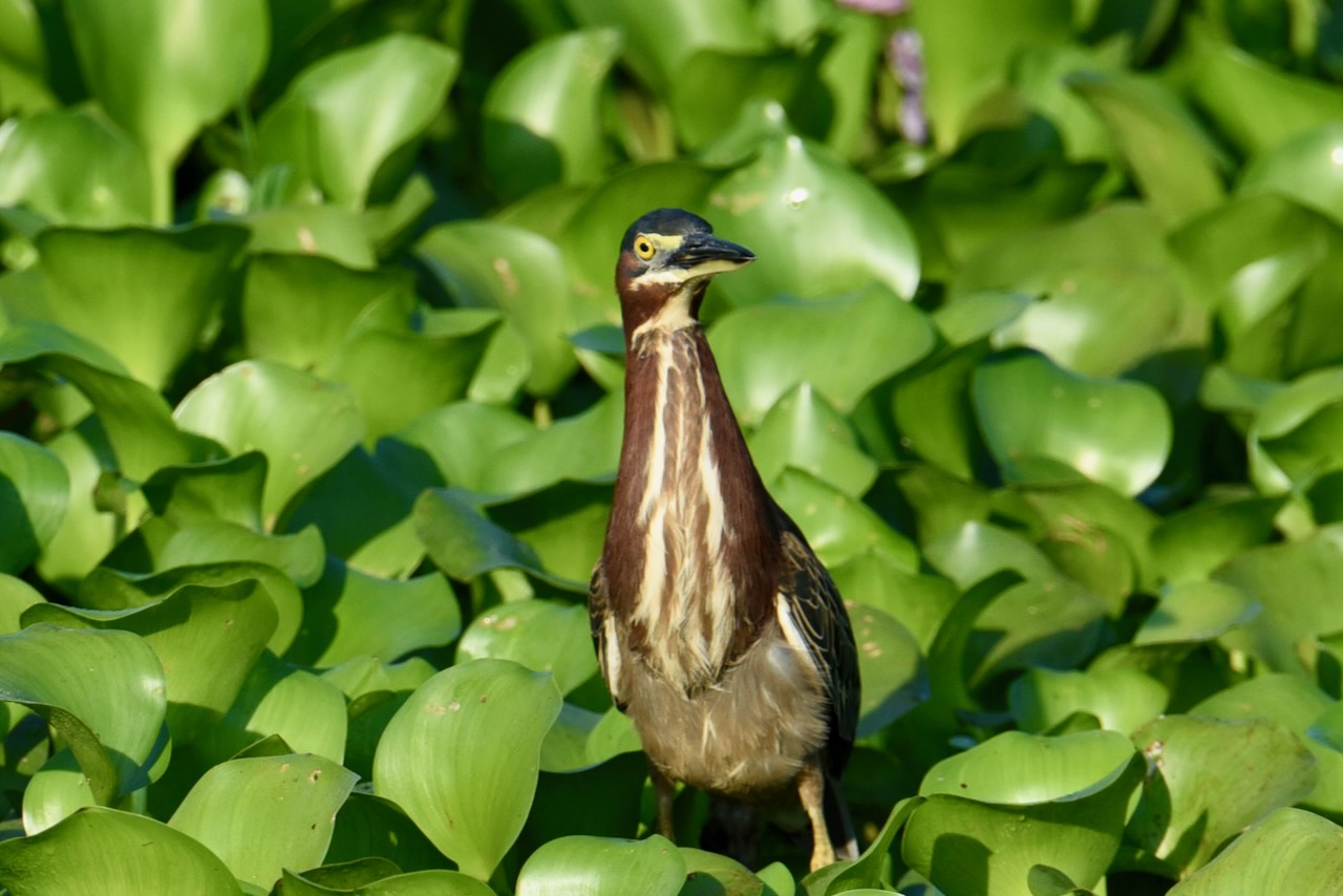
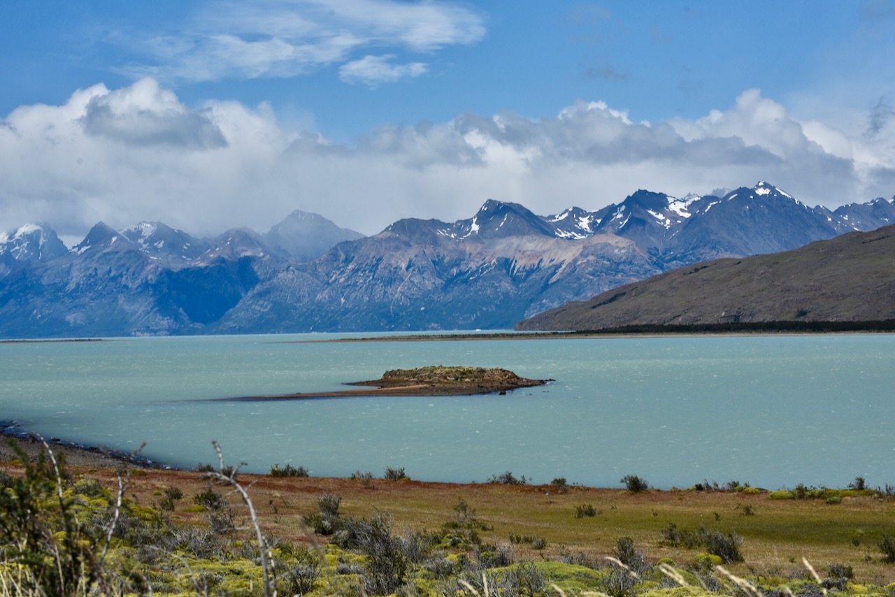
The next day the weather deteriorated. It was windy, very cloudy with rain in the forecast. Instead of hiking we drove around. First we went to Lake Viedma. One cannot see Viedma Glacier because of how the mountains are, but the lake and birds around it are good. Then we went up towards Rio Electrico to check access to the alternative route for Laguna Los Tres hike via Piedras Blancas glacier lookout that we were considering.

Lake Viedma view near El Chalten, Argentina

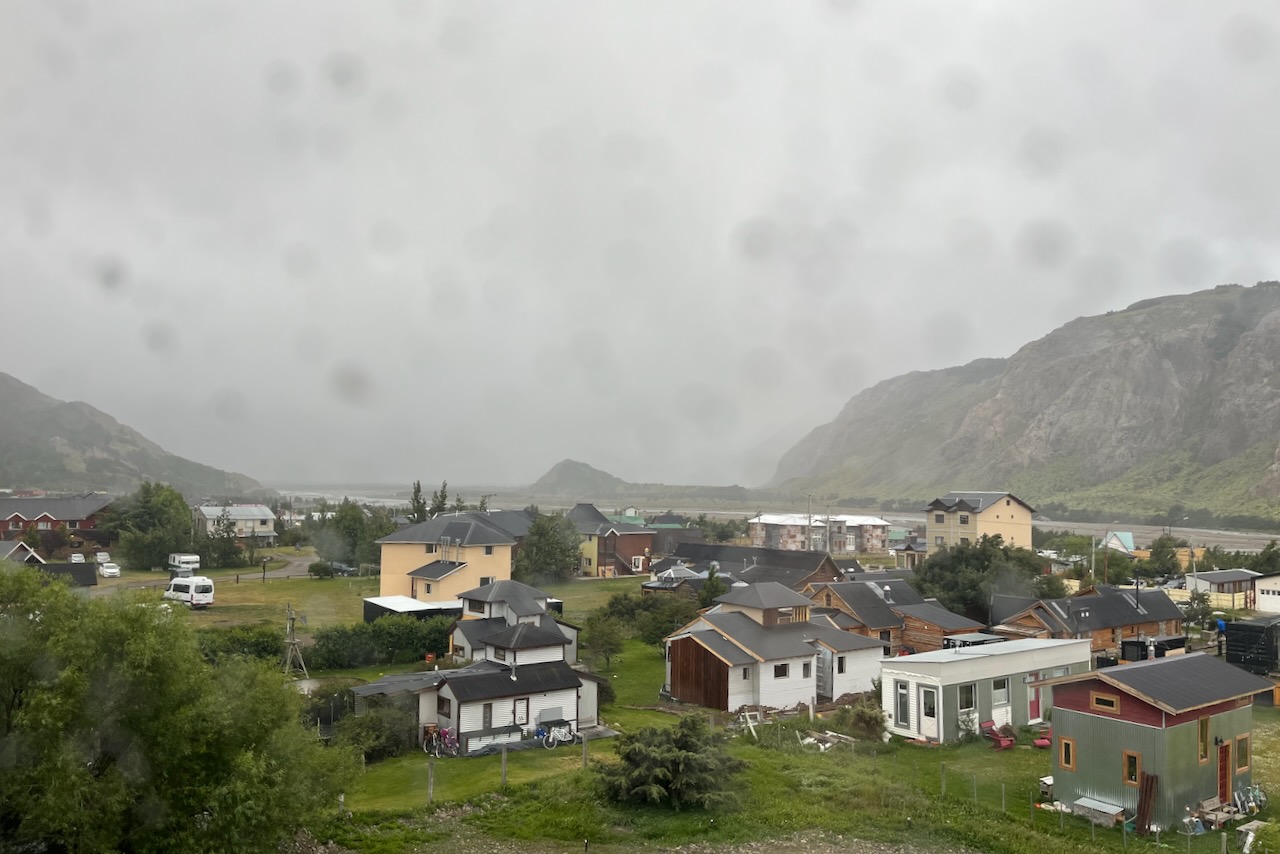
The weather kept getting worse. Winds were blowing at over 40kmh and rain started. There was no point driving around as we could not see much of the scenery. We went back to our airbnb to watch the storm from inside and enjoy some Argentinian vino.

View on El Chalten from our room with weather deteriorating, El Chalten, Argentina

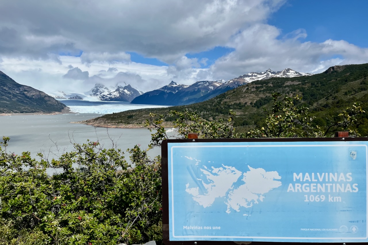
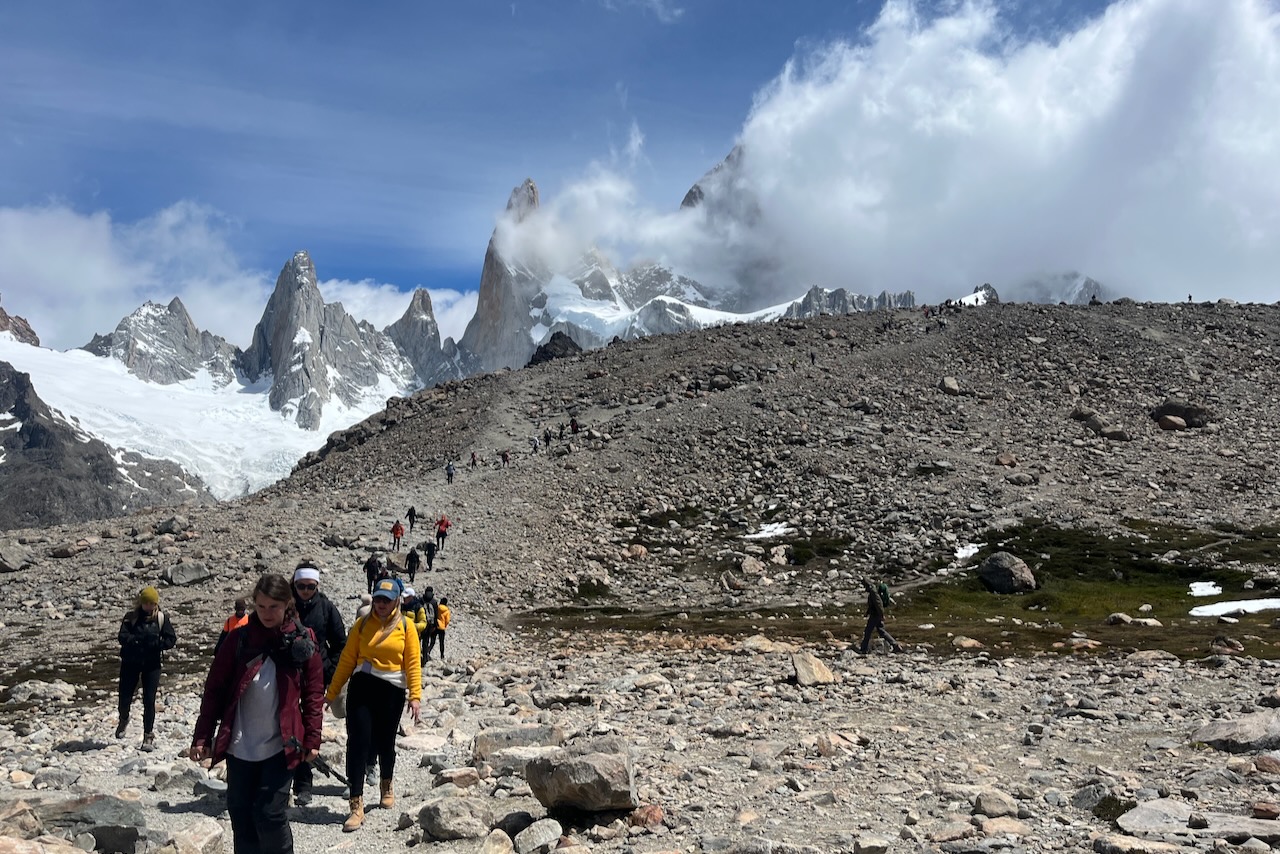
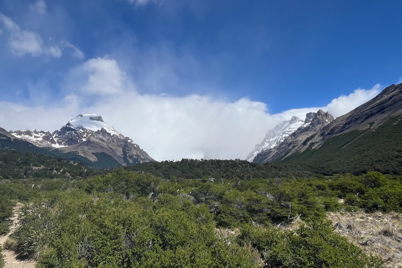
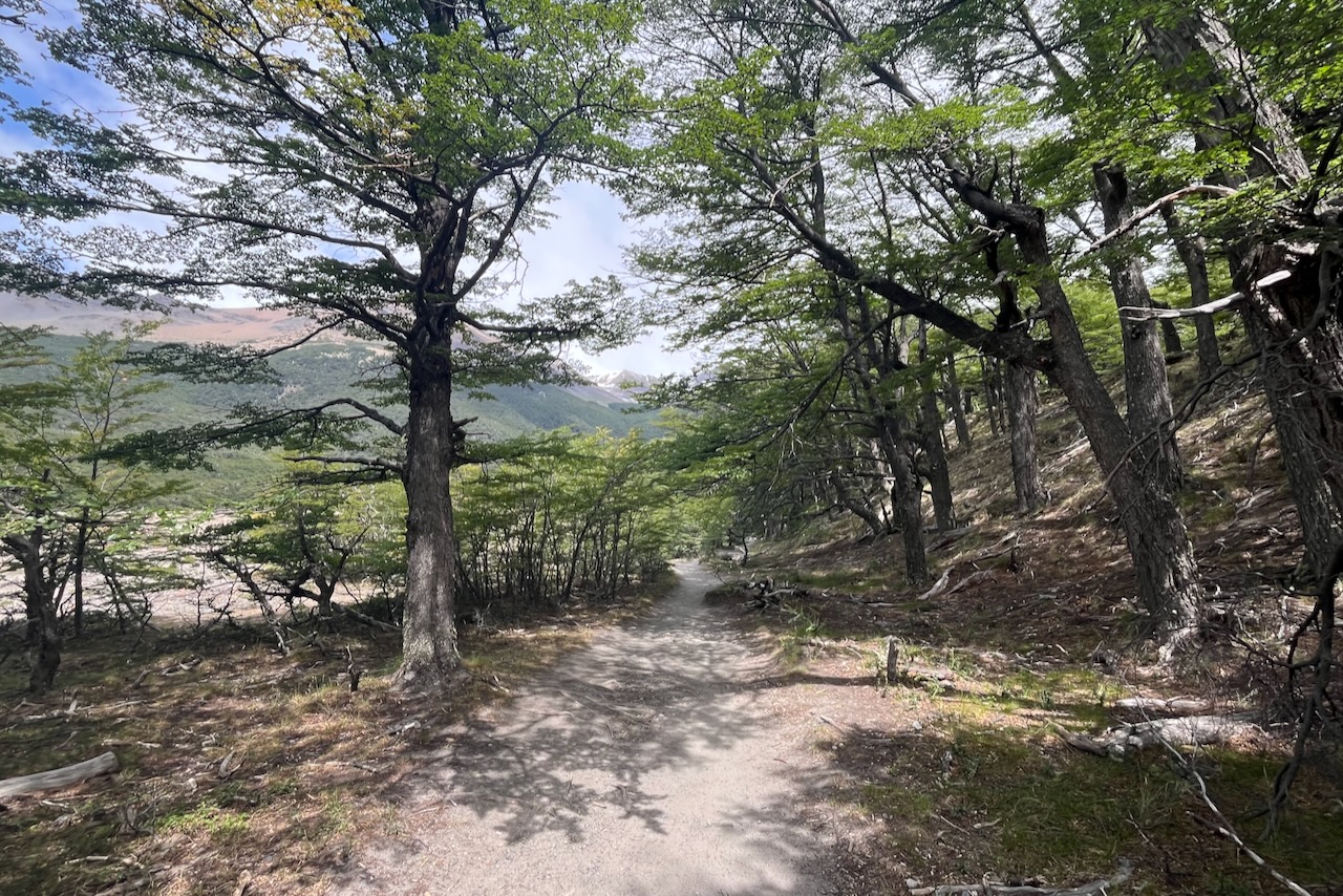
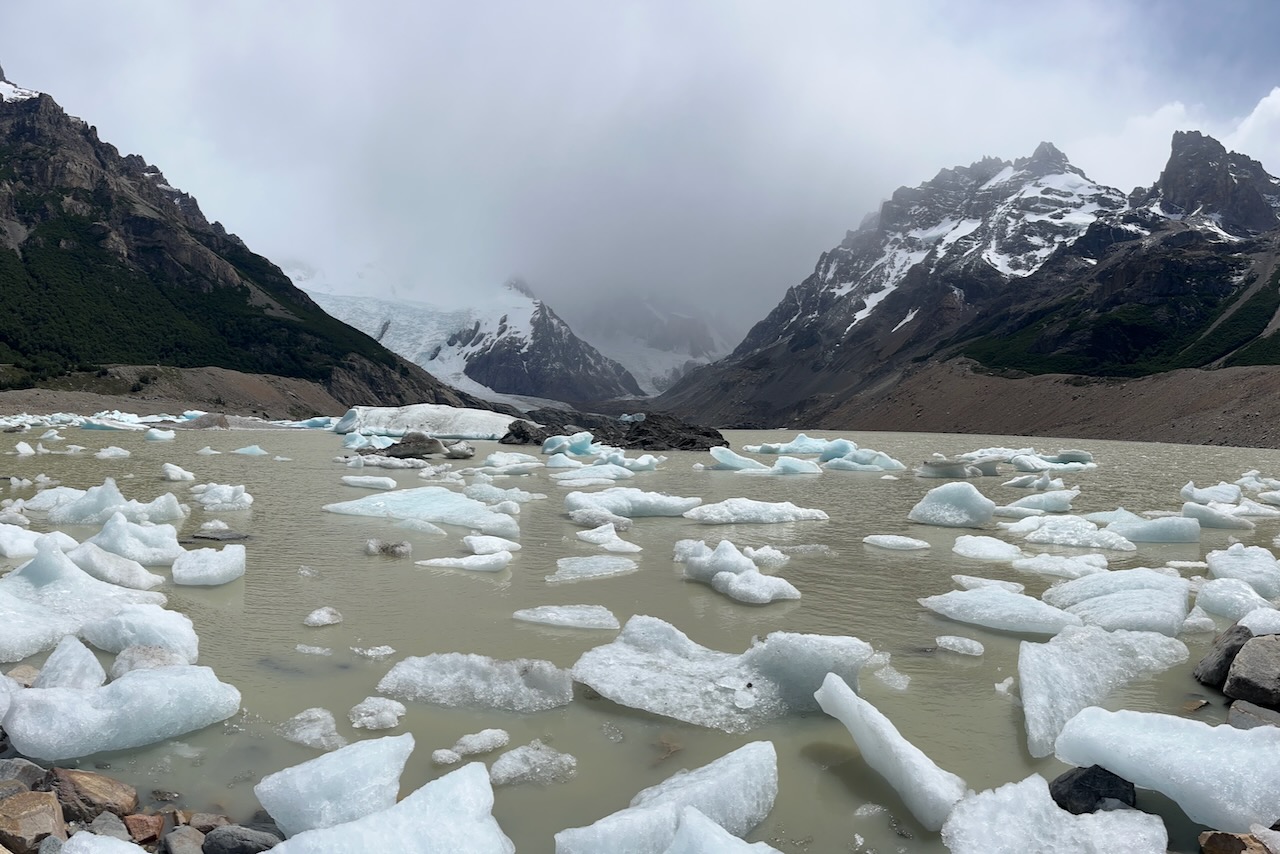
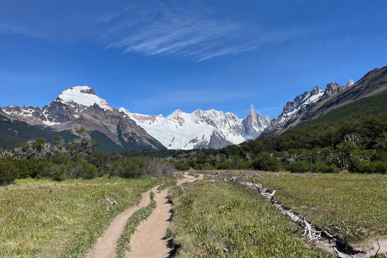
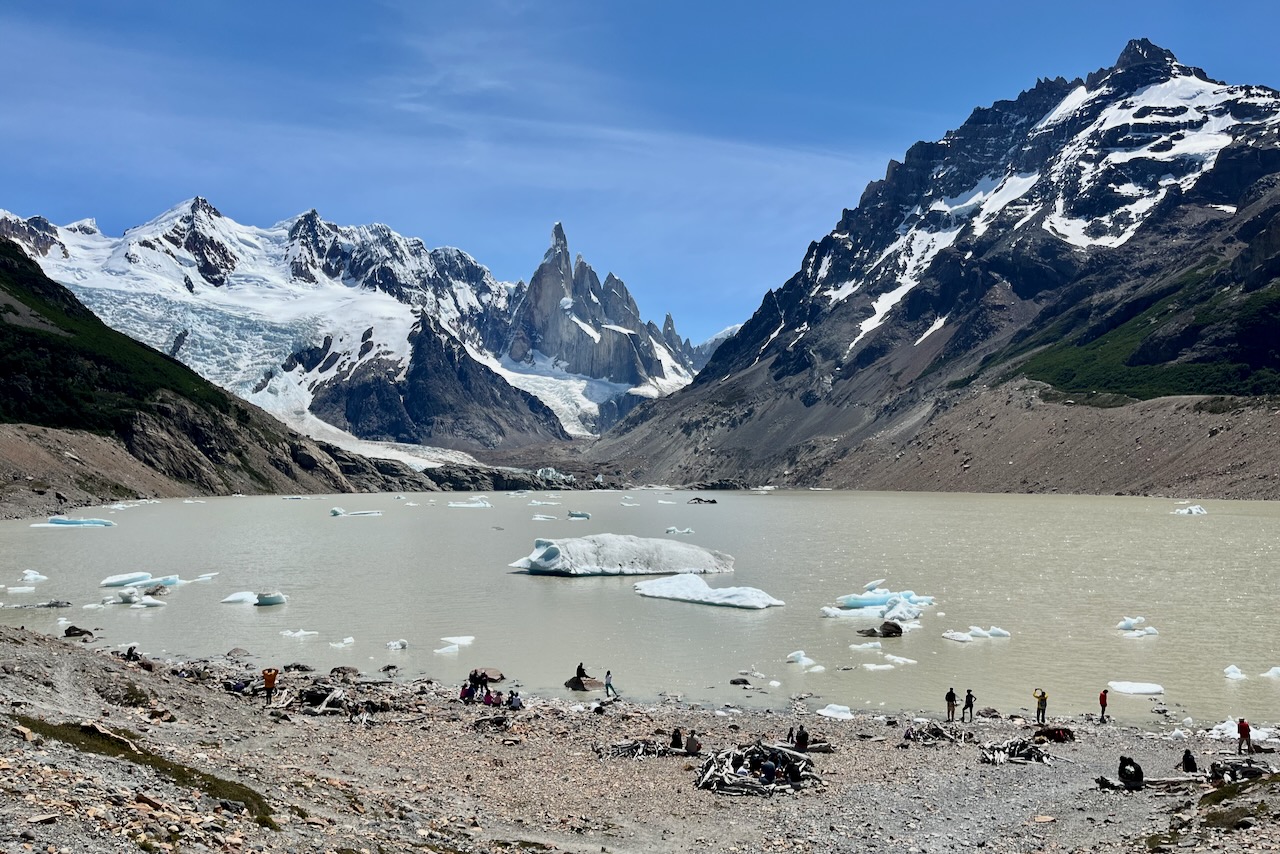
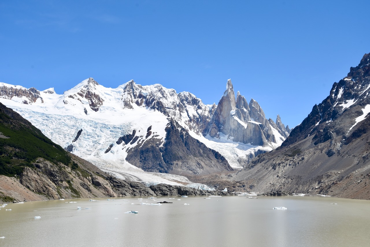
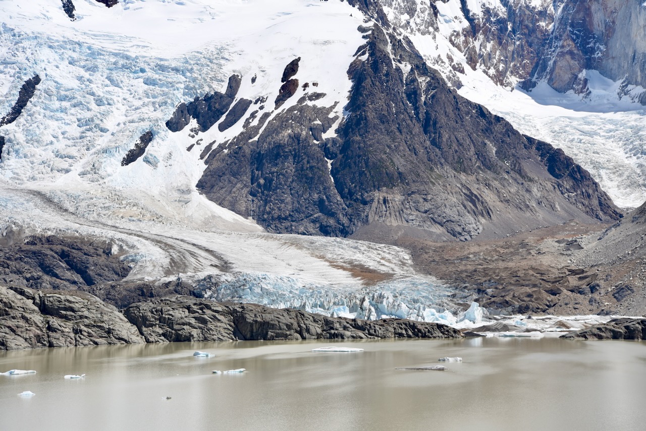
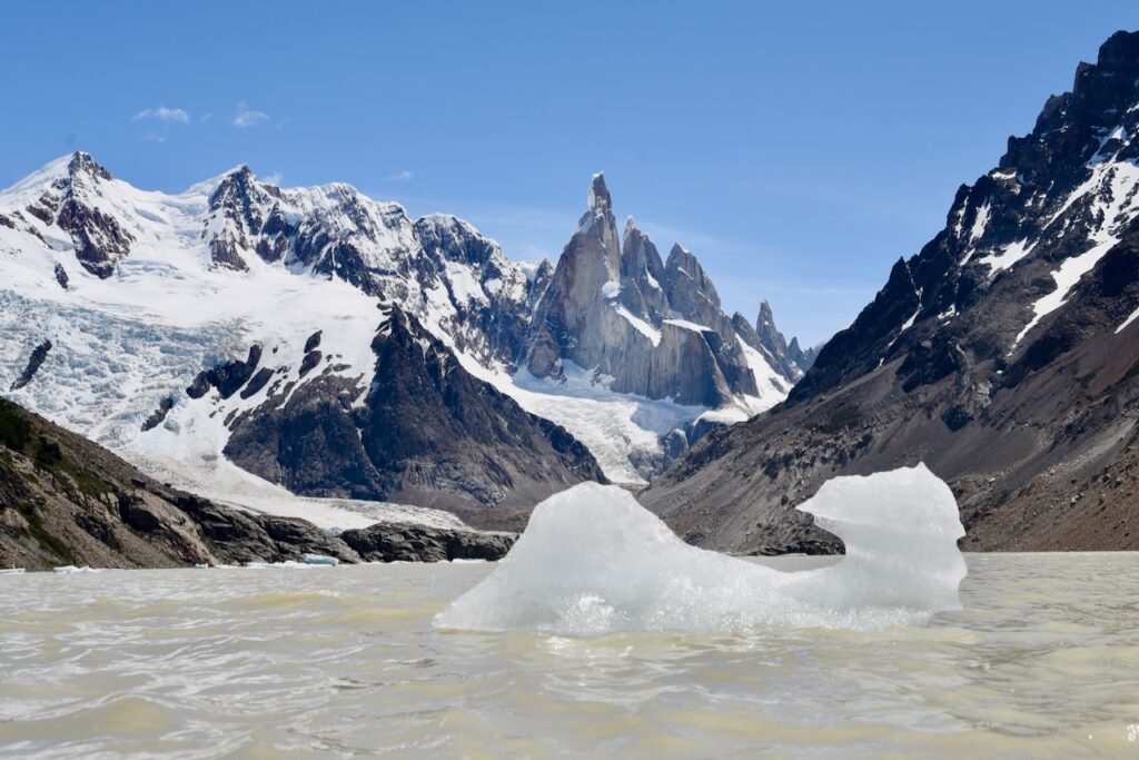
On our third day in El Chalten sun came back and we went hiking to Laguna Torre. It is a 20km mostly flat hike. The hike was great and skies mostly blue. But Cerro Torre was covered by solid cloud that was not lifting. Good thing is that we had a few days in El Chalten so we went to Laguna Torre again on our fifth and last day, after we made it to Laguna de Lost Tres. Here is more on our Laguna Torre hikes.

Laguna Torre and Cerro Torre view, Argentina

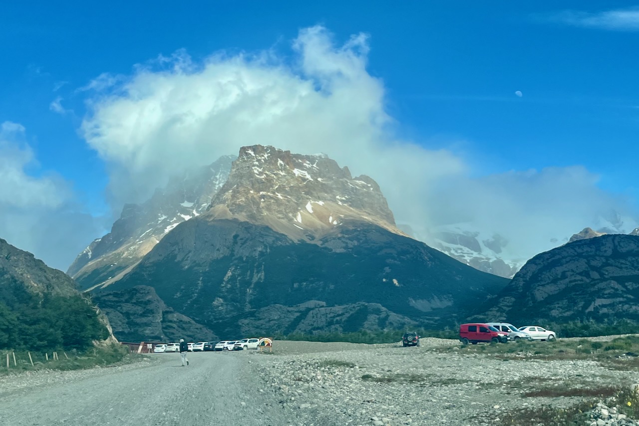
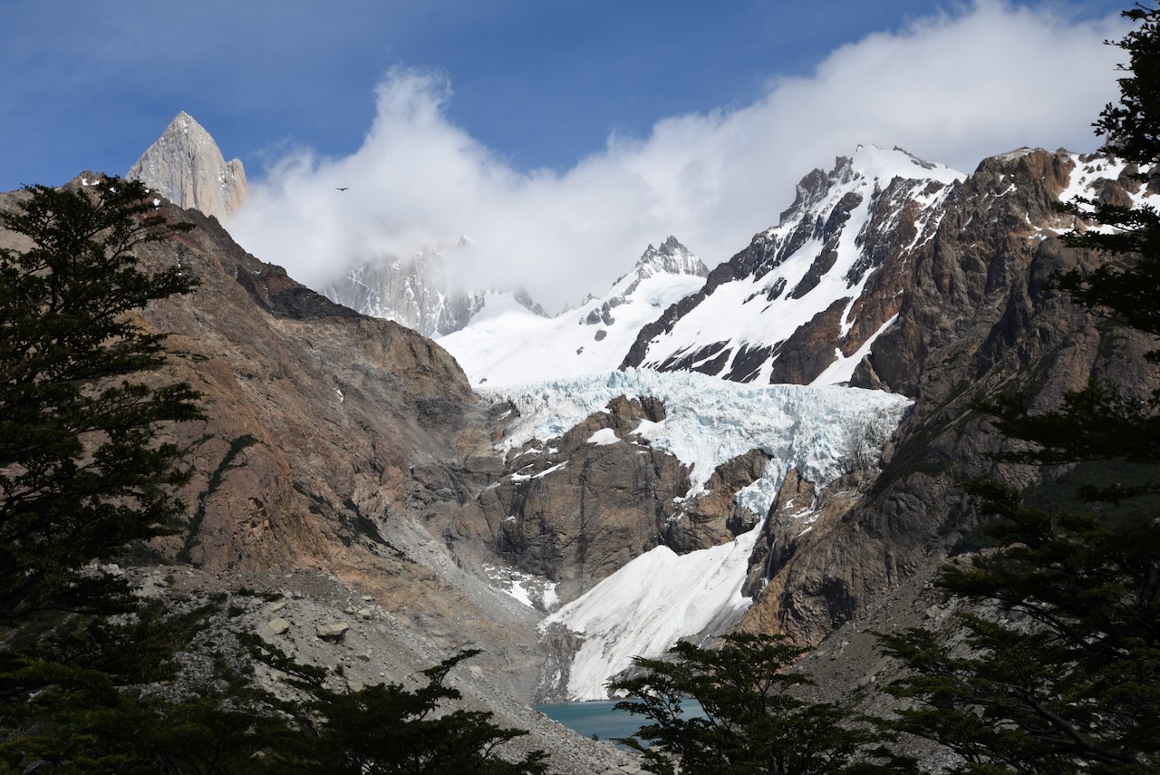
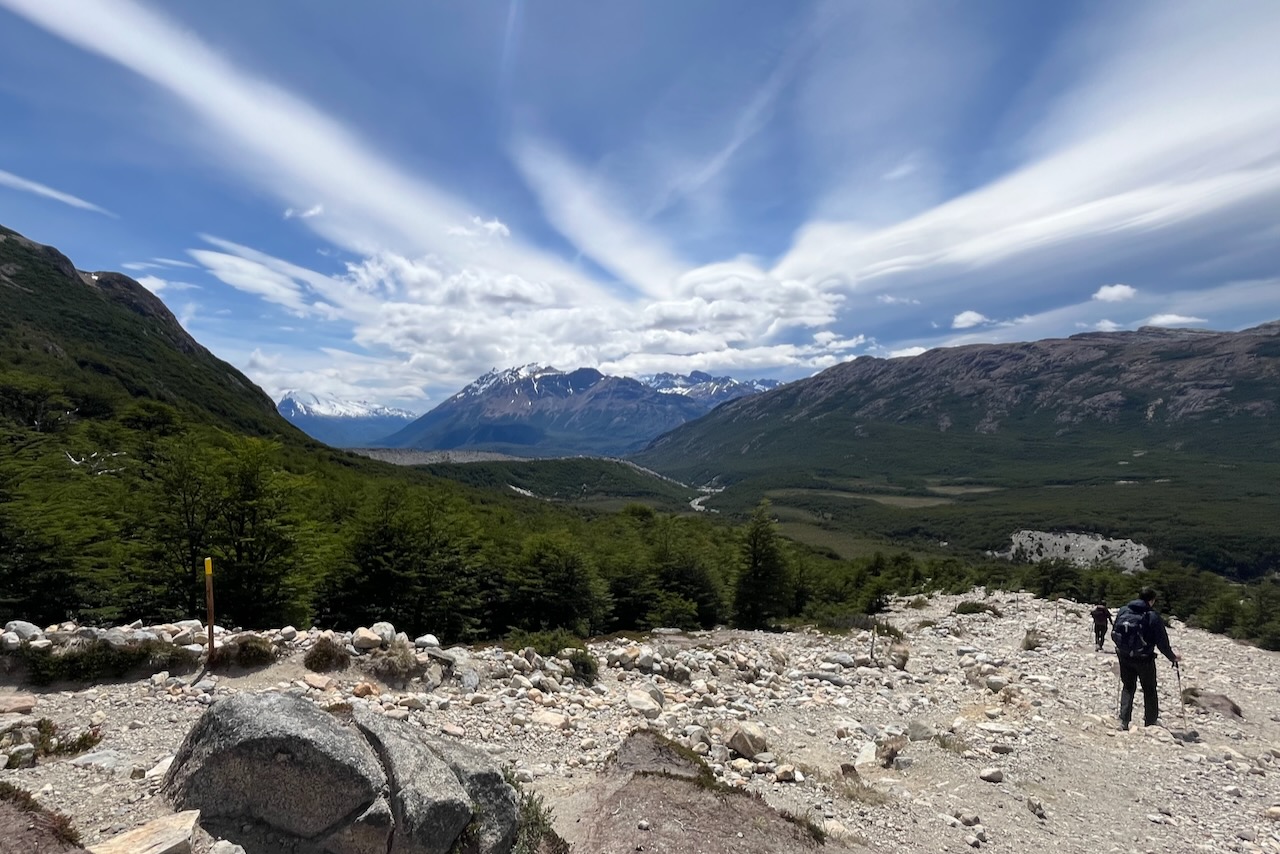
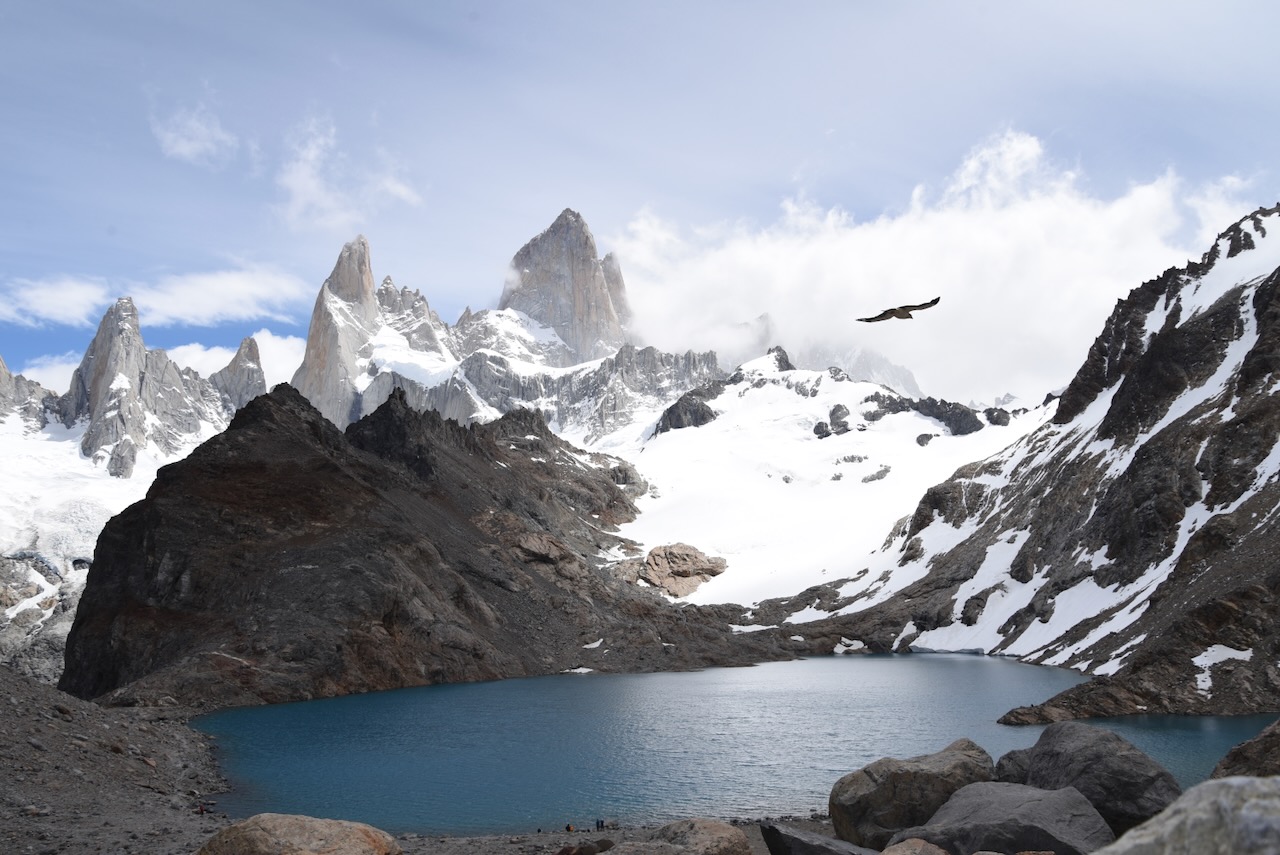
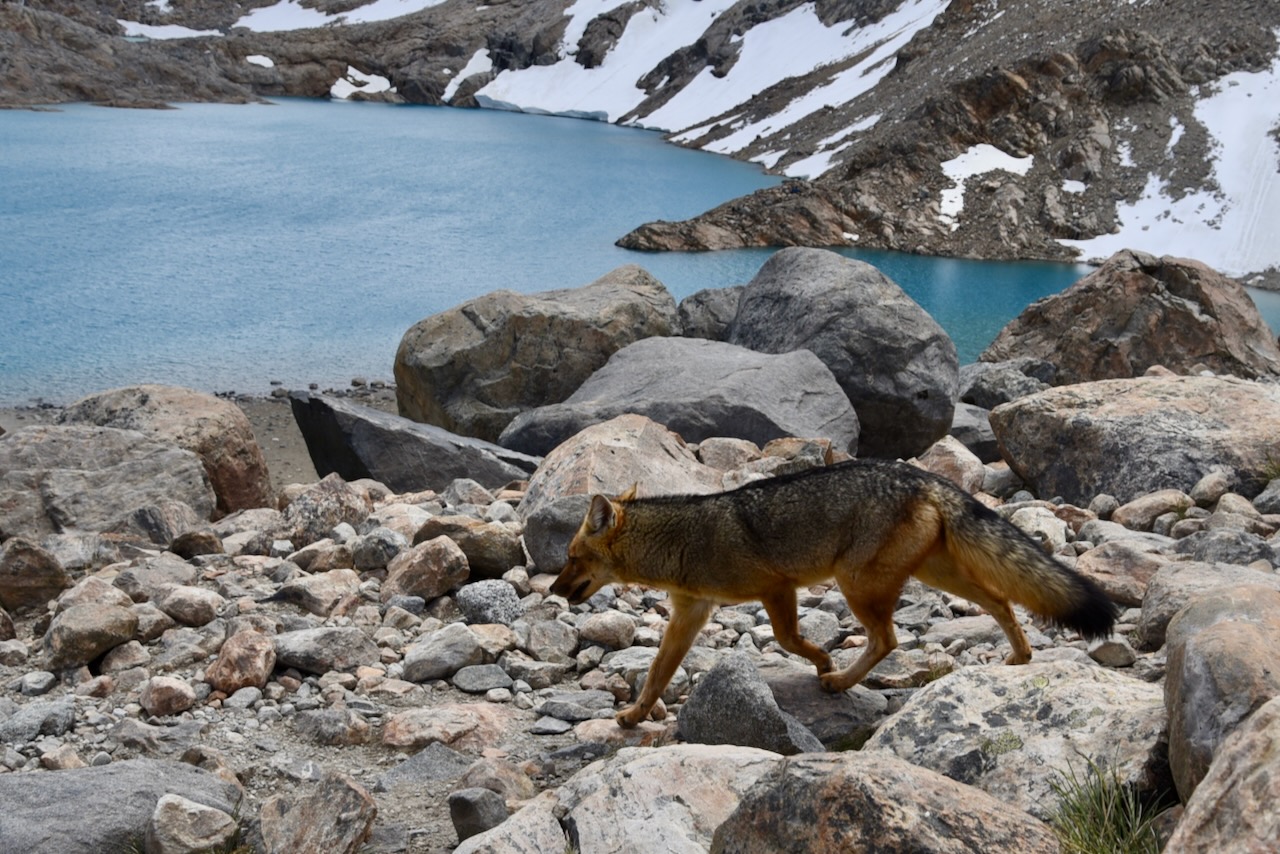
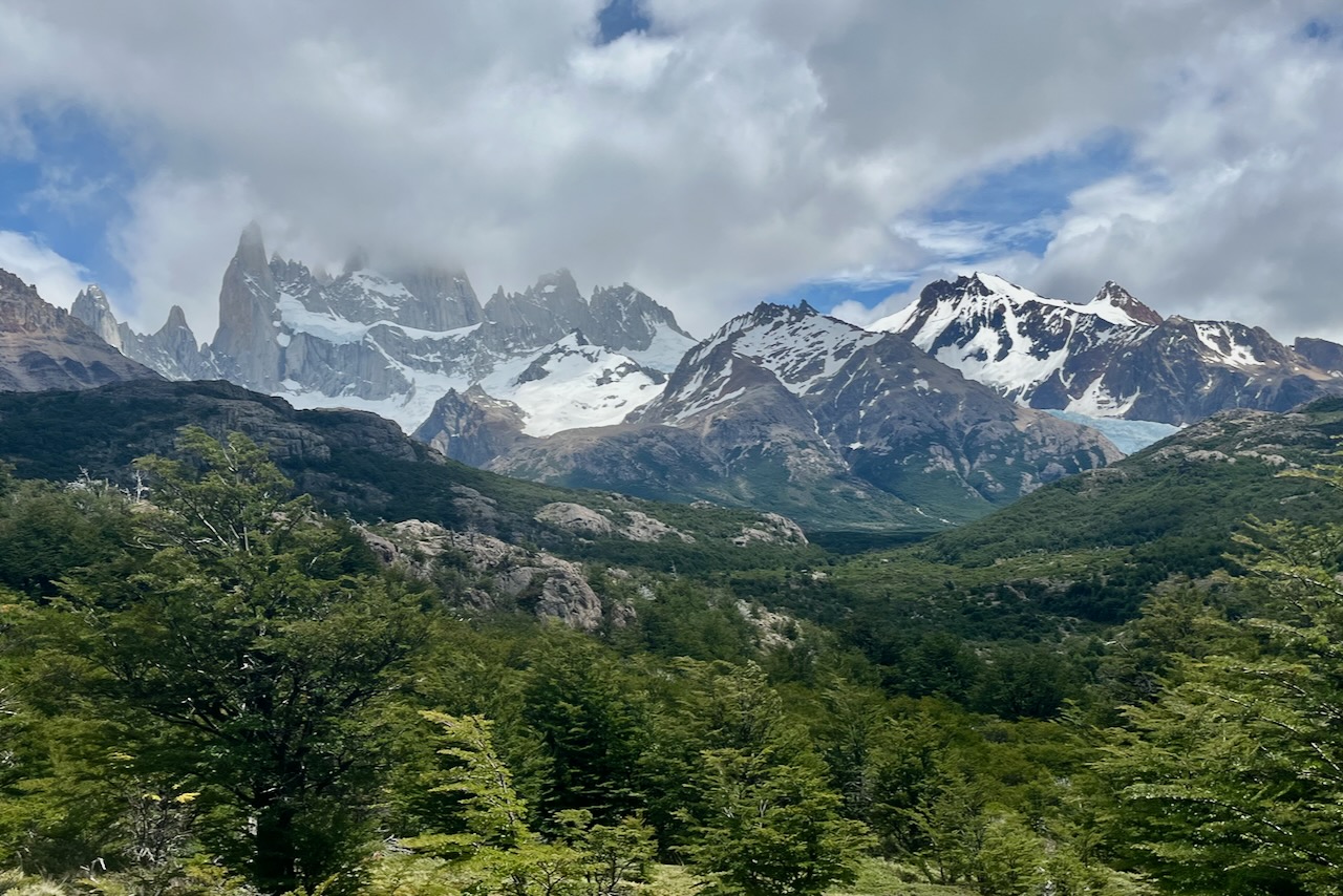
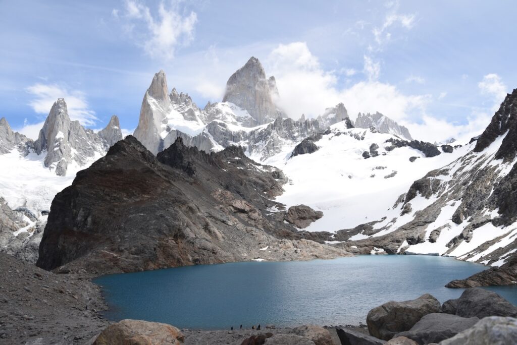
On our fourth day in El Chalten we finally headed to Laguna de Los Tres. Since we already did half of the trail when we went to Laguna Capri, we decided to take a different route. We started at Rio Electrico near Hosteria El Pilar and hiked past Piedras Blancas Glacier lookout point. This route is slightly shorter arguably flatter. Except for the steep last section of the hike to Laguna de Los Tres that one has to do no matter what. We felt that this hike was more difficult than Laguna Torre, but not as difficult as Torres Base lookout in Torres del Paine in Chile. The view at Laguna de Los Tres was definitely worth it. Here is more on Laguna de Los Tres hike.

View of Laguna de los Tres and Mount Fitz Roy, Argentina

We had excellent stay spending full five days in El Chalten. It has a really nice vibe and just feel slike a very happy place. It is also helped by the fact that El Chalten has some phenomenally good restaurants. We made our own sandwiches for lunch for all the hiking but ate out every night. Our favorites were La Tapera, La Oveja Negra, and Fuegia Bistro.

El Chalten street view with mount Fitz Roy in the background, Argentina

Back to Argentina Patagonia trip to Los Glaciares

Perito Moreno – a huge glacier with easy access, Argentina

Perito Moreno is a very large beautiful glacier with excellent tourist infrastructure making it easy to visit. Until recently the glacier also was quite an exception in that it was a stable glacier, not retreating like many other glaciers around the world. However a recent study shows that that is changing now and Perito Moreno is shrinking away too.

Entrance to Los Glaciares National Park, Argentina

Perito Moreno is part of Los Glaciares National park, also including Fitzroy mountain and area around it. We bought online a multiday permit that enabled us to go to Perito Moreno and later to all our hikes in El Chalten. The rates for the park entrance tickets are here.

Road to Perito Moreno Glacier, Los Glaciares National Park, Argentina

Mirador de Los Susperos is the first lookout point of Perito Moreno Glacier that one reaches. It has a beautiful view of the glacier and Lago Argentino around it. As at some other major tourist sites, we saw Malvinas Argentinas sign. We also saw it near El Chalten and at Iguazu falls with respective distances to the islands. Malvinas other name is Falkland islands, British overseas territory that Argentina and UK fought a war over in 1982. It is clearly not a closed question in Argentina.

View of Perito Moreno Glacier and Malvinas Argentinas sign, Argentina

After the lookout point we headed to the parking lot for the Perito Moreno Glacier. Parking lot is very large and is far from the Glacier walking trails and platforms. One can walk it (uphill to the glacier visitor center) or take a shuttle. We took a shuttle. There are extensive walkways and viewing platforms to admire the glacier. It was busy with many tourist buses but the platforms have a lot of space to view the glacier. We have seen several chunks of ice breaking off, calving, while we were there. It is a very impressive spectacle.

Perito Moreno Glacier, Argentina
Perito Moreno Glacier closer view, Argentina

Unexposed and submerged part of the glacier has a different very blue color, because of its higher density. When pieces of glacier break off and flip over one can see this very beautiful, blue ice. Over time it cracks and starts to look white, like regular ice.

Freshly flipped piece of glacier with its blue ice, Perito Moreno, Argentina
Water color changes near Perito Moreno glacier, Argentina
Perito Moreno Glacier and tourist boat, Argentina
Floating pieces of ice that broke off glacier, Perito Moreno, Argentina

We walked all the platforms to appreciate different view points. We had our sandwich lunch admiring the glacier. And by the time we were leaving, most tour bases have departed and we enjoyed the Glacier without crowds.

Back to Los Glaciares National Park

Laguna de Los Tres – a full day hike for stunning views of Mount Fitz Roy, Argentina

Laguna de Los Tres is the most famous hike from El Chalten. We did this hike from Rio Electrico and via Piedras Blancas glacier lookout. The more common route is from El CHalten via Laguna Capri. But since we already did Laguna Capri we wanted to try this different route. It was also meant to be marginally shorter and maybe flatter. We drove to the parking lot near Rio Electrico and started the hike along the river valley. The hike is about 22km return.

Parking lot near Rio Electrico to start hiking to Laguna de Los Tres, Argentina
Sign to Laguna de Los tres near Rio Electrica bridge, Argentina
Sign to Laguna de Los tres near Rio Electrico bridge, Argentina

The first part of the trek is along the river bed. We did not see many people on the hike. The trail was well marked. The views are beautiful.

Views along the Rio Blanco river valley on trek to Laguna de Los Tres, Argentina

The trail then turns up and continues in the woods along the valley with ocational views of the mountains in the distance through gaps between the trees.

Entrance to the trail on the hike to Laguna de Los Tres and Piedras Blancas glacier, Argentina
Piedras Blancas glacier and Mt Fitzroy, Argentina

When we reached the lookout of the Piedras Blancas glacier the mountains in the back were partially covered by clouds. The glacier is a little bit far but a very beautiful site with waterfalls of melting water coming down. There were also some condors flying around but very high up.

Piedras Blancas glacier lookout, Argentina
View of Mount Fitz Roy on the trail to Laguna de Los Tres, Argentina

The final part of the trek is a very steep ascent gaining about 400m of elevation over 1km. It was the busiest section of the hike partly because it is slow moving partly because there are no trees so you can see more.

Views from trail to Laguna de Los Tres, Argentina
Steep ascent section of the trail to Laguna de Los Tres, Argentina
The fnal section of ascent over to the Laguna de Los Tres lookout, Argentina
Mount Fitz Roy, Argentina

Once we reached the top though all the hard work climbing up was worth it. Again we were lucky and clouds parted just enough for us to see Mount Fitz Roy peak. We spent some time at the top hiding among the rocks as it was very windy up there. Had our sandwiches. Saw the fox that it appears frequents the site as some hikers give it food (should not). And just took in the beauty before heading back all the 11km to the parking lot.

Laguna de Los Tres and Mount Fitz Roy, Argentina
Fox at Laguna de Los Tres, Argentina

Back to El Chalten

Laguna Torre – a full day hike from El Chalten, Argentina

The first time we hiked Laguna Torre, we started this 20km hike from the same point as Laguna Capri hike.

Start of hiking trails near El Chalten, Argentina

After the trail split we continued through the forest on a mostly flat trail. We were spotted an orchid which was very exciting.

Porcelain orchid, Chloraea Magellanica on the trail to Laguna Torre, Argentina
Sign at Mirador Cerro Torre, Argentina

Mirador Cerro Torre is mean to provide the view of Cerro Torre. But on the day we arrived that part of the range was covered by a very thick cloud. We could se Cerro Solo very well, but no Cerro Torre. We still decided to go ahead and see what we see at the lagoon.

View of Cerro Solo and obstructed by clouds Cerro Torre over Fitz Roy river valley, Argentina
Views on the trail to Laguna Torre along Fitz Roy River, Argentina

At the lagoon there was a lot of floating ice that broke off the glacier. Cerro Torre was still covered by thick cloud and there was no any sign of it lifting, unlike on our Laguna Capri hike.

Laguna Torre with ice and cloud covered Cerro Torre, Argentina

We still enjoyed the hike and did not find it too difficult. On our last full day in El Chalten we decided to do Lagune Torre hike again as weather looked much better. This time we started from a different point. This one is also in El Chalten and not too far to the one with all other trails that we used before. It provides a slight shortcut it seems at the start of the hike. Or maybe it is an older trailhead because the sign looked older and there were no guards checking passes. But there were many hikers heading through.

Sign for the Laguna Torre hike, El Chalten, Argentina
Sign on Laguna Torre hike, Argentina

What a difference. Now at Mirador Cerro Torre we had a clear view of the Cerro Torre and glacier next to it.

Mirador Cerro Torre, Argentina
View over Fitz Roy River valley to Serro Torre and Cerro Solo, Argentina

We spent some time at the lagoon eating our sandwiches and enjoying the view and nice weather. There seemed to be less ice than the first time in the lagoon. And more hikers.

Laguna Torre and Cerro Torre, Los Glaciares National Park, Argentina
Glacier at Laguna Torre, Los Glaciares National Park, Argentina
Cerro Solo, Cerro Torre, Mount Ftiz Roy view, Chile

We returned back to El Chalten through the same “shortcut” route. Laguna Torre is very nice and not difficult full day hike.

El Chalten from Laguna Torre hike view, Argentina

Back to El Chalten

Condors and Aguilas lookout hike from El Chalten, Argentina

The hike to Los Condores lookout starts at the visitor center. It is a somewhat steep but shork walk up to a rocky outcrop with spectacular views of El Chalten village and Mount Fitzroy in the distance

After admiring the view one can go to Aguilas (eagle) lookout. This is mostly flat slightly rolling half an hour walk around the top of the hill. It has the view of the Viedma lake. One cannot see Viedma glacier as it is behind the hill.

Walking back from Aguilas lookout there are more beautiful views of the Mount Fitzroy, Torres, and other mountains in the range.

We had a perfect day without clouds. Since this was our first day we did not realize how lucky this was as tops of the mountains are often covered by clouds.

We took awhile admiring the views at both lookouts and waiting for condors. We did not get condors (maybe because there was no wind at all). But we enjoyed the scenery and spent around 3 hours walking around and sitting at lookouts.

Back to El Chalten

Laguna Capri and Fitzroy lookout – a beautiful half day hike from El Chalten, Argentina

Most hikes around Fitzroy mountain start from the edge of town in El Chalten. We walked down from our airbnb, showed our multi-day passes to the guards at the gate and headed up the hills.

The gate to trails around Mount FitzRoy, El Chalten, Argentina
Trails head to Laguna del Los Tres and others, El Chalten, Argentina

Th trail to Laguna Capri (all of them actually) starts with a steep assent that reaches a nice view point of El Chalten. Later trails diverge. After the initial steep assent, the trail to Laguna Capri is mostly rolling flat – some ups and downs but nothing too strenuous.

View of El Chalten from the trail to Laguna Capri and others, El Chalten, Argentina
View from trail to Laguna Capri, El Chalten, Argnentina
View from Mirador rio de las Vueltas on trail to Laguna Capri, El Chalten, Argnentina
Trail to Laguna Capril ,El Chalten, Argentina
Magellanic Woodpecker, male, on trail to Laguna Capri, El Chalten, Argentina

When we reached Laguna Capri, Fitz Roy peak was covered by thick clouds. The cloud cover was moving all around and there was a threat of drizzle coming in. We decided not to proceed to Laguna de Los Tres which was a very steep hike up to the beautiful lagoon with a view of Fitz Roy mountain, if clouds did not cover it.

Laguna Capri view with Fitzroy covered by clouds, Argentina
Fitz Roy mountain covered by clouds, view from Laguna Capri, Argentina

We then headed back on the trail stopping at Fitz Roy lookout. At this point we decided to eat our lunch, watch clouds shifting over Fitz Roy and wait for Condors (it was a windy day). We saw several condors cruising around though all of them pretty high up and too far for a photo. Then clouds started lifting and we could see almost the entire mountain range. We decided to walk back to Laguna Capri again and get a photo of Laguna with Fitzroy.

View of Mout Fitz Roy with clouds lifting, Argentina

It was a completely different scene at Laguna Capri – sun shining and a beautiful view of the mountain. We learned our lesson for Patagonia – weather always changes, four seasons in a day. If you wait clouds might lift (or not), but all landscapes are beautiful in their own way.

Laguna Capri and Mount Fitz Roy, Argentina

Back to El Chalten

Monterrico on Guatemala Pacific coast – great nature and fishing

For the last part of our Guatemala trip we were hiring a car and driving to the Pacific West coast. The road from Guatemala City to the Port of San Jose on the coast is excellent but there is very heavy truck traffic.It took us around 3 hours to get out of Guatemala city and get to the coast.

Trucks traffic on the road from Guatemala City to Port San Jose on Pacific coast, Guatemala

Turning south from Port San Jose one goes on a local road that connects little beach villages almost all the way to El Salvador border. We stayed in an airbnb in one of the beach houses along the shore near Monterrico. We had an ocean front place, with a pool and all the conveniences one needed. At first we were surprised that there was no fence as one gets used to seeing every property fenced in in Central America and the Caribbean. But here we were in Guatemala, on the coast and no fences and no grills on the windows. The area is popular with Guatemalas for beach holidays. Quite a few property developments – these ones fenced in – start to show up. But for now it is still a very laid back authentic place.

Beach on Pacific Coast of Guatemala near Monterrico, Guatemala
Walkway to the beach from our airbnb, near Monterrico, Guatemala
Sunset over Pacific and pelicans, near Monterrico, Guatemala

Guatemala’s Pacific coast is an important nesting site for variety of turtles. Community Biological station at El Banco monitors nesting beaches, collects eggs to incubate them and then release to imrpove chances of survivals for baby turtles. One can visit every day around 5pm and for a small donation participate in releasing the baby turtles.

Baby Oliver Ridley turtle ready for release at El Banco, near Monterrico, Guatemala
baby turtles going to sea, El Banco, near Monterrico, Guatemala

Guatemala has a reputation for great sports fishing. In fact some say Guatemala is the world capital of deep sea sports fishing. Not sure about world capital and how one would measure that, but we had to try the fishing. We went on a local charter boat from Iztapa. Iztapa is located closer to Port of San Jose and is the center for deep sea fishing. There are quite a few charters and hotels specializing in accommodation and fishing packages. We went for a day with Mad Marlin Sport Fishing. The boat was great, the crew was excellent. Sail fish showed up. We caught (and released) 5 sailfish! We also caught a couple of nice mahi mahi and they were very delicious on barbeque and as a sashimi. While at sea we saw dolphines, turtles and tuna jumping. It was also very cool to see coastline with all the volcanoes, though covered in haze and smoke.

Guatemala Pacific coastline near Iztapa, Guatemala
Fishing charter, Guatemala
Sailfish, of the coast of Guatemala
Dolphin jumping, off the coast of Guatemala

Monterrico Nature reserve protects a 20km stretch of mangroves along the Pacific coast. We went on a boat tour through mangroves early in the morning to look for birds. To book our tour, we drove up to Monterrico’s main street near the beach and found a booth there advertising mangrove tours. The next day we drove up to the boat launching area on mangroves side and met our guide with the boat. We paddled in the dark and reached a large lagoon for sunrise. It was cloudy and we could not see volcanoes, but we did see beautiful sunrise and many birds. We then meandered along the channels looking for birds. It was a very enjoyable morning and we did see many birds and beautiful views.

Boat tour in Monterrico mangroves before sunrise, Guatemala
Sunrise in Monterrico mangroves, Guatemala
Monterrico mangroves, Guatemala
Grey heron, Monterico mangroves, Guatemala
Great egret, MOnterrico mangroves, Guatemala
Ibises at Monterrico mangroves, Guatemala
Jacana, Monterrico mangroves, Guatemala
Black-necked stilt, Monterrico mangroves, Guatemala
Tiger heron, Monterrico mangroves, Guatemala
Fishermen, Monterrico mangroves, Guatemala
Monterrico mangroves, Guatemala
Pier in Monterrico mangroves, Guatemala

One of the days we decided to drive up along the coast to El Paredon. El Paredon was another contender for our base on the west coast of Guatemala and we wanted to check what we were missing. El Paredon is known as a great place for surfing. And if surfing is what you want to do then probably El Paredon is the place. It felt much more touristy in a backpacker kind of way than Monterrico. It also seemed to be going through a major construction boom with many new guest houses being built. it was very sandy with not too many trees. All in all we decided that we made a good call staying where we did.

We had great few days in Monterrico to relax as we were wrapping up our glorious Guatemala trip. And then on the last day we just drove to Guatemala city, dropped off the car and caught our flight out.

Back to Guatemala.

Lake Atitlan – unreal beauty in Guatemala highlands

We headed from Antigua towards lake Atitlan on the 30th of December. The road is very good. Oddly, all along the way we saw people sitting by the side of the road in small groups. According to our driver they were “having a picnic” while waiting for the passing buses since everyone was traveling some place for the new year celebrations/ returning from Christmas celebrations.

People waiting for buses along the road from Antigua toward lake Atitlan, Guatemala

People of Guatemala are very industrious and at times it does seem that the entire population is either embroidering or making pottery. All along the way there were shops selling all manner of crafts and pottery.

Pottery and souvenir shop along the way from Antigua to lake Atitlan, Guatemala

After researching about various villages around lake Atitlan, we decided to stay in San Marcos La Laguna on the western side of the lake. To get there we first arrived by road to Panajachel and then took a boat. Panajachel is developing fast and even has high rise hotels. We felt we wanted a more quiet place. The drive from Antigua took about 2.5 hours. We then took a public water taxi – the lake version of a chicken bus. The water taxi stops by various villages dropping off and picking up passengers making a circle around the lake. We were traveling in the early afternoon and the waves were starting to pick up a little bit. Prepare to get splashed a little though they do have curtains to block of the spray. The luggage goes on top of the boat and also may get some spray on it.

One of the villages on Lake Atitlan shore between Panajachel and San Marcos, Guatemala

We stayed in an airbnb just outside of San Marcos. Main transportation in the area, once one gets off the boat, is tricycle. We found them to be readily available and reliable. A couple of times our tricycle drivers looked like they were 12, but they drove very well! The development has reached lake Atitlan with a construction boom visible. There are quite a few cottages built around and many airbnbs. There is also a number of small hotels and yoga retreats as San Marco is known to be the “hippie” village. Our airbnb had phenomenal views over the lake and we were very happy we decided on this option rather than busy Panajachel.

Lake Atitlan view, San Marcos la Laguna, Guatemala
Fisherman on Lake Atitlan, near San Marcos La Laguna, Guatemala.

A short and very scenic boat ride from San Marcos are San Pedro and San Juan. We took the water taxi boat to San Pedro – a lively village with many restaurants and bars and a popular base for backpackers on lake Atitlan.

Jetti in San Pedro La Laguna, Guatemala

In San Pedro we took a tricycle for the scenic route to three view points of the lake. Each viewpoint has a restaurant or two with multiple viewing platforms at it. Local and foreign tourists alike are fans of selfies and photos with stunning views. Most of these restaurants/ view point also have special attractions to take photos with, like a giant colorful hummingbird or a giant fish, in case lake view is not enough. We also walked around the town and had a nice lunch.

Lake Atitlan and San Pedro La Laguna, Guatemala
Street market in San Pedro La Laguna, Guatemala
Street view in San Pedro La Laguna, Guatemala

We then took a short tricycle ride to San Juan La Laguna known for its artistic side. The streets in San Juan were creatively decorated with murals, hanging hats, umbrellas and textiles. There are plenty of workshops selling all variety of handicrafts. It had a very cheerful vibe. Since we were there on 31 of December many locals seemed to be shopping for this celebrations. And the main road to the pier was busy with musicians and street food vendors.

San Juan La laguna street view, Guatemala
Traditional musicians San Juan La laguna, Guatemala
San Juan La laguna street view, Guatemala

Not too far away from San Marcos, across the lake, is a Mayan town of Santiago Atitlan. We headed there one early morning for a birdwatching tour at Rey Tepepul Municipal Nature Reserve to search for resplendent quetzal. Quetzal is a national bird of Guatemala and even its currency is named after it. It is a very beautiful bird living in cloud forest. Quetzal population is declining due to habitat loss despite its protected status.

Santiago Atitlan jetty with the view of Atitlan volcano, Guatemala

We arrived by boat at sunrise at Santiago jetty and then headed up the hills to the cloud forest on the slopes of Atitlan volcano in the back of a pick up truck. A very authentic experience.

Santiago de La laguna street view in early morning, Guatemala

We hiked for an hour or so through beautiful forest to the spot where quetzals were sited. This is a working forest and there are stacks of harvested wood and plantations of pampano (calathea lutea) along the way. Our guide pointed out several bird species along the way. With 700 species Guatemala is a major draw for birdwatchers.

Wood harvested along the trail near Santiago La Laguna, Guatemala
Pampano plantations in cloud forest near Santiago La Laguna, Guatemala

First we found emerald toucanet. Soon after quetzals arrived to the same tree. we were lucky to see several pairs of quetzals and had really great sightings. It is a really strikingly beautiful bird, especially the male with brights feathers and long tail. We were very happy we went for this bird watching tour even though we are not exactly birders.

Northern emerald toucanet, Rey Tepepul Municipal Nature Reserve near lake Atitlan, Guatemala
Resplendent Quetzal, Rey Tepepul Municipal Nature Reserve near lake Atitlan, Guatemala

A town of Chichicastenango nearby is well known for its market. Most tourist operators offer tours on market days (Thursday and Sunday). It is only 60km from San Marcos but takes about 2 hours zigzagging on mountain roads.

Atitlan lake views on the road from San Marcos to Chichicastenango, Guatemala
Pine forest in highlands along the road from lake Atitlan to Chichicastenango, Guatemala

Chichicastenango market is a huge area selling everything. While there ae quite a few tourists coming to have a look and a large area where handicrafts are sold, for the most part it is a regular market for Guatemalas to buy stuff. There is food, appliances, clothes, household items, basically everything one could possibly need more or less. The main Church Santo Tomas is at the edge of the market and has a blend of pre-Colombian and Catholic worship. The stes of the church are increadibly colorful due to all the flower sellers there. Worshipers buy flowers and insents to make offerings. The inside is fascinating offering a glimpse of this world that mixes so diverse influences. It is absolutely not allowed to take pictures inside out of respect for people’s beliefs. But one is welcome to enter and have a look. Fascinating.

Santo Thomas church, Chichicastenango, Guatemala
Flower sellers, Chichicastenango market, Guatemala
“Food court” with fresh vegetable sellers and tortilla makers, Chichicastenango market, Guatemala
Textiles for sale at Chichicastenango markets, Guatemala

We were very limited by our luggage size and had to exercise maximum willpower at Chichicastenanho markets. There are were so many beautiful things to buy. Very beautiful decorative textiles and all manner of handicraft. It is also increadible to see all the traditional clothes, mostly women’s. It seems men have moved on to western style clothing mostly but women wear elaboarate beautiful traditional outfits. The quantity and quality of these beautiful textiles is overwhelming. Guatemalan women making them must be the most hard working and productive women in the world.

Textiles and fashions at Chichicastenango market, Guatemala

We had fantastic several days at lake Atitlan. And after days of exploring nearby sites, or paddling around the lake it was wonderfully relaxing to just sit on our airbnb verandah taking spectacular views of volcanoes. Including far away Fuego, still visible and still fuming.

From here we headed back to Guatemala City to pick up a rental car and start our self driving portion of the trip to Monterirco on the Pacific Coast.

Back to Guatemala

Exploring Mayan Ruins and Mountain Pine Ridge Reserve in Belize

Before and after our dive trip in Belize we explored the top side covering most major Mayan ruins in the country. Belize has impressive history and ruins from Maya period. Unlike Mexico, the sites were not crowded at all, sometimes we had a site to ourselves. One can also climb many of the pyramids still.

The first site we went to was Lamanai. We went in the morning and got back in time to board our liveaboard by late afternoon.

River view on the way to Lamanai, Belize

Lamanai site is located on a shore of the New river. Most tours access it by boat from the town of Orange walk. Boat ride is very picturesque and we saw a couple of crocodiles and some nice birds on the way. Site is partially excavated and has a couple of pyramids one can climb. Lamanai is one of the longest continuously occupied sites – people lived here over 3 thousand years.

Lamanai

After finishing our diving trip. We got off the boat in the morning and picked up our car rental from the airport. We then headed to Altun Ha – a Mayan site near Belize city – before making our way over across the country to San Ignacio. Altun Ha is an impressive site with some buildings partially excavated and some waiting to be uncovered.

Altun Ha

As we headed west, we made a few stops on the way. First we stopped at the community baboon sanctuary. Local community agreed not to cut trees between their estates to let animals pass and now offers tours to go and see howler monkeys and possibly other species. We were first hoping to go on the boat tour that the center also operates. But this was the day of a solar eclipse and the guide declared that there would be no boat tour because day will turn into night with the eclipse. There was no point in debating and we headed instead on foot to find howler monkeys. It did not take long 10-15min at most, we found a little group of howlers, they ate and mostly napped in the tree but one came down closer and another one howled. Good stop to do.

howler monkey, Belize

On the way we stopped by Belize zoo and tropical education center. It serves as rescue and rehabilitation facility. We stopped in the middle of the day and most animals were hiding. The place is popular for visiting with kids.

And then we headed to San Ignacio. Belize is not a big country so it only takes a couple of hours to cross it east to west. We made it to San Ignacio in time to visit Cahal Pech just before sunset – another Mayan ruin located in the town of San Ignacio.

While exploring the site we saw several agouties running around. We could hear parrots and toucans but could not see them. It is a very nice site with a good museum.

Agouti at Cahal Pech, Belize

We stayed at Falling Leaves Lodge right next to Cahal Pech. The place is surrounded by big trees and is one of the hot spots for birdwatchers. Food was delicious too.

View from Falling Leaves Lodge

At sunset dozens of vultures make cell phone tower nearby their roust. Is quite a site

VUltures on cell phone tower, San Ignacio, Belize
Toucan, San Ignacio, Belize
Red lored parrot, San Ignacio, Belize

Mountain Pine Ridge Reserve and Caracol

The next day we headed to Caracol and explored a little of the Mountain Pine Ridge reserve on the way back. The new road to Caracol was about 1/3 built at the time we were visiting and the work continues. First one drives on a brand new excellent road and then on compacted but not paved road. We were in a small 2 wheel drive and did not have any issues. It was dry when we visited though and after heavy rains the road might be more difficult to pass. It is a very scenic drive. Pines suffered from a decease some years ago and many of them did not survive, but it seems the forest is recovering. At lower elevations jungle is sick and lush. It took us about 2 hours to reach Caracol.

New road from San Ignacio to Caracol, Belize
Not yet paved section of the road from San Ignacio to Caracol
Caracol entrance sign, Belize

Caracol is one of the more famous Mayan sites and was a major settlement in its day. The site is very large with impressive buildings and excavation work continuing. We were the first to arrive and at the start had the entire site to ourselves. As day went on a few more groups came, but we did not see more than 20 people in total throughout the day. Definitely a benefit of traveling in low season, and before the road is finished and cruise tourists can reach the site!

Caracol, Belize
Caracol, view from the tallest pyramid, Belize

There were many animals and birds around the site. We saw toucans, white nosed coatie, howling monkeys and parrots.

White nosed coati at Caracol, Belize

On the way back from Caracol we stopped at a few scenic spots on the drive through Mountain Pine Ridge Reserve. it is a stunningly beautiful place. We only had less than a half day left but there is definitely much to do and explore.

Rio on pools views, Belize

First we stopped at Rio on pools lookout.There is a nicely organized area and there were quite a few people having picknicks enjoying the view. A little walk from the look out one walks to the rock pools themselves. There were quite a few people there, big groups enjoying cooling down in the waters. The short trail is only about 5 minutes. And the site is well managed with toilets and no trash in site. It is a beautiful place and had a very nice peaceful happy vibe about it with all the locals enjoying cool waters.

Rio on pools, Belize

Then we drove by 5 sisters restaurant in a lodge. A great place to have lunch overlooking beautiful waterfalls cascade. Food was great too.

five sisters waterfalls, Belize

And then we stopped by nig rocks falls. This one has long set of steps down. Steps are in a good shape, Easy to go up and down just many of them. Pool at the bottom of the falls is very nice and by the time we were there, there was barely any people. Very nice other stop.

We then tried to get to 1000 foot falls, but day was running out on us and the road was not paved. We decided to keep it till next time as clearly, there is much more to do in the area.

On the last day we headed to Xunantunich, a major Mayan site less than half hour from San Ignacio. The site is spectacular, one can climb the tollest pyramid and see Guatemala border from it and all the countryside around. We also saw many spider monkeys in the trees around the site, toucans, other birds and could hear howlers howling. And again, perhaps because of low season, we almost had site to ourselves – an amazing experience.

Xunantunich, Belize
Xunantunich, Belize
Spider monkey, Xunantunich, Belize

All in all a phenomenal trip with history, nature and good diving.

Back to Belize

Floreana island, Galapagos

We did a day trip to Floreana island in the Galapagos, when we were staying in Santa Cruz. Floreana has the smallest population with currently about 100 people. It has iguanas that are reddish in color, a tortoise reserve, a short hike up the hill to see caves where pirates used to stay back in the day, and a nice little bay to snorkel in. The boat ride from Santa Cruz to Floreana was about 2 hours.

pier at Puerto Velazco Ibarra, Floreana Island, Galapagos

Floreana was the first island to be occupied in Galapagos. In the 1930s it had a set of characters which involved a doctor who removed his teeth before moving to the island and a Baroness with her lovers. Arguments among these settlers culminated in disappearance of several of them – quite a drama for such a small sleepy place – you can read more here. Now not much is happening on Floreana. Any prospects of growth are limited by lack of significant fresh water sources on the island.

a restaurant on Floreana island, Galapagos

The island accommodates day trippers mostly. It has a couple of very basic restaurants. There is also a resort and it is possible to stay overnight.

tortoise, Floreana island, Galapagos

Tortoises went extinct on Floreana island in the mid 1800s. A conservation program started in 2017, with several Floreana heritage tortoises now living on the island and a number of others in the breeding center in Santa Cruz.

tortoise, Floreana island, Galapagos
the view to the ocean from the hill in Floreana island, Galapagos

During 16th and 17th centuries, pirates used Floreana as a base to raid Spanish ships passing through the area. They stayed in the caves on tops of the hills and one still can see carved out spaces they made to make themselves more comfortable.

pirates' caves, Floreana island, Galapagos
pirates’ caves, Floreana island, Galapagos
pirates' caves, Floreana island, Galapagos
pirates’ caves, Floreana island, Galapagos
face carved in the rocks by pirates, Floreana island, Galapagos

We then headed down to the white sand beach for a swim and a snorkel. There was a lot of reef fish around, but we did not see turtles or sea lions on this occasion.

After the snorkel we headed back to the pier. On the way we passed the black sand beach. This is where historically visitors were arriving to (before pier was built). And also where the one resort is located, owned by the descendants of those early settlers from 1930s.

All around the pier and near the shore we saw marine iguanas. On Floreana they were reddish in color, unlike those we saw on Santa Cruz.

Back to Galapagos